Archaeology · Crosses of Glossop

Whitfield Cross

Whitfield Cross. An odd name for a road that doesn’t have a cross on it.
Leading from Gladstone Street up to Hague Street/Cliffe Road, the road takes you past Whitfield Wells, and into the heart of the Whitfield Conservation Area. I lived on King Street for a number of years, and regularly walked up and down the street, without really noticing the name beyond “hmmm, I bet there was cross here at some stage”.

However, whilst delving into the history of the area, I came across an article by the marvellous Robert Hamnett (my namesake) entitled “Botanical Ramble to Moorfield”, dated to about 1890. There is not much botany, but it is a goldmine of local history. You can read the article in PDF form here via the scanned scrapbooks of the New Mills History Society – they have a whole bunch of them to ready to read, all from the late 19th and early 20th century, and all history local to New Mills and surrounding areas, including Glossop. But I digress…

As I read the article my jaw dropped. I repeat the relevant chapter here in full as it is full of great language, some of which might need explaining.

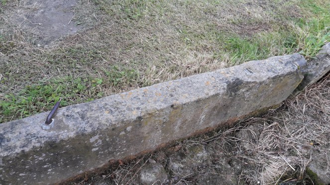
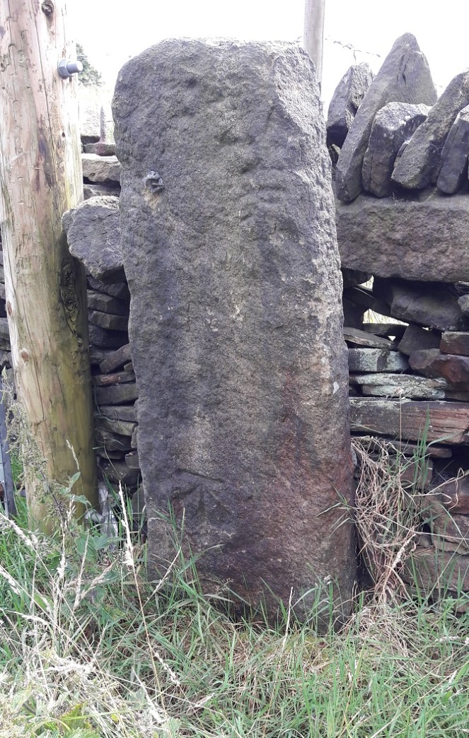
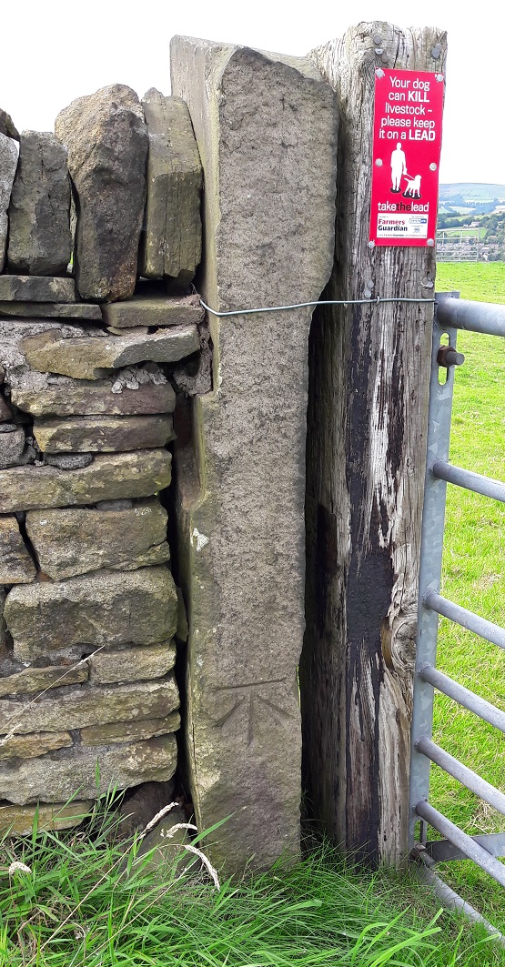
“In the latter part of the last century the Cross Cliffe lads planned and partially carried out what was to them a most daring and audacious deed. One ” Mischief Night,” the eve of the first of May, it was resolved to steal the Whitfield cross. In the depth of night, when all was quiet, and the Whitfield lads were slumbering or dreaming of their “May birch”, the Cross Cliffe invaders came and detached a portion of the cross. With secrecy, care, and much labour, it was conveyed away nearly to its projected destination, but the exertions required for the nefarious deed had been under estimated, their previous work in removing all articles left carelessly in the yards or at the back doors of the good people of Cross Cliffe and neighbourhood, such as clothes lines, props, buckets, etc., etc., to their “May birch” had already taken much of their energy out of them, and, coupled with the steepness of the ascent to the “Top o’ th’ Cross,” distance and roughness of the road to Cross Cliffe, and the weight of the stone, they were reluctantly obliged to abandon their “loot” in the last field near to the pre-arranged destination. What the feelings were of the Whitfield lads on discovering the desecration and loss of a portion of their cross can be better imagined than described. The stolen portion remained in the field for some years. Mr Joseph Hague, of Park Hall, was solicited to restore the cross to its original form and position, but being imbued with a little Puritanism, he refused, and the other portions gradually disappeared until there is nothing left of the Whitfield Cross, except the stolen portion, which is now part and parcel of a stile in a field at Cross Cliffe, where the then tenant of the field placed it, over a century ago.”

“Blimey!”, thought I!

Date wise, the removal of the cross would have been 1790 or so. I find it interesting that the boys of Crosse Cliffe carried half a metric ton of stone for a prank… no wonder they left it a short distance from where it originally stood. An interesting bit of trivia here, though; in the northern counties of Yorkshire, Lancashire, Derbyshire, and Cheshire, Mischief Night was on May Eve rather than November 4th as it is now. How and why it switched, no one knows, but I can remember my father telling me about it (born in 1942 in Macclesfield), as well as my grandfather (born in 1909 in Blackley). A little research on the internet repays a lot of information about this, though curiously not the origin of the phrase “May birch”, meaning a prank, which I can find no reference to anywhere else.

So there the cross sits still, passed each day by dozens of dog walkers and hikers.

Upon reading this passage I quite literally ran out and had a look around, but, not knowing exactly where it was (and it is not marked on any OS Map that I have seen), I drew a blank. Weeks later, walking for pleasure rather than exploring, I walked along the right path, and the cross hoved into view.

Cross Map
The location of the cross on a footpath. To get your bearings, Cliffe Road is on the left, and just above the houses there are the allotments.

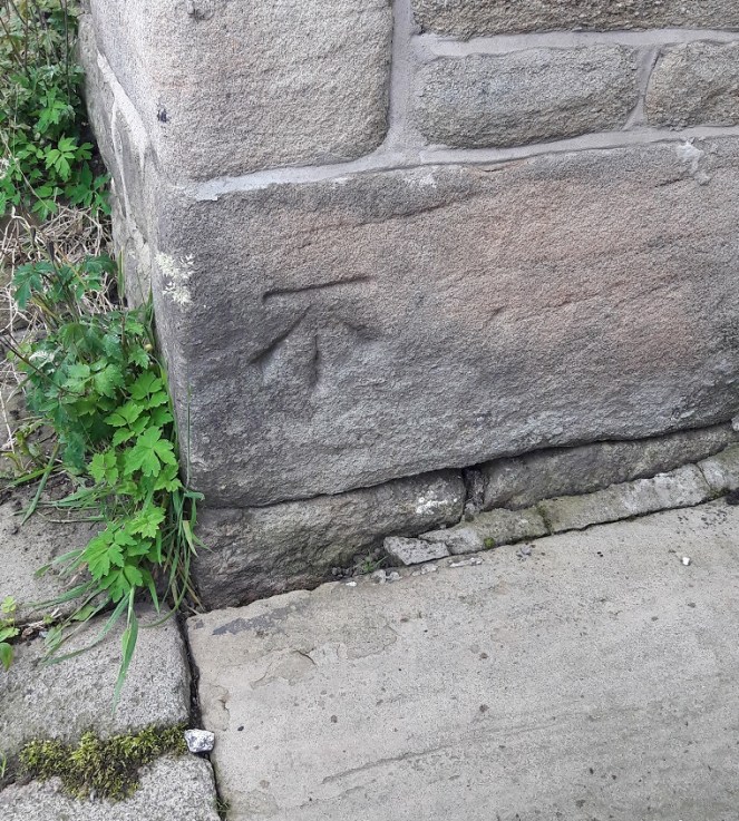
And it really is unmistakable.

6
The Whitfield Cross, now permanently marked by a Bench Mark.

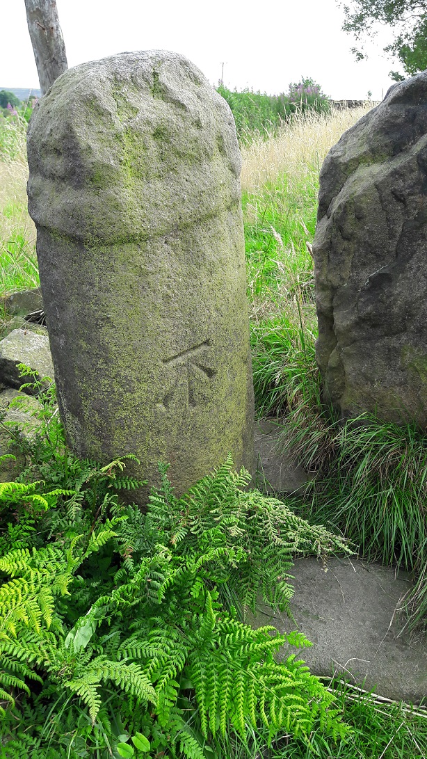
Technically, it is a 9th Century Mercian Round Shaft. That is, it is Anglo-Saxon in origin, carved and placed sometime between 800 and 900AD, and is of a type that is only found in this relatively small geographical area, the kingdon of Mercia. I say ‘this’ area, but technically we are living in the land of the Pecsaetan – the peak dewllers – an independent tribe until they merged with the Mercians prior to the invasion of 1066. Crosses normally have square or rectangular shafts, but the Round Shaft are characterised by an almost pot-bellied round shape, and the very characteristic band around the neck below the cross itself. Sometimes the shafts are decorated, but more often they are plain, as is our cross. Originally, it would have had a simple cross form on the top, just above the collar, and this as well as the neck, could sometimes decorated in panels. There are a few other examples of the round shaft in the area, but the closest are Robin Hood’s Picking Rods (which will be the subject of a future post).

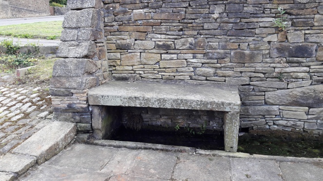
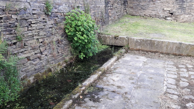
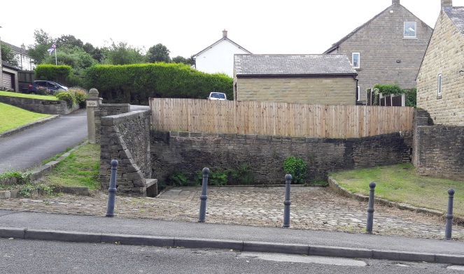
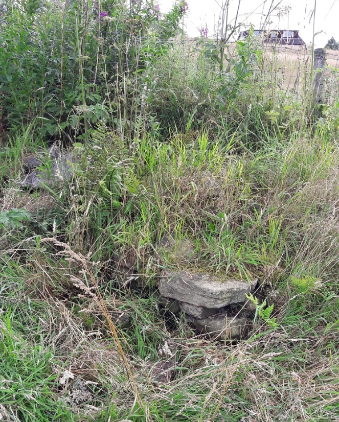
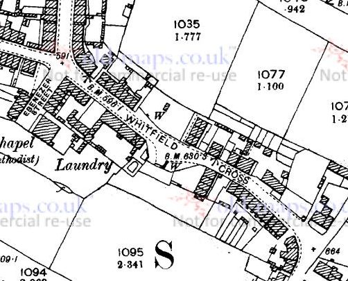
Hamnett suggests that the original location for our cross was at the Whitfield Wells, and the early maps show an area set back from the road that would work. However, it would make more sense for the cross to have stood at the top of Whitfield Cross (the road) as crosses of this sort usually mark road junctions. Here, there is the meeting of three (then) important roads.

Cross Location
The location of the cross would have been where, coincidentally, the cross is at the centre of the map. That cross represents a ‘spot height’ above sea level, but the fact that figure is 666ft is deliciously ironic.

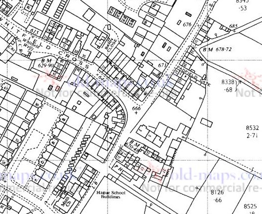
The old pack horse route comes from the south (Peak Forest, Buxton, and Chesterfield) through Gnat Hole, along Hague Street, through to the appropriately named Cross Cliffe, down to Old Glossop (for local traffic – the market and the parish church on Sundays), and on to Woodhead (and Yorkshire beyond, for commercial traffic). The stone would have marked the junction of the track that went along Whitfield Cross, Freetown, Hollincross Lane (Holy Cross? A cross standing by, or covered in, Holly?), Slatelands, and onto Simmondley and beyond. There was another spur coming out along what is now Gladstone Street, leading to that area of the town, and again onto Woodhead.

Cross - Location
The location of the cross would have been dead centre. The roads all widen out at this point, presumably to have accommodated the cross. Left is to Peak Forest/Buxton, right down Whitfield Cross to Simmondly, behind the camera leads to Old Glossop/Woodhead

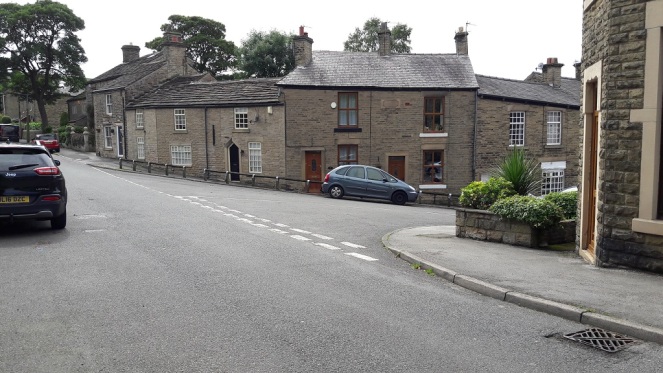
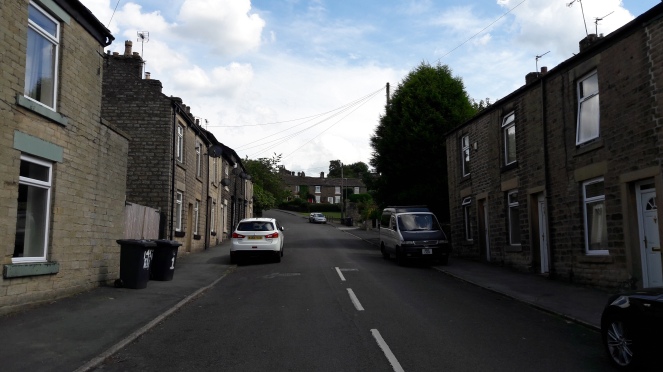
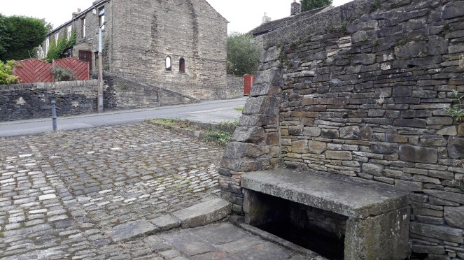
As we can see in the top photograph, the height of the land on either side of Whitfield Cross (the road) is surely testament to the age of the trackway, it being worn down to its present depth by millennia of use.

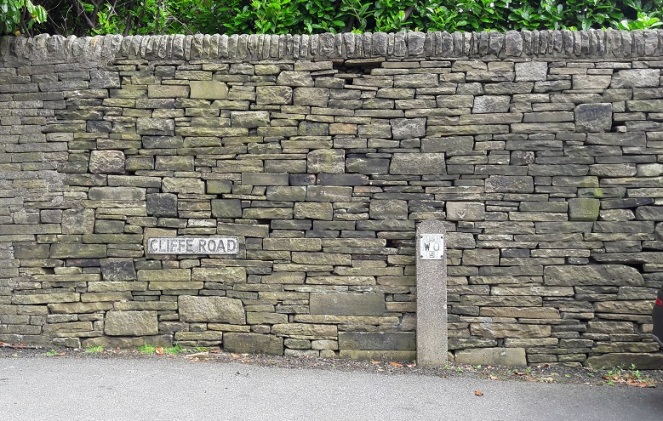
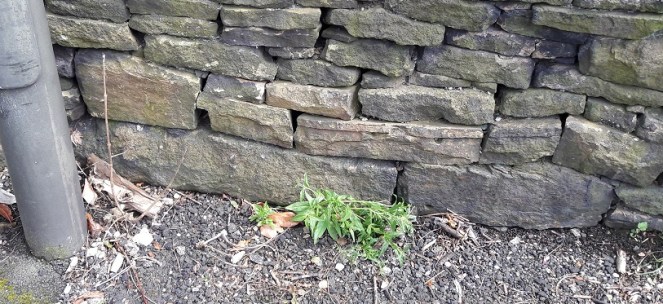
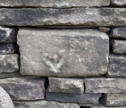
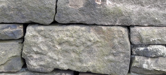
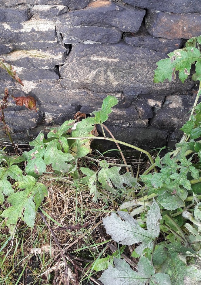
Neville Sharpe in his masterful study Stone Crosses of the Peak District notes that there are several large pieces of large built into the wall at the junction that could have formed the cross base. Closer inspection reveals numerous stones that have been re-used in the wall, several of which could be related to the cross, but without dismantling it in search of sockets, we can’t be certain.

Re-Use - c
A section of walling – note the reused stone, any one of which could be part of the cross base.
Candidate 1
Likely candidates?
Candidate 2
Another candidate? Ignore the arrow, that was carved to indicate an electricity supply is buried there.
Candidate 3
Another candidate?
Mystery Stone
Whilst looking at the wall, I spotted this dressed stone. It seems to have been a capstone to an arch – the curved line at the bottom gives it that impression, as does the diagonal sides. A doorway? A bridge?  The rectangular panel has been deliberately pecked, perhaps to remove a date or name, or even a carving. I would suggest that it is early in date judging by its dressing – medieval perhaps? It’s amazing what you see in walls!

According to Sharpe, John Nelson, an assistant to John Wesley, preached at the cross in the mid 1700’s. This is very typical of the Wesleyan way – preaching outside and using a local landmark – and I’m surprised that Wesley himself didn’t preach here, given his activities in and love for the area. Alas, there is no mention of this is his diaries. There is a very interesting piece about the history of Methodism in the area, including a biography of Nelson, here.

I wonder how many of those dog walkers and hikers are aware of what it is they are passing by when they use that stile? Seriously though, I urge you to go and see it – it is truly a remarkable piece of history, and one that deserves a better fate than is currently befalling it.

I have a big idea about the cross! I would love to see it restored to its original site, or better yet, outside the Whitfield Wells, with a little placard explaining the history of both. The setting is perfect, and it would surely be a fantastic companion to the wells, particularly when dressed. Although in the infant stages, I am exploring possibilities… watch this space.

Whitfield Well 1
The cross would look perfect here, especially if the wells were decorated.


Bench Marks

More Bench Marks

Following on from the original Bench Mark post (here), I thought I would have a look around and see if any others were nearby. And so, after a fun evening spent poring over old maps, making notes, glass of wine in hand, I thought I’d spend a few hours stomping around Whitfield trying to find the lost Bench Marks.

I have used the 1898 1:2500 and the 1969 1:2500 Ordnance Survey maps. There are differences; marks have clearly disappeared, to be replaced by others, buildings have gone, and land has become altered meaning that some marks are now on private property. Here are the maps with the Bench Marks numbered, the photos follow. There are more Bench Marks on the maps that I haven’t numbered yet – I will update the blog when I get round to looking for them!

BM - 1898 Map 1
The 1898 1:2500 OS Map. Cliffe Road runs SW-NE, Whitfield Cross is just off the bottom left, and The Beehive pub is down, Volcrepe and Old Glossop are Straight up. The numbers in red correspond to photographs and discussion below.

What follows are the photographs I took of the various remaining Bench Marks, their number corresponding to that on the map.

1
1 (679.1 ft above sea level)
Tucked away at the side of the house, and quite worn. I wonder how many people living in these houses know they are there?
2
2 (700.8 ft above sea level)
Clear on a wall on the path.
3
3 (728.8 ft above sea level)
Marked on a gatepost


4 (698.8 ft above sea level)

Originally on a wall running down to Cliffe Road, and now on private land. It may well be still there, but I wasn’t able to see. It is not marked on the 1969 map.

5
5 (716.2 ft above sea level)
Another gate post, and again very clear and fresh.


In between Marks 5 and 6 you pass through this stile.

5a

Now, I will post more about this stile later on as I think there is a lot more going on here, really quite interesting things, and it deserves its own post.

6
6 (682.0 ft above sea level)
This is a particularly important bench mark as it has been placed on the actual Whitfield Cross. THE Whitfield Cross. The cross was moved from its original position at the top of Whitfield Cross (the road) in the 1790’s and ended up as a stile post in a field. The cross itself is Saxon in date (probably 9th Century) and is of a type known as a Mercian Round Shaft. You can see the band around the top that both dates it… and makes it look somewhat phallic! I will go into a lot more detail about the cross in a later post, as I think it is one of the most important pieces of history in the area, and one of the most overlooked, but for now, let’s move on


7 (682.6 ft above sea level)

Again, on a wall that is now on, I think, private land. I did have a quick look, but couldn’t see anything, so I left it and moved on.  This Bench Mark is not marked on the 1969 map.

8 - Location Only
8 (636.7 ft above sea level)
Originally on the corner of a retaining field wall. I searched high and low, even pulling over the stones that had fallen down hoping to find the mark, but to no avail. I suppose a full-scale excavation might uncover the stone, but I’m giving it up as a lost cause. It is not marked on the 1969 map.
9 - Location Only
9 (627.3 ft above sea level)
A similar story here, too. The stone has gone missing, perhaps one of the stones at the top that has collapsed down, although the wall itself looks like it has been rebuilt at some stage which may explain its absence.
10
10 (671.8 ft above sea level)
Flatt Farm, on the corner of the farm building, and very difficult to see. It took me a while, but the level of the pavement has risen in the last century or so, leaving the level just visible above the tarmac surface, the arrow now buried below.


Moving onto the 1969 map, there are two additions: 11 and 12. The Bench Marks that are not on the 1969 map have been noted above.


BM - 1969 Map 1

11
11 (657.64 ft above sea level)
This one should be on the corner of the last house on Bright’s Terrace – the last row of houses on Cliffe Road. I found no sign of it, and it is probably hidden behind the flower bed.
12
12 (611.48 ft above sea level)
A little down the hill on the right, clear on a wall.


And so ends my brief sojourn – both geeky and fun. I have done a bit more Bench Mark walking, and I’m sure they will feature in future posts, but that’s it for now.

Incidentally, both maps are available for free from http://www.old-maps.co.uk a truly marvellous website that has old Ordnance Survey maps for the whole country dating back to the mid 19th Century, and all for free. Seriously, if you find any of this interesting in any way, hop over and have fun!

Bench Marks

Whitfield Cross Bench Marks

Bench marks are a bit of an oddity. Most people would never know they were there, and of the people that do notice them, most have no clue what they are. And yet, they are quite literally all over the United Kingdom, and once you have seen one, you will start to see them everywhere!

In short, when the original Ordnance Survey maps were being drawn up (1840’s or thereabouts, though work continued until the 1950’s), the surveyors needed to know the height above sea level at certain points in the landscape, so that they could work out hill heights, elevations, contour lines and such. These were marked on the map, but as translating the exact location on the map to that on the ground could leave room for mistakes, it was decided that a permanent and precise mark would be made on the place where the measurement was taken. This is the Bench Mark. They were carved very carefully by chisel onto stone that was either fixed, or very unlikely to be moved – churches, pubs, grand buildings, gate posts and the like. The symbol was usually paced at ground level, and was very simple, and very subtle – a single horizontal line (from where the measurement was taken), and underneath three lines forming a vertical arrow like this:

Benchmark - Example

Over half a million of these marks existed at one time, and the entire network of marks (at least 1 per square mile in rural areas, a much greater density in urban areas) was maintained by the Ordnance Survey until 1972 when they abandoned it as too expensive. Whilst large numbers of the marks have disappeared (buildings are demolished or changed, stones are moved, etc.) the majority are still here, hidden, waiting to be found. Whilst looking at an old OS map of Whitfield Cross (1898 1:2500), I noticed there were two on the road. They are marked BM, followed by a number (the height, in feet, above sea level), and their location is shown by the arrow.

BM Map

The first was at the bottom of Whitfield Cross, at the edge of the building that used to be The Roebuck pub.

BM1 - Actual

It is very worn, but you can just make out the three lines that make up the arrow – now just hollows – and the level on top. This particular Bench Mark is 598.1 feet above sea level.

The other Bench Mark is on the edge of a pair of houses, and is much clearer and better preserved. It seems the surveyors used the flat top of the bottom course of stone as the spot height, which is exactly 630.3 feet above sea level.

BM2

That’s a difference of 32 feet, or thereabouts; Whitfield Cross is a steep hill.

And for comparison, here is the Benchmark near the Beehive pub at the top of the hill

BM - By the BeehiveThis is at 670.9 – 70 or so feet higher.

It is a bit geeky, but there is something about Bench Marks that really intrigues me – information hidden in plain sight, and a piece of forgotten history. There are even people who ‘collect’ them, ticking them off against the log that the OS had (see here), but that is, I fear, a step too far down Geek Avenue for even me!

Now that you know what they are, and where they are, keep your eyes peeled.

Whitfield Well

Whitfield Well

Welcome to the first post of the blog, and I thought I’d start with a subject (very, for me) close to home: Whitfield Well.

Whitfield Well 1

Situated on Whitfield Cross, halfway up on the right hand side, and set back from the road in a paved and ‘cobbled’ area. It is, I think, the overlooked star of the Whitfield Conservation Area. It is also a Grade II listed feature, and the description in the listing is far better and more concise than mine would be, so here it is:

Name: WHITFIELD WELL
List entry Number: 1384307
Location: WHITFIELD WELL, WHITFIELD CROSS
National Grid Reference: SK 03620 93405
County: Derbyshire
District: High Peak
Grade: II
Date first listed: 27-Jan-1978

Summary of Building:
Well. Mid C18, restored C20. Tooled slabs of gritstone. L-shaped series of rectangular troughs enclosing spring water along 2 sides, with moulded stone dams at intervals, and stone table above part of trough to east side. To rear of wells 2 sections of rubble walling with coping, that to north side partly rebuilt. East side has stone buttress. Third side bounded by stone wall of adjoining industrial yard.

So there you go. But there is a lot more to it that just that dry description.

It is a spring fed perpetual well, meaning that flows in even the most severe droughts. Indeed, its heavy flow once supplied the houses hereabouts with their drinking water, even after most other houses were plumbed into the mains. Because of its importance, it was, for a long time, the focus of a well dressing. Well dressings are justifiably famous and important aspects of the folk calendar of Derbyshire and parts of Staffordshire, and are probably a continuation, however distant, of the pagan veneration of the god or goddess of the water there. This same reverence of wells such this led to them being named, in the Christian period, after saints, though this too fell out of favour in the post-reformation period. We have no idea about the attribution of the well in either the pagan or Christian periods, but a well such as this would surely have had one.

The well dressing at Whitfield was an important and rather grand affair, and seems to have coincided with the wakes week (early September), and the rush bearing ceremony at the Whitfield parish church, St James’. This involved a special blessing of the well by the vicar of St James’, and the creation of a rush cart to take the rushes to the church, where they would be used as flooring. The rush cart and celebratory archway and bunting can be seen in this (c.1920) photograph taken at the junction of Gladstone Street, and looking up Whitfield Cross.

Whitfield Well Dressing
The Well Dressing arch, with the rush cart underneath. Note the shadowy chimney visible in the sky behind the arch at the right.

The building at the extreme left of the photograph is the Roebuck Inn (now a private residence), where the Well Dressing Committee would meet to discuss that year’s celebrations. Apparently, this well was the only one in Derbyshire to be decorated with heather gathered from the surrounding moorland, though Hamnett (the actual historian, not my pseudonym) mentions it being “beautifully decorated with flowers and shrubs” Incidentally, Hamnett also believed that the Whitfield cross, the one that gave the name to the road, originally stood here at the well. More recent work has placed its original site at the top of the road, at the junction with Hague Street – which makes more sense. The cross will be the subject of a later blog post.

The View Today
The same view today, some has changed, but it is still recognizable.

When the well dressing died out, and why, is not clear; there is online a photograph of the 1976 well dressing fancy dress competition winners, so it continued until at least then (click here). One suspects, though, that by then it had lost some of the wonderful Victorian seriousness that the committee would have brought to it.

The water from the well also supplied a Brewery for a time. This was a two-storied building adjacent to the wells, and built in 1849 by James Robinson (who also built the Surrey Arms on Victoria Street, as well as many other houses and building hereabouts). The Whitfield Brewing Company seems never to have been successful, and it changed hands numerous times, eventually ending up as a steam laundry at the end of the 19th Century, before being demolished in the late 40s or early 50s and the area used as a builder’s yard. Finally, houses were built on the site. The tall square chimney of the brewery can just about be seen in background of the photo above – it is also marked on the 1975 1:2500 Ordnance Survey map, although I can’t believe it stood that long. There is a good, if short, history of the brewery here. Incidentally, the 1968 OS map shows a phone box at the western end of the well area.

Here are some photographs.

Well Bench
The well bench. Not sure what the original purpose of the bench was – perhaps a table for those using the well? The spring rises from below the bench and flows to the right along the troughs.
Bench - Railing
There are two holes in the kerb below the bench a uniform distance apart – possibly the remains of a railing? The iron and lead affair at the bottom of the photo is a staple that joins two kerb stones together; there are several of them around the length of the well.
Well - water
The water troughs; the stone ‘dams’ are visible amongst the pond weed.
The Trough
The water disappears under the stone at the end, there, reemerging in a drain to the right.
More railings
More evidence for railings – Victorian or earlier in date with the lead packing.
The capped well
The capped well that originally stood in the brewery yard.
The Drain
The drain, covered by a Victorian cast iron grid, where the Whitfield water ends up.
View from the well
The view from the well onto Whitfield Cross.

I went out last week and cleared the site up a bit. The well is a hangout for the local youth, and inevitably mess and litter accumulate (ranging from coke cans… to a scooter!). So I swept up and dredged the troughs for rubbish… my good deed for the week. Amongst the detritus were four interesting bits – three pottery sherds and a piece of glass.

I say interesting, but I realise that interesting is an entirely subjective word!

The two sherds on the right are white glazed fairly boring bits – bowls or plates probably, and late 19th or 20th century in date. One is a transfer-printed glazed rim of a plate roughly 12cm in diameter, and again late 19th or early 20th century in date. The glass fragment is from the neck of a bottle, possibly a mineral water bottle, or a beer bottle, perhaps. The bluey-green aquamarine tinge allows me to give it a date of… yep, you guessed it 19th or early 20th century. Many mass produced Victorian bottles are of this colour, the result of iron and other impurities in the sand used to make them, and it disappears in the early 20th century.

The Pottery
The pottery. Not quite Roman, but ‘interesting’ enough.

It would seem, then, that leaving litter at the well was a Victorian habit too. It is odd that they survived on the setts for so long, though. Perhaps they eroded out of the surrounding soil? And talking of Victorian habits, Neville Sharpe, in his book ‘Crosses of the Peak District’ notes that there was “an ancient practice in Whitfield township of local youths throwing strangers into the wells”. 

If anyone has any information relating to the well, and especially if corrections are needed, please email me or you can drop a comment in the box below.

I should mention here that I am currently making plans to reinstate the tradition of well dressing at Whitfield Wells. I would be very keen to hear from anyone who wants to join in, who remembers them from when they were originally going, or who has any old photographs or other detail relating to the well dressing.

I have big plans, but can’t do it on my own! Drop me a line with anything you want to say, or leave a comment below.

EDIT:

Deeds
Deeds showing the wells in 1846