Oddities · Stones of Glossop · Waterways of Glossop

Brrrrr… Glossop’s Ice Age History

What ho, wonderful denizens of the blog reading world! How are we all? Well this is something of a to-do… what? Two posts in February? Truly I am spoiling you. Well, it’s about time I picked up the pace a little! I actually had a choice of about 4 half finished articles that I was going to go with, and I actually started working on all of them at some point in the last few weeks before I plumped for this one. Anyway, I hope you enjoy it.

So, I recently discovered the glacial erratic on Pyegrove Park. Now, I should clarify… I didn’t actually ‘discover’ it – lots of people already knew it was there, and in fact I already knew it was there, it’s just that I’d never been able to find it. But the discovery got me thinking: this blog is about archaeology, that is the study of humans and their history through the physical remains they left behind. And yet where we are, and how we live, and indeed how we have lived, has been dictated to us through the landscape, and our place within this. In short, there would be no Glossop without Longdendale, and there would be no Longdendale without the glaciers. So wrap up well, people… we’re off the the ice age.

Ok, so some background, and not being a geologist I really had to put in the homework here, so you’d best appreciate it! Honestly, my brain only has so much space in it: I once learned to ice skate and forgot how to use a knife and fork. What follows then is the ‘back of a fag packet’ version of the last period of glaciation (and before we move on, I must give a massive shout out to a superb website which really helped iron out some of the trickier bits – AntarcticGlacier.org – fascinating, well written, and aimed at non-specialists… well worth checking out if any of this interests you even in the slightest).

So then, there are three distinct periods of glaciation (that is, the process of glaciers forming and moving) within Britain – the Anglian (roughly 478,000 to 424,000 years before present [BP]), the Wolstonian (300,000 to 130,000 BP), and the Devensian (roughly 27,000 to 11,000 BP). Leaving aside the first two, lets focus on the last – the Devensian (also known as the Last Glacial Maximum), as this one was the only one that would have had anatomically modern humans living through it.

At this point, roughly 2/3 of Britain and Ireland, including all of Scotland and Ireland, most of Wales, and the north of England was covered by what is known as the British Irish Ice Sheet. Starting in the Arctic, as the land cooled this glacier moved further south until it reached a limit at about 27,000 BP, at which point the cllimate began to warm, and it slowly began to retreat, and was gone by 11,000 BP. The effect that this moving back and forth had on the land was catastrophic – carving out valleys (think the glens of Scotland, the Lake District, and even our own Peaks), and forever altering the land.

An awesome image of the extent of the Devensian Glaciation at its maximum. I make no claim to this image – it is all the work of Andy Emery at AntarcticGlaciers.org – I merely pinched it… this time with a little shame!

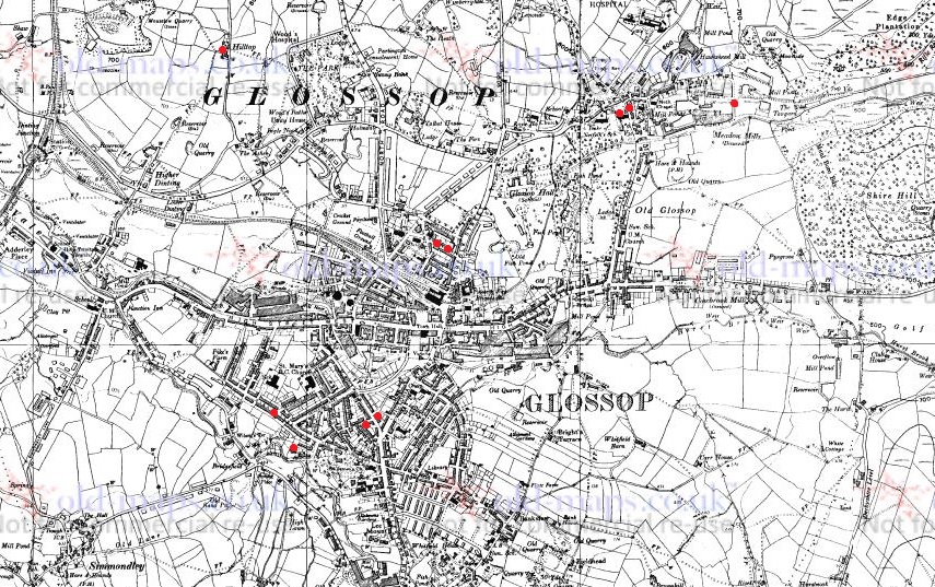
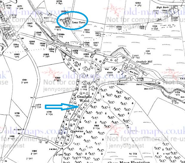
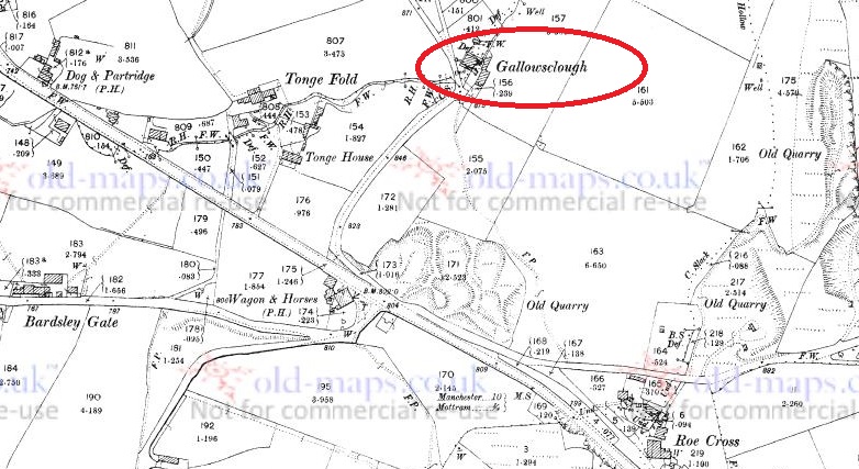
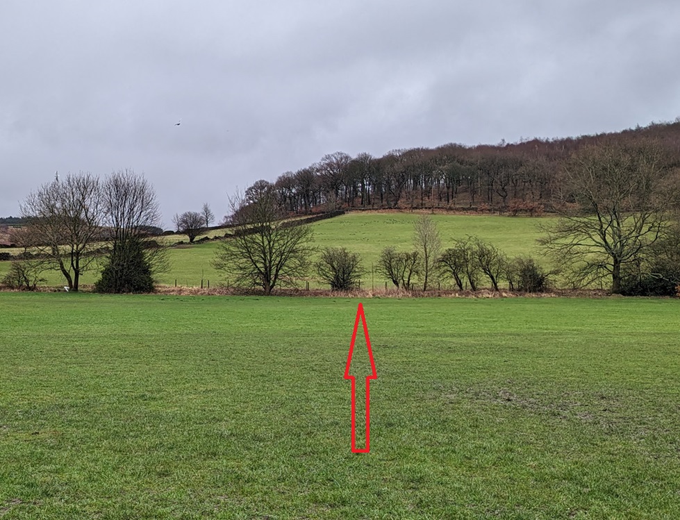
Now, here’s where it gets more interesting… and complicated. There are no definitive models, but it seems that Longdendale was at the southern/south-western edge of the Devensian ice sheet – the literal edge of the glacier in the last ice age. This might explain why the Peak District is, well… ‘peaky’, but the land to the west and south-west isn’t; Longdendale is the last valley before the land smooths out towards Manchester and Cheshire. Indeed, if you look at the above map and think about the landscape to the south and east beyond the edge of the ice sheet, whilst it can certainly be hilly, there are no peaks and steep valleys.

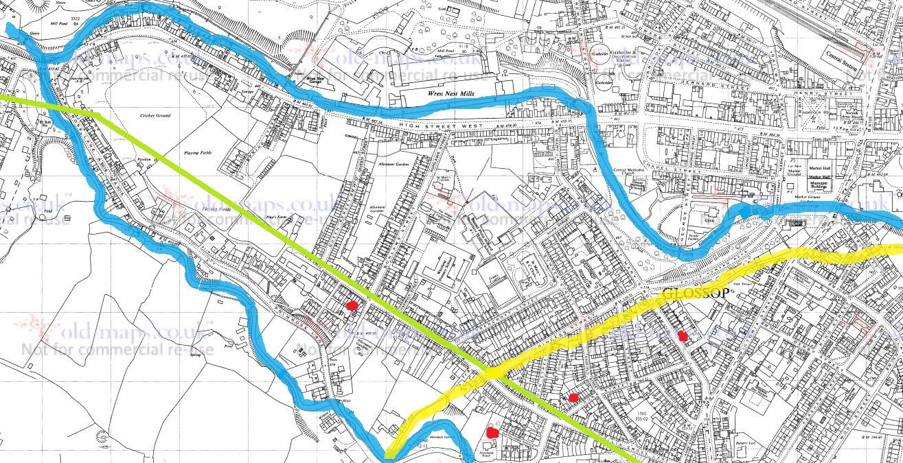
Of course, that’s not to say that the glaciers didn’t affect the land beyond that edge – already frozen solid and all but inhabitable, once the glaciers began to melt, the water had to go somewhere. There is some evidence for what are termed ‘glacial lakes’, huge bodies of meltwater, beneath or adjacent to the glacial edges. There seems to have been one covering the whole of Glossop as it is now – the landscape here being suitably bowl shaped – and which was perhaps dammed at the Mottram end with ice and clay. Not going to lie to you, folks, that honestly makes me feel… weird and terrified. Indeed, originally the Etherow ran to the west of here, toward Manchester, but was forced to change it’s course due to sand, gravel, and ice blocking the original route. And to give an idea of the power that such a lake bursting, one such steam blasted out the gorge (actually, a natural geological fault line) at Broadbottom which the viaduct now has to cross.

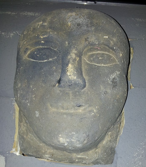
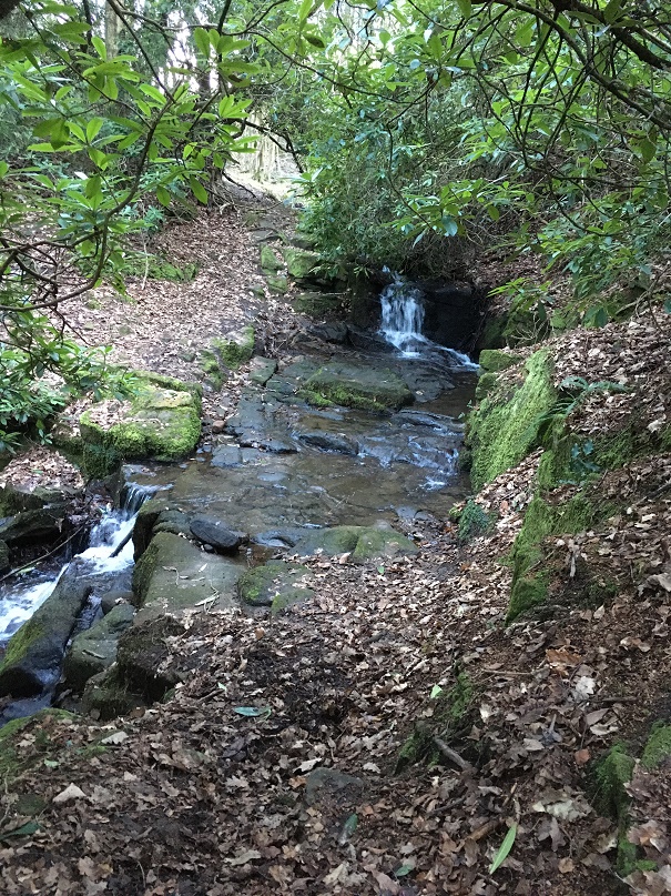
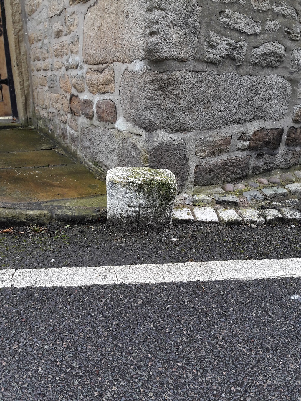
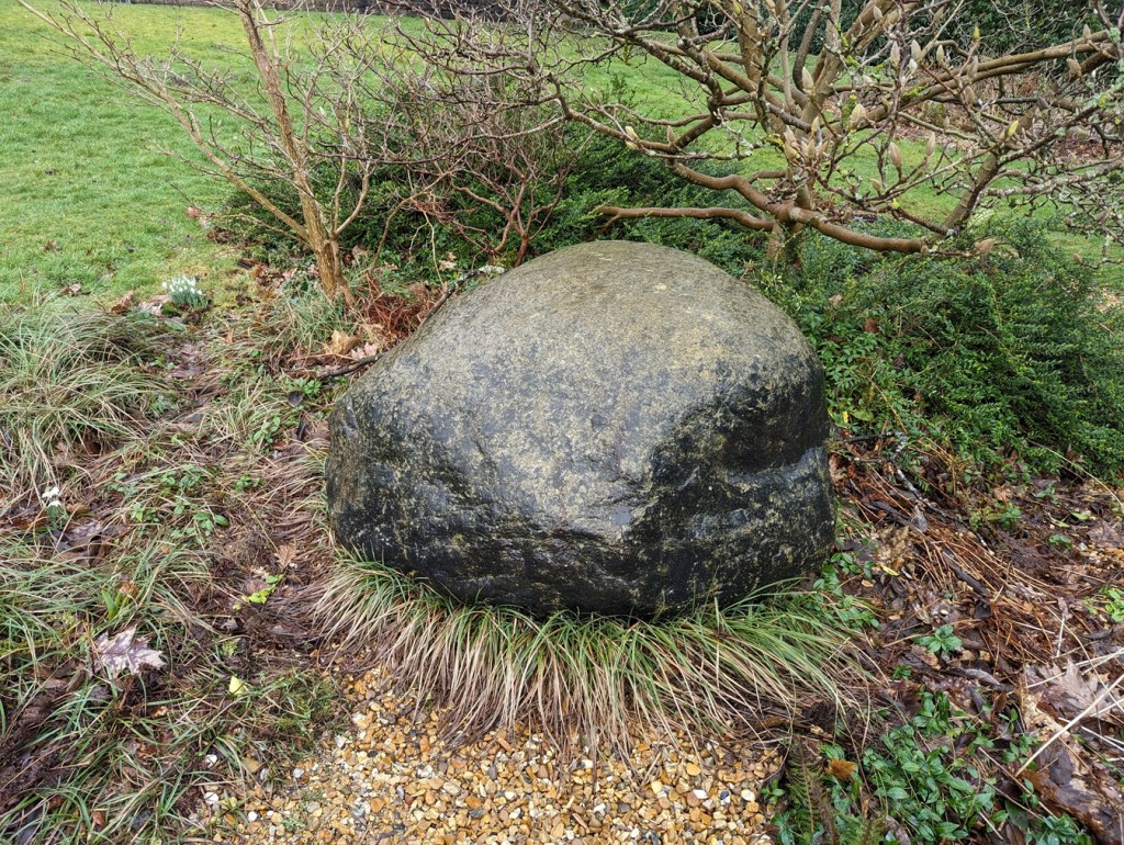
But the glaciers also gave another gift. As they moved up and down (and indeed round – there is evidence that it wasn’t a straight-forward linear motion), they picked up bits of geology – random stones and chipped-off bits of mountain. These they occasionally dropped as they went along in the form of what we know as ‘glacial erratics’ – defined by AntarcticGlaciers as “a far-travelled stone of a different lithology (stone type) to the local bedrock“. Now, the Glossop area has four of these that are known about (but there are a lot of odd looking stones dotted about that to my eyes look like they are erratics, but as I say, not being a geologist, I don’t know). If anyone has a geological speciality, or has any thought about the types of stone these are, and thus perhaps their origin, then please get in contact. The first of these is the one I have already mentioned at Pyegrove, here:

Roughly where the big red arrow is.
Turns out the big red arrow is visible on the ground, too!

Lurking in the bushes, it hides its history well.

Using What3Words, it is located at easygoing.harmonica.ramming. Now, I’m not sure what to make of that!

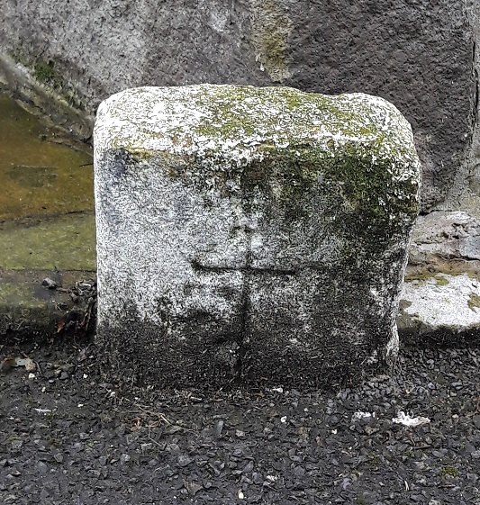
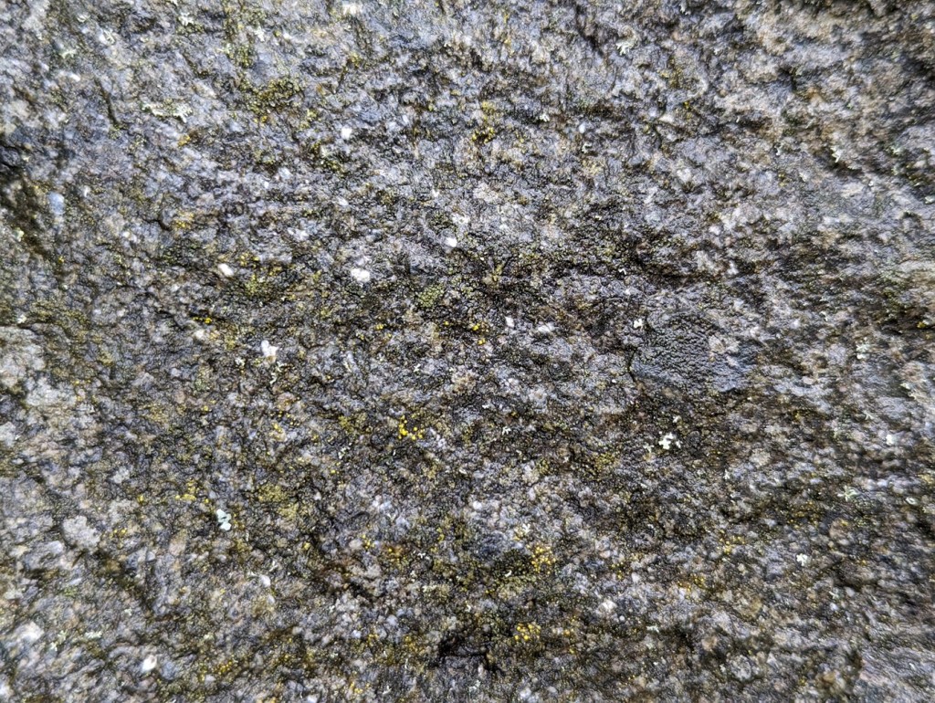
Now, other than it being non-local, and shaped rather like a large pebble (due to the grinding and rolling movement via glacier), I know nothing about it, geologically speaking. It’s coarse, with a sandstone-like structure, but not quite like any local stone I know of.

Close-up of the ‘fabric’ of the stone. It seems to be a type of rough sandstone – almost, but not quite like Millstone Grit.

I assume that it comes from geology further north than here, but where? Lake District? Scotland? Norway? Was this where it was dropped? Or has it been found in a field and moved? Possibly the latter, as it is on the field edge, and marks the track between Pyegrove House (and Hurst, etc.) and Glossop, now simply an overgrown hollow path at the edge of the field, but once an important route from Jumble, Hurst and Pyegrove to Glossop.

The sunken trackway – or holloway – worn by years of use.

Of course, it may be that the field boundary used the erratic as a reference point, and thus the track, but I still think it’s likely that it has been moved.

The next erratic is to be found in Howard Park, here to be precise:

Here, right in front of what was Wood’s Hospital, now Reuben’s Retreat. What3Words is overpaid.courier.recover.
Lovely stuff. Also, looks like it has a moustache!

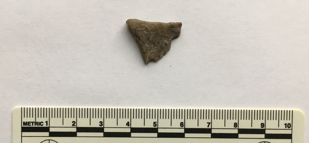
So, it’s a very similar stone to the Pyegrove example, possibly even from the same source. Here, in the close-up:

Not a million miles from the Pyegrove example.

The rock also shows very clearly the marks of being crushed and scraped along other rocks by the glacier.

Linear striations show how it was scraped along a surface… imagine the forces involved in this.
Also much banged around – again, massive forces involved in this.

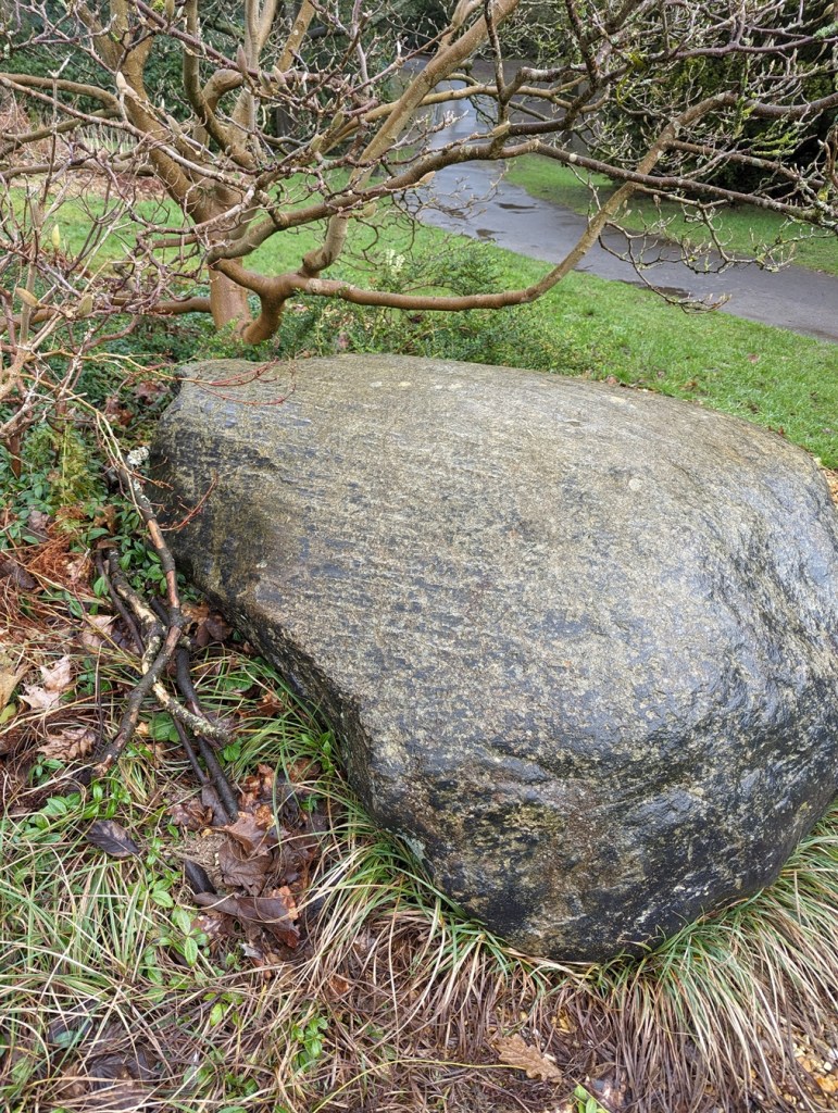
This one has certainly been moved, but from where?

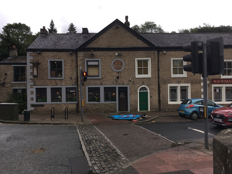
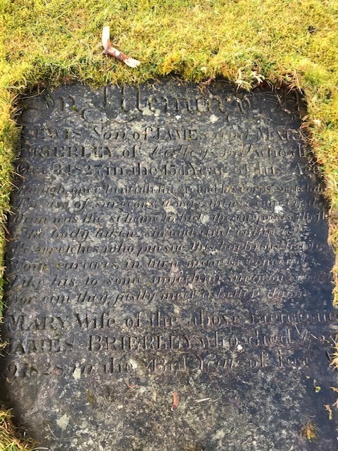
Our last two erratics are to be found in the grounds of the old Grammar School and library building, here, to be precise:

Against the wall of Fitzalan Street, and at earlobes.tutorial.daytime using What3Words… you couldn’t make these addresses up!
Here they are in context.
Smoother than the others, but again not local in origin.

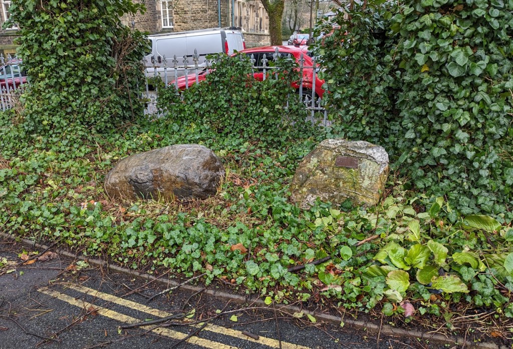
Here it is is close-up:

Very much smoother.
Very different from all the others, this one has quartzite in it, producing a much more jagged rock.

Here it is in close-up:

Very odd geology – a rough rock with striations of quartzite… probably quite unremarkable to a geologist! Possibly related somehow to Shap Granite which has similarities. I think.

They even have a plaque helpfully explaining where they were found, and potentially where they originated.

Shelf Brook… well worth checking out, apparently!

As the climate began to warm up, the land began to come back to life – this was the start of the Holocene period, the modern human world. Trees, shrubs, and plants started to grow, and these are soon followed by the animals that eat them. And following them, hunting and gathering, people. By probably 8000BC, at certainly by 7000BC, people were passing through the Glossop area following game in small bands, and moving between seasonal hunting camps. Their movement through the area may have been part of a cycle of many years, and many hundreds of miles from place to place, stopping for a period of months – summer in the higher ground, winter in the warmer valleys – meeting other groups in specific locations, trading resources and marriage partners, and moving on again, through a landscape that was marked only by natural monuments. The Mesolithic (Middle Stone Age, c. 8000 – 4000 BC) is a fascinating period, but we know so little of their daily lives. Indeed our only clues to their existence hereabouts are the flint tools they made and used, and which are quite commonly found in the hills around Glossop.

Some lovely Mesolithic flint bits. Left, a small scraper; middle, a core from which tiny blades (microliths) were chipped or knapped; and right a notched blade which are common in the Mesolithic, but which no one seems to know what they were used for. My guess would be to scrape down arrow shafts. To be honest, flint tools are like Swiss Army Knives – multiple uses in multiple ways.

I’m also going to use this article to put to bed a story I’ve heard from several sources over the years – that Coombes Edge is a caldera – the blown out remains of a long dead Volcano. Essentially, a smallish volcano erupted, and blew out the north-western side, spewing it’s contents over towards Hyde. This is not the case, and the unusual land formation is the result of a huge landslip caused by under soil water movement, and which occurred sometime between 10,000 and 7,000 BP – so somewhere in the Mesolithich period. One wonders if the landslip was noticed by anyone, either as they were nearby, or after they came back into the area and found the huge landslide. And I wonder what they thought of it.

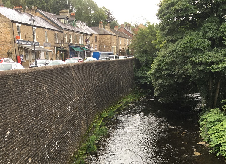
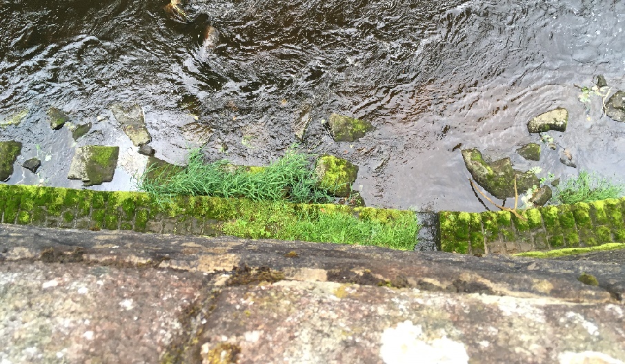
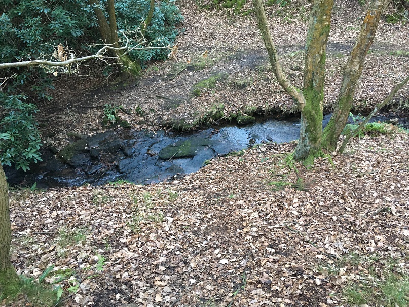
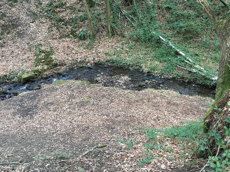
Also, I wonder if we have a look in Shelf Brook, but other streams around here, we might find some more glacial erratics, large and small. Who’s with me?

Right, I’m off to light the fire… and pour a glass of the stuff that warms.

In other news.

There will definitely be a guided archaeological & historical (hysterical?) walk in the next month or so, so watch this and other spaces for news. This will probably be just before the new edition of the Where/When zine – No.2 – comes out. I have decided to aim for 3 zines a year – December, April, and August, but I want to be flexible on this… my life is hectic enough as it is! I’ve also got some ideas for some special editions, but that’s far in the future. In the meantime, who wouldn’t want a Where/When t-shirt with the slogan “What ho, Wanderer!” on it? Just a thought!

As usual, keep in touch, even if it’s just to tell me I’m talking out of my hat. So until next time, look after yourselves and each other, and I remain.

Your humble servant,

TCG

Archaeology · Oddities · Whitfield

A Song of Sixpence

What ho! What ho! What ho!

The Christmas season is upon us once more, and my word it seems to have come round again very quickly… in my mind it’s only September! It’s also bloody cold at the moment, and despite the protestations of Mrs C-G, the heating is not going on… honestly woman, just put another jumper on! Anyway, kind and wonderful folk of the blog-reading variety, here’s a little offering to keep you warm.

So, a number of years ago (22 July 2018 according to my records), I found this object on the footpath below Lean Town:

A metallic disc. And no, before you ask, I’m not deformed… I just have chunky and somewhat stubby fingers, Nor is it me holding the disc with my foot/toes either, as someone once ‘amusingly‘ commented.

A coin” I thought, excitedly. And I still think it is. Well, a trade token, perhaps, but it has no discernible features that allow identification; it is completely effaced. A closer look reveals that some of the original surface has survived, revealing the dark green of oxidised bronze – so we know what it was made from. It is very thin, and seems to be relatively poor quality metal, so I err on the side of it being a trade token of some type, rather than a coin.

A close up. The central circular worn patch is the result of wear, and it looks as though the metal has delaminated. You can see the original surface – smooth green patches – above and to the right of the circular wear patch.
Another close up. This side seems more worn, although the original surface is visible in places.

A trade token, incidentally, was a privately minted token used as small change between people, or for a specific retailer or trader. They were common in the 17th century and later when small denomination coins were rare, and often come with the name of the trader, or other information. This one… alas!

Some trade tokens – not mine, but some for sale here.

However, for me, the most interesting thing about it is that it has been bent on the edge, and this wasn’t accidental:

The bend is clearly not accidental, but instead deliberate and thoughtful.

As damage goes, it seems to be very targeted, unlike the rest of the damage which is the result of acidic ground conditions. No, this is a deliberate bend, put there by human intention, and that, dear and gentle readers, neatly leads us into an obsession of mine: the bent coin.

As you might have noticed I have a tendency to be somewhat… focused, shall we say? Yes, I know other words are available, but I was being kind to myself! In my real life, I am honestly a shambles; a veritable clown-car at times, complete with wheels that regularly fall off and an enormous horn (madam, calm yourself please, this is not that sort of website). But by Jove, when it comes to archaeology, I can tell you the what, where, and when with almost surgical precision, complete with spreadsheets, plastic bags, labels, and typologies – with archaeology, then, I am mustard, tickety-boo and, I’d venture, oojah-cum-spiff. The ability to focus on single topics in such a way means that I sometimes fall down rabbit holes (literally, as it happens, as well as figuratively) and become obsessed with certain features, topics, and objects… and so it was here with bent coins.

A number of years ago, whilst sorting the small finds at the Blackden Trust, I came across a coin that had been bent into something of an ‘S’ shape. “Hmmmmm…” thought I, and off I wandered – and wondered… why would a coin be bent like that?

A survey of what little literature there is on the subject revealed that coins bent in this manner are a relatively common find by metal detectorists. Further research revealed a fascinating history of coin bending traditions that begin in the medieval period as an important, if not official, religious function, which later shifts to encompass such concerns as love, luck, and loss.

A silver sixpence of the 1690’s bent into an ‘S’ shape. It must have taken some effort to do. I mean, perhaps not lots, but it’s not the sort of thing you can do accidentally. You can often see teeth marks in the bends, which may answer the question of how it was done.

The first account we have of coins being bent in a deliberate manner comes from the 1160’s or 1170’s. A monk from Durham had injured his testicles in a riding accident (look, I’m not making this up, I promise. And there is absolutely nothing funny about a monk with knackered knackers. Nothing at all. Nope.) Anyway, in pain and desperation, the poor chap bent a coin and dedicated it to St. Cuthbert, asking for the saint’s help, and promising to go on a pilgrimage to the shrine of the saint on Lindisfarne to make an offering of the coin. Once there, the monk made the offering and immediately began to recover. Here, then, we are presented with the essentials of the medieval practice; the idea behind the bending of the coin being one of mutually beneficial exchange designed to strike a deal with the saint. A coin is held aloft and bent in honour of that particular saint, with the hope that they will intercede on your behalf. In return you’ll undertake a pilgrimage and deposit the same coin at the saint’s shrine in order to further promote their glory.

This was a common practice in the medieval period: we hear of a William Child, a constable from Peterborough, bending a coin over his ‘dead’ child in the name of Simon de Montfort and the child miraculously recovered. When, during a storm at sea, a man amongst the crew of a ship bent coin with the words “I vow myself and this penny to my lord St. Wulftan”, the storm passed with the miracle attributed to Wulfstan. A coin bent to St. Wulfstan calmed a woman “in the grip of insanity” when it was tied around her neck, and a coin bent over a still-born child and dedicated to St. Richard of Chichester effected an immediate cure. Following an injury, a certain Alice had a suppurating foot, and her father bent a coin to St. Thomas Cantilupe, afterwards making a pilgrimage to his shrine at Hereford. Ann Plott was run over by a cart in 1485 on the Isle of Sheppey, one of her neighbours bent a coin over her body and she recovered. A certain Katherine Bailey, blind in one eye, was told by a stranger to bend a coin to Henry VI; making a mental promise to do so, she found she could see with both eyes. Somewhat bizarrely, it helped with criminals as well as the innocent; in the early 1290’s, a William Cragh was hanged for arson and 13 counts of homicide. Taken from the gallows, a coin was bent over him, and miraculously he lived, apparently for another 15 years.

A half groat of Henry VII (1485 – 1509). The coin has been bent double at some stage in its life – you can see the crease running top to bottom.

A lot can be made of the symbolism of bending a coin, and even the shape can be open to interpretation. The coin itself may have been seen as a relic of the miracle it brought about, and worn round the neck it may have acted as a talisman. Medieval ‘popular religion’ (i.e. not officially allowed by the Church, but done anyway) and magical practice are interests of mine, but I won’t go into it here (never mind yelling “thank God“. And the person bending a 20p coin asking for help in getting me to stop talking about pottery is, frankly, just being rude). Buy me a drink sometime, though, and I’ll tell you allllllllll about it!

During the reign of Henry VIII, the religious upheaval of the Reformation meant the role of saints within the Church was very much downplayed, and the practice of bending a coin lost it religious meaning. However, coins continued to be bent, only now redefined as tokens of love or remembrance. The meaning is the same – faith, promise, and devotion – but the object of this faith and devotion shifted from a saint to a person, and from the sacred to the secular.

A sixpence of William III dated 1696.

Thus we read of Alice Benden, a protestant martyr, who in 1557 gave her brother a ‘bowed shilling’ as a keepsake on the occasion of her execution. In a letter dated 1790 we read the following: “I have a bent sixpence with a hole through it, which was given by my only brother as a keepsake”. More commonly, though, they were given as love tokens by one, or both, of the partners as a way of promising their faithfulness, and showing their devotion to one another, and references to this activity are found in literature. Indeed, the giving of a coin was a similar gesture to giving an engagement ring, and was often understood to be a statement of betrothal or marriage. In 1715, Lady Bridget Osbourne, eldest daughter of the 2nd Duke of Leeds, gave the Reverend William Williams half a gold coin “which she had almost bent double with her teeth” as a way of announcing her intention to marry him. The ensuing clandestine marriage produced a scandal that was played out in court, with the coin figuring quite prominently within the case. It is interesting that here the protagonists are educated middle and upper class individuals, suggesting that all elements of society understood the gesture.

A silver shilling of George III (1816) that has been bent into an ‘S’ shape. What is interesting about this coin is that it has obviously been kept for a long time – the coin is very worn along the bend. Was it a treasured possession and kept in the pocket?

Bent coins were also considered lucky, and people carried them on their watch chains, or around their necks, and were often referred to as ‘touch pieces’. George Eliot in Silas Marner writes “You’ve got the beauty, you see, and I’ve got the luck, so you must keep me by you for your crooked sixpence; you’ll never get along without me”. They were also used to protect against witchcraft; milk that wouldn’t churn properly had a bent coin dipped in it to reverse the spell that was assumed to be the cause of the problem. We also read about more direct action against alleged witches, animals believed to be the witch in disguise were shot with a bent coin to lift a curse.

As a practice, coin bending seems to have ceased by the early Victorian period, although examples are known from as late as 1860’s. After this period, and into the early 20th century, coins were still used as keepsakes and love tokens, but were inscribed with names, verse, dates, and pictures instead.

It’s quite a story from a little disc of metal I almost overlooked as it lay in the mud. Makes you wonder what else is there… And as you can see I have collected a number of bent coins over the years (actually, quite a number. In fact, I’m not going to lie to you, I have many. Just don’t tell Mrs C-G, she has no idea! Bloody rabbit holes). Some of this blog post was extracted from a dense academic paper I have written on the subject – complete with references and soooo much more information. If anyone is interested, I will happily send you a copy – drop me an email. In fact get in touch anyway, wonderful blog reading folk, even to tell me you want more pottery posts. What’s that? Of course you do!

In other news, I have written a story for the Glossop Winter Story Trail organised by the incredible people of Glossop Creates. The idea is 24 creative types (myself included) have written short stories that are displayed in shop windows dotted all over Glossop town centre – follow the trail to read them all and uncover a hidden poem. Mine, obviously, is the story of a sherd of pottery and can be read in the window of The Bureau on Henry Street, Norfolk Square. You can also listen to it being read here.

Right then, I’m off to clean some pottery in preparation for the next instalment (which may happen before the New Year). In the meantime, have a wonderful Christmas, and as always, take care of yourselves and each other. I remain, Your humble servant.

TCG

Archaeology · Oddities · Whitfield

What If…? Of Stone Heads and Stories.

What ho, you wonderful people, you.

So, despite having half a dozen half-written posts, piles of interesting objects and sherds to talk about, and a few adventures to recount, I want to try something a little different today. “Oh no!” I hear you cry. But fret ye not, gentle reader, for it is still archaeology, it is still Glossop based, and it is still interesting. But it is a little… quirky. You’ll see what I mean.

I have a friend who is a writer, and quite a good one at that. He has often mentioned that stories usually start with what he terms a “What If?” moment, where something – often an object – presents itself, and the question is posed “what if…?” From there the story grows, based on and around that one question. The answer that comes doesn’t have to be ‘real’, it is fiction after all, but it has to be possible. What if a house was haunted? And what if the house fell down? And what if a brick from the house was haunted too? And what if a dashing archaeologist took the brick home to write about it on his extremely popular and incredibly interesting blog? What if…?

Archaeology, I think, uses a similar technique. An object is excavated, and the interpretation – the story – begins. However, where we differ from writers is that we base our ‘what ifs…?’ on evidence and supposition grounded in data. The interpretation, in this sense, has to be ‘real‘, although it is only ‘real’ for as long as the data supports it. Sometimes though, It’s fun to play “what if…?” – and here we join today’s post.

A stone head displaying all the characteristic features, including almond eyes. This one was allegedly found on Mouselow, and now lives on a wall in Buxton Museum

Stone heads. A lot has been written about them. They are cursed and evil. Or they are warm and friendly. They are ‘Celtic’ (i.e. Iron Age or Romano-British) in date. Or they are medieval or early modern in date. Or a combination of both. They represent an unbroken pre-Christian tradition, and an aspect of the whispered ‘Old Ways‘. Or they are simply folk art, and just decorative. Or they are magically protective (that wonderful word, apotropaic, again). Or both. Or neither. A brief trawl of the internet gives a lot of different sites and opinions, ranging from the scholarly and the more open minded, to what can only be termed outright nonsense.

Whatever they are, carved stone heads are a feature of this part of the Pennines – from Longdendale, over the hills to West Yorkshire, and up to the Calder Valley. I actually have a serious project that is looking at them; cataloguing known examples from Glossop and Longdendale, and trying to place them geographically, as well as giving some sort of date to them. There are at least 23 examples from the Glossop area, with more doubtless waiting to be uncovered. But it’s an ongoing project, and not really ready to publish – here, or anywhere else for that matter – and I just keep chipping away at it. It was during the course of trying to map where they were found, that I noticed something very interesting.

Stone head in Old Glossop. Image stolen shamelessly from the Old Glossop website (follow this link – the website is very good)

Before we go any further, I should state that my personal belief is that most of the stone heads are medieval or post-medieval in date (indeed, there is a record of them being carved in the 19th Century). That’s not to say that Iron Age ‘Celtic’ examples don’t exist (one was found at Binchester Roman Fort, in County Durham in 2013), it’s just that it is very difficult to date them as they usually don’t come from any secure archaeological context, and basing a date on ‘style’ or method of carving, as has happened in the past, is notoriously dodgy. That stated, there is the possibility that I might be wrong. And this led to my ‘what if…?‘ moment.

Back to the find location, sadly the majority of the heads are simply “found in Glossop area“, and thus have no exact place. But from various sources, I was able to identify where some of the heads were found. The distribution map is below:

1:10,000 map of Glossop. The Find spots – where the heads were found – are marked in red.

They seem to be dotted all around the area: Mouselow, Manor Park Road, several in Old Glossop, etc. However, looking at the above map, I noticed there was a distinct grouping in Whitfield – four of them centred around Slatelands Road and Hollin Cross Lane. Hmmmmm… let’s have a closer look, then.

Here is the Whitfield group on the 1:2500 map.

Duke Street, Pikes Lane, St Mary’s Road, and Slatelands Road. Geographically, they are in the same tangle of roads in that area. But the heads more than likely pre-date the Victorian roads, so we need to strip them back. What was there then? Well fields, mainly, though the medieval track from Simmondley to Glossop ran through here (that blog post is coming, I promise!). And before that, the Roman road also ran through here, along Pikes Lane, before kinking over Long Clough Brook and onto the fort and settlement at Melandra.

And then, the “what if…?” hit me.

For the sake of a good story, what if these heads actually were Iron Age or Roman in date? What could this cluster mean?

Looking again at the area stripped of the Victorian houses, it’s very clearly a promontory, a high plateau that runs between two brooks – Glossop Brook to the north, and Long Clough Brook to the south. In the Iron Age, they liked their elevated places – Mouselow, which dominates the area, is a classic Iron Age hillfort, and others exist nearby, at Mellor and Mam Tor. One only has to look at St Mary’s Road from Harehills Park to see how steep those slopes are (try doing it pushing Master Hamnett in a pram with a load of shopping from Aldi). And on the other side, who hasn’t cursed Slatelands Road halfway up, gasping for breath. This is a very real landscape feature, completely masked by later development, but one which would have been very visible back then. This would have been particularly true where the peninsular narrows at the west, leading down to the junction of the two brooks. This too, is significant.

Throughout prehistory water was a sacred thing, and was considered ritually important. A spit of land, elevated, defined by water and ending in the confluence of two bodies of water, would have been hugely significant. Actually, a perfect place for an Iron Age temple or shrine, perhaps one devoted to the ‘Celtic head cult’ as suggested by scholars such as Dr Ann Ross (in her Pagan Celtic Britain)? Indeed, the North Derbyshire Archaeological Survey notes that the number of heads in the Glossop area “might suggest a cult centre” based in the town in the Romano-British period (Hart 1984:105). It has been suggested that the heads are sometimes associated with liminality and boundaries, and were protective. What if they were they placed facing down the peninsular, to mark out the sacred space, and to defend it?

The Roman road moves through this promontory, sticking to the high ground away from the valley floors and marshy terrain, as the Romans preferred (see map below). But what if the location of the possible shrine or temple influenced the choice of road location, ploughing through the sacred enclosure, perhaps to make a point about Roman dominance?

The location of the heads in relation to the landscape. The blue is the waters of Glossop Brook (north) and Long Clough Brook (south), forming the spit of land. The yellow line is the medieval trackway, and the green line is the course of the Roman road.

What if…?

Now, I’m not suggesting for a moment that that the above is absolutely true; this is a wild flight of fantasy, and pure fiction – a story. Indeed, doubts are being raised about the reality of the ‘Celtic head cult’ theory in general. But it is a possibility, at least: an archaeological what if…? However, if that isn’t the answer, there still remains the issue of why four stone heads were found in a cluster in this area. What is going on?

If we return to my original thought, that the heads are medieval or post-medieval in date, might they be related to the Simmondley – (Old) Glossop trackway in someway? If we look at the map above, we can see this track (marked in yellow) runs broadly along the line of Princess Street. And just to the east of the three of the heads run along the same alignment. Is this significant? What if people somehow, and for some reason, deposited these heads to the east of the track? But why? Well, I came across a possible reference to just such a practice in this area – Clarke states that “Oral tradition in the High Peak of Derbyshire suggests heads were buried as charms beneath newly-built roads, presumably to keep permanent watch over them” (1999:286). He cites no sources for this “oral tradition”, but this type of apotropaic function – preventing witchcraft and promoting good fortune – is associated with carved heads all over the United Kingdom (Billingsley 2016). Perhaps, then, we are seeing the ritual deposition of carved heads as part of the road building tradition.

What if…?

Heads
A pair of Whitfield Heads. These are at the end of Kershaw Street… and that is all I know about them. It’s on my ‘to do’ list, don’t worry.

No, it is a mystery, and ultimately we are left with questions for which there are no obvious answers. Three of the heads are in Manchester Museum, and the fourth presumably in the hands of the owner/finder. I will have to go and see them, as that might help in dating. As I say the project is ongoing, and any comments or help in the area would be greatly appreciated. Do you know of any stone heads? Do you have photographs of any? Or stories – they seem to attract folklore and superstition like nothing else! Please contact me in the usual way – email me, or through twitter ( @roberthamnett ). Or just come and find me in the street, as people are increasingly doing… so much for pseudonyms and anonymity!

I do hope you enjoyed the little flight of fantasy, but we’ll be back to business as usual next time – the sherds are mounting up! Until then, look after yourselves and each other.

And I remain, your humble servant

RH

References:

John Billingsley – Instances and Contexts of the Head Motif in Britain

David Clarke – The Head Cult: Tradition and Folklore Surrounding the Symbol of the Severed Human Head in the British Isles. (Unpublished PhD Thesis, accessed here)

Anne Ross – Pagan Celtic Britain: Studies in Iconography and Tradition

Marple Bridge · Oddities

Matlock’s Leap – A Story of Improbable Escapes… and Graverobbing.

Welcome, welcome, one and all. I hope you are all well, and that in these uncertain times you are staying safe as we stumble towards something approaching real life. Today’s post does something I try not to do very often: it strays from Glossopdale and Longdendale. Don’t panic however,  we’re still in Derbyshire. Marple Bridge to be specific. And there may be a link to Mottram, so there’s that. And quite frankly this story is just too good to miss.

I was looking through some online sources a while back, specifically the ones posted on the North West Derbyshire Sources website. There’s all kinds of interesting primary historical sources published there – censuses, trade catalogues, personal recollections, etc. and all of them are for this area – Glossop, Charlesworth, Hadfield, Hayfield – it’s well worth checking out, a truly award-winning website. One of the sources for Charlesworth is the diary of a certain George Booth, dated between 1832 and 1834. The diary is not perhaps what you would describe as the most riveting record of life in a small village; typical entries are very short, personal, and along the lines of “Today and yesterday I have been building a wall as a spur against the weir” (April 11th 1832) and “Daniel Thorneley’s wife died today” (April 28 1832), but these are recorded history, and for this it is invaluable. Certainly, the wall against the weir isn’t important in the grand scheme of history, but it provides us with the date and a personal record of who built it, and why – and these are surely the aims of all historical and archaeological inquiry? And it is these little snapshots – who built what wall, who moved house where, crimes committed, the price of pork, and tales of fire, flood, and cholera – that escape the archaeological record, making the diary an invaluable source. Here, read it for yourself, you won’t regret it.

And of course, although it is Charlesworth/Chisworth based, Mr Booth wanders all over the area, to Glossop, Gamesley, Chinley, Marple Bridge, Broadbottom, and beyond. It was one of these entries that caught my eye:

3rd May 1832

A Stone to commemorate Matlock’s Leap was fastened in the wall by the river side a little above Marple Bridge on the Derbyshire side, on this occasion there was a Mare [Mayor] chosen (I suppose the first Mare there ever was at Marple Bridge of this sort) and a regular Mare’s Walk consisting of the Mare (John Kirk) and a great many of the neighbouring Gentlemen after the walk the partook of a good Dinner at one of the Inns. which was paid for out of a subscription raised for that purpose this took place last Easter Monday.

So what was Matlock’s Leap? And why was it so important that it required a stone and a slap up meal to celebrate it, and particularly on a bank holiday Easter Monday (it would have been held on 23rd April 1832), and at the same time as choosing a mayor? Clearly it was so familiar to George Booth that it required no further explanation – it is almost a throwaway comment. And yet, the phrase “Matlock’s Leap” typed into Google provides just one relevant hit. It turns out that whilst the mystery was relatively easily solved, it is nonetheless quite a tale, and there may be yet more to be uncovered.

The single reference to the ‘leap’ is in ‘Cheshire Notes and Queries‘. This Victorian weekly periodical allowed readers to post questions of a historical or literary nature, and others to answer these questions, or to post some historical research they had undertaken. They are an absolute mine of folklore, history, archaeology, gossip, rumour, and all round fascinating stuff, and the Cheshire version is published online by the archive.org project – you can read it by following the link above (alas, the ‘Derbyshire and Nottinghamshire’ volumes have not yet been digitised). Here’s what was printed:

30th March 1889

About fifty years ago I recollect seeing a tablet in the wall, about twenty yards from the bridge, on the Derbyshire side, with the words Matlock’s Leap, and I think the date was upon it. I recollect being told at the time that it had been placed there by the landlord, Mr James Boulton, who, at that time kept the Norfolk Arms Inn, to commemorate a miraculous escape that a man named Matlock had one dark night. This man was in the Norfolk Arms, and he was suspected of having committed some depredation, and he was told the constable was at hand, when he immediately ran out of the house, ran across the road, and jumped over the wall down into the river, which I should think is here about forty feet perpendicular. I was told the man was not hurt. His friends got a ladder and got him up again all right. I have noticed that the tablet referred to has been removed from the wall where it was fixed. I shall be glad if any of your readers can tell me why and where it has gone.

Ashton-under-Lyne. I. W. B.

Now this was interesting.

Firstly, Matlock’s Leap was a thing… which is a relief. So Matlock was a person, and the leap was one over a wall and 40ft into the river Goyt… and he lived. Blimey! But also here is a wealth of detail. The tablet commemorating the event had evidently disappeared by 1889, but at least we know where it was – about here, to be exact:

Matlock's Leap 8
About 20 yards down from the Norfolk Arms. No sign of the “stone” or “tablet”, alas.

I looked, and could see no sign of where the stone would have been fixed, and looking along, it seems to me that the whole of the wall has been replaced at some stage post-1832 – it looks Victorian, rather than Georgian, and it may have been then that the stone was removed.

No
The wonderful Norfolk Arms.
Matlock's Leap 9
The view of the Norfolk Arms from the place where Matlock jumped into the Goyt.
Matlock's Leap 6
This photo, taken from the bridge, shows the place where the leap took place – roughly 20 yards from the Norfolk Arms – is just about where the kink in the wall is. That’s 40ft if it’s an inch. I am certain, though, that the wall has been rebuilt since the 1830’s, and it may be that the riverbed has altered. Even so, that’s a hell of a jump!
Matlock's Leap 7
The same stretch of the river viewed directly down from the bank. Here is where Matlock landed in the river. I would love to doubt this, but all the evidence points to it being a real event.

Presumably, given the Norfolk Arms was the location of the leap, and that the landlord had put the tablet up, the pub was also the location of the slap up meal mentioned by George Booth. I was also intrigued by the ‘depredation‘ of which Matlock was accused.

DEPREDATION. noun.                                                                                                                                       The act or an instance of plundering; robbery; pillage

That’s an oddly specific word… what did he do?

Two weeks after the above query was published, a comprehensive answer was given, one which reveals the whole story – it’s easier to reproduce the whole thing:

13th April 1889

MATLOCK’S LEAP.

In reply to your correspondent who asks about Matlock’s Leap, I may say that I do not profess to give anything I know personally, but I recently accidentally met a friend who lived at Marple when a youth, now he is over 70 years of age, and he told me a few matters he remembers about it. His first recollection of Matlock was before the “leap” had taken place, but he had often heard of “burkers,” “body snatchers,” and “resurrection men,” and was no little alarmed when he was told that these men stole dead bodies from churchyards for the doctors, and that the doctors made physic out of them which caused physic to taste “so bad.” One day, quite 60 years ago, my friend went to the Horse Shoe Inn for his father, who was indulging rather unduly to the neglect of his business. When he got there he found his parent in conversation with a man, and the father wishing to let the lad know who he was, contrived to whisper to him, and said, “that is Matlock; he is a burker, fetches dead people out of church yards at nights.” This was so strongly impressed on his youthful mind that he remembers it yet quite distinctly.

With regard to the stone that formerly marked the place of Matlock’s leap, my friend informed me that a present alderman of Stockport told him on one day that he last saw it in Compstall Gardens when they were kept by Mr Calab Warhurst.

The wide-awake “burker” had received a commission from a local practitioner, who, to tell the truth, was a most successful doctor, to supply him with a subject to operate on. And one night when the doctor was very busy in his surgery with patients, in walked Matlock with a bag on his back. The wily doctor did not wish to enter into any conversation or explanation with the “burker,” or seem negligent with his patients by leaving them to attend to him, so he simply gave him a well understood motion to go on through the surgery, which he did, and shortly returned, the doctor giving him five shillings, with which instalment he left the place. But, lo! when the doctor went to examine his bargain, he found that his hitherto trusty agent had hoaxed him, for instead of a corpse the bag was filled with lumber. So much my informant can vouch for, to which rumour adds – and, with a knowing nod, my friend says it was so – that the doctor was not only very clever in his medical profession, but also of much more robust build, and more capable of self-defence than was his tricky agent; and that when he next met with the ”burker” he give him a sufficient fisticuff chastisement. After this reconciliation and better understanding was entered into between then, and their friendship and business engagements were resumed from time to time as it suited their various purposes.

A short account that I have had from another source about the immediate cause of the leap, may be of interest to some of your readers. On the day I read your last issue and saw the account of Matlock’s leap, I met with a person who resides not far from the place, so, in a jocular manner, I said to him, “Do you know anything about Matlock’s leap and the resurrectioning case?” He replied “Yes,” and added, “and you will be surprised when I tell you whose body it was. Then he told me that the grave had been watched fop seven nights for fear that some one should come and snatch a body which he said was that of a large stout man that had been buried in Mellor Churchyard, in the year 1831, and after watching the grave for so long, the family and friends thought there would not then be any attempt made to take the body, but on the eight night it was ‘snatched’ or taken away, and a week after the coffin was found in a lime hole in the neighbourhood” and, he continued, “I have a cousin now living at Hazel Grove who was one of the watchers, and the body was that of my father.” The informant was only six weeks old when this occurred, so of course only knows what he has been told, perhaps chiefly by his own family.

I will conclude with a short account of the leap as it has been told to me by my elder informant who was living on the spot at the time. One night a number of men of the village were at the Norfolk Arms, and were bent on having a lark. It had been agreed that there should be a tap-room trial of Matlock for the ” snatching ” of this body. A judge was appointed, a jury was empanneled, and Matlock was on his trial; when matters were at their height, one, Dick (Richard) Middleton, a plumber and glazier, went into the room and said to Matlock “the constable is after you d_____l “. Now, just what was expected, happened. Matlock was startled, and rushed out of the house; it had been planned that a number of men should be outside – on the right side of the house, and a like number on the left side – so that whichever way he went they were to pretend to try and catch him. He first ran up the bridge and was met, and a scuffle took place, from which he was permitted to escape, and ran to try the other way; here again he was met by another gang and again there was a scuffle, without any serious attempt to secure him, for that, too early accomplished, would have spoiled their sport ; but he saw the two crowds meeting together, and himself hemmed in between them and in such close quarters, and having only time to think of the judge and jury in the house, the crowd on the right hand and the crowd on the left, in a sort of despair, he took the terrible leap into the river, as stated by your correspondent. This is correct in the main. If any little error of detail is seen by anyone who may be better informed, perhaps they will be kind enough to correct it.

H.H. Stockport.

Well, there we have the full story… Matlock was a bodysnatcher. Blimey!

Prior to 1832 only the bodies of people executed could be cut up and examined anatomically, it was actually a part of their punishment. There was, then, a serious shortage of cadavers with which to teach anatomy, which in turn meant that doctors, and in particular surgeons, often had little experience in the reality of the human body and how it worked. In order to address this, an illegal trade in corpses was started, in which criminals – ‘resurrectionists’ – dug up the newly buried, and removed them to be sold to doctors, surgeons, and medical schools. Seemingly few questions were asked, and from a rational and medical perspective, this made sense – the dead are dead, but they can in turn help the living. Ethically and morally, however, the trade left a little to be desired, and the public at large, as well as grieving widows and parents in particular, were outraged. As the ‘trade’ reached fever pitch in the 1820’s and 30’s, watch groups were set up to keep a watch over newly buried bodies to ensure they got their eternal rest.

Matlock must have been connected to a certain Captain Seller and his gang of ressurectionists based in Cocker Hill, Stalybridge; their fascinating story is told on the Cocker Hill website here and in this Facebook post here (well worth a read). It seems the gang were active in the Hollingworth area as well, so Marple and Mellor are but a cart ride away. Bodies were dug up by the gang and spirited away to Stalybridge, where they were transported via canal to Manchester. However, the Peak Forest Canal actually passes through Marple Bridge on the Cheshire side, so the journey from Mellor church (mentioned in H. H.‘s answer above) would be easier to make.

Might we suggest, then, that he was also connected to the taking of bodies from Mottram Church? Famously the churchyard of Mottram St. Michael and All Angels is the home of the empty grave of 15 year old Lewis Brierley, whose corpse was stolen in 1827. His grieving father displayed the empty coffin at the Crown Pole at Mottram, opposite what was once the White Hart pub (now being converted to houses), giving the eulogy that was later inscribed on the gravestone above the empty grave:

Tho’ once beneath the ground his corpse was laid
For use of surgeons it was thence convey’d.
Vain was the scheme to hide the impious theft
The body taken, shroud and coffin left.
Ye wretches who pursue this barb’rous trade
Your corpses in turn may be convey’d
Like his to some unfeeling surgeons room
Nor can they justly meet a better doom.

In memory of Lewis, son of James and Mary Brierley of Valley Mill, who died October 3rd 1827 in the 15th year of his age

The father apparently kept the coffin and was eventually himself buried in it. The gravestone, complete with inscription, is to be found to the north of the church.

Mattle
The gravestone. My thanks to the wonderful Sandra Teasdale who took this photo and sent it to me after I failed to find it despite stumbling around the graveyard for an afternoon. Not that I’m bitter.

The proximity of Mottram to Stalybridge, and the fact that it is unlikely that there was more than one group active in the area, suggests strongly that Matlock was indeed connected. I’d like to return to this subject at some stage in the future, as I find it fascinating, if a little grim.

In 1832 parliament passed the Anatomy Act, which effectively ended the trade by allowing any unclaimed body to be anatomised, and from then on poorhouses in particular supplied the surgeons with their dissection corpses in great numbers.

So where is the stone now? The above letter by ‘H.H.’ of Stockport suggests it was last seen in Compstall Gardens sometime prior to 1889 (when they were kept by a Calab Warhurst). I presume that this refers to the pub once known as The Compstall Gardens Inn and the “private recreation and dancing grounds” that were attached to the pub – here, for example. These are still attached to the pub, which is now known as The Spring Gardens, and are shown here on the 1898 OS map.

Spring Gardens
Compstall Gardens, now The Spring Gardens. The pub is marked PH, and the formal gardens are visible. For orientation, the Windsor Castle pub (PH) and Glossop Road are at the bottom
Spring
The Spring Gardens on Compstall Road. A photograph taken from Google streetview, because it is so much better than the photograph I took.

And here the matter must rest, alas… the trail went cold. I emailed the Spring Gardens asking if they had any information about the stone’s whereabouts, but sadly to date I have not heard anything back. I will pop in for a pint (or two) when lockdown ends and make an enquiries then, but I am not holding out hope. Even the wonderful Marple Local History Society people had no information about it (my thanks to Hilary Atkinson for her help). It was most likely lost or made into part of a patio, which is a shame as this little slice of history is no longer widely known about.  

So there we have it, a tale of improbable escapes and graverobbing. If I find anything more about the stone or the graverobbing, I’ll let you all know. In the meantime, stay safe and look after yourselves and each other, and until then I remain, 

Your humble servant, 

RH 

Folk Tales · Oddities · Waterways of Glossop

Nat Nutter: Glossop’s Very Own Witch

Greetings all.

An interesting title, and a tantalising tale, today. I was originally going to post today’s topic at the end of the Lean Town posts (here and here), but after they became too large I thought I’d do it as a separate post.

Reading through Hamnett the other day, I came across this:

“The Gnat Hole Wood is very pleasant in the Summer time when there are no gnats about. The small stream of water that runs through the wood at one place forms a small pool; this was known as Old Nat Nutter’s Porridge Kettle. She had the reputation of being a witch and fortune teller and used this pool for unholy practices and incantations. She was a bogey to children.”

Interesting… I do love a good folk story, and one with tantalising clues, too.

So off I buggered (in those happy-go-lucky pre-covid times, when one could just bugger off into the woods) to look for the Porridge Kettle, and any signs of Nat Nutter.

The stream referred to is, presumably, the one pointed to by the large blue arrow in the map below, as it is the only one to run through Gnat Hole Wood (or Gnat Hole Plantation, as the earlier maps name it).

Nat Map
The map of the area. For reference, Lean Town is circled in blue.

As far as I can tell, it is unnamed. I’m sure it had a name at some stage in its history, as watercourses are one of those landscape features that no matter how small – and this one is less than a mile long – are given a name, even if only a local one. However, we must remember that the surveyors who actually drew the maps, whilst superhuman, were not invincible – they might have had an off day, or it might have been raining and they didn’t fancy getting wet, or there was no one around to ask the name of that particular stream, or… you get the idea. Moreover, the fact that Hamnett himself didn’t know the name, particularly given his uncanny ability to “know things”, seems to indicate that the name was lost by 1910 (when the article was written), and probably a good deal earlier. The brook itself begins on, and is formed largely from the water run off from, Shaw Moor (perhaps we should call it Shaw Moor Brook) and it joins Bray Clough Brook between Gnat Hole Mill and Lean Town.

I travelled through the woods here, looking for a “pool”, or something that might match the description:

Nat 3
This is the upper part, with Bray Clough Brook below.

Nat 2
Here it drops into a series of waterfalls, in a steep secluded glade. Atmospheric to be sure, and perhaps a perfect place for witchcraft.

Nat 1
Lower down, and more open, but still steep sided

Alas, I found nothing that would definitely be called a pool as such, nor anything that could be connected to Nat Nutter. The area must have changed a huge amount since 1910, and even more so since the ‘witch’ was supposedly living there (early 19th century, perhaps earlier?), so it’s not surprising. Disappointing, but there you go.

So who was this Nat Nutter? Well, the description of her as “a witch and fortune teller” suggests that she was what is known as a ‘wise woman’ or ‘cunning woman‘ – a sort of combination of healer, folk magician, and someone who divines for fortune or lost objects. A particularly important function they performed was the production of spells and magically protective charms, as well as being a first port of call for medical matters, especially those involving pregnancy and abortion. They were common from the medieval period until the early part of the 20th century.

Whoever she was in reality, she was still remembered by 1910. Her name, though. Well, her name is suspicious, and is perhaps a construction – Nat Nutter, living in Gnat Hole Wood? Hmmmm. Also, the Nutter part recalls Alice Nutter, the Pendle Witch executed in 1612. It all seems a little too good to be true! But perhaps this was deliberate, the name adding to the mysterious otherness of the scary woman who lived in the woods by a stream that she used as a witch’s cauldron.

Nat 4
The old ways are not too dead – this tree is overlooking the brook.

Marvellous stuff.

Please feel free to comment, even if just to tell me that you are related to Nat Nutter, and that I have libelled her.

Stay safe, and look after yourselves and each other. More to follow soon(ish).

Until then I remain, your humble servant,

RH

Archaeology · Folk Tales · Oddities

Gallowsclough

There’s no mistaking some etymologies.

Placenames in the past were given because of what was there, not aspirational or deliberately flowery. They were practical. Descriptive. Truthful. There was no Laurel View if there was no view of laurels. Gnat Hole was not named ironically. And Shittern Clough was… well, you get the picture.

For me, Gallowsclough has always stood out in the map of the area – the clough, or narrow valley, where the gallows were. There is something of the macabre about the name, and I was also aware of a folktale from the area which really made an impression on me (more of that in a bit). So I decided to do some exploring, to see if I could add to the placename, and see if I could work out where the gallows were… as Mrs Hamnett put it “lucky me, you take me to the loveliest places”.

I’ve blogged about this area before (White Stone of Roe Cross), but the area is effectively the Deep Cutting between Mottram and Stalybridge. Gallowsclough is highlighted (the clough itself, or small deep valley, running towards the Dog and Partridge).

Gallows 1b
Gallowsclough and area. This from the 1898 1:2500 OS map (via the awesome oldmaps.co.uk). The main road to Stalybridge from Mottram runs diagonally through the map, with the deep cutting starting at the Wagon and horses.

So then, the gallows.

The last person to be hanged in public was in 1868, after which time, and until capital punishment was abolished in 1965, executions took place within the prison, away from the public eye. But before 1868 it was a public spectacle, to the point that the hangings at Tyburn were turned into a public holiday. Often associated with the public hangings of the 17th and 18th centuries was the punishment of gibbeting, in which the hanged criminal was enclosed in a tight fitting cage or chains, and effectively left to rot. The body was  covered in tar in order to protect it against the elements, and hung there as a warning to others until it finally fell to pieces.

Each area, feudal estate, or manor had a gallows/gibbet, and certainly until the later Tudor period or even the early modern period, capital punishment was the responsibility of the lord or equivalent. It seems that the victims were buried underneath, or nearby, the gallows, but certainly not on consecrated ground. To be executed was to be condemned to eternal restlessness, to never know peace, and to wander the Earth an unhappy spirit.

In order to achieve maximum visual impact, the gallows were normally set up at prominent places – central open spaces, or more normally, crossroads. And so it was here, in Roe Cross. The body swinging, both at execution, and in a gibbet, could be seen  easily by both locals, and by travellers moving along the various roads – a physical reminder to obey the laws, or suffer the consequence. Interestingly, this tradition of both execution and burial at a crossroads has given rise to the concept that a crossroads is an odd, supernatural, place. If you want to sell your soul to the devil, where do you do it? Where do you bury witches? Or suicides? Or criminals? At the crossroads, that’s where.

So where were the gallows at Gallowsclough? It is very doubtful that they would have placed them further up the clough – difficult to get to, in arable land, and there are no crossroads. No, I think they erected the gallows at the point Gallowsclough – the clough, or deep valley, upon which the gallows are placed – crosses the road. At almost exactly the point seven – count them – seven tracks join. This is no crossroads… this is a crossroads and a half. Here is a map showing the tracks (numbered).

Gallows 1
The seven tracks shown on the map existed before both the turnpike road and the ‘Deep Cutting’ were made. Walking them, you can see why the turnpike was created. It is still perfectly possible to travel to and from places on these tracks, but perhaps don’t if you don’t have a 4×4.

This is the area close up – you can see the tracks meeting.

Gallows 1 - closeup
Right by the Wagon and Horses… enjoy your pint!

Crossroad Blues
This is the site. You can see the roads meeting, and here at the bottom of Gallowsclough Road, you can see the setts of the original track, laid to give horses some traction at the start of the hill.

The roads are as follows (the numbers are faint in blue in the map above):

  1. Gallowsclough Road – From Saddleworth, via Millbrook (avoiding Stalybridge). This is the Roman Road between Castleshaw Roman fort and Melandra (thanks Paul B.)
  2. From… well, the middle of nowhere – local traffic from farms
  3. From Hollingworth.
  4. From Mottram via the old road.
  5. From Hattersley, via Harrop Edge.
  6. From Newton.
  7. From Stalybridge, via the old road.

A perfect situation for an execution and gibbet. It was said that it was to these gallows that Ralph de Ashton (1421 – 1486) sent the unfortunate tenant farmers who couldn’t pay the fines for allowing Corn Marigold to grow amongst their crops. The death of the hated Ralph is the origin of the Riding the Black Lad custom and the Black Knight Pageant in Ashton Under Lyne, a tradition sadly no longer undertaken. Naturally, the area is said to be haunted, with the locals avoiding the place, even in daytime. Although, as is so often the case, there are no references, only suggestions.

This is the clough

GH
The brook flows under Gallowsclough Farm.

hg
Gallowsclough in the background, behind Gallows Clough Farm. The electricity pylons completely ruin the area, unfortunately.

Of course, whilst I was stomping around, I happened upon a bunch of mole hills…

RC1

Evidence of nightsoiling (as I’m sure you all know, having read previous posts about this). The top row right: a medium bone china plate (c.18cm in diameter), hand painted flowers and abstract floral designs in pastel colours. This is quite nice, and is probably early Victorian in date. Middle is a plain white glazed plate, thin, and again about 18cm in base diameter (you can see the ring of the base in the photo), which makes it perhaps 24cm or more in ‘real’ diameter. Left is more difficult – it has an undulating rim, with a curled decorative motif – which means that I can’t tell you how big it is. Over 25cm in diameter, I suspect. It is a shallow dish, or deep plate, and is deocrated with abstract floral designs. Date wise? Late Victorian? Looks more modern than that, though… Edwardian? The bottom four are fairly boring body sherds, though the sherd on the left is a blurred willow pattern, so potentially quite early?

RC2
Contents of a Molehill, pt. II

The ubiquitous lump of coal/coke to the right, and the ubiquitous clay pipe to the left. The lower of the pipes is nice as it still has the spur that juts out and forms the base of the bowl, which you can see just emerging. It’s probably early to mid-Victorian in date. -Check out this wonderful website for more information.

pipe
The spurred type of pipe is middle right.

And finally, to end on, this lovely thing.

RC3
Ding dong, the Mesolithic calling.

A flake of quartzite that has been struck in prehistory, during the course of making a tool. Flint doesn’t occur naturally in this area, so all sorts of stones were used in the making of stone tools in prehistory. Quartz, though a poor cousin of flint, still keeps enough of an edge to be useful, and this piece carries all of the hallmarks of a bit chipped off a larger tool or weapon – the striking platform (top), and the bulb of percussion (facing, half way down). I suspect that this is Mesolithic in date, so c.6000 – 4000 bc, or thereabouts. I’ll post some more flint/chert/quartzite when I get a chance, as it’s fascinating stuff, and the area is not exactly lacking in it.

*

Interestingly, there is a brewery marked on the map (top left, numbered 8). This is the Matley Spring Brewery, which brewed beer here, using the local spring for water, and presumably selling it in the Dog and Partridge, at the end of the wonderfuly named Blundering Lane. I was going to write a little about it, but came across this site with some information and photographs. Actually, the whole blog is a good read, filled with fascinating titbits relating to the area, so go forth and explore.

*

And finally, as promised, I’ll end with the folk story of Gallowsclough. This is taken from Thomas Middleton’s Legends of Longdendale (the book is a mine of local legends and folktales, as well as some good photographs, and is well worth seeking out – or reading in the pdf format at the link below)

Follow this link for The Legend of Gallow’s Clough.

It’s very Victorian in its telling, but the story is as black and evil as any I have read; there is something about it that disturbs and lingers in the mind – the imagery, and particularly the witch walking away at the end. No, I like a good dark folktale, but this is just on the border of being a little too dark for my tastes. Enjoy at night, and you have been warned…

So there you go. There’s plenty more in the pipeline, so watch this space. As always, comments are very welcome, and all will be published.

And I remain, your humble servant,

RH

Oddities

More Mystery Stones

I love train journeys. Even the daily commute has something adventure-like about it. It’s also non-time, time spent sitting, waiting for the destination to arrive. My time to sit and think, read, and listen to music. And to write, of course. Gentle reader, I am writing this sitting on the 17.25 train from Piccadilly Station heading home to Glossop – the joys of having a new phone. We slow down as we approach Guide Bridge station, and there the post begins.

For the last umpteen years I have been commuting up and down this track, and I feel like I know every inch of it, in all seasons and in all weathers. But I have been utterly perplexed by two stones at the end of one of the platforms at Guide Bridge station (the one opposite the new ticket office, on which the train stops if you are going to Glossop from Manchester). These are the fellows:

Guide Bridge Posts 1
Not my photo, alas. I had several nice close-ups, but I cannot find them in any of my files. 

There they sit, painted and mysterious. I was so intrigued a few years ago, that I got off the train and had a closer look. They stand about a foot tall, and taper to a mushroom head. They are painted black and white, as you can see, and have the letters ‘I’ and ‘G’ carved into them. I am not certain what they are made from, either. It is is either concrete with very small pebbly bits added, or a coarse grained conglomerate stone. What I find intriguing is that the letters are done in a very old way – almost Georgian, or even earlier. Also, someone has taken the time to paint them with some degree of care – top, bottom, and letters are carefully marked out, and despite this being a busy, and recently modernised station. They must, in their present location, post-date the 1970’s updating of the station, but I feel certain they have been moved. The only mention of them I could find online is here, where the suggestion is that they represent “posts defining the area controlled by different District Engineers or suchlike”, with ‘G’ being Glossop, although the ‘I’ is still unexplained.

And there the matter ended… until last year. The train stopped just outside Guide Bridge to allow another train through, and I tiredly looked out of the window, blinked, and nearly yelled. Could it be? Yes, it was… another stone. Fumbling for my phone, all I could make out was the letter ‘G’, and then the train moved on before I could get a photograph. Bugger! Since then I have been trying to get the right set of circumstances to allow me that shot again. And a few months ago, I managed it!

Guide Bridge Posts 4
A map of the area. The original posts on the platform are marked 1, the new post is marked 2.

And here is the new stone:

Guide Bridge Posts 2
Difficult to spot, but it sits against the wall. 

Guide Bridge Posts 3
And in close-up, the carved ‘G’ is visible. 

It’s clearly the same thing – same shape, size, and even the antiquated way the letter have been carved is clear. And it too has been painted black and white, and in the same design, at some stage in the relatively recent past. It is no longer cared for in the same way, I suspect, as it is now overgrown and seemingly forgotten. I wonder too, if it was originally part of a pair, and the ‘I’ post has gone? Anyway, there the matter ended.

Or so I thought.

Pulling into Hatterseley station a few weeks ago, coming from Glossop, I was looking out of the right hand side of the train, and just after the big road bridge that carries the A560/Stockport Road, down, and tucked into a nook in the wall, I spotted two more of the things. They are situated where the end of the Hattersley Tunnel No.1 came out (long before Hattersley Station was built) – here on the map.

Guide Bridge Posts 5
New posts marked 3

I have no photo, as the train is always in motion at this point, though I might try and get a shot off with my new phone (snazzy camera, apparently). Two of them, mossy and overgrown, but the same shape, if a little shorter. No paint that I can see, but they might have been originally. The letters are ‘I’ and ‘G’ again, but they run the opposite way to those at Guide Bridge (‘G’ and ‘I’ as opposed to ‘I’ and ‘G’).

I am now intrigued to the point of obsession! So then, the question is. What are they? There must be someone out there who knows. Surely!

I know they are technically not Glossop related, but I thought as so many of my gentle and wonderful readers commute, and that everyone loves a good mystery, you would forgive the misuse of the blog. Anyway, if nothing else, it will give you a chance to play i-spy on your next train journey, trying to spot the posts (the Hattersley ones are hard – blink and you will miss them).

There will be more posts this weekend too, real Glossop history ones. With pottery and other goodies!

As always, answers and comments are most welcome.

RH

Archaeology · Oddities

A Puzzling Piece of Pottery

Evening all. The third blog post of June… see, I am trying.

Anyway, this one should (hopefully) provoke a bit of a response. I say hopefully because, dear and precious readers… I need a favour.

Some back story.

I received an email from the wonderful Sandra T. some months ago, asking whether I knew anything about this piece of pottery that she had found in Manor Park. She, like most of the people who read this blog, pick up random things they find interesting, which is to be commended (although, apparently, she keeps them in a clock… but let’s not judge).

Pot Mystery 1
The mystery object – AA battery for scale. Copyright Sandra T.

Now, I had no idea what it was, but it rang a bell. a brief search through my ‘interesting things’ box, and lo!

Pot Mystery 2
Two more of these mystery objects.

So now we have three of these mystery objects. I found mine in an old dump near Broadbottom, which at the latest was 1910’s, but was generally earlier – say 1890’s – which at least gives us a time period to look at.

Interesting. I thought I’d do this post eventually, as someone out there might know what , when, and why.

Last month my new neighbour (hello Simon A.) partly demolished and rebuilt a wall on our property line, and in the process discovered that the whole wall sits on a bed of pottery and other domestic waste. This mountain of material will be the subject of a future post, especially as it makes a fairly coherent deposit, thus can tell us interesting things. The wall can only have been built post 1850-ish, and definitely before 1860, which gives us a clear date, too. Amongst the bits and pieces was this:

Pot Mystery 3
Another one… what are they?

So now we have four of them.

They are roughly conical, tapering to the base,  measure between 10 and 12mm high, 13-14mm across the top, and roughly 11mm across the bottom. The bottom is flat, the top is hollow in a perfect hemisphere (I say top and bottom, but actually they might work either way up). Some are glazed all over, but one is only glazed on the interior of the hollow. This last point is important, and may hold the key to understanding what they are; it matters that only this bit is glazed, i.e. waterproof, not the rest of the object. Why? Also, they are clearly mass produced, and have a very specific role… but what?

I have two suggestions, both of which may work, but equally they are guesswork!

1) Kiln furniture. When you fire pots in a mass group, as they were being in the Victorian period, you need to keep the plates, etc. separate in the kiln, or the heat won’t circulate properly and you end up with poorly fired plates. These spacers were made in their millions, and were about the same size and shape. Though what they would be doing here in Glossop – not known for it pottery kilns – is anyone’s guess.

2) A way of selling medicine. The little hollow bit is glazed, but the exterior isn’t, so perhaps the medicine was stored in that bit, and scraped out when needed? Or it held a single pill that could be crushed in the hollow?

So over to you. Please, please comment and let me know what you think. The question is very simple. What on earth are they?

I’ll buy a drink for anyone who can tell me, with proof, what they are.

RH

Oddities · Stones of Glossop

A Little Mystery Stone

Here’s a strange one, and one that may have a perfectly reasonable explanation, but it is a bit of a mystery.

First some context. I have always been intrigued by free-standing stones, and the multiple uses to which people put them. From glacial erratics to carved crosses, and from prehistoric standing stones marking a ritual space to boundary stones marking a modern urban district boundary, we rely on the natural material as a marker, as we have since we first found a need to mark place. There is something very human about a stone marker. A lot of my work in archaeology has been involved exploring space, and how we mark it, how we make it different from other space (specifically, in my case cemeteries and ritual places). I won’t get too bogged down in the detail here – I have a bigger post planned that explores some of these themes (you’ve been warned… and there will be questions afterwards), but for now, I present the first entry in a series entitled “The Stones of Glossop” that will explore the multitude of free-standing stones that populate the area.

And it is a bit of an odd one.

Walking on Hague Street, heading toward Derbyshire Level, and just past King Charles Court, the road bends to the left and passes very close to the 17th Century House there. Just on the corner of the house, and placed on the kerb, is a small stone.

White Stone
Here!

Less than a foot high, rectangular, and dirty, it was once painted white, making it very visible, one assumes, in darkness. What makes this stone particularly interesting is the neat cross carved on the front.

White Stone 1
The stones of the 17th Century house are clearly visible behind, with what, I have just noticed, looks like a face carved into the uppermost stone in the photograph. Coincidence, obviously, but spooky nonetheless!

The cross is of the Christian variety, with an elongated vertical piece, and is very clearly intentional, with the grime of the road and many winters highlighting the effect. There may be other marks on the front surface, but it is difficult to tell if they are intentional or the result of wear and tear. It is worn, especially on the right hand side, but not as much as I would expect if it were particularly old, especially situated by a roadside, and the stone has largely maintained its rectangular shape. It has also been painted fairly recently; this may be the continuation of a tradition of painting roadside stones, or it might have been done for the first time two years ago.

White Stone 2
Close up of the stone and the cross.

It may be modern – although that would be perhaps surprising – or it may be older – in which case, why does no one mention it in any of the texts? It could be a road marker, but there is a massive building behind it that marks the road in a much more clear way! And what is the purpose of the cross? I suppose in some way it should be considered a roadside cross, but if that is the case, I’m not sure how to interpret it. I quite literally know nothing about this oddity.

Any thoughts, anyone?

Archaeology · Oddities

The Letter ‘R’

At the bottom of St Mary’s Road, on the left hand side, and just behind the back yard of The Retreat beauty salon, there is a gatepost next to the footpath. It is a fairly standard, if precisely carved, gatepost, and much like many of the others you would find in the area. However, this one has a large upper case letter ‘R’ carved expertly into its face.

Letter R 1
The letter ‘R’ beautifully carved.

I have no clue why it was carved, nor who did it, nor when. The buildings in this part of Glossop centre are among the oldest (1840’s or thereabouts), and the letter style certainly suggests Victorian origin, and probably early Victorian – the large serifs recalls Georgian lettering. It has clearly been used as a gatepost multiple times, with different gate sizes and shapes, and even paint colours – you can see the evidence in the form of holes and paint. Importantly, most of these were placed over the carving, so post-date it.

Letter R 2
Use and re-use – the evidence of the holes, fixings, and paint.

I checked the early maps for any idea, but nothing was shown that may explain its origin. I haven’t had time to check the census records, and these may shed some light on it, but as it stands… no idea! Whilst looking at the post, I found a child’s toy marble in the gutter – not a particularly old one, but it has seen some use, and is covered in scratches and chips. So obviously, I picked it up!

Marble
I can’t resist a find, even if it is not quite archaeology.

Any thoughts or suggestions regarding the letter on a postcard please (or you could just, you know, post a comment below).