Archaeology · History · Medieval · Standing Stones · Stones of Glossop · Whitfield

The Holy Stones of Glossop

What ho! lovely people, What Ho!

I know it’s a stereotype that we Brits moan about the weather, whatever the weather, but seriously… why is it so ridiculously hot? It can stop being over 30 degrees any time it would like to… soon, ideally.

Anyway, enough of the moaning – it won’t make any sense in 6 months time anyway (and by which time we shall be complaining about being too cold!)! instead, let’s look at the subject of today’s article: holy stones (that is, stones with holes, rather than sacred rocks).

Briefly, years ago, I started to notice stones with a squarish hole carved into them. My first thought was that they were some sort of gatepost, but the hole seemed unusual, and I couldn’t work out quite how they would function. Ok, interesting, I thought.
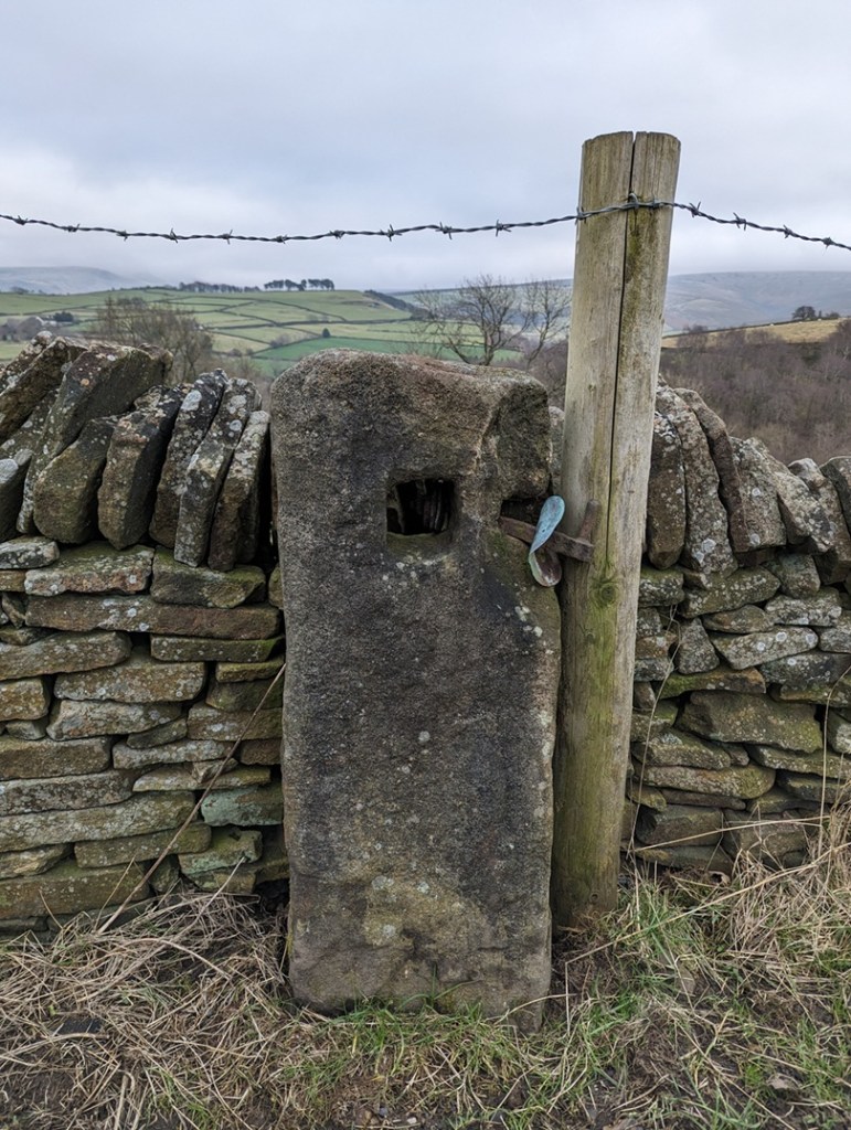
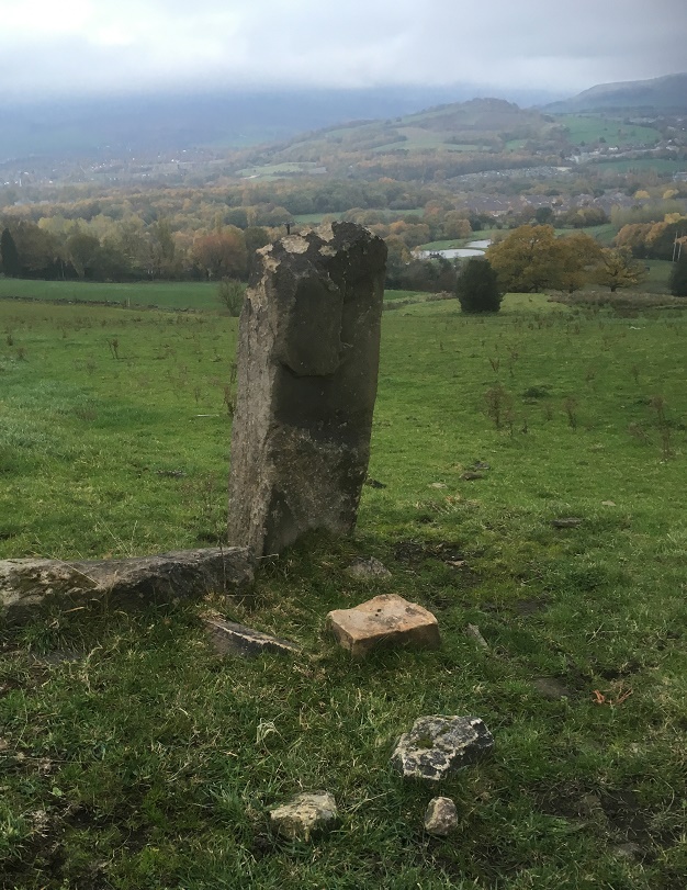
This is the sort of thing I mean, this one is between Lees Hall and Herod Farm.

Characterised by the (mostly) single hole of a square-shape roughly carved into the upper part of the upright stone. In this area, they are of an undressed coarse gritstone, very much unlike the newer carved gateposts, which have a smoothly dressed surface – these are rough. They also looked older than any other gateposts, seemingly quite worn and in no particular shape, simply vertical and between 1 and 2 foot accross – they seem part of the landscape, grown organically, rather than imposed onto it and standing as markedly different, as the more modern gateposts do. In fact, so much so, that the first one I noticed properly I thought might actually have been a reused prehistoric standing stone.

But as I did some research into the medieval and post-medieval trackways, I began to notice that these stone were found along the older roads in the area, and often located at junctions in tracks, where they split, or at particular curves, and I began to think of the holed stones as being track markers, with the hole perhaps taking a piece of wood to act as a finger post?

I was wrong! They are definitely gateposts – the full explanation is explored here in this article, but basically a piece of wood was inserted into the hole, this then had two holes drilled into it, and then another piece of – green – wood was curved into the two holes making a loop, and it was into this that the gate was firmly fixed. This would explain, also, why the holes in the stones never face where you would expect the gate to be.

Being that sort of person, I plotted all the ones I know about (currently 26) on a map, and a surprising pattern emerged. They all seem to be clumped around early field systems – the ones with the long thin selions, and with evidence of ridge and furrow. These ‘fields’ had no need for walls and boundaries, they were part of the “open field system” in which land was communal, and allotted to individuals within the settlement on a rotating basis. So the concept of a stone gatepost was not needed here until about 1433, when the Talbot family took ownership of the Glossop estate from the monks at Basingwerk. The Talbots, shrewd businessmen, understood that not much money could be made from peasants growing subsistence crops, so instead changed the local economy to sheep farming – the peasants got paid, the Talbots made money from the wool. Of course, sheep wander off, so we start to see walls appearing at this time (you also need to keep the sheep of the small crops you are growing). Which leads me to my working hypothesis: I wonder if these gateposts are the first ones that appear after the mid 15th century, as the fields are increasingly enclosed? Certainly in his 1815 book, General View of the Agriculture and Minerals of Derbyshire, John Farey notes that “Anciently, the Gates in the Peak Hundreds were formed and hung without any iron-work“, and proceeds to describe the holed stones in use as gateposts. That he uses the term “anciently” suggests great age.

This got me further thinking… if the gateposts are associated with medieval fields, might they not tell us where these fields were situated, assuming we don’t know? I don’t know the answer to that, but watch this space for more research.

However, I want to share with you a small field trip I did (in association with Lee, of the Punk Archaeology Podcast) to collect some data on these holed gateposts. A sample of them around the Whitfield Field System was explored, and I thought you might be interested in the results.

This is the map of the posts – the blue arrows mark each one, with its name:
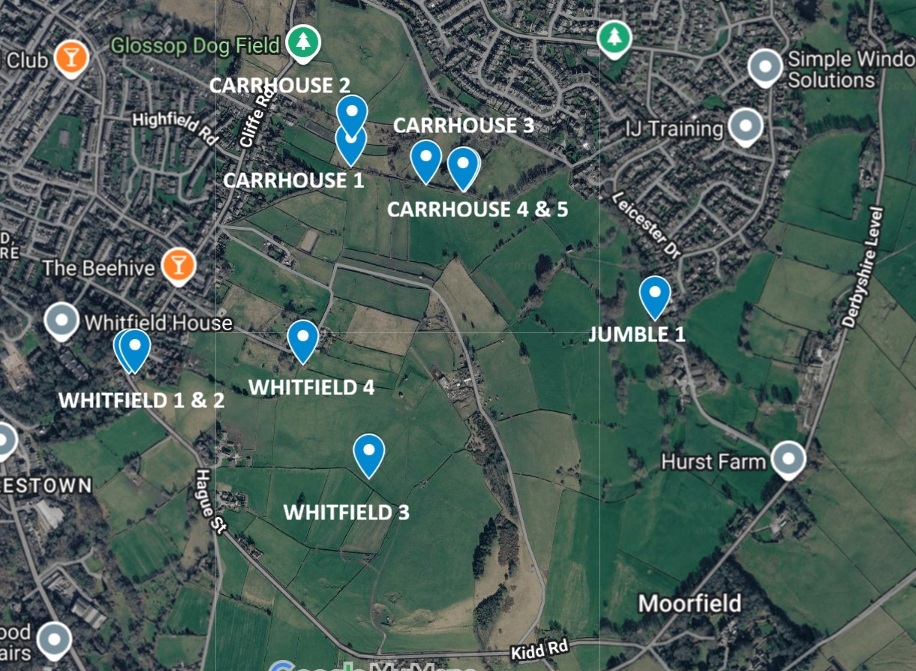
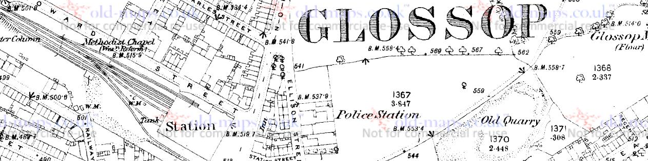
You can see the field system – the long thin ‘reverse-S’ shaped fields throughout the middle, but it is clearer on this 1890 map as the area has not yet been built up:
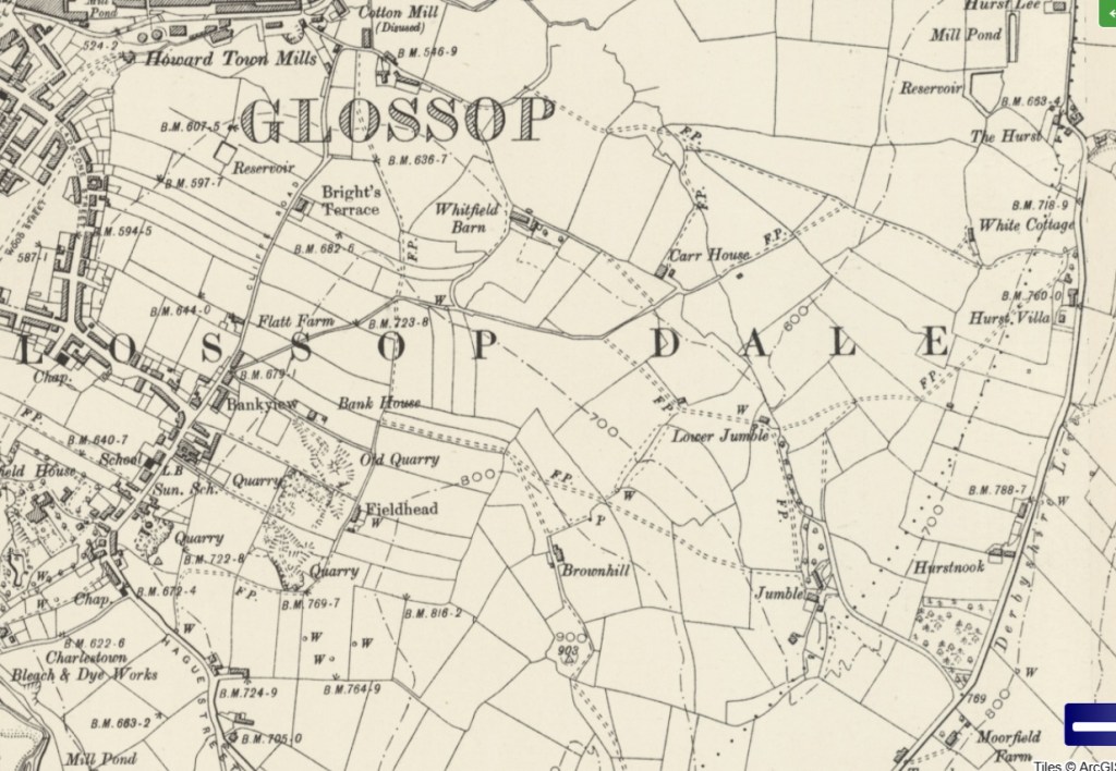
Everything on either side of Cliffe Road,, and below the word Glossop, as well as all kinds of stuff east of there. It’s a jumble, which is, in all honesty, probably how Jumble Farm got its name! Honestly, this part of the medieval field system in Whitfield is not talked about very much, and it needs to better known.

So then, what did we see on each of these points? Well, 10 of these stones with square holes. We measured the holes with the idea that if they all had broadly the same size hole, then they might be of a similar age/date/construction – I’ll put the size under each photo (in inches, not cm… it seemed more appropriate, and whilst the farmer making the hole wouldn’t be measuring strictly, he would have an idea in his head of the ‘right’ size the hole needed to be). I’m also giving the ‘What 3 Words’ location to each of the stones – I kno wit’s a bit gimmicky, but the idea of being able to enter 3 words into a free app, and be able to get the location down to 1m square is truly bean-altering. I’m not sponsored by them (I wish!), but I honestly believe W3W is a great tool… providing you have a phone signal!

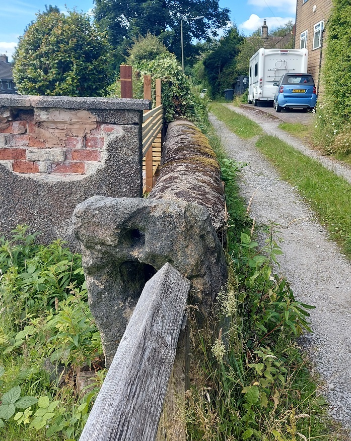
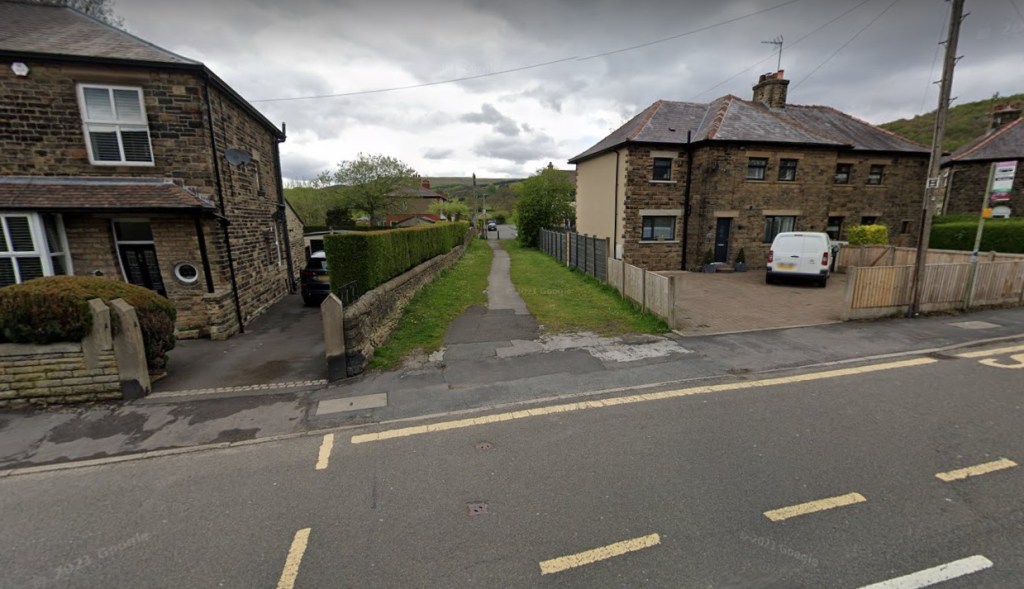
Whitfield 1 (W3W – seagull / birdcage / pausing, Hole = 4″ x4″) – on Hague Street. Squat and chunky, it stands where it has stood for a few centuries at least, right on the road – the main road between Glossop and Hayfield in the medieval period – and right on a property boundary.

Just behind it is Whitfield 2. This one on private property, and given its proximity to Whitfield 1, we suspect it might have been moved, but who knows.
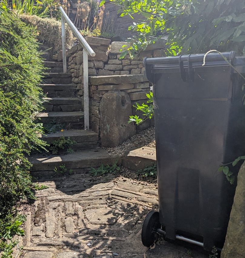
Whitfield 2 (W3W – seagull / birdcage / pausing, Hole = 4.5″ x 4″) – Whitfield 1 can just be seen in the bottom right, so you can see how close it is. Does this mean it has been moved? Well no, and given that it stands at about the same height, perhaps it was part of a complex system of gates that controlled access? I don’t know… you decide!

The next one is difficult to spot – right in the middle of a field, away from any paths, but not hidden from the prying eyes of binoculars:
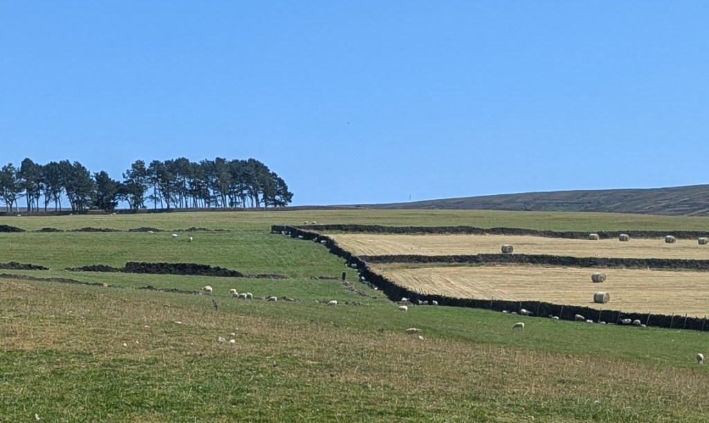
Whitfield 3 (W3W – powering / assets / flooding, Hole = No Data, as I couldn’t get near it) – The dark standing stone is pretty much dead centre of this photograph.

Previously I had asked Master CG if he could see if it had a hole in it – I explained that my eyes can’t see from that distance… he replied yes, it did have a hole, and then muttered something about “ancient” presumably referring to the stone, and “put in a home“… which I didn’t fully understand.

Next up we have this somewhat disguised beauty:
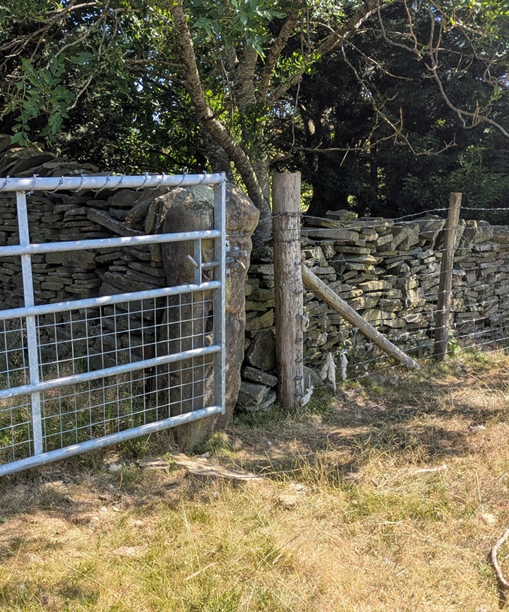
Whitfield 4 (W3W – acoustics / martini / pocket, Hole = 3″ wide x 4″ tall) – still used as a modified gatepost, now taking a steel gate rather than a wooden oddly constructed affair. I like this, it shows continuity of use, and of the continued need of a gate into a field that remained in the same location for centuries.

The other side also reveals another surprise – an Ordnance Survey benchmark, although this one does not appear on any map I have seen – it is a lost benchmark without a height above sea level. I wonder if it was carved, but the height was either not recorded, or somehow was unreadable, and it was never resurveyed.
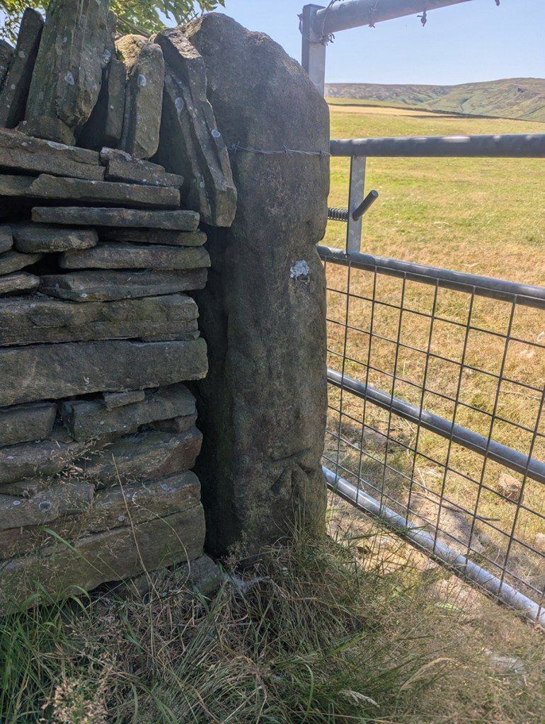
Whitfield 4 again, the OS benchmark is at the base of the stone.

Moving on, along this line, we come to what I have named Carrhouse 1, as it actually sits on Carrhouse Lane:
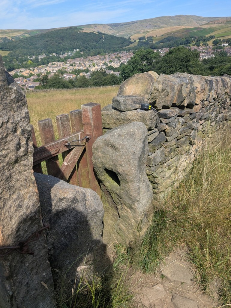
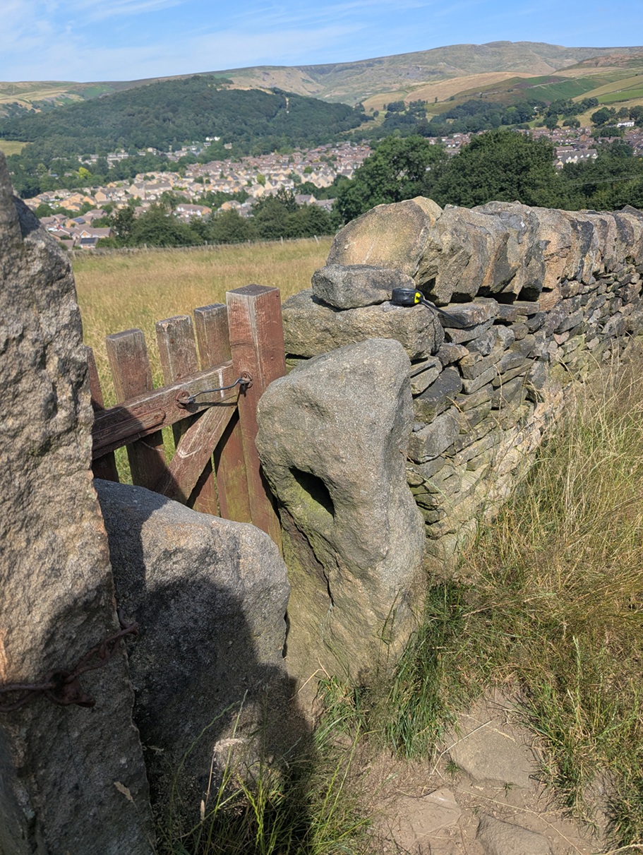
Carrhouse 1 (W3W – whisker / deform / nibbles, Hole = 5″ x 5″). I love this photo; Shire Hill in the background, and the view over the Shirebrook Estate puts this in its modern landscape. You can also see my tape measure on the wall, just used to measure the hole.

This is being used as a stile/gate, but the other stone, opposite it, is its mirror – same height and rough shape – only it doesn’t have a hole in it. Odd, but I feel the two must be connected, somehow.

On we go, along this path a short distance, across two fields, and over the stile there, immediately on the floor at the left, and lying face up, is Whitfield 5:
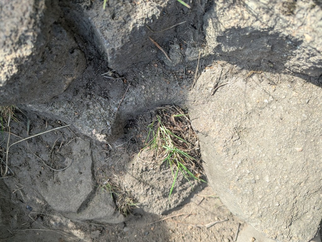
Whitfield 5 (W3W – tanks / falters / animates, Hole = 5″ x 5″). The square hole with rounded corners is in the centre of the photograph, with grass growing out of it. I’d love to dig this up and set it upright once again… it deserves more.

Clearly it had been broken at some stage in its history – the upper part of the holed bit has sheered off – and the farmer has replaced it with a stile… but the hole is still visible.

Back the way we came, and left along Carrhouse Lane, on the right we soon come to a hugely overgrown gateway, and nestled against the newer gatepost is:
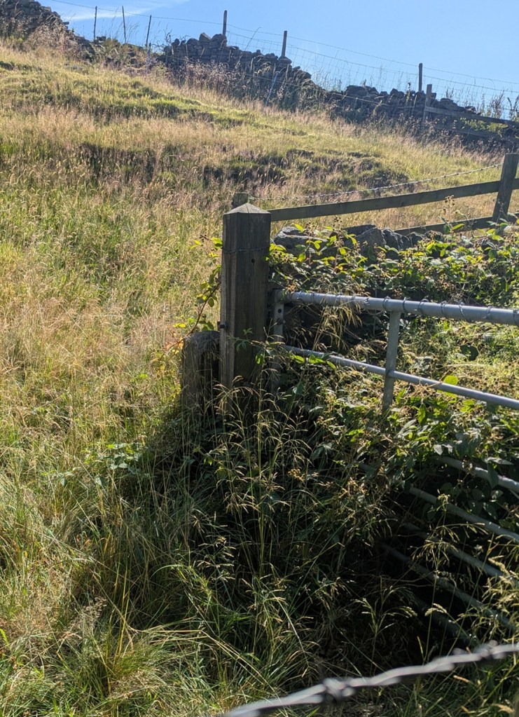
Carrhouse Lane 2 (W3W – majors / creamed / swam, Hole = No Data. The entrance is buried by about 3 metres of blackberry!). I have been close enough to this one to put my hand into the hole, so it is real, despite the awful photograph. I shall try again in winter, and update the article.

I shall get a better shot of this one, I promise, but you can just about make out the dark area that is the hole in the short post.

A little further on, on the left, is this pair of beauties:

The post on the left has two holes in it, and is a bit of an anomaly, although there are other examples of multiple holes around the area. It has actually been split at the upper part of it, the result of a farmer sometime in the Victorian period drilling a hole to take an iron pintle, and cracking the rock.
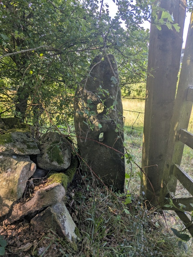
Carrhouse 3 (W3W – goad / tidal / bigger, Holes: upper = 3.5″ x 4″, lower = 3.5″ x 4″). Lovely.

The other side of the gateway confused me at first, though: there was no hole… or so I thought. Looking more closely, it seems that the hole has been cemented up, possibly to prevent or repair a crack?
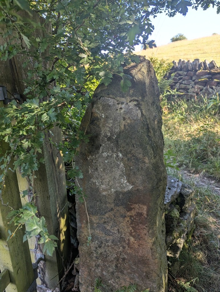
Carrhouse 4 (W3W – goad / tidal / bigger, Hole = 4″ x 4″). Although, I looked, I couldn’t see that the upper part of the cement was covering a hole – I think it was whoever did it filling in some gaps? I shall double check, of course, next time I’m passing.

Finally, walking on the path toward Jumble Farm, we find this one, shorter than most, just before you get into the farmyard:
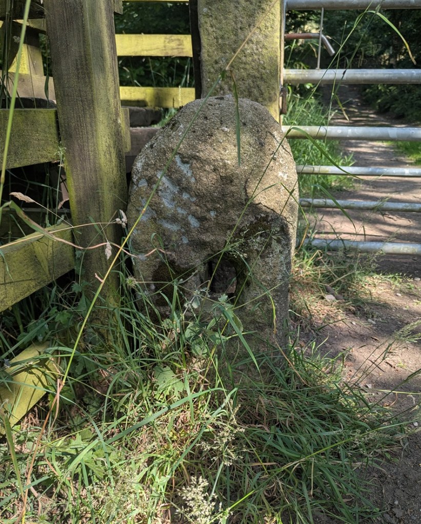
Jumble Farm 1 (W3W – reclined / monk / swept, Hole = 4″ x 5″). It original function here is replaced by large Victorian carved gateposts.

Well there we are – a small selection of holed stones on a quick walk around Whitfield, and all associated with the Whitfield Medieval Field System. I’m not saying it proves my hypothesis, but they are all clearly of the same age, with the same size hole, and same rough shaping – we just need to identify that age. And I would argue the late medieval period (post-1450). More research is definitely needed – I have 26 holed stones that I know about – they’re all in a map that I’ll share with you below, and you can go and look at them yourselves – each one is marked by a blue arrow.

However, there are doubtless 100s more out there, lurking, hidden… lost. And that is where you come in. Please, do me a favour… if you know of any, or after reading this notice some in the Glossop(ish) area, please let me know – send me a photo, a dropped pin in Google maps, a What 3 Words, an email telling me where it is… anything. But let me know, as I think there is more here to be uncovered regarding land use and field systems in the medieval and post-medieval periods. Exciting, and I want you all to share in this, so go forth and do some research that might help us.

The map is here, just click on the link: Map of Holed Stones

Stay in touch!

Right, that’s all folks for this time. My thanks to Lee of the Punk Archaeology Podcast (first episode is coming soon) for the help in exploring this group of stones.

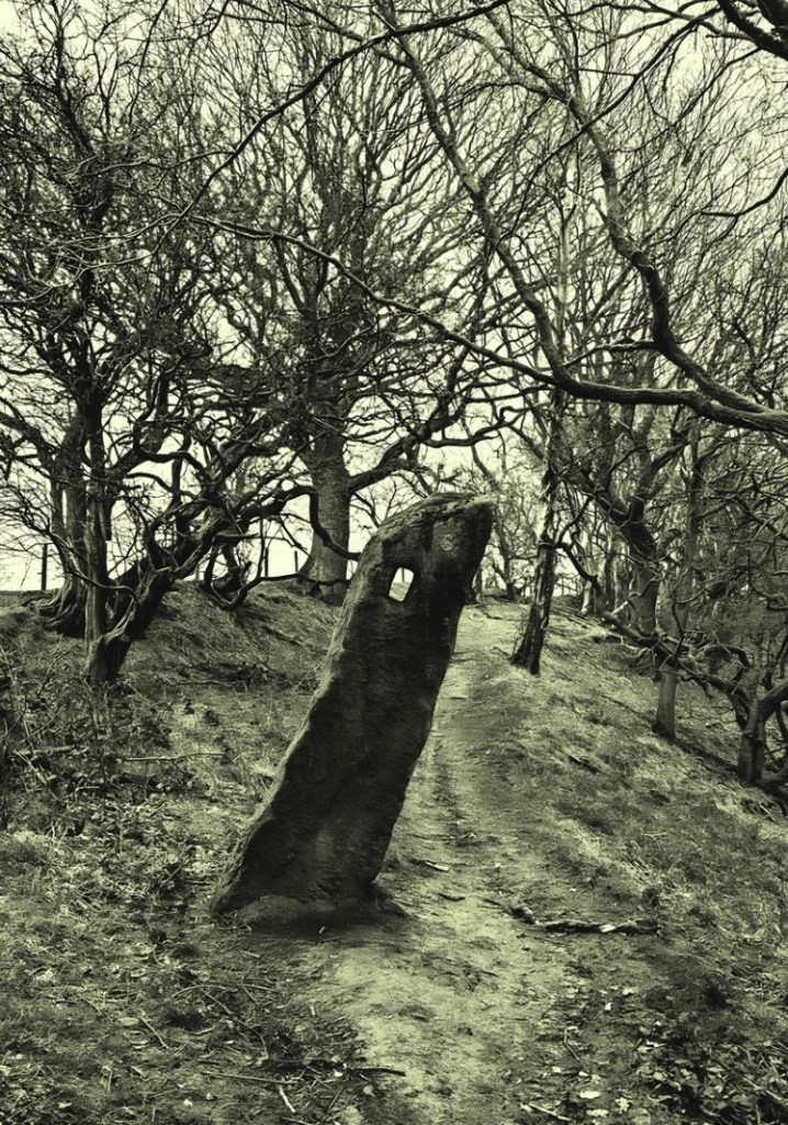
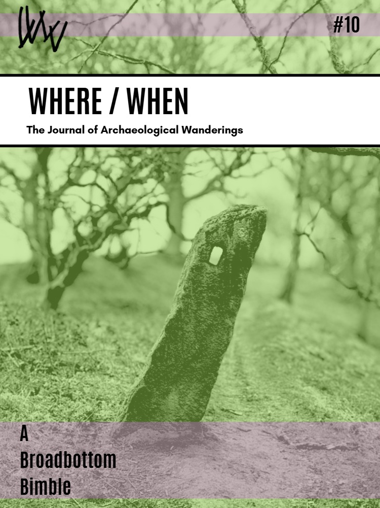
By an amazing coincidence, holed stones also feature in the latest Where/When, available in the usual places (alright, Dark Peak Books), but also directly from me (link here), and I can post it to you.
Archaeology · Roads · Stones of Glossop

Ma(r)king Tracks

What ho, wonderful people!

Nope, no pottery today. Instead we have tracks. And stones. And holes. Look, just read on… it’s simpler.

Now, I do love a good track. Ask anyone who knows me, and they’ll say “why yes, that ruggedly handsome, wonderously whiskered, and all-round splendid chap does indeed love a good track or two“. I also love a good stone. In fact, ask anyone who knows me, and they’ll say “why yes, that marvellous man, that genius gentleman, that… ” What’s that? What do you mean “get on with it!“? Honestly.

Ok, so several years ago I noticed that dotted around the Glossop area are a number of standing stones that have holes carved in them. I did wonder about them, but presumed they were a form of gatepost, even if they didn’t seem to be in a place one would expect a gatepost.

A holed stone on Hague Street. They remind a bit of Hattifatteners from the Moomin stories… they probably come to life at night.

More recently I have been looking at tracks:

TRACK (noun) A rough path or road, typically one beaten by use rather than constructed.

And more specifically, the old – medieval or post-medieval (10th – 17th centuries) – trackways that dotted the area. Glossop is a great example of what we call a medieval ‘dispersed settlement’ – essentially, whilst there is a central focus – Old Glossop, with the church and market – most people actually lived in the many surrounding ‘dispersed’ farmsteads – Heath, Dinting, Ashes, Jumble, etc. People came together every Sunday for Mass, as well as other feast days and holy-days, for market days, as well as socially – for a drink in the tavern, for example. But by and large, Glossop in the medieval and early modern periods was dispersed throughout the valley in farmsteads. In this instance, a farmstead may be understood as a farmhouse and associated buildings – barns, shippons, and various ‘farm-ey’ outbuildings – as well as houses for the farmworkers. In total, we’re looking at perhaps 20 people or so for a larger farmstead, maybe 5 for a smaller. Of course, people need to travel, and roads were made through the landscape, connecting these farmsteads, and it these I incredibly interesting.

This is the track that runs down from Ashes to Dinting – once the main thoroughfare, now a beautiful sunken trackway, or holloway as they are known, its age is shown by its depth, worn through use.

They were not just a means of physical movement through the landscape, but also a conduit for other aspects of life. As packhorse routes (no horse and carts here, just heavily laden beasts of burden) they connected everybody, and allowed goods and produce to move between places and markets. News of the wider world also moved along these tracks – a new king or a new religion, or news of battles and wonders in far off places. But so did disease and infection; the Black Death and Great Plague once walked these tracks. We also encounter the more local and personal aspects of life, too: newlyweds from church, newborns from baptisms, and the final journey from the farmstead to the church yard, as the deceased was carried for burial, often for miles, along the tracks, followed by mourning family and friends. All of life is contained in a track, worn deep by use, and all of history held there, if only we could access it.

However, the collision of stone and track didn’t connect until last year, when it occurred with an audible click at Pyegrove.

Pyegrove circled in red. For orientation, the Snake Pass runs horizontally across the bottom, with the Commercial Inn on Manor Park Road circled in blue on the right, and the Royal Oak, left. Note the green arrow. Map from the marvellous and incredibly useful National Library of Scotland map website – well worth an explore.

An afternoon playdate with Master Hamnett and his friend led us to Manor Park via Pyegrove. Now Pyegrove is an interesting corner of Glossop, with a long history; the name means the copse or thicket’ (grove or greve, as it is in older maps) of the magpie (the ‘Pie’ or ‘Pye’ element) which suits its location below Shire Hill perfectly. The house here has a datestone that reads “I.M.A. 1747” (no photographs, alas… it’s difficult to even see it without overtly trespassing), so that the house is at least that early. However, in the baptism record of a John Shepperd at Glossop on Christmas Day 1735, his father (Robert Shepperd the Younger) gives his address as Pyegreve, so we know something else was there at an earlier date. Pyegrove is, I suspect, another medieval farmstead… but all that (along with tales of Buffalo Bill) is for another time. Let’s return to tracks and stones.

The footpath at Pyegrove splits – right skirts Shire Hill down to Mossy Lea, left ploughs on over the playing fields to Glossop.

Tarmacked, unlike the original, choose your path wisely.

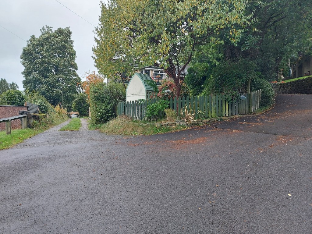
But just at the split I noticed this:

Oooooh!, thought I – a holed stone…

It was at that point it suddenly struck me, and as I stood there gasping like a stunned fish, ignoring the children, and mentally ran over all the holed stones I knew about (5 at that point). Of course, I thought, they all marked a junction in a footpath or track! And all of those tracks, I was fairly certain (and am now convinced) were the preservation of early (medieval or post-medieval) trackways between farmsteads. I have talked about this before – the fossilisation of early trackways, preserved as footpaths within modern settings, but in essence once the newer – and much better – roads were constructed for the mills (1790’s onwards), these old roads fell out of use, but as they often were more direct, and were known by locals who still used them, they gradually became public rights of way.

The stones, being big and heavy, are often not moved, so there they sit as testament to the tracks that were once the main roads between the dispersed settlements that made up Glossop. I know of 9 holed stones now (and two more that might be relevant), and looking closely at the stones, they all share similar aspects. Upright, and roughly shaped from millstone grit or similar gritstone, and they seem quite worn – usually an indicator of age. The hole, made through the stone, is broadly square in shape, measuring between 3 and 4 inches across, roughly carved, and placed in the top third of the stone. I am convinced they were shaped and set up by the same group of people to make using the notoriously bad road system around Glossop easier. Of the stones, the obvious question is why does it have a hole in it? My first thought was that it would mark the stone as different from others that might be in the area, making sure that a junction wouldn’t be missed in the dark or bad weather. This might be the case, but then I remembered reading that in 1693 a law was passed that trackways had to have a guide post showing destinations (the Whitfield Guide Stoop was a result of this law, but probably a later incarnation), and I wonder if the hole was there to allow a wooden sign to be placed in it with destination painted or carved on it? Or perhaps a simple stick pointing the way? Any thoughts on this, o’ wonderful readers? I also wonder how far this tradition continues – certainly I know of no others in surrounding areas – even Tintwistle or Hadfield, for example, seem to have no holed stones, although I’m happy to be proven wrong. .

But let’s have a virtual explore the Pyegrove to Glossop track here, starting at the stone that started it all.

Ignore the later drilled circular hole, and the rusty bolt through the hole – this is a classic junction marker, with its ‘square’ hole and rough shaping.

Ignoring the A57/Snake Pass (opened in 1821, although bits are older), behind us is what is now Derbyshire Level, with the farmsteads of The Hurst, Jumble, and Gnat Hole, and also the road to Whitfield and Chapel en le Frith. Going left, then, a track along the edge of some houses leads out into Pyegrove Playing Fields.

Looking back at Pyegrove, the overgrown track hides what was once a main thoroughfare into Glossop. O’ for an excavation of this track!

Along the northern edge of the playing fields the track is no longer used, but is visible as a ‘holloway’ – a track worn deep with use.

Here is the Holloway, Green Way, or sunken trackway, depending on how you call it. Do you known what, it’s oddly difficult to photograph a dip in the field, but it is there… honestly!

We join the track again at the corner of the playing field, where there is a lovely squared off standing stone.

A simple standing stone, if such a thing exists.

This seems to mark the junction of a track that originates at Cross Cliffe, here marked in blue:

The trackway is visible in the older maps, and although it fizzles out on the ground, it is preserved in field boundaries and fossilised in strangely preserved bits of pathway.

Whilst it is just about marked on older maps, it is no longer in use, although its memory is fossilised in this bit of unnecessary and unusually wide stretch of pedestrianised path leading from the Snake Pass to Pyegrove Park (marked with a red circle in the above map)

Oddly wide, and completely unnecessary, this is the fossilisation of an older track from Cross Cliffe.

These simple – unholed – standing stones sometimes mark junctions, but more normally simply mark the line of a path where is might not be obvious, particularly in the dark or rough environment (I know of about 12 of these, too).

We continue along our Pyegrove track beyond the stone and past the remains of the Royal Observer Corps station. Briefly, the station was meant to monitor potential enemy aircraft in the immediate post-WWII period, but it would also serve as a monitoring post, observing and recording the effects of any nuclear detonation on Manchester – wind speed, radiation levels, blast radius, etc. This is why it is built into the hillside, 15ft below ground level. A sobering thought, and one sadly now relevant once more. This will also be the subject of a future blog post, don’t worry!

An interesting slice of much more modern history, but one that is certainly worth a look at .

Back to the task in hand, and on to another standing stone. This one, looking for all the world like a gravestone, was originally one of a pair (its partner is embedded, horizontally now, in the wall.

One of a pair – the other can be seen lying horizontally built into the wall – same stone type, same width, same depth, and presumably the same length, accounting for a few feet underground.

These gravestone pairs are usually found mid track or at the start of junctions, and seem to be a later addition to the tracks (probably post-1790’s) and seem to be an attempt to force packhorses and traffic onto the newer roads (and presumably so they can pay the tolls) – and early form of traffic calming, if you will. I am fairly certain with the date of c.1800 as Whitfield Cross was used as a partner to one of these ‘gravestone’ pairings after it was moved in about 1800. There is some graffiti carved on the top of this stone – ‘G.B.’.

G.B. step forward and take a bow – I do like a bit of carved graffiti.

From here we continue, round the corner, to the farmstead of Hall Fold.

Converted barn and outbuildings of the farmstead of Hall Fold

A datestone here records ‘J.S.J. 1806’, but this was apparently found when the owner was digging a foundation, and clearly Hall Fold Farm is older that that.

Not my photo – stolen shamelessly from the Old Glossop website, which has a bit of history and a series of very interesting photographs of Hall Fold Farm – here.

The name itself may refer to a long demolished, possibly medieval, original Glossop Hall (Manor Park Road was once known as Hall Street). This is also the location of a junction – our track is joined from one that comes from Whitfield (an extension of this one).

A fork in the track!

Our track from Pyegrove is on the left hand, but the one from Whitfield comes via Old Glossop Cricket Club, and would have come through the gates ahead. Though no longer in use, its presence is preserved in field boundaries and the fact that these houses (c.1830’s) respect the track, which is why they are built at that strange angle. It’s also visible in LIDAR under the cricket pitch.

Sadly, no marker stone remains at Hall Fold Farm (although I didn’t start poking around people’s gardens, and it may well be lurking somewhere – large stones are hard to completely lose). From here, the medieval centre of Glossop is a hop, skip and a jump… if you are feeling so inclined.

I have to say, though, walking into Glossop this way is a much more interesting – and authentic – experience, and one that is very different from walking along Manor Park Road! We take our modern roads for granted, and I’m not going to lie – the idea of moving along these tracks in bad weather and in darkness fills me with fear.

This is a small part of a much larger project I’m working on, tracing these tracks all over Glossopdale. Each of the settlements that make up ‘Glossop’ – from Wooley Bridge in the west, to Pyegrove in the east, Tintwistle at the north, to Chunal in the south – have multiple tracks linking them, and for the large part they are still there, often hidden, occasionally ‘fossilised’ as footpaths, or even still in use. This is truly an overlooked, and indeed largely undiscovered, aspect of Glossop’s pre-Victorian/pre-Industrial history, but one that was vital to its development. And I have to say it is great fun being able to walk these ways, and pondering the history they hold – if anyone fancies joining me, give me a shout. Also, and this is a serious request, if anyone knows of any holed stones (or any standing stones, for that matter) that I might not know about, please do get in touch – often half hidden in hedgerows, they will lurk where two or more tracks join.

Right, that’s all for now. More pottery next time (did anyone else hear that high-pitched screaming sound?), but until then look after yourselves and each other, and I remain,

Your humble servant,

RH.

Bench Marks

A Lost Bench Mark

Morning all. Apologies for the recent lack of activity; all usual reasons apply, but we’ll spare the grovelling and move swiftly on.

I was contacted recently by the wonderful Geoff Bell, who informed me that he knew the whereabouts of one of the bench marks that had been declared lost by me in this post. Specifically, this one.

GB BM
The location of the no longer missing bench mark, 562.5 ft above sea level. 

How wrong I was! I popped over to see him (and his wonderful garden), and he showed me the stone and mark. It wasn’t easy to get to, but at least I can now tick it off my list.

Here is the stone:

GB BM1
Stood at the end of, and incorporated into, the wall.

The stone is interesting. It is clearly in its original place, with the current wall being relatively recently added, but following the line of the original wall. This original wall used the stone as a reference point (it curves to meet it), and it was clearly here before the wall was built, leading to the question of… what was it? It seems not to have functioned as a gatepost, it has no evidence of metal ‘fixings’, nor is it shaped like other gateposts, and it would be an odd place to have it. It is possible that it was a free-standing standing stone, perhaps even prehistoric, but it is difficult to prove. It might also have marked a track, and although the probably Medieval or earlier Bank Street runs close by, it’s way below (some 39 ft and more, to be precise), and no one moves a stone that big very far up hill. No, it’s a bit of a mystery, but hey ho.

So, this is what 562.5ft above sea level looks like! Apologies for the close-up – there was no easier way of taking the shot – it really was quite inaccessible!

GB BM2
Exactly 562.5ft above sea level. 

So there we have it. My sincere thanks to Geoff (lovely to meet you) for alerting me to this. If anyone else wants to get in touch and tell me about anything interesting, please do… especially if it involves bench marks!

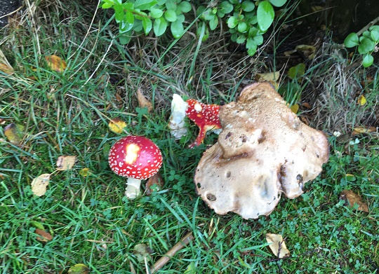
Oh, and on the way out of his garden, I saw these striking Fly Agaric mushrooms:

GB BM3
Amanita Muscaria – the Fly Agaric. 

Wonderful to look at, and used by shamen throughout the world to commune with the other worlds and work magic. Interesting, but I really wouldn’t recommend it.

Right. I ‘ll try and get another post done this evening, but for now, I remain.

Your humble servant

RH

Standing Stones · Stones of Glossop

Standing Stones

So, apologies for the late running of this blog post. I have half a dozen half-written posts at any one time, and this one seems to have had a difficult birth! It was finally scrawled on the back of the minutes of the AGM for the Glossop & Longdendale Archaeological Society in a cafe whilst waiting for Mrs Hamnett to come out of surgery in Wythenshaw Hospital! (All is good on that front, and she is making a recovery). Apologies also for the length of this one, and for the archaeological theory. I do love a good bit of interpretation, and in my previous archaeological life this was the stuff that nourished!

I was having a conversation with my brother-in-law the other day (Hi Chris), and he asked whether I had seen the standing stone on Long Lane, between Charlesworth and Broadbottom Bridge. As it happens, I had, and it was on my ‘to do’ blog list.

And here it is, being done… well, we’ll get to it in a minute

Standing stones and stone circles are some of the things that first grabbed me when I began to look at archaeology seriously. The fact that they were a tangible and impressive representation of the past made them stand out, and yet they were enigmatic – their function and meaning still not fully understood. Single standing stones in particular have been overlooked as monuments; their very nature – a single stone, standing upright – has meant interpretation is difficult. Moreover, they are largely undatable unless associated with other monuments such a stone circle, and people throughout history have stood stones upright, and for a variety of reasons (cattle scratching post, waymarker, gatepost, etc.). Generally, though, they are considered to belong to the later Neolithic and Early Bronze Age (roughly 3000BC – 2000BC). As to their function, they are often viewed as marking a territory, or as a meeting place, usually with ‘ritual’ overtones. In more recent times, they are often associated with folklore and the supernatural, and even leylines.

STST 1
A stone beside the River Etherow, in Broadbottom. This one is, I think, a glacial erratic.

Recent archaeological work has begun to unpick the possible meanings and functions of many of the monuments of prehistoric Britain, and especially those of the Neolithic. This has been done more subtly and intuitively than previously, and looks at monuments in their surroundings, and how the people would have experienced, used, and passed through them, rather than viewing them as just objects. Words like landscape and phenomenology are used, and it often draws on other disciplines such as philosophy to help with understanding the past. Extrapolating from this work at the larger monuments, and in particular the pits, causewayed enclosures, and chambered tombs of the Early Neolithic, we can use some of these ideas to explore a possible meaning of the standing stones of the Late Neolithic and Early Bronze Age.

As I’ve said before, a standing stone is just that, a stone, standing. But conceptually, it is much more than that, it is a fixed point in the landscape, around which human experience can revolve, and emerges from a concern with marking a particular space as being different from it surroundings, transforming it, and placing it within the landscape but apart.

It is clear that the actual creation of monuments such as these was just as important as the finished product, and the erection of a standing stone is not a simple task. It requires group work and cooperation; with the stone weighing perhaps a ton or more, families, extended families, kinship groups, or even clans would be working together to make the stone. It would be a period of community, sharing work and food, and the creation of joint place. The stone would have to be shifted and shaped, and here we have decision to be made. From where is the stone to be quarried? The source may be significant to the people creating the monument, and perhaps that quarry or stone type already figures in their stories and beliefs, already a sacred site. Although practical considerations are possible, it may not always be the case – the Stonehenge Bluestones were moved by land, sea, river, and land from the Preseli Hills in Wales – a journey of over 150 miles, because they were deemed important. Our practical concerns are different from theirs.

Then we must consider location, why was the stone sited where it was. The larger monuments, such as the enclosures of the Early Neolithic, often have evidence of earlier occupation, and it seems that the monuments are referencing these flint scatters and back-filled pits, a way of acknowledging those who went before – the ancestors. It may be the case with the standing stones. But equally, they may reference something else – a feature of the landscape, or perhaps some other, more numinous reason which we would never be able to fathom. Did a shaman have a vision suggesting the site? Or did lightning strike? Or someone die there? Or… you get the idea. And did the stones stand on a bare hillside as they do now, or did they lurk in a bright woodland clearing?

Stst11
Another stone by the River Etherow. This one is shaped, and was perhaps a gatepost.

Once in place, the people responsible for erecting it might visit periodically – every year on midsummer’s eve, for example, or every full moon, or when the cattle are herded from lowland pasture to the upper areas, or even every day. But certainly through these periodic visits it would be seen as, calendar-like, marking time, or even creating a ‘mythic’ time, outside of ‘real’ time. They might have visited in large groups, taking the form of kin-related clan-wide celebrations, for example, or perhaps in small family groups, or even as individuals. Each visit would recall previous visits, previous times of coming together in celebration, or in mourning, for example. But there would be feasting and celebrating, certainly, with people gathered in their groups round hearths and fires.

Perhaps the area around the stone was kept spotlessly, meticulously, clean, and each visit revealed traces of the old hearths clearly, and the conversations, people, exchanges, jokes even, that happened around those hearths would be recalled and spoken about. And it’s not hard for us to imagine a group of people, framed by firelight, moving in a circular fashion around the stone, dancing. But perhaps, and I suspect more likely, the area around the stone was littered with the detritus of these older meetings – pottery, animal bone, flint, pits dug into the earth, stone, and other bits and pieces, all deliberately displayed as a reminder of the past visits. There may well have been human remains, too, in the form of cremation or as an internment, or even random bones, carefully kept and handled – curated for generations – before finally being deposited around the stone. Each item or object speaking to the people of the past, of past lives and events, and of the ancestors. With each visit, again and again, there was the creation of new memories, new meetings, and yet still the recollection of older ones – the ancestors would have loomed large and heavily in these times.

The stone here acts as a mnemonic device, an object that helps us remember. That is its purpose, its meaning… to help us recall previous visits to the stone. Using the stone as a focus in this way, time can be manipulated: the individual can visit past people and events, travelling and recalling; but equally the ancestors and past gatherings can be brought into the present through shared memory. Importantly, the ancestors can be projected forward into the future, asking for their intercession for a good harvest, for example, or for help and advice.

And of course, when the people gathered together for feasting and celebrating, there would have been exchanges in the form of gifts and barter – and from hearth to hearth, and valley to valley, there was an exchange of resources, news, gossip, alliances, ideas, beliefs, objects, allegiances, skills, animals, marriage partners, and so on.

In fact, all the drama of human existence revolving round this fixed point in the universe, a node, a single stone standing in not just a physical landscape, but in this case a cultural landscape, and on a personal level, a psychological landscape.

Phew!

So then, the stones…

  • Hargate Hill Stone

Let’s start with the stone that sits on the corner of Hargate Hill Lane and High Lane, the road between Simmondley and Charlesworth. It’s here:

STST3
The stone is circled. The air shaft to the right is the mine shaft down which Albert Burrows, the Simmondley Pit Murderer, pushed his four victims – the subject of a future blog post.

Here is the stone.

STST5
The standing stone above Hargate Hill. Mouselow Iron Age Hillfort is in the background.

The stone is very obviously deliberately placed, and sits on the junction of two tracks, both clearly ancient, and like many standing stones, it stands mid-slope, i.e. not at the top or bottom of the hill. It could be argued that the stone is placed as a marker for the tracks, but I suspect that the track from Hargate Hill used an already existing stone as a sight marker. Interestingly, Neville Sharp suggests that its chisel-like head points towards Shire Hill,  some 3km north west of the stone. And yes, seemingly it does.

stst6
Shire Hill looms darkly through the murk.

This may be important. It is not uncommon for standing stones to reference features like this, and Shire Hill is fairly prominent in the landscape, even on gloomy days, it can be made out easily, as the above photograph shows. Interestingly, in the mid 1950’s, the cremated remains of a female dating to the Late Bronze Age was uncovered on the south slope of Shire Hill during the building of a bungalow there. The remains had been placed in an upturned burial vessel, which was laid on a bed of charcoal. Sadly, there is very little information available about this important find. Out of our period, but points to prehistoric activity on the site.

There is, marked on the 1887 OS map (see above) another stone just to the east of this one. I have looked but cannot find any remains of a stone, even a small one, and not even reused as part of a wall – whatever was there in 1887 is no longer there now, sadly. But it is worth mentioning that standing stones sometimes occur in pairs.

  • Hague Stone.

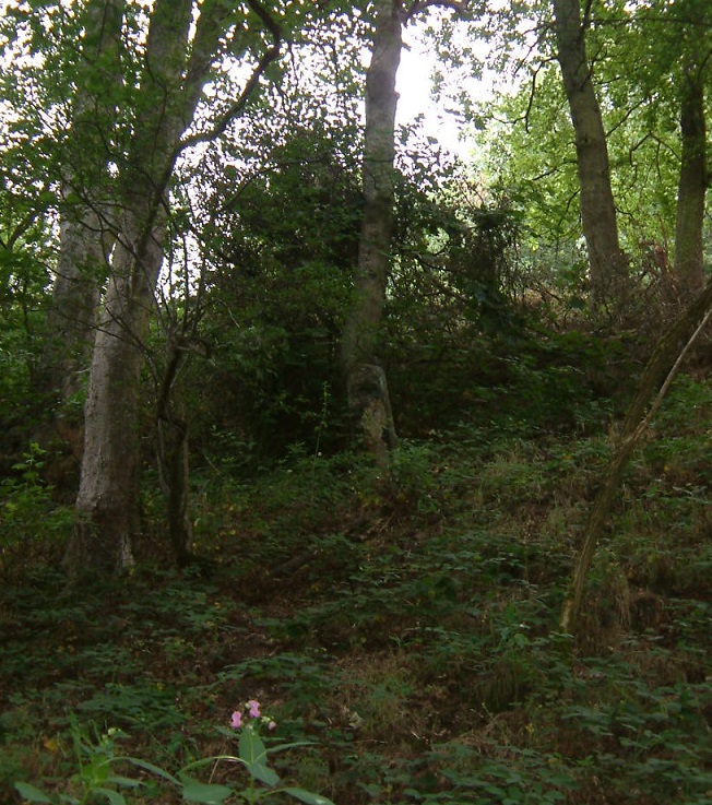
I found this one years ago – I did a ramble in search of this stone and Pymm’s Parlour Roman rock shelter on the banks of the River Etherow (the subject of a future blog). Finding it was not easy, as it now tucked away in a wooded area, and for some reason I didn’t take any decent photographs… not sure why.

stst9
Hague Stone marked in red, Pymm’s Parlour (here Prim’s), a Roman rock shelter, in green.       1898 1:2500 OS map

Here’s the stone.

stst10
The Hague Stone, dead centre, disguised as a tree. Apologies for the photograph.

It’s a fairly hefty stone, as you can see, and tucked away, though the 1898 OS map shows it as standing in open fields. I will get a better photograph this winter, I promise! Not a great deal to say about this stone, though I think it is important, as we’ll see.

  • Long Lane Stone

Very visible from Long Lane, this stone has long intrigued me.

stst8
The Long Lane Stone marked in red. Another stone is circled in green. 1887 1:2500 OS Map

I have been unable to get a decent photograph of the stone, as it stands in a field that grows turf for Lymefield Garden Centre, and one doesn’t like to trample on the new grass (and I don’t recommend you do either). Every other time I’ve tried, it’s been too dark, too bright, etc. So here is the Google maps version. I’ll keep trying, and replace when I can.

STST7
The Long Lane stone. Long Lane is behind the camera, and Charlesworth to the left.

It’s a fairly bog-standard standing stone, shaped and set into the ground in the middle of a field. The 1898 OS map shows it standing at the head of what it describes as an ‘Old Quarry’, something that the earlier maps don’t show. I can’t believe it’s a quarry… what would they be quarrying here? A marl pit perhaps, but not a quarry. Perhaps it is a feature associated with the stone? What I do find interesting is that the stone hasn’t been moved – either in the past, or more recently, in order to make harvesting the turf more easy. Folkloric associations with bad luck? Whatever the reason, it’s great that it remains

As with the Hargate Hill stone, on the 1887 OS map, there is another stone marked, south of the main one, further up the hill toward the church (in green on the map). I have not been able to investigate this as it now stands on very private property, behind a locked and alarmed gate. I have not been able to see anything on later maps or aerial photographs, and it may just be a small unrelated stone – the early OS surveyors marked anything that couldn’t be moved on their maps. I would still like to investigate though, so if anyone knows anyone or anything, please let me know.

Now, these last two stones, for me, are particularly interesting. Let’s play a game of ‘what if’ Assuming that the stones existed at the same time, they would have been intervisible – you could see one from the other. They stand on opposite sides of the river, and on opposing hillsides, but are at about the same elevation, and both middle hill, not at the top. In a sense they are facing each other, and we may understand them perhaps as rivals, representing two different nodal points, perhaps for two different clans. But what if, instead, they are viewed as complementary? What if we take them together, as a pair, making a statement? The location of the Hague stone is at the head of the valley, just past the Besthill Bridge and the cliffs of Cat’s Tor there. The cliffs are steep and difficult, and logically the slope where the stone is located is the first patch of land that would allow it to be dug in. I feel almost certain that the stone references this point, and that it is placed at the head of the Longdendale Valley.

STST2
The view from just about where the Hague stone is. The Long Lane stone is far to the right, the Longdendale Valley is opening out ahead, and the Iron Age Hill Fort at Mouselow is middle right.

If we accept that the Long Lane stone references the Hague stone, then we seem to have a pair of distant, yet connected, stones standing at the head of the Longdendale Valley – gateposts of a sort allowing you access into the valley, and which form a part of a larger landscape, shaped and controlled by the people in prehistory. This puts a very different spin on the place, and suggests all sorts of areas for further research.

Of course, it is all ‘what ifs’ – a story if you will, and one that is completely unprovable. But it is possible, and I genuinely believe that the Hague stone at least is there for that purpose; you often find stone circles situated at the confluence or head of valleys, so why not a single (or pair of) stone(s)? Something to think about, if nothing else.

If you are interested in the ideas about British prehistory that I have been talking about, there are a number of very good books on this subject. I would recommend starting with:

  • Britain BC by Francis Pryor                                                                                                         An excellent and easily read overview of prehistoric Britain. Really very good.
  • Stonehenge by Mike Parker Pearson                                                                                         A compelling & easily read account of the Stonehenge Riverside Project, and in   particular it covers Parker Pearson’s theory that stone = death, and wood = life.
  • Ancestral Geographies of the Neolithic by Mark Edmonds                                                   Academic, but a good and accessible read. Full of wonders. Highly recommended.

These next are academic archaeological books that are a bit more complicated, and require some background knowledge.

  • Understanding the Neolithic by Julian Thomas                                                                        Essential reading, but very dense. Not recommended for the casual reader.
  • The Significance of Monuments by Richard Bradley.                                                                Another good one, dense in places
  • Ritual and Domestic Life in Prehistoric Europe by Richard Bradley.                                    Again, really good, and quite accessible. It covers the whole of Europe.

As always, any comments, questions or corrections are welcome, just drop me a line – either email in ‘contact’ above, or in the comments section below. Next time I’ll blog about some interesting pottery… I think.

Your humble servant,

RH