Cross Cliffe · Crosses of Glossop · Placenames · Whitfield

When Is A Cross Not A Cross?

Ok, so I think I’m onto something!

EDIT: No… no I’m not!

Alas, a mis-attribution in the Place-Names of Derbyshire has meant I have barked up the wrong tree! That’s not to say that there definitely isn’t a cross at Cross Cliffe,  as suggested below, just that we can’t rely on the early place name evidence. Read the insightful comments by Neil Buckley below, which give what must surely be the correct reading of the text. My thanks to him for supplying the information, and working out the details. I’ll return to this in a later post as I think it is important, and in the meantime, feel free to re-read the blog post.   

You know those moments when something that you have been staring at for years suddenly, and jarringly, comes into focus, and there is a slight tingle at the back of the neck. And then you dig a little deeper, and the tingle becomes a hunch, and then a possibility, and then a… you get the idea. Well, I’m there, and I’d like to share a discovery with you. This is still theoretical, even if the theory is based on good evidence, and I’m fairly certain that I can never prove it. But I’m getting ahead of myself.

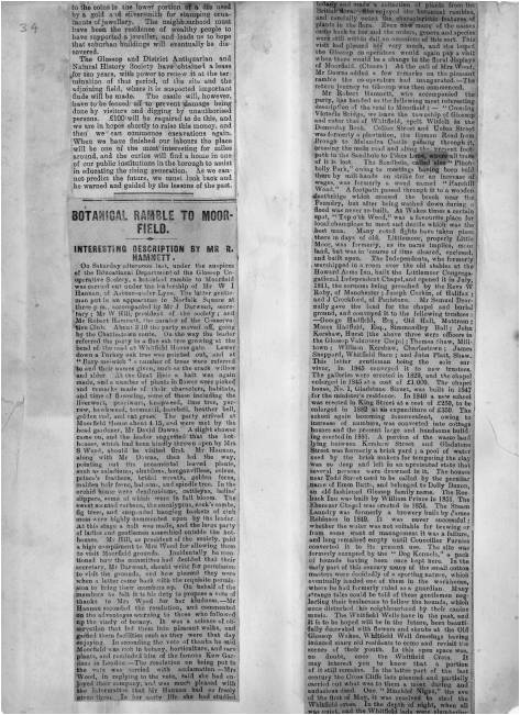
Diving in and out of The Place-Names of Derbyshire to various previous blog posts (HERE and HERE) was a joy, and had me marvelling at both the sheer number of placenames recorded in the book, and the incredible depth of scholarship that accompanied their explanation. For those that have never read the book (and you should), it is a list of all the names of towns, villages, fields, roads, and streams in the area. However, on page 104, under the Glossop general heading, I came across a curious entry that got me thinking. 

Cross Cliffe 4
Here is the page in question

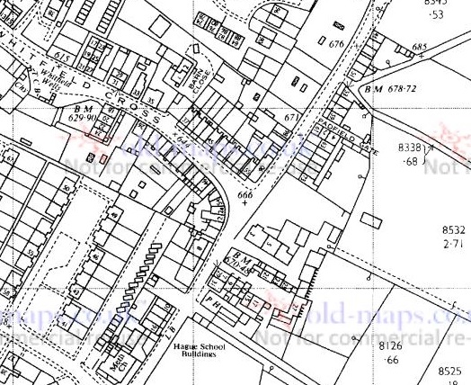
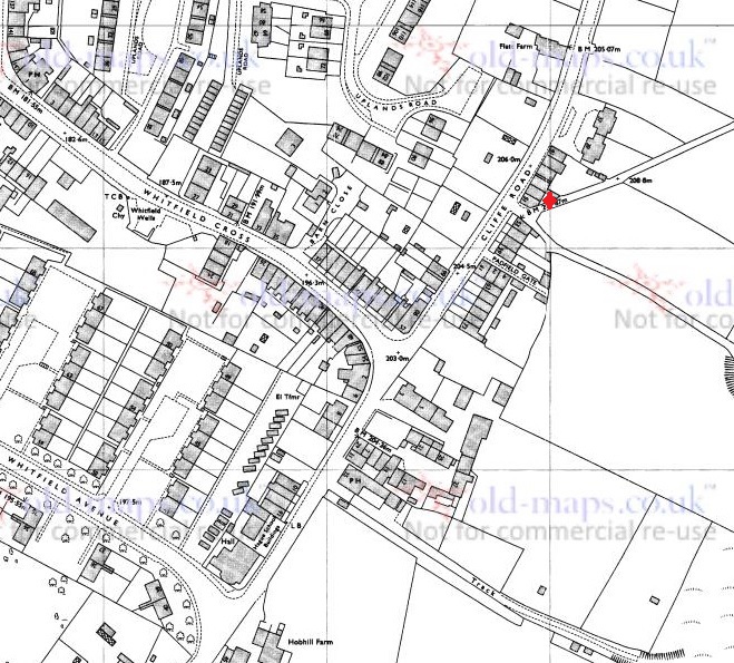
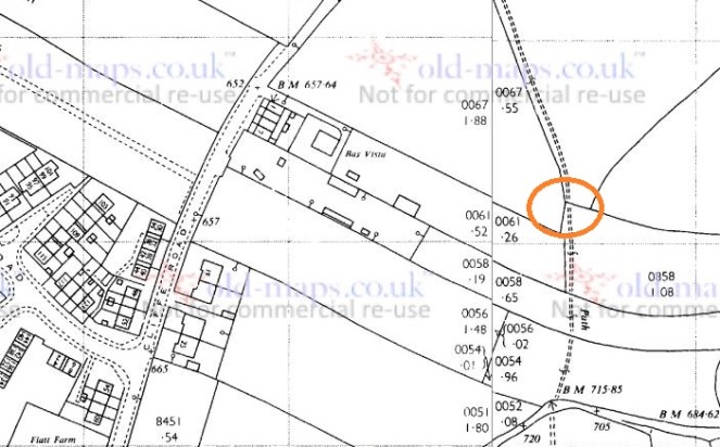
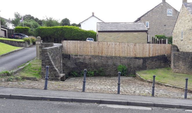
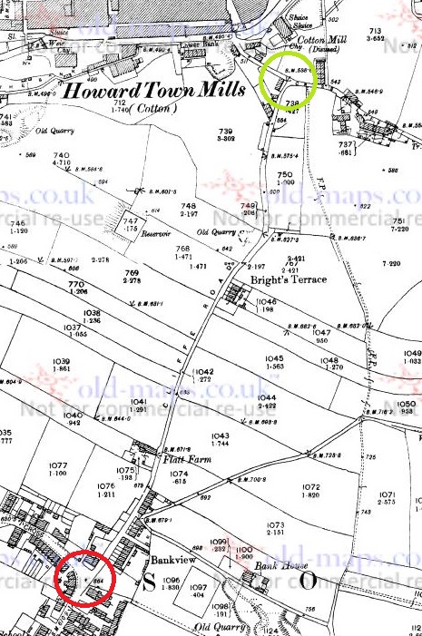
Specifically the entry for the road/area Cross Cliff, in Whitfield. For those of you who don’t now the area (and why not?), Cross Cliffe is this area, here:

Cross Cliffe 7
Cross Cliffe is broadly that area circled in red.

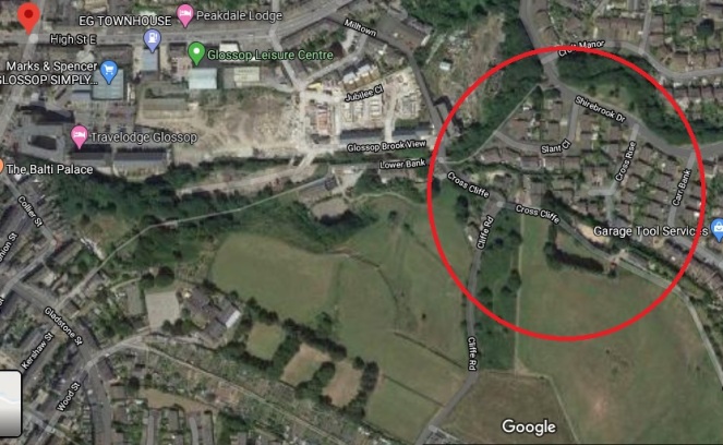
Although now it gives its name to a road, it was once an area (circled in red above) which  started at the bottom of Cliffe Road and lead down to Hurst Clough. The entry in the book reads:

Cross Cliff (6″), crucem de Cresclyf 1285 For.

It gives the earliest example of the name (crucem de Cresclyf), the date of this (1285), and the reference for this example (For = Forest Proceedings). So far, so perfectly ordinary.

So then, Cross Cliffe… and then a thought. “Hang on a minute… Crucem de Cresclyf?

Now, I’ll admit it, my medieval Latin is about as good as my understanding of the language of the San people of Botswana – the one that uses clicks and other sounds. Or indeed, Klingon. I checked, and was – broadly – right (hurrah… personal victory, I’ll take that). I also checked with a real linguist (thank you AG), and was – broadly – backed up.

Crucem de Cresclyf: the cross of Cross Cliffe.

The cross? Which cross? Oooooh…

Bloody hell, thought I, and I went and bored Mrs Hamnett with this potential discovery. More research later, and I think I have just about convinced myself.

This, the first reference to Cross Cliffe, is taken from a 1285 document which gives a description of the boundary of land owned by a certain Thomas le Ragged. Thomas was a forester in the Peak Forest, and was given the lands by William Peverel, son of William the Conquerer and resident of the castle in Castleton. These lands included the hamlet of Whitfield. The descendants of Thomas le Ragged sold the Whitfield portion in 1330 to a John Foljambe, and from there it was portioned off and sold in lumps (Whitfield really does have an interesting history).

The description of the boundary of this land reads:
Required by the Foresters and others concerning the metes and bounds of the land of Thomas le Ragged of Fernley who claimed liberties, who say, that the metes and bounds of the said lands of the said Thomas begin at the Bridge of Welegh by the Royal Way to the (cross) to Crescliff, and from the said cross by certain caves (fovia) up to Routing-clought, and from Routing to Brownhegge, and up to the Waynstones, and from Waynstones descending to the Hocklow, and from Hocklow descending to the water of G’wit and by the water of G’wit ascending to the wood of Horworth.

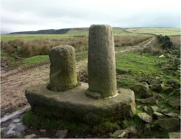
Boundaries are based on and related to landscape features, and always incorporate immovable and visible objects, ones that can’t be disputed. Now, out of this, only a few points are identifiable. Whaley Bridge, Cross Cliffe, Hucklow, the River Goyt (G’wit), and possibly the Wain Stones on Bleaklow (although, I suspect that it may reference another ‘Wain Stones’, now lost to us). The other places I have not been able to identify (any help would be appreciated), and I’m not sure what to make of the caves – are these literal or figurative, and does a cave (fovia in the text) in the 14th century mean the same as it does now.

I digress, as the important bit here relates to Crosse Cliffe, or rather “crucem de Cresclyf” as it is in the orginal – the cross of Cross Cliffe. Not the bridge at Cross Cliffe, or the brook at Cross Cliffe, but the cross at Cross Cliffe. This is at a time when they didn’t use metaphors or flowery terms for place names – if it says the cross at Cross Cliffe, it meant the cross at Cross Cliffe. A physical, actual, stone cross. One that has been there long enough for everyone to know where it is, and use it as a point of reference. Which is very interesting. A previously unknown cross.

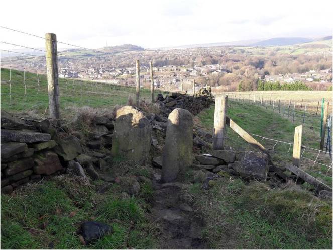
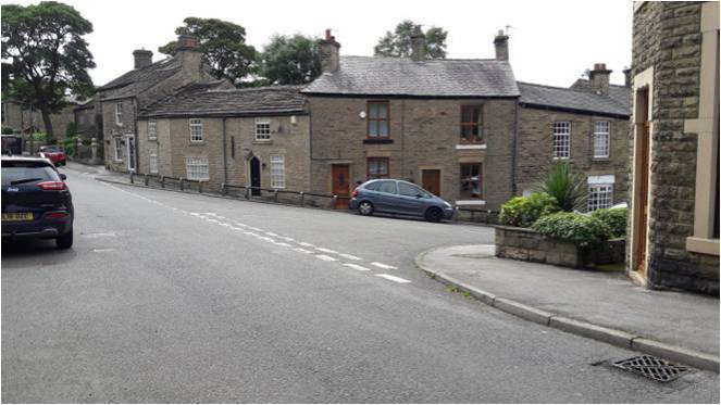
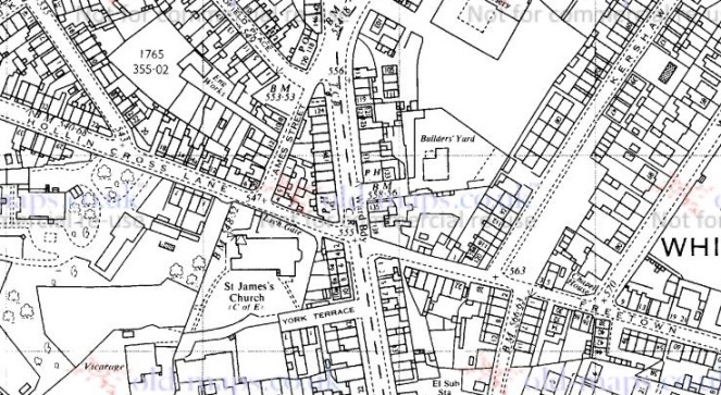
Its location also would support this. It would be situated on a crossroads – a favoured spot for crosses of this sort (Whitfield Cross for example). The present layout of the roads does not show this easily, but they have been changed, probably in the 18th century – I’ve got a post almost ready to go that explains all that, but here is a map to help:

Cross Cliffe 3
The cross roads, with Cliffe Road coming from the bottom, Cross Cliffe (the road) on the right, Bank Street on the left, and the original line of the road heading down to the bridge/ford over Hurst Brook, and on to Old Glossop. The green circle marks the – hypothetical – location of the cross. For orientation, the red star marks the location of what was Volcrepe.

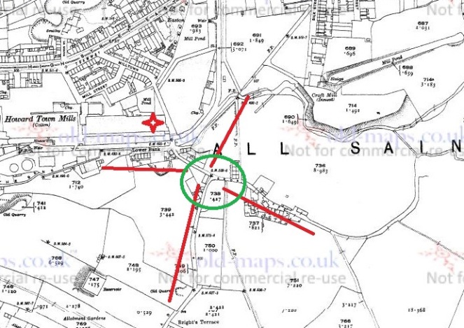
The upcoming blog post will make a lot more sense of this area, but for now, roll with it!

Cross Cliffe 5
This is broadly the area in which the hypothetical cross would have stood. It was once a crossroads, with the road having continued on and down to Hurst Clough 50m away. Probably.

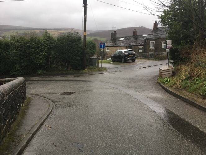
Importantly, the cross would have stood at the border between the manors of Whitfield and Glossop – effectively Hurst Clough – and boundaries like this are exactly the sort of places that crosses are erected. Then there is the name Cross Cliffe. I had always, at the back of my mind, assumed that it meant the place where you crossed the cliff – perhaps a tall edge over Hurst Clough that no longer exists – or simply references the footbridge here. Well no. Delving further into the etymology of the name, it is derived from ‘Cliff‘ meaning a steep river bank, and ‘Cross‘ meaning, well, a cross. The name is literally ‘the steep river bank with a cross on it’, and crucem de Cresclyfe is then ‘the cross of the steep river bank with a cross on it‘. This a perfect description of that monster of a hill –  it drops from 650ft at Bright’s Terrace to 500ft at the bridge over Hurst Clough – a 150ft drop over roughly 1000ft.

Placename evidence, coupled with a physical description, and a reading of the landscape and roads, seems fairly convincing. Well, to me anyway.

Now, there might a possibility that I am reading too much into this (‘surely not!’ groans everyone… I can hear you, you know! Don’t think I can’t). The ‘Cross of Cross Cliffe’ might refer to Whitfield Cross which would have been situated at the start of a small rise before the long steep slope down to Hurst Clough. If this is the case, then there is no need to look for another cross. However, I’m just not sure that this is the case. For one, the wording is too specific; “the cross of Cross Cliffe”, not just Cross Cliffe as an area –  Whitfield Cross would surely have been too far away to be the cross described there, it is firmly in Whitfield, not Cross Cliffe.

Cross Cliffe 6
The red circle marks the original location of Whitfield cross, the green circle marks the location of the hypothetical Cross Cliffe cross – a distance of over 1/3 of a mile.

Moreover, if Thomas’s land went to just the Whitfield Cross, then everything beyond that – including what is now Cross Cliff – would be outside of the described land. No, it makes sense his land went to the very edge of Whitfield, and the natural border of Hurst Clough, and it used a cross at the crossroads there as a marker.

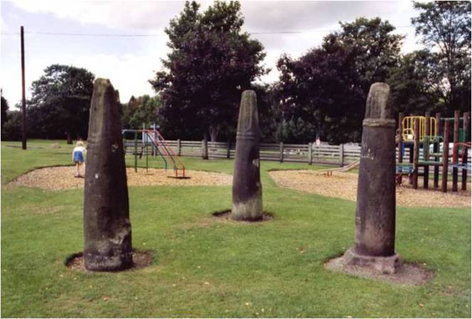
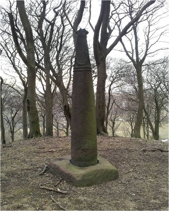
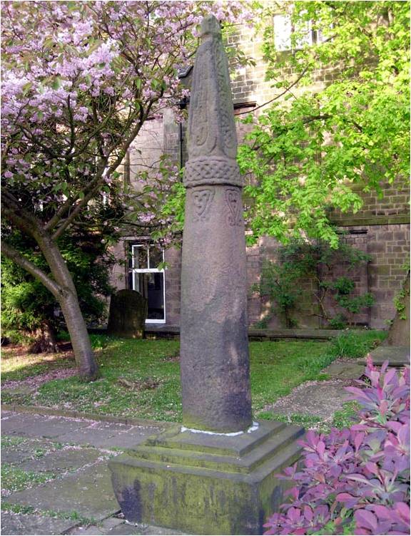
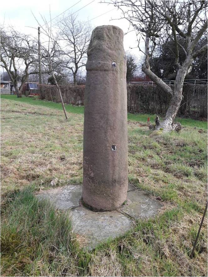
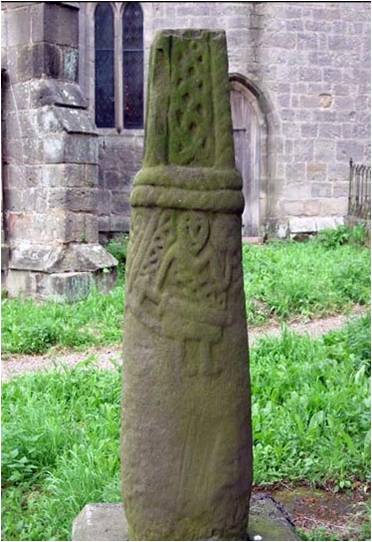
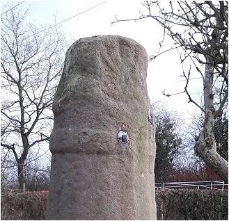
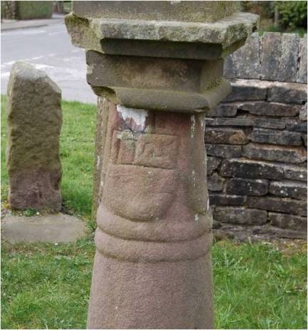
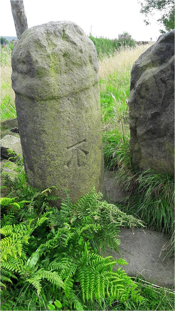
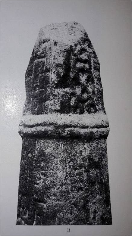
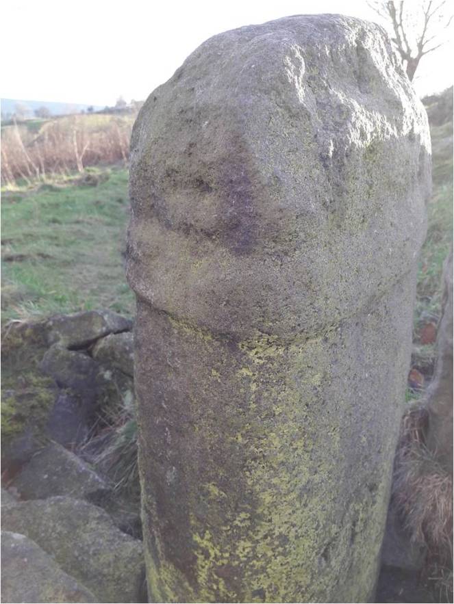
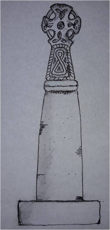
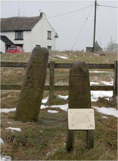
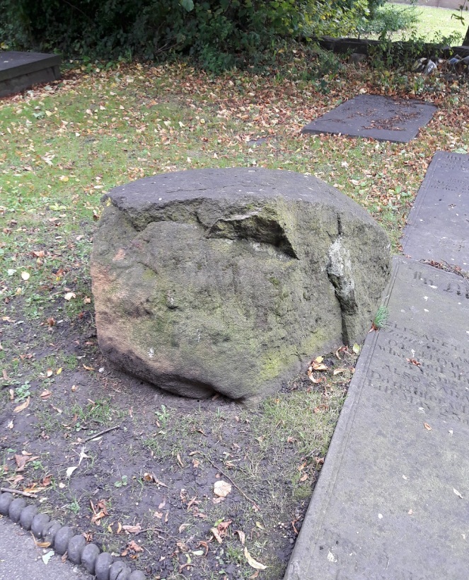
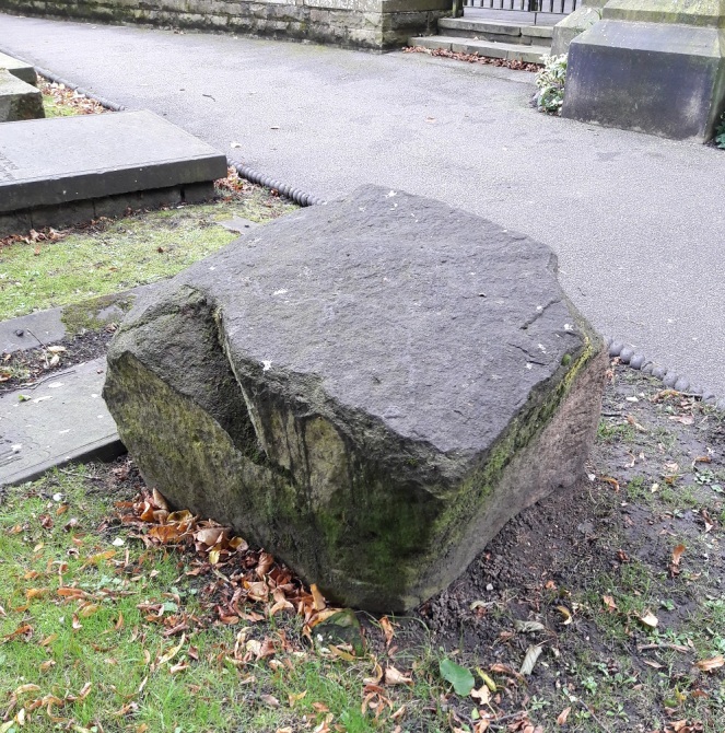
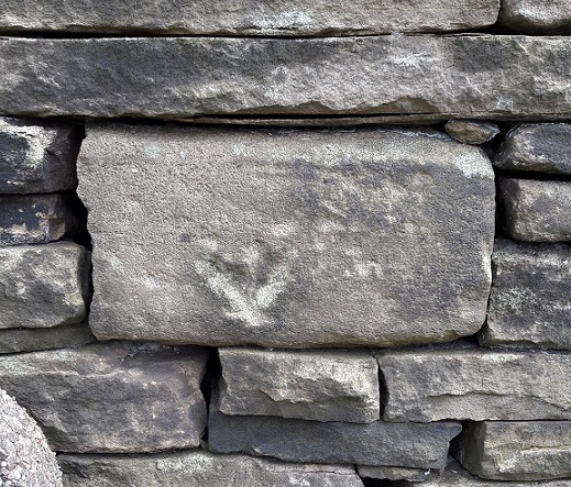
What type of cross would it be, then? I would suggest that it was probably the same type as that which originally stood further up the same road at Whitfield – a 10th century Anglo-Saxon stone cross.

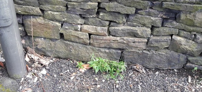
If this is correct, then where is the actual cross? 1000 years is a long time for a stone cross to survive. It may have been swept away in the iconoclasm of the Protestant Reformation of the Tudor period, or the iconoclasm that followed the Civil War, when crosses were routinely smashed – I read the other day of a Saxon cross that was broken up and used to fill a pothole in a road. However, the fact that Whitfield Cross survived these periods would suggest to me that Cross Cliffe would have likely survived, too. Perhaps we are looking at something more mundane; maybe it was accidentally broken, or worse, simply forgotten about as an important object, gradually falling into obscurity, to be lost in the hedgerows. Perhaps – and this really is a flight of fantasy – the stealing of the Whitfield Cross by the Cross Cliffe lads as a Mischief Night prank was not just a prank, and instead they were stealing a cross to replace theirs that was lost. It has never made sense that they would steal something so ridiculously large and heavy, so is this the answer? Well, probably not, but one can speculate wildly!

If anyone fancies joining me looking in hedgebacks and ditches for the original cross – after the current corona madness has subsided, obviously – then please drop me a line.

More soon – as I say, I have a whole post about the crossroads almost ready to go.

Until then, stay safe and stay inside, and take care of yourselves and each other.

And I remain, your humble servant,

RH

Crosses of Glossop · Whitfield Cross

Whitfield Cross – The Talk

I gave a talk to the wonderful folk at the Glossop and Longdendale Archaeological Society on Tuesday night, on the subject of Whitfield Cross. I was honestly really quite nervous. Like most people, I am genuinely scared of speaking in public, and it’s not a thing that comes naturally to me. Indeed, research seems to show that people are more frightened of public speaking than they are of death – that is, they would rather be in the grave and dead, than standing over the grave and delivering the eulogy. However, I went ahead and did it – feel the fear, and do it anyway… as the rather cliched saying goes.

I think it went rather well, thankfully. Hopefully.

Anyway, here is the edited-for-blog transcript of the talk. It builds on the original Whitfield Cross post, but has lots of new information and photographs… so please read on, even if you have read the original.

I live in Whitfield.

For those of you who don’t know, Whitfield is a distinct area within Glossop, and was mentioned in the Domesday Book as a separate settlement from Glossop (as Witfeld), and remains a parish in its own right.

Now, my local pub is The Beehive, on Hague Street at the top – highly recommended, by the way – but in order to get to it, I had to walk up the steep hill of Whitfield Cross.

And every time I did, I pondered the name. Whitfield Cross is an odd name for a road that has no cross on it. I vaguely thought to myself, there must have been a cross here or somewhere nearby at some stage, but after a cursory scan on the internet, and a rifle through the local history section of the library, I drew a blank regarding the history of the cross. I must state that I hadn’t yet come across Neville Sharpe’s excellent book ‘Crosses of the Peak District’ which does have an entry for it, albeit a very short one.

However, sometime later whilst delving into the history of the area, I came across an article by our old friend Mr Hamnett entitled “Botanical Ramble to Moorfield”, dated to about 1890.

Picture4
Newspaper cutting stolen from the New Mills History Society – Visit the original via link here. With thanks.

There is not much botany, but it is an absolute goldmine of local history. And as I read the article my jaw dropped. I’m going to read you the relevant part here, as it captures perfectly what makes Hamnett so good. Plus the language is great!

“In the latter part of the last century the Cross Cliffe lads planned and partially carried out what was to them a most daring and audacious deed. One ”Mischief Night” the eve of the first of May, it was resolved to steal the Whitfield Cross. In the depth of night, when all was quiet, and the Whitfield lads were slumbering or dreaming of their “May birch”, the Cross Cliffe invaders came and detached a portion of the cross. With secrecy, care, and much labour, it was conveyed away nearly to its projected destination, but the exertions required for the nefarious deed had been under estimated, their previous work in removing all articles left carelessly in the yards or at the back doors of the good people of Cross Cliffe and neighbourhood, such as clothes lines, props, buckets, etc., etc., to their “May birch” had already taken much of their energy out of them, and, coupled with the steepness of the ascent to the “Top o’ th’ Cross,” distance and roughness of the road to Cross Cliffe, and the weight of the stone, they were reluctantly obliged to abandon their “loot” in the last field near to the pre-arranged destination. What the feelings were of the Whitfield lads on discovering the desecration and loss of a portion of their cross can be better imagined than described. The stolen portion remained in the field for some years. Mr Joseph Hague, of Park Hall, was solicited to restore the cross to its original form and position, but being imbued with a little Puritanism, he refused, and the other portions gradually disappeared until there is nothing left of the Whitfield Cross, except the stolen portion, which is now part and parcel of a stile in a field at Cross Cliffe, where the then tenant of the field placed it, over a century ago.”

“Blimey!”, I thought!

Date wise then, the removal of the cross would have been 1790 or so, and the cross would have originally stood at the junction of the road Whitfield Cross and Hague Street/Cliffe Road but we shall return to that in a minute. Cross Cliffe is at the top, along Cliffe Road, and it extends further off screen.

Cross Location
The cross would have originally stood dead centre of the above picture, inappropriately marked 666!

Upon reading this passage I quite literally pulled on my boots and headed up to Cliffe Road and went exploring. Alas, not knowing exactly where the cross was – and it is not marked on any OS Map that I have seen – I failed to find it. Weeks later, however, and walking for pleasure rather than exploring, I by chance took the correct path… and this was the sight that greeted me.

Picture6
The cross is the right of the two stones. Note Mouselow Iron Age hillfort in the background.

Now, I know what you’re thinking… what exactly is it?

Well, it’s a 9th, or more likely 10th , century Anglo Saxon stone cross of a type known as a Mercian Round Shaft or Mercian Pillar Cross. There are roughly 30 known examples, with doubtless quite a few more waiting to be discovered. Originally though… who knows. Hundreds? Thousands?

Most stone cross shafts are square or rectangular in section. The Mercian variety is defined by its round or slightly oval shaped shaft. It’s difficult to understand exactly what the crosses would have looked like from the Whitfield example alone – it is particularly worn and has been defaced. However, although no complete examples survive, by studying the better preserved examples we can begin to build up a picture of how they would have looked.

So then. There is the defining characteristic shaft.

Picture7
The round shafts are very obvious in this picture of the three crosses in West Park, Macclesfield. Photo and information here.

Round or slightly oval in section, and usually under 5ft in height, although some, such as that at Cleulow in Cheshire, reach as high as 7ft.

Picture8
Cleulow (or Clulow) near Wincle, Cheshire.

The shaft is normally plain and undecorated, although examples exist where this is not the case – Leek and Blackden for example.

Picture9
Leek cross, in the churchyard of St Edwards.
Picture10
The cross shaft at Blackden, Cheshire. You can just make out the very worn decoration on the side of the shaft.

A notable example is at Brailsford, where we can see a seated solder holding a sword.

Picture11
The seated soldier with sword on the shaft of Brailsford cross. Photo and much more info here courtesy of the Mellor Archaeological Trust.

The shaft tapers to a single, or more commonly, double band or collar that runs around the shaft.

Picture12
A single band on the cross at Blackden.


Picture13
A double band on the Shall Cross on Elnor Lane, south of Whaley Bridge (thank you David Dunford)

This band is not normally decorated, although at Leek, and elsewhere, it is (see above photograph for detail)

Above the band is a rectangular neck that is more often than not missing. Where the neck is present, it is normally decorated – often simply, but sometimes with complex knotwork and rope motifs such as these examples from Disley.

Picture15
Ornately carved, these two were possibly once attached to the cross shafts discussed below

On top of this neck the cross itself would have sat. Fragments, such as those from Disley, allow us to reconstruct the cross head – it would have been a ‘wheel’ type with four arms and a central boss, perforated, and probably heavily decorated with rope and knot motifs.

Picture16
A reconstructed cross head would look something like this – this is from Neville Sharpe’s book.

So, with this in mind, let’s look more closely at Whitfield Cross.

Picture17
Note the perfectly carved Bench Mark – the surveyors had no respect for heritage! Incidentally, this one is at 682 ft above sea level.

We can see immediately it is very worn. The shaft, made from the local millstone grit, is a lightly flattened round shape in section, and tapers slightly up to the collar. The collar is, at first glance, a single band. But, with the eye of faith, I think I can detect a groove running around its centre, meaning it would be a double.

Picture18
A close up of the double band – you can make out the detail quite clearly here.

It is worn, but I think would have originally been something like this.

Picture19
This is one of the Macclesfield crosses – we can see it’s a shallow groove, rather than a properly carved double collar.

Back to Whitfield Cross, we see the neck is worn almost beyond recognition, surviving only 6inches above the collar. However, and again with the eye of faith, I think I can detect the remains of knotwork or similar decoration.

Picture20
The relief work is perhaps visible – just about.

The depressions you can see on the neck are possibly the remains of the hollow parts, the relief, of the knotwork decoration. Look again at the photographs above, and then compare with the Macclesfield example above – you can clearly see the relief work and how it would look if it was worn.

As for the cross head… we have no clue. Instead, we must rely on Sharpe’s reconstruction for guidance.

So then, and apologies in advance for the rather bad penmanship on my part – I am a good technical drawer, but an awful artist – here is my reconstruction of how the cross might have originally looked, assuming all the ‘eye of faiths’ are correct!

Picture23
Reconstruction of Whitfield Cross – it now only survives a few inches above the collar.

So then, further questions are raised – the first of which is, well… what is it?

It’s a cross… obviously, but what is the meaning of it, why was it carved, and why is it here?

The urge to leave a mark in the landscape is undoubtedly a universal feeling, and one that has been with us since we humans first started ‘thinking’. Stones have often been used to leave this mark, to somehow own the land, and to act as a focus, I’m thinking prehistoric standing stones, here. Stone crosses are very much a continuation of this act of permanently stamping yourself into the landscape.

But they can convey much more information.

They were often placed as boundary markers, showing where parish, territory, hunting rights, farmland and such begin and ended. Indeed, there are many stone crosses in the area that do just that. They act as a reminder of the adoption of Christianity in the area, a symbol stating loudly that “we are Christians”. It may also have been used as a gentle reminder that “you are Christians, now” as certainly in the early Saxon periods, and with the later Scandinavian incursions, the old pagan Gods were never far away, and it was far from certain that Christianity would prevail.

However, if we look again at where the Cross originally stood, we can see another, more practical, purpose for the cross – that of marking an important junction in the contemporary roads.

Map

So, we have the old pack horse route that comes from the south – Peak Forest, Buxton, and Chesterfield – to Old Glossop, and on to Woodhead and Yorkshire, beyond, and now called Hague Street/Cliffe Road. The cross would have marked the junction of the track that went along Whitfield Cross and Hollincross Lane, and onto Simmondley and beyond. There was another spur coming out along what is now Gladstone Street, leading to that area of what is now the town, and again onto Woodhead.

Picture25
The Junction at the top of Whitfield Cross in real life.

It has been suggested that some roadside crosses were placed as a gift of thanks for the completion of a safe journey, effectively a votive offering in payment for an answered prayer (i.e. help me get home in this awful weather, and I’ll set up a cross to say thank you). They might also function as a spiritual fortifier, reminding the traveller of God’s watchful eye and his protective power over the faithful. It is easy, I think, in these days of surfaced roads, street lights, and large settlements, to forget just how dark and treacherous travelling in the pre-modern era was – making your way from A to B in total darkness, along a muddy track, and with no map as such, and knowing that if you took a wrong turn somewhere, you were lost.

There is also a further, more subtle, reason, too for the cross being here. Actually, one that perhaps wouldn’t have been that subtle when it was first carved and erected, and this reason is tied in with another important question: Who made it?

It is known as a Mercian round shaft because it occurs only in the Anglo Saxon kingdom of Mercia. However, that is to massively oversimplify the answer, and it is more complex and more interesting than that.

Picture26
The Kingdom of Mercia in early 10th Century. The Peak District is the top right section.

Mercia was for a time, the dominant kingdom in Britain, but by the 9th & 10th centuries it had lost that dominance to Wessex. Even so, we can see that the kingdom is still a massive area. The occurrence of these particular cross types is confined almost completely to the northern part of the kingdom, and specifically where we are now – north west Derbyshire, east Cheshire, and northern Staffordshire: in short, the Peak District.

One of the smaller kingdoms absorbed by the Mercians was that of the Pecsaetan, literally the people of the peak, and who probably gave their name to the Peak District. They seem to have been a distinct tribal grouping, relatively autonomous, but owing tribute and allegiance to the King of Mercia. Interestingly, the land upon which the Pecsaetan farmed and lived, coincides precisely with that in which the crosses occur – Northern Mercia.

I am speculating, obviously, but it is possible that this specific cross type is a product of the people of Pecsaetan kingdom, or at least what remained of it. Moreover, this was at a time – the 9th and 10th centuries – when the Mercian dominance was on the wane – just the time that a little national pride would be in order. And thus, we may speculate that the cross – a region or people specific type – might even have become a symbol, or totem perhaps, for the Pecsaetan kingdom.

There are other examples of Mercian Round Shafts in the area. As I say, there are about 30 known crosses, give or take – there seems to be no definite number recorded, and doubtless there are more waiting to be uncovered. I note that the Derbyshire section of the book series the ‘Corpus of Anglo Saxon Stone Sculpture’ is due to be published, but without having a spare £100, I’ll have to wait until the library gets a copy to check what it says about the crosses.

Our nearest examples are Robin Hood’s Picking Rods in Ludworth, roughly 3 miles south west of Glossop.

Picture27
Robin Hood’s Picking Rods.

Originally known as the Maiden Stones, these are an example of a double cross, that is, two crosses set up side by side. This seems to have been a feature peculiar to the Mercian Round Shaft, but it is unclear what the purpose or meaning of this was. The Picking Rods sit on the parish boundaries of Mellor, Ludworth, Thornsett, and almost that of Chisworth. Perhaps then, the fact there are two of them may be related to their importance in marking this out – with two different parishes choosing to erect a cross each. Another possibility is that they were originally two separate crosses, but were brought together at some stage in the past – with perhaps one of them originally marking the parish boundary for Chisworth.

There is another pairing of crosses to be found in Disley, some 10miles or so south west of Glossop.

Picture28
it is possible that the cross necks illustrated above may have once sat upon these shafts.

These too have no obvious reason behind their pairing, and although they have been moved from their original site, the old, double, cross base is still there marking the place.

Other, single, examples of Mercian Round Shafts are to be found at Macclesfield, Fernilee, Bakewell, Alstonfield, and notably Leek. Importantly, at Bakewell and Alstonfield, there are large numbers of cross shafts and heads, which, suggests Neville Sharp, may be where some were made and distributed.

What then, does the cross tell us of Glossop in the so-called Dark Ages?

Sadly, not very much. The post-Romano-British period is massively under-represented in the area, to a point where it is virtually non-existent – there is the possible glass bead from Mouselow, and that is about it.  And yet we know something was here as Whitfield, Glossop, Chunal, Hadfield and Padfield are all mentioned in the Domesday book – they are clearly important enough to be counted. There is also the possibility that All Saint’s church in Old Glossop has a Saxon origin, but that is currently unproven. Neville Sharpe in his book Glossop Remembered suggests that the lack of a Saxon presence in Glossopdale may be due to a lack of interest and funding by local landowners prior to the area being industrialised. This may be the case to a point, but we do see Roman material coming to light from that point in Glossop’s history, so where is the Saxon?

No, seemingly all we are left with is the monuments – Robin Hood’s Picking Rods… and Whitfield Cross.

Picture6
Our single link to our Saxon past.

What the cross can tell us, though, is that Whitfield, and by extension Glossopdale as a whole, was clearly in contact with other areas of Mercia. There was no mass media, and so the particular style of cross – the Round Shaft – could only have been communicated and spread through contact and travel. Even in this insular and provincial northern part of the kingdom of Mercia, it seems that the Glossop area was very much a part of the greater Anglo Saxon world with access to all that that brought.

And there it sits, a single monument to the late Saxon inhabitants of Glossop – the most tangible connection we have with the residents of the area at that time.

And sadly one of the most overlooked.

I would love to see the cross moved from its present location and placed somewhere where it can be seen and understood by everyone, as a vital part of the heritage of the area. I have suggested before that the wells on Whitfield Cross, the road, would be ideal, but that is a project for the future.

Thanks for reading, and apologies for the lengthy post. As always, any comments, questions, or corrections are very welcome.

RH

Archaeology · Crosses of Glossop · Whitfield Cross

Whitfield Cross – The Talk (of The Town)

Greetings to you all.

Well, so far I have managed to fail utterly in my New Year’s resolution in posting at least once a week. So my apologies. A lot of my spare time has recently been taken up with writing and preparing for a talk I am going to give on the subject of Whitfield Cross. Interestingly, the Whitfield Cross post (here) is by far and away the most popular on this blog. I know this because behind the scenes here, there are a whole pile of statistics that can be accessed that tells me how many people visit each day, what they look at, and even from where they come – yesterday, for example, I even had a visitor from South Africa! Now, I have no idea why the Whitfield Cross post is so popular, but when I was asked to give a talk on any subject, I though I’d go with that!

The talk is titled: Whitfield Cross – Glossop’s Saxon Heritage

To be given to the excellent folk of the Glossop and Longdendale Archaeological Society (website here) on Tuesday 3rd April at the Bluebell Wood pub, Glossop Road, Gamesley. Talk starts at 7.30, so get there a little earlier, and it’ll cost £2 on the door (although for £5, you can join GLAS and reap the benefits for the year).

The talk will draw on the blog post, but will include new research into Glossop’s only Anglo Saxon feature, and include a discussion of other examples of Mercian Round Shafts.

Plus, this is your chance to find out who Robert Hamnett actually is… and buy him (well, me) a drink!

In all seriousness though, come along – if you are interested in the blog, or Whitfield Cross, you’ll be interested in this.

Right, despite having another cold (courtesy of the ever ill James), I shall try and bash out another blog entry

Archaeology · Crosses of Glossop

Hollincross Lane Cross

In his book ‘Crosses of the Peak District’, Sharpe (2002) lists Hollincross Lane, by St James’ church, Whitfield, as being the site of one of Glossop’s long lost crosses (p.110, paraphrasing Hamnett). When I had previously thought about Hollincross Lane, I had assumed that the name refers to the Whitfield Cross, and thus the road that runs down into Hollincross Lane via Freetown. But actually, a cross here would make sense as it would mark the junction of three trackways: north to Woodhead and beyond, east to Whitfield and thence to (Old) Glossop or Chunal via Gnat Hole, and west to Dinting and Simmondley. The way south, Charlestown Road, only came into existence with the construction of the turnpike road in the early 19th century – before that, the only way to Chunal was via Gnat Hole.

Hollincross Map
1969 1:2500 map showing routes north, east, and west. The hypothetical situation of the cross would probably have been at the church end of James Street

A cross marking this junction would have had its uses, then. Indeed, we can also play a speculation game (putting on my prehistorian’s hat for a moment) and suggest that the siting of St James’s Church (1840 or thereabouts – the foundation stone was laid on 27th September 1844, and it was consecrated almost 2 years later on 8 September 1846) was influenced by the existence (or memory) of a cross there indicating holy ground. Wild speculation, I know… but let’s pretend! Etymologically speaking ‘Hollincross’ may be understood as either ‘Holy Cross’, or ‘Holly Cross’ – a cross covered in or situated by some holly

Now obviously there is no cross there now, and Hamnett, writing in the late 19th century, could find no trace of a cross either – seemingly it’s location was lost to even the oldest residents of Whitfield. At some stage, then, our hypothetical cross has been removed. This could have happened for any number of reasons, ranging from pious iconoclasm (a stone cross is an object of adoration and thus ‘Popery’, or Roman Catholic veneration of things and people) to it simply being in the way of traffic. I know of one example, not local, of a 9th century Mercian Roundshaft that was rescued from a farmer who was in the process of rolling it down a hill and into a stream in order to plough his field. And this was in the 1960’s…

Crosses and bases were, then, broken up and re-used in walls, and as people don’t move stone further than they have to, especially in a stone rich area such as this, it sometimes pays to have a look around to see what you can see. With this in mind, and taking advantage of a lull in the rain, James and I went for a wander down to St James’ churchyard (via the park, obviously). He had a whale of time, helped no doubt by the drink of juice that the rector gave him! So, what did I find? Nothing definite, certainly, but just possibly, something.

Hollincross 1
A stone amongst the stones. What is this lump?

Just opposite the main entrance to the church, by the path and amidst the gravestone sits a large lump of stone. It is roughly 2′ square and 1′ high, has been knocked about a fair bit, and is now fairy shapeless. However, one side has clearly been shaped and worked, and with the eye of faith one can see chisel marks.

Hollincross 2
The side closest to the camera is flat and has been worked by tools. Is this the base of Hollin Cross?

Now, I am not sure what this is! It is not a glacial erratic as they are often rounded and smooth like a pebble, and I don’t think it is part of the church building, as it is the wrong type of stone. It might be the cross base, but there is no visible socket – the hole in which the cross shaft sits to make it secure. However, the socket may have been on the part that has been knocked off, or is perhaps underneath if the base had been up-ended. It is very uncertain, but we can be sure that the stone was not planned as such to be there – it makes no sense, and doesn’t even have an aesthetic value – rather it is a left-over from the land prior to the construction of the church.

I had a look around the walls for cross pieces, but could find nothing likely, and I think a winter trip around the churchyard is in order!

Of course, whilst I was there, I took the opportunity to photograph the bench mark on the church itself – how could I resist!

BM - St James, Whitfield
548.9 ft above sea level, to be precise. That’s a roughly 120 ft difference between here and the top end of Whitfield Cross.

Any thoughts or comments are always welcome.


Archaeology · Crosses of Glossop

Whitfield Cross

Whitfield Cross. An odd name for a road that doesn’t have a cross on it.
Leading from Gladstone Street up to Hague Street/Cliffe Road, the road takes you past Whitfield Wells, and into the heart of the Whitfield Conservation Area. I lived on King Street for a number of years, and regularly walked up and down the street, without really noticing the name beyond “hmmm, I bet there was cross here at some stage”.

However, whilst delving into the history of the area, I came across an article by the marvellous Robert Hamnett (my namesake) entitled “Botanical Ramble to Moorfield”, dated to about 1890. There is not much botany, but it is a goldmine of local history. You can read the article in PDF form here via the scanned scrapbooks of the New Mills History Society – they have a whole bunch of them to ready to read, all from the late 19th and early 20th century, and all history local to New Mills and surrounding areas, including Glossop. But I digress…

As I read the article my jaw dropped. I repeat the relevant chapter here in full as it is full of great language, some of which might need explaining.

“In the latter part of the last century the Cross Cliffe lads planned and partially carried out what was to them a most daring and audacious deed. One ” Mischief Night,” the eve of the first of May, it was resolved to steal the Whitfield cross. In the depth of night, when all was quiet, and the Whitfield lads were slumbering or dreaming of their “May birch”, the Cross Cliffe invaders came and detached a portion of the cross. With secrecy, care, and much labour, it was conveyed away nearly to its projected destination, but the exertions required for the nefarious deed had been under estimated, their previous work in removing all articles left carelessly in the yards or at the back doors of the good people of Cross Cliffe and neighbourhood, such as clothes lines, props, buckets, etc., etc., to their “May birch” had already taken much of their energy out of them, and, coupled with the steepness of the ascent to the “Top o’ th’ Cross,” distance and roughness of the road to Cross Cliffe, and the weight of the stone, they were reluctantly obliged to abandon their “loot” in the last field near to the pre-arranged destination. What the feelings were of the Whitfield lads on discovering the desecration and loss of a portion of their cross can be better imagined than described. The stolen portion remained in the field for some years. Mr Joseph Hague, of Park Hall, was solicited to restore the cross to its original form and position, but being imbued with a little Puritanism, he refused, and the other portions gradually disappeared until there is nothing left of the Whitfield Cross, except the stolen portion, which is now part and parcel of a stile in a field at Cross Cliffe, where the then tenant of the field placed it, over a century ago.”

“Blimey!”, thought I!

Date wise, the removal of the cross would have been 1790 or so. I find it interesting that the boys of Crosse Cliffe carried half a metric ton of stone for a prank… no wonder they left it a short distance from where it originally stood. An interesting bit of trivia here, though; in the northern counties of Yorkshire, Lancashire, Derbyshire, and Cheshire, Mischief Night was on May Eve rather than November 4th as it is now. How and why it switched, no one knows, but I can remember my father telling me about it (born in 1942 in Macclesfield), as well as my grandfather (born in 1909 in Blackley). A little research on the internet repays a lot of information about this, though curiously not the origin of the phrase “May birch”, meaning a prank, which I can find no reference to anywhere else.

So there the cross sits still, passed each day by dozens of dog walkers and hikers.

Upon reading this passage I quite literally ran out and had a look around, but, not knowing exactly where it was (and it is not marked on any OS Map that I have seen), I drew a blank. Weeks later, walking for pleasure rather than exploring, I walked along the right path, and the cross hoved into view.

Cross Map
The location of the cross on a footpath. To get your bearings, Cliffe Road is on the left, and just above the houses there are the allotments.

And it really is unmistakable.

6
The Whitfield Cross, now permanently marked by a Bench Mark.

Technically, it is a 9th Century Mercian Round Shaft. That is, it is Anglo-Saxon in origin, carved and placed sometime between 800 and 900AD, and is of a type that is only found in this relatively small geographical area, the kingdon of Mercia. I say ‘this’ area, but technically we are living in the land of the Pecsaetan – the peak dewllers – an independent tribe until they merged with the Mercians prior to the invasion of 1066. Crosses normally have square or rectangular shafts, but the Round Shaft are characterised by an almost pot-bellied round shape, and the very characteristic band around the neck below the cross itself. Sometimes the shafts are decorated, but more often they are plain, as is our cross. Originally, it would have had a simple cross form on the top, just above the collar, and this as well as the neck, could sometimes decorated in panels. There are a few other examples of the round shaft in the area, but the closest are Robin Hood’s Picking Rods (which will be the subject of a future post).

Hamnett suggests that the original location for our cross was at the Whitfield Wells, and the early maps show an area set back from the road that would work. However, it would make more sense for the cross to have stood at the top of Whitfield Cross (the road) as crosses of this sort usually mark road junctions. Here, there is the meeting of three (then) important roads.

Cross Location
The location of the cross would have been where, coincidentally, the cross is at the centre of the map. That cross represents a ‘spot height’ above sea level, but the fact that figure is 666ft is deliciously ironic.

The old pack horse route comes from the south (Peak Forest, Buxton, and Chesterfield) through Gnat Hole, along Hague Street, through to the appropriately named Cross Cliffe, down to Old Glossop (for local traffic – the market and the parish church on Sundays), and on to Woodhead (and Yorkshire beyond, for commercial traffic). The stone would have marked the junction of the track that went along Whitfield Cross, Freetown, Hollincross Lane (Holy Cross? A cross standing by, or covered in, Holly?), Slatelands, and onto Simmondley and beyond. There was another spur coming out along what is now Gladstone Street, leading to that area of the town, and again onto Woodhead.

Cross - Location
The location of the cross would have been dead centre. The roads all widen out at this point, presumably to have accommodated the cross. Left is to Peak Forest/Buxton, right down Whitfield Cross to Simmondly, behind the camera leads to Old Glossop/Woodhead

As we can see in the top photograph, the height of the land on either side of Whitfield Cross (the road) is surely testament to the age of the trackway, it being worn down to its present depth by millennia of use.

Neville Sharpe in his masterful study Stone Crosses of the Peak District notes that there are several large pieces of large built into the wall at the junction that could have formed the cross base. Closer inspection reveals numerous stones that have been re-used in the wall, several of which could be related to the cross, but without dismantling it in search of sockets, we can’t be certain.

Re-Use - c
A section of walling – note the reused stone, any one of which could be part of the cross base.
Candidate 1
Likely candidates?
Candidate 2
Another candidate? Ignore the arrow, that was carved to indicate an electricity supply is buried there.
Candidate 3
Another candidate?
Mystery Stone
Whilst looking at the wall, I spotted this dressed stone. It seems to have been a capstone to an arch – the curved line at the bottom gives it that impression, as does the diagonal sides. A doorway? A bridge?  The rectangular panel has been deliberately pecked, perhaps to remove a date or name, or even a carving. I would suggest that it is early in date judging by its dressing – medieval perhaps? It’s amazing what you see in walls!

According to Sharpe, John Nelson, an assistant to John Wesley, preached at the cross in the mid 1700’s. This is very typical of the Wesleyan way – preaching outside and using a local landmark – and I’m surprised that Wesley himself didn’t preach here, given his activities in and love for the area. Alas, there is no mention of this is his diaries. There is a very interesting piece about the history of Methodism in the area, including a biography of Nelson, here.

I wonder how many of those dog walkers and hikers are aware of what it is they are passing by when they use that stile? Seriously though, I urge you to go and see it – it is truly a remarkable piece of history, and one that deserves a better fate than is currently befalling it.

I have a big idea about the cross! I would love to see it restored to its original site, or better yet, outside the Whitfield Wells, with a little placard explaining the history of both. The setting is perfect, and it would surely be a fantastic companion to the wells, particularly when dressed. Although in the infant stages, I am exploring possibilities… watch this space.

Whitfield Well 1
The cross would look perfect here, especially if the wells were decorated.