What ho, you amazing people.
Hopefully none of you will have melted in this seemingly eternal heat. It’s odd, given my background in Greek archaeology, but I really don’t cope well with heat. At a beach, I am usually to be found under a parasol, reading. And as for walking around, I tend to curl myself, vampire-like, into shadows and shade. I am a man of simple pleasures: a pub garden, a pint of something cold and refreshing (and cheering, if taken in the right quantity), and a parasol, and I’m as happy as anything. Nope… it’s too bloody hot for me at the moment! And by the time I have got round to publishing, it is, of course, raining! So, back to normal then!
Anyway, enough of this small talk, let’s get onto the meat and two veg of the subject, so to speak: more datestones.
Now, as you all know, I love a datestone or two, specifically pre-Victorian datestones (Part 1 of this vaguely ongoing series is here, and Part 2 is here). I have photographed as many as I can – I’m missing a few, but it is difficult to get them properly; one does not simply walk up to Hobroyd Farm, to pick an example at random, and give a quick “what ho… I say my good man, I wonder if you wouldn’t mind me taking a photo of the stone above your door…”. One is liable to find oneself on the business end of a dog, quick sharp! So, if anyone has any photographs of the stones that are missing, please let me know. So here we are, for your delectation, the next batch.
Let’s start at Higher Dinting – all taken with the owner’s permission, of course.
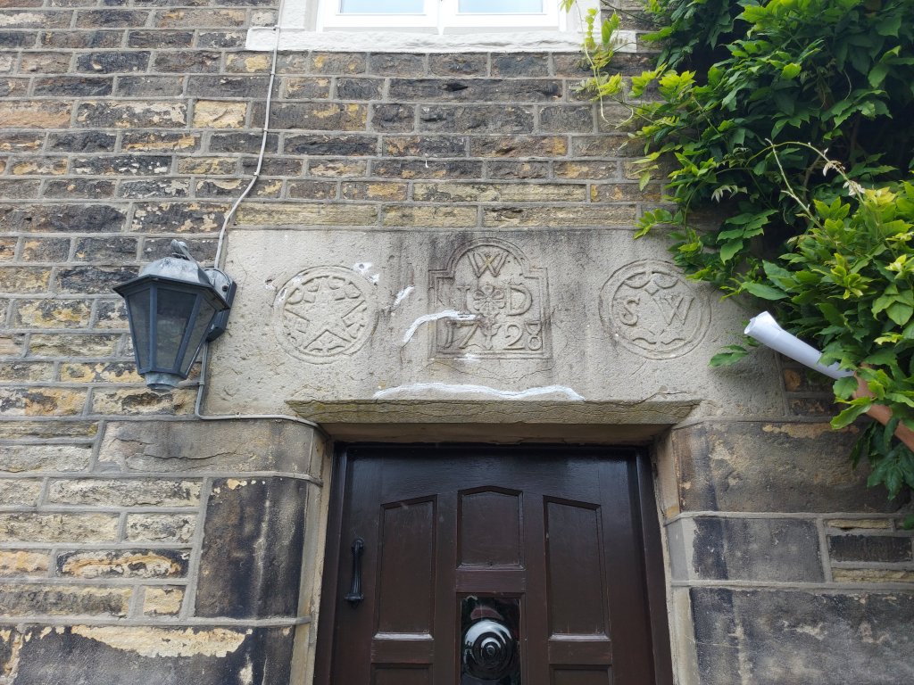
‘W.I.D’ / ‘S.E.’ / 1728. The ‘W’ is Wagstaffe, a well known family in the area who built many houses in Higher Dinting and elsewhere. “S, W” is, presumably, another Wagstaffe. And then there is the decoration: flowers, and a pentagram – it is a lovely datestone, and reminds me of others in the area – in particular the gatehouse to Mottram Old Hall on, and dated to a year earlier:
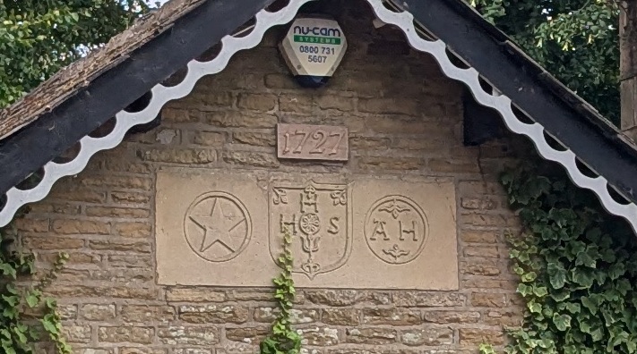
They look so similar that I wonder if the same person carved them, or if they were both drawing on the same ‘fashion’ in datestones. Also, I wonder if the pentagram might also have a deeper meaning here, as it does, for example, in the 14th century story of Gawain and the Green Knight – chivalry, and potentially a religious meaning, too. This latter may be particularly interesting when we remember that the Blessed Nicholas Garlick, Roman Catholic martyr, was born just 150m south of this building in 1555. This may be nothing significant, but then again… I have a theory that this part of the world was a hotbed of recusant Roman Catholics.
The next datestone is also Wagstaffe related, standing next door to the above one in Higher Dinting: ‘W’ / ‘S.E.’ / ‘I.B’ / 1697. Very worn, this datestone stands on the barn, now converted into a private house.
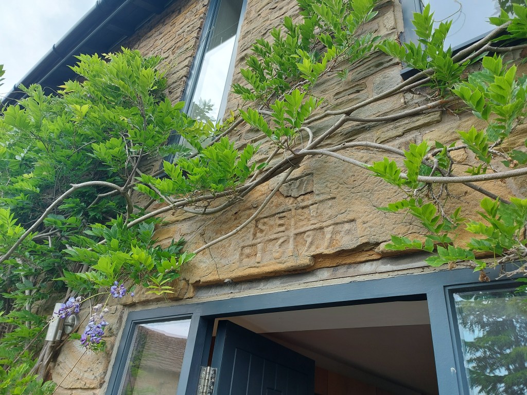
Around the side is this lovely thing:
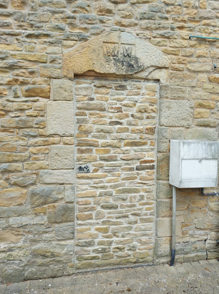
‘W.W.’, assigned to William Wagstaffe, it is a blocked up side entrance into the barn, and is presuambly the same date as the other stone – late 17th century. The way the ‘W’ are carved seems to exaggerate the ‘double ‘V” and reminds me very much of the ‘interlocking ‘V” motif found in apotropaic marks – marks made to ward off evil – throughout the country at this time. Now obviously, this is just the way that people wrote the letter ‘W’ at this point in history, but the similarity surely cannot have been lost on the Wagstaffe family.
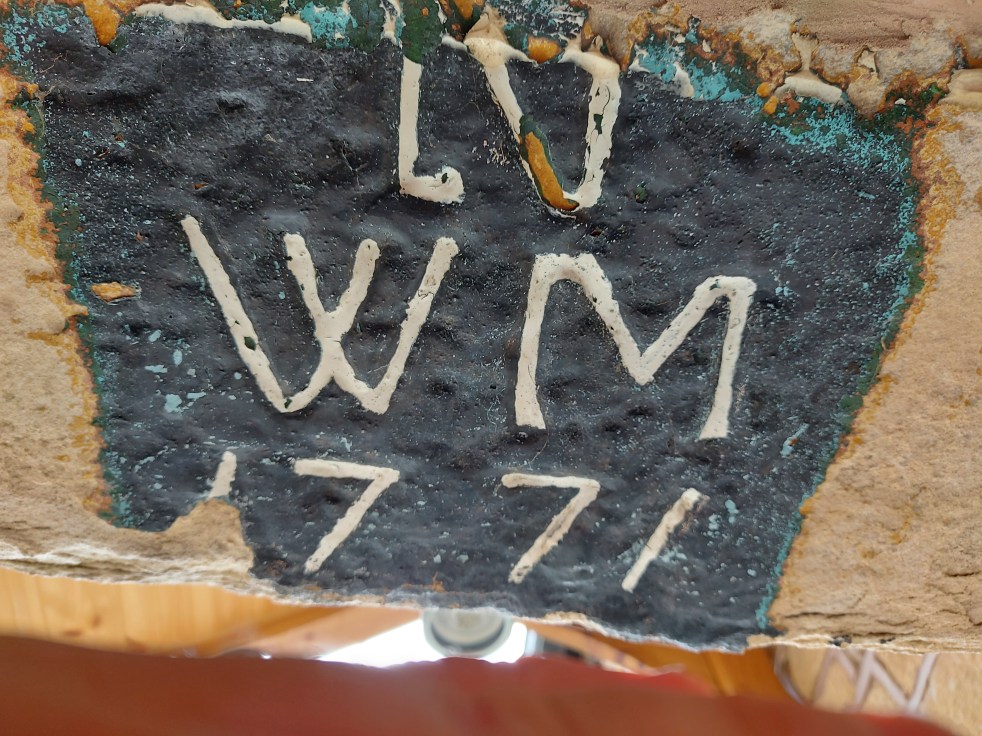
Or indeed, here, at Whitehouse Farm, Ashes, just down the road. Again, taken with owner’s permission, this is carved into the door lintel.
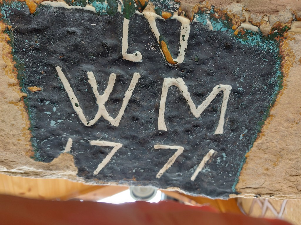
‘N.W.M / 1771’ This is a fascinating building that I would say is at least 100 years, and possibly much, older than this datestone, which might instead commemorate a rebuild or extension.
This next one is in Padfield – 53 Post Street, to be precise.
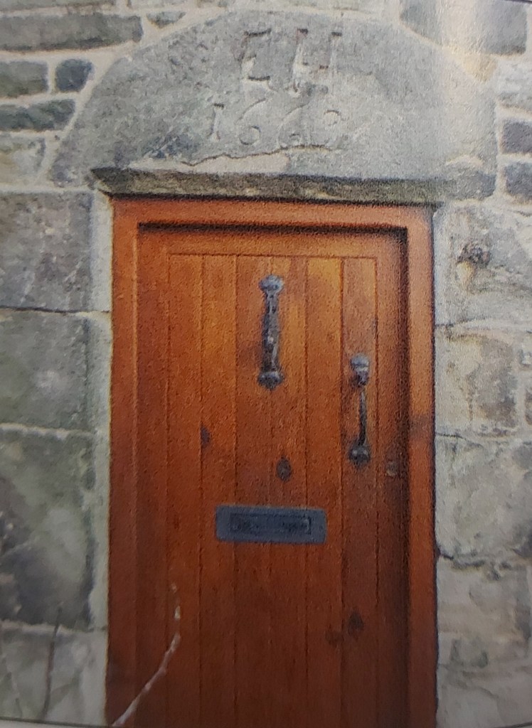
‘E.H / 1669’. The image is not mine – the door is inaccessible – but shamelessly stolen from ‘A Portrait of Padfield’ by the Residents Society, available online, or in Dark Peak Books in Glossop. It’s a wonderful book that digs deep into the history of the place.
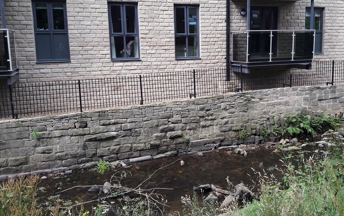
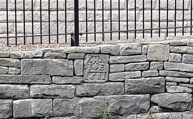
This next one has been posted on the website before, but for the sake of keeping all the datestones in one place, I’m going to post it again. And what a datestone it is. Found when the retirement flats were built, the builders placed it on display on the side of Glossop Brook, which is great.
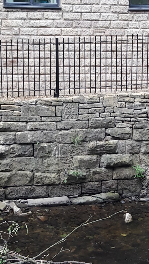
“H, I, E, 1681” Probably a John (no ‘J’ in the 17th century, they used an ‘I’ instead) and Elizabeth Hadfield.
This one has also been published on the site before, but again, to keep them all together I thought I’d do it again:
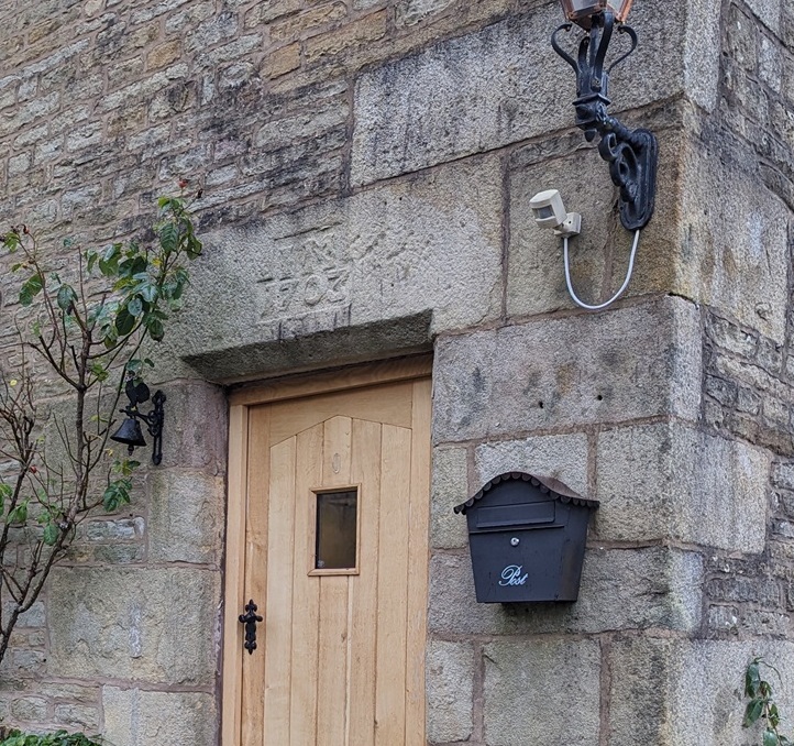
Herod Farm, below Whitley Nab. ‘I.M. / 1703’ – John Morton who also held next door Lees Hall, and discussed a little here.
And now, we have a mystery. A while ago I was in the local studies section of Glossop Library, flicking through the photograph archive they have there. Truly amazing stuff hidden in there, by the way… well worth a poke about. Among the gems was this one which notes that it is in Manor Park:
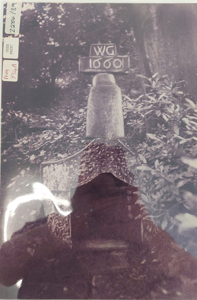
So, a datestone. It sits on top of a… post? I don’t recognise what this post is, but the more I stare at it, the more it looks like the upper part of one of those 10th century Anglo-Saxon round-shaft crosses, like that at Whitfield, here. It’s not… but you never know. But I do recognise the shaped thing they both sit on – it’s the stone well in the woodland of Manor Park. Actually, the objects together look like a collection of ‘found’ bits cobbled together to create a folly of sorts – even the well is not a functioning water source, just a talking point. And, of course, it is no longer there, just a pile of stone.
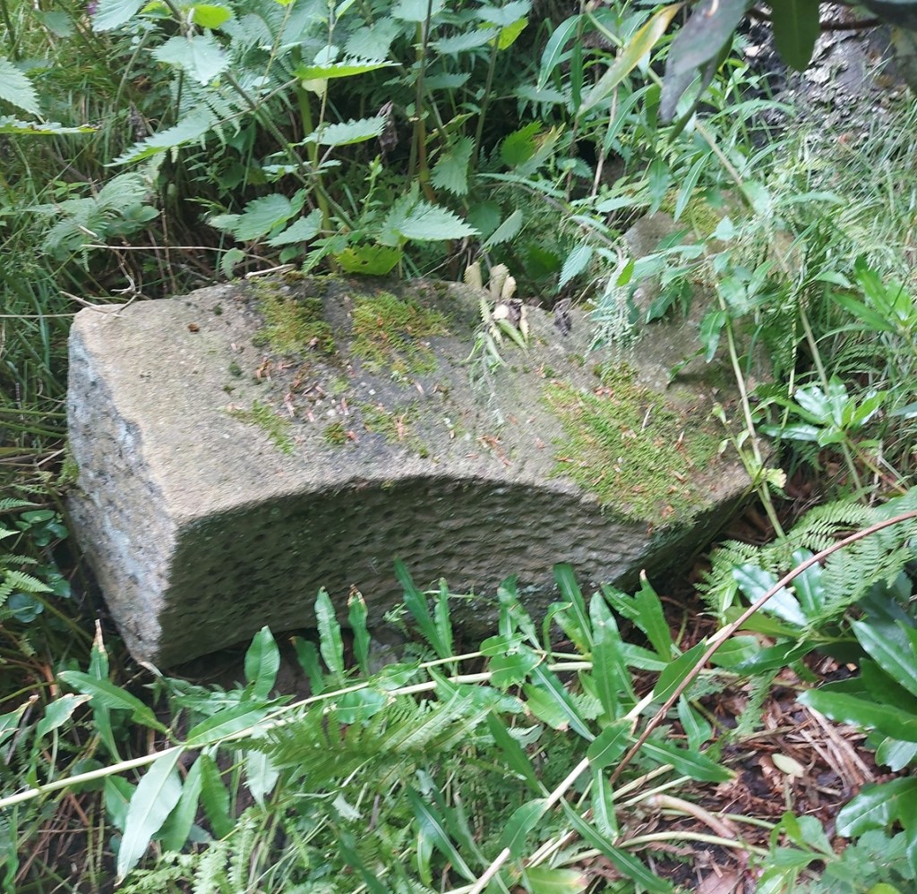
So where is the datestone now? And where did it come from? I’ll go back and have another look in the bushes, and I must ask the park maintenance staff if they have any ideas the next time I am there… but right now, it’s throwing it down – so the kettle is going on (sadly, and even by my woefully lax standards, it’s too early for a glass of the stuff that cheers!).
And now, an appeal for help – the datestone for which I have no photographs are:
| 81 Simmondley Village (Hanover Farm) (datestone of 1719) Hobroyd Farm (datestone of 1752) White House, Chunal (datestone of 1669, apparently) Bulls Head, Old Glossop (rear door, datestone of 1607) Pyegrove, Old Glossop (datestone of 1747) |
If you have a photograph of these, or you live at these properties and are happy for me to take a photo, or even make a drawing, then please get in contact – as I’d love to get them all.
That’s all for now. Next time will be pottery, I promise – I know how much you missed it! No, thank you Mr Shouty-Outy, you don’t need to show us how much you have missed it, we get the point! Until then, look after yourselves and each other. And I remain.
Your humble servant,
TCG