Archaeology · History · Medieval · Standing Stones · Stones of Glossop · Whitfield

The Holy Stones of Glossop

What ho! lovely people, What Ho!

I know it’s a stereotype that we Brits moan about the weather, whatever the weather, but seriously… why is it so ridiculously hot? It can stop being over 30 degrees any time it would like to… soon, ideally.

Anyway, enough of the moaning – it won’t make any sense in 6 months time anyway (and by which time we shall be complaining about being too cold!)! instead, let’s look at the subject of today’s article: holy stones (that is, stones with holes, rather than sacred rocks).

Briefly, years ago, I started to notice stones with a squarish hole carved into them. My first thought was that they were some sort of gatepost, but the hole seemed unusual, and I couldn’t work out quite how they would function. Ok, interesting, I thought.
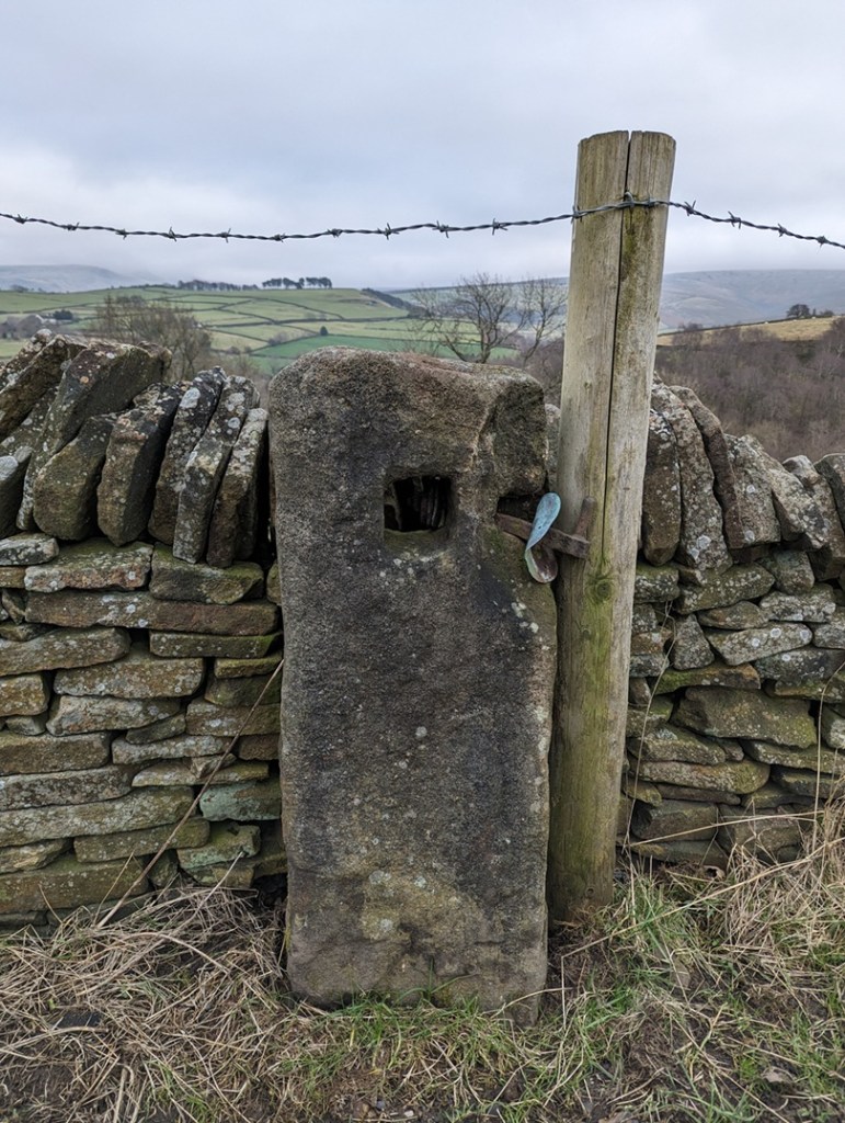
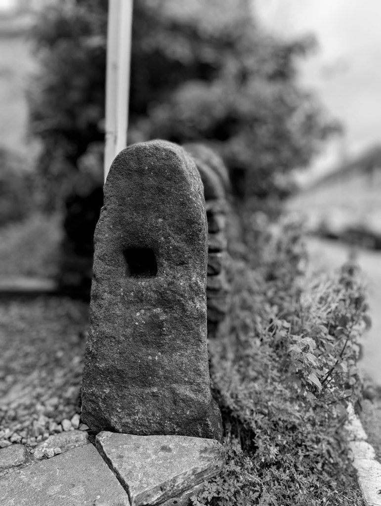
This is the sort of thing I mean, this one is between Lees Hall and Herod Farm.

Characterised by the (mostly) single hole of a square-shape roughly carved into the upper part of the upright stone. In this area, they are of an undressed coarse gritstone, very much unlike the newer carved gateposts, which have a smoothly dressed surface – these are rough. They also looked older than any other gateposts, seemingly quite worn and in no particular shape, simply vertical and between 1 and 2 foot accross – they seem part of the landscape, grown organically, rather than imposed onto it and standing as markedly different, as the more modern gateposts do. In fact, so much so, that the first one I noticed properly I thought might actually have been a reused prehistoric standing stone.

But as I did some research into the medieval and post-medieval trackways, I began to notice that these stone were found along the older roads in the area, and often located at junctions in tracks, where they split, or at particular curves, and I began to think of the holed stones as being track markers, with the hole perhaps taking a piece of wood to act as a finger post?

I was wrong! They are definitely gateposts – the full explanation is explored here in this article, but basically a piece of wood was inserted into the hole, this then had two holes drilled into it, and then another piece of – green – wood was curved into the two holes making a loop, and it was into this that the gate was firmly fixed. This would explain, also, why the holes in the stones never face where you would expect the gate to be.

Being that sort of person, I plotted all the ones I know about (currently 26) on a map, and a surprising pattern emerged. They all seem to be clumped around early field systems – the ones with the long thin selions, and with evidence of ridge and furrow. These ‘fields’ had no need for walls and boundaries, they were part of the “open field system” in which land was communal, and allotted to individuals within the settlement on a rotating basis. So the concept of a stone gatepost was not needed here until about 1433, when the Talbot family took ownership of the Glossop estate from the monks at Basingwerk. The Talbots, shrewd businessmen, understood that not much money could be made from peasants growing subsistence crops, so instead changed the local economy to sheep farming – the peasants got paid, the Talbots made money from the wool. Of course, sheep wander off, so we start to see walls appearing at this time (you also need to keep the sheep of the small crops you are growing). Which leads me to my working hypothesis: I wonder if these gateposts are the first ones that appear after the mid 15th century, as the fields are increasingly enclosed? Certainly in his 1815 book, General View of the Agriculture and Minerals of Derbyshire, John Farey notes that “Anciently, the Gates in the Peak Hundreds were formed and hung without any iron-work“, and proceeds to describe the holed stones in use as gateposts. That he uses the term “anciently” suggests great age.

This got me further thinking… if the gateposts are associated with medieval fields, might they not tell us where these fields were situated, assuming we don’t know? I don’t know the answer to that, but watch this space for more research.

However, I want to share with you a small field trip I did (in association with Lee, of the Punk Archaeology Podcast) to collect some data on these holed gateposts. A sample of them around the Whitfield Field System was explored, and I thought you might be interested in the results.

This is the map of the posts – the blue arrows mark each one, with its name:
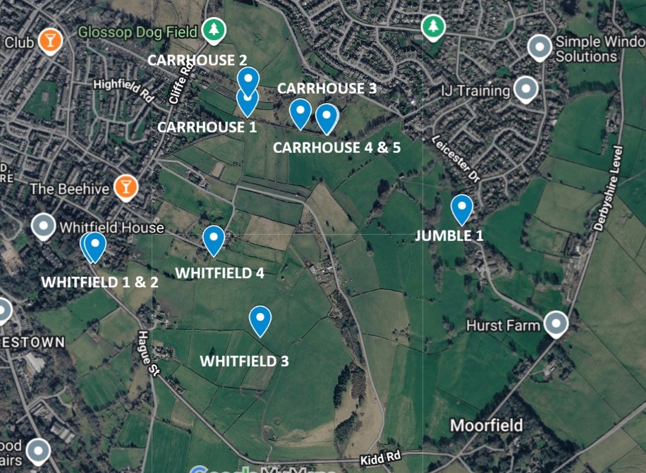
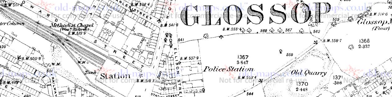
You can see the field system – the long thin ‘reverse-S’ shaped fields throughout the middle, but it is clearer on this 1890 map as the area has not yet been built up:
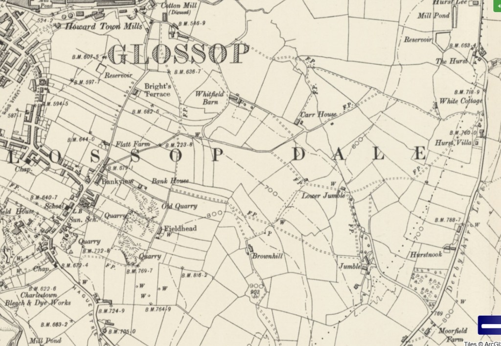
Everything on either side of Cliffe Road,, and below the word Glossop, as well as all kinds of stuff east of there. It’s a jumble, which is, in all honesty, probably how Jumble Farm got its name! Honestly, this part of the medieval field system in Whitfield is not talked about very much, and it needs to better known.

So then, what did we see on each of these points? Well, 10 of these stones with square holes. We measured the holes with the idea that if they all had broadly the same size hole, then they might be of a similar age/date/construction – I’ll put the size under each photo (in inches, not cm… it seemed more appropriate, and whilst the farmer making the hole wouldn’t be measuring strictly, he would have an idea in his head of the ‘right’ size the hole needed to be). I’m also giving the ‘What 3 Words’ location to each of the stones – I kno wit’s a bit gimmicky, but the idea of being able to enter 3 words into a free app, and be able to get the location down to 1m square is truly bean-altering. I’m not sponsored by them (I wish!), but I honestly believe W3W is a great tool… providing you have a phone signal!

Whitfield 1 (W3W – seagull / birdcage / pausing, Hole = 4″ x4″) – on Hague Street. Squat and chunky, it stands where it has stood for a few centuries at least, right on the road – the main road between Glossop and Hayfield in the medieval period – and right on a property boundary.

Just behind it is Whitfield 2. This one on private property, and given its proximity to Whitfield 1, we suspect it might have been moved, but who knows.
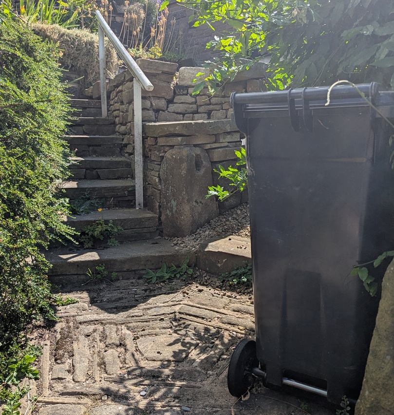
Whitfield 2 (W3W – seagull / birdcage / pausing, Hole = 4.5″ x 4″) – Whitfield 1 can just be seen in the bottom right, so you can see how close it is. Does this mean it has been moved? Well no, and given that it stands at about the same height, perhaps it was part of a complex system of gates that controlled access? I don’t know… you decide!

The next one is difficult to spot – right in the middle of a field, away from any paths, but not hidden from the prying eyes of binoculars:
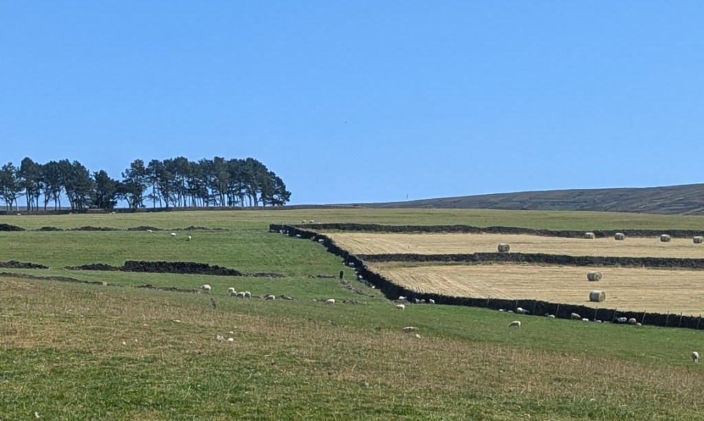
Whitfield 3 (W3W – powering / assets / flooding, Hole = No Data, as I couldn’t get near it) – The dark standing stone is pretty much dead centre of this photograph.

Previously I had asked Master CG if he could see if it had a hole in it – I explained that my eyes can’t see from that distance… he replied yes, it did have a hole, and then muttered something about “ancient” presumably referring to the stone, and “put in a home“… which I didn’t fully understand.

Next up we have this somewhat disguised beauty:
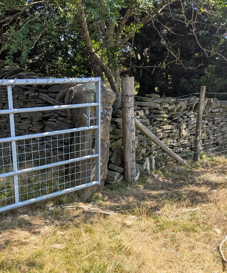
Whitfield 4 (W3W – acoustics / martini / pocket, Hole = 3″ wide x 4″ tall) – still used as a modified gatepost, now taking a steel gate rather than a wooden oddly constructed affair. I like this, it shows continuity of use, and of the continued need of a gate into a field that remained in the same location for centuries.

The other side also reveals another surprise – an Ordnance Survey benchmark, although this one does not appear on any map I have seen – it is a lost benchmark without a height above sea level. I wonder if it was carved, but the height was either not recorded, or somehow was unreadable, and it was never resurveyed.
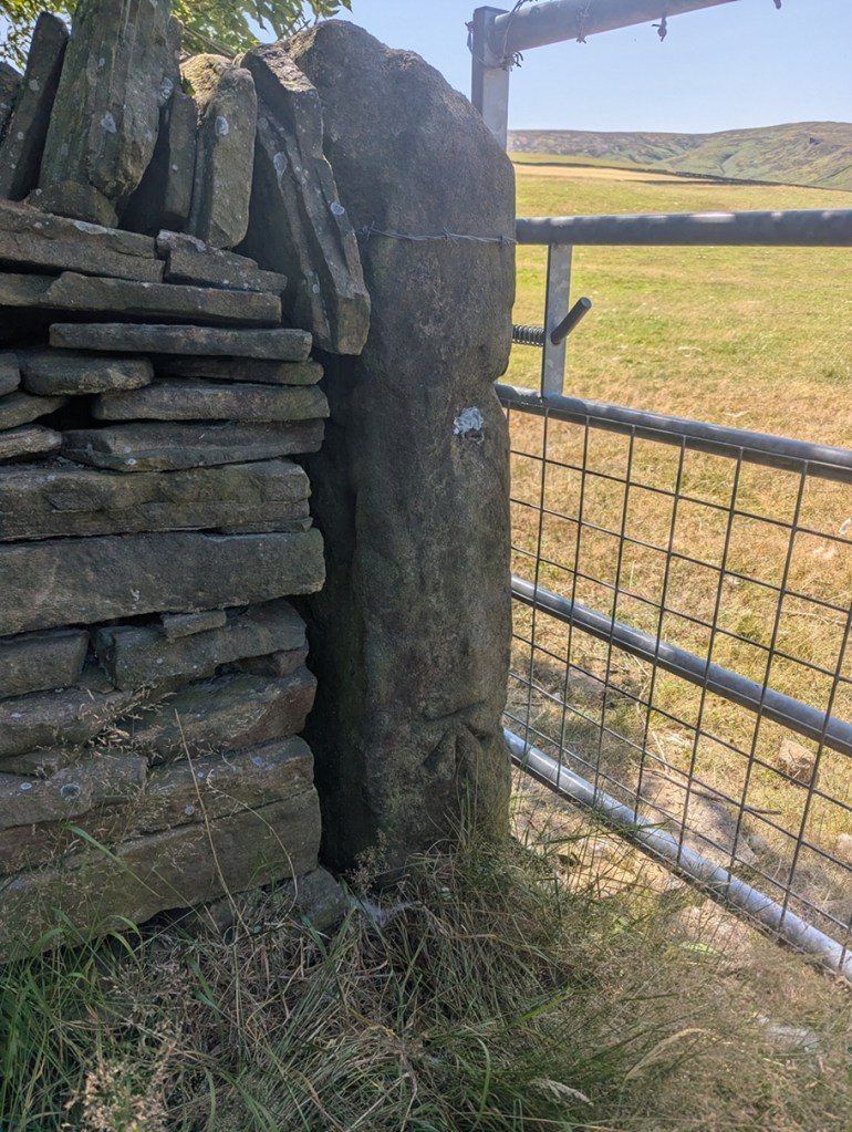
Whitfield 4 again, the OS benchmark is at the base of the stone.

Moving on, along this line, we come to what I have named Carrhouse 1, as it actually sits on Carrhouse Lane:
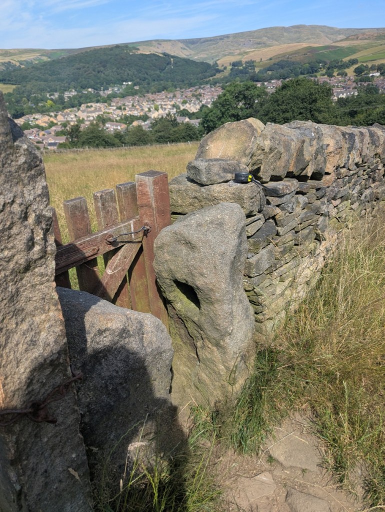
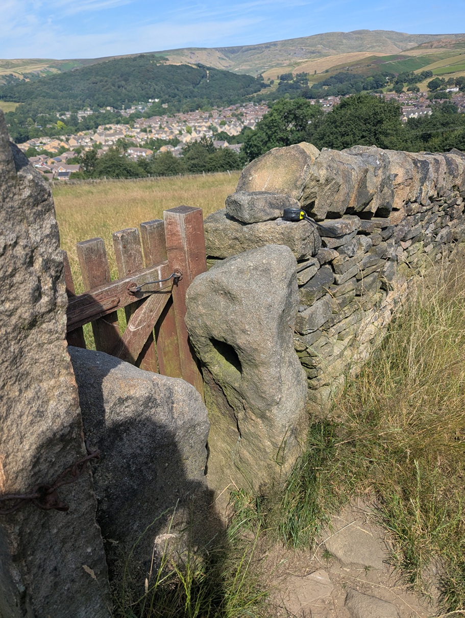
Carrhouse 1 (W3W – whisker / deform / nibbles, Hole = 5″ x 5″). I love this photo; Shire Hill in the background, and the view over the Shirebrook Estate puts this in its modern landscape. You can also see my tape measure on the wall, just used to measure the hole.

This is being used as a stile/gate, but the other stone, opposite it, is its mirror – same height and rough shape – only it doesn’t have a hole in it. Odd, but I feel the two must be connected, somehow.

On we go, along this path a short distance, across two fields, and over the stile there, immediately on the floor at the left, and lying face up, is Whitfield 5:
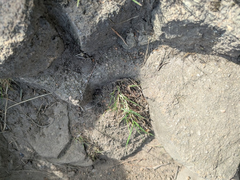
Whitfield 5 (W3W – tanks / falters / animates, Hole = 5″ x 5″). The square hole with rounded corners is in the centre of the photograph, with grass growing out of it. I’d love to dig this up and set it upright once again… it deserves more.

Clearly it had been broken at some stage in its history – the upper part of the holed bit has sheered off – and the farmer has replaced it with a stile… but the hole is still visible.

Back the way we came, and left along Carrhouse Lane, on the right we soon come to a hugely overgrown gateway, and nestled against the newer gatepost is:
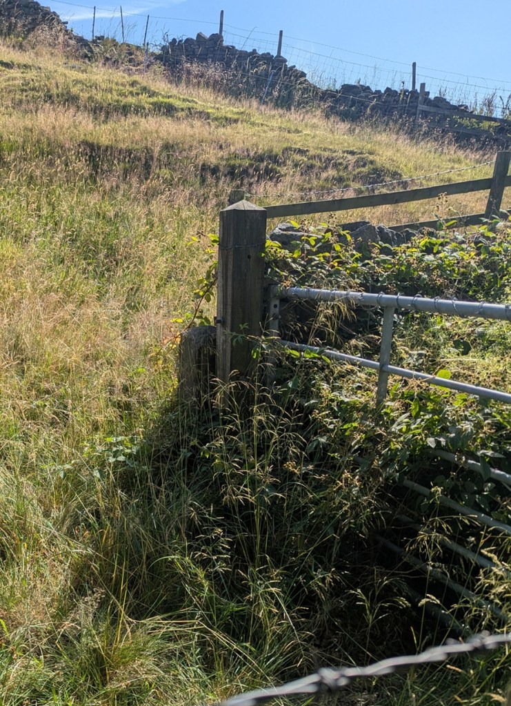
Carrhouse Lane 2 (W3W – majors / creamed / swam, Hole = No Data. The entrance is buried by about 3 metres of blackberry!). I have been close enough to this one to put my hand into the hole, so it is real, despite the awful photograph. I shall try again in winter, and update the article.

I shall get a better shot of this one, I promise, but you can just about make out the dark area that is the hole in the short post.

A little further on, on the left, is this pair of beauties:

The post on the left has two holes in it, and is a bit of an anomaly, although there are other examples of multiple holes around the area. It has actually been split at the upper part of it, the result of a farmer sometime in the Victorian period drilling a hole to take an iron pintle, and cracking the rock.
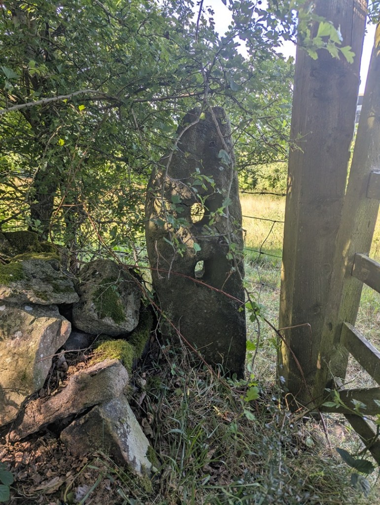
Carrhouse 3 (W3W – goad / tidal / bigger, Holes: upper = 3.5″ x 4″, lower = 3.5″ x 4″). Lovely.

The other side of the gateway confused me at first, though: there was no hole… or so I thought. Looking more closely, it seems that the hole has been cemented up, possibly to prevent or repair a crack?
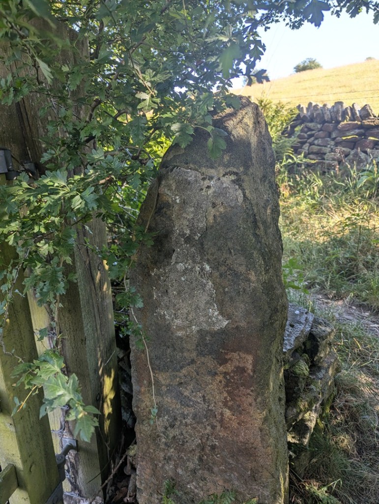
Carrhouse 4 (W3W – goad / tidal / bigger, Hole = 4″ x 4″). Although, I looked, I couldn’t see that the upper part of the cement was covering a hole – I think it was whoever did it filling in some gaps? I shall double check, of course, next time I’m passing.

Finally, walking on the path toward Jumble Farm, we find this one, shorter than most, just before you get into the farmyard:
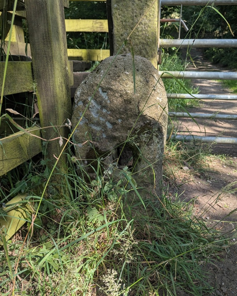
Jumble Farm 1 (W3W – reclined / monk / swept, Hole = 4″ x 5″). It original function here is replaced by large Victorian carved gateposts.

Well there we are – a small selection of holed stones on a quick walk around Whitfield, and all associated with the Whitfield Medieval Field System. I’m not saying it proves my hypothesis, but they are all clearly of the same age, with the same size hole, and same rough shaping – we just need to identify that age. And I would argue the late medieval period (post-1450). More research is definitely needed – I have 26 holed stones that I know about – they’re all in a map that I’ll share with you below, and you can go and look at them yourselves – each one is marked by a blue arrow.

However, there are doubtless 100s more out there, lurking, hidden… lost. And that is where you come in. Please, do me a favour… if you know of any, or after reading this notice some in the Glossop(ish) area, please let me know – send me a photo, a dropped pin in Google maps, a What 3 Words, an email telling me where it is… anything. But let me know, as I think there is more here to be uncovered regarding land use and field systems in the medieval and post-medieval periods. Exciting, and I want you all to share in this, so go forth and do some research that might help us.

The map is here, just click on the link: Map of Holed Stones

Stay in touch!

Right, that’s all folks for this time. My thanks to Lee of the Punk Archaeology Podcast (first episode is coming soon) for the help in exploring this group of stones.

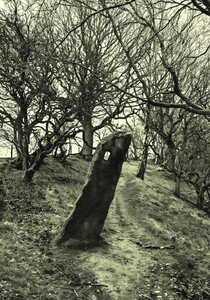
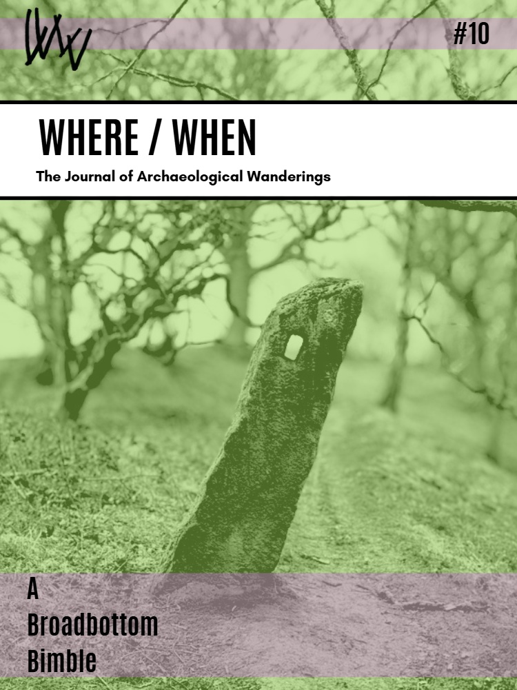
By an amazing coincidence, holed stones also feature in the latest Where/When, available in the usual places (alright, Dark Peak Books), but also directly from me (link here), and I can post it to you.
Archaeology · Bench Marks · Graffiti · Standing Stones

Gateposts

What ho, lovely people of the blog world. I hope you are all well as we hurtle headlong into summer, each of us fearing what terrible weather will mar an otherwise splendid season. Nevermind, this too shall pass and all that, and indeed we must grasp the nettle by the horns, or something, and make H whilst the S shines…

Today’s post is one of those brought about by happy coincidence, where a series of events conspire, almost waving at you, until you finally notice and say, loudly, “what ho… a blog post!” Or, in this case, a Gate Post. The first event was posting a few photographs on Twitter and Instagram (@roberthamnett on Twitter, and @timcampbellgreen on Instagram, for those of you who might fancy checking it out). Turns out I’m not the only one who likes a good gatepost or two. And then the next event was my seeing a tiny piece of metal in the soil whilst doing a recce for a Where/When (No.7, to be precise… Of Forts and Crosses: A Mellor Wander). All will become clear, honestly.

For years now I have been obsessed with gateposts. Mundane, utilitarian, and always overlooked, a good gatepost can be as interesting as a prehistoric standing stone to me, and truthfully, there is often very little difference: both made of stone, both standing upright, both important in the past, and also in the present. And if anything, gateposts have more interesting features! I mean, obviously prehistoric is fascinating, but they don’t really give us much to go on, whereas the later gateposts… well, read on.

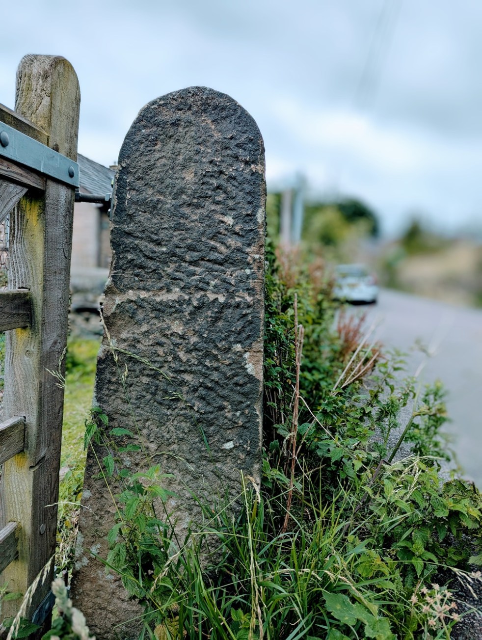
They can be decorated – often just roughly dressed.

A simple rough dressing, to shape it in a uniform manner.

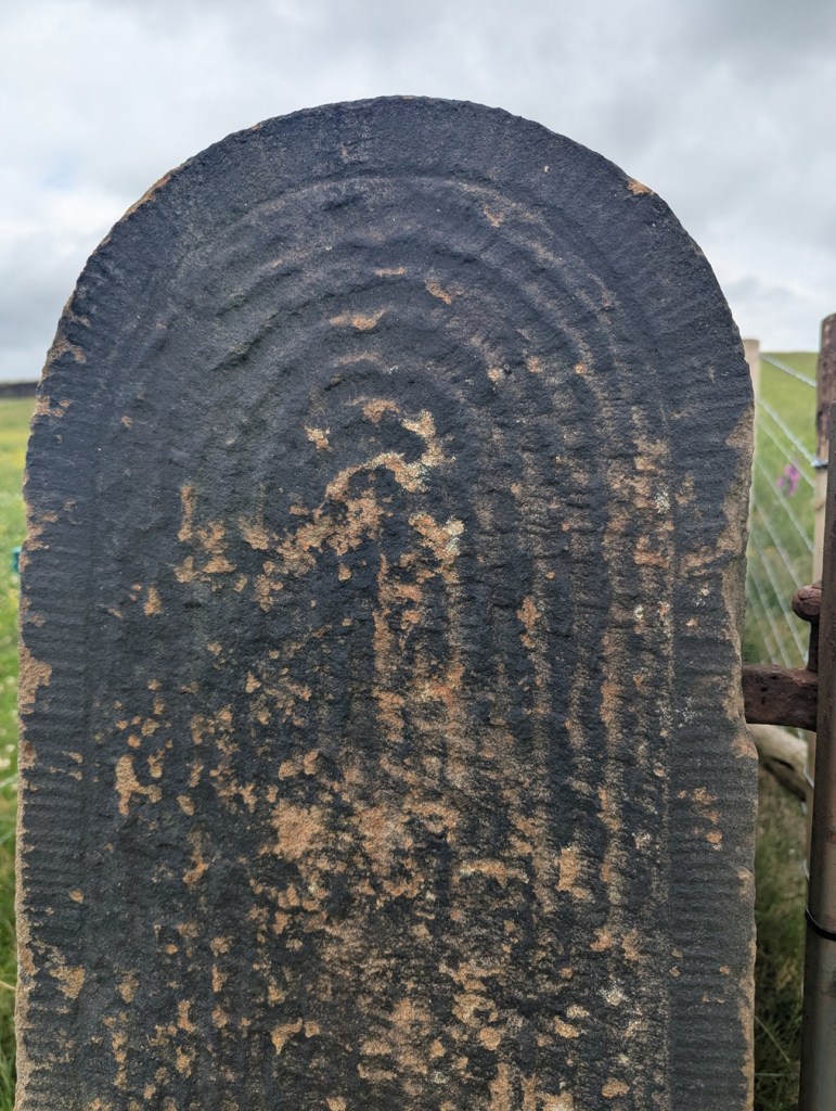
But sometimes some thought has gone into them, to create a pleasant design – which for a utilitarian functional object seemingly goes beyond what is needed.

A simple cross, surrounded by a border. I say simple… it takes some doing.

I mean, the only time you see the gateposts is when you are opening a gate to let sheep or cattle in and out, and it’s probably not something you’d see everyday. And even if you did, it’s only for a moment or two, it frankly doesn’t matter if it looks good, and I doubt farmers are wandering around making snarky comments about the plain decoration of another farmer’s gateposts. So why? What is the purpose behind them? I don’t mean they had some sort of secret meaning behind the decoration, rather they simply represent someone’s choices, but why those choices I wonder? Possibly it’s probably more to do with pride in the work taken by the stonemason who shaped it, perhaps a form of identifier: we know it’s person X who shaped it, as he always decorated it with a cross. But then there are those that go beyond simple decoration, and instead turn it into a work of art.

This is wonderful! The way it shifts from the upper band with a circular motif, to the lower aspect with the herringbone pattern is amazing. A lot of effort went into this.
This too, is truly wonderful. The circular motif, with a border, is just amazing. This post seems to be in the reddish Cheshire sandstone, which makes sense given that it, and the last gatepost was found in the Mellor area, rather than Glossop.

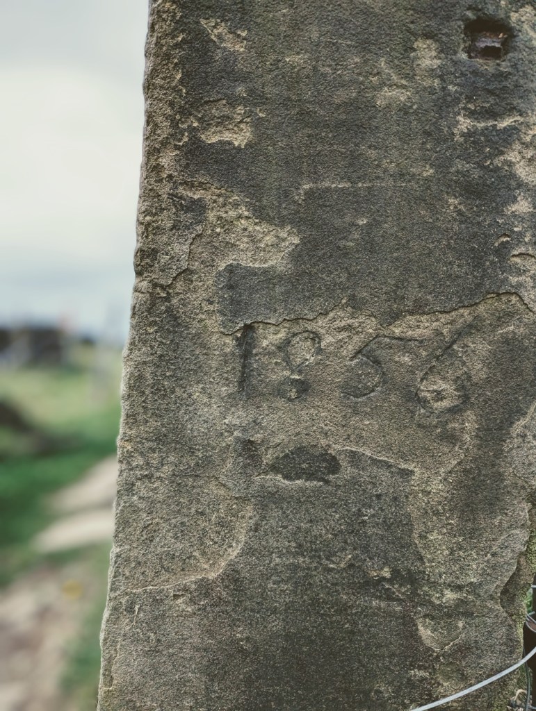
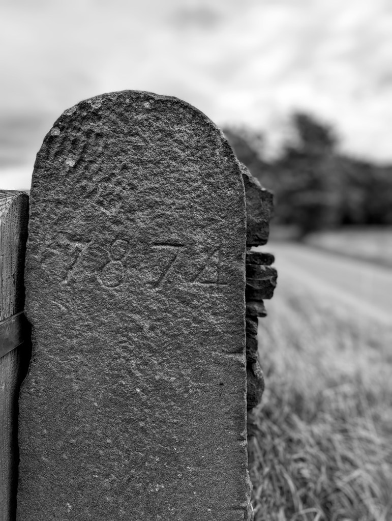
Other times, we find words and dates on gateposts. Often these are faded and barely legible, the weather and environment are not kind to these solid sentinels, and they have no shelter.

‘1856’, on the track from Fieldhead Farm to Whitfield Cross.
I went all arty with this shot… I’m quite proud of it! ‘1874’ in a very similar hand to that of the above gatepost – I wonder if it was the same person? This is on Kidd Road, just before its junction with Derbyshire Level.
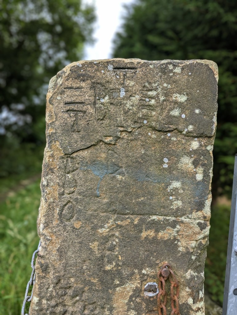
Multiple ‘B’, ‘D’, and ‘O’ – from a post just by Fieldhead Farm.

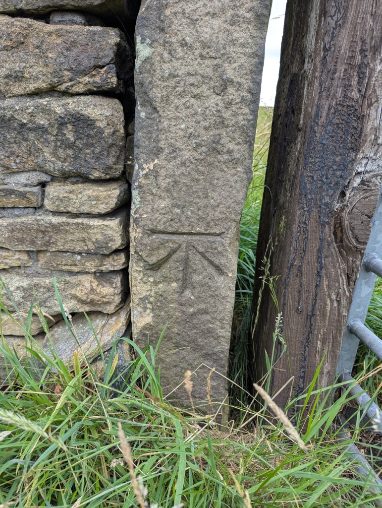
The Ordnance Survey often use them to carry benchmarks – after all they’re not likely to be moved, and so are a safe and permanent marker for heights above sea level.

The line above the arrow is 682 ft above sea level, precisely.
This one is 716ft 2″ above sea level.
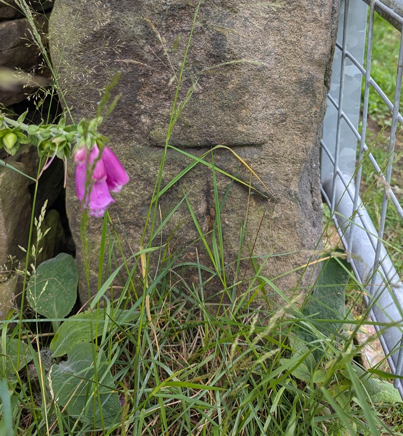
I love this photo… the grass almost mirrors the benchmark. Oddly, I don’t have a height for this mark – for some reason, no OS map I have come across shows its existence. Strange.

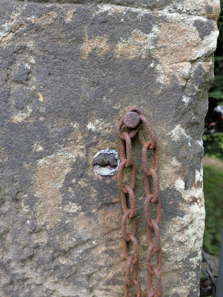
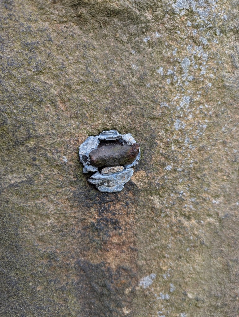
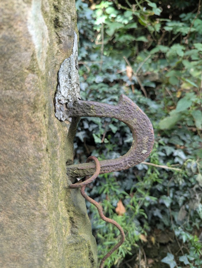
The fixtures and fittings of gateposts always fascinate me, too. Cast iron hoops and hooks, held in place by the tell tale grey/blue of lead. Sometimes you can only see the lead, the actual latch or pintle missing, it’s function no longer having purpose – it is just now a standing stone.

A now missing something or other, the metals eroding, staining the stone. It can get so bad that it actually kills the moss and lichen.
More something or other, now missing, but once important. The lead fixing is a tell-tale sign that the iron whatjamacallit is missing. I honestly love this, it really does show my theory of objects having a biography.
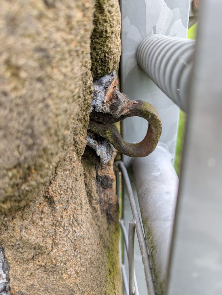
This is lovely… beautiful cast iron eyelet, twisted and shaped whilst red hot, and then held in place with lead. Although no longer needed to make the gatepost function – the modern steel gate does that (leaving it’s own scars on the stone) – it remains a part of its history.
Multiple phases of use, each leaving a mark.
Again, scars, but once meaning, purpose.
Hand made, and truly wonderful.

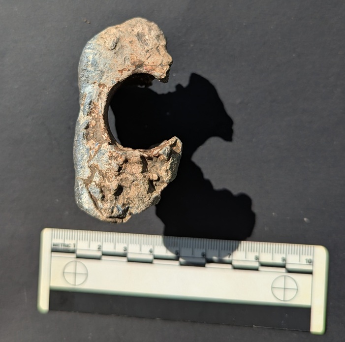
It was actually one of the lead fixings that I found that partly inspired this post. I saw what was obviously lead sticking out of the ground, and bending to remove it as I always do – it’s really not good for the environment – I realised it was bigger than I expected. I studied it for a moment trying to work out what it was, when suddenly: “aha” I thought “that’s a fixing“.

You can see rust on the inside, where the iron whatsit was held in place.

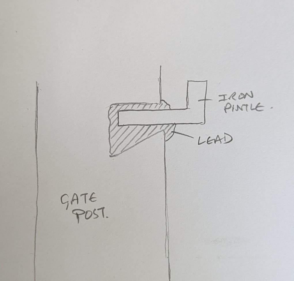
Looking at this lump, and using a small diagram, you can see what it is and how it worked. The long hollow through the middle once held the iron fixture – a pintle or latch, perhaps.

The iron whatsit was circular in section.

The shape of the lead piece is also a clue to how it actually held this in place. A hole is made into the side of the gatepost that needs the ironwork on it, with the lower part of the hole made deeper. The ironwork is placed in the hole, and the molten lead poured in using a funnel to hold it within the stone and around the iron whilst it cools.

If this makes sense.

When hardened, it forms a plug that is very difficult to move, keeping the iron work in place; clever, and elegantly simple. It’s also nice to see the ‘inside’ of the gatepost, or rather a cast of the inside, and one wonders why the lead has come away so intact from its original home – one can only imagine that the post itself was broken, freeing this fixing, which then found itself at my feet in the wilds of Derbyshire years later.

In terms of dates for these gateposts – well, it’s not clear. I think the more uniform stones, with a rounded head, are Georgian and Victorian – later 18th and 19th century. However, there are some that I think are significantly older – 17th, 16th, even 15th century, possibly. These are generally less formally worked, are shorter, and importantly are characterised by having a single straight hole through the stone a few feet above the ground.

Another arty shot, this one of the ancient gatepost on Hague Street.
Carrhouse Lane, Whitfield. And no, I didn’t stick my hand in the hole…

I was, until fairly recently, convinced that these were marker stones for trackways, the square hole perhaps taking a wooden pointer. However, I started to notice that this didn’t always fit the pattern, and despite multiple blog articles, twitter posts, and it even published in Where/When, I began to doubt this explanation. I then received an email that pretty much confirmed it for me (thank you PB, you amazing man!). In it, the author quoted a John Farey, whose 1815 book – General View of the Agriculture and Minerals of Derbyshire: With Observations on the Means of Their Improvement. Drawn Up for the Consideration of the Board of Agrigulture [sic] and Internal Improvement – gave the following quote:

Anciently, the Gates in the Peak Hundreds were formed and hung without any iron-work, even nails, as I have been told; and some yet remain in Birchover and other places, where no iron-work is used in the hanging: a large mortise-hole is made thro’ the hanging-post, perpendicular to the plane of the Gate, at about four feet and a half high, into which a stout piece of wood is firmly wedged, and projects about twelve inches before the Post; and in this piece of wood, two augur holes are made, to receive the two ends of a tough piece of green Ash or Sallow, which loosely embraces the top of the head of the Gate (formed to a round), in the bow so formed : the bottom of the head of the Gate is formed to a blunt point, which works in a hole made in a stone, set fast in the ground, close to the face of the Post. It is easy to see, by the mortise-holes in all old Gate-Stoops, that this mode of hanging Gates was once general.

Of course, it made sense, despite me banging on about them being marker stones. So, please accept my apologies for this; I am not always correct, and my knowledge is always growing. And thank you PB, who brought this to my attention – this is your discovery, not mine (you can read the book here – P.92 is the quote. There are about 20 of these gatepost types I know of, with many more awaiting discovery. And I actually think these are quite significant, as if we plot their location on a map, we might get a better grip on land use in the pre-industrial period. Marvellous.

I am obsessed with gateposts, and I want you to be, too. Everytime I pass one, I check it out, and often I am rewarded with some nugget of information, graffiti, decoration, or just a blast of the past. Let me know what you find via the contact page, and let’s keep an eye out for those holed ancient stones.

Right, I think that’s all for this month, and lucky you the next post will, I suspect, be a pottery post! Woohoo! I have found lots of cool stuff recently, and it all needs writing about. As always, I have about 30 projects ongoing, not all of which is coming to fruition anytime soon, but some will emerge relatively rapidly – watch this space. In the meantime, do please check out the Etsy store, or the Ko-Fi page – and feel free to buy me a beer coffee, or yourself a copy of Where/When, or even a t-shirt!

But until next time, please do look after yourselves and each other. I know I always say that, but you all matter, and we all need to take better care of each other… the world can be scary place at times, so lets band together and help each other.

And as always, I remain.

Your humble servant,

TCG