What ho, one and all!
A bit of a quick one today, exploring one of the lesser-known, and certainly overlooked, bits of Glossop. Truthfully, I thought there might be more of a story here – perhaps even some pottery – but alas, there is very little to be said about today’s subject. I’m really not selling it you, am I? Ahem… so then, ladies and gentlemen, may I present Moodsbottom Bridge.
Can anyone else hear crickets? And why is that tumbleweed cartwheeling across Victoria Street? And what’s that I hear you cry? “I say, old TCG, where is this Moodsbottom Bridge of which you speak?”. Well, quite!
So then, it’s here…
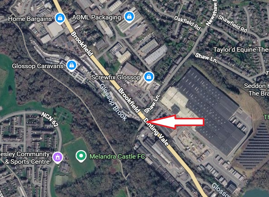
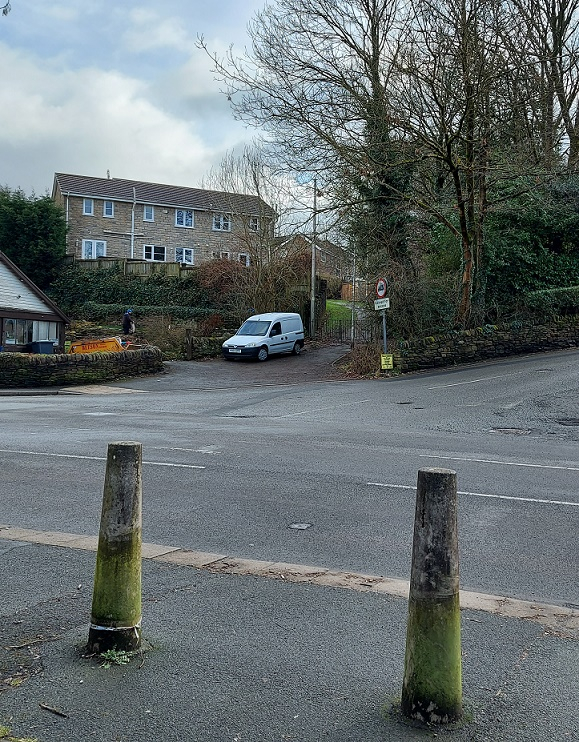
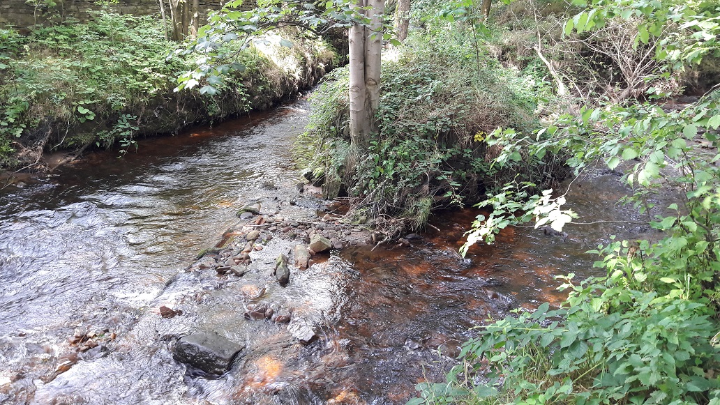
Just before Glossop Caravans on the left, and at the junction with Newshaw Lane, it crosses over Glossop Brook. You will have driven past it thousands of times, and perhaps even vaguely acknowledged it was there, sat in traffic, but unless you were actively seeking it, you would simply overlook it. By the way, it should not be confused with the ‘modern’ bridge over the brook, the one you drive over in the line of traffic that ignores the older bridge on the left.
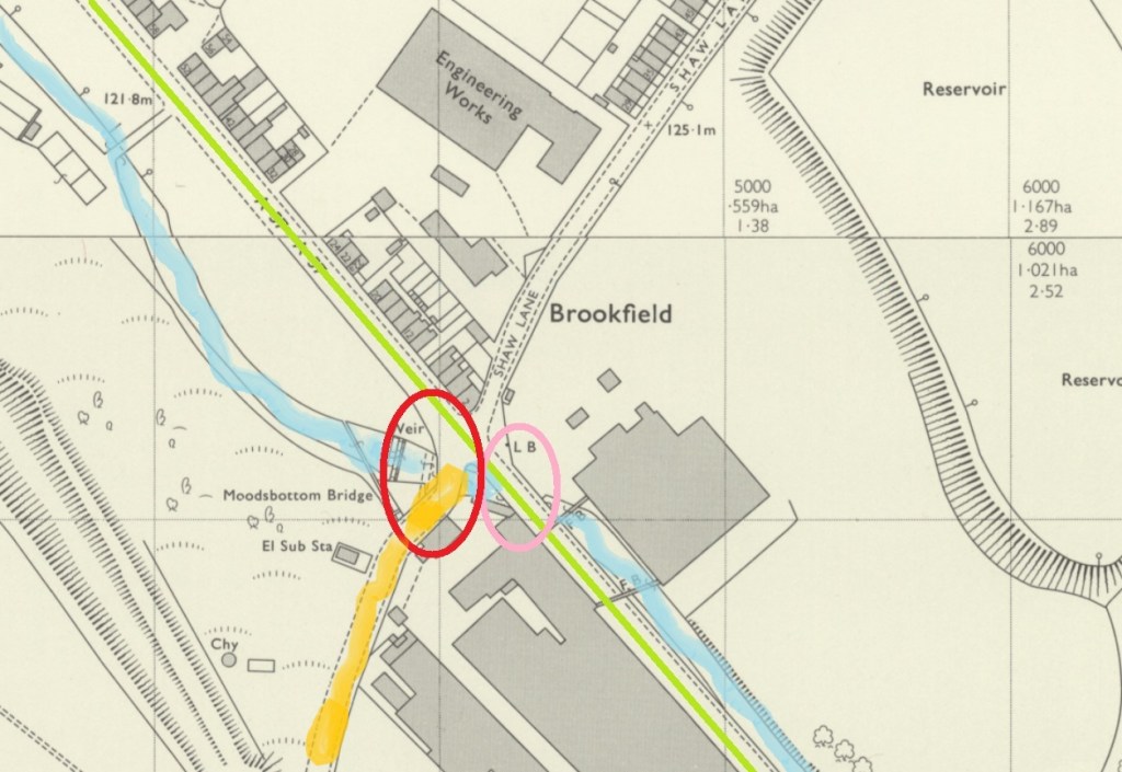
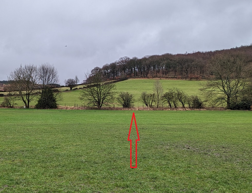
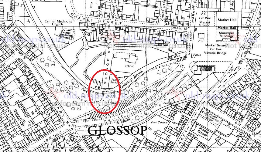
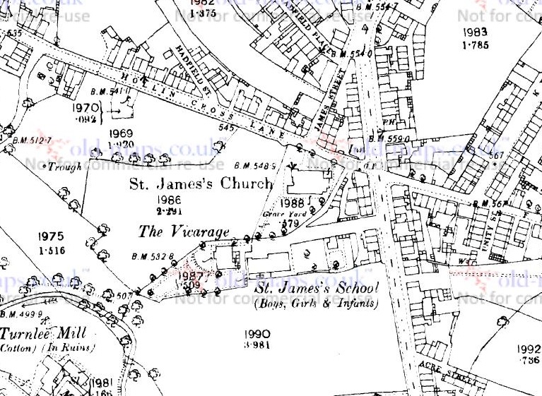
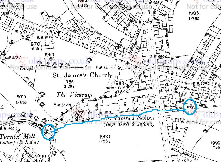
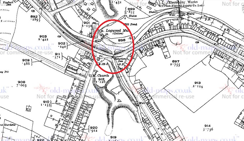
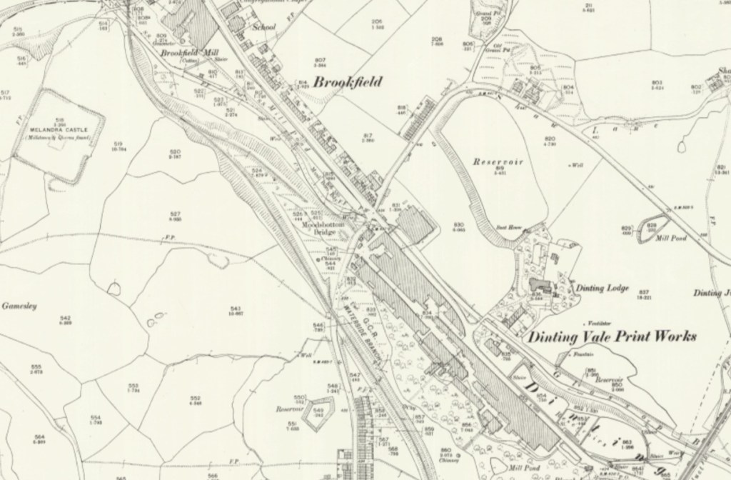
To clarify, in this image, we see Glossop Brook (marked in blue), the line of the modern road (in green), Cottage Lane (up to Gamesley, in orange), the new bridge carrying the modern road (originally the Turnpike Road, and circled in pink), and our bridge – Moodsbottom Bridge – circled in red.
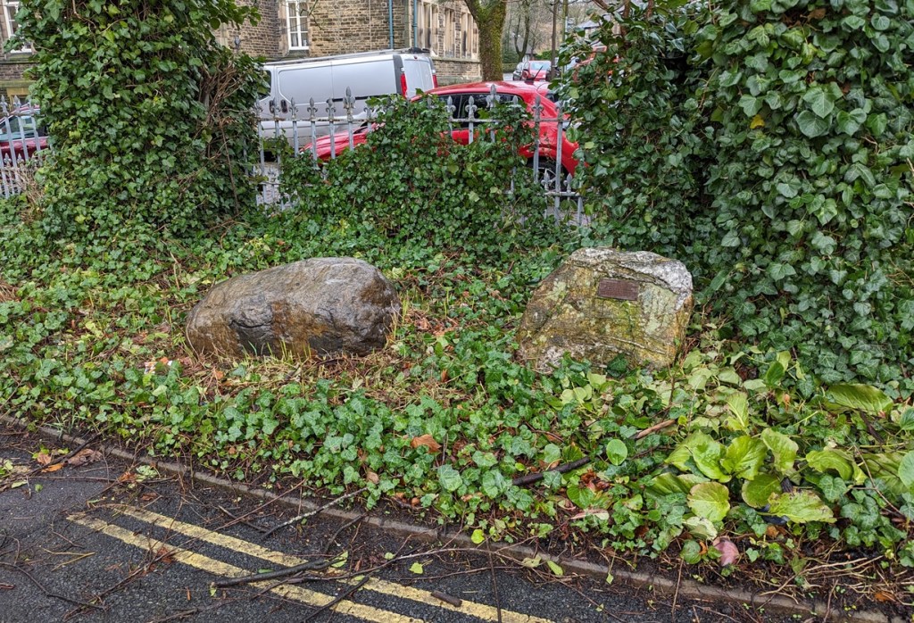
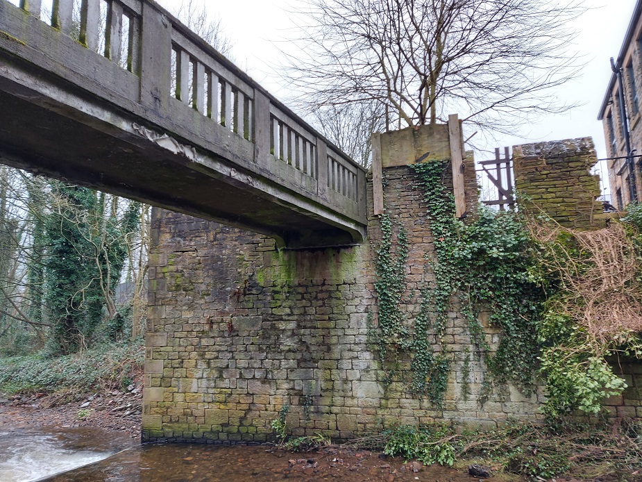
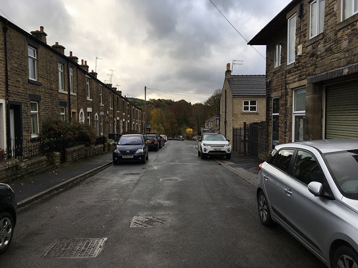
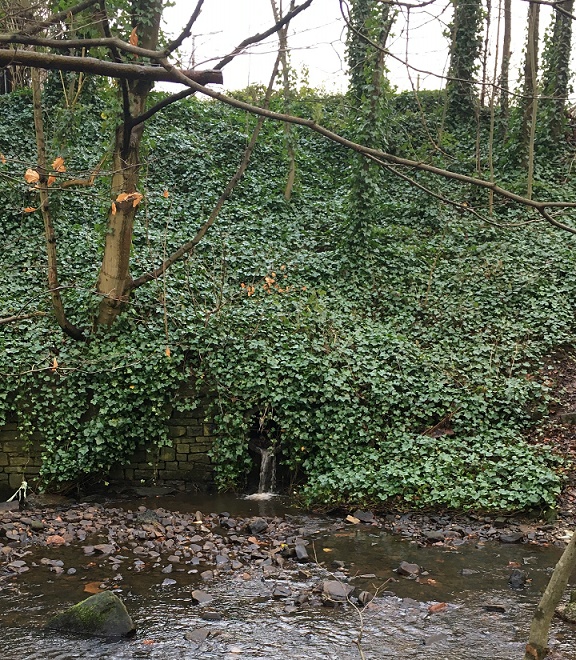
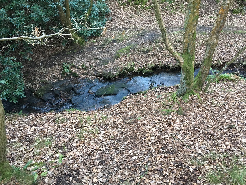
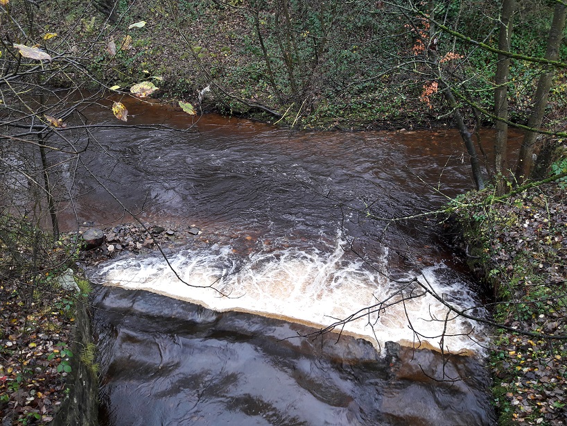
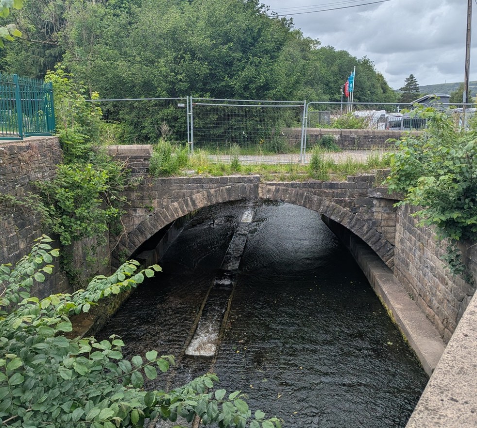
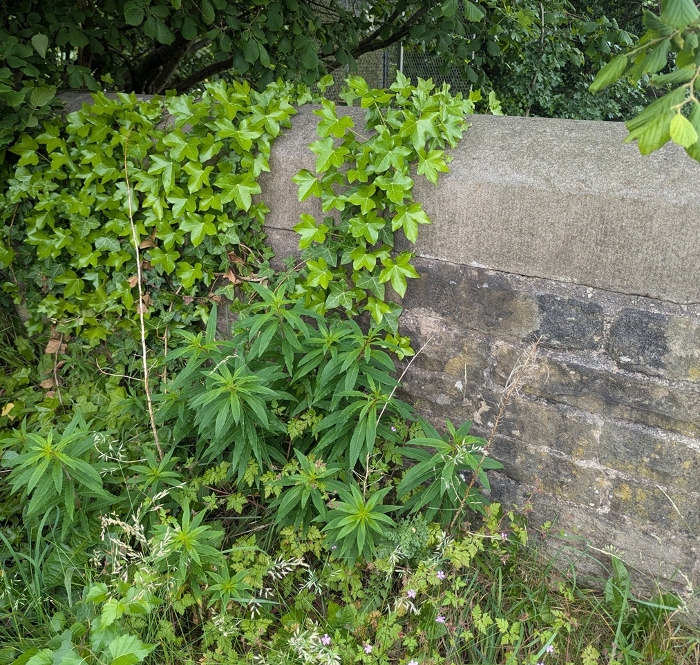
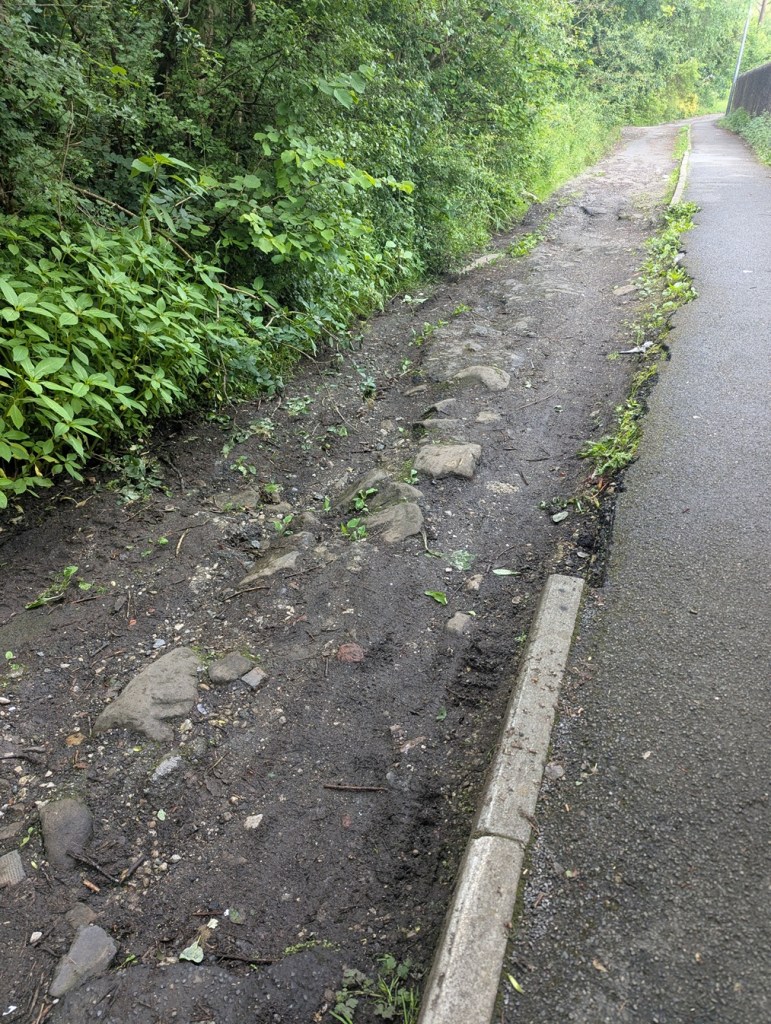
Here is the bridge as viewed from the road – it’s lost some of it’s walling, and is in a poor state of preservation, but this is what is visible now.

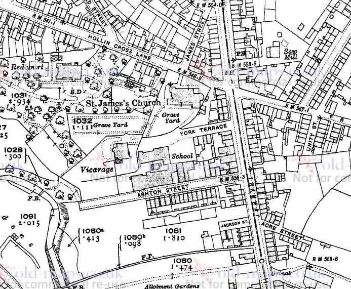
It seems to have been a fairly important crossing at one point in the past, and is the latest visible aspect of the crossing which probably started as a ford across Glossop Brook. Looking at older maps, it seems to take the track from Mottram, Hague, and Lower Gamesley Farm across the brook, as well as a track from Hargate Hill, crosses, and then up to Hadfield via Shaw, and (Old) Glossop, via Dinting. It was clearly the meeting of many of the old tracks that existed in the pre-turnpike era (pre-1800 or thereabouts), and one of only a handful of crossings of the brook.
And yet truthfully, though, I’ve no idea of the age of the crossing and bridge, and its history is confused and murky, which is a pity. There is very little discussion in any of the history books or articles, and a brief google of “Moodsbottom” produces just 10 hits (11, now, I assume).
As if to illustrate this frustrating murkiness and general lack of knowledge, the earliest reference to the bridge I have found is from 17th February, 1794, when the trustees of the newly formed turnpike trust ordered “the river below Moodsbottom Bridge be piled to prevent carriages travelling to the coal pits”. “Piled” here probably refers to having the river bank’s sides made steep and secure with piling, to prevent the carriages from fording it, and thus avoiding the fees for road use. But the turnpike road (now the modern, green, road in the map above) was only put through in 1804 or so, some 10 years later – so why the trustees of the turnpikes trusts were making this ruling is not clear.
At about this time (1795), according to Robert Hamnett (quoted here) a John Loton built three houses at “Gamesley Bridge” (not the viaduct over the railway, which was built in 1843). There was also a white cottage belonging to a Roger Dumphy; possibly an older building, it had some ‘pleasure gardens’ at the rear, which were apparently quite popular. Presumably these all stood on what later became known as Cottage Lane (in orange, on the map above), and which was apparently named after Dumphy’s White Cottage.
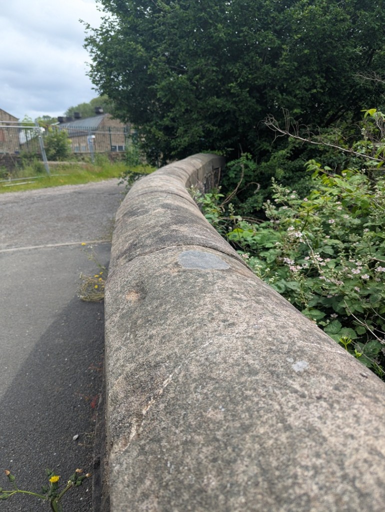
We also know that on 17th December 1863, a meeting of ratepayers was held to discuss the making and improving of certain highways. This was in response to the ‘Cotton Famine’ of the mid 1860’s, when raw cotton ceased to be imported from America due to the ongoing civil war there. The effect of this was to put thousands of mill workers out of work, and create hardship and poverty throughout the area. In order to mitigate the effect, jobs were ‘created’, and large numbers of public works were initiated – including the creation and improvements of many roads in the area. Among these were “the making of a public road from the Glossop and Marple Bridge turnpike road, at Gamesley, to the Glossop and Marple Bridge turnpike road at Moodsbottom Bridge.” – that is, what we now know as Cottage Lane. Looking at the stonework, it would seem that the current bridge dates to about that time, and the whole area seems to have been reconstructed and formalised then. What the bridge would have looked like prior to this is unknown – stone, but less… well, Victorian!
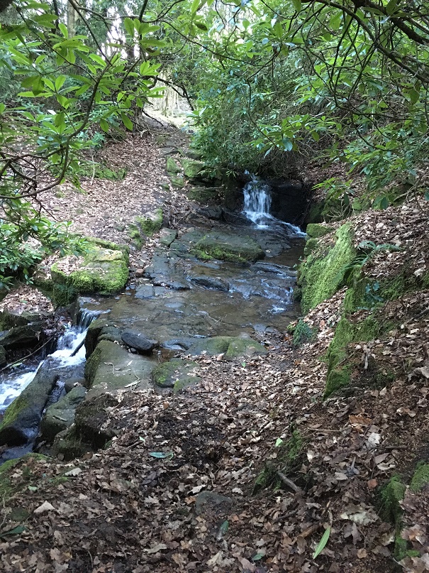
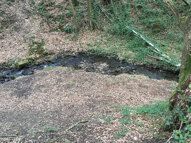
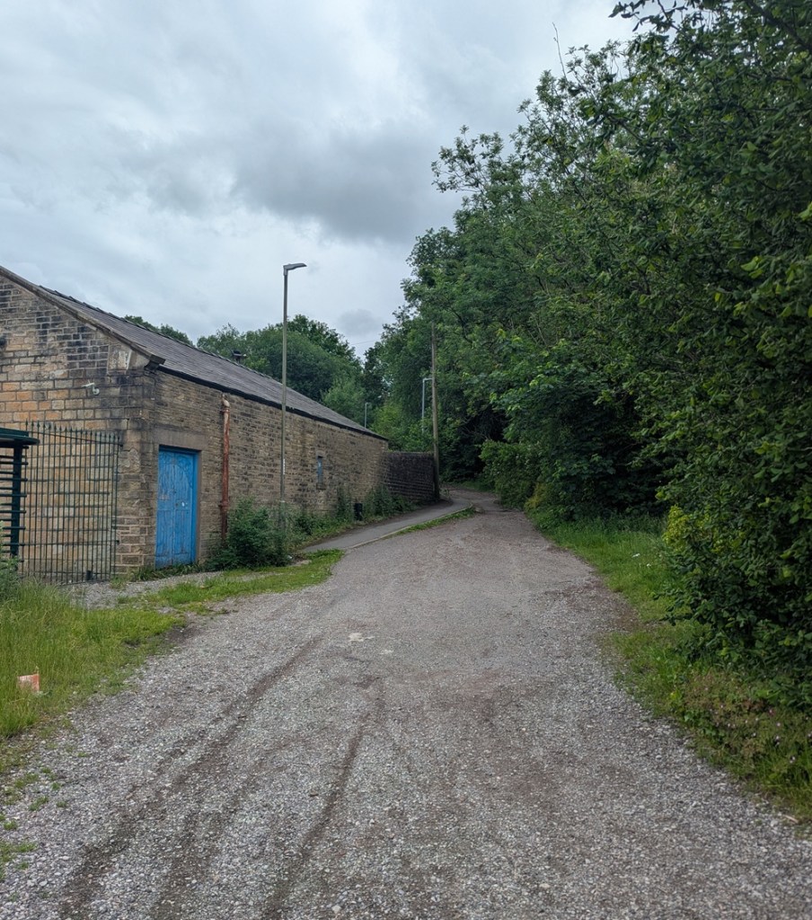
So what is there now? Here are some photographs taken last week…
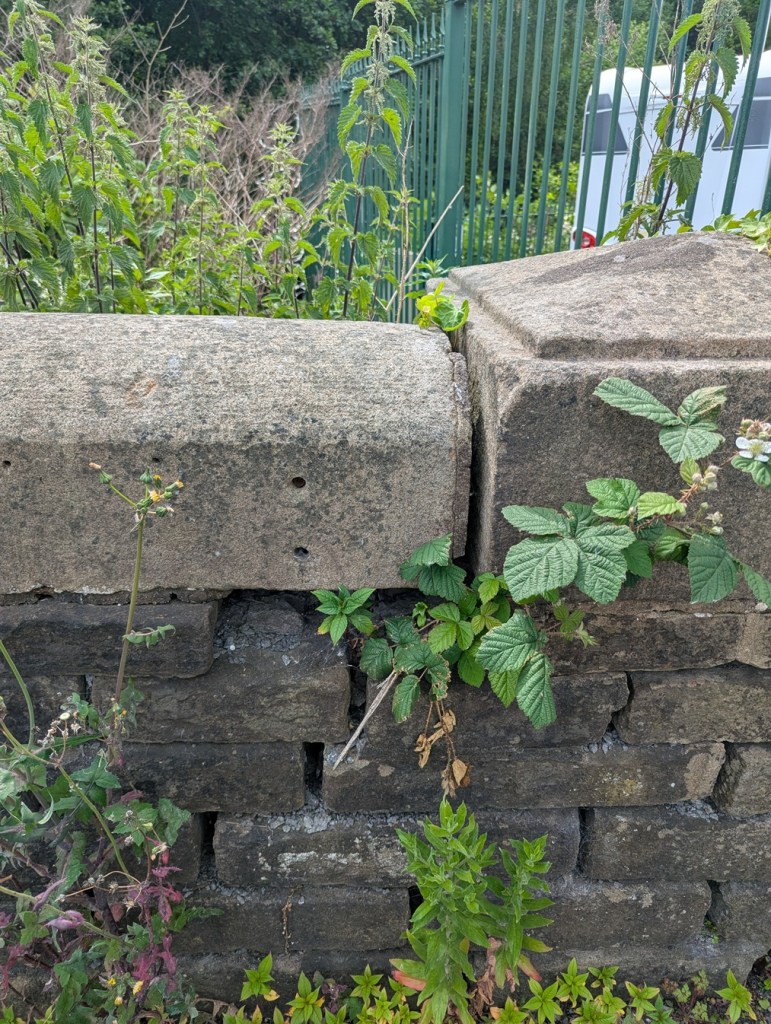

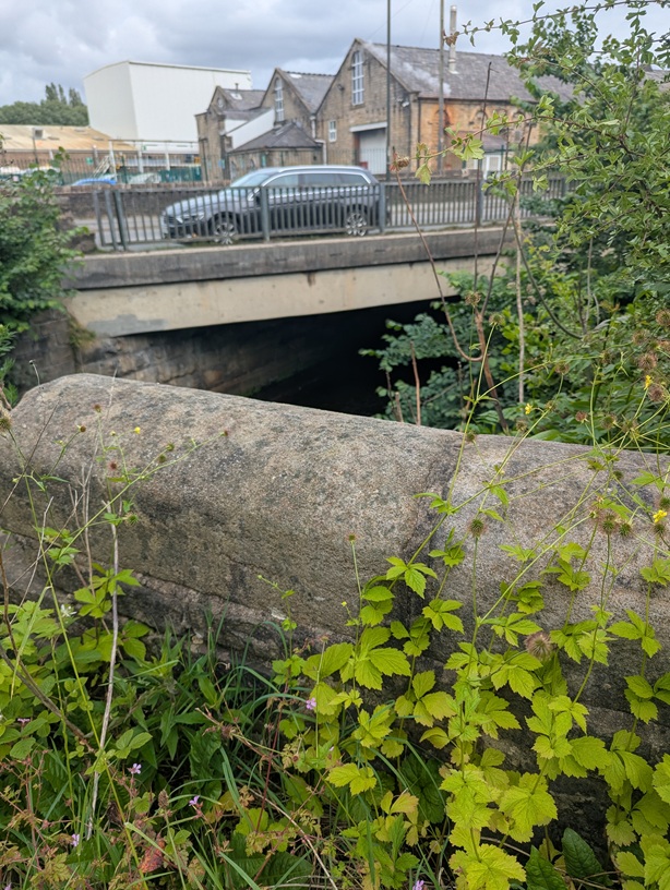

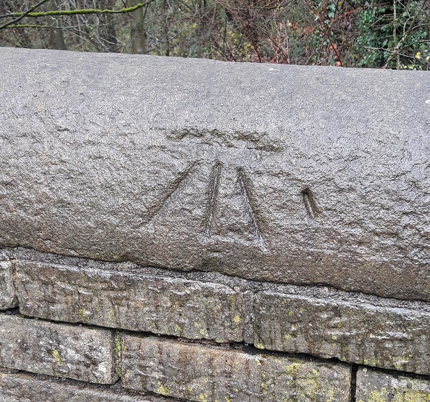
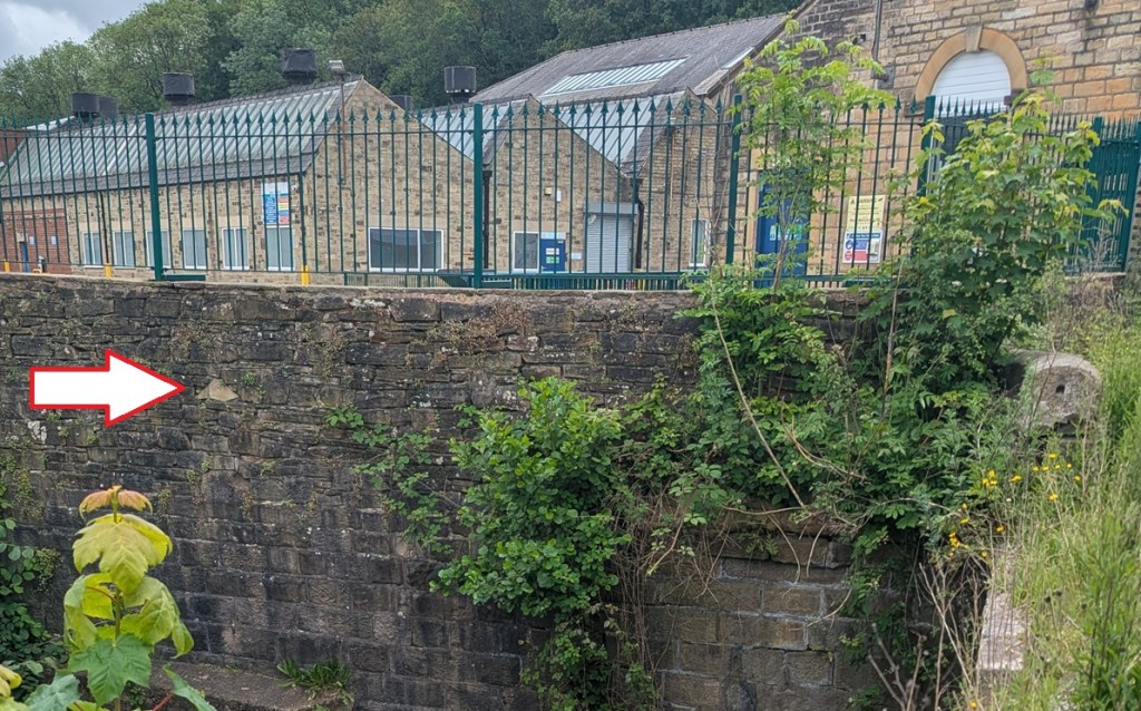
There is an interesting aside in Neville Sharpe’s book, Glossop Remembered, where he notes that during WWII, the local Home Guard put gun loops (holes that allow soldiers to shoot through) into the wall belonging to a factory that overlooked the bridge, allowing rifles and machine guns to train up the road that comes from Woolley Bridge (and Hollingworth) – the likely direction of invasion into Glossop from the west – and up Newshaw Lane to the north: even in 1940, the bridge held strategic importance.
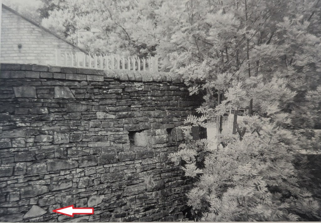
Alas, as so often happens, the evidence of the past is erased – the wall has been truncated since the above photo was taken (1980’s? 1990’s?), and as this modern photo shows, what we are left with is… not a lot. You can see where the loops were by spotting the triangular shaped stone in both photographs, indicated by the big white arrow!
Incidentally, logically there must have been a similar defensive position to the east – somewhere at the bottom of the snake pass, in order to protect that road – and I think I might have a likely location! Let me check it out, and I’ll let you know what I find…
The name is interesting, though. Moodsbottom? What does that mean?
It’s named as “Mousbottom” in Ralph Bernard Robinson’s Sketches of Longdendale (1863). This seems to be a contraction of ‘Mouselow Bottom’, and may account for Moodsbottom, which sounds very similar. But – and here we stray into ‘placename’ territory – I have another theory, one that plays into the idea that Mouselow was a hugely important site in the Saxon period as well as the Iron Age, and early medieval periods.
I suspect that Mouselow, the Iron Age hillfort that sits just above Moodsbottom, was used in the Anglo-Saxon period (let’s say 9th and 10th centuries), holding a special status as a Moot place – where the local ‘council’ of surrounding villages held monthly meetings to discuss issues such as land use and roads, for example. I discussed moots here in regards to Mottram, and I have a whole article almost ready to go about this, but one of the central ideas is that ‘Mouselow’ is derived from ‘Motts Low’, the ‘mound’ (low) of the ‘moot’ (mott). If this is the case Moodsbottom is derived from ‘Moots Bottom’ – the bottom of the moot… which it is. More on this soon, I promise, but for now I’ll leave you with that tantalising glimpse.
So, there you are, a small piece of Glossop’s history, imperfect and not fully understood, and very much overlooked, but full of a possible story. Wonderful!
In other news… the latest Where/When has landed in the shops – both physical and online. Behold: The Broadbottom Bimble!
It’s a circular Wander from the station (well, let’s face it, the Harewood Arms), to Far Woodseats Farm and back, via Broadbottom Beach, some amazing standing stones, medieval fields, Georgian and Victorian factories, packhorse tracks, bridges, brooks, and some incredible geology. What’s not to love?
It’s available now, as indeed they all are (No’s 1-9) from Dark Peak Books at 96 High Street West, Glossop; from my Ko-Fi shop (and do feel free to buy me a coffee, or a glass of the stuff that cheers); or just find me in the street, hail me with a hearty “what ho!”, and I’ll give you one. Cheers, and happy Wandering.
Right, that’s all for this time. More to follow, soonish… probably. And whatever does follow will be pottery based – maybe even the final instalment of the pottery guide, or an updated version of the already published guide, you lucky folk, you.
Whatever comes, look after yourselves and each other. We live in turbulent times all around us, and each one of us is going through our own personal things. So let’s be kind to one another, because we all matter.
And so, until then, I remain.
Your humble servant,
TCG