Archaeology · History · Medieval · Standing Stones · Stones of Glossop · Whitfield

The Holy Stones of Glossop

What ho! lovely people, What Ho!

I know it’s a stereotype that we Brits moan about the weather, whatever the weather, but seriously… why is it so ridiculously hot? It can stop being over 30 degrees any time it would like to… soon, ideally.

Anyway, enough of the moaning – it won’t make any sense in 6 months time anyway (and by which time we shall be complaining about being too cold!)! instead, let’s look at the subject of today’s article: holy stones (that is, stones with holes, rather than sacred rocks).

Briefly, years ago, I started to notice stones with a squarish hole carved into them. My first thought was that they were some sort of gatepost, but the hole seemed unusual, and I couldn’t work out quite how they would function. Ok, interesting, I thought.
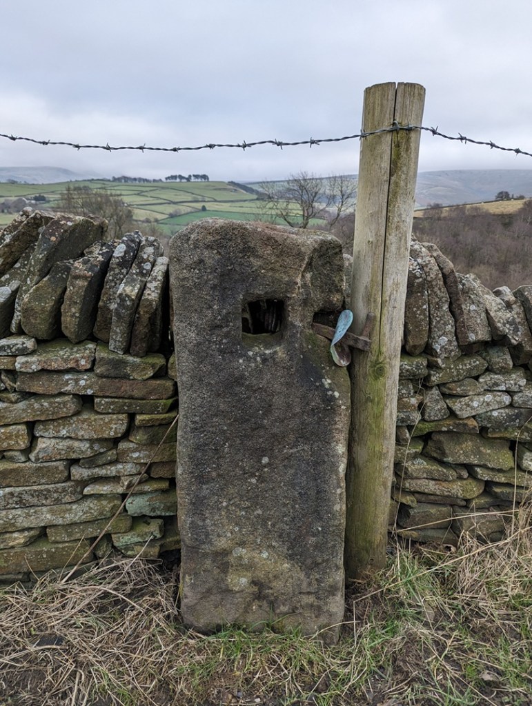
This is the sort of thing I mean, this one is between Lees Hall and Herod Farm.

Characterised by the (mostly) single hole of a square-shape roughly carved into the upper part of the upright stone. In this area, they are of an undressed coarse gritstone, very much unlike the newer carved gateposts, which have a smoothly dressed surface – these are rough. They also looked older than any other gateposts, seemingly quite worn and in no particular shape, simply vertical and between 1 and 2 foot accross – they seem part of the landscape, grown organically, rather than imposed onto it and standing as markedly different, as the more modern gateposts do. In fact, so much so, that the first one I noticed properly I thought might actually have been a reused prehistoric standing stone.

But as I did some research into the medieval and post-medieval trackways, I began to notice that these stone were found along the older roads in the area, and often located at junctions in tracks, where they split, or at particular curves, and I began to think of the holed stones as being track markers, with the hole perhaps taking a piece of wood to act as a finger post?

I was wrong! They are definitely gateposts – the full explanation is explored here in this article, but basically a piece of wood was inserted into the hole, this then had two holes drilled into it, and then another piece of – green – wood was curved into the two holes making a loop, and it was into this that the gate was firmly fixed. This would explain, also, why the holes in the stones never face where you would expect the gate to be.

Being that sort of person, I plotted all the ones I know about (currently 26) on a map, and a surprising pattern emerged. They all seem to be clumped around early field systems – the ones with the long thin selions, and with evidence of ridge and furrow. These ‘fields’ had no need for walls and boundaries, they were part of the “open field system” in which land was communal, and allotted to individuals within the settlement on a rotating basis. So the concept of a stone gatepost was not needed here until about 1433, when the Talbot family took ownership of the Glossop estate from the monks at Basingwerk. The Talbots, shrewd businessmen, understood that not much money could be made from peasants growing subsistence crops, so instead changed the local economy to sheep farming – the peasants got paid, the Talbots made money from the wool. Of course, sheep wander off, so we start to see walls appearing at this time (you also need to keep the sheep of the small crops you are growing). Which leads me to my working hypothesis: I wonder if these gateposts are the first ones that appear after the mid 15th century, as the fields are increasingly enclosed? Certainly in his 1815 book, General View of the Agriculture and Minerals of Derbyshire, John Farey notes that “Anciently, the Gates in the Peak Hundreds were formed and hung without any iron-work“, and proceeds to describe the holed stones in use as gateposts. That he uses the term “anciently” suggests great age.

This got me further thinking… if the gateposts are associated with medieval fields, might they not tell us where these fields were situated, assuming we don’t know? I don’t know the answer to that, but watch this space for more research.

However, I want to share with you a small field trip I did (in association with Lee, of the Punk Archaeology Podcast) to collect some data on these holed gateposts. A sample of them around the Whitfield Field System was explored, and I thought you might be interested in the results.

This is the map of the posts – the blue arrows mark each one, with its name:
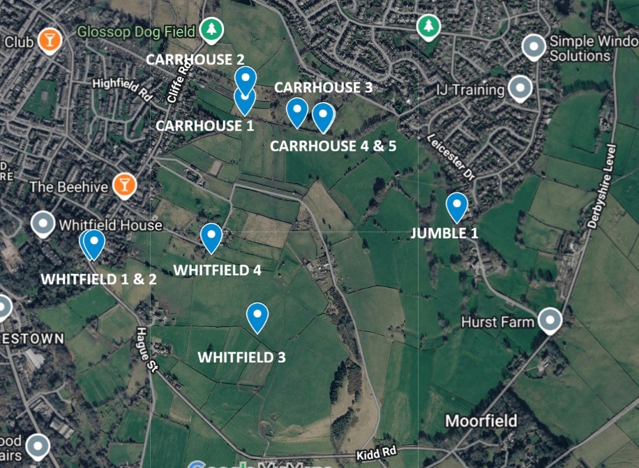
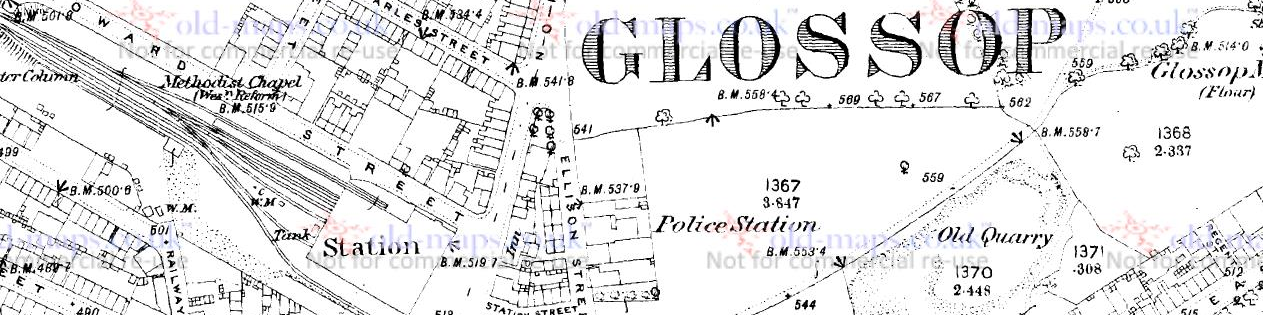
You can see the field system – the long thin ‘reverse-S’ shaped fields throughout the middle, but it is clearer on this 1890 map as the area has not yet been built up:
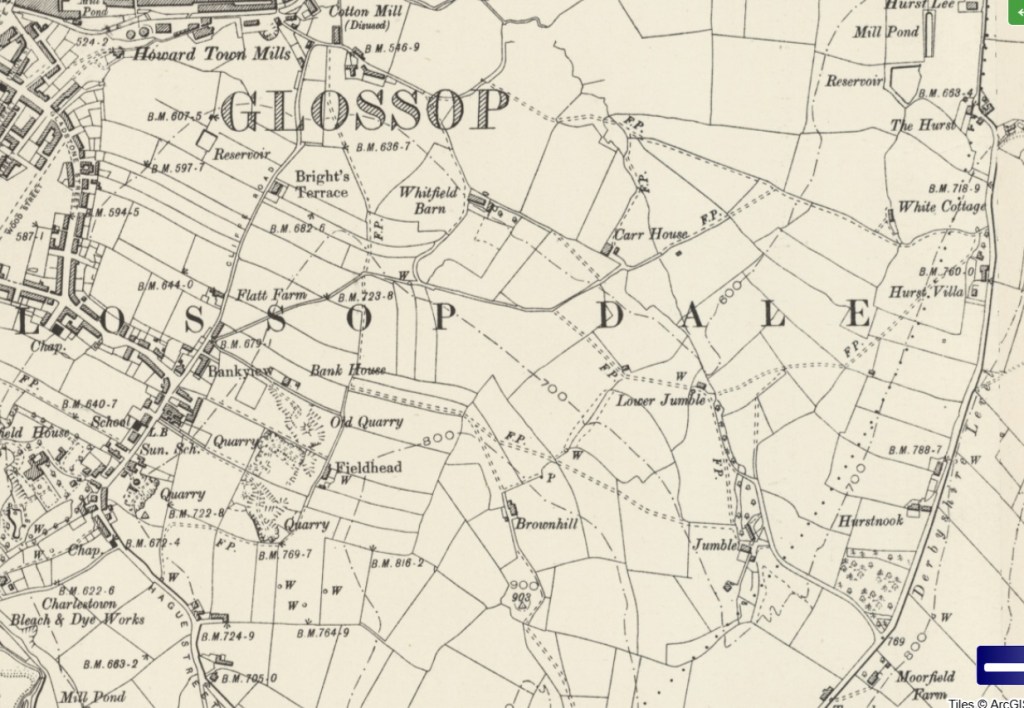
Everything on either side of Cliffe Road,, and below the word Glossop, as well as all kinds of stuff east of there. It’s a jumble, which is, in all honesty, probably how Jumble Farm got its name! Honestly, this part of the medieval field system in Whitfield is not talked about very much, and it needs to better known.

So then, what did we see on each of these points? Well, 10 of these stones with square holes. We measured the holes with the idea that if they all had broadly the same size hole, then they might be of a similar age/date/construction – I’ll put the size under each photo (in inches, not cm… it seemed more appropriate, and whilst the farmer making the hole wouldn’t be measuring strictly, he would have an idea in his head of the ‘right’ size the hole needed to be). I’m also giving the ‘What 3 Words’ location to each of the stones – I kno wit’s a bit gimmicky, but the idea of being able to enter 3 words into a free app, and be able to get the location down to 1m square is truly bean-altering. I’m not sponsored by them (I wish!), but I honestly believe W3W is a great tool… providing you have a phone signal!

Whitfield 1 (W3W – seagull / birdcage / pausing, Hole = 4″ x4″) – on Hague Street. Squat and chunky, it stands where it has stood for a few centuries at least, right on the road – the main road between Glossop and Hayfield in the medieval period – and right on a property boundary.

Just behind it is Whitfield 2. This one on private property, and given its proximity to Whitfield 1, we suspect it might have been moved, but who knows.
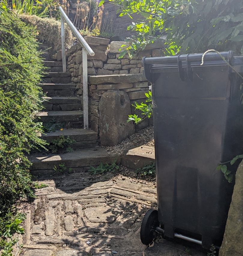
Whitfield 2 (W3W – seagull / birdcage / pausing, Hole = 4.5″ x 4″) – Whitfield 1 can just be seen in the bottom right, so you can see how close it is. Does this mean it has been moved? Well no, and given that it stands at about the same height, perhaps it was part of a complex system of gates that controlled access? I don’t know… you decide!

The next one is difficult to spot – right in the middle of a field, away from any paths, but not hidden from the prying eyes of binoculars:
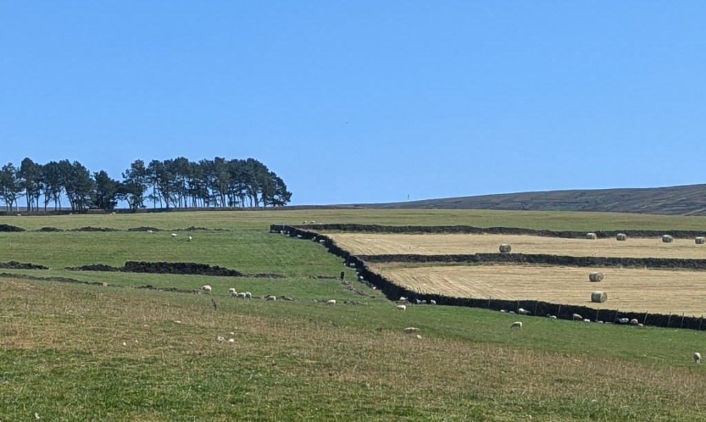
Whitfield 3 (W3W – powering / assets / flooding, Hole = No Data, as I couldn’t get near it) – The dark standing stone is pretty much dead centre of this photograph.

Previously I had asked Master CG if he could see if it had a hole in it – I explained that my eyes can’t see from that distance… he replied yes, it did have a hole, and then muttered something about “ancient” presumably referring to the stone, and “put in a home“… which I didn’t fully understand.

Next up we have this somewhat disguised beauty:
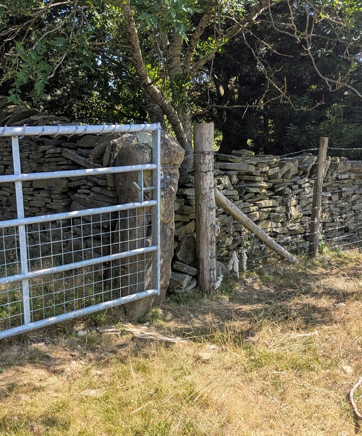
Whitfield 4 (W3W – acoustics / martini / pocket, Hole = 3″ wide x 4″ tall) – still used as a modified gatepost, now taking a steel gate rather than a wooden oddly constructed affair. I like this, it shows continuity of use, and of the continued need of a gate into a field that remained in the same location for centuries.

The other side also reveals another surprise – an Ordnance Survey benchmark, although this one does not appear on any map I have seen – it is a lost benchmark without a height above sea level. I wonder if it was carved, but the height was either not recorded, or somehow was unreadable, and it was never resurveyed.
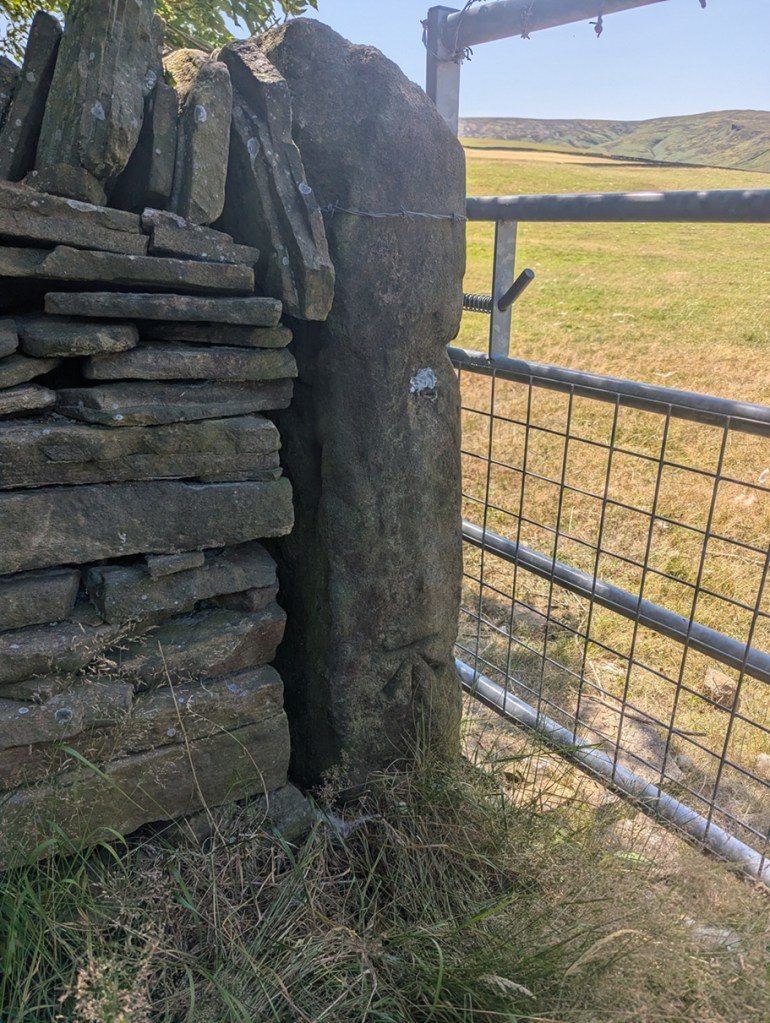
Whitfield 4 again, the OS benchmark is at the base of the stone.

Moving on, along this line, we come to what I have named Carrhouse 1, as it actually sits on Carrhouse Lane:
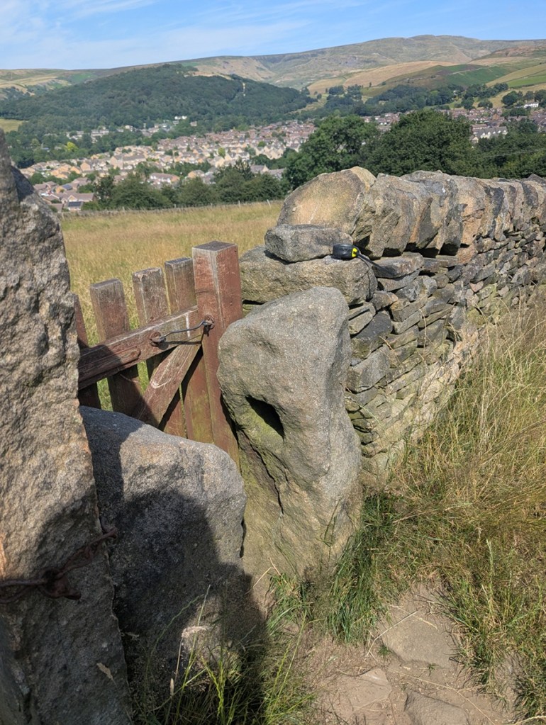
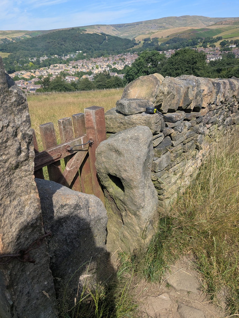
Carrhouse 1 (W3W – whisker / deform / nibbles, Hole = 5″ x 5″). I love this photo; Shire Hill in the background, and the view over the Shirebrook Estate puts this in its modern landscape. You can also see my tape measure on the wall, just used to measure the hole.

This is being used as a stile/gate, but the other stone, opposite it, is its mirror – same height and rough shape – only it doesn’t have a hole in it. Odd, but I feel the two must be connected, somehow.

On we go, along this path a short distance, across two fields, and over the stile there, immediately on the floor at the left, and lying face up, is Whitfield 5:
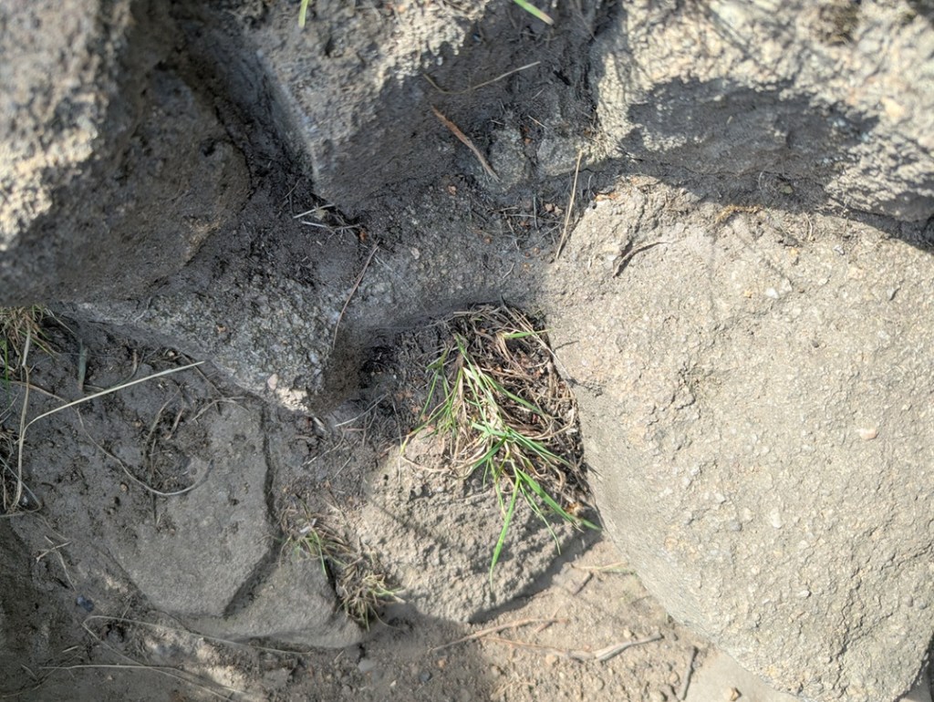
Whitfield 5 (W3W – tanks / falters / animates, Hole = 5″ x 5″). The square hole with rounded corners is in the centre of the photograph, with grass growing out of it. I’d love to dig this up and set it upright once again… it deserves more.

Clearly it had been broken at some stage in its history – the upper part of the holed bit has sheered off – and the farmer has replaced it with a stile… but the hole is still visible.

Back the way we came, and left along Carrhouse Lane, on the right we soon come to a hugely overgrown gateway, and nestled against the newer gatepost is:
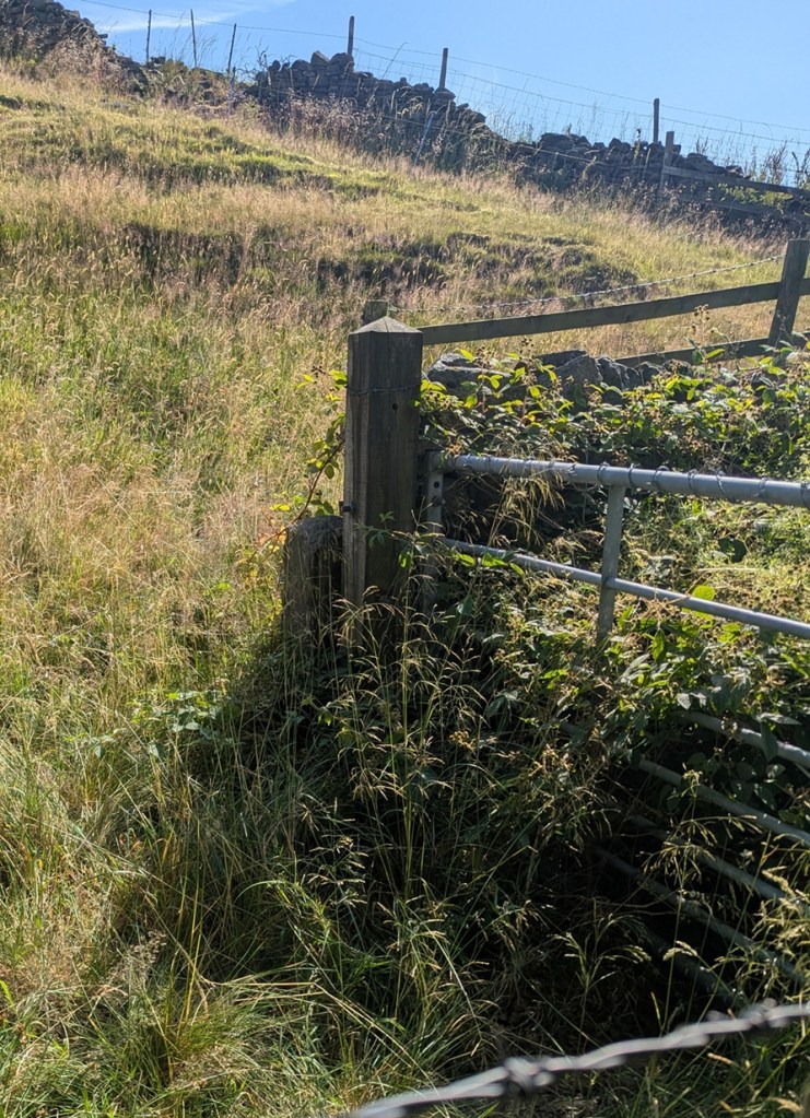
Carrhouse Lane 2 (W3W – majors / creamed / swam, Hole = No Data. The entrance is buried by about 3 metres of blackberry!). I have been close enough to this one to put my hand into the hole, so it is real, despite the awful photograph. I shall try again in winter, and update the article.

I shall get a better shot of this one, I promise, but you can just about make out the dark area that is the hole in the short post.

A little further on, on the left, is this pair of beauties:

The post on the left has two holes in it, and is a bit of an anomaly, although there are other examples of multiple holes around the area. It has actually been split at the upper part of it, the result of a farmer sometime in the Victorian period drilling a hole to take an iron pintle, and cracking the rock.
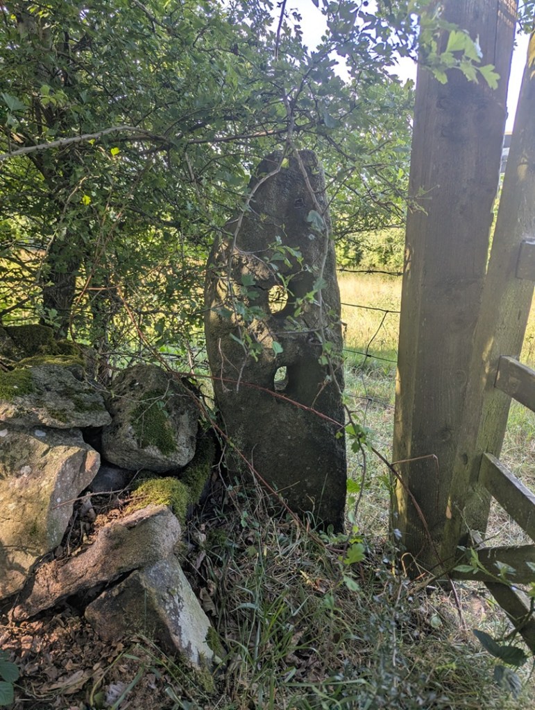
Carrhouse 3 (W3W – goad / tidal / bigger, Holes: upper = 3.5″ x 4″, lower = 3.5″ x 4″). Lovely.

The other side of the gateway confused me at first, though: there was no hole… or so I thought. Looking more closely, it seems that the hole has been cemented up, possibly to prevent or repair a crack?
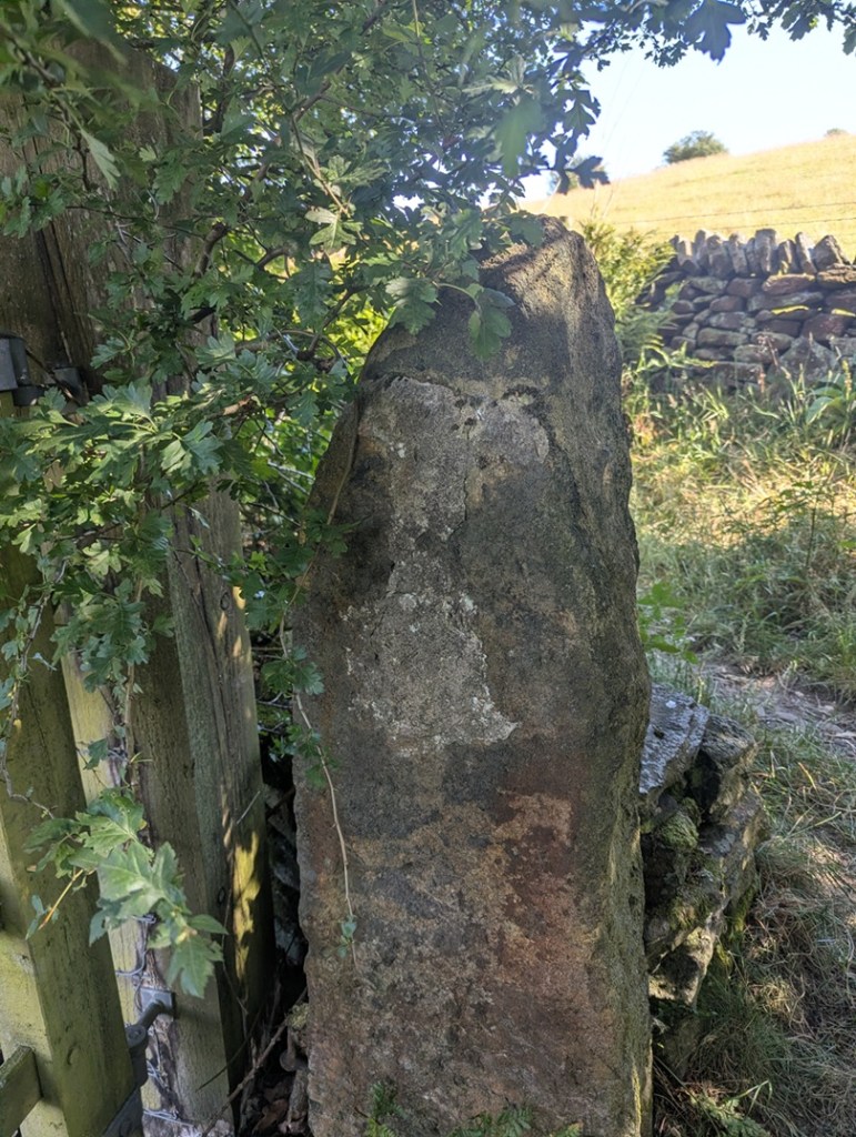
Carrhouse 4 (W3W – goad / tidal / bigger, Hole = 4″ x 4″). Although, I looked, I couldn’t see that the upper part of the cement was covering a hole – I think it was whoever did it filling in some gaps? I shall double check, of course, next time I’m passing.

Finally, walking on the path toward Jumble Farm, we find this one, shorter than most, just before you get into the farmyard:
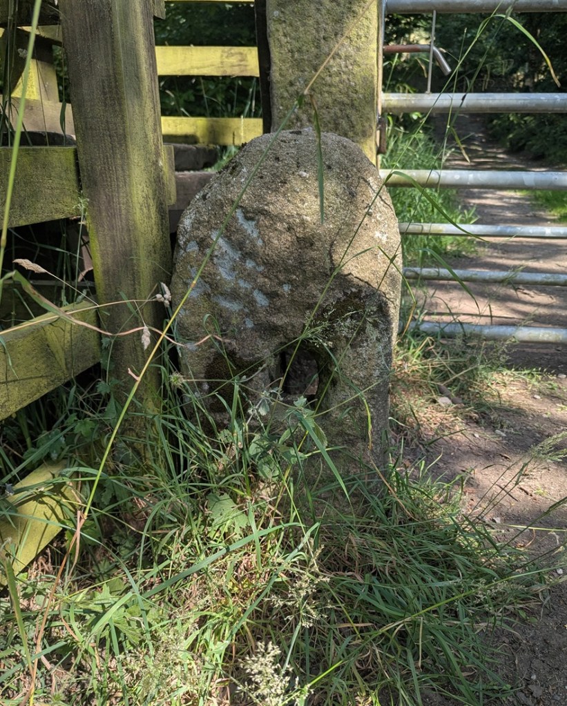
Jumble Farm 1 (W3W – reclined / monk / swept, Hole = 4″ x 5″). It original function here is replaced by large Victorian carved gateposts.

Well there we are – a small selection of holed stones on a quick walk around Whitfield, and all associated with the Whitfield Medieval Field System. I’m not saying it proves my hypothesis, but they are all clearly of the same age, with the same size hole, and same rough shaping – we just need to identify that age. And I would argue the late medieval period (post-1450). More research is definitely needed – I have 26 holed stones that I know about – they’re all in a map that I’ll share with you below, and you can go and look at them yourselves – each one is marked by a blue arrow.

However, there are doubtless 100s more out there, lurking, hidden… lost. And that is where you come in. Please, do me a favour… if you know of any, or after reading this notice some in the Glossop(ish) area, please let me know – send me a photo, a dropped pin in Google maps, a What 3 Words, an email telling me where it is… anything. But let me know, as I think there is more here to be uncovered regarding land use and field systems in the medieval and post-medieval periods. Exciting, and I want you all to share in this, so go forth and do some research that might help us.

The map is here, just click on the link: Map of Holed Stones

Stay in touch!

Right, that’s all folks for this time. My thanks to Lee of the Punk Archaeology Podcast (first episode is coming soon) for the help in exploring this group of stones.

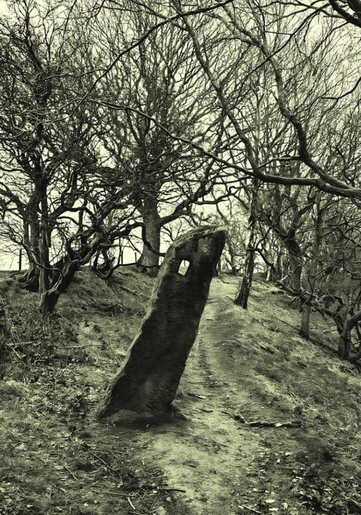
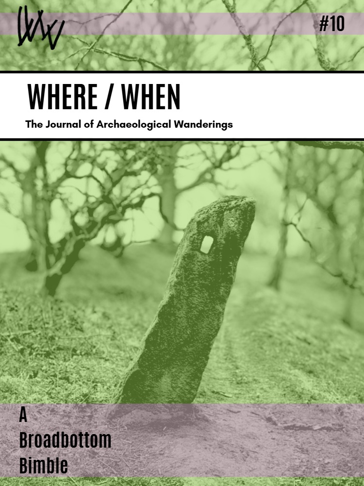
By an amazing coincidence, holed stones also feature in the latest Where/When, available in the usual places (alright, Dark Peak Books), but also directly from me (link here), and I can post it to you.
History · Placenames · Waterways of Glossop · Where / When

A Bridge Too Far?

What ho, one and all!

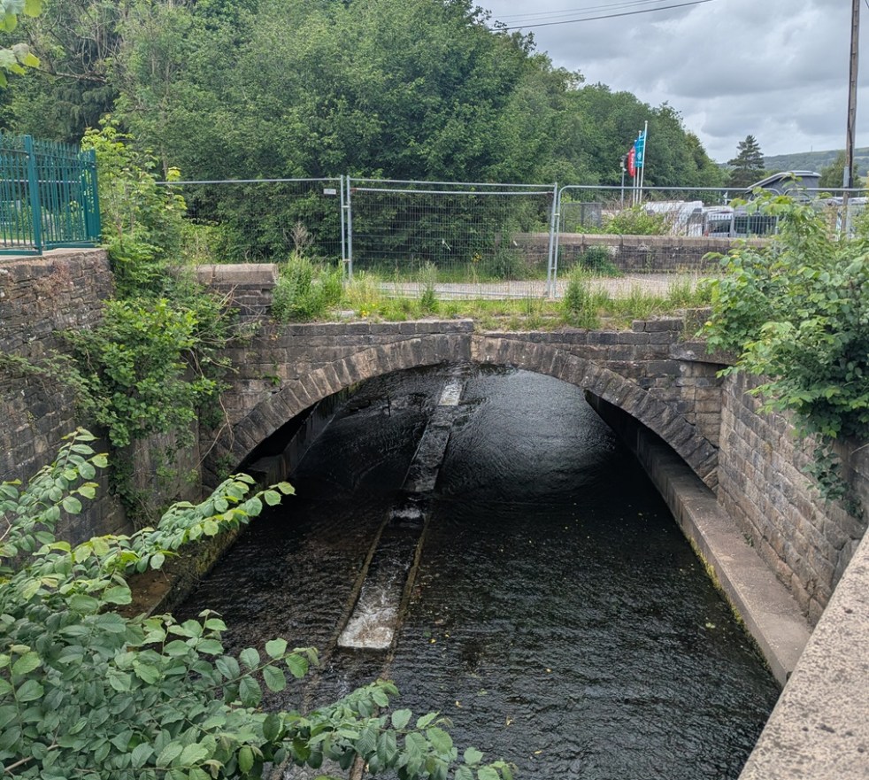
A bit of a quick one today, exploring one of the lesser-known, and certainly overlooked, bits of Glossop. Truthfully, I thought there might be more of a story here – perhaps even some pottery – but alas, there is very little to be said about today’s subject. I’m really not selling it you, am I? Ahem… so then, ladies and gentlemen, may I present Moodsbottom Bridge.

Can anyone else hear crickets? And why is that tumbleweed cartwheeling across Victoria Street? And what’s that I hear you cry? “I say, old TCG, where is this Moodsbottom Bridge of which you speak?”. Well, quite! 

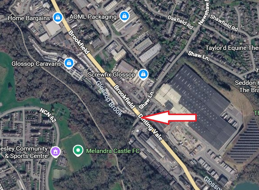
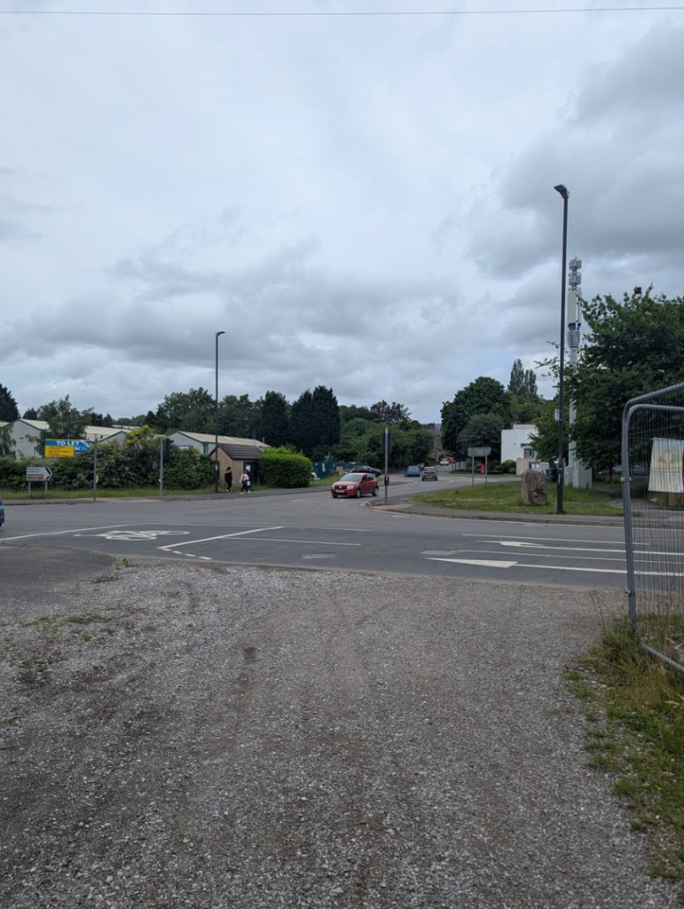
So then, it’s here…

Just before Glossop Caravans on the left, and at the junction with Newshaw Lane, it crosses over Glossop Brook. You will have driven past it thousands of times, and perhaps even vaguely acknowledged it was there, sat in traffic, but unless you were actively seeking it, you would simply overlook it. By the way, it should not be confused with the ‘modern’ bridge over the brook, the one you drive over in the line of traffic that ignores the older bridge on the left.

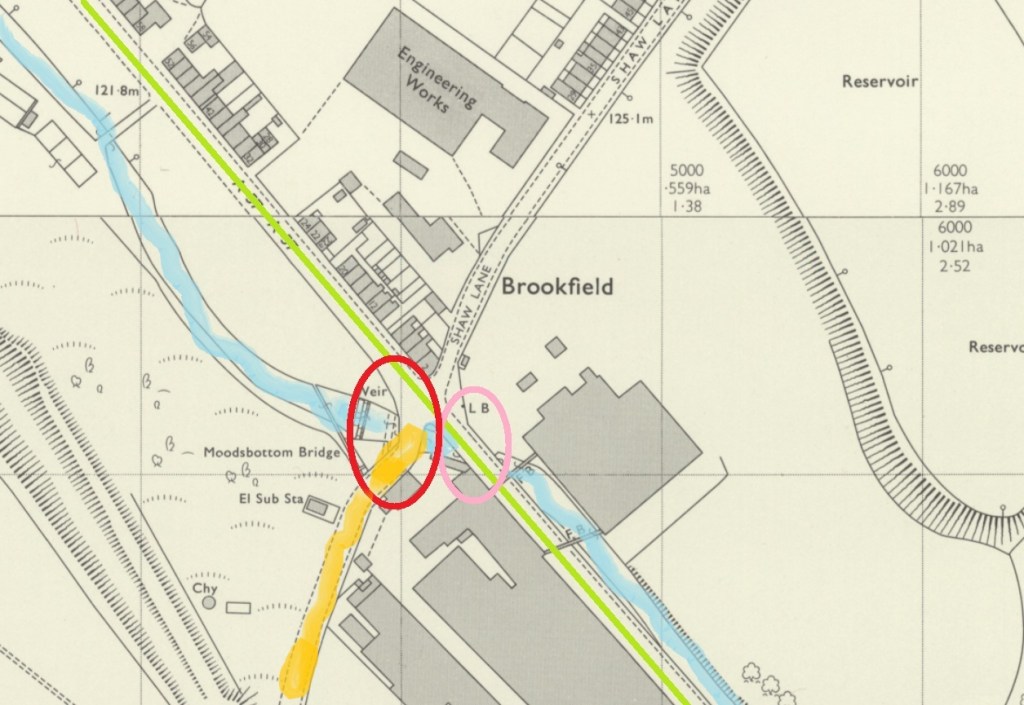
My skills with Microsoft Paint knows no bounds!

To clarify, in this image, we see Glossop Brook (marked in blue), the line of the modern road (in green), Cottage Lane  (up to Gamesley, in orange), the new bridge carrying the modern road (originally the Turnpike Road, and circled in pink), and our bridge – Moodsbottom Bridge – circled in red.

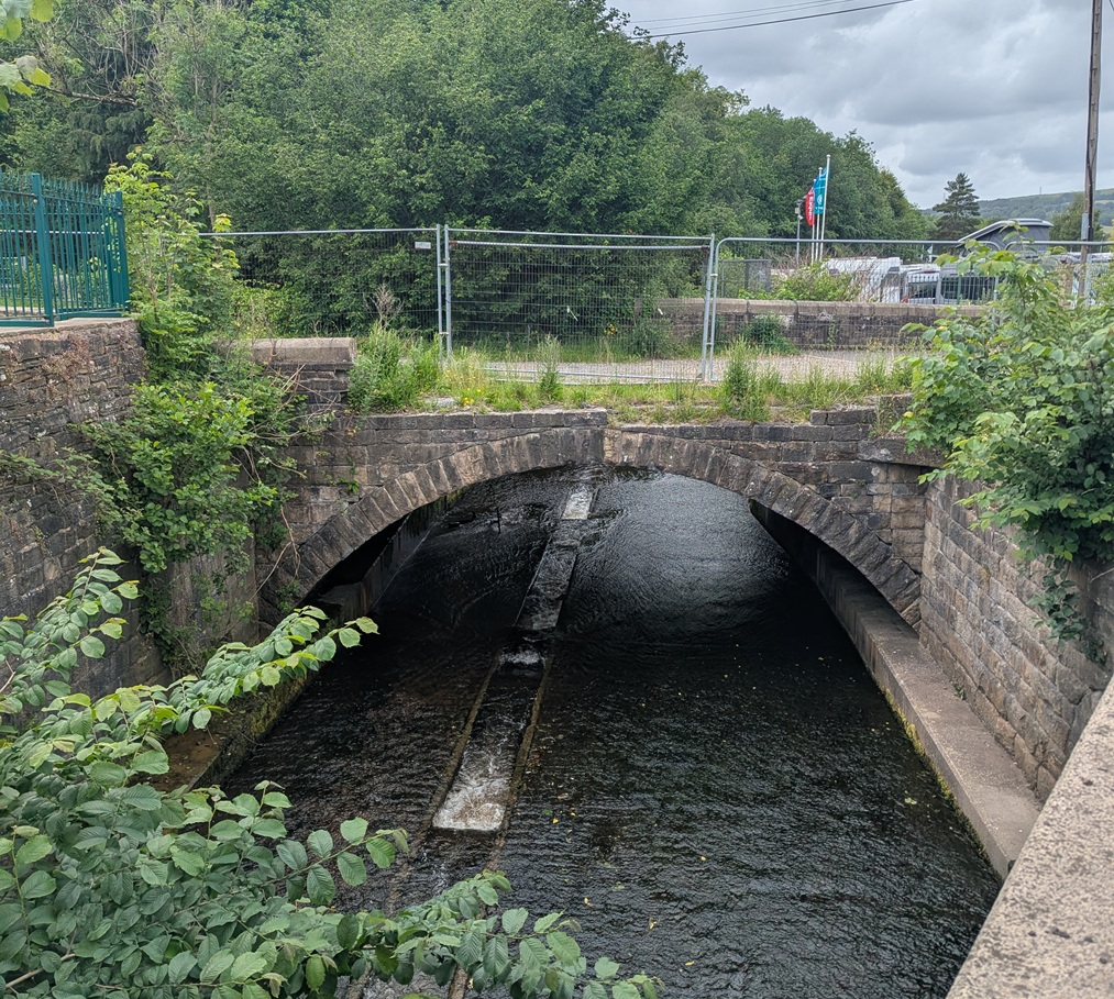
Here is the bridge as viewed from the road – it’s lost some of it’s walling, and is in a poor state of preservation, but this is what is visible now.

Glossop Brook – leading to the river Etherow – has been seriously monkeyed around with, and the whole area has been landscaped.

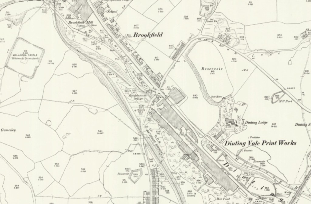
It seems to have been a fairly important crossing at one point in the past, and is the latest visible aspect of the crossing which probably started as a ford across Glossop Brook. Looking at older maps, it seems to take the track from Mottram, Hague, and Lower Gamesley Farm across the brook, as well as a track from Hargate Hill, crosses, and then up to Hadfield via Shaw, and (Old) Glossop, via Dinting. It was clearly the meeting of many of the old tracks that existed in the pre-turnpike era (pre-1800 or thereabouts), and one of only a handful of crossings of the brook.

25″ OS map from roughly 1900

And yet truthfully, though, I’ve no idea of the age of the crossing and bridge, and its history is confused and murky, which is a pity. There is very little discussion in any of the history books or articles, and a brief google of “Moodsbottom” produces just 10 hits (11, now, I assume).

As if to illustrate this frustrating murkiness and general lack of knowledge, the earliest reference to the bridge I have found is from 17th February, 1794, when the trustees of the newly formed turnpike trust ordered “the river below Moodsbottom Bridge be piled to prevent carriages travelling to the coal pits”. “Piled” here probably refers to having the river bank’s sides made steep and secure with piling, to prevent the carriages from fording it, and thus avoiding the fees for road use. But the turnpike road (now the modern, green, road in the map above) was only put through in 1804 or so, some 10 years later – so why the trustees of the turnpikes trusts were making this ruling is not clear.

At about this time (1795), according to Robert Hamnett (quoted here) a John Loton built three houses at “Gamesley Bridge” (not the viaduct over the railway, which was built in 1843). There was also a white cottage belonging to a Roger Dumphy; possibly an older building, it had some ‘pleasure gardens’ at the rear, which were apparently quite popular. Presumably these all stood on what later became known as Cottage Lane (in orange, on the map above), and which was apparently named after Dumphy’s White Cottage.

We also know that on 17th December 1863, a meeting of ratepayers was held to discuss the making and improving of certain highways. This was in response to the ‘Cotton Famine’ of the mid 1860’s, when raw cotton ceased to be imported from America due to the ongoing civil war there. The effect of this was to put thousands of mill workers out of work, and create hardship and poverty throughout the area. In order to mitigate the effect, jobs were ‘created’, and large numbers of public works were initiated – including the creation and improvements of many roads in the area. Among these were “the making of a public road from the Glossop and Marple Bridge turnpike road, at Gamesley, to the Glossop and Marple Bridge turnpike road at Moodsbottom Bridge.” – that is, what we now know as Cottage Lane. Looking at the stonework, it would seem that the current bridge dates to about that time, and the whole area seems to have been reconstructed and formalised then. What the bridge would have looked like prior to this is unknown – stone, but less… well, Victorian!

So what is there now? Here are some photographs taken last week…

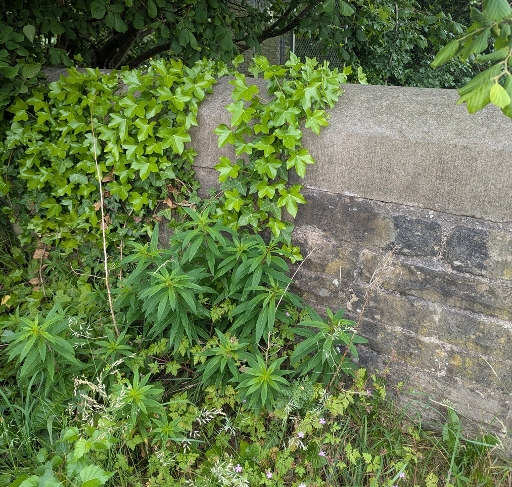
Close up of the ivy clad western wall.
Another close up of the western wall.
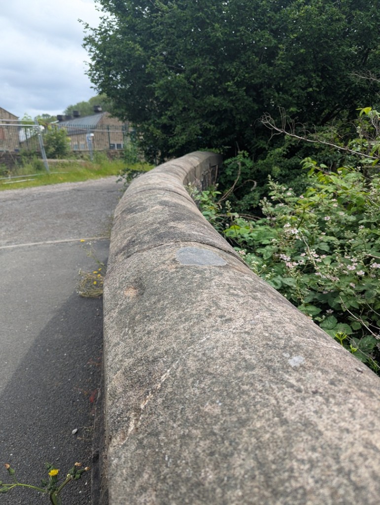
Another shot of the western wall, snaking into the distance along Cottage Lane, the lovely dressed Victorian stonework smooth and tactile.
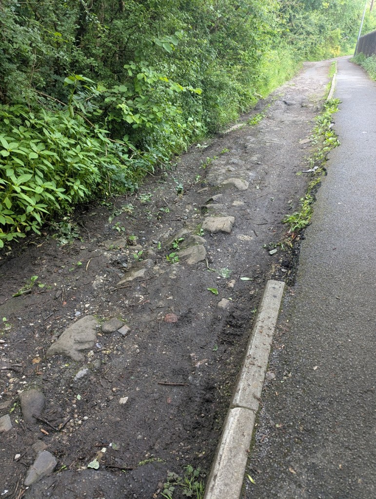
Cottage Lane – a particularly rough track all but impassable now. The large stones in the road are, I suspect, the remains of the 1863 rebuild, or even of an earlier build. And no, there was no pottery to be had anywhere around here… depressingly!
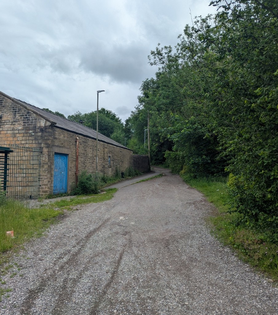
Looking up Cottage Lane from the bridge.
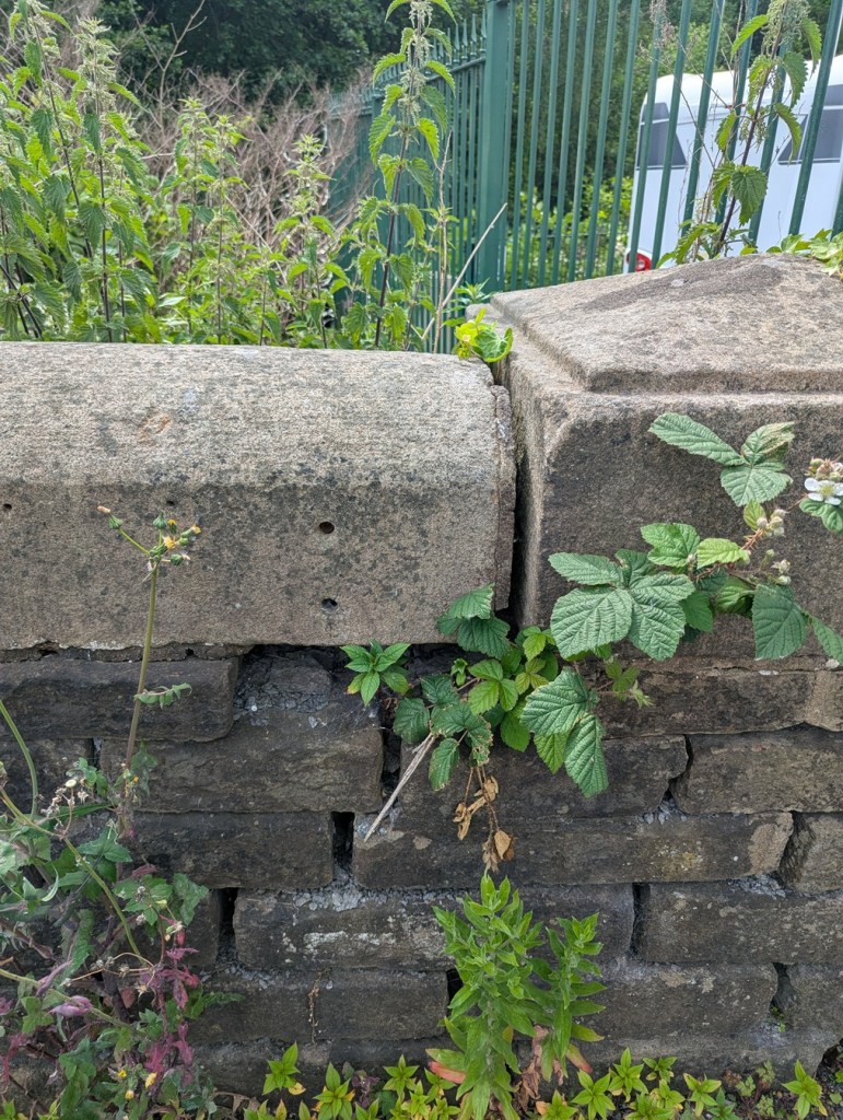
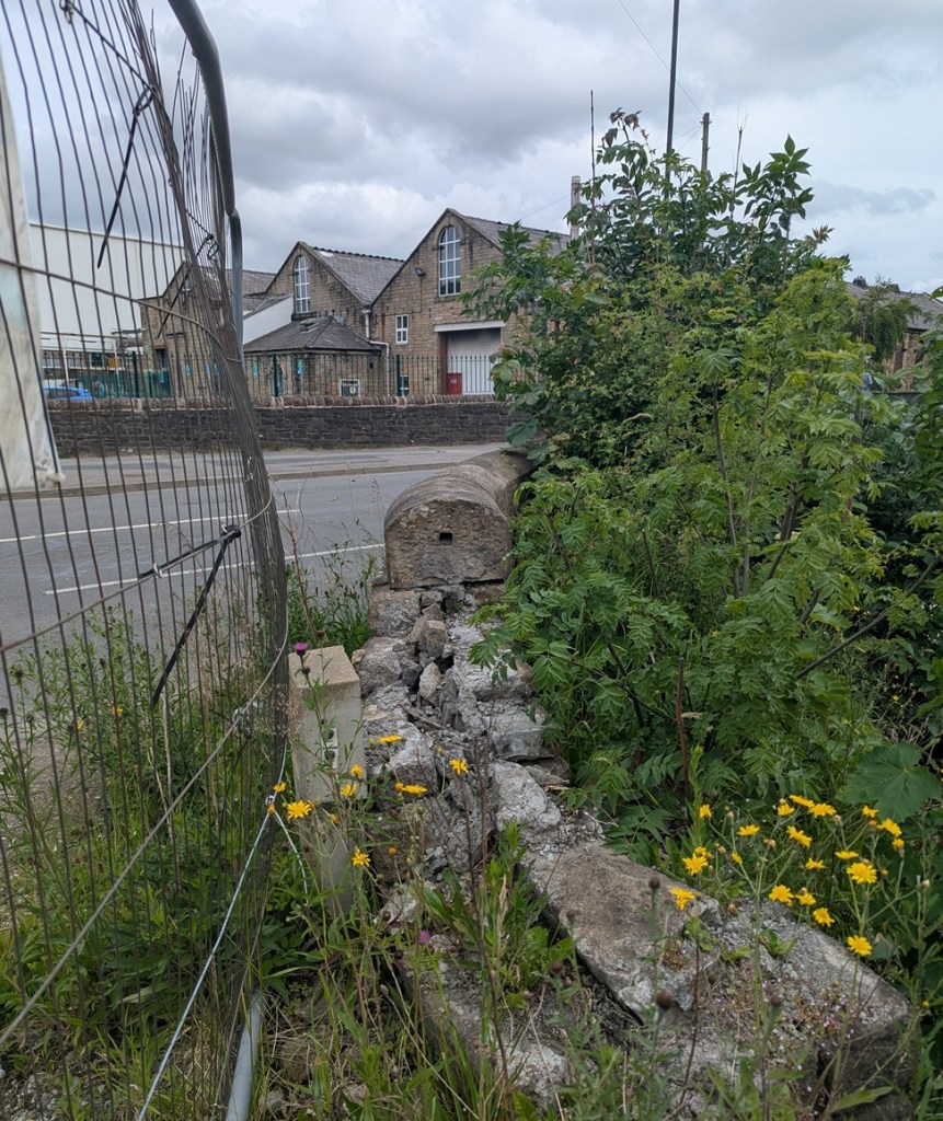
The partly collapsed eastern wall. This shows the construction method – presumably an iron rod was placed into the hole in the end of the roughly dressed stone, joining it to another similarly shaped stone.
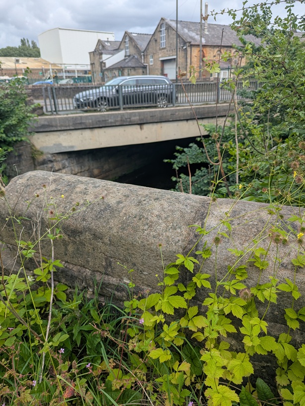
Another shot of the eastern wall, this part still intact, and showing the modern Moodsbottom Bridge behind it.
The view from the bridge at the crossroads: behind us is Cottage Lane, ahead is Shaw Lane, and running left-right is the A57, the turnpike road constructed in 1804.

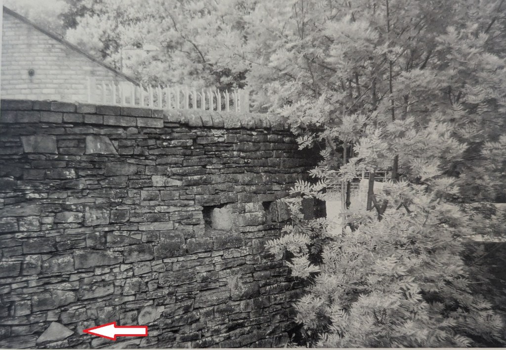
There is an interesting aside in Neville Sharpe’s book, Glossop Remembered, where he notes that during WWII, the local Home Guard put gun loops (holes that allow soldiers to shoot through) into the wall belonging to a factory that overlooked the bridge, allowing rifles and machine guns to train up the road that comes from Woolley Bridge (and Hollingworth) – the likely direction of invasion into Glossop from the west – and up Newshaw Lane to the north: even in 1940, the bridge held strategic importance.

Neville Sharpe’s photograph, in which the holes are clearly visible, as is their direction – imagine guns pointing out of them. Note the arrow pointing to a triangular stone

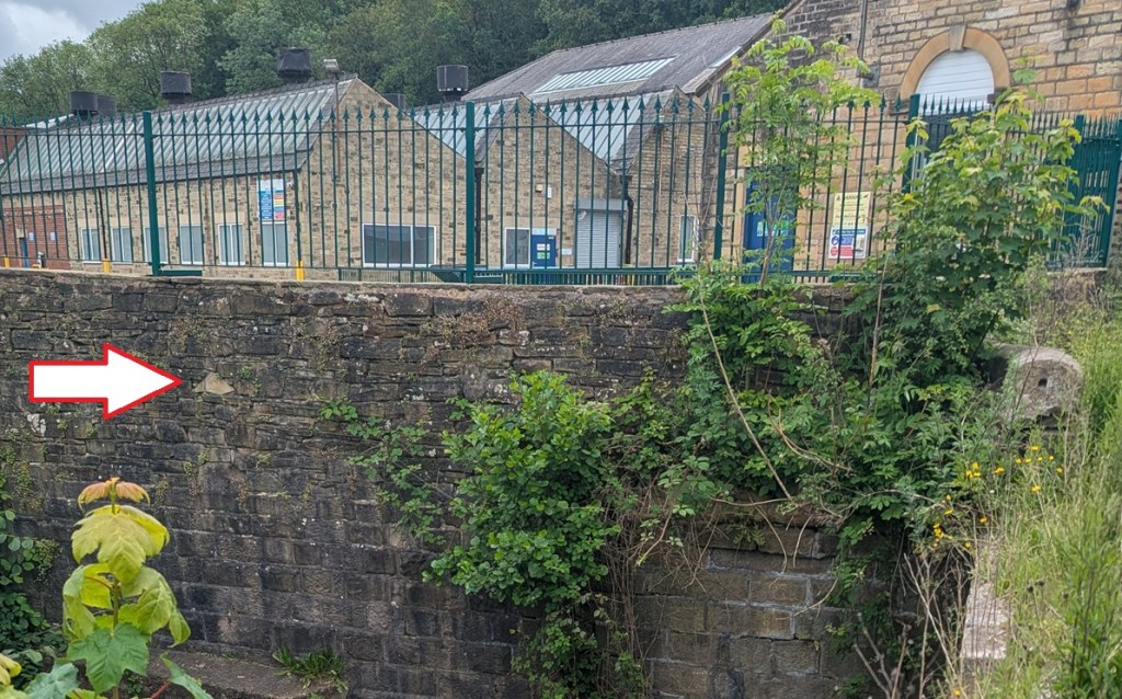
Alas, as so often happens, the evidence of the past is erased – the wall has been truncated since the above photo was taken (1980’s? 1990’s?), and as this modern photo shows, what we are left with is… not a lot. You can see where the loops were by spotting the triangular shaped stone in both photographs, indicated by the big white arrow!

The whole row of stones that includes the gun loops – and upwards – has been removed.

Incidentally, logically there must have been a similar defensive position to the east – somewhere at the bottom of the snake pass, in order to protect that road – and I think I might have a likely location! Let me check it out, and I’ll let you know what I find…

The name is interesting, though. Moodsbottom? What does that mean?

It’s named as “Mousbottom” in Ralph Bernard Robinson’s Sketches of Longdendale (1863). This seems to be a contraction of ‘Mouselow Bottom’, and may account for Moodsbottom, which sounds very similar. But – and here we stray into ‘placename’ territory – I have another theory, one that plays into the idea that Mouselow was a hugely important site in the Saxon period as well as the Iron Age, and early medieval periods.

I suspect that Mouselow, the Iron Age hillfort that sits just above Moodsbottom, was used in the Anglo-Saxon period (let’s say 9th and 10th centuries), holding a special status as a Moot place – where the local ‘council’ of surrounding villages held monthly meetings to discuss issues such as land use and roads, for example. I discussed moots here in regards to Mottram, and I have a whole article almost ready to go about this, but one of the central ideas is that ‘Mouselow’ is derived from ‘Motts Low’, the ‘mound’ (low) of the ‘moot’ (mott). If this is the case Moodsbottom is derived from ‘Moots Bottom’ – the bottom of the moot… which it is. More on this soon, I promise, but for now I’ll leave you with that tantalising glimpse.

So, there you are, a small piece of Glossop’s history, imperfect and not fully understood, and very much overlooked, but full of a possible story. Wonderful!

EDIT!

A welcome email from the always illuminating Roger Hargreaves recently arrived (trouble with the website means he can’t post the responses directly, annoyingly…) regarding Moodsbottom Bridge. He is a lot more knowledgeable about this particular period than I am, and especially regarding the roads in the area, so it’s great to read what he has to say.

You’re correct that the bridge, or at least the crossing point, was originally part of the ancient network of lanes on either side of the brook; even in the late 20th century older residents on the Gamesley side still referred to Cottage Lane as “Shaw Lane.”

However, whether or not there was a bridge there before, I’m pretty certain that the present one dates from about 1804-5, when the turnpike from the Plough to Woolley Bridge, a branch of the Glossop-Marple Bridge turnpike authorised in 1803, was run across it. At the same time the Howard estate would have lowered and straightened the brook to drain the land and make it viable for the road (although it still floods!) and create sites for mills, although these took some time to arrive probably due to the Napoleonic War – Brookfield was built in 1818 and Woolley Bridge in1825.  Prior to that, as the brook would have been higher and wider there may just have been a ford, and if there was a bridge it would have been hump-backed and much narrower.

The old lane would then have been “stopped up” by taking out a section to prevent rat-running around the Plough tollbar – this can be seen clearly on the 1837 OS survey – and its line was later built over in the expansion of Potter’s printworks.  Its reinstatement during the Cotton Famine was on a different, more northerly line.  The turnpike may have put a chain across it, but perhaps by that time they were less concerned about lost revenue. 

At some point between the 1857 Poor Law and 1879 OS surveys, Potter expanded again.  He had built his long sheds along the west side of the turnpike and rather than building on the other side and having the traffic running through the middle of his works he just diverted the road to run alongside the brook, necessitating a new bridge. His rather fancy cruciform library was a casualty, so he built another one within the works on the former line of the road; sadly it was demolished in the 1990s.   

The reference to the bridge in February 1794 is, I think, an error. This is in the minutes of the Chapel-Enterclough turnpike, the most important bit of which was the branch from Wimberry Hill to Woolley Bridge, which until the road along Brookfield was built was the only way out from (Old) Glossop to Manchester and therefore the main artery of the cotton trade.  It makes no sense as it stands – Moodsbottom Bridge isn’t even on the river (the Etherow that is) – but perfect sense if it actually meant Woolley Bridge. The original Woolley Bridge – the modern one dates from the 1820s – was probably built in the late 17th century, the turnpike being just an improvement of the existing road, and it replaced a ford lower down the river, the position of which, opposite Woolley hamlet, can clearly be seen on the 1837 map.

However, the ford would still be viable, and unless “stopped up” would allow rat-running around the new Woolley Bridge tollbar.  And there was a very big incentive for the rats, as the Earl of Stamford’s coal pits were just across the river, and his coal may well have been better and cheaper than that from the Duke of Norfolk’s pits in Simmondley.  There was therefore also a big incentive for the Duke’s agent Matthew Ellison, who in practice controlled both turnpike trusts, to make sure that the tolls couldn’t be avoided.Hamnett’s reference to “Gamesley Bridge” is a bit of a puzzle.  I can’t identify any bridge in Gamesley in 1795 with houses next to it, but it would make sense if he was referring to the modern railway bridge.  Three houses built at that date would almost certainly be on the new turnpike, and he says that one of them “was afterwards Robert Marsden’s beerhouse” so there must have been passing trade.

Thanks Roger, and please keep commenting.

_______________________________________________________________________________

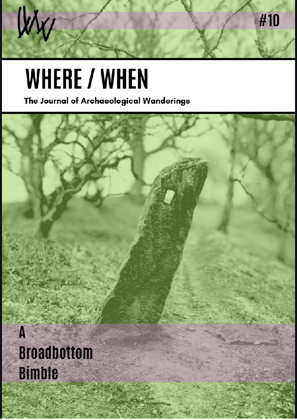
In other news… the latest Where/When has landed in the shops – both physical and online. Behold: The Broadbottom Bimble!

It’s a circular Wander from the station (well, let’s face it, the Harewood Arms), to Far Woodseats Farm and back, via Broadbottom Beach, some amazing standing stones, medieval fields, Georgian and Victorian factories, packhorse tracks, bridges, brooks, and some incredible geology. What’s not to love?

It’s available now, as indeed they all are (No’s 1-9) from Dark Peak Books at 96 High Street West, Glossop; from my Ko-Fi shop (and do feel free to buy me a coffee, or a glass of the stuff that cheers); or just find me in the street, hail me with a hearty “what ho!”, and I’ll give you one. Cheers, and happy Wandering.

Right, that’s all for this time. More to follow, soonish… probably. And whatever does follow will be pottery based – maybe even the final instalment of the pottery guide, or an updated version of the already published guide, you lucky folk, you.

Whatever comes, look after yourselves and each other. We live in turbulent times all around us, and each one of us is going through our own personal things. So let’s be kind to one another, because we all matter.

And so, until then, I remain.

Your humble servant,

TCG