
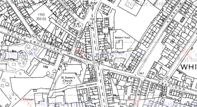
In his book ‘Crosses of the Peak District’, Sharpe (2002) lists Hollincross Lane, by St James’ church, Whitfield, as being the site of one of Glossop’s long lost crosses (p.110, paraphrasing Hamnett). When I had previously thought about Hollincross Lane, I had assumed that the name refers to the Whitfield Cross, and thus the road that runs down into Hollincross Lane via Freetown. But actually, a cross here would make sense as it would mark the junction of three trackways: north to Woodhead and beyond, east to Whitfield and thence to (Old) Glossop or Chunal via Gnat Hole, and west to Dinting and Simmondley. The way south, Charlestown Road, only came into existence with the construction of the turnpike road in the early 19th century – before that, the only way to Chunal was via Gnat Hole.
A cross marking this junction would have had its uses, then. Indeed, we can also play a speculation game (putting on my prehistorian’s hat for a moment) and suggest that the siting of St James’s Church (1840 or thereabouts – the foundation stone was laid on 27th September 1844, and it was consecrated almost 2 years later on 8 September 1846) was influenced by the existence (or memory) of a cross there indicating holy ground. Wild speculation, I know… but let’s pretend! Etymologically speaking ‘Hollincross’ may be understood as either ‘Holy Cross’, or ‘Holly Cross’ – a cross covered in or situated by some holly
Now obviously there is no cross there now, and Hamnett, writing in the late 19th century, could find no trace of a cross either – seemingly it’s location was lost to even the oldest residents of Whitfield. At some stage, then, our hypothetical cross has been removed. This could have happened for any number of reasons, ranging from pious iconoclasm (a stone cross is an object of adoration and thus ‘Popery’, or Roman Catholic veneration of things and people) to it simply being in the way of traffic. I know of one example, not local, of a 9th century Mercian Roundshaft that was rescued from a farmer who was in the process of rolling it down a hill and into a stream in order to plough his field. And this was in the 1960’s…
Crosses and bases were, then, broken up and re-used in walls, and as people don’t move stone further than they have to, especially in a stone rich area such as this, it sometimes pays to have a look around to see what you can see. With this in mind, and taking advantage of a lull in the rain, James and I went for a wander down to St James’ churchyard (via the park, obviously). He had a whale of time, helped no doubt by the drink of juice that the rector gave him! So, what did I find? Nothing definite, certainly, but just possibly, something.
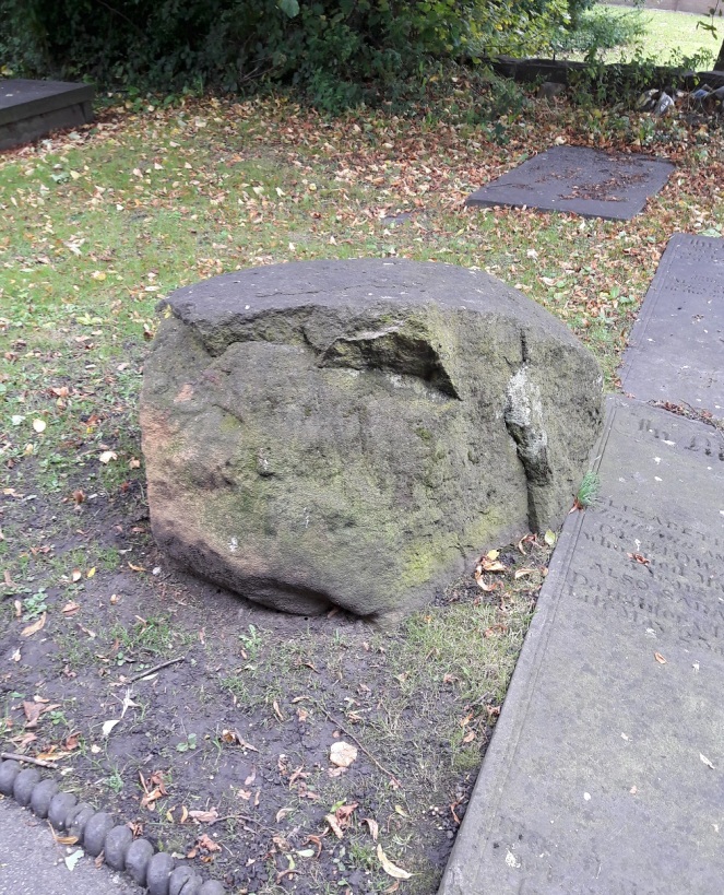
Just opposite the main entrance to the church, by the path and amidst the gravestone sits a large lump of stone. It is roughly 2′ square and 1′ high, has been knocked about a fair bit, and is now fairy shapeless. However, one side has clearly been shaped and worked, and with the eye of faith one can see chisel marks.
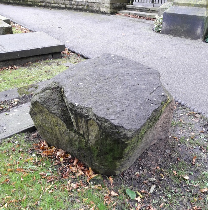
Now, I am not sure what this is! It is not a glacial erratic as they are often rounded and smooth like a pebble, and I don’t think it is part of the church building, as it is the wrong type of stone. It might be the cross base, but there is no visible socket – the hole in which the cross shaft sits to make it secure. However, the socket may have been on the part that has been knocked off, or is perhaps underneath if the base had been up-ended. It is very uncertain, but we can be sure that the stone was not planned as such to be there – it makes no sense, and doesn’t even have an aesthetic value – rather it is a left-over from the land prior to the construction of the church.
I had a look around the walls for cross pieces, but could find nothing likely, and I think a winter trip around the churchyard is in order!
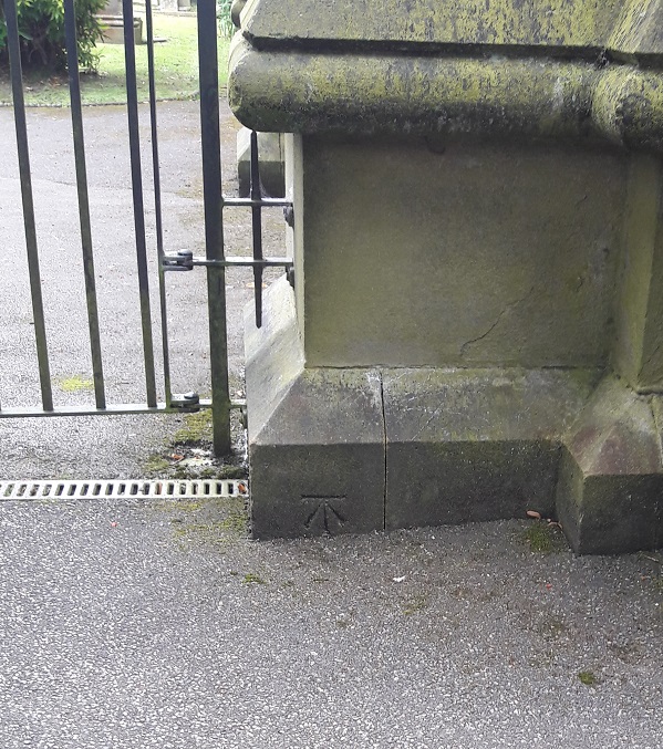
Of course, whilst I was there, I took the opportunity to photograph the bench mark on the church itself – how could I resist!
Any thoughts or comments are always welcome.

We know that there was a mediaeval way between the two monastic bases of Charlesworth and (Old) Glossop, which was paved at least at some points (see HER entry no 33345) and this would have clipped the NW corner of the churchyard (where the stone is, in other words). From here there would have been a lane (Freetown) going east to Whitfield village, and another (Pikes Lane) going west to Dinting. At some point (probably mid/late C17th) a “bypass” was made via a bridge at Bridge End (now the car park behind Wetherspoon’s) so that traffic going north could avoid Glossop, and this is represented by James Street.
This would therefore be a four-way junction, roughly half way between the two monastic centres, and therefore a good place for a cross. What’s puzzling, though, is why Robert Hamnett (the other one) who was a churchwarden and is buried there, didn’t spot the significance of the stone. Perhaps it wasn’t there then, or it was and he knew what it was.
LikeLike