Archaeology · Oddities

A Philosophy of a Fireplace

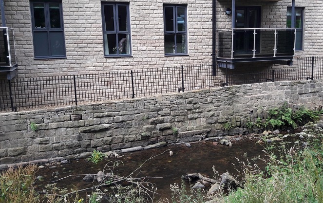
As you walk down Freetown toward St James’s church, just before you get to Charlestown Road there is, on the right-hand side, a small thin passageway that ends in a gate, probably leading to someone’s back garden or something. Now, I’m not sure if this private land as such, but I don’t think so. It is, rather, one of the anomalous bits of land left over after the extensive demolition and remodelling that this part of Whitfield underwent in the late 1960’s. A sort of architectural no-man’s land, the result of imposing a rigid housing plan onto an already existing street system, and one that had grown somewhat organically, and in a ramshackle and piecemeal way throughout the 19th Century. It doesn’t quite fit, so there are these angles and nooks left over which I like to explore. I never can resist a good nook!

Fireplace - 1968 - 1-2500

Fireplace 1
Innocuous enough, and overlooked.

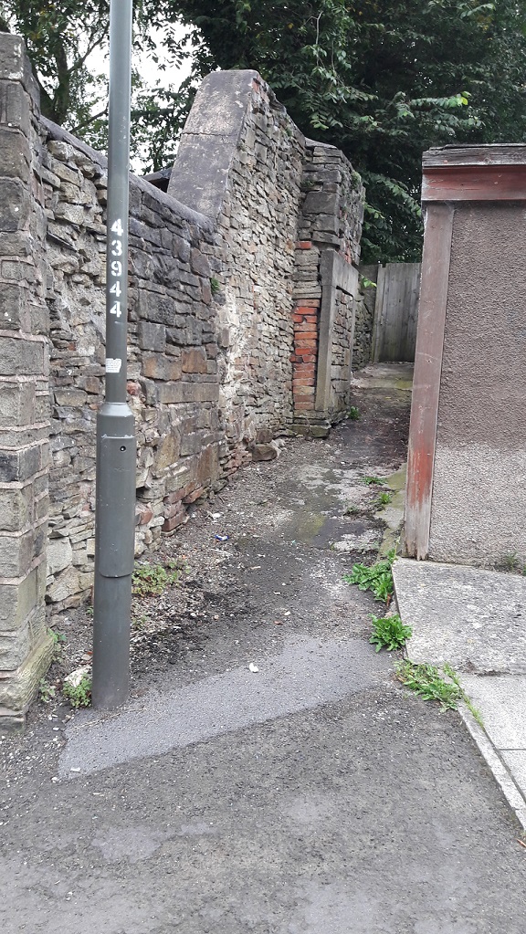
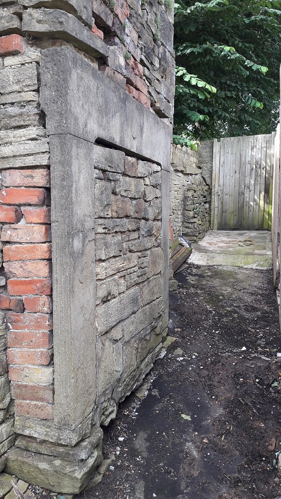
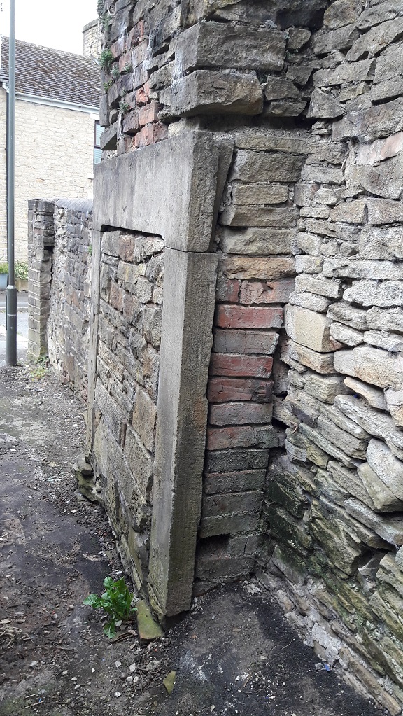
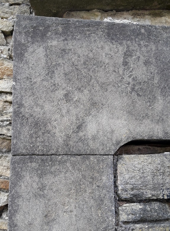
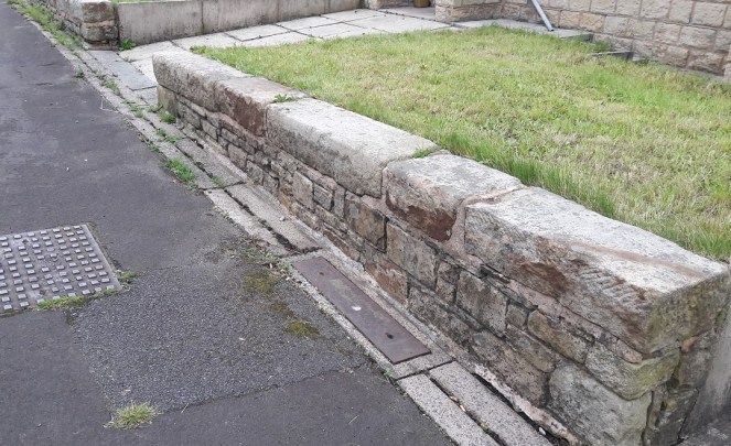
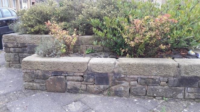
This one contains a bit of a surprise. A fireplace. A large inglenook fireplace made up of three stone – two uprights and a lintel – carved, dressed, and sitting proudly in the wall, exactly as it should be.

Except it’s not… it’s outside.

What you see is the front of the fireplace – as you face it, you would have had your back into the room. But there is no room.

Fireplace 2
Given the size of the fireplace, and the cramped location, it is difficult to get a good photograph, so my apologies.
Fireplace 3
The dressed surface and delicate lines are clearly visible. The walls around it would originally have been plastered and flat, once you get that, you can begin to reconstruct the house around the fireplace structure.

Now, putting my anthropologist head on for a moment (as we archaeologists do fairly often), we may note that humans almost universally, and throughout all periods of history, have placed great importance between the ‘outside’ and ‘inside’. This binary concept is prevalent throughout our lives, and is just about hard-wired into our brains. The inside of a house represents the safety of the domestic and the social, the known familar world, one with distinct limits (the walls), and one that is warm and safe and light. The exterior is the opposite of that – it is dark, wild, cold, dangerous, full of unknowns and without limits. Out there, we are helpless, alone, and out there, man is no longer the hunter, but is the hunted, pursued by predators. Consider too the garden; technically outside, it can be seen as symbolically taming the wild. It is outside, but is not – it is bounded by walls and fences, and the grass is cut, unwanted plants are weeded out, the trees are nurtured and the flowers are fed and watered – it is controlled by us, and is carefully and jealously guarded against incursion from the wild.

Fireplace 4

Arguably, the whole of humanity’s struggles and the evolution of society is based around this concept – making the distinction between outside and inside, developing the domestic, and keeping the ‘other’ at bay. Certainly the ‘Neolithic Revolution’ is as much about this as it is about farming, and the two go hand in hand.

Fireplace 5
The bricked up central part seals its fate as merely part of a wall.

Now what, I hear you cry, has this got to do with a fireplace? Well, the fireplace or hearth is the embodiment of the domestic, the heart and soul of a house. Warmth, light, food, and safety all come from this one point, and it physically and metaphorically represents the concept described above; beyond the light of the fire is darkness, and we don’t know what lies in the darkness. To see it outside, the exact opposite of where it should be, is, anthropologically speaking, wrong – it is an inversion of the norm, it is unsettling and disturbing, and it is somehow dangerous.

Taking off my anthropological head, it is also a very nice piece of carved stone, and so it’s a shame to see it wasted like this. Indeed, I have a fireplace exactly like this one in my own house.

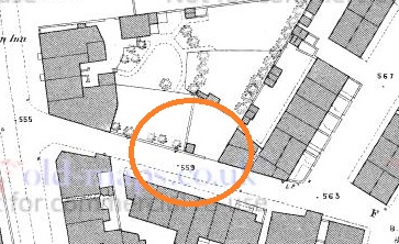
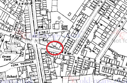
So, how did it end up here? Taking a look at various historical maps, there are a number of buildings marked here over time. The earliest, 1880, seems to have been a small outhouse, possibly a privy. The others are a bit more substantial, particularly that shown on the 1898 map, which may well be our source.


Fireplace 1880 - 1-500
1880 1:500 map. A small outhouse or privy?
Fireplace 1898 1-2500
1898 1:2500. A more substantial building.
Fireplace - 1921
1921 1:2500. The building is now on an east-west axis. 

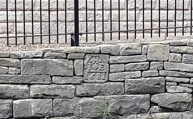
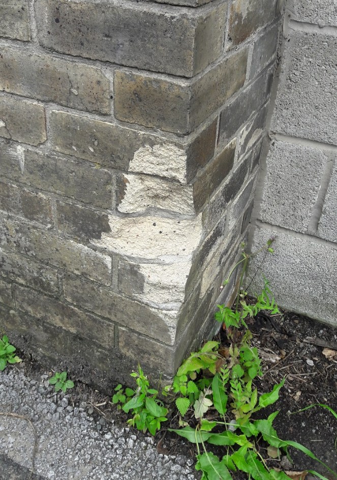
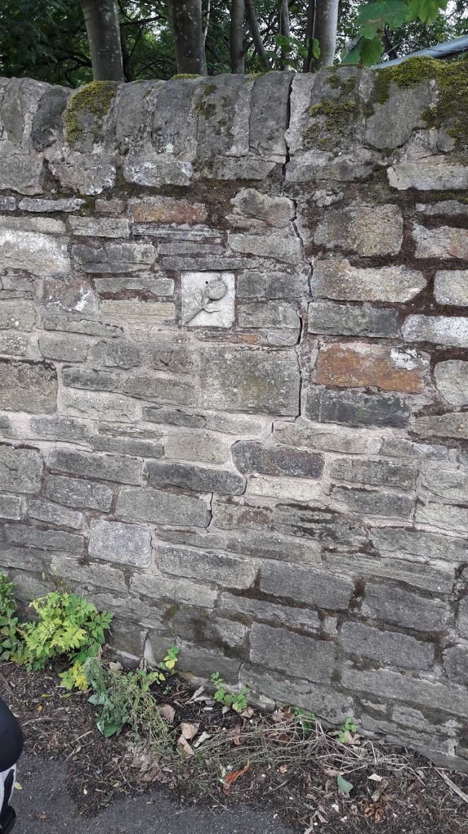
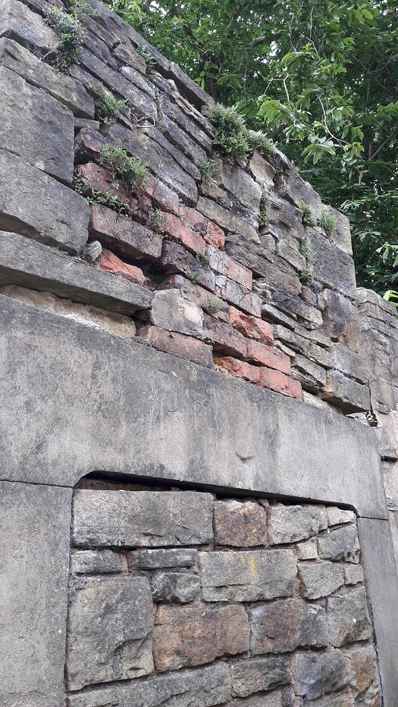
The remodelling, probably largely uneccesary, of Whitfield has thrown up some interesting anomalies (not to mention the re-use of some of the original housing stone – see photos), but I think this is the oddest.

Re-use 2
Re-use of the original building stone of the 1860’s houses of Whitfield and Freetown. These form the front garden wall of some of the 1960’s built ‘new’ houses.
Re-use 1
Doorway lintels, foundation stones, and window sills make up part of this planter on Freetown.

As always, comments and corrections are very welcome.

Oddities

Roman Inscription… Or Lack Thereof!

The previous post about the date stone reminded me of something I read a few years ago. It took me a while to track it down, but here it is.

Melandra Roman Fort is one of the places that you have to visit in the area if you have an interest in the past. It is situated at the edge of a dreary housing estate, and has a slightly desolate air about it, particularly the car park. But turn your back to the 1960’s built houses, and face out, standing at the centre of the AD 60’s fort, you really understand why they built it there – you can see all along Longdendale, across Glossopdale, and on the promontory it reaches out almost to the bank of the Etherow, which it overlooks for a long way either way. Strategically, it is a perfect place – commanding the area, yet safe and secure.

The area was known as ‘Castle Yard’ since time immemorial, and when it was first described in 1775 by Reverend John Watson (in Archaeologia Vol 3) the area was untouched by the plough, and the full fort could be made out by standing walls. Incidentally, it is likely that Watson made up the name Melandra – there is no record of anyone ever calling the field by that name before 1775, and crucially, Melandra is Greek in origin. I’m not certain, but I think we can go out on a limb and suggest that no rural Derbyshire farmer spoke classical Greek in the 18th Century. It’s actual Roman name seems to have been Ardotalia, a word vaguely associated with the name of the river, Etherow.

Over the years, the local farmers used the walls as quarries, building houses, walls, sheds and the like with the dressed stone found there. Amongst them, inscibed stones were found – probably one inscription placed above each of the four entrances into the fort, with more, and an altar, inside. One farmer had even built an inscribed stone over his doorway. However, not everyone understood the value in these inscriptions… I’ll let my pseudonym tell the story:

“Previous to the reservoir belonging to the Manchester Corporation being made at the Hague on the Cheshire side, the river Etherow was undermining the bank, and it was found necessary to build a wall to prevent its encroachments. For this purpose the workmen took away all the stone then lying at Melandra, and amongst them was another inscribed stone. One of the men had no knowledge of its antiquarian value and built it in the interior of the wall, though a bystander remonstrated with him for doing so, using these words in the local dialect: “thart puttin summut in neaw ut ul be wanted sum day”. A few days afterward, Mr. Bennet Woodcroft, a gentleman visiting in the neighbourhood, hearing of the matter, went to the place and offered £5 if the workman would recover the stone, but the clerk of the work would not permit the wall to be taken down, as the exact spot it was could not be accurately located”

Hamnett, R. 1899. “Melandra Castle” in Derbyshire Archaelogical and Natural History Society 21: 10-19

Amazing to think that there, on the banks of the Etherow, lies an unknown Roman inscription, bricked up by some ignoramus who couldn’t recognise its value beyond being just a piece of stone. Which makes me even more thankful that history didn’t repeat itself on the banks of Glossop Brook.

EDIT: Just out of interest, I just ran a quick value equivalency programme – £5 in 1850 is today worth about £500 – a significant sum of money.

Oddities

Mystery Date Stone

I was coming back from a visit to the supermarket the other day, and thought it would be a nice stroll, with James in the pram, to go along Glossop Brook and through Harehills Park up to the Market.

Now, if I may digress for a moment, despite the presence of a plaque, I steadfastly refuse to call this ‘The People’s Park’ which is an entirely new invention… and sounds absolutely awful. Even the name Harehills is of recent coinage, dating only from 1921 when the park was given to Glossop by Lord Howard to Glossop in memory of his son who was killed in the First Word War. Prior to that, the rough unused ground was known simply as the Sandhole – named, presumably, for the sand that was quarried here. Indeed, during the Cotton Famine (1861-65, caused by cotton no longer available from America due to the ongoing civil war there) Lord Howard employed the jobless mill workers in the area to dig sand – in essence giving them a paid ‘non-job’ so that they wouldn’t starve. He was alright, was that Lord Howard bloke! The area is still sandy, and indeed sand covers the footpath at one point along the way.

The location, on the brook, is lovely, and several developments have recently brightened up the area, including the redevelopment of the Old Glove Works on George Street (into flats, one assumes, but that is better than a derelict building). The new retirement flats just opposite the park itself went up surprisingly quickly, and look rather nice. However, if you poke your head over the side of the brook (carefully) you can see all sorts of history – dressed stone, drains, the old bridge, etc.

As I was pondering the detritus of history, I noticed a date stone had been cemented into the newly built wall adjoining the brook. Hmmm… I thought.

Datestone 1
Difficult to see, but just there, on the upper course of stone, a bit to the left of centre.
Datestone 2
Close up. J and E H.

The date is 1681, refers to the date of the construction of the (now long gone) building to which the stone belonged, and the letters refer to the people who built it, usually a husband and wife. In this case, their initial would be, I assume, I (or J more likely) and E, and their surname began with H. This is important, as 1681 is a particularly early date for a building in Glossop – the Bulls Head pub in Old Glossop, usually reckoned to be the oldest building, has a date stone of 1607. I’m sure someone out three would be able to work out who they were and to what building the stone belonged, but it is beyond me I’m afraid. I am just glad that someone though enough about history to cement the stone the right way round in order to provide us with this little mystery.

As usual, any thoughts, comments, or general pointing and laughing, please drop me a line – email or comment below.

Oddities

Brick and Stone

I was walking toward Manor Park the other day, down Crosse Cliffe and then along Milltown past the old Volcrepe buildings (well, the remaining one at least) and toward the Prince of Wales. This area is chock full of interesting historical bits and pieces, some of which I’ll share in later posts. But for now, I present an oddity and a mystery, both of which caught my eye, and which I’d like to share.

First, the oddity.

The derelict Volcrepe buildings, now partly demolished and missing its iron walkway, was a Glossop landmark. Huge and abandoned, they loomed large and formed a stone canyon down which one walked in order to get to the town centre from Cliffe Road. Spooky at night… and day, as it happens!

Volcrepe
The ‘famous’ iron walkway between the two buildings, below which the Milltown road ran/still runs. This image is shamelessly stolen, with thanks, from the amazing ’28 Days Later’ urban exploration website (more Volcrepe here). Copyright ‘Oliver’ from that website.

It is now massively reduced in size, with only the eastern building remaining, the massive western side having made way for housing and Lidl. Alas… progress!

Walking along, pushing the pram, I noticed a bricked up doorway. Nothing wrong with that, the buildings are 150 years old, and doors and windows fall in and out of use. It was what it was bricked up with that puzzled me! London Stock Brick – the yellow brick that was favoured in London buildings during the 19th century and until the early 20th Century.

London Brick

It is found all over the greater London area, but particularly in the East End, and is very distinctive – bright yellow, but quite soft – the product of the brickyards of Kent, Sussex, and the inner London areas. It is very recognisable, and a walk along Brick Lane – no pun intended – will show you just how common it is in that area (more details here, or search for photographic examples).

London Brick - Closeup
Unmistakeable – the yellow London Stock Brick, the place where someone has hit it with their car revealing the colour untarnished by coal pollution underneath.

How and why it ended up here, in Derbyshire, being used to block up a doorway, I have no clue. An oddity, as I say!

Now the mystery…

A little further along the road, and on the same side, toward the end of the wall of the Volcrepe factory, a square block caught my eye.

Tulip 1

Distinct from the rest of the wall, I approached, and was amazed.

Behold… a tulip!

Tulip 2

Delicately carved in stone, a carefully cemented into the wall, the flower sits. It was clearly placed into the wall when the wall was built, and is not a later intrusion – you can see that it fits perfectly and deliberately, and none of the stones are cut to allow it to fit in. I don’t think the wall is the same age as the rest of the building, as it seems a little too ramshackle when compared to the wall of the factory, and there are bricks included in the matrix. But it still raises the question of why was the stone placed there, and by whom. And what is the significance of the tulip? Also, it’s such an odd place to put it – not above or near a door, or next to a window or other feature, it’s almost like it was found and cemented in place. And what is the purpose of the surely deliberate hole placed centrally above the flower?

A mystery!

If anyone has any thoughts or comments, please drop me a line or leave a comment below as I would love to know what and why!