
Bench marks are a bit of an oddity. Most people would never know they were there, and of the people that do notice them, most have no clue what they are. And yet, they are quite literally all over the United Kingdom, and once you have seen one, you will start to see them everywhere!
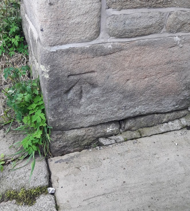
In short, when the original Ordnance Survey maps were being drawn up (1840’s or thereabouts, though work continued until the 1950’s), the surveyors needed to know the height above sea level at certain points in the landscape, so that they could work out hill heights, elevations, contour lines and such. These were marked on the map, but as translating the exact location on the map to that on the ground could leave room for mistakes, it was decided that a permanent and precise mark would be made on the place where the measurement was taken. This is the Bench Mark. They were carved very carefully by chisel onto stone that was either fixed, or very unlikely to be moved – churches, pubs, grand buildings, gate posts and the like. The symbol was usually paced at ground level, and was very simple, and very subtle – a single horizontal line (from where the measurement was taken), and underneath three lines forming a vertical arrow like this:

Over half a million of these marks existed at one time, and the entire network of marks (at least 1 per square mile in rural areas, a much greater density in urban areas) was maintained by the Ordnance Survey until 1972 when they abandoned it as too expensive. Whilst large numbers of the marks have disappeared (buildings are demolished or changed, stones are moved, etc.) the majority are still here, hidden, waiting to be found. Whilst looking at an old OS map of Whitfield Cross (1898 1:2500), I noticed there were two on the road. They are marked BM, followed by a number (the height, in feet, above sea level), and their location is shown by the arrow.
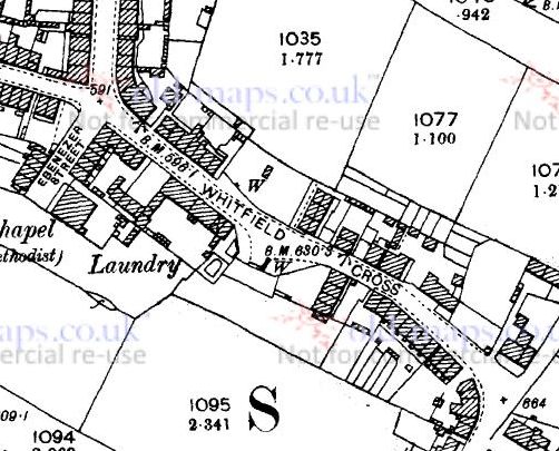
The first was at the bottom of Whitfield Cross, at the edge of the building that used to be The Roebuck pub.

It is very worn, but you can just make out the three lines that make up the arrow – now just hollows – and the level on top. This particular Bench Mark is 598.1 feet above sea level.
The other Bench Mark is on the edge of a pair of houses, and is much clearer and better preserved. It seems the surveyors used the flat top of the bottom course of stone as the spot height, which is exactly 630.3 feet above sea level.

That’s a difference of 32 feet, or thereabouts; Whitfield Cross is a steep hill.
And for comparison, here is the Benchmark near the Beehive pub at the top of the hill
 This is at 670.9 – 70 or so feet higher.
It is a bit geeky, but there is something about Bench Marks that really intrigues me – information hidden in plain sight, and a piece of forgotten history. There are even people who ‘collect’ them, ticking them off against the log that the OS had (see here), but that is, I fear, a step too far down Geek Avenue for even me!
Now that you know what they are, and where they are, keep your eyes peeled.

2 thoughts on “Whitfield Cross Bench Marks”