
Greetings all
After my last post on milestones, I received a message from the always interesting Roger Hargreaves (see comments below the above article). Now, Roger is something of an expert in these matters, and has done some considerable research into the road system of the area through the ages – Roman to 19th Century in fact – and he helpfully offered some information, and some photographs, too.
So then, the milestones…
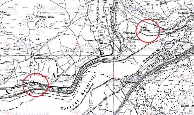
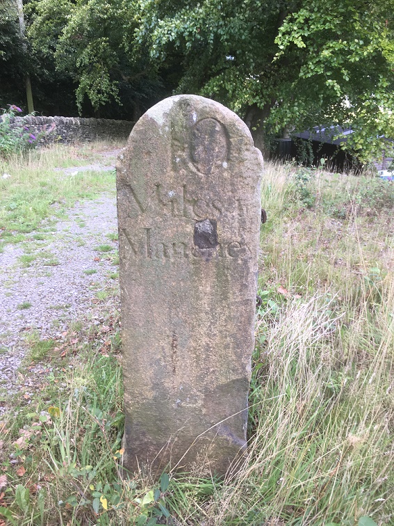
Following an act of parliament in 1770, the milestones were erected every mile (hence the name) along the 1730’s turnpike from Manchester to Saltersbrook by the surveyor James Brown jr. Later sections of turnpike were built from Saltersbrook to t’other side o’ Pennines – there’s a great website, with lots of pictures, dealing with that section, here. This road from Roe Cross follows broadly the route of what is now A628 / Woodhead Pass, itself a turnpike from the early 19th Century, and which overlays the original road.
However, in places, this 1730 turnpike is still visible where the 19th Century road deviates, perhaps taking an easier route, and so sections can be walked, and it is along these that milestones, where they survive, can be seen.

Now, because milestones are placed exactly one mile from each other, it is possible to work out where they should be. Of course, in some places where we would expect to find them, however, the newer road has obliterated all traces of the older road, and presumably the milestones would have been broken up and used as hardcore, although not necessarily, and it might be worth a further investigation – they are perfect for gateposts, after all.
So, starting from Roe Cross, then
11 Miles (somewhere on Mottram Moor) and 12 Miles (far side of Hollingworth) are missing – the area has been built up, although they may well still be in a hedgeback somewhere.

14 miles is missing, but would presumably have stood east of Townhead Farm – again, worth a look in hedgebacks and walls.

16 Miles would be just below Highstones, where the track still exists, and so would be a strong contender for a survival in the walls and hedgebacks.
17 Miles and 18 Miles are in places where the 19th Century road overlies the 18th Century, and thus are likely to be lost. Although, again, maybe worth a look.

20 and 21 Miles to Manchester are beyond this, and although there is a survival of the road in these areas, there are no walls in which the stones may be hiding. It is likely that they are simply buried in the peat in that area, waiting to be discovered. A walking trip with a steel pole, anyone?
This takes us to Saltersbrook, and the other side of the turnpike system there. Here is a map of the road from Saltersford into Yorkshire.

So after the journey, let’s end on a song – a particular favourite of mine, from a particularly good album, and whose title is very apt.
I also want to thank Roger Hargreaves for allowing me to use his photographs, and for the additional information.
As always, comments or questions are always welcome.
Your humble servant.
RH

One thought on “Milestone Update”