Stones of Glossop

The White Stone of Roe Cross

So, a while back I went looking for the White Stone of Roe Cross… and failed miserably in my mission.

As I said here, it is mentioned in Sharpe’s book “Crosses of the Peak District” as potentially marking the junction of the boundaries of Matley, Hollingworth, and Mottram, so I thought it would be worth a look, and maybe make a comment on what, where, and why.

I did some digging (pun fully intended), and came up with very little; it has almost zero presence online (other than this letter), and other than a modern book (about more, later), virtually nothing but an oblique reference. I began to despair… until I started to dig a little further – my ‘spidey sense’ began to tingle. Summat wants fettling, thought I.

What I did come across time and again was a reference to the legend of Sir Ralph de Staley, and his relation to Roe Cross, and the Roe Cross. Now, the story of Sir Ralph de Staley (Staveley or Stavelegh or Staveleigh – there are numerous spellings), is a variant of “The Disguised Knight”, a story trope that can be traced back to at least Homer’s ‘Odyssey’. Our story, culled from several sources, runs like this.

With Richard I, Sir Ralph sets sail on a crusade leaving behind his wife, Elizabeth, and estate. By and by, and following many great battles, he is captured by the Saracens, and held for many years in a dungeon. Eventually, he gains his freedom, takes on the appearance of a Palmer (a pilgrim), and pays a visit to the pilgrimage sites in the Holy Land. One night, in Jerusalem, he had a prophetic dream “boding ill to his wife and home far away”, and so, invoking the intercession of the Virgin, he prayed and presently fell asleep.

Upon awakening, he immediately knew something was different – “before him, shining fair in the summer sunlight, rich in fulsome melody of singing birds, was a fair English landscape, and beyond it his own ancestral hall of Staley”. He had been miraculously transported home.

He set off for his house, and came upon a faithful old servant and his favourite dog, who presently recognised him. He told Sir Ralph that his wife, who had finally given up all hope and now believed him dead, was to be married the following day. So off he jogs to his hall, and asks to see the lady of the house. He is refused, but begs a drink of Methyglin (a type of spiced mead, apparently), and after draining the cup, pops his ring into it, and begs the maid to take it to her lady. She does, his wife recognises the ring as belonging to her husband, and asks an important question “if it be Sir Ralph himself, he will know of a certain mole on me, which is known to none but to him” (racy stuff, this). Of course, all ends well and happily, and the bounder that is trying to get Sir Ralph’s lands and his missus, is ejected rapidly into the night. And quite right, too.

So ends the story.

Staleyhall
The 15th Century timber-framed Staley Hall before being done up. That is truly one of the most depressing photographs I have ever seen. How we can let our history end up in this state…
Staleyhall2
That’s better, although the wall at the front is a little off putting. The restoration work here is particularly good.

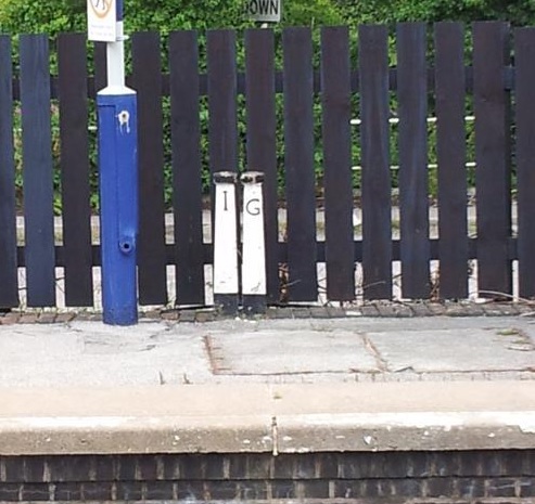
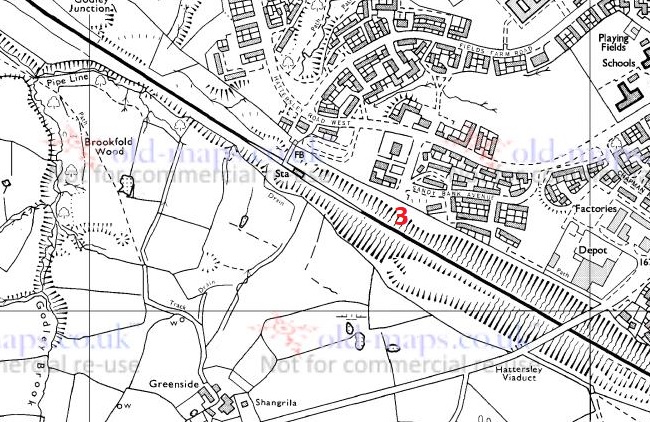
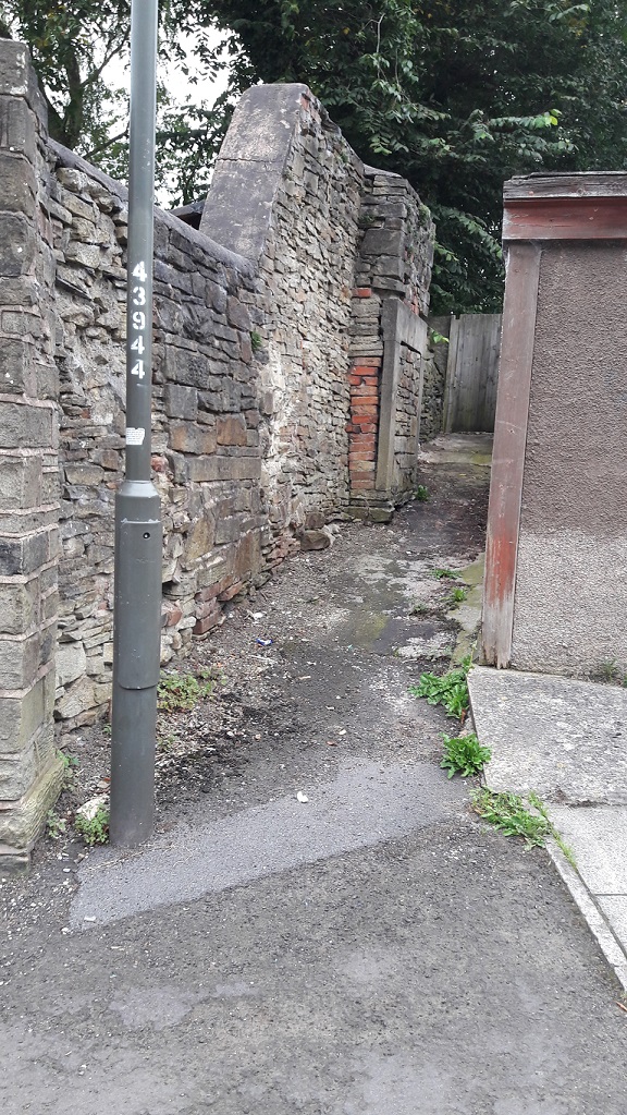
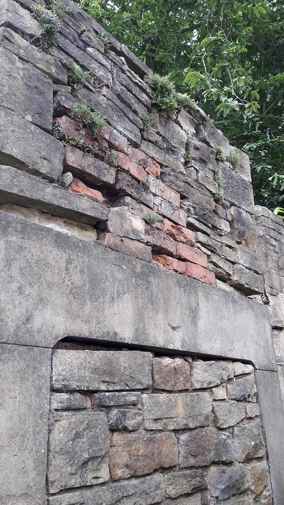
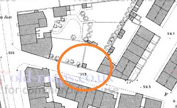
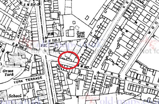
Now, here’s where it gets interesting. As a post script, most versions of the story (there are about 5, each with subtly different aspects) state that a cross was erected either where Sir Ralph meets the servant and dog, or where he wakes up following his miraculous movement. This is the Roe Cross – Ro, or Roe, apparently, being a shortened version of Ralph. Indeed, several sources mention a cross standing on the old road from Stalybridge to Mottram. But where is the cross? There is certainly not one there now, nor is there any evidence attesting to one. There is, however, the White Stone.

Ok, so here is what I think happened.

I don’t think there ever was a cross, not as such. None of the sources I consulted actually describes a cross, only that one was there (as told by the story and indicated by the name), or that there are the “remains of an ancient cross” on the road there (and thus presumably referring to the White Stone). It seems that the White Stone and the Roe Cross have become intertwined. Ralph Bernard Robinson, in his book ‘Longdendale: Historical and Descriptive Sketches‘ (1863) illustrates this perfectly by noting the existence of both cross and stone as separate monuments, but he only describes the stone, not the cross. I would argue that it doesn’t/didn’t exist.

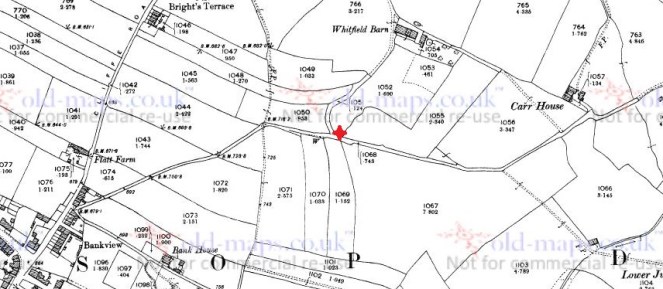
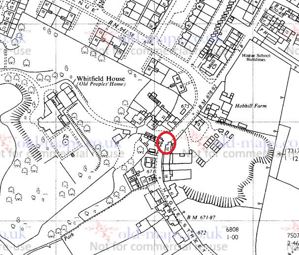
It is most likely the name Roe Cross is derived from ‘roads cross’; the area is, after all, the junction of seven roads – Harrop Edge Road, Matley Lane, Gallowsclough Road, Mottram Road (Old Road), Hobson Moor Road and Dewsnap Lane. Indeed, according to Dodgson’s Place Names of Cheshire (Vol.1, p.315), there seems to be no reference to Roe Cross prior to 1785 (although this may turn out to be incorrect, with further research).

Roads Cross
Roads Cross = Roe Cross. You can see the coming together of all seven ancient tracks, converging on Roe Cross. Ignore the 18th Century Turnpike at the bottom.

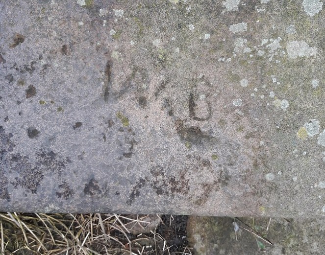
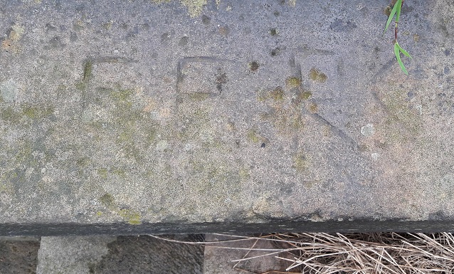
So far, so good… now bear with me. The White Stone is a marker stone, marking tracks over the tops, and/or marking the boundaries of Matley, Stalybridge, and Hollingworth, and it has been there from the year dot. As a feature in the landscape, it was given a story, as all such features are – they accumulate stories, because people have an intrinsic need to have a relationship with their environment – and it takes on a personality, and gains a biography. As the archaeologist Richard Bradley says of monuments “they dominate the landscape of later generations so completely, that they impose themselves on their consciousness”. The story of Sir Ralph (whether ‘true’ or not) was given as a way of explaining both name – Roe Cross – and reason for the existence of the marker stone. In fact, in Ralph Bernard Robinson’s account of the legend, Sir Ralph wakes up “beside a large stone”, and later on notes that “tradition points out the stone under which he found himself laid: and a queer old stone it is.” Clearly he is describing this from his own personal experience, and surely there can be only one stone that is worth pointing out in the Roe Cross area… it has to be The White Stone.

As a postscript to the postscript, Sir Ralph and his wife, Lady Elizabeth Stayley, are supposedly buried in St Michael and All Angel’s church, Mottram. There are two 15th Century carved effigies that are to be found in the Stayley Chapel there, which almost certainly are meant to represent the good knight and his wife, and which were originally placed against the south wall of the chapel. As Aikin in his ‘Description of the Country Thirty to Forty Miles Round Manchester’ (1795) notes, “many fabulous stories concerning them are handed down by tradition among the inhabitants”.

Staly
This from Aikin’s Description of the Country Thirty to Forty Miles Round Manchester’
Staly 2
Sir Ralph and Lady Elizabeth de Staley. This taken from the official guide to Mottram Church here.

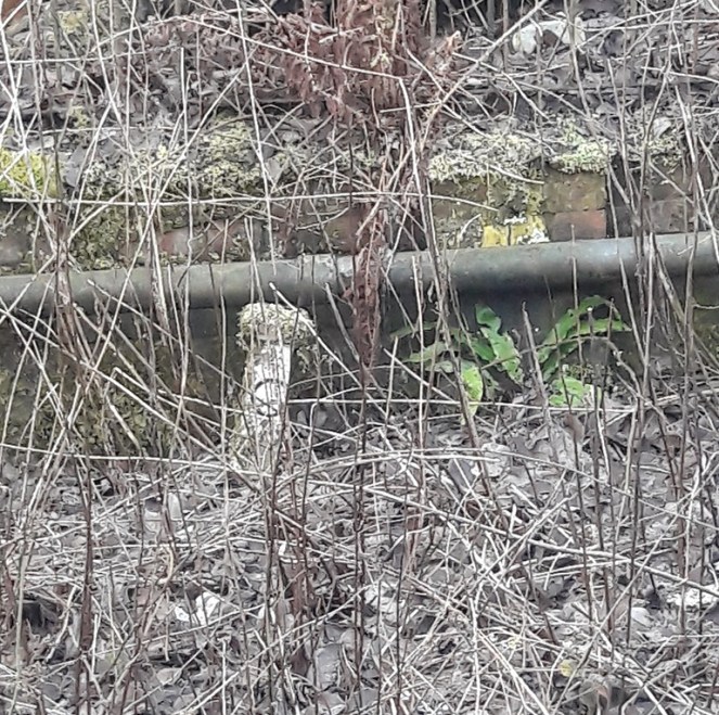
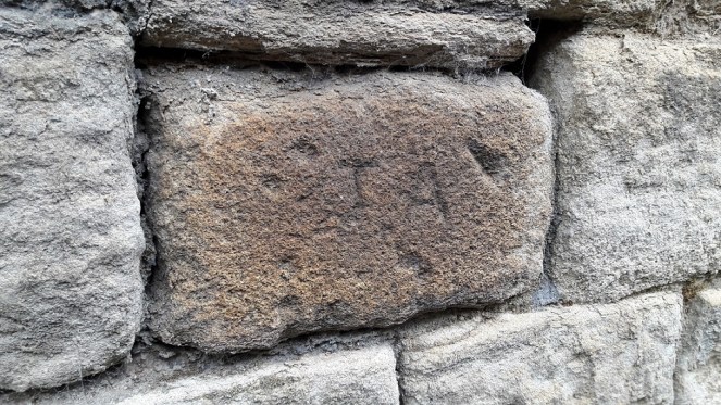
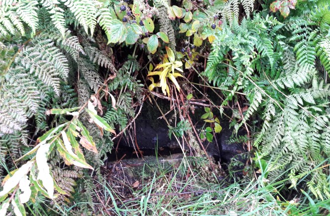
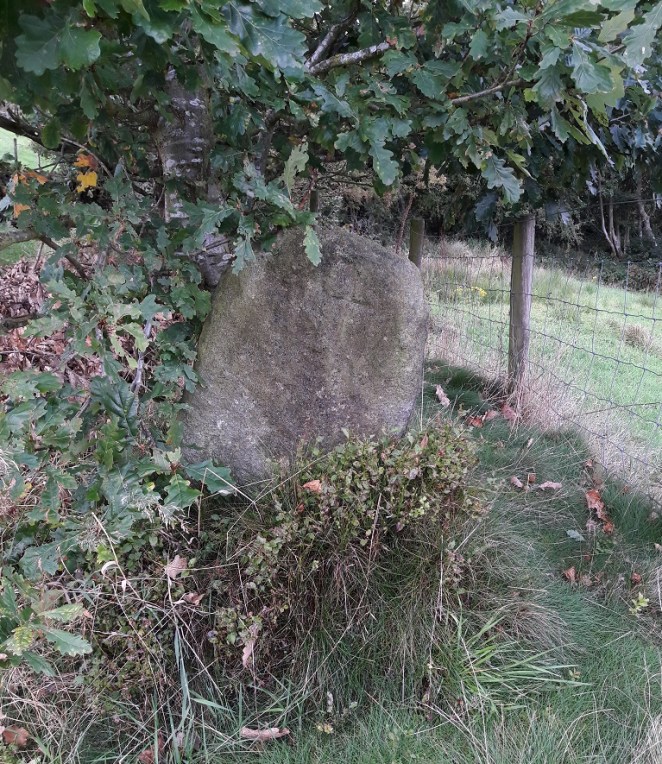
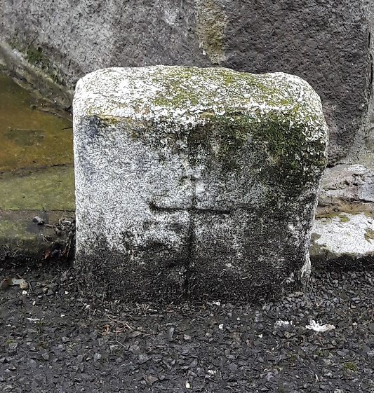
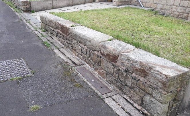
So then, the White Stone. Well, I still haven’t found it! But I do know a bit more about it, and now – drum roll please – I have a photograph of the bloody thing, stolen shamelessly from Keith Warrender’s book ‘Manchester Oddities‘. I heartily recommend this book, as it’s chock full of just the sort of odd bits of history that this blog looks at. Buy it here. Or better yet, order and buy it from Bay Tree Books – buy local and keep independent shops afloat.

So here is the offending stone, in whose shade, Sir Ralph found himself transported from the holy land.

White Stone a
The White Stone of Roe Cross – it is indeed a “queer old stone”.

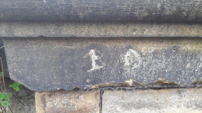
The reason for it being white is presumably to make it stand out, to ensure this important stone (boundary marker, track marker, or teleportation stone) is kept vividly different from any other in the area. Apparently it’s now on private property, which would explain why I couldn’t find it last time I went looking for it. I’m not sure of its exact location, but somewhere in the vicinity of White Stone Cottage would seem to make sense. Here is the drawing in Sharpe’s ‘Crosses of the Peak District‘.

White Stone b
Not very cross base shaped, but then I haven’t seen it close up. Yet.

I love it when a legend has a physical mark in the landscape, it makes it more real, and as I say, it is a natural instinct in humans to build stories around their places. I recently led a guided archaeological tour of Alderley Edge, which looked at the Legend of the Wizard through an archaeological lens, and this same element, on a smaller scale, was at play here. Place and story working together, informing and shaping each other.

Apologies for the slightly rambling nature of this blog post, but I hope you enjoyed it.

As always, comments and questions are most welcome.

Your humble servant,

RH

Oddities

More Mystery Stones

I love train journeys. Even the daily commute has something adventure-like about it. It’s also non-time, time spent sitting, waiting for the destination to arrive. My time to sit and think, read, and listen to music. And to write, of course. Gentle reader, I am writing this sitting on the 17.25 train from Piccadilly Station heading home to Glossop – the joys of having a new phone. We slow down as we approach Guide Bridge station, and there the post begins.

For the last umpteen years I have been commuting up and down this track, and I feel like I know every inch of it, in all seasons and in all weathers. But I have been utterly perplexed by two stones at the end of one of the platforms at Guide Bridge station (the one opposite the new ticket office, on which the train stops if you are going to Glossop from Manchester). These are the fellows:

Guide Bridge Posts 1
Not my photo, alas. I had several nice close-ups, but I cannot find them in any of my files. 

There they sit, painted and mysterious. I was so intrigued a few years ago, that I got off the train and had a closer look. They stand about a foot tall, and taper to a mushroom head. They are painted black and white, as you can see, and have the letters ‘I’ and ‘G’ carved into them. I am not certain what they are made from, either. It is is either concrete with very small pebbly bits added, or a coarse grained conglomerate stone. What I find intriguing is that the letters are done in a very old way – almost Georgian, or even earlier. Also, someone has taken the time to paint them with some degree of care – top, bottom, and letters are carefully marked out, and despite this being a busy, and recently modernised station. They must, in their present location, post-date the 1970’s updating of the station, but I feel certain they have been moved. The only mention of them I could find online is here, where the suggestion is that they represent “posts defining the area controlled by different District Engineers or suchlike”, with ‘G’ being Glossop, although the ‘I’ is still unexplained.

And there the matter ended… until last year. The train stopped just outside Guide Bridge to allow another train through, and I tiredly looked out of the window, blinked, and nearly yelled. Could it be? Yes, it was… another stone. Fumbling for my phone, all I could make out was the letter ‘G’, and then the train moved on before I could get a photograph. Bugger! Since then I have been trying to get the right set of circumstances to allow me that shot again. And a few months ago, I managed it!

Guide Bridge Posts 4
A map of the area. The original posts on the platform are marked 1, the new post is marked 2.

And here is the new stone:

Guide Bridge Posts 2
Difficult to spot, but it sits against the wall. 
Guide Bridge Posts 3
And in close-up, the carved ‘G’ is visible. 

It’s clearly the same thing – same shape, size, and even the antiquated way the letter have been carved is clear. And it too has been painted black and white, and in the same design, at some stage in the relatively recent past. It is no longer cared for in the same way, I suspect, as it is now overgrown and seemingly forgotten. I wonder too, if it was originally part of a pair, and the ‘I’ post has gone? Anyway, there the matter ended.

Or so I thought.

Pulling into Hatterseley station a few weeks ago, coming from Glossop, I was looking out of the right hand side of the train, and just after the big road bridge that carries the A560/Stockport Road, down, and tucked into a nook in the wall, I spotted two more of the things. They are situated where the end of the Hattersley Tunnel No.1 came out (long before Hattersley Station was built) – here on the map.

Guide Bridge Posts 5
New posts marked 3

I have no photo, as the train is always in motion at this point, though I might try and get a shot off with my new phone (snazzy camera, apparently). Two of them, mossy and overgrown, but the same shape, if a little shorter. No paint that I can see, but they might have been originally. The letters are ‘I’ and ‘G’ again, but they run the opposite way to those at Guide Bridge (‘G’ and ‘I’ as opposed to ‘I’ and ‘G’).

I am now intrigued to the point of obsession! So then, the question is. What are they? There must be someone out there who knows. Surely!

I know they are technically not Glossop related, but I thought as so many of my gentle and wonderful readers commute, and that everyone loves a good mystery, you would forgive the misuse of the blog. Anyway, if nothing else, it will give you a chance to play i-spy on your next train journey, trying to spot the posts (the Hattersley ones are hard – blink and you will miss them).

There will be more posts this weekend too, real Glossop history ones. With pottery and other goodies!

As always, answers and comments are most welcome.

RH

Archaeology · Oddities

A Puzzling Piece of Pottery

Evening all. The third blog post of June… see, I am trying.

Anyway, this one should (hopefully) provoke a bit of a response. I say hopefully because, dear and precious readers… I need a favour.

Some back story.

I received an email from the wonderful Sandra T. some months ago, asking whether I knew anything about this piece of pottery that she had found in Manor Park. She, like most of the people who read this blog, pick up random things they find interesting, which is to be commended (although, apparently, she keeps them in a clock… but let’s not judge).

Pot Mystery 1
The mystery object – AA battery for scale. Copyright Sandra T.

Now, I had no idea what it was, but it rang a bell. a brief search through my ‘interesting things’ box, and lo!

Pot Mystery 2
Two more of these mystery objects.

So now we have three of these mystery objects. I found mine in an old dump near Broadbottom, which at the latest was 1910’s, but was generally earlier – say 1890’s – which at least gives us a time period to look at.

Interesting. I thought I’d do this post eventually, as someone out there might know what , when, and why.

Last month my new neighbour (hello Simon A.) partly demolished and rebuilt a wall on our property line, and in the process discovered that the whole wall sits on a bed of pottery and other domestic waste. This mountain of material will be the subject of a future post, especially as it makes a fairly coherent deposit, thus can tell us interesting things. The wall can only have been built post 1850-ish, and definitely before 1860, which gives us a clear date, too. Amongst the bits and pieces was this:

Pot Mystery 3
Another one… what are they?

So now we have four of them.

They are roughly conical, tapering to the base,  measure between 10 and 12mm high, 13-14mm across the top, and roughly 11mm across the bottom. The bottom is flat, the top is hollow in a perfect hemisphere (I say top and bottom, but actually they might work either way up). Some are glazed all over, but one is only glazed on the interior of the hollow. This last point is important, and may hold the key to understanding what they are; it matters that only this bit is glazed, i.e. waterproof, not the rest of the object. Why? Also, they are clearly mass produced, and have a very specific role… but what?

I have two suggestions, both of which may work, but equally they are guesswork!

1) Kiln furniture. When you fire pots in a mass group, as they were being in the Victorian period, you need to keep the plates, etc. separate in the kiln, or the heat won’t circulate properly and you end up with poorly fired plates. These spacers were made in their millions, and were about the same size and shape. Though what they would be doing here in Glossop – not known for it pottery kilns – is anyone’s guess.

2) A way of selling medicine. The little hollow bit is glazed, but the exterior isn’t, so perhaps the medicine was stored in that bit, and scraped out when needed? Or it held a single pill that could be crushed in the hollow?

So over to you. Please, please comment and let me know what you think. The question is very simple. What on earth are they?

I’ll buy a drink for anyone who can tell me, with proof, what they are.

RH

Graffiti

Graffiti

The urge to leave a mark in the landscape – a part of you or a reminder that you were there, once, even long after you are gone – is undoubtedly a universal feeling, and one that has been with us since we humans first started ‘thinking’. The cave art seen in places like Lascaux and others are believed to be ritual and ‘Shamanic‘ in nature, as well as displaying entoptic traits, probably drawn under the influence of hallucinogenic substances, and again ritual in origin. However, I am also convinced that some of them are the Upper Palaeolithic equivalent of “Kilroy Woz ‘Ere”.

Graffiti can be an eyesore – scrawls and rude words for example. But it can also be rather beautiful; there is some amazing ‘street art’ out there, done by people with phenomenal talent. However, it must be stated that even the rude word variety has an impressive heritage – the Romans were famous for it! Even medieval churches were not immune to it – if eternal hellfire and damnation isn’t deterrent enough, an asbo certainly won’t cut the mustard.

But it is the humble name that is most often written; a cry in the wilderness of life, and wish to be remembered, to have left a mark, however small, so that some part of you is immortal. Now, I’m not about to post a bunch of photographs of random spraypainted words… no, no, no! This graffiti has some age to it.

Nowadays, any moron can (and frequently does) use spraypaint, marker pen, emulsion, or any one a number of other ways to leave their mark. However, back in the Victorian period, if you wanted to write your name, you really had to mean it! Armed with a hammer and a heavy duty chisel, and a good few minutes whilst you etched your initials permanently into stone. It is surprisingly common to come across this sort of thing, but recently I have been photographing the ones I see in Glossop. I have more photographs somewhere, but for now, may I present ‘Gone, But No Longer Forgotten’.

Bank Street - Graffiti
This is on Bank Street – my favourite path. Slightly haphazard initials – T.A. – carved into a stone that is oddly coloured. There are no other similarly coloured stones around it, and it looks like it has been burnt at some point before being used in this wall.
Whitfield Rec - Graffiti 1
This one is from Whitfield Recreational Ground, the Wood Street side. ‘B.D.’ carved into a capstone. It also looks like it has been filled in at some stage. Given that the park was opened properly in 1902, we have a firm date after which it must have been carved. It’s also nice to see the marks of the chisel that dressed the stone – all representing one person’s labour spent in shaping it.
Whitfield Rec - Graffiti 2
Whitfield Recreation Ground once again, this time the Wood Street stairs. ‘W.B.’ very messily carved – standards clearly slipping. There is possibly a ‘J’ carved below the W.
Whitfield Rec - Graffiti 3
This one is also on the Wood Street stairs. ‘F.F.R.C’? Unclear, and I think this is more modern than the others – there has been no attempt to carve the curves of each letter, and instead an unskilled hand has block carved the initials. Shocking!

As I say, I do have more somewhere, and I’ll post them when I find them. In the meantime, if anyone knows of any more, let me know. I have some on my garden wall that are particularly interesting, but I’m saving them for their own post.

Next blog post will involve pottery… probably.

Or Victoria Bridge.

Anyway, Happy New Year to you all, and as always, comments are welcome… especially if you know the identity of any of these miscreants!

RH


Stones of Glossop

Carr House Lane Stone

With all the talk of Carr House Lane and the guide stoop there (or lack thereof) the Whitfield Cross post generated (see comments here), I thought I’d go back and walk down Carr House Lane and do a post about the ‘Stone Cross’ there. Incidentally, I have a post about Carr House Lane archaeology that I will get to after this (lots of lovely Victorian pottery), but I want to concentrate on the ‘cross’ for now. The stone is situated here:

Carr House Lane - Stone Location
For orientation, bottom left is the top end of Whitfield Cross where it joins Cliffe Road. the red cross marks the… well, cross. Or whatever it is.

The sunken road from Cliffe Road becomes increasingly boggy the further you go down, not helped, after you turn east, by the stone built spring fed well on the right (marked ‘W’ on the map). This is entirely appropriate – the word ‘Carr’ is derived from the Old Norse ‘Kjarr’ meaning a low lying boggy area… they’re not kidding.

Carr House Lane - Well
A terrible photograph of the stone trough of the well on the south side of Carr House Lane. I must wait for winter for better photographs.

The stone, when you come upon it, is very easily seen, despite being tucked away and in the shelter of an oak tree.

Carr House 5
Nestled in an Oak tree, the stone sits at a jaunty angle on the left hand side as you come down the track from the Whitfield end.

What is immediately obvious, more so on the ground than on the map, is that the stone marks the point where a track branches from Carr House Lane down to Whitfield Barn. Whitfield Barn is at least 18th Century in date, and probably earlier in origin, though without closer inspection is impossible to tell. The main track continues down to Carr House, a farm building of similar date, and which lends its name to the pathway.

This is significant, as it is exactly the sort of place one would expect to find a cross, marking a track junction (see here and here, and the comments for both, for discussion).

Carr House 2
The track down from the Whitfield end of Carr House Lane.
Carr House 1
Carr House Lane as it continues down from Whitfield to Carr House itself.
Carr House 4
The branch that comes off Carr House Lane down to Whitfield Barn. The cross lies just out of shot to the right.

And yet it is not a true cross, not in the general sense anyway – it is simply a stone with a cross carved into it. I think it likely that the stone was there long before the the cross, and that it was originally a waymarker making sure the track down to Whitfield Barn wasn’t lost, particularly in the dark.

Now, it is just possible that it is a standing stone, by which I mean a prehistoric standing stone – there are several in the area. However, this interpretation is problematic. Firstly, a prehistoric standing stone is just that… a standing stone, erected in prehistory. However, a standing stone erected yesterday will look exactly the same. Thus, without any associated datable features (a barrow, a stone circle, a burial), we cannot state that the stone is prehistoric. Could be, but might not be. Secondly, its situation, at the junction of the tracks, suggests a connection with, and thus a product of and post-dating, them. It could be argued that the tracks are situated to take into account an already existing stone – that is, the track to Whitfield Barn could have been made anywhere along Carr House Lane, but it made sense to split it at the stone – but again that is impossible to prove.

What I will say is that the stone certainly isn’t a disused gatepost, nor is it naturally occurring in that upright position. Which means it has been placed, with purpose and meaning, by someone. Neville Sharpe, in his book ‘Crosses of the Peak District‘, states that it has been shaped, which is certainly the case, so it seems some thought and care has gone into what it looks like.

The cross carved into it is interesting, also. It has been suggested that some roadside crosses were placed as a gift of thanks for the completion of a safe journey, effectively a votive offering in payment for an answered prayer (i.e. help me get home in this awful weather, and I’ll set up a cross to say thank you). They might also function as a spiritual fortifier, reminding the traveller of God’s watchful eye and protective power over the faithful. It is easy, in these days of surfaced roads, street lights, and large settlements, to forget just how dark and treacherous travelling in the pre-modern era would have been – making your way from A to B in total darkness, along a muddy track, and with no map as such, and knowing that if you took a wrong turn somewhere, you were lost. And I find it difficult enough to find the bathroom at night!

That stated, there is something about the cross that suggests to me that it seems to have been more of an afterthought – the result of a sudden onset of piety perhaps, long after the stone was set in place.

Carr House 6
Close up of the carved cross. I really need to go back and re-photograph it properly.

It is two simple chisel strokes, one vertical, one horizontal, and the job is done. Why go to the effort of raising and bedding a stone that weighs 1/4 tonne, perhaps more, and then just carve a simple cross into it? The cross is not particularly well executed, either – it is certainly not the effort of a stonemason or even someone familiar with stone. Sharpe (p.42) suggests that it was cut “a long time ago” as the cross would have been vertical when carved, and age has slumped the stone. Logically, this is a sound argument, but the fact that there is an Oak tree growing behind it and to the left (i.e. the direction from which it would push the stone) may suggest a more modern date. Whatever the case, I would suggest that the raising of the stone and the carving of the cross are two separate events that probably occurred many years apart.

What I do find intriguing is that the carved cross strongly resembles this mystery carved cross. Well, obviously…  it’s a cross, one of the simplest and easiest designs you can carve onto a stone surface. But the cross design, two simple strokes, thin and unfussy, but seemingly not done by a professional, is similar. Moreover, it is something of a coincidence that two seemingly random stones, separated by roughly 700m, both have a very simple cross design carved into them, and probably as an afterthought. I wonder if someone in the area caught a little divine inspiration and went on a carving spree? And I wonder, if we keep our eyes open, will we find any more?

As always, thoughts, comments, and corrections are very welcome.

Oddities · Stones of Glossop

A Little Mystery Stone

Here’s a strange one, and one that may have a perfectly reasonable explanation, but it is a bit of a mystery.

First some context. I have always been intrigued by free-standing stones, and the multiple uses to which people put them. From glacial erratics to carved crosses, and from prehistoric standing stones marking a ritual space to boundary stones marking a modern urban district boundary, we rely on the natural material as a marker, as we have since we first found a need to mark place. There is something very human about a stone marker. A lot of my work in archaeology has been involved exploring space, and how we mark it, how we make it different from other space (specifically, in my case cemeteries and ritual places). I won’t get too bogged down in the detail here – I have a bigger post planned that explores some of these themes (you’ve been warned… and there will be questions afterwards), but for now, I present the first entry in a series entitled “The Stones of Glossop” that will explore the multitude of free-standing stones that populate the area.

And it is a bit of an odd one.

Walking on Hague Street, heading toward Derbyshire Level, and just past King Charles Court, the road bends to the left and passes very close to the 17th Century House there. Just on the corner of the house, and placed on the kerb, is a small stone.

White Stone
Here!

Less than a foot high, rectangular, and dirty, it was once painted white, making it very visible, one assumes, in darkness. What makes this stone particularly interesting is the neat cross carved on the front.

White Stone 1
The stones of the 17th Century house are clearly visible behind, with what, I have just noticed, looks like a face carved into the uppermost stone in the photograph. Coincidence, obviously, but spooky nonetheless!

The cross is of the Christian variety, with an elongated vertical piece, and is very clearly intentional, with the grime of the road and many winters highlighting the effect. There may be other marks on the front surface, but it is difficult to tell if they are intentional or the result of wear and tear. It is worn, especially on the right hand side, but not as much as I would expect if it were particularly old, especially situated by a roadside, and the stone has largely maintained its rectangular shape. It has also been painted fairly recently; this may be the continuation of a tradition of painting roadside stones, or it might have been done for the first time two years ago.

White Stone 2
Close up of the stone and the cross.

It may be modern – although that would be perhaps surprising – or it may be older – in which case, why does no one mention it in any of the texts? It could be a road marker, but there is a massive building behind it that marks the road in a much more clear way! And what is the purpose of the cross? I suppose in some way it should be considered a roadside cross, but if that is the case, I’m not sure how to interpret it. I quite literally know nothing about this oddity.

Any thoughts, anyone?

Archaeology · Oddities

The Letter ‘R’

At the bottom of St Mary’s Road, on the left hand side, and just behind the back yard of The Retreat beauty salon, there is a gatepost next to the footpath. It is a fairly standard, if precisely carved, gatepost, and much like many of the others you would find in the area. However, this one has a large upper case letter ‘R’ carved expertly into its face.

Letter R 1
The letter ‘R’ beautifully carved.

I have no clue why it was carved, nor who did it, nor when. The buildings in this part of Glossop centre are among the oldest (1840’s or thereabouts), and the letter style certainly suggests Victorian origin, and probably early Victorian – the large serifs recalls Georgian lettering. It has clearly been used as a gatepost multiple times, with different gate sizes and shapes, and even paint colours – you can see the evidence in the form of holes and paint. Importantly, most of these were placed over the carving, so post-date it.

Letter R 2
Use and re-use – the evidence of the holes, fixings, and paint.

I checked the early maps for any idea, but nothing was shown that may explain its origin. I haven’t had time to check the census records, and these may shed some light on it, but as it stands… no idea! Whilst looking at the post, I found a child’s toy marble in the gutter – not a particularly old one, but it has seen some use, and is covered in scratches and chips. So obviously, I picked it up!

Marble
I can’t resist a find, even if it is not quite archaeology.

Any thoughts or suggestions regarding the letter on a postcard please (or you could just, you know, post a comment below).


Archaeology · Oddities

A Philosophy of a Fireplace

As you walk down Freetown toward St James’s church, just before you get to Charlestown Road there is, on the right-hand side, a small thin passageway that ends in a gate, probably leading to someone’s back garden or something. Now, I’m not sure if this private land as such, but I don’t think so. It is, rather, one of the anomalous bits of land left over after the extensive demolition and remodelling that this part of Whitfield underwent in the late 1960’s. A sort of architectural no-man’s land, the result of imposing a rigid housing plan onto an already existing street system, and one that had grown somewhat organically, and in a ramshackle and piecemeal way throughout the 19th Century. It doesn’t quite fit, so there are these angles and nooks left over which I like to explore. I never can resist a good nook!

Fireplace - 1968 - 1-2500

Fireplace 1
Innocuous enough, and overlooked.

This one contains a bit of a surprise. A fireplace. A large inglenook fireplace made up of three stone – two uprights and a lintel – carved, dressed, and sitting proudly in the wall, exactly as it should be.

Except it’s not… it’s outside.

What you see is the front of the fireplace – as you face it, you would have had your back into the room. But there is no room.

Fireplace 2
Given the size of the fireplace, and the cramped location, it is difficult to get a good photograph, so my apologies.
Fireplace 3
The dressed surface and delicate lines are clearly visible. The walls around it would originally have been plastered and flat, once you get that, you can begin to reconstruct the house around the fireplace structure.

Now, putting my anthropologist head on for a moment (as we archaeologists do fairly often), we may note that humans almost universally, and throughout all periods of history, have placed great importance between the ‘outside’ and ‘inside’. This binary concept is prevalent throughout our lives, and is just about hard-wired into our brains. The inside of a house represents the safety of the domestic and the social, the known familar world, one with distinct limits (the walls), and one that is warm and safe and light. The exterior is the opposite of that – it is dark, wild, cold, dangerous, full of unknowns and without limits. Out there, we are helpless, alone, and out there, man is no longer the hunter, but is the hunted, pursued by predators. Consider too the garden; technically outside, it can be seen as symbolically taming the wild. It is outside, but is not – it is bounded by walls and fences, and the grass is cut, unwanted plants are weeded out, the trees are nurtured and the flowers are fed and watered – it is controlled by us, and is carefully and jealously guarded against incursion from the wild.

Fireplace 4

Arguably, the whole of humanity’s struggles and the evolution of society is based around this concept – making the distinction between outside and inside, developing the domestic, and keeping the ‘other’ at bay. Certainly the ‘Neolithic Revolution’ is as much about this as it is about farming, and the two go hand in hand.

Fireplace 5
The bricked up central part seals its fate as merely part of a wall.

Now what, I hear you cry, has this got to do with a fireplace? Well, the fireplace or hearth is the embodiment of the domestic, the heart and soul of a house. Warmth, light, food, and safety all come from this one point, and it physically and metaphorically represents the concept described above; beyond the light of the fire is darkness, and we don’t know what lies in the darkness. To see it outside, the exact opposite of where it should be, is, anthropologically speaking, wrong – it is an inversion of the norm, it is unsettling and disturbing, and it is somehow dangerous.

Taking off my anthropological head, it is also a very nice piece of carved stone, and so it’s a shame to see it wasted like this. Indeed, I have a fireplace exactly like this one in my own house.

So, how did it end up here? Taking a look at various historical maps, there are a number of buildings marked here over time. The earliest, 1880, seems to have been a small outhouse, possibly a privy. The others are a bit more substantial, particularly that shown on the 1898 map, which may well be our source.


Fireplace 1880 - 1-500
1880 1:500 map. A small outhouse or privy?
Fireplace 1898 1-2500
1898 1:2500. A more substantial building.
Fireplace - 1921
1921 1:2500. The building is now on an east-west axis. 

The remodelling, probably largely uneccesary, of Whitfield has thrown up some interesting anomalies (not to mention the re-use of some of the original housing stone – see photos), but I think this is the oddest.

Re-use 2
Re-use of the original building stone of the 1860’s houses of Whitfield and Freetown. These form the front garden wall of some of the 1960’s built ‘new’ houses.
Re-use 1
Doorway lintels, foundation stones, and window sills make up part of this planter on Freetown.

As always, comments and corrections are very welcome.

Oddities

Roman Inscription… Or Lack Thereof!

The previous post about the date stone reminded me of something I read a few years ago. It took me a while to track it down, but here it is.

Melandra Roman Fort is one of the places that you have to visit in the area if you have an interest in the past. It is situated at the edge of a dreary housing estate, and has a slightly desolate air about it, particularly the car park. But turn your back to the 1960’s built houses, and face out, standing at the centre of the AD 60’s fort, you really understand why they built it there – you can see all along Longdendale, across Glossopdale, and on the promontory it reaches out almost to the bank of the Etherow, which it overlooks for a long way either way. Strategically, it is a perfect place – commanding the area, yet safe and secure.

The area was known as ‘Castle Yard’ since time immemorial, and when it was first described in 1775 by Reverend John Watson (in Archaeologia Vol 3) the area was untouched by the plough, and the full fort could be made out by standing walls. Incidentally, it is likely that Watson made up the name Melandra – there is no record of anyone ever calling the field by that name before 1775, and crucially, Melandra is Greek in origin. I’m not certain, but I think we can go out on a limb and suggest that no rural Derbyshire farmer spoke classical Greek in the 18th Century. It’s actual Roman name seems to have been Ardotalia, a word vaguely associated with the name of the river, Etherow.

Over the years, the local farmers used the walls as quarries, building houses, walls, sheds and the like with the dressed stone found there. Amongst them, inscibed stones were found – probably one inscription placed above each of the four entrances into the fort, with more, and an altar, inside. One farmer had even built an inscribed stone over his doorway. However, not everyone understood the value in these inscriptions… I’ll let my pseudonym tell the story:

“Previous to the reservoir belonging to the Manchester Corporation being made at the Hague on the Cheshire side, the river Etherow was undermining the bank, and it was found necessary to build a wall to prevent its encroachments. For this purpose the workmen took away all the stone then lying at Melandra, and amongst them was another inscribed stone. One of the men had no knowledge of its antiquarian value and built it in the interior of the wall, though a bystander remonstrated with him for doing so, using these words in the local dialect: “thart puttin summut in neaw ut ul be wanted sum day”. A few days afterward, Mr. Bennet Woodcroft, a gentleman visiting in the neighbourhood, hearing of the matter, went to the place and offered £5 if the workman would recover the stone, but the clerk of the work would not permit the wall to be taken down, as the exact spot it was could not be accurately located”

Hamnett, R. 1899. “Melandra Castle” in Derbyshire Archaelogical and Natural History Society 21: 10-19

Amazing to think that there, on the banks of the Etherow, lies an unknown Roman inscription, bricked up by some ignoramus who couldn’t recognise its value beyond being just a piece of stone. Which makes me even more thankful that history didn’t repeat itself on the banks of Glossop Brook.

EDIT: Just out of interest, I just ran a quick value equivalency programme – £5 in 1850 is today worth about £500 – a significant sum of money.

Oddities

Mystery Date Stone

I was coming back from a visit to the supermarket the other day, and thought it would be a nice stroll, with James in the pram, to go along Glossop Brook and through Harehills Park up to the Market.

Now, if I may digress for a moment, despite the presence of a plaque, I steadfastly refuse to call this ‘The People’s Park’ which is an entirely new invention… and sounds absolutely awful. Even the name Harehills is of recent coinage, dating only from 1921 when the park was given to Glossop by Lord Howard to Glossop in memory of his son who was killed in the First Word War. Prior to that, the rough unused ground was known simply as the Sandhole – named, presumably, for the sand that was quarried here. Indeed, during the Cotton Famine (1861-65, caused by cotton no longer available from America due to the ongoing civil war there) Lord Howard employed the jobless mill workers in the area to dig sand – in essence giving them a paid ‘non-job’ so that they wouldn’t starve. He was alright, was that Lord Howard bloke! The area is still sandy, and indeed sand covers the footpath at one point along the way.

The location, on the brook, is lovely, and several developments have recently brightened up the area, including the redevelopment of the Old Glove Works on George Street (into flats, one assumes, but that is better than a derelict building). The new retirement flats just opposite the park itself went up surprisingly quickly, and look rather nice. However, if you poke your head over the side of the brook (carefully) you can see all sorts of history – dressed stone, drains, the old bridge, etc.

As I was pondering the detritus of history, I noticed a date stone had been cemented into the newly built wall adjoining the brook. Hmmm… I thought.

Datestone 1
Difficult to see, but just there, on the upper course of stone, a bit to the left of centre.
Datestone 2
Close up. J and E H.

The date is 1681, refers to the date of the construction of the (now long gone) building to which the stone belonged, and the letters refer to the people who built it, usually a husband and wife. In this case, their initial would be, I assume, I (or J more likely) and E, and their surname began with H. This is important, as 1681 is a particularly early date for a building in Glossop – the Bulls Head pub in Old Glossop, usually reckoned to be the oldest building, has a date stone of 1607. I’m sure someone out three would be able to work out who they were and to what building the stone belonged, but it is beyond me I’m afraid. I am just glad that someone though enough about history to cement the stone the right way round in order to provide us with this little mystery.

As usual, any thoughts, comments, or general pointing and laughing, please drop me a line – email or comment below.