
What ho, delightful historical types (hysterical types?)! Welcome to a new article… don’t worry too much, it’s not pottery (I’m saving that for next time). Nope. This one looks at an interesting feature of Glossop’s personality. Buckle up!
So, some posts I can polish off in an evening (glass of stuff that cheers in hand, obviously). Others takes weeks to brew, and the process can be painfully slow. This one, though, is very different. I started writing it in August 2017… and it’s taken just under 8 years to publish it! No reason as such, it’s just I paused writing it, and moved onto something else, then I went back to it, and then did the same, and so on, and never quite finishing it. In fact, it’s so old, that it was written using an older version of WordPress (the platform I use for my website) which wasn’t really useable any more, and I had to paste the entire thing onto the newer version. Well, here we go.
It’s often said that Glossop is a town of different areas, and with different character. When I first moved here, I realised that a lot of these areas were named ‘town’ – Howard Town, for example. On a simple level, ‘town‘ here refers to a collection of houses in an area rather than the traditional meaning of a large urban conurbation. I wonder of this is a local dialect, or perhaps more likely, Howard Town was named as such, and then the others followed suit, possibly ironically (Roughtown), or perhaps as a way of keeping in fashion (Milltown? Anway, this and is a which got me thinking… how many of these towns are there? And where are they all?
Well, in answer to these questions, may I present…
MILLTOWN
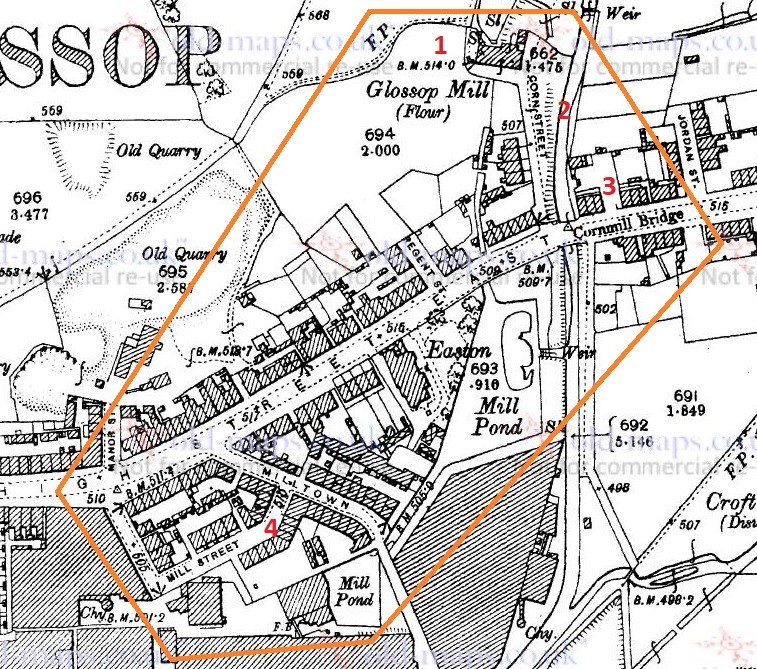
Despite its location, and seemingly obvious derivation, Milltown as an area has nothing to do with the Victorian mills, but instead it is so named because of its proximity to the medieval corn mill. Situated on what is now Corn Street, the mill was owned by the Lord of the Manor, and the people of the area paid to have their corn ground there – and nowhere else. It was, to all intents and purposes, a bit of a racket, but one that was universal throughout the land at the time. As you can see from the map below (and from photographs), there was a flour mill here in 1898, an 18th century building replacing an earlier one. It was demolished in the 1920’s, but you can still see the mill leat running alongside Corn Street. Also, the bridge over Shelf Brook as called Cornmill Bridge, which I did not know until just before I wrote these words… I love that!
LEAN TOWN
Lean Town is the name given to a group of four houses at the bottom of an apparently unnamed lane that runs from Hague Road to Gnat Hole. I can’t believe it is unnamed, but there you go… no map or document has so far given me a name! As you come from The Beehive toward Derbyshire Level, you pass a right hand downward track – follow this and eventually you hit Lean town. I wrote about Lean Town, here.
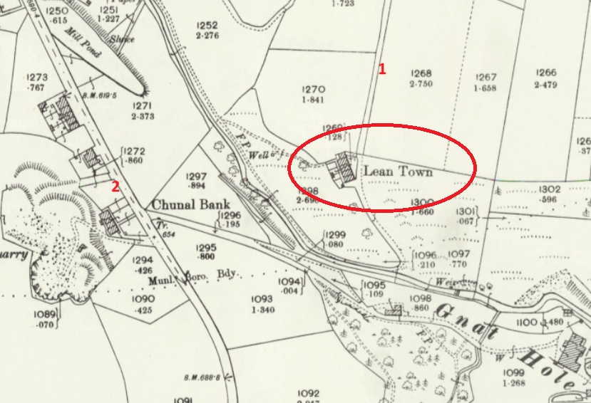
The origin of the name ‘Lean Town’ is unclear; it might mean lean, as in not very rich, or poor for growing crops, or might be derived from ‘ling’, meaning the plant ‘heather‘ that grows around here.
CHARLESTOWN
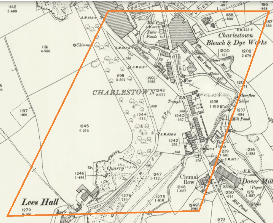
Once an area in its own right, it is now largely remembered in the name of Charlestown Road (and Charlestown Motors who I can heartily recommend, as it happens). It was named after Charles Hadfield who lived in Lees Hall in the late 18th century, and built the mill in Charlestown (now flats and houses).
ROUGHTOWN
Hope Street in Old Glossop was known as Roughtown, seemingly referring to the uncouth behaviour of its inhabitants, largely quarrymen from the nearby Glossop Low Quarries just up the road.
Apparently Roughtown was used as a semi-official name, with it appearing on census returns and trade directories of the time. Sticking with Old Glossop, we have…
TOP O’ TH’ TOWN
The area between Thorp Street and Church Street in Old Glossop. It is, I suppose, quite literally the top of the town.
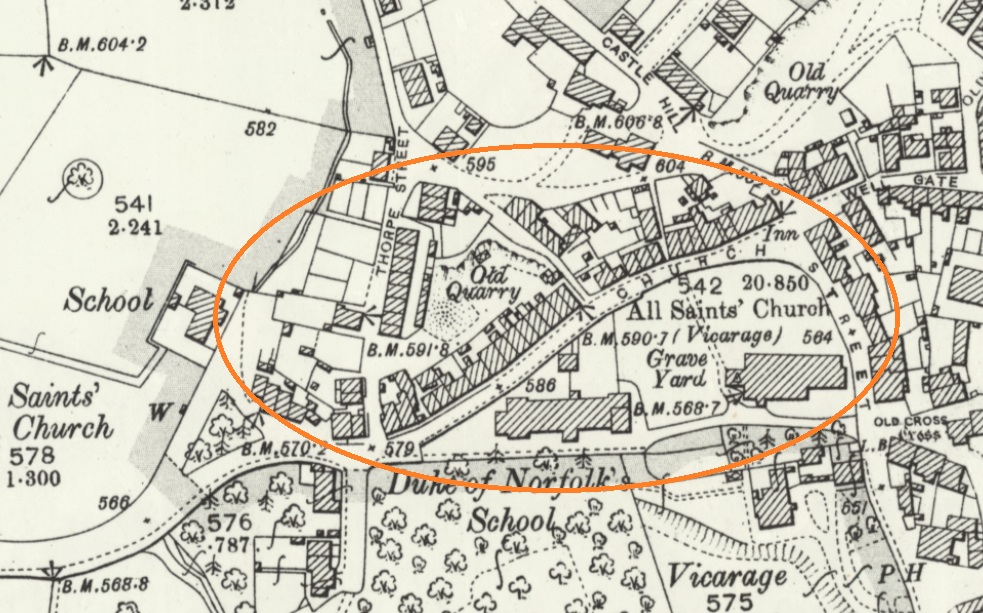
And the area at the end of Top o’ th’ Town is known as ‘Town End‘, which make sense. Over in Whitfield, however, we have…
FREETOWN
Stretches from the bottom of Whitfield Cross to the junction with Charlestown Road.
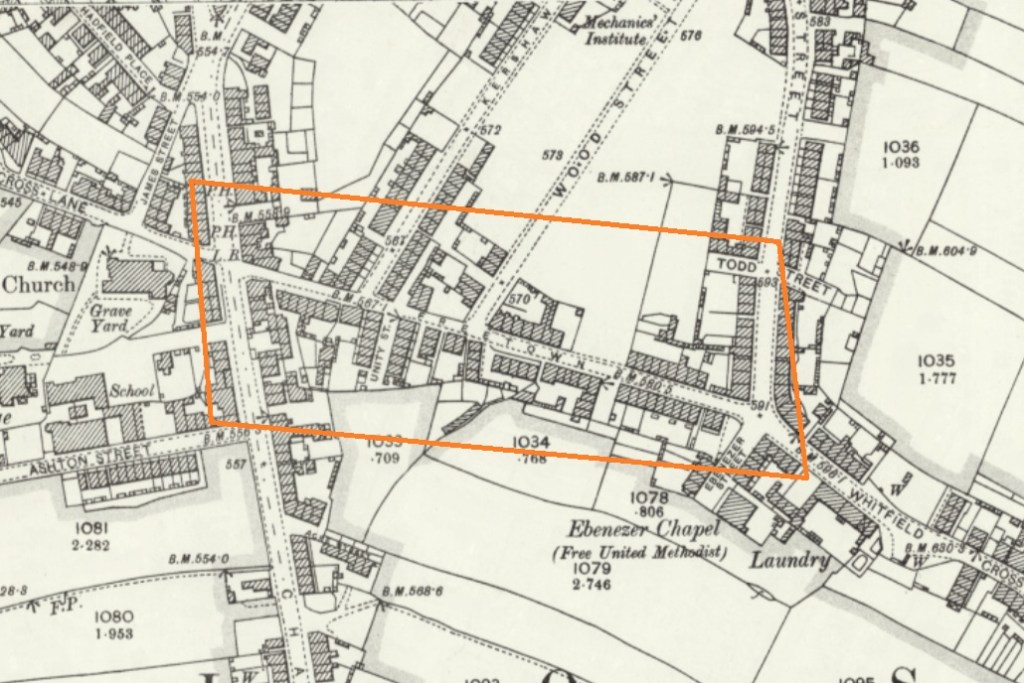
Technically, and originally, Freetown was the name given to this area of Whitfield, with the name being derived from the fact that the land in this area, and subsequent houses built here, were freehold, as indeed it is still the case (my own house here included).
HOWARD TOWN
Essentially, what we understand as Glossop – the railway, Norfolk Square, the crossroads, and the whole area around the market and Wetherspoons.
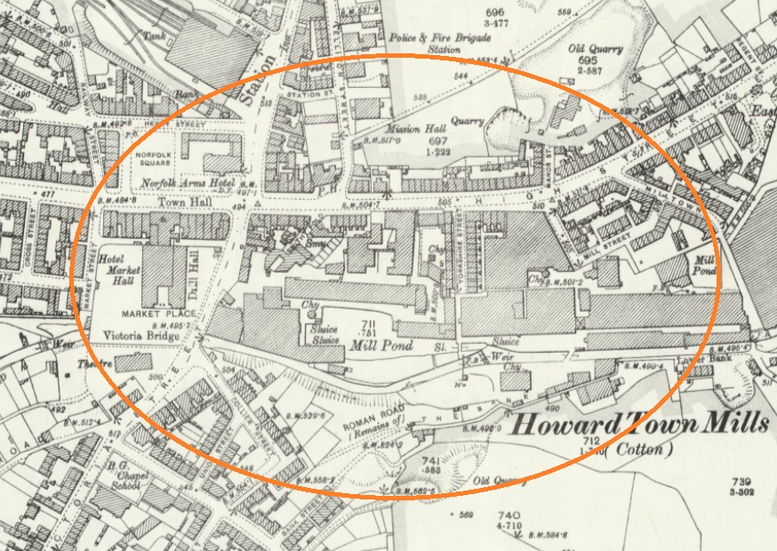
Named after Bernard Edward Howard, 12th Duke of Norfolk (1765-1842) who invested heavily in Glossop – money and time. He built roads, the town hall, remodelled the whole area, and changed the focus of Glossop from what we now know as Old Glossop to what we now know as Glossop, but was originally Howard Town. This may have been the start of the ‘town’ naming process, as others followed suit, whether by flattery or through satire.
JERRYTOWN
A bit of an obscure one this – it’s mentioned by Hamnett as stretching along High Street West, from roughly The Grapes inn to the former Junction Inn and around.
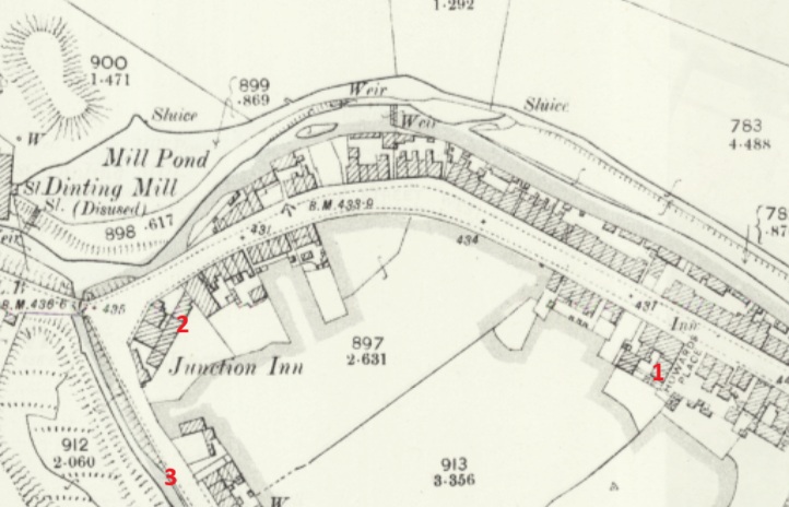
Apparently named after a Jerry Sykes (1779 – 1856) who built a number of houses in this area in the 1820’s.
And there we have it! The many towns of Glossop town. I can already feel several of you desperate to tell me that I’ve got something wrong, or that I’ve missed a ‘town’ out. Please feel free to do so. Honestly, please let me know if I’ve messed up – I’d rather the information was correct.
I do have pottery for next time, and I owe you a new Rough Guide To Pottery – Part 11 unless I’m mistaken, you lucky people, you.
In other news, I’m doing a guided walk at the end of the month… which should be amazing.
You can get tickets here – follow the link
Now that spring is coming I’m going to be walking the route of the Where/Whens so far published, and trying out some other new routes. Tickets for these will be available after the above walk has been done, and will be at the weekend, so everyone can take part – come and join us! Watch this space.
Talking of Where/When, No.5 has just been released.
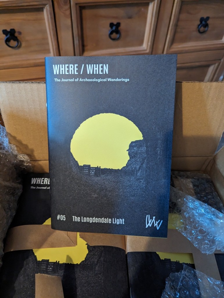
An exploration of the history and archaeology of the Longdendale Trail, from the start at Hadfield to the tunnel entrances. Honestly, there is so much to see.
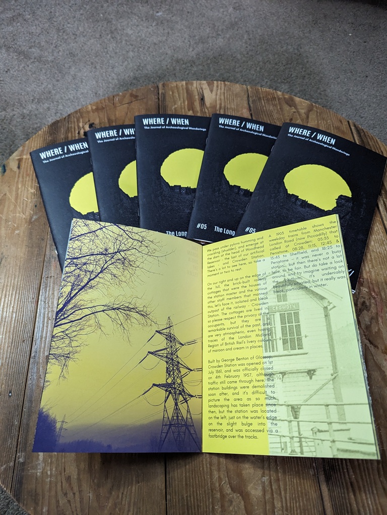
It’s available to buy from the usual places – Dark Peak Books, 96 High Street West, Glossop; the website’s store; or you can track me down and buy one.
I’m busy! Too busy, but it’s happening! I’ll post again soon, but until then, please look after yourselves, and each other, and I remain.
Your humble servant,
TCG

Finally, finally a list of place names where my ancestors were born, baptized and died in the 1700s and 1800s – their churches, their funky streets, their neighborhoods — all those numerous spots noted in parish registers and government registrations which I couldn’t identify. I confused. Thank you! Peggy in California
LikeLike