No, fear not, dear and gentle reader, I have not had some sort of ‘attack’, or a fit of the vapours, or conniptions, or a melancholic fever, nor indeed some form of ‘brain disorder’ resulting in a sharp dose of the ‘lah-lah-lahs’ (despite what some of you may think). I am tickety-boo; hunky dory; cock-a-hoop; and all is, in fact, distinctly oojah-cum-spiff… I am perfectly normal. Honestly, and all shall be revealed, so stick around.
What ho, wonderful folk, what ho! Spring is upon us: I have seen sweet blessed blossom on trees, and daffodils. Oh, daffodils! Now, if it can just stop raining for a minute or two, I might actually dance. But enough of this frivolity, let us look at some bench marks! Stop that moaning, you at the back… it’s unbecoming of a gentleman.
If you have spent any time on this website you will know that have covered Ordnance Survey bench marks before. Several times, in fact. And will also know that I love them with a passion. What on earth do you mean “obsessed” – I have an interest, that’s all. I can handle it. It’s not like I approach strangers and tell them all about benchmarks. Often. Well, not since the rather nasty court case and the restraining orders. Anyway, let’s move on. Swiftly.
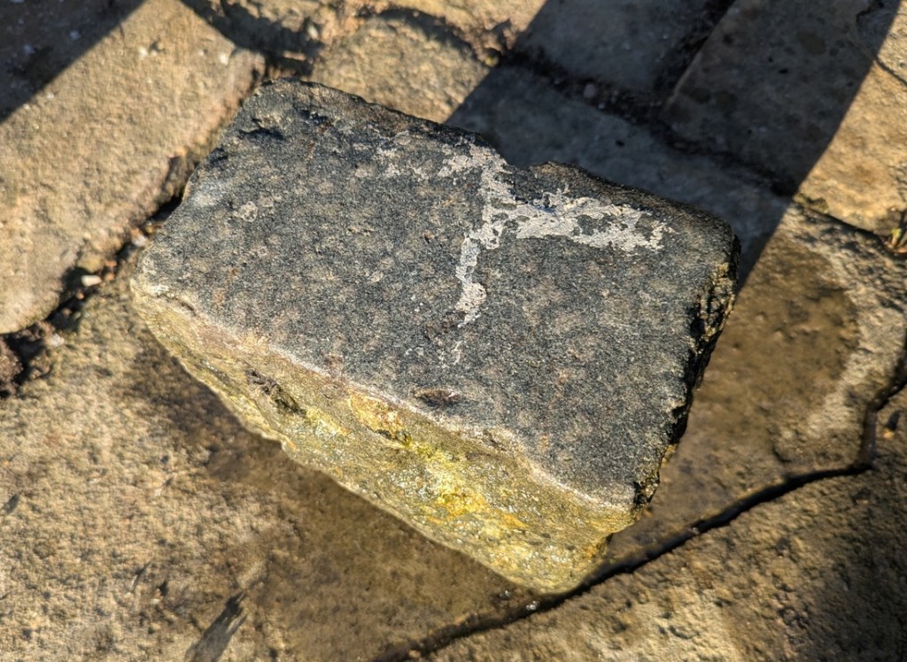
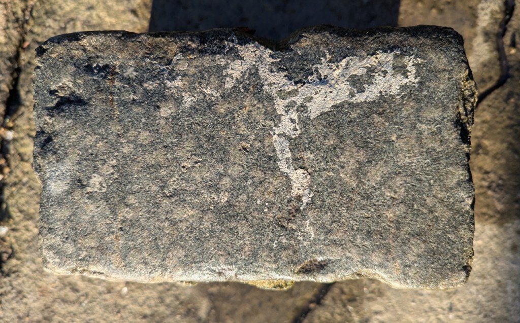
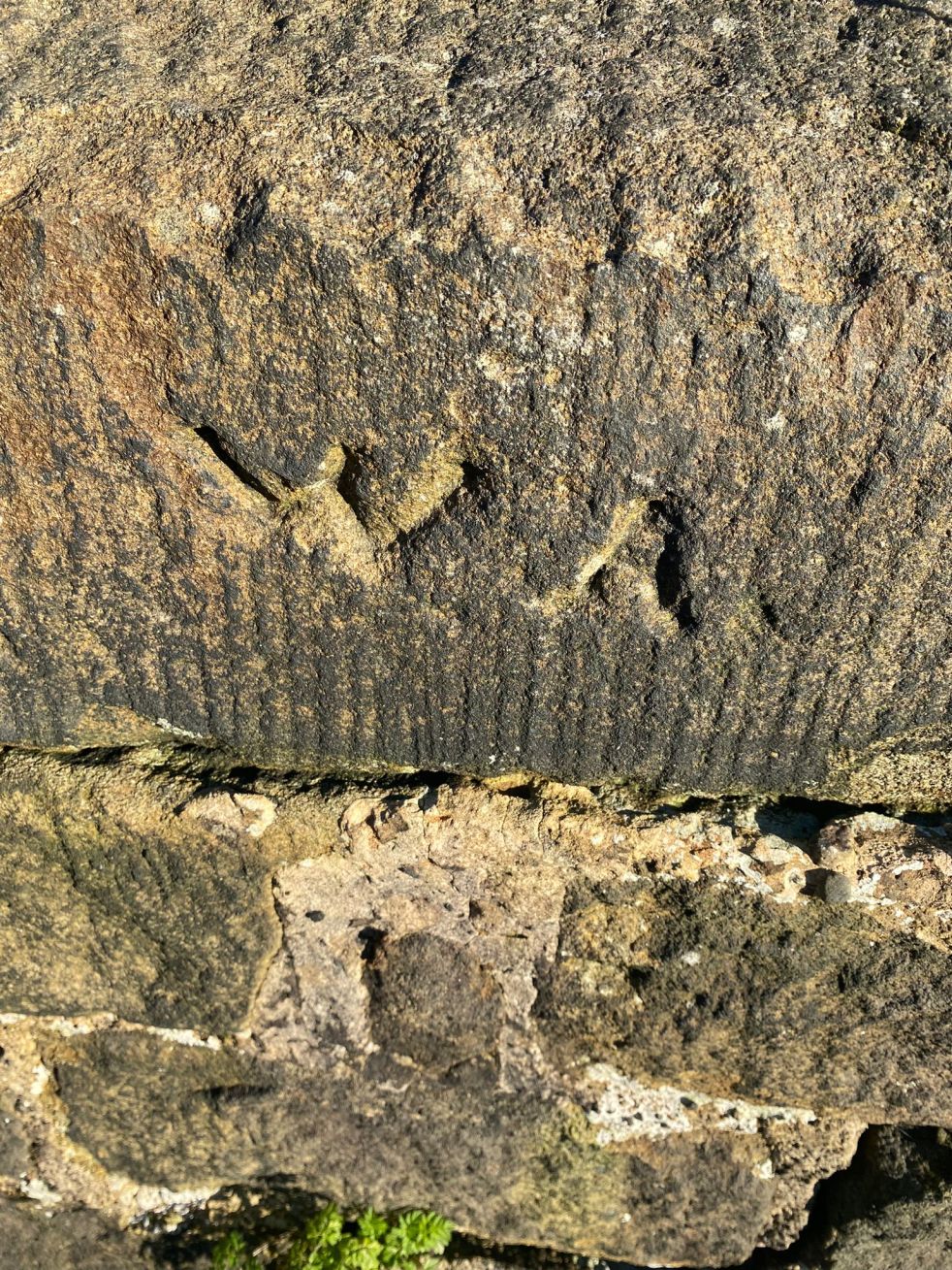
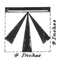
For those of you who don’t know (but dash it all, you should know), an Ordnance Survey benchmark is a mark carved onto a building or other immovable object that marks out a specific height above sea level. They are most often found as an arrow with a line above it:

They are the remains of the original, and subsequent, surveys made by the Ordnance Survey in the 1840, allowing engineers and surveyors to record the whole country by height and distance. A remarkable feat, when you think about it: with each mark being intervisible with another, they are a literal network of heights, which, whilst visible in plain sight, is nonetheless overlooked or simply not known about by 99% of the population. I first encountered them whilst working as an archaeologist in the Oxford area where we used them to provide a height for the sites we were working on – essentially using an old fashioned level and ranging rod, we leapfrogged from the benchmark on a church to our site about a mile away, as this was the nearest benchmark, and we were working in the middle of nowhere! Benchmarks are marked on older OS maps, and they are found in their hundreds of thousands all over the country.
The system is no longer maintained, sadly, and they are falling into disrepair, but are much loved by nerds such as myself, who become, against their better judgement – and ignoring vague threats of divorce – Benchmark Baggers.
Now, occasionally, mistakes happen. The Ordnance Survey is very – painfully – good at what it does, but the people it serves – us – are not. Benchmarks go missing, or are moved, and sometimes too they are marked on buildings, but seem to have not been marked on maps. That is what this post is about – the anomalies and the oddities, not so much a benchmark… more a menchbark.
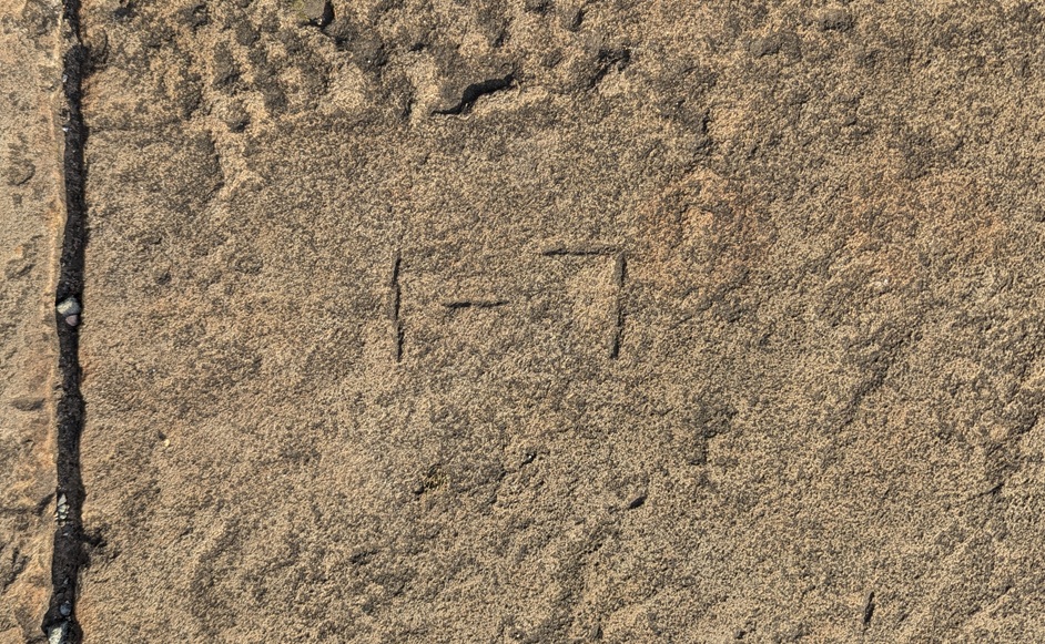
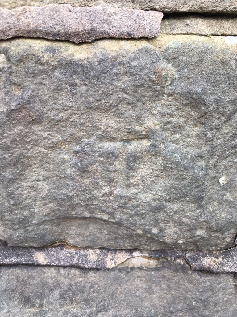
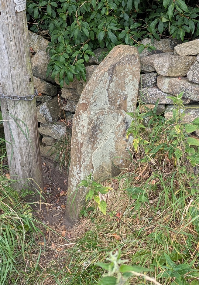
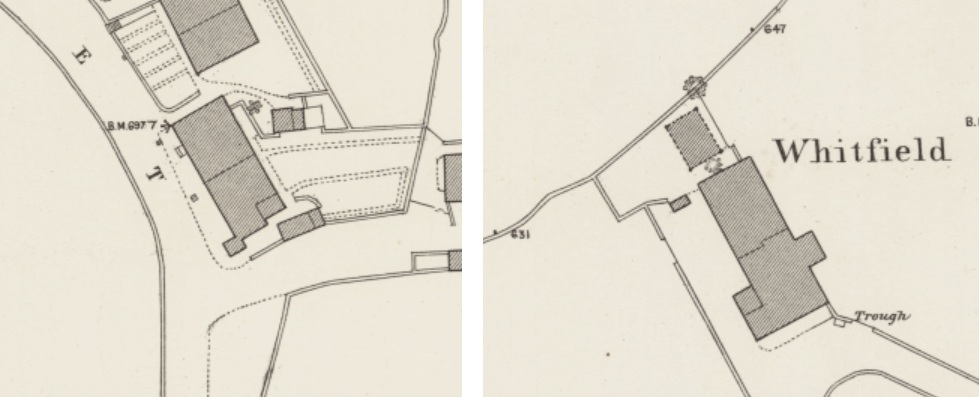
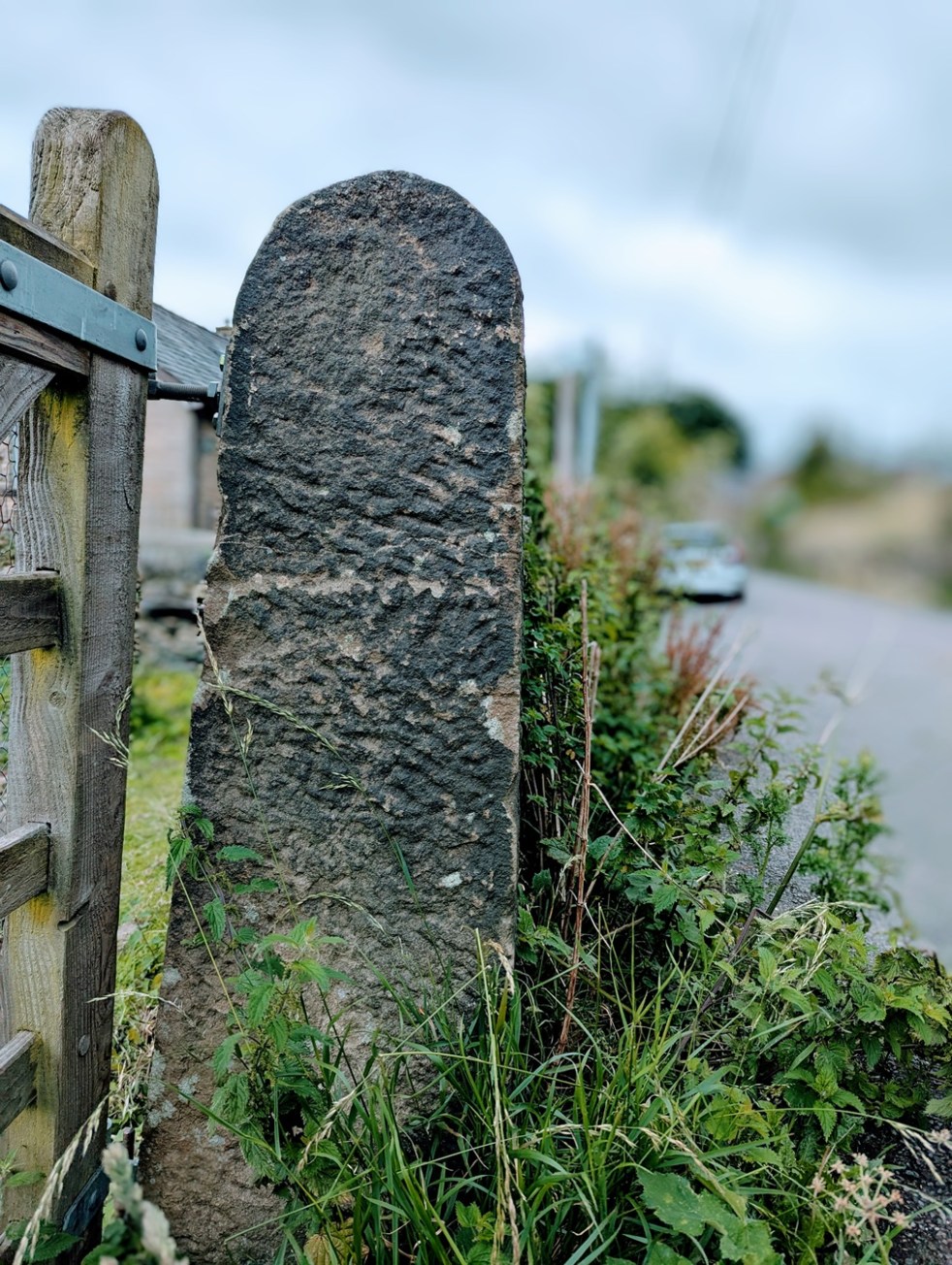
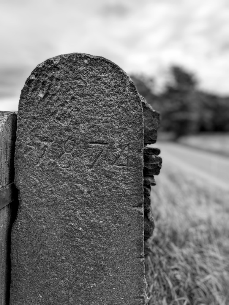
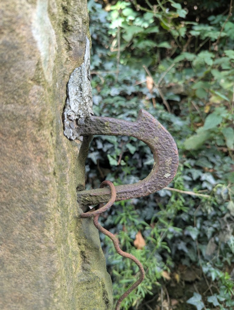
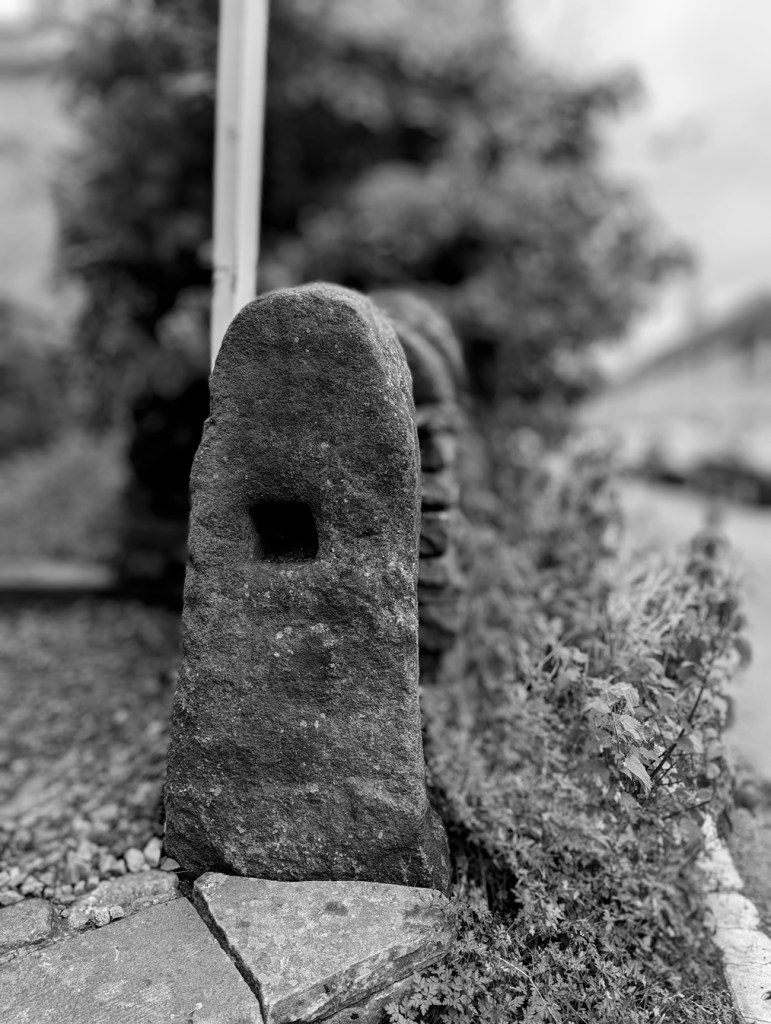
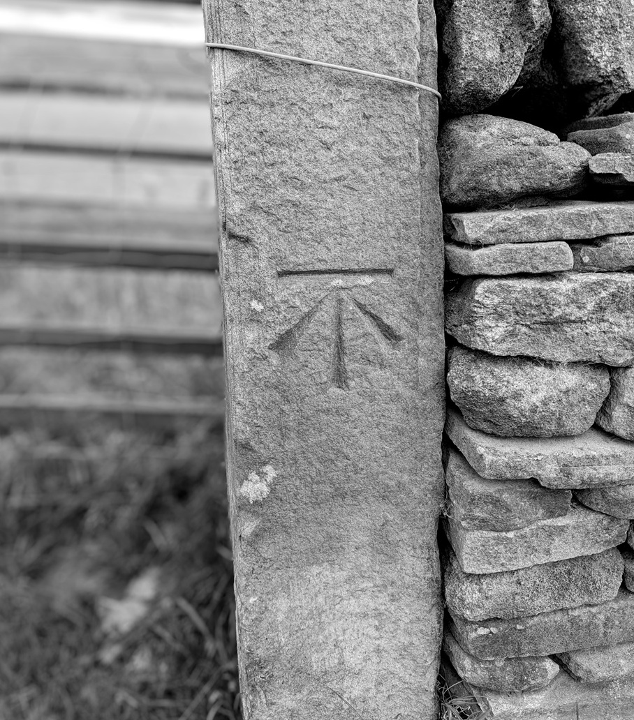
We start with Fieldhead Farm, Whitfield. The farm building itself has a benchmark, but nearby is a gatepost with a clearly carved benchmark on it; proudly stating the height above sea level of… we don’t know! It’s here on the map:
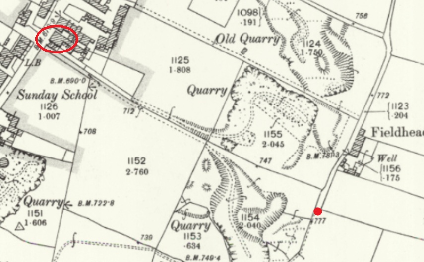
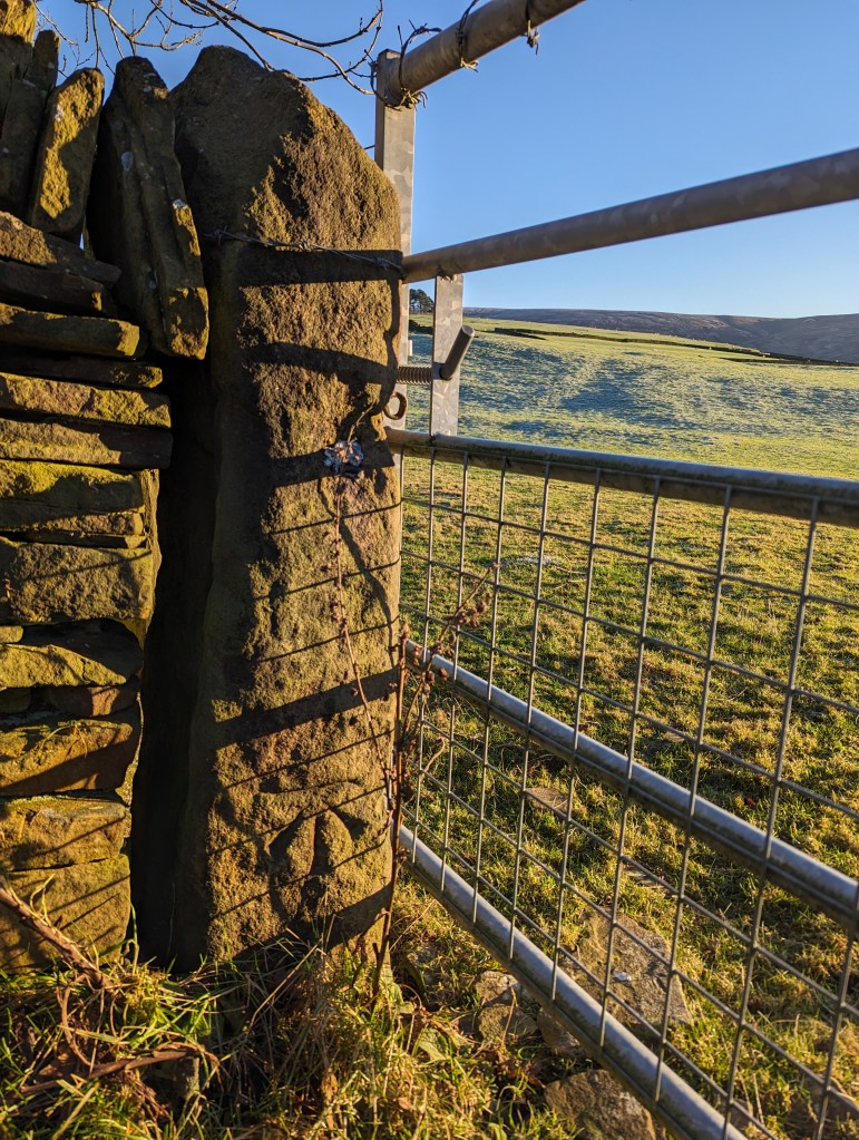
There’s the mark, but the OS have never marked it on any map I’ve ever seen. And I don’t believe it has been moved from anywhere, either – that’s a solid piece of gatepost! Interestingly, it does replace a smaller square-holed medieval/post-medieval post. This is a very curious part of Whitfield that has a greater history than we currently understand – even the name ‘Fieldhead’ may suggest medieval origins.
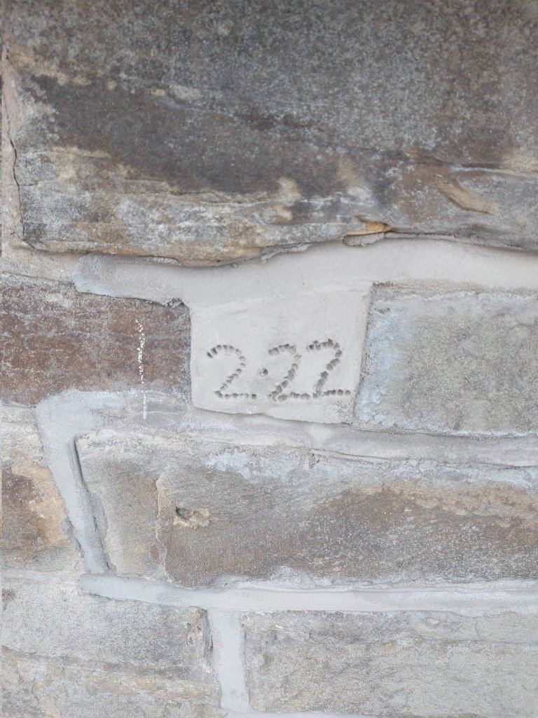
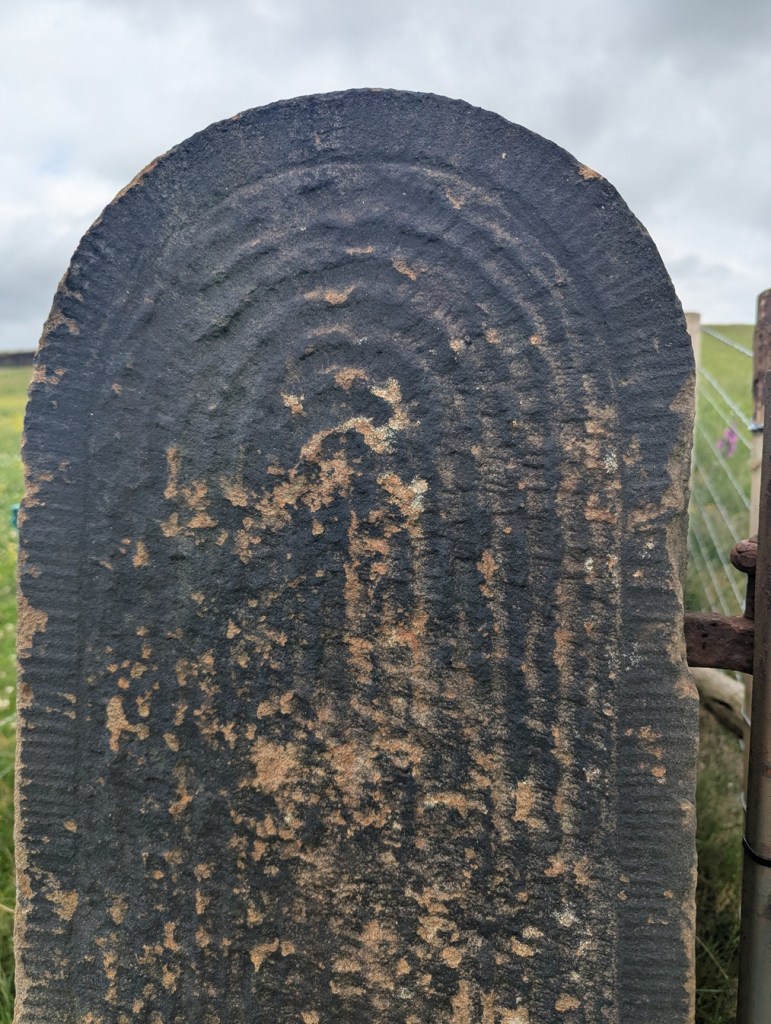
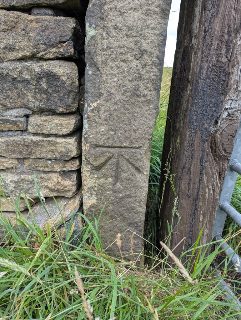
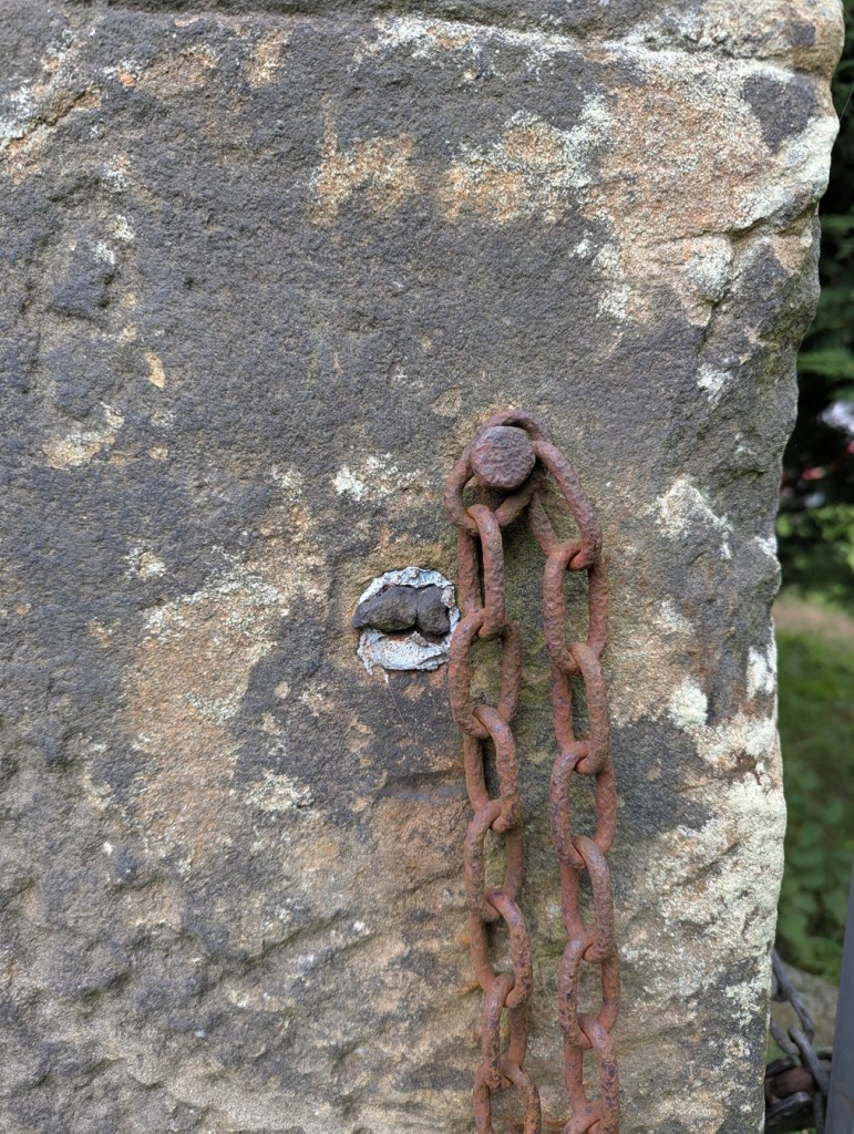
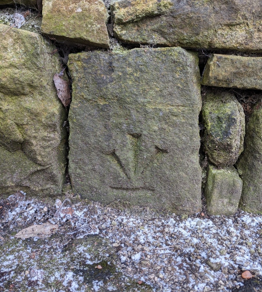
Nearby, on Derbyshire Level is this lovely example:
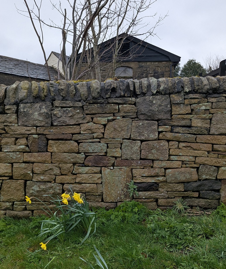
This one was originally in the wall of the garden of Lane Ends Farm, Derbyshire Level. It still is in the wall, but the wall has been rebuilt fairly recently, and whilst it originally marked a height of exactly 705ft above sea level, and has been replaced in roughly the same place (amazing work, whoever did that), Jove alone knows what it marks now!
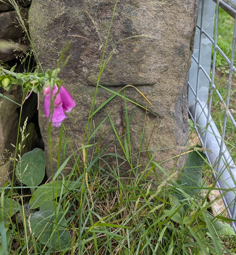
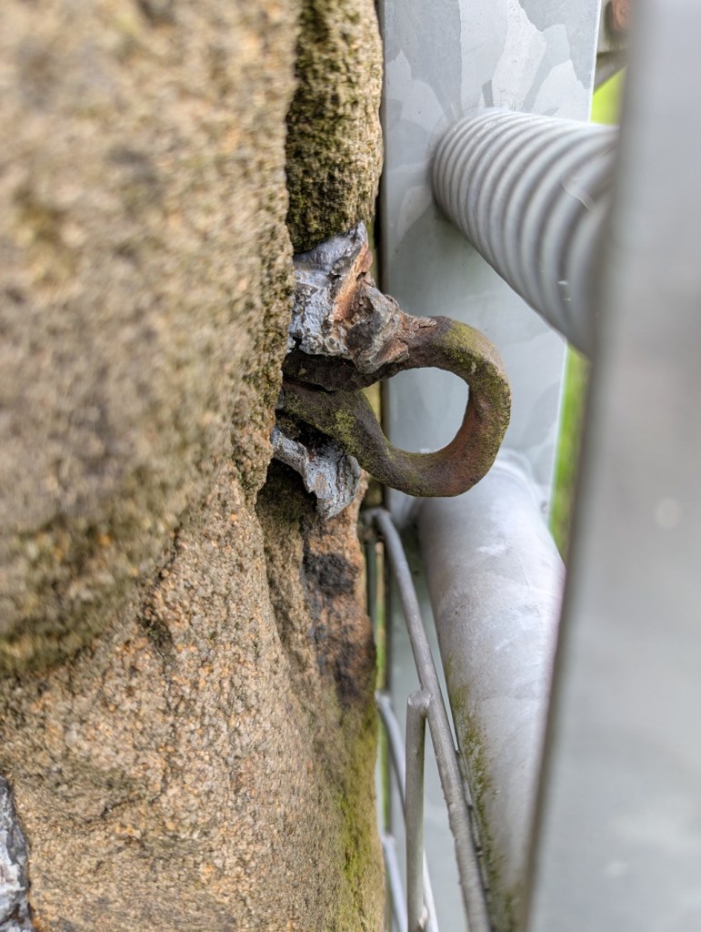
However, at least the people who rebuilt the wall understood that the benchmark had a purpose… and a right way up. Whoever rebuilt this wall in Hadfield – under the disused railway just by the start of the Longdendale Trail – had no idea what to do with it, so the benchmark was replaced upside down:
I mean to say… given that benchmarks for me represent an unmoving, permanent and fixed, point in a chaotic world (and mind), the sight of this inverted mark is literally turning my world upside down… and quite frankly gives me the heebie-jeebies.
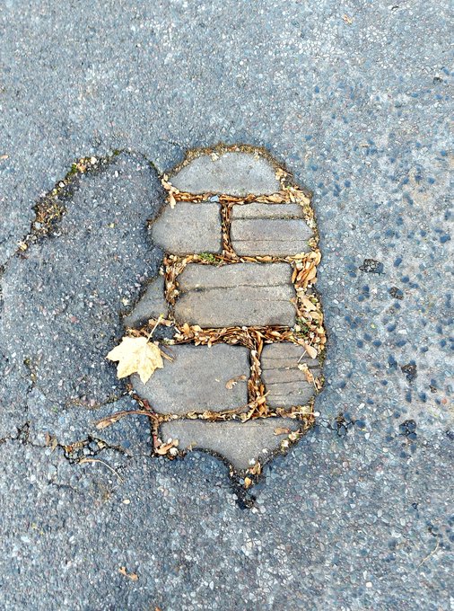
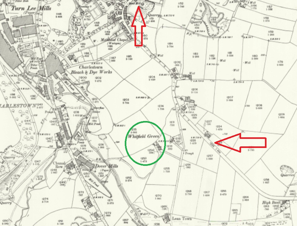
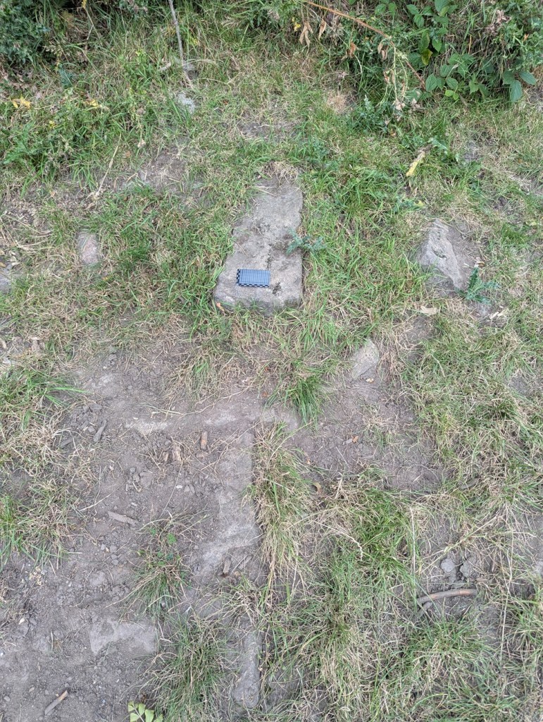
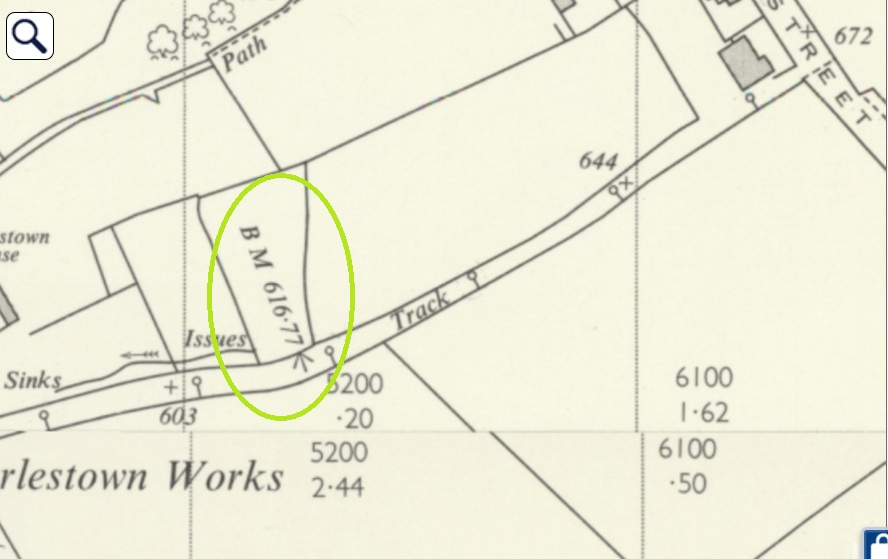
Here, on the southernmost of a pair of paths between Hague Street and Charlestown Road (and discussed in this article), we see that sometimes the mark is moved, probably due to some form of destruction or movement. So in 1898, the mark is on an object to the south of the path (a gatepost that is no longer visible, perhaps):
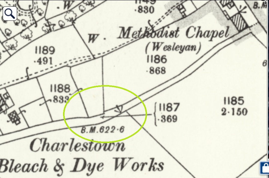
At some stage, the mark is rendered useless, and by 1968 it’s moved to the north side, and carved onto a gatepost, itself no longer used:
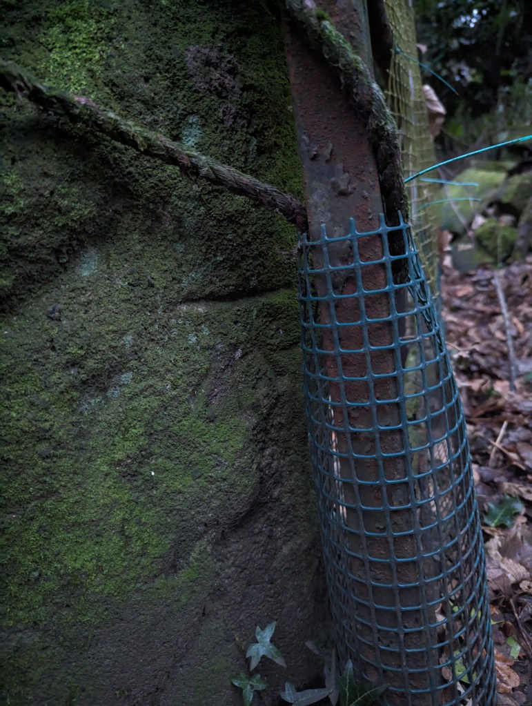
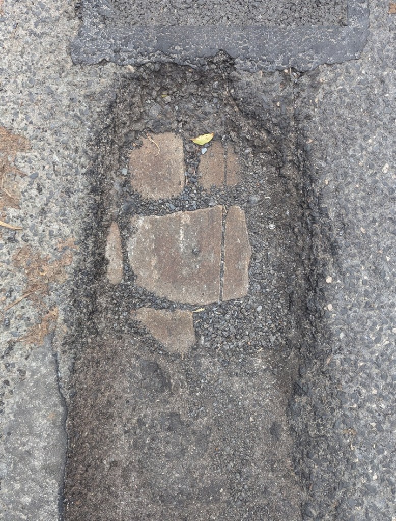
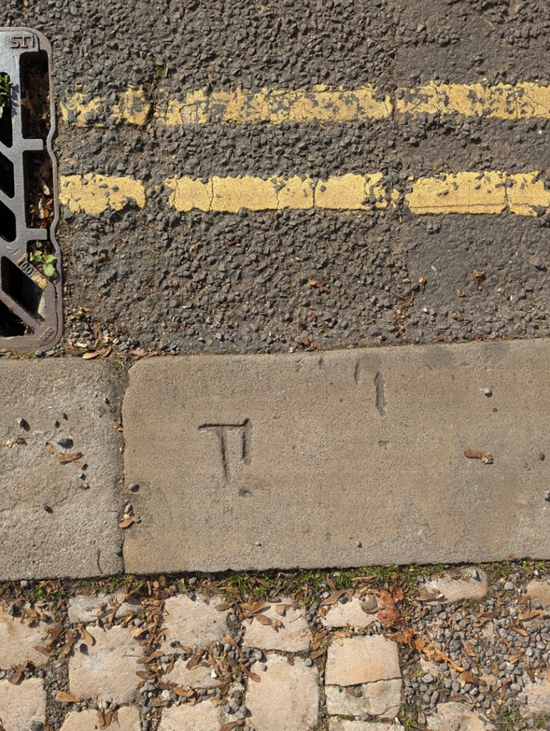
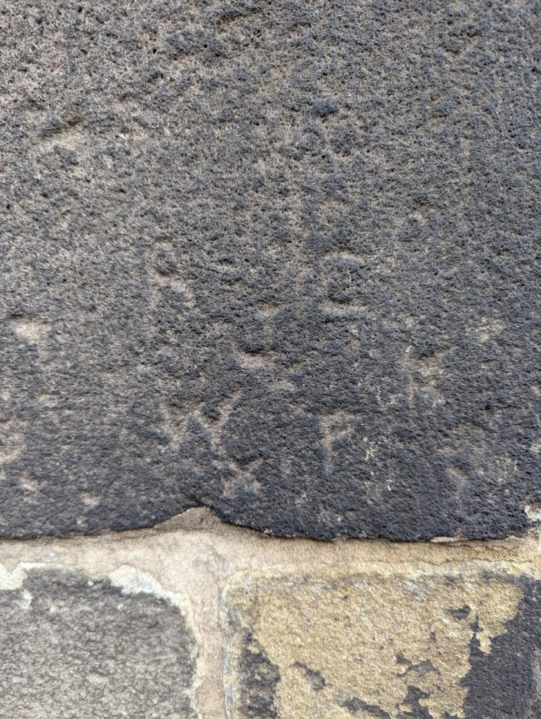
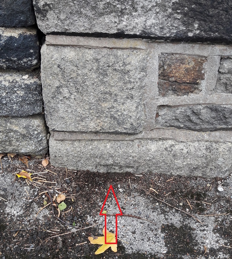
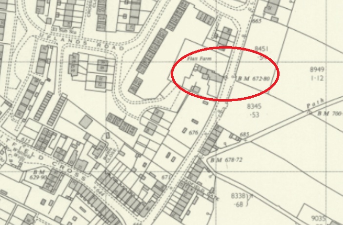
Next up, we have Flatt Farm, on Cliffe Road, Whitfield. The original benchmark is here:
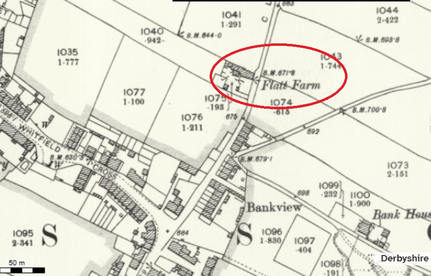
To the left of the building’s gable end. It is ridiculously low to the ground, with only the flat top showing – the result of the ground level having risen about 1ft.
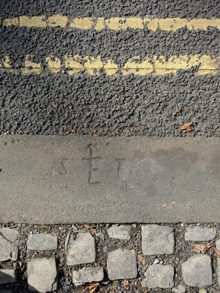
As a result, a later benchmark was cut into the right-hand side of the gable end:
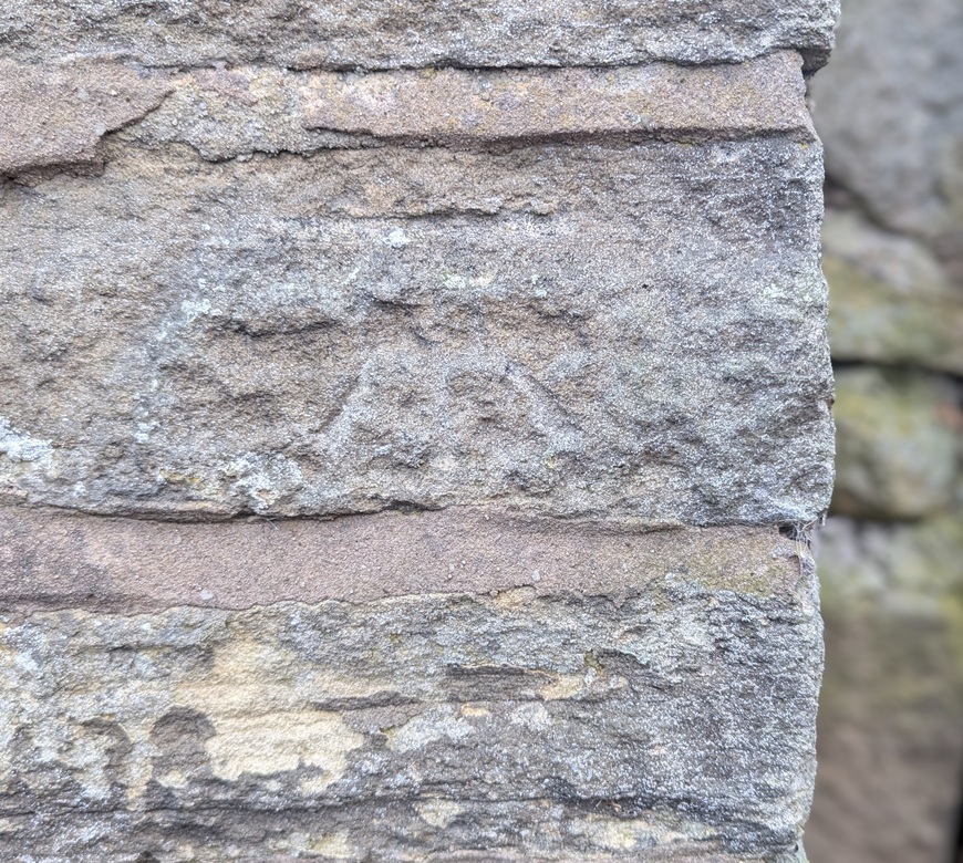
The ‘new’ carving was poor by comparison, and has faded quickly, a symptom, perhaps; by 1969, the whole system was falling into disuse, and benchmarks no longer were marked on OS maps as a general rule. Sad, but there you go. Of course, now we don’t use them at all due to GPS, etc. But I honestly think there is something grounding and wonderful about them.
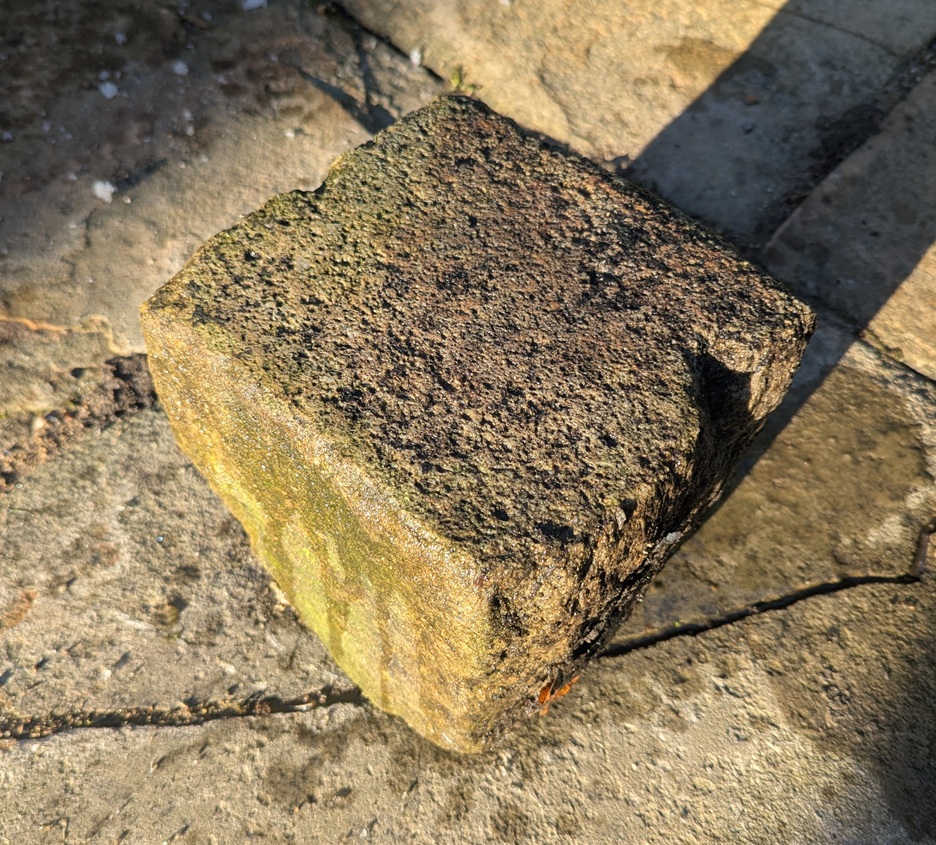
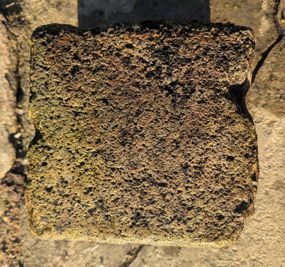
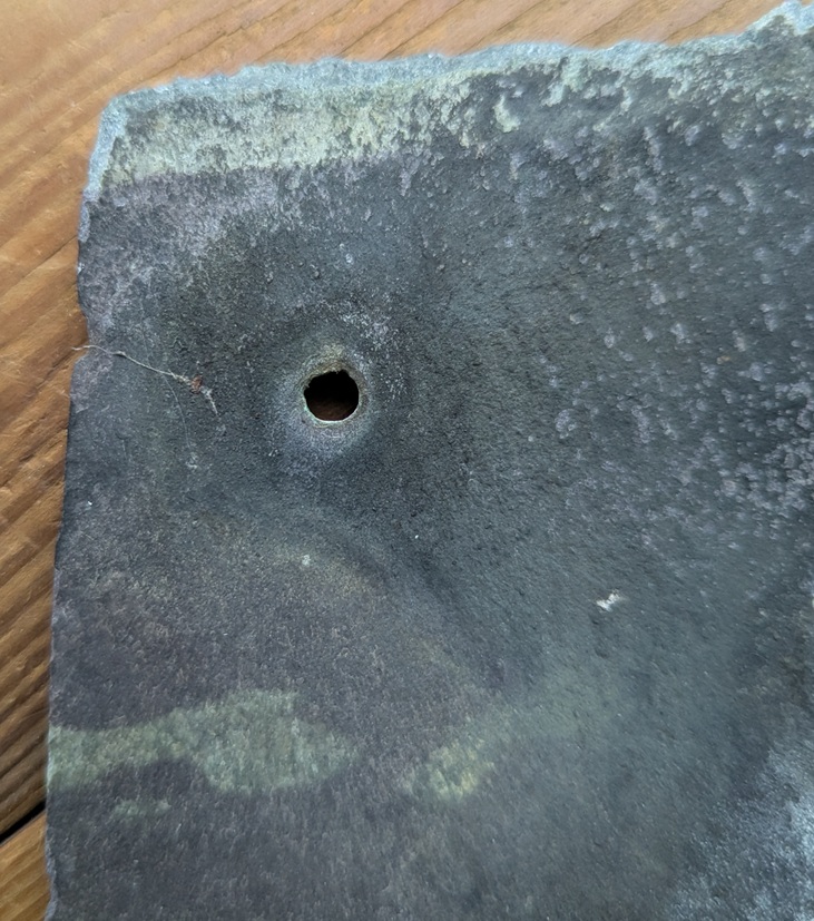
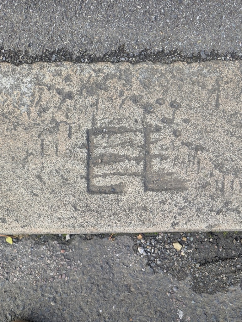
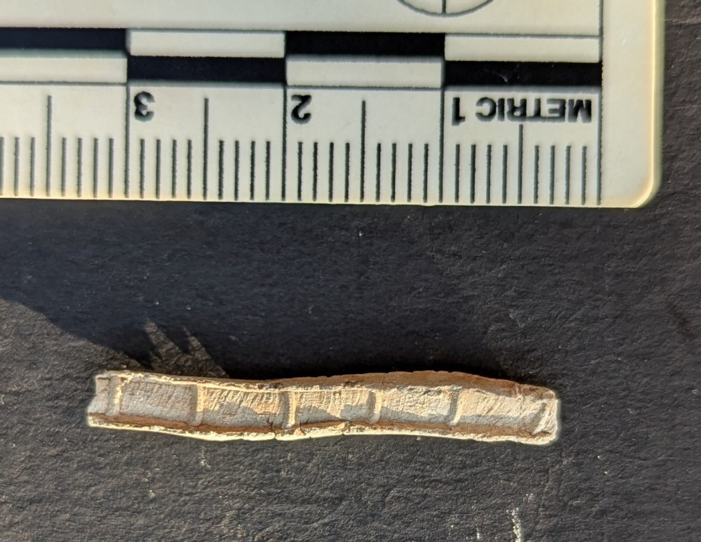
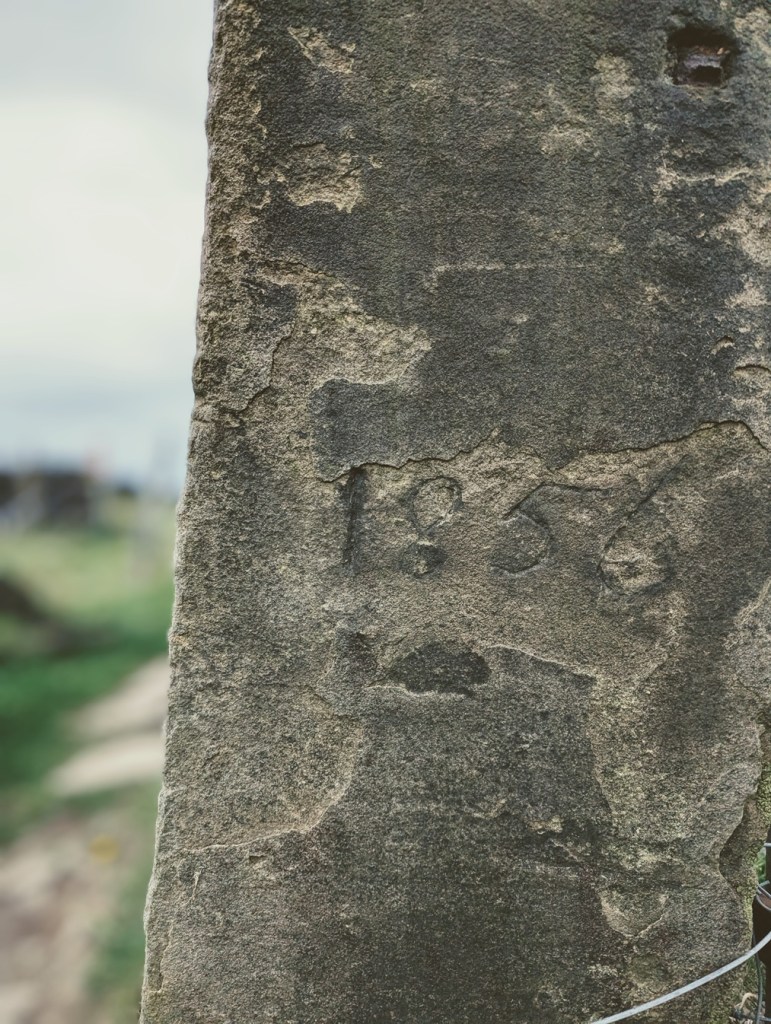
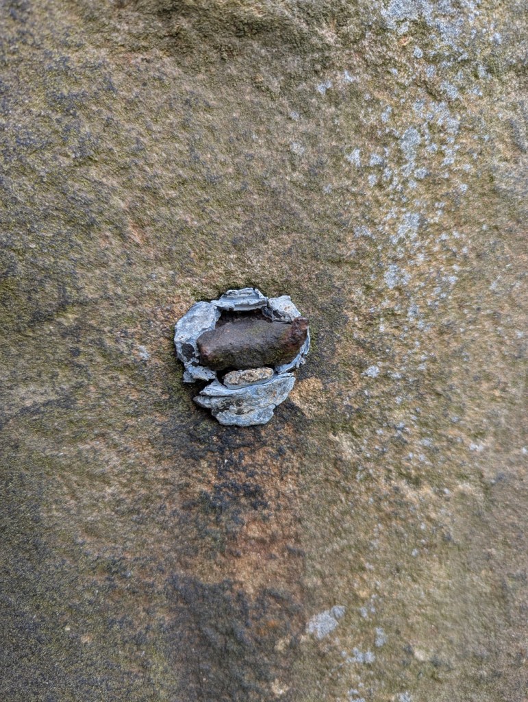
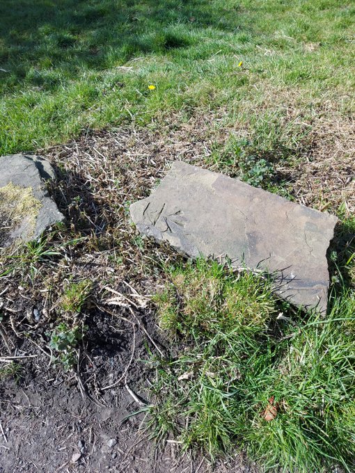
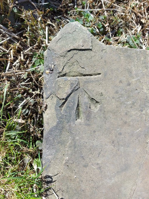
Anyway, whilst researching the latest Where/When (No.9), I discovered this wonderful specimen: potentially an abandoned attempt at a benchmark:
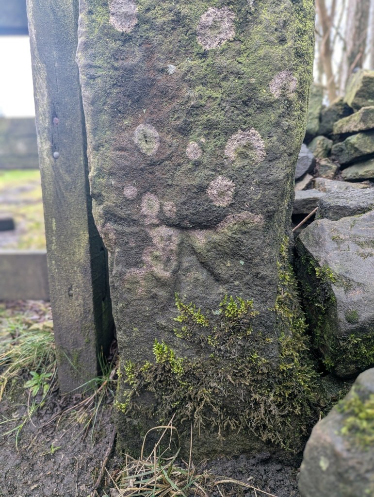
It’s at the right height – 1ft off the ground – and on the right sort of immovable object – a gatepost -and it would be in a perfect place for one, but it seems that during the carving process, a mistake was made – the stone may have crumbled, or a careless stroke was made, and the whole was abandoned. I might be wrong, of course, but that is what it looks like to me. You can have a look yourselves, here:
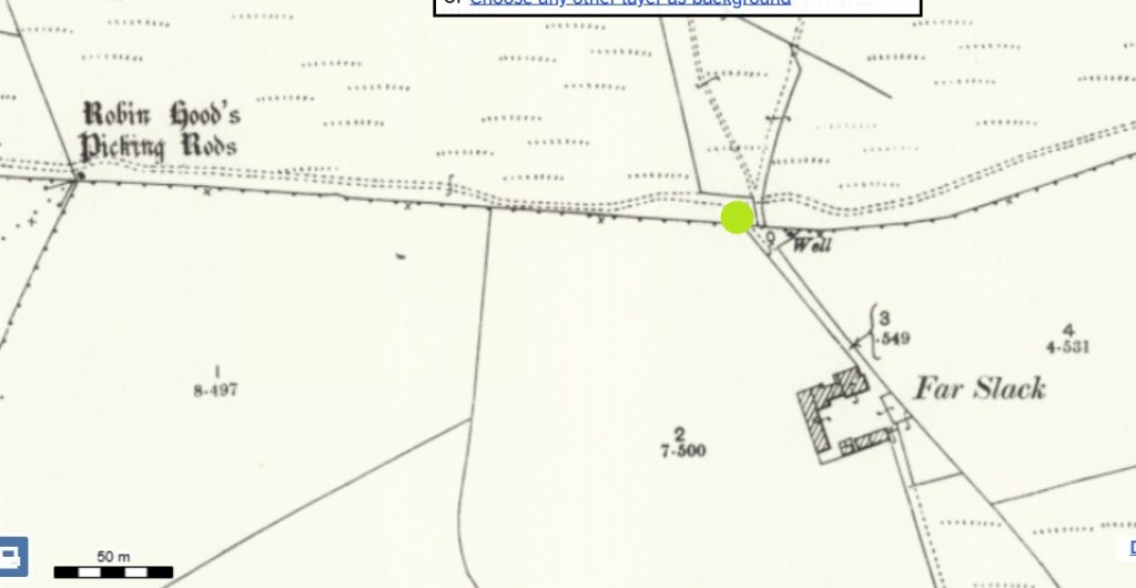
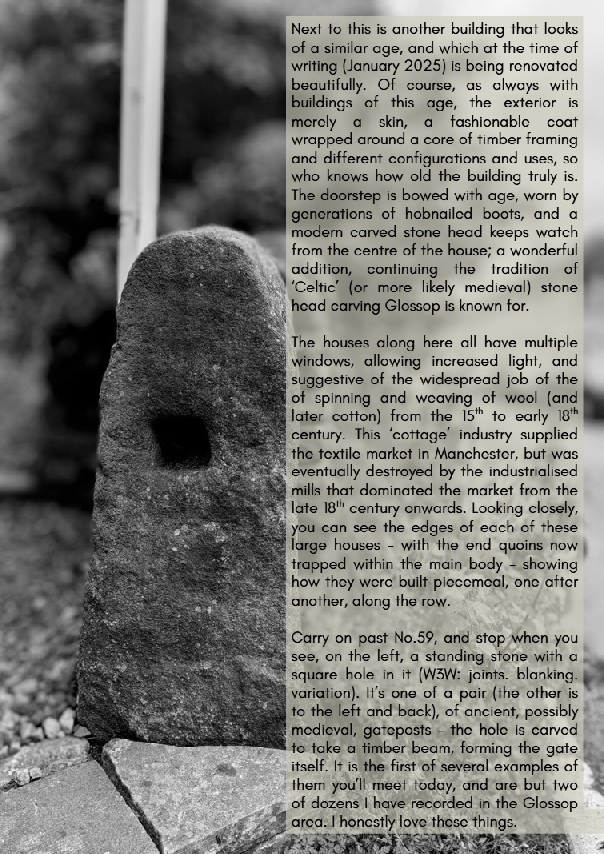
Facing the track to Far Slack farm, it’s the left hand gatepost (alos, right next to a rather spiffing holed gatepost, now lying on it’s side). The mark is also right by Robin Hood’s Picking Rods – a pair of 10th Century Anglo-Saxon Stone Cross shafts, and coincidentally, the stars of the latest Where/When – see below. Definitely worth checking out.
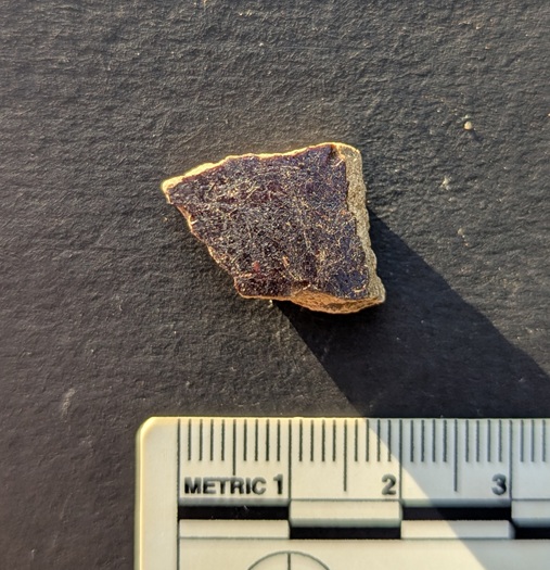
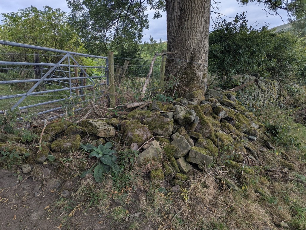
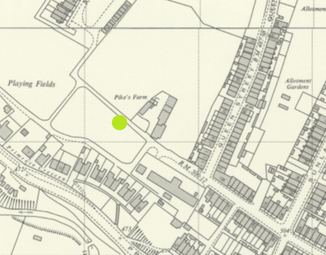
We’ll end on that most rare thing… a feral benchmark. Escaped from who knows where, it lurks, in a recumbent posture, and mocking all attempts at identification, just by Pikes Farm at the end of Pikes Lane. It’s been dumped from somewhere… but Jove knows where!
It was once on an upright gatepost, but is made from a non-local stone, so may have been brought from a distance. I contacted the OS, and they have no knowledge. A welcome visitor in our town, found here:
So there we go… interesting stuff. Well I like it, and I hope some of you like it too. Not you, Mr Shouty-Outy, we know, not you.
If you’re interested in benchmark bagging, I have recently begun using a phone app called TrigFindAR to help me find them. It has an almost complete map and database of benchmarks across the whole country, and allows you to tick them off as you find them (make them go from red to green) and to get onto the database kept at bench-marks.org.uk and look at that particular benchmark. I’m not sponsored – sadly – but it is truly a superb bit of kit, and is totally free; I cannot recommend it enough for you geeky types out there.
Elsewhere, the new edition of Where/When is out!
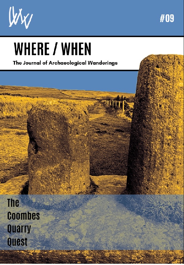
It’s an exploration of Cown Edge, Coombes Edge, medieval, prehistoric, and Roman archaeology, and a journey from The Beehive (Whitfield) to The Hare and Hounds (Simmondley). Essentially a guided walk around some really cool old stuff that starts and ends at a pub… what’s not to love. Think of it as a paper form of this website, but involving footpaths and loads to explore.
Available for £6.50 from the Where/When link above, or through the amazing Dark Peak Books and Gifts on High Street West, Glossop. Or just stop me and buy one!
Right, I’m off. I’m tired, grumpy, and am due a glass of the stuff that cheers any moment now. More soon, I promise, but until then, look after yourselves and each other. Please. We are all important, even if we don’t feel it sometimes. And until the next time, I remain.
Your humble servant,
TCG