I do love a good bit of alliteration.
What ho! What ho! What ho! Here is another post, as promised. This one is something of a hash, with multiple elements sharing the theme of Freetown (the road in Whitfield, not the capital of Sierra Leone, just in case you are here by mistake), and all presented in the style of a thriller novel. Enjoy.
The House(s) of Horror
I was perusing my namesake’s History of Glossop the other day, and came across this:
Freetown is really part of Hollincross Road (now Lane); it was called Freetown on account of the land being mostly freehold. The oldest house is no 28 built in 1809 and long owned and occupied by Robert Bennett. The chief rent was sold 29th June 1891 to Mrs. Wood for £52 who also bought the chief rents of the Unity Street property. No 28 was sold 16th January 1893 to Ald B. Furniss for £445, it has an outdoor licence attached to it.
The late Mrs. Sarah Hargreaves of Hadfield Street, remembered Freetown when this house was the only house in the road. On each side were hedges right down to Pikes Farm. The next houses to be built were Nos. 36 and 36a, in 1830 by Peter Handford, better known as “Peter before the Shower.” Many houses were built in 1835 and 1836 but the majority now existing were built during the last 60 years.
I live just by Freetown, and as I walk up and down it at least 8 times a week dropping off and picking up Master Hamnett from school, I have become very familiar with it.
It really is quite an interesting place; 1860’s housing cheek by jowl with 1960’s housing, and where widespread ‘remodelling’ in the 1960’s destroyed the homogeneity of the Victorian stone built heart of Whitfield. A shame really. I have mentioned bits around Freetown before (here, for example), and I’d really like to do a longer piece, particularly on Whitfield recreation ground (the park), but for now, I’ll keep this brief(ish)!
Anyway, the article got me wondering… and wandering. Are these old houses still in existence, and what else is interesting here in the Freetown area.
Well, the first part of the question was easily answered.
No.
The council pulled them down in the 1960’s. With no thought to heritage or the past in any form. I am constantly amazed and appalled at the shortsightedness of councils in the 1960’s – no effort was made to preserve, only to destroy and rebuild in a ‘better’ way. This thinking has had so many effects in the present day, not least of which is the destruction of close-knit multi-generational communities in Manchester in the name of ‘slum clearances’. I can angrily rant and rave about this all day, so I’ll move on.
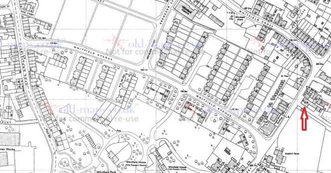
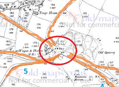
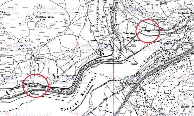
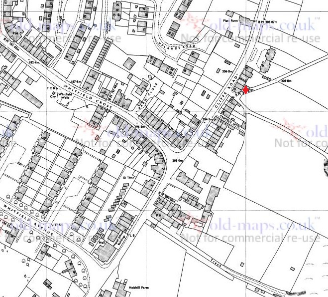
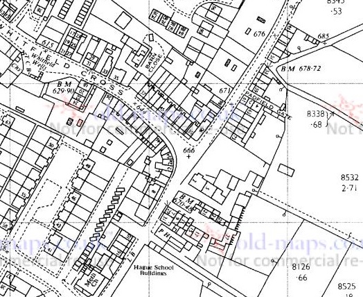
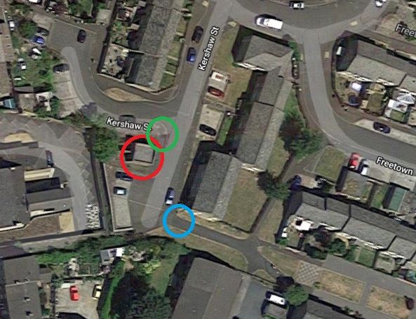
Number 28 is marked in red, 36 and 36a is marked in green. Ignore the blue arrow for now… we shall return to it.
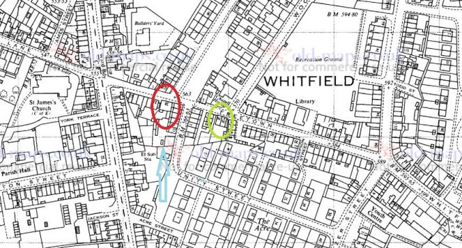
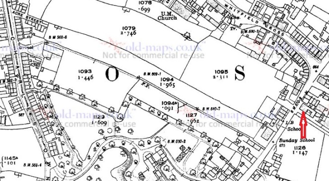
What is interesting is that the roads Wood Street and Kershaw Street seem to have been aimed at them, almost as though the town planners were using these early buildings as reference points – which they almost certainly were. Kershaw Street (begun in 1834) runs from Bank Street to Number 28, and Wood Street (in 1913 was still under construction, though there as a track prior to that) runs from the opening toward St Mary’s School (and the allotments) off Gladstone Street to Number 36 and 36a. Here are the buildings in 1880, in much better focus.
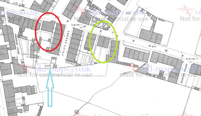
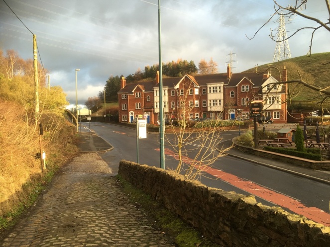
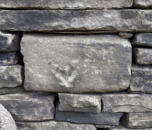
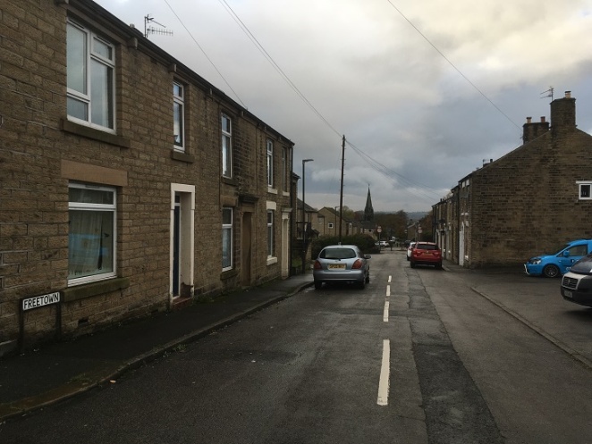
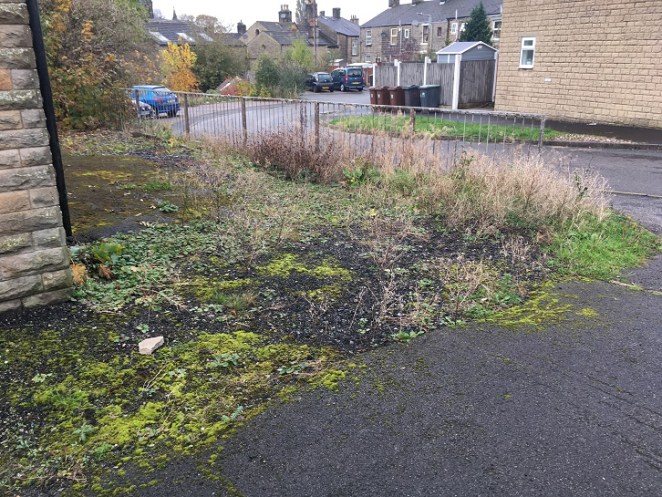
28 (red circle) seems to have been a large, oddly shaped, affair, and probably quite Georgian looking, with a central doorway and large windows. Actually, I’m amazed no photographs exist of 28 prior to its demolition – I should peruse the Glossop Heritage Trust archive for some – you never know what might be lurking. Here is what it looks like now:

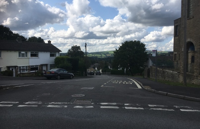
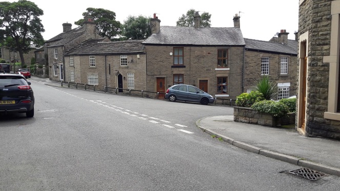
Number 28 would have occupied some of the same space as the building there now, and to the right, but would also have come up to the edge of the path, where the grass is. It’s nice to know that at least some of the footings and foundations will be preserved below ground, and it makes you wonder at the sort of pottery and bits that lurk in the garden there… Given how busy Freetown and area is, and how many houses are here, it’s hard to picture what it would have been like as Sarah Hargreaves remembered it, with this being the only house from here to Pikes Farm – amazing.
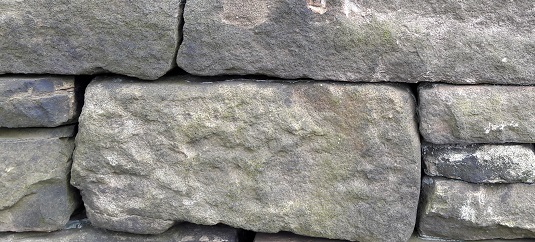
Numbers 36 and 36a (in green) were semi-detached (well, terraced) stone built affairs, probably very similar in design and style to many of the other houses built around the same time in the area. I love the nickname given to the builder, Peter Handford – ‘Peter Before The Shower’ – what on earth could it mean? Any thoughts, anyone?
Anyway, here is what is there now:
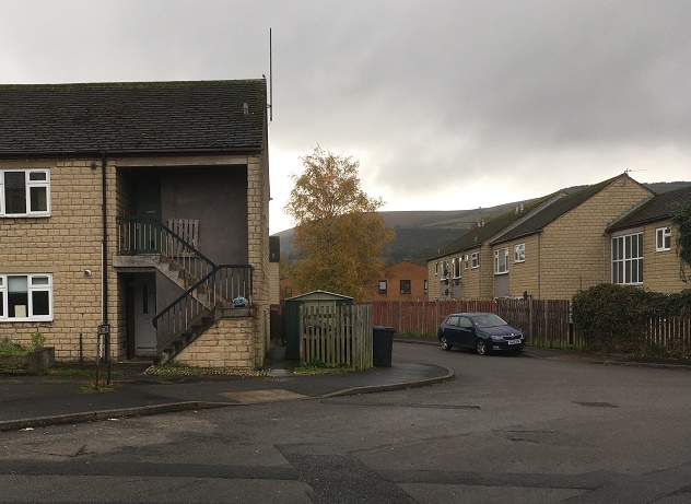
Numbers 36 and 36a stood broadly where the right side of the current building is, the shed, and out into the road – in a sense, the centre of the photograph.
So there we have it… a loss of history, sadly. I wonder if the people who live there now know what they are living on (if you are reading this, can I have a poke around your garden?).
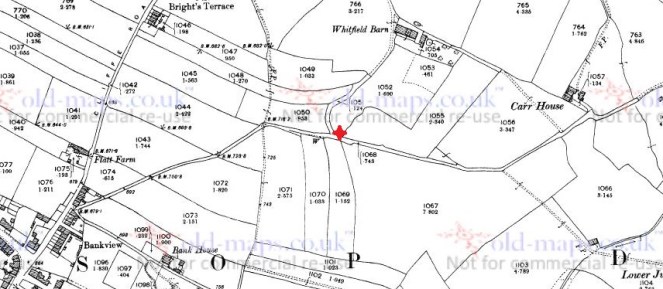
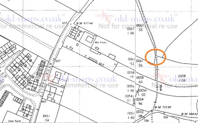
The next three parts of this post are all based around this small area, so we’ll skip to an aerial photograph of the place, with each area marked in coloured circles. All will become clear in a moment, don’t worry!
The Blue Arrow
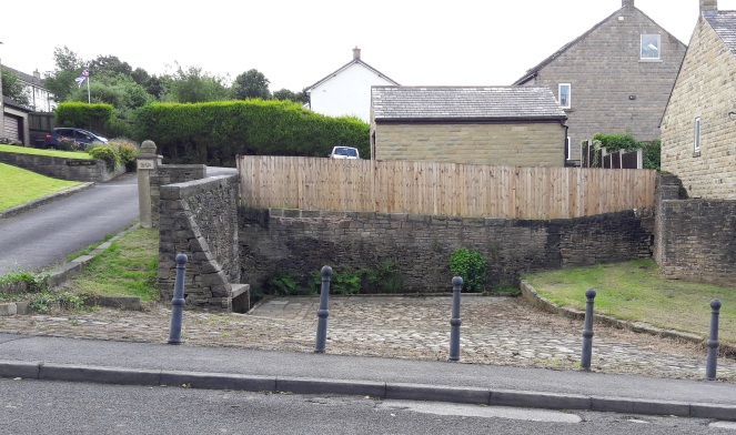
So, that blue arrow! whilst I was sorting that lot out, and doing some map work, I came across mention of a well (check out the blue arrows in the above maps, you can see it). A well would have been important to the people of Whitfield, as they always had issues with the water supply in the area (this is a whole other blog post, we’ll save it for another day). The word ‘well’ implies a reliable water source, and importantly, some form of structure associated with it – even if only a trough. Indeed the 1880 1:500 map (above) shows just such a structure, with the well placed against what seems to be a wall. I had high hopes of finding something.
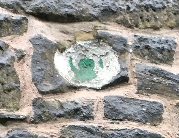
Alas, ’twas not to be. There is quite literally nothing even remotely old about any of the area where the well once stood – it has all been remodelled. Here is the location of the well as marked on the map:
I would think it would be difficult to destroy a well completely – it is flowing water after all, and if you stop it up, it will just bubble elsewhere. This, coupled with the fact that it is not marked on any map past 1880 suggests that it might have simply dried up. Oh well.
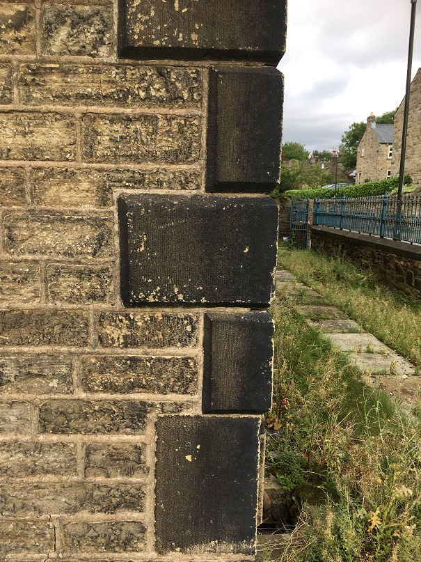
The Electrifying Edifice
So, right next to the well location (and circled in red) is this:
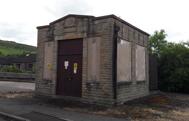
A vaguely classical temple looking electricity substation, sitting seemingly on its own in the wilderness of this part of Kershaw Street – it’s all a bit spooky, and I have the sneaking suspicion that the ‘Danger of Death’ notices refer not to the electricity, but something that lives inside it. It’s probably 1920’s or 1930’s in date, and clearly supplied power to the area, and indeed still does, quite remarkably surviving the 1960’s demolition. Above the doorway is a lintel with the letters ‘SHMD’ carved into it – a sure sign of its age, as it would just be a plastic sign now.
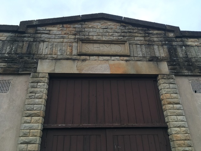
A brief search on the internet reveals that it refers to the “Stalybridge, Hyde, Mossley & Dukinfield Tramways & Electricity Board”. They have an interesting history in this area (which you can read about here and here), but briefly they were founded in 1901, supplied electricity to the named places (and Glossop), as well as running bus services and trams, and eventually became part of Norweb in 1948. So there you go.
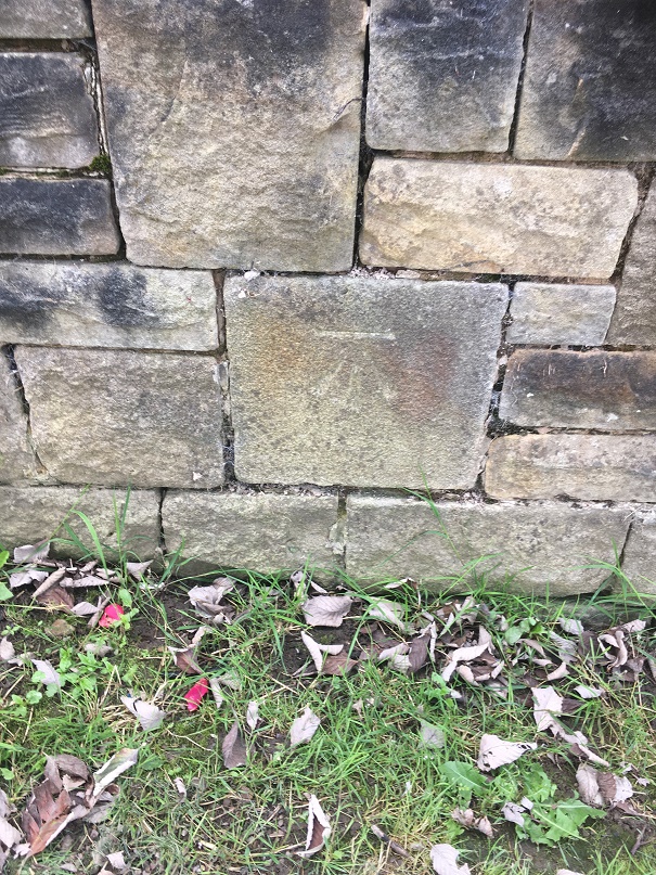
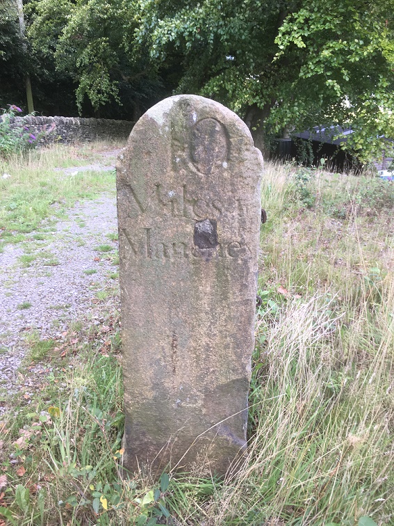
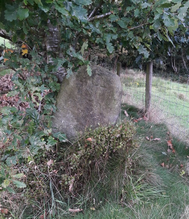
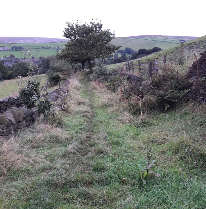
The Mystery of The Disappearing Gatepost
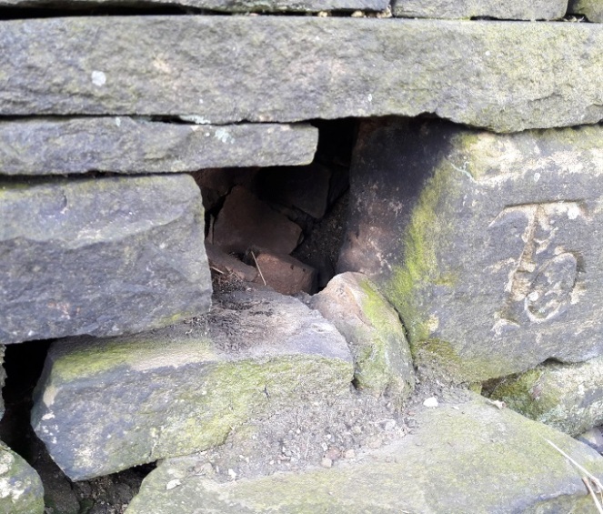
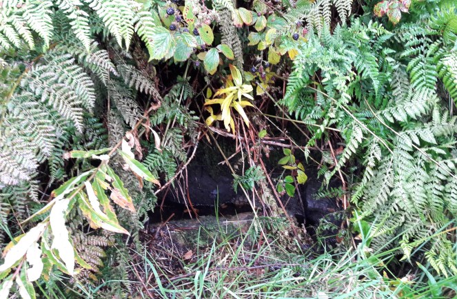
As I was navigating the streets via Google maps, trying to work out where the well was, I spotted something interesting at the very bottom of the continuation of Kershaw Street, at the left hand (easterly) turn along a pedestrianised track (circled in blue in the above aerial photograph).
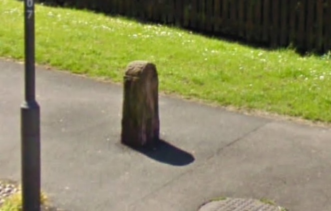
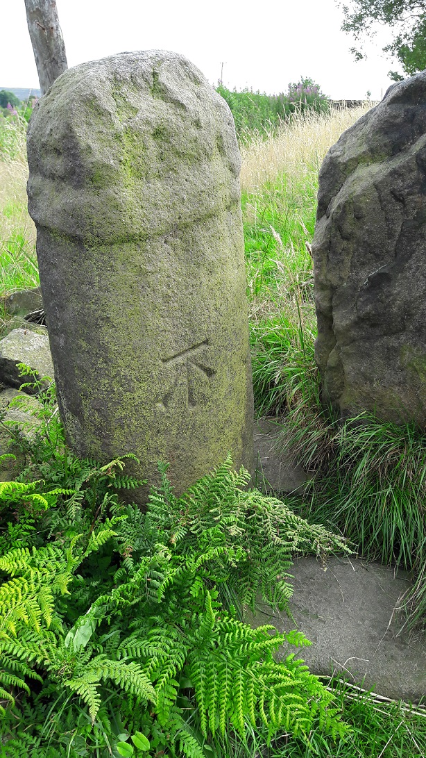
It looked to me like a very out of place gatepost, reused as a bollard to prevent ne’er-do-wells riding motorbikes and cars along the pedestrianised bit. You can even make out the carved shoulders, making it reminiscent of a milestone (and here). It is certainly jarring against the 1960’s concrete that is used in this area. Interesting, thought I.
So off I popped to have a look.
Nope. Nothing. Just a tarmacked hole in the ground where once it stood.
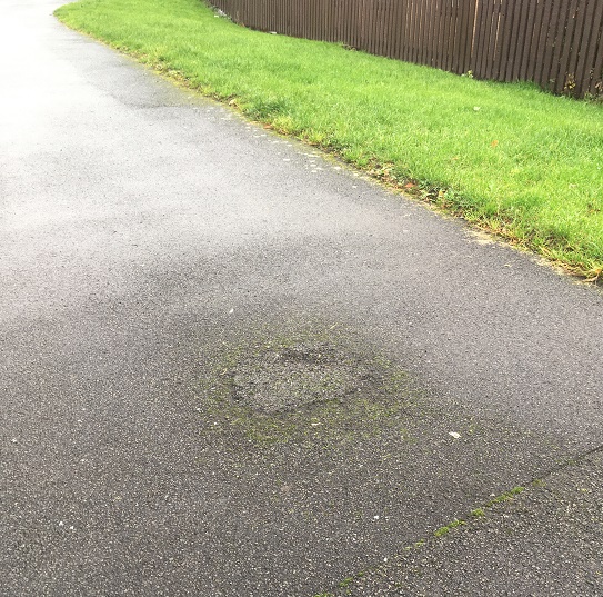
I had a look around in hedgebacks and ditches, but found nothing. Something has happened to it since May 2009 when the Google streetview image was taken… but what? Now, nobody has stolen it, clearly – it would weigh a serious amount. And if the council took it away, then why? It’s all a bit of a mystery; if anyone knows anything, then please drop me a line.
The Nailbiting Conclusion
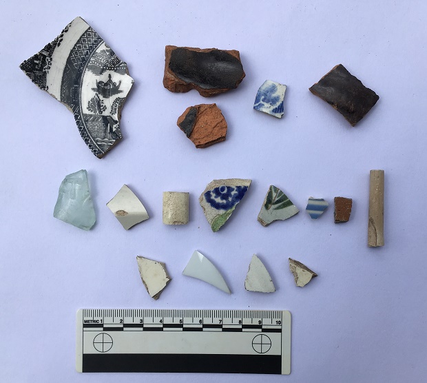
And to end with, some archaeology. As I’m sure you know, I like to pick up interesting things that I find (I can hear Mrs Hamnett sighing in agreement). Now, within the space of a single week, I picked up two copper nails from Freetown; one at the upper end, and another at the lower, nearest St James’ church. I love these things – such history in a tiny object – and I’ve blogged about them before, here. And have also come across them elsewhere in Glossop.
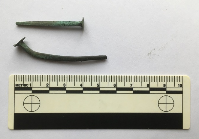
I always have my eyes on the ground (to the point I am worried about developing a stoop!), but to find two in a week seems oddly lucky… perhaps I should play the lottery. Or has my luck been ‘used up’ on worthless copper nails? Anyway, keep looking people, and get in contact with anything you find.
Right-ho, that’s about all I have at the moment. A bit of a hotch-potch, to be honest, but I hope entertaining, or at least diverting. If you have any comments about the blog post, or just in general about Glossop’s past, please feel free to email me. I have a lot more bits and pieces to blog about, and am trying to better manage my time, so hopefully I’ll have something more to you in the next week or so. Until then, I remain.
Your humble servant,
RH