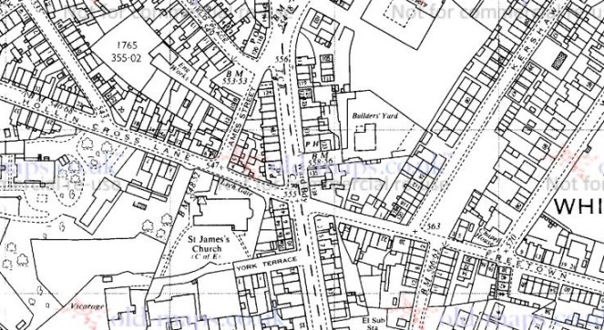
With all the talk of Carr House Lane and the guide stoop there (or lack thereof) the Whitfield Cross post generated (see comments here), I thought I’d go back and walk down Carr House Lane and do a post about the ‘Stone Cross’ there. Incidentally, I have a post about Carr House Lane archaeology that I will get to after this (lots of lovely Victorian pottery), but I want to concentrate on the ‘cross’ for now. The stone is situated here:
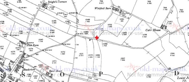
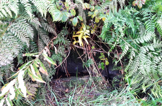
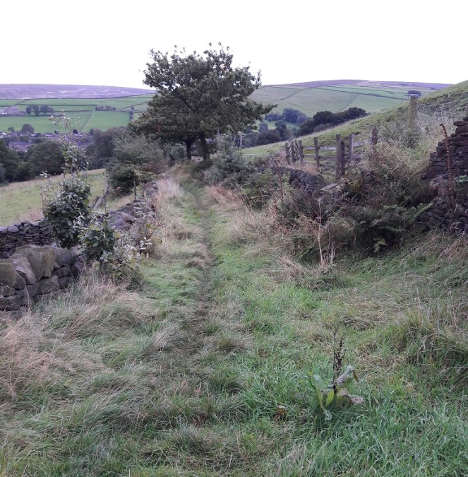
The sunken road from Cliffe Road becomes increasingly boggy the further you go down, not helped, after you turn east, by the stone built spring fed well on the right (marked ‘W’ on the map). This is entirely appropriate – the word ‘Carr’ is derived from the Old Norse ‘Kjarr’ meaning a low lying boggy area… they’re not kidding.
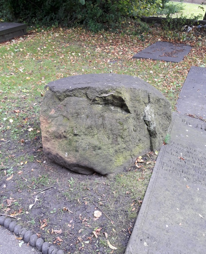
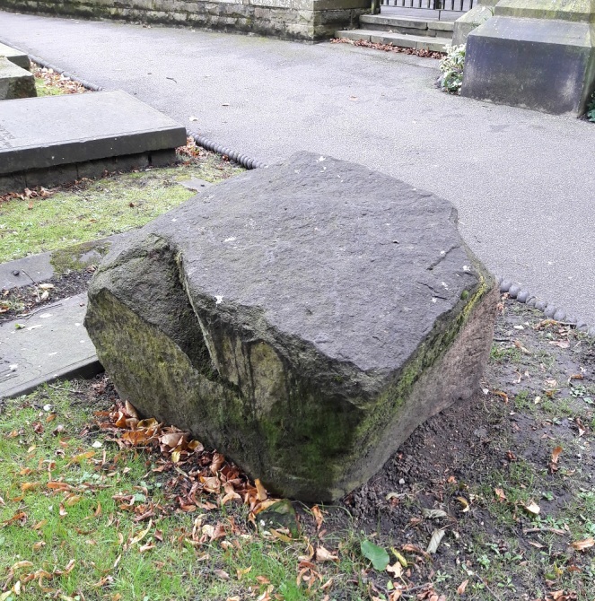
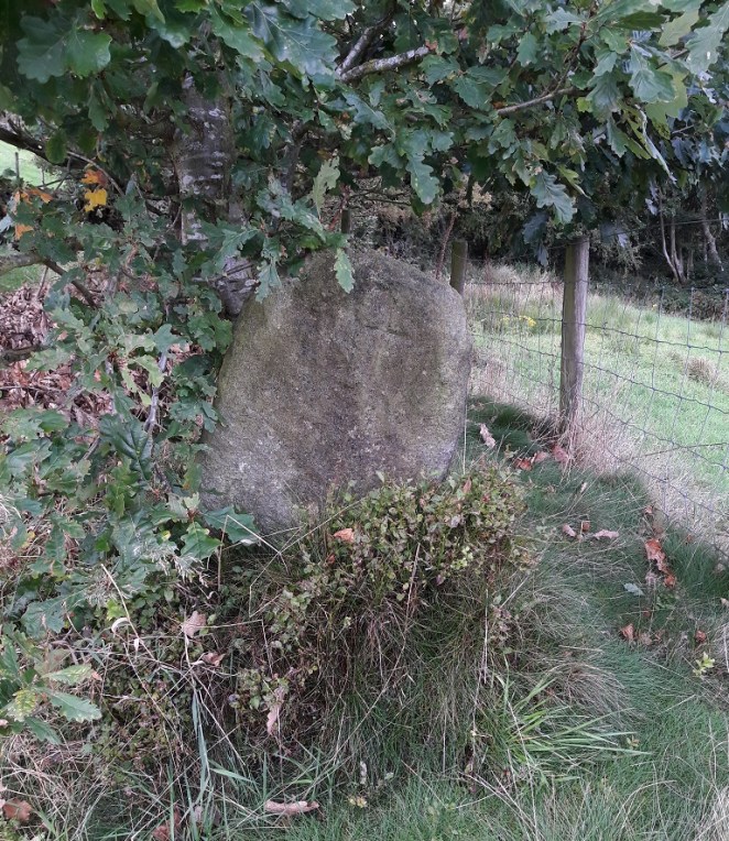
The stone, when you come upon it, is very easily seen, despite being tucked away and in the shelter of an oak tree.
What is immediately obvious, more so on the ground than on the map, is that the stone marks the point where a track branches from Carr House Lane down to Whitfield Barn. Whitfield Barn is at least 18th Century in date, and probably earlier in origin, though without closer inspection is impossible to tell. The main track continues down to Carr House, a farm building of similar date, and which lends its name to the pathway.
This is significant, as it is exactly the sort of place one would expect to find a cross, marking a track junction (see here and here, and the comments for both, for discussion).


And yet it is not a true cross, not in the general sense anyway – it is simply a stone with a cross carved into it. I think it likely that the stone was there long before the the cross, and that it was originally a waymarker making sure the track down to Whitfield Barn wasn’t lost, particularly in the dark.
Now, it is just possible that it is a standing stone, by which I mean a prehistoric standing stone – there are several in the area. However, this interpretation is problematic. Firstly, a prehistoric standing stone is just that… a standing stone, erected in prehistory. However, a standing stone erected yesterday will look exactly the same. Thus, without any associated datable features (a barrow, a stone circle, a burial), we cannot state that the stone is prehistoric. Could be, but might not be. Secondly, its situation, at the junction of the tracks, suggests a connection with, and thus a product of and post-dating, them. It could be argued that the tracks are situated to take into account an already existing stone – that is, the track to Whitfield Barn could have been made anywhere along Carr House Lane, but it made sense to split it at the stone – but again that is impossible to prove.
What I will say is that the stone certainly isn’t a disused gatepost, nor is it naturally occurring in that upright position. Which means it has been placed, with purpose and meaning, by someone. Neville Sharpe, in his book ‘Crosses of the Peak District‘, states that it has been shaped, which is certainly the case, so it seems some thought and care has gone into what it looks like.
The cross carved into it is interesting, also. It has been suggested that some roadside crosses were placed as a gift of thanks for the completion of a safe journey, effectively a votive offering in payment for an answered prayer (i.e. help me get home in this awful weather, and I’ll set up a cross to say thank you). They might also function as a spiritual fortifier, reminding the traveller of God’s watchful eye and protective power over the faithful. It is easy, in these days of surfaced roads, street lights, and large settlements, to forget just how dark and treacherous travelling in the pre-modern era would have been – making your way from A to B in total darkness, along a muddy track, and with no map as such, and knowing that if you took a wrong turn somewhere, you were lost. And I find it difficult enough to find the bathroom at night!
That stated, there is something about the cross that suggests to me that it seems to have been more of an afterthought – the result of a sudden onset of piety perhaps, long after the stone was set in place.

It is two simple chisel strokes, one vertical, one horizontal, and the job is done. Why go to the effort of raising and bedding a stone that weighs 1/4 tonne, perhaps more, and then just carve a simple cross into it? The cross is not particularly well executed, either – it is certainly not the effort of a stonemason or even someone familiar with stone. Sharpe (p.42) suggests that it was cut “a long time ago” as the cross would have been vertical when carved, and age has slumped the stone. Logically, this is a sound argument, but the fact that there is an Oak tree growing behind it and to the left (i.e. the direction from which it would push the stone) may suggest a more modern date. Whatever the case, I would suggest that the raising of the stone and the carving of the cross are two separate events that probably occurred many years apart.
What I do find intriguing is that the carved cross strongly resembles this mystery carved cross. Well, obviously… it’s a cross, one of the simplest and easiest designs you can carve onto a stone surface. But the cross design, two simple strokes, thin and unfussy, but seemingly not done by a professional, is similar. Moreover, it is something of a coincidence that two seemingly random stones, separated by roughly 700m, both have a very simple cross design carved into them, and probably as an afterthought. I wonder if someone in the area caught a little divine inspiration and went on a carving spree? And I wonder, if we keep our eyes open, will we find any more?
As always, thoughts, comments, and corrections are very welcome.