So, I have returned. I’m not going to bore you with the usual apologies for a lack of posts… let’s just ignore it and awkwardly move on.
Interesting things have occurred since I last blogged. I no longer work at a certain local museum, which means I now have more time to spend doing this sort of thing. For the first time in too many years, I put a trowel in the ground and went back to my roots of excavation rather than the academic theorising of more recent years. Even if it was only a 1m x 1m test pit, it was a good feeling, particularly as it was at Melandra, where my namesake excavated in the early part of last century. I didn’t find anything interesting (a piece of flint amongst some modern backfill), but the project as a whole seems to have made a significant discovery… more about that another time.
I have also recently returned from Florida, spending some time with my amazing daughter (hello Evie). Nothing archaeological to report from there, but we did find some nice bits of Native American flint in a flea market – I’ll blog about it, as it’s fun to look at.
So then, today’s post is a bit of a placeholder. I have almost finished a long and interesting post about a wall (stop groaning… I can hear you, you know!), but I need a few more photographs. Until then, I’ll post a short companion piece.
Mrs Hamnett, Master Hamnett, and myself, went on a short ramble the other day, to blow away the cobwebs so to speak (not a reflection on Mrs Hamnett’s housekeeping…). Being short in the leg department, and peculiarly large in the whingeing department, young Master Hamnett sets the length of our walks these days. And so, with much faffing and snot on the face, we set off “up and over” – that is, past The Beehive, along Hague Street, left into the field, and then follow the path round until we arrive at Fieldhead, and then down to The Beehive (or if we are feeling full of energy and less full of whinge, we push on to Whitfield Cross (the cross) and then back. The last few times we have done this, I have picked up some bits and pieces of pottery and glass along the path – nothing earth shattering, but interesting nonetheless. I’ll post them tomorrow, as well as a third installment – the original post – later this week. Today’s post is made up of two of my obsessions: carved graffiti and benchmarks.
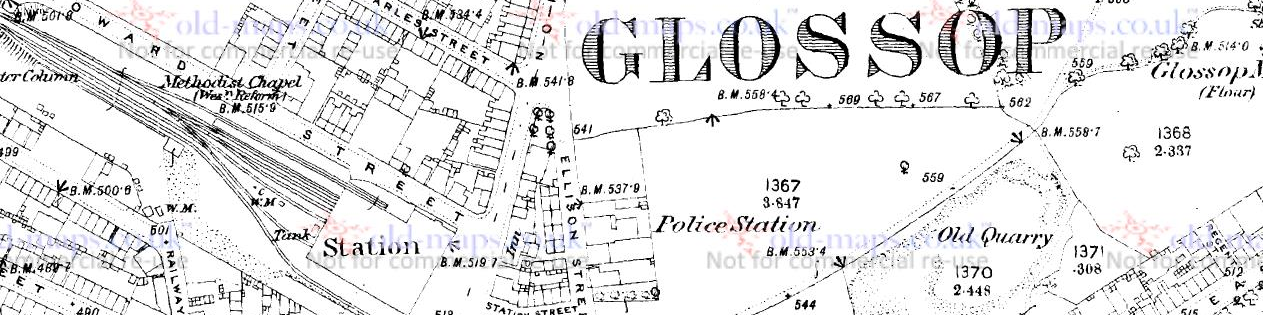
This is the route we took.
We didn’t get as far as the cross, but instead cut back towards the Guide Stoop. The red lines show the route taken (1898 1:2500 OS map via old-maps.co.uk)
Bits and pieces of pottery were along the path, as I say, but I stopped to take these photographs in the areas marked with a green circle.
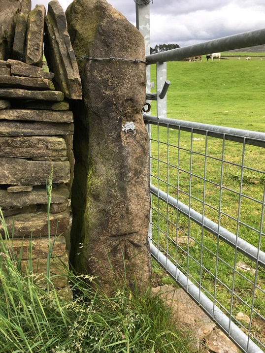
The first, in the lower circle… a benchmark! I’ve not posted many recently, and I really must address that as, well, they’re great. There are several on this route, as you can see from the map above, and a few hidden in field walls in the middle of nowhere. I’d like to do an odyssey at some stage, and track them all down – if anyone fancies joining me, give me a shout! Anyway, here is the benchmark in all its glory:
Fairly standard choice of immovable object – a gatepost – but some nice detailed carving on the mark.
This is a bit of an odd one. It’s clearly a bench mark, it’s clearly on an immovable object, and the gate is clearly marked on the maps, but… there is no bench mark marked on the map at that point – check it out in the map above. The nearest is a spot height of 777 ft above sea level. Spot heights are recorded OS heights above sea level, but are not marked on the landscape by carving them – they serve more as a guide, than a definite point. I trawled through a pile of maps, and eventually found a spot height at that point on the 1954 OS map of 779 ft above sea level. It is probably a late entry in the Ordnance Survey, and it seems whilst they marked it on the stone, they forgot to mark that on the map. If there was a category for ‘rare’ types of bench marks, this would surely be one (and no, I’m not looking for bench mark collectors websites; I have too many ‘collections’ as it is, if I get sucked into bench mark collecting, Mrs Hamnett will almost certainly divorce me*). The gatepost itself is interesting; it appears to be a roughly shaped upright stone, rather than a carefully dressed, more traditional, post. Whilst one is hesitant to say ‘standing stone‘ for several reasons, it is quite common for them to be used as gateposts, and a brief glance at all the other gateposts in the area reveals them to be like the photograph below – shaped properly for the job.
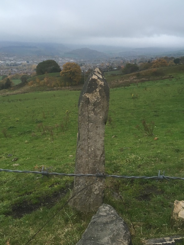
Here is the upper green circle… carved graffiti!
Another gatepost. Fieldhead is in the background.
An inexperienced hand, but very clearly writing letters. At the top, we have a ‘T’ and a ‘B’ or ‘R’, and on the left, running down, are a ‘T’, a ‘B’, and an ‘O’, and there are other marks carved around the top, but nothing recognisable. The Ts are carved quite nicely with serifs, but overall it’s a bit messy… 3/10?
Right, that’s all for today. As I say, I have two more related posts almost ready to go (tomorrow for at least one of them, if I get chance), and lots more to go after that.
As always, comments are very welcome, and please feel free to email me with any information or questions.
More soon, I promise.
But until then I remain, your humble servant.
RH
*Alright, so I lied. I did check. And there are so many. So like a moth to a flame… apparently, we are called ‘bench mark baggers’. Here are two websites to whet your appetite: One is the central bench mark database, which is worth an explore, and the other is a blog run by someone worryingly like me, well worth checking out. I might be single again very soon.
So, apologies for the late running of this blog post. I have half a dozen half-written posts at any one time, and this one seems to have had a difficult birth! It was finally scrawled on the back of the minutes of the AGM for the Glossop & Longdendale Archaeological Society in a cafe whilst waiting for Mrs Hamnett to come out of surgery in Wythenshaw Hospital! (All is good on that front, and she is making a recovery). Apologies also for the length of this one, and for the archaeological theory. I do love a good bit of interpretation, and in my previous archaeological life this was the stuff that nourished!
I was having a conversation with my brother-in-law the other day (Hi Chris), and he asked whether I had seen the standing stone on Long Lane, between Charlesworth and Broadbottom Bridge. As it happens, I had, and it was on my ‘to do’ blog list.
And here it is, being done… well, we’ll get to it in a minute
Standing stones and stone circles are some of the things that first grabbed me when I began to look at archaeology seriously. The fact that they were a tangible and impressive representation of the past made them stand out, and yet they were enigmatic – their function and meaning still not fully understood. Single standing stones in particular have been overlooked as monuments; their very nature – a single stone, standing upright – has meant interpretation is difficult. Moreover, they are largely undatable unless associated with other monuments such a stone circle, and people throughout history have stood stones upright, and for a variety of reasons (cattle scratching post, waymarker, gatepost, etc.). Generally, though, they are considered to belong to the later Neolithic and Early Bronze Age (roughly 3000BC – 2000BC). As to their function, they are often viewed as marking a territory, or as a meeting place, usually with ‘ritual’ overtones. In more recent times, they are often associated with folklore and the supernatural, and even leylines.
A stone beside the River Etherow, in Broadbottom. This one is, I think, a glacial erratic.
Recent archaeological work has begun to unpick the possible meanings and functions of many of the monuments of prehistoric Britain, and especially those of the Neolithic. This has been done more subtly and intuitively than previously, and looks at monuments in their surroundings, and how the people would have experienced, used, and passed through them, rather than viewing them as just objects. Words like landscape and phenomenology are used, and it often draws on other disciplines such as philosophy to help with understanding the past. Extrapolating from this work at the larger monuments, and in particular the pits, causewayed enclosures, and chambered tombs of the Early Neolithic, we can use some of these ideas to explore a possible meaning of the standing stones of the Late Neolithic and Early Bronze Age.
As I’ve said before, a standing stone is just that, a stone, standing. But conceptually, it is much more than that, it is a fixed point in the landscape, around which human experience can revolve, and emerges from a concern with marking a particular space as being different from it surroundings, transforming it, and placing it within the landscape but apart.
It is clear that the actual creation of monuments such as these was just as important as the finished product, and the erection of a standing stone is not a simple task. It requires group work and cooperation; with the stone weighing perhaps a ton or more, families, extended families, kinship groups, or even clans would be working together to make the stone. It would be a period of community, sharing work and food, and the creation of joint place. The stone would have to be shifted and shaped, and here we have decision to be made. From where is the stone to be quarried? The source may be significant to the people creating the monument, and perhaps that quarry or stone type already figures in their stories and beliefs, already a sacred site. Although practical considerations are possible, it may not always be the case – the Stonehenge Bluestones were moved by land, sea, river, and land from the Preseli Hills in Wales – a journey of over 150 miles, because they were deemed important. Our practical concerns are different from theirs.
Then we must consider location, why was the stone sited where it was. The larger monuments, such as the enclosures of the Early Neolithic, often have evidence of earlier occupation, and it seems that the monuments are referencing these flint scatters and back-filled pits, a way of acknowledging those who went before – the ancestors. It may be the case with the standing stones. But equally, they may reference something else – a feature of the landscape, or perhaps some other, more numinous reason which we would never be able to fathom. Did a shaman have a vision suggesting the site? Or did lightning strike? Or someone die there? Or… you get the idea. And did the stones stand on a bare hillside as they do now, or did they lurk in a bright woodland clearing?
Another stone by the River Etherow. This one is shaped, and was perhaps a gatepost.
Once in place, the people responsible for erecting it might visit periodically – every year on midsummer’s eve, for example, or every full moon, or when the cattle are herded from lowland pasture to the upper areas, or even every day. But certainly through these periodic visits it would be seen as, calendar-like, marking time, or even creating a ‘mythic’ time, outside of ‘real’ time. They might have visited in large groups, taking the form of kin-related clan-wide celebrations, for example, or perhaps in small family groups, or even as individuals. Each visit would recall previous visits, previous times of coming together in celebration, or in mourning, for example. But there would be feasting and celebrating, certainly, with people gathered in their groups round hearths and fires.
Perhaps the area around the stone was kept spotlessly, meticulously, clean, and each visit revealed traces of the old hearths clearly, and the conversations, people, exchanges, jokes even, that happened around those hearths would be recalled and spoken about. And it’s not hard for us to imagine a group of people, framed by firelight, moving in a circular fashion around the stone, dancing. But perhaps, and I suspect more likely, the area around the stone was littered with the detritus of these older meetings – pottery, animal bone, flint, pits dug into the earth, stone, and other bits and pieces, all deliberately displayed as a reminder of the past visits. There may well have been human remains, too, in the form of cremation or as an internment, or even random bones, carefully kept and handled – curated for generations – before finally being deposited around the stone. Each item or object speaking to the people of the past, of past lives and events, and of the ancestors. With each visit, again and again, there was the creation of new memories, new meetings, and yet still the recollection of older ones – the ancestors would have loomed large and heavily in these times.
The stone here acts as a mnemonic device, an object that helps us remember. That is its purpose, its meaning… to help us recall previous visits to the stone. Using the stone as a focus in this way, time can be manipulated: the individual can visit past people and events, travelling and recalling; but equally the ancestors and past gatherings can be brought into the present through shared memory. Importantly, the ancestors can be projected forward into the future, asking for their intercession for a good harvest, for example, or for help and advice.
And of course, when the people gathered together for feasting and celebrating, there would have been exchanges in the form of gifts and barter – and from hearth to hearth, and valley to valley, there was an exchange of resources, news, gossip, alliances, ideas, beliefs, objects, allegiances, skills, animals, marriage partners, and so on.
In fact, all the drama of human existence revolving round this fixed point in the universe, a node, a single stone standing in not just a physical landscape, but in this case a cultural landscape, and on a personal level, a psychological landscape.
Phew!
So then, the stones…
Hargate Hill Stone
Let’s start with the stone that sits on the corner of Hargate Hill Lane and High Lane, the road between Simmondley and Charlesworth. It’s here:
The stone is circled. The air shaft to the right is the mine shaft down which Albert Burrows, the Simmondley Pit Murderer, pushed his four victims – the subject of a future blog post.
Here is the stone.
The standing stone above Hargate Hill. Mouselow Iron Age Hillfort is in the background.
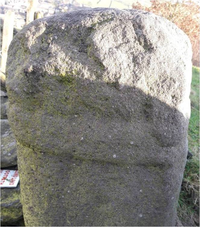
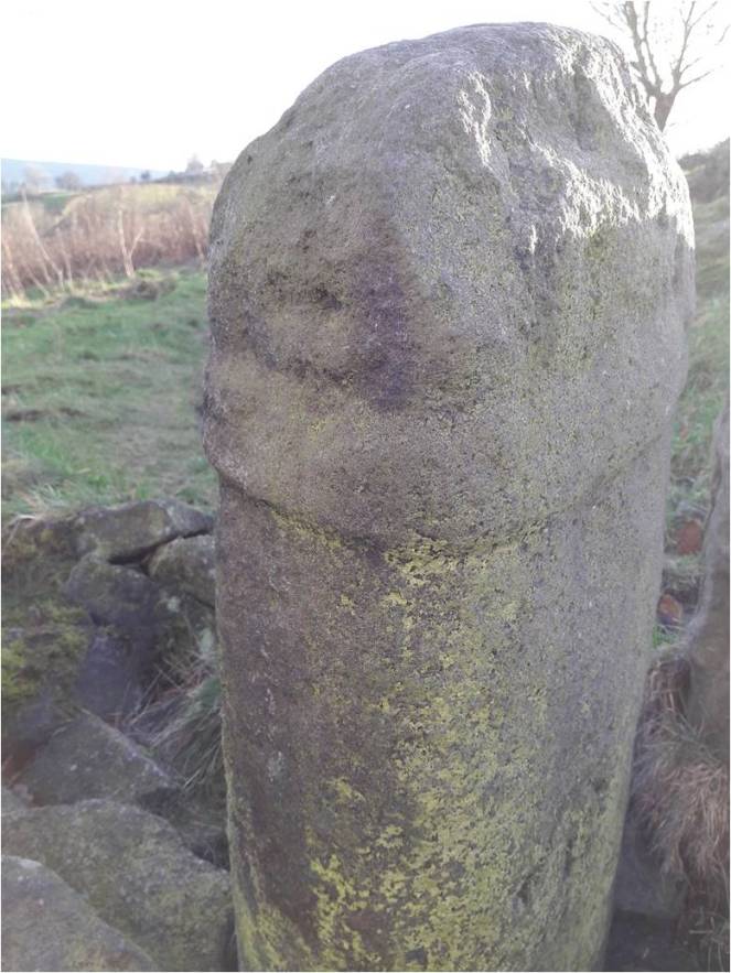
The stone is very obviously deliberately placed, and sits on the junction of two tracks, both clearly ancient, and like many standing stones, it stands mid-slope, i.e. not at the top or bottom of the hill. It could be argued that the stone is placed as a marker for the tracks, but I suspect that the track from Hargate Hill used an already existing stone as a sight marker. Interestingly, Neville Sharp suggests that its chisel-like head points towards Shire Hill, some 3km north west of the stone. And yes, seemingly it does.
Shire Hill looms darkly through the murk.
This may be important. It is not uncommon for standing stones to reference features like this, and Shire Hill is fairly prominent in the landscape, even on gloomy days, it can be made out easily, as the above photograph shows. Interestingly, in the mid 1950’s, the cremated remains of a female dating to the Late Bronze Age was uncovered on the south slope of Shire Hill during the building of a bungalow there. The remains had been placed in an upturned burial vessel, which was laid on a bed of charcoal. Sadly, there is very little information available about this important find. Out of our period, but points to prehistoric activity on the site.
There is, marked on the 1887 OS map (see above) another stone just to the east of this one. I have looked but cannot find any remains of a stone, even a small one, and not even reused as part of a wall – whatever was there in 1887 is no longer there now, sadly. But it is worth mentioning that standing stones sometimes occur in pairs.
Hague Stone.
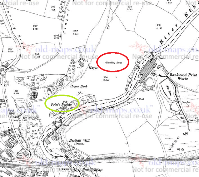
I found this one years ago – I did a ramble in search of this stone and Pymm’s Parlour Roman rock shelter on the banks of the River Etherow (the subject of a future blog). Finding it was not easy, as it now tucked away in a wooded area, and for some reason I didn’t take any decent photographs… not sure why.
Hague Stone marked in red, Pymm’s Parlour (here Prim’s), a Roman rock shelter, in green. 1898 1:2500 OS map
Here’s the stone.
The Hague Stone, dead centre, disguised as a tree. Apologies for the photograph.
It’s a fairly hefty stone, as you can see, and tucked away, though the 1898 OS map shows it as standing in open fields. I will get a better photograph this winter, I promise! Not a great deal to say about this stone, though I think it is important, as we’ll see.
Long Lane Stone
Very visible from Long Lane, this stone has long intrigued me.
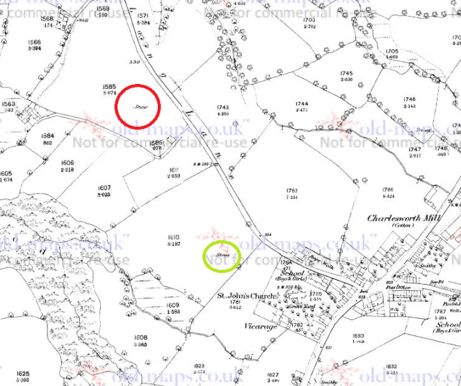
The Long Lane Stone marked in red. Another stone is circled in green. 1887 1:2500 OS Map
I have been unable to get a decent photograph of the stone, as it stands in a field that grows turf for Lymefield Garden Centre, and one doesn’t like to trample on the new grass (and I don’t recommend you do either). Every other time I’ve tried, it’s been too dark, too bright, etc. So here is the Google maps version. I’ll keep trying, and replace when I can.
The Long Lane stone. Long Lane is behind the camera, and Charlesworth to the left.
It’s a fairly bog-standard standing stone, shaped and set into the ground in the middle of a field. The 1898 OS map shows it standing at the head of what it describes as an ‘Old Quarry’, something that the earlier maps don’t show. I can’t believe it’s a quarry… what would they be quarrying here? A marl pit perhaps, but not a quarry. Perhaps it is a feature associated with the stone? What I do find interesting is that the stone hasn’t been moved – either in the past, or more recently, in order to make harvesting the turf more easy. Folkloric associations with bad luck? Whatever the reason, it’s great that it remains
As with the Hargate Hill stone, on the 1887 OS map, there is another stone marked, south of the main one, further up the hill toward the church (in green on the map). I have not been able to investigate this as it now stands on very private property, behind a locked and alarmed gate. I have not been able to see anything on later maps or aerial photographs, and it may just be a small unrelated stone – the early OS surveyors marked anything that couldn’t be moved on their maps. I would still like to investigate though, so if anyone knows anyone or anything, please let me know.
Now, these last two stones, for me, are particularly interesting. Let’s play a game of ‘what if’ Assuming that the stones existed at the same time, they would have been intervisible – you could see one from the other. They stand on opposite sides of the river, and on opposing hillsides, but are at about the same elevation, and both middle hill, not at the top. In a sense they are facing each other, and we may understand them perhaps as rivals, representing two different nodal points, perhaps for two different clans. But what if, instead, they are viewed as complementary? What if we take them together, as a pair, making a statement? The location of the Hague stone is at the head of the valley, just past the Besthill Bridge and the cliffs of Cat’s Tor there. The cliffs are steep and difficult, and logically the slope where the stone is located is the first patch of land that would allow it to be dug in. I feel almost certain that the stone references this point, and that it is placed at the head of the Longdendale Valley.
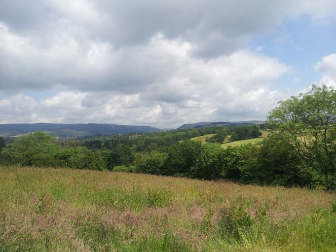
The view from just about where the Hague stone is. The Long Lane stone is far to the right, the Longdendale Valley is opening out ahead, and the Iron Age Hill Fort at Mouselow is middle right.
If we accept that the Long Lane stone references the Hague stone, then we seem to have a pair of distant, yet connected, stones standing at the head of the Longdendale Valley – gateposts of a sort allowing you access into the valley, and which form a part of a larger landscape, shaped and controlled by the people in prehistory. This puts a very different spin on the place, and suggests all sorts of areas for further research.
Of course, it is all ‘what ifs’ – a story if you will, and one that is completely unprovable. But it is possible, and I genuinely believe that the Hague stone at least is there for that purpose; you often find stone circles situated at the confluence or head of valleys, so why not a single (or pair of) stone(s)? Something to think about, if nothing else.
If you are interested in the ideas about British prehistory that I have been talking about, there are a number of very good books on this subject. I would recommend starting with:
Britain BC by Francis Pryor An excellent and easily read overview of prehistoric Britain. Really very good.
Stonehenge by Mike Parker Pearson A compelling & easily read account of the Stonehenge Riverside Project, and in particular it covers Parker Pearson’s theory that stone = death, and wood = life.
Ancestral Geographies of the Neolithic by Mark Edmonds Academic, but a good and accessible read. Full of wonders. Highly recommended.
These next are academic archaeological books that are a bit more complicated, and require some background knowledge.
Understanding the Neolithic by Julian Thomas Essential reading, but very dense. Not recommended for the casual reader.
The Significance of Monuments by Richard Bradley. Another good one, dense in places
Ritual and Domestic Life in Prehistoric Europe by Richard Bradley. Again, really good, and quite accessible. It covers the whole of Europe.
As always, any comments, questions or corrections are welcome, just drop me a line – either email in ‘contact’ above, or in the comments section below. Next time I’ll blog about some interesting pottery… I think.
Mrs Hamnett, Master Hamnett, and myself found ourselves passing through Macclesfield a few weeks ago. So I took the opportunity to visit the three splendid Mercian Round Shaft crosses that were erected in West Park there. I had tentatively suggested that one of them was a dead ringer for Whitfield Cross, and in a slightly better state of preservation. Definitely worth a closer look, and, of course, Master Hamnett was pleased as it means he got to go to the park.
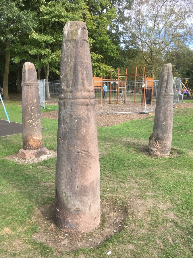
The three cross shafts are located in the middle of the play area, and impossible to miss.
The Macclesfield Crosses, situated in the excellent West Park in town centre.
They were originally sited together at Ridge Hall Farm in Sutton (about a mile south of Macclesfield – here). Two of them were being used as gateposts, with iron and lead fixings carved into the stone, and the third was in a pile of rubbish. Their importance recognised, they were promptly moved to West Park, arriving there on 7th January 1858. Interestingly, Ridge Hall Farm was originally a moated farmhouse of medieval date – the remains of the moat can be seen in the aerial photograph above, circling the farm at the south and west.
Now, although the crosses were ‘found’ together, I don’t think that the farm was their original site, and it is likely that they had been moved there from points unknown. The probability of their movement is given evidence by the fact that the farmer had two cross shafts on his land, exactly the right width and in exactly the right location to form a useful gate. And by the fact that one of the crosses was “in a pile of rubbish” – such wording suggests it had been moved and discarded, perhaps awaiting employment as a fence or gate post. Also, whilst they occur in pairs (and the gatepost pair may well be an example of this), we know of no other examples of three crosses occurring together. However, caution should perhaps be urged here; with so few examples of this cross type surviving, we don’t have a huge body of evidence from which to draw comparisons or to make bold statements, and as the old archaeological dictum runs, absence of evidence in not evidence of absence. But in this instance, and on balance, I think it is likely they had been moved. Given that Ridge Hall Farm is not near any parish boundary, nor is close to a church, we might tentatively suggest that they originally marked the junction of tracks, as Whitfield Cross once did.
But I digress.
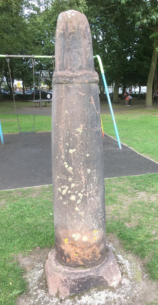
The one that resembles Whitfield Cross is on the left of the three in the above picture. In the Cheshire and Lancashire volume of Corpus of Anglo-Saxon Sculpture (website here) it is listed as Sutton (Ridge Hall Farm) 1, and dates it to 10th or 11th Century. Here is a close up.
The south-west side of the cross.
Although it is made of a similar stone, it is unclear if the cross base is original to the cross. I have to say, it looks like it might be, and if it is the case then we might suggest that this cross was in its original position on the farm. The other two crosses don’t have their bases, and it seems doubtful that the farmer would go to all the trouble of digging up the cross base, when he could just sink a hole and place the shaft that way. Also, if the other two had their bases, then the 19th Century antiquarians who were responsible for their movement would have taken them too.
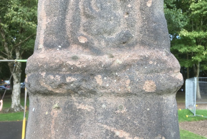
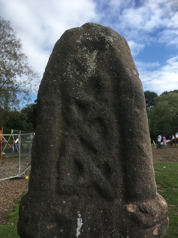
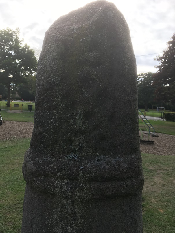
The collar is of a very similar style to Whitfield – sloppily executed with a rough groove drawn around the neck, rather than two distinct bands.
The Macclesfield cross – note the collar.Whitfield Cross – detail of the neck band. Similar in style to the Macclesfield Cross above.
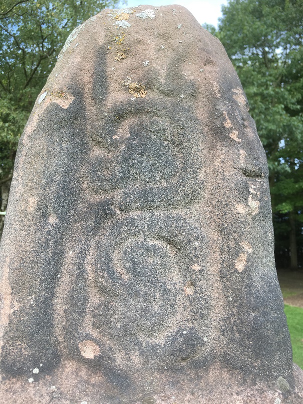
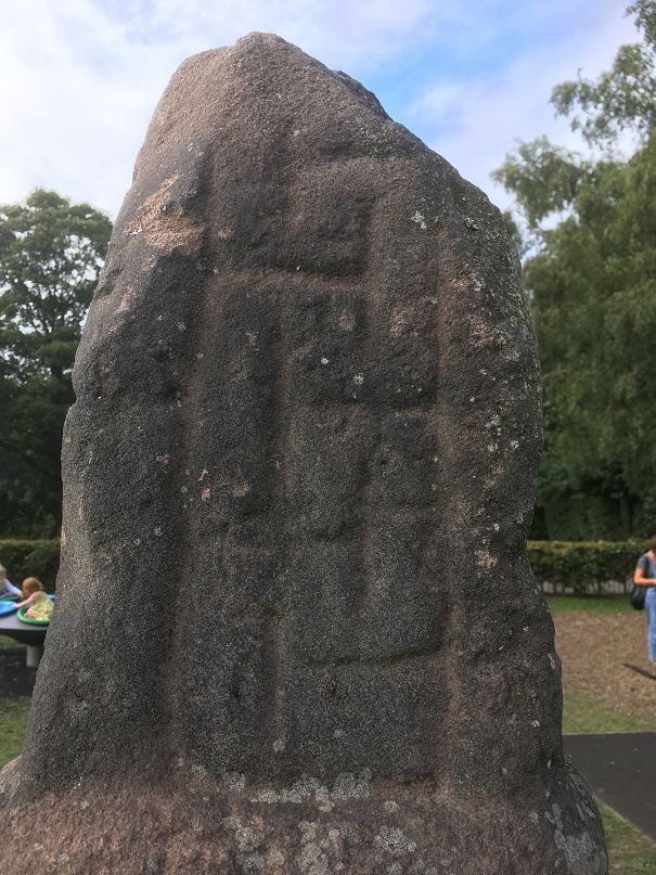
I also suggest that the decoration which is missing from Whitfield would be of a similar nature to the Macclesfield example. Here is a closeup of the decoration. You can see what remains of decoration on the Whitfield example above and below.
The decoration is, with the eye of faith, just about visible. Compare with those below.South west side, described in the Corpus as a “simple scroll, its three offshoots terminating in a triple round scooped leaves”. That looks about right.North east side, described in the Corpus as “crossing two-strand interlace terminating in a Stafford knot with pointed terminals”.South-east side – described in the Corpus as simply a “meander pattern”.North-west side, described in the Corpus as “two-strand encircled twist, with two loose and inward-turning ends at the bottom of the composition”
So there you are. This is what I think a little better preserved Whitfield Cross would have looked like had the puritans and drunken louts of the 18th Century not got hold of it. Having said that, I recently read about people digging up roadside crosses because they believed treasure was buried beneath them, which is another reason these crosses are so rare. Bloody barbarians!
Anyway, I know this is a long way from Glossop, but I think it is important that the comparison with Whitfield Cross is made and explored… who knows, the same craftsman or woman may have carved the crosses. And it’s interesting nonetheless.
Next time, I’ll be a lot more local… very local indeed.
As always, any comments and questions are welcome. There really is quite a thriving community of people out there, and it’s great to hear from you all.
After my last post on milestones, I received a message from the always interesting Roger Hargreaves (see comments below the above article). Now, Roger is something of an expert in these matters, and has done some considerable research into the road system of the area through the ages – Roman to 19th Century in fact – and he helpfully offered some information, and some photographs, too.
So then, the milestones…
Following an act of parliament in 1770, the milestones were erected every mile (hence the name) along the 1730’s turnpike from Manchester to Saltersbrook by the surveyor James Brown jr. Later sections of turnpike were built from Saltersbrook to t’other side o’ Pennines – there’s a great website, with lots of pictures, dealing with that section, here. This road from Roe Cross follows broadly the route of what is now A628 / Woodhead Pass, itself a turnpike from the early 19th Century, and which overlays the original road.
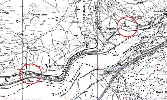
However, in places, this 1730 turnpike is still visible where the 19th Century road deviates, perhaps taking an easier route, and so sections can be walked, and it is along these that milestones, where they survive, can be seen.
Here is a section of the original 1730’s turnpike. It leaves the Woodhead pass at the first circle, and rejoins past Crowden, at the second circle.The 1730’s turnpike as seen on Google Streetview. The road originally went up to the left – you can see the path, and can walk along it for a large portion.
Now, because milestones are placed exactly one mile from each other, it is possible to work out where they should be. Of course, in some places where we would expect to find them, however, the newer road has obliterated all traces of the older road, and presumably the milestones would have been broken up and used as hardcore, although not necessarily, and it might be worth a further investigation – they are perfect for gateposts, after all.
So, starting from Roe Cross, then
10 Miles from Manchester – this would have stood at the Toll House at Roe Cross
11 Miles (somewhere on Mottram Moor) and 12 Miles (far side of Hollingworth) are missing – the area has been built up, although they may well still be in a hedgeback somewhere.
13 Miles to Manchester – this would have originally stood somewhere in Tintwistle – annoyingly, the mileage doesn’t work with it being situated at the toll gate there, which stood at the far end of the village, west of Townhead Farm.
14 miles is missing, but would presumably have stood east of Townhead Farm – again, worth a look in hedgebacks and walls.
15 Miles to Manchester. Just by Rhodeswood Reservoir. Photograph by Roger Hargreaves. And a damn fine one it is too!
16 Miles would be just below Highstones, where the track still exists, and so would be a strong contender for a survival in the walls and hedgebacks.
17 Miles and 18 Miles are in places where the 19th Century road overlies the 18th Century, and thus are likely to be lost. Although, again, maybe worth a look.
19 Miles to Manchester – mutilated and forlorn in a wall at Higher Wooodhead. Photograph by Roger Hargreaves. I love this photograph.
20 and 21 Miles to Manchester are beyond this, and although there is a survival of the road in these areas, there are no walls in which the stones may be hiding. It is likely that they are simply buried in the peat in that area, waiting to be discovered. A walking trip with a steel pole, anyone?
This takes us to Saltersbrook, and the other side of the turnpike system there. Here is a map of the road from Saltersford into Yorkshire.
The Yorkshire side of the turnpike road, from Saltersford to Wortley. There are plenty of milestones and other interesting goodies along this route, but they are truly beyond the scope of this blog. Check them out in this really amazing website.
So after the journey, let’s end on a song – a particular favourite of mine, from a particularly good album, and whose title is very apt.
I also want to thank Roger Hargreaves for allowing me to use his photographs, and for the additional information.
As always, comments or questions are always welcome.
So, a while back I went looking for the White Stone of Roe Cross… and failed miserably in my mission.
As I said here, it is mentioned in Sharpe’s book “Crosses of the Peak District” as potentially marking the junction of the boundaries of Matley, Hollingworth, and Mottram, so I thought it would be worth a look, and maybe make a comment on what, where, and why.
I did some digging (pun fully intended), and came up with very little; it has almost zero presence online (other than this letter), and other than a modern book (about more, later), virtually nothing but an oblique reference. I began to despair… until I started to dig a little further – my ‘spidey sense’ began to tingle. Summat wants fettling, thought I.
What I did come across time and again was a reference to the legend of Sir Ralph de Staley, and his relation to Roe Cross, and the Roe Cross. Now, the story of Sir Ralph de Staley (Staveley or Stavelegh or Staveleigh – there are numerous spellings), is a variant of “The Disguised Knight”, a story trope that can be traced back to at least Homer’s ‘Odyssey’. Our story, culled from several sources, runs like this.
With Richard I, Sir Ralph sets sail on a crusade leaving behind his wife, Elizabeth, and estate. By and by, and following many great battles, he is captured by the Saracens, and held for many years in a dungeon. Eventually, he gains his freedom, takes on the appearance of a Palmer (a pilgrim), and pays a visit to the pilgrimage sites in the Holy Land. One night, in Jerusalem, he had a prophetic dream “boding ill to his wife and home far away”, and so, invoking the intercession of the Virgin, he prayed and presently fell asleep.
Upon awakening, he immediately knew something was different – “before him, shining fair in the summer sunlight, rich in fulsome melody of singing birds, was a fair English landscape, and beyond it his own ancestral hall of Staley”. He had been miraculously transported home.
He set off for his house, and came upon a faithful old servant and his favourite dog, who presently recognised him. He told Sir Ralph that his wife, who had finally given up all hope and now believed him dead, was to be married the following day. So off he jogs to his hall, and asks to see the lady of the house. He is refused, but begs a drink of Methyglin (a type of spiced mead, apparently), and after draining the cup, pops his ring into it, and begs the maid to take it to her lady. She does, his wife recognises the ring as belonging to her husband, and asks an important question “if it be Sir Ralph himself, he will know of a certain mole on me, which is known to none but to him” (racy stuff, this). Of course, all ends well and happily, and the bounder that is trying to get Sir Ralph’s lands and his missus, is ejected rapidly into the night. And quite right, too.
So ends the story.
The 15th Century timber-framed Staley Hall before being done up. That is truly one of the most depressing photographs I have ever seen. How we can let our history end up in this state…That’s better, although the wall at the front is a little off putting. The restoration work here is particularly good.
Now, here’s where it gets interesting. As a post script, most versions of the story (there are about 5, each with subtly different aspects) state that a cross was erected either where Sir Ralph meets the servant and dog, or where he wakes up following his miraculous movement. This is the Roe Cross – Ro, or Roe, apparently, being a shortened version of Ralph. Indeed, several sources mention a cross standing on the old road from Stalybridge to Mottram. But where is the cross? There is certainly not one there now, nor is there any evidence attesting to one. There is, however, the White Stone.
Ok, so here is what I think happened.
I don’t think there ever was a cross, not as such. None of the sources I consulted actually describes a cross, only that one was there (as told by the story and indicated by the name), or that there are the “remains of an ancient cross” on the road there (and thus presumably referring to the White Stone). It seems that the White Stone and the Roe Cross have become intertwined. Ralph Bernard Robinson, in his book ‘Longdendale: Historical and Descriptive Sketches‘ (1863) illustrates this perfectly by noting the existence of both cross and stone as separate monuments, but he only describes the stone, not the cross. I would argue that it doesn’t/didn’t exist.
It is most likely the name Roe Cross is derived from ‘roads cross’; the area is, after all, the junction of seven roads – Harrop Edge Road, Matley Lane, Gallowsclough Road, Mottram Road (Old Road), Hobson Moor Road and Dewsnap Lane. Indeed, according to Dodgson’s Place Names of Cheshire (Vol.1, p.315), there seems to be no reference to Roe Cross prior to 1785 (although this may turn out to be incorrect, with further research).
Roads Cross = Roe Cross. You can see the coming together of all seven ancient tracks, converging on Roe Cross. Ignore the 18th Century Turnpike at the bottom.
So far, so good… now bear with me. The White Stone is a marker stone, marking tracks over the tops, and/or marking the boundaries of Matley, Stalybridge, and Hollingworth, and it has been there from the year dot. As a feature in the landscape, it was given a story, as all such features are – they accumulate stories, because people have an intrinsic need to have a relationship with their environment – and it takes on a personality, and gains a biography. As the archaeologist Richard Bradley says of monuments “they dominate the landscape of later generations so completely, that they impose themselves on their consciousness”. The story of Sir Ralph (whether ‘true’ or not) was given as a way of explaining both name – Roe Cross – and reason for the existence of the marker stone. In fact, in Ralph Bernard Robinson’s account of the legend, Sir Ralph wakes up “beside a large stone”, and later on notes that “tradition points out the stone under which he found himself laid: and a queer old stone it is.” Clearly he is describing this from his own personal experience, and surely there can be only one stone that is worth pointing out in the Roe Cross area… it has to be The White Stone.
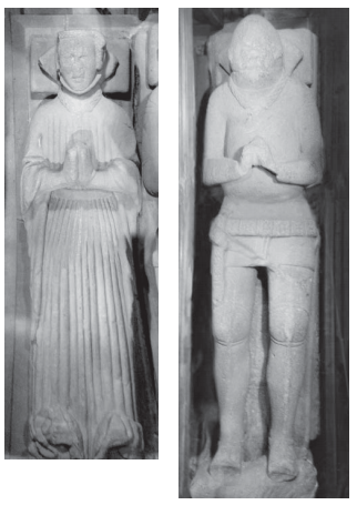
As a postscript to the postscript, Sir Ralph and his wife, Lady Elizabeth Stayley, are supposedly buried in St Michael and All Angel’s church, Mottram. There are two 15th Century carved effigies that are to be found in the Stayley Chapel there, which almost certainly are meant to represent the good knight and his wife, and which were originally placed against the south wall of the chapel. As Aikin in his ‘Description of the Country Thirty to Forty Miles Round Manchester’ (1795) notes, “many fabulous stories concerning them are handed down by tradition among the inhabitants”.
This from Aikin’s Description of the Country Thirty to Forty Miles Round Manchester’Sir Ralph and Lady Elizabeth de Staley. This taken from the official guide to Mottram Church here.
So then, the White Stone. Well, I still haven’t found it! But I do know a bit more about it, and now – drum roll please – I have a photograph of the bloody thing, stolen shamelessly from Keith Warrender’s book ‘Manchester Oddities‘. I heartily recommend this book, as it’s chock full of just the sort of odd bits of history that this blog looks at. Buy it here. Or better yet, order and buy it from Bay Tree Books – buy local and keep independent shops afloat.
So here is the offending stone, in whose shade, Sir Ralph found himself transported from the holy land.
The White Stone of Roe Cross – it is indeed a “queer old stone”.
The reason for it being white is presumably to make it stand out, to ensure this important stone (boundary marker, track marker, or teleportation stone) is kept vividly different from any other in the area. Apparently it’s now on private property, which would explain why I couldn’t find it last time I went looking for it. I’m not sure of its exact location, but somewhere in the vicinity of White Stone Cottage would seem to make sense. Here is the drawing in Sharpe’s ‘Crosses of the Peak District‘.
Not very cross base shaped, but then I haven’t seen it close up. Yet.
I love it when a legend has a physical mark in the landscape, it makes it more real, and as I say, it is a natural instinct in humans to build stories around their places. I recently led a guided archaeological tour of Alderley Edge, which looked at the Legend of the Wizard through an archaeological lens, and this same element, on a smaller scale, was at play here. Place and story working together, informing and shaping each other.
Apologies for the slightly rambling nature of this blog post, but I hope you enjoyed it.
As always, comments and questions are most welcome.
So, I received a pair of emails recently, and both of them answered an outstanding question that has been bugging me for some time.
Answers people, we actually have answers! I asked, you listened, and by Great Zeus (or Arnomecta, perhaps) you answered.
So, drum roll please…
THE STONE IN ST JAMES’S CHURCHYARD, WHITFIELD.
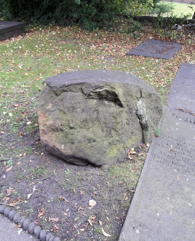
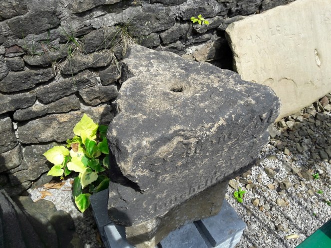
I mused here on the possibility that a large, out of place, stone in the churchyard St James’s, Whitfield, might be part of the base of the Hollin Cross that almost certainly stood at the junction there, on Hollincross Lane.
Here is the stone in St James’s – not a cross base!
I was wrong. And how!
I got an email from Louise Seville which states:
“My father-in-law Neal Seville had some connection with the church (Sunday school??), I think in the 1970s. He was giving a talk based on the parable of the wise man and the foolish man. He and his friend Bert Taylor from Chunal, brought the stone from Bert’s own small quarry at the back of his house on Chunal. The stone was moved on a truck – Bert had a haulage company. The stone was used in church to illustrate the story and was abandoned in the churchyard afterwards as it proved to be too difficult to move. Neal said that in the future people would wonder how the stone got there and come to all sorts of conclusions! “
And how right he was!
So there we have it folks. I genuinely think that it was bonkers to use a stone that size to illustrate the parable, no matter how factually correct! But apparently that was about right for Neal, who got up to all sorts of capers. Here is the parable, for those of you that slept through Sunday School.
So my thanks to Louise and Eddie Seville for solving the mystery. And, of course, thanks to the late Neal Seville for providing one in the first place.
Now, the next one has bugged me for years, so I am truly grateful for its solution.
THE ODDLY SHAPED CERAMIC OBJECTS
I asked for ideas about these bits of pottery that Sandra T. and I had found. They were so oddly shaped, and so similar in production, that they must have had a single, very specialised, purpose. But what purpose, that was the question.
The puzzling pieces of pottery
Well, bam! An email from the wonderful Eddie Picton arrived in my inbox the other day.
May I suggest that they are “creel peg pivots” as used in textile machinery. A roving bobbin had sliver wound on it, this was then put upon a creel peg and then put in following machine creel. The lower end then would be free to rotate on the ceramic with minimal friction. I worked in the last spinning mill in Oldham, the last of this type of creel was scrapped in the early 1990s, the mill finally closing 2002.
The connection between the object and the place – both connected with weaving and spinning – made this very likely, and it is not an interpretation I had thought of before. I did a bit of research, and began to understand how they would have worked. Yes, it seemed to fit.
Last night, Eddie was at the Glossop and Longdendale Archaeological Society talk on ‘Melandra – Past and Future’ given by Mike Brown and Roger Hargreaves (and very good it was too). He gave me this drawing of how the creel peg pivot would have worked and where it sat in the machine.
Great drawing Eddie, thanks.
Our pottery pieces are those marked ‘Pot’ in the picture, with the bobbin/creel peg sitting in the hollow, glazed, part of the mystery object. They are tapered slightly so that they can fit into the holes in the frame.
These are those, in situ, in Styal Mill. The photo is Eddie’s.
So that’s that solved! Thanks for that, Eddie, you’re a star. And it seems I owe you a drink… I’m as good as my word. See you on the first Tuesday of November.
I have another blog almost ready to go, so fingers crossed you’ll get a bumper crop of posts by the weekend.
As always, comments and questions are very welcome.
What ho, what ho, what ho! So, I’m back from my summer holiday. Actually, I was only in France for two weeks (with lots of cheese and wine), and the rest of the time I have been busy with life… alas. I have loved the weather here for the last 10 weeks – a decent summer at long last, and the polar opposite of the spring we had. Bizarre.
So, missing out August completely, I’m back with a bang, and hopefully more than one post over the weekend, here we go.
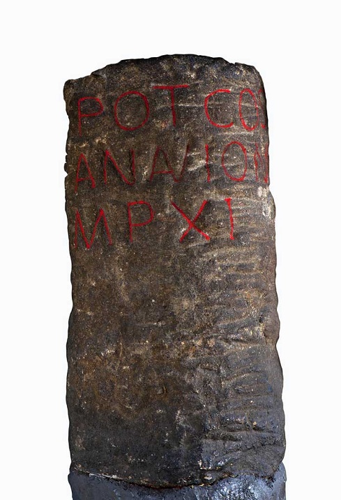
I love milestones. There is something so definite and so grounding about them, and the way in which they locate with reference to other places – you are X miles from Y – you know exactly where you are in the world. They have a long history – the Romans used them all the time, and in reality, they haven’t changed since. This one was found in Buxton, and is inscribed with the following: “TRIB POT COS II P P A NAVIONE M P XI”.
Buxton Roman Milestone, found in 1862 (and shamelessly stolen by me from the wonderful ‘Wonders of the Peak‘ website). Honestly, it is well worth taking the time to look around the site.
Which translates as “With tribunician power, twice consul, father of this country, from Navio, 11 miles”. The Roman fort of Navio is at Brough, near Castleton (information here). This is a great little fortlet, right on the river there, and well worth a trip out to see it. There’s not a great deal to see as such – rather like Melandra, it is lumps on the ground, requiring a bit of imagination – but it produced some fascinating archaeology. My favourite being an altar to the goddess Arnomecta – a local goddess, about whom we know nothing at all. She may be the same as the Goddess Arnemetiae who gave her name to Roman Buxton – Aquae Arnemetiae, but then again possibly not. Something about that both fascinates and frightens me – a lost Goddess.
Altar dedicated to Arnomecta – stolen again from the wonderful Wonders of the Peak website (use the link in the text above it for more information on the stone).
But I digress… where were we?
Milestones. Mine are nothing like as old, but they are interesting. Honest.
The first is located on the Woodhead Road/B6105 by Allmans Heath Farm and B&B. It is carved into the side of a mounting block, used for getting onto horses, is/was painted white, and it simply states ‘Glossop 1 mile’ with an arrow pointing the direction.
The milestone is at the bottom, carved into a niche. The ring on the block would have held your horse in place whilst you climbed aboard.Close up of the milestone: “Glossop 1 Mile”
Now, the mounting block is clearly old. They don’t make them anymore, for one, and the fact that the ring has been set in place using lead would certainly age it to the Victorian period, and potentially earlier. The carving is another matter altogether. I had assumed that the words would have been carved in the Victorian period, but on the way to take the photograph, I got speaking to the owner of the house there who informed me that they were only 10 years or so old – her ex-husband, being a stonemason, carved them. Well, why not? The fact that the mounting block sits next to a very old stone gatepost (on the right in the upper picture) suggests that the owners had moved the stone to the front wall in order to create a feature, which it does.
So, this one might not be of any great age, but the next two certainly are, even if they are slightly out of the area.
I went looking for the fabled White Stone of Roe Cross the other day.
I say fabled as there is very little information about it, and I was hoping to see it to put in my two penn’orth about what it is, why it is, and where it is. It is mentioned in Sharpe’s “Crosses of the Peak District” as potentially marking the junction of the boundaries of Matley, Hollingworth, and Mottram, so I thought it would be worth a look. Alas, I failed utterly to locate it, although I did get as near as White Stone Cottage, so I could’t be too far away. It has almost no presence online, either, besides a letter that was written to protest against the proposed Mottram bypass which mentions it in passing, and references to White Stone Cottage.
If anyone knows the location of the stone, please let me know, as I’d love to see it – and you all know how much I love a good stone.
Now, that same letter, also mentions a carved milestone in that area, and thinking it might be worth a look, young Master Hamnett and I set off down Dewsnap Lane to find it. Which we did in record time – standing alone in a right hand turn into the riding stables there (the location is shown by the red circle on the map below).
The Lonely Milestone
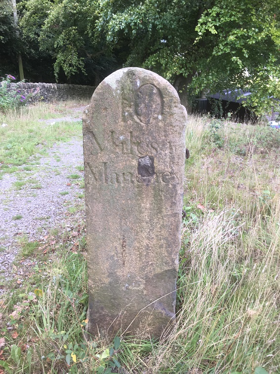
The stone states it is “10 Miles From Manchester” and I have no reason to doubt that. It has clearly been used as a gatepost at some stage, and you can see the hole where the hinge was mounted.
Close up of the writing and hinge hole.
As I turned around to leave the stables area I noticed another milestone, this one placed against the wall.
Another milestone
This one proclaimed itself to be ’13 Miles From Manchester’.
“Hmmmmm”, thought I. “Ice cream” thought Master Hamnett.
Close up of the carving.
Now, I know what you are thinking… that Roe Cross is a geographical anomaly, being simultaneously both 10 and 13 miles from Manchester; a quantum place, if you will.
The two stones are obviously carved by the same hand and at the same time – the rounded top and squared shoulders are the same in both instances, and the stone is the same – a coarse sandstone. The writing is also the same, and with the ‘long S‘ in the word ‘Manchester’, we can roughly date it to not later than the first half of the 19th Century, and possibly a little before. After this time it falls out of use, and people used the ‘short S’.
So what are they doing there? I don’t know for certain, but I have a possible/probable answer.
The ‘Deep Cutting’ between Mottram and Matley/Roe Cross was opened in 1826 as part of the Manchester to Saltersford turnpike road. Essentially, it allowed easy access between Yorkshire and the east of the country, and Manchester and the west. Prior to this, the roads were in a terrible state of repair, and the heavily laden packhorses that made that journey really had to struggle. The turnpike roads were privately financed and built, and in order to recoup costs they operated as toll roads, charging for their use (think M6 Toll road for a modern comparison).
The toll gate at Roe Cross, the place you had to pay for passage, was situated here:
The Roe Cross Toll Gate is marked on the map (indicated by the arrow). The circle shows where the milestones are now situated. This from the 1875 1:2,500 OS map.
Now, obviously, the milestones are not in their original location, and I would like to suggest that they were originally situated near to, or at, the toll gate, showing the distance to Manchester along the road. However, if that was the case, then why the difference in distance? Well, perhaps the ’10 Mile’ sign was put next to the new road, whilst the ’13 Mile’ sign was by the original, old, road. With both signs showing, most people would want to shave 3 miles off their journey, and travel along a new well surfaced road, rather than along a muddy track, pitted with animal and cart ruts – after all look how many people use the M6 Toll Road. The tentative date of the stones, too, fits with the construction of the road – the first quarter of 19th Century.
Of course, once the toll gate ceased to exist, the stones lost their usefulness, and particularly once new, more clear, signs began to be used on the roads. However, instead of being broken up, their size and shape is perfect for a gatepost, and so they were hauled a few hundred yards up the hill and given a new function.
Well worth a look of you get chance, and there is lots of good walking to be had up there. I am going to have good explore myself sometime soon, particularly up Gallowsclough, which, as a placename, can have only one meaning – ‘the valley where they hanged people’. Blimey!
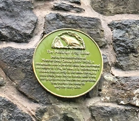
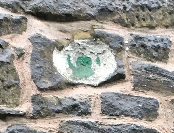
Incidentally, I love the Deep Cutting for the Mottram Frog Stone which is celebrated on the wall there, about half way down on the right (going from Mottram to Stalybridge). I couldn’t do this post and not mention it – I tweeted about it, but it is so good, that it needs to be celebrated on the blog, too.
The truth or plausibility of the story is much less important than the legend – no one criticises a fiction story for not being real, one just enjoys it!The stone itself, marked with a green frog.
There may be more this weekend, if I can manage it, but I will try to get back to my one a week post target, so stick around. Thanks for reading, and please, as always, comments and corrections are always welcome.
I love train journeys. Even the daily commute has something adventure-like about it. It’s also non-time, time spent sitting, waiting for the destination to arrive. My time to sit and think, read, and listen to music. And to write, of course. Gentle reader, I am writing this sitting on the 17.25 train from Piccadilly Station heading home to Glossop – the joys of having a new phone. We slow down as we approach Guide Bridge station, and there the post begins.
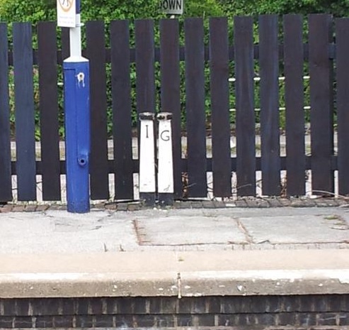
For the last umpteen years I have been commuting up and down this track, and I feel like I know every inch of it, in all seasons and in all weathers. But I have been utterly perplexed by two stones at the end of one of the platforms at Guide Bridge station (the one opposite the new ticket office, on which the train stops if you are going to Glossop from Manchester). These are the fellows:
Not my photo, alas. I had several nice close-ups, but I cannot find them in any of my files.
There they sit, painted and mysterious. I was so intrigued a few years ago, that I got off the train and had a closer look. They stand about a foot tall, and taper to a mushroom head. They are painted black and white, as you can see, and have the letters ‘I’ and ‘G’ carved into them. I am not certain what they are made from, either. It is is either concrete with very small pebbly bits added, or a coarse grained conglomerate stone. What I find intriguing is that the letters are done in a very old way – almost Georgian, or even earlier. Also, someone has taken the time to paint them with some degree of care – top, bottom, and letters are carefully marked out, and despite this being a busy, and recently modernised station. They must, in their present location, post-date the 1970’s updating of the station, but I feel certain they have been moved. The only mention of them I could find online is here, where the suggestion is that they represent “posts defining the area controlled by different District Engineers or suchlike”, with ‘G’ being Glossop, although the ‘I’ is still unexplained.
And there the matter ended… until last year. The train stopped just outside Guide Bridge to allow another train through, and I tiredly looked out of the window, blinked, and nearly yelled. Could it be? Yes, it was… another stone. Fumbling for my phone, all I could make out was the letter ‘G’, and then the train moved on before I could get a photograph. Bugger! Since then I have been trying to get the right set of circumstances to allow me that shot again. And a few months ago, I managed it!
A map of the area. The original posts on the platform are marked 1, the new post is marked 2.
And here is the new stone:
Difficult to spot, but it sits against the wall. And in close-up, the carved ‘G’ is visible.
It’s clearly the same thing – same shape, size, and even the antiquated way the letter have been carved is clear. And it too has been painted black and white, and in the same design, at some stage in the relatively recent past. It is no longer cared for in the same way, I suspect, as it is now overgrown and seemingly forgotten. I wonder too, if it was originally part of a pair, and the ‘I’ post has gone? Anyway, there the matter ended.
Or so I thought.
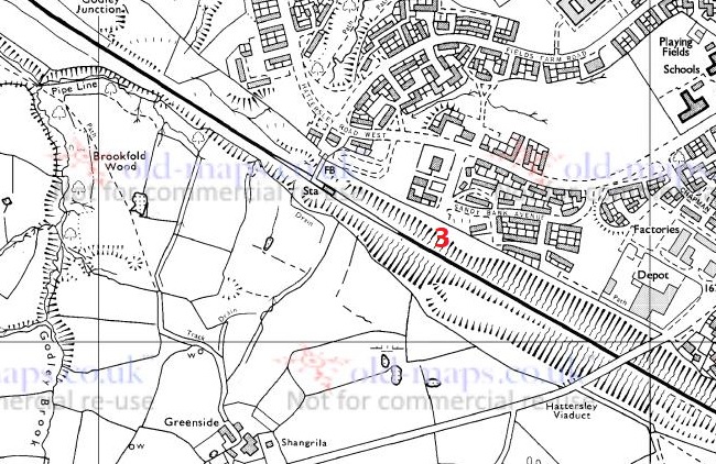
Pulling into Hatterseley station a few weeks ago, coming from Glossop, I was looking out of the right hand side of the train, and just after the big road bridge that carries the A560/Stockport Road, down, and tucked into a nook in the wall, I spotted two more of the things. They are situated where the end of the Hattersley Tunnel No.1 came out (long before Hattersley Station was built) – here on the map.
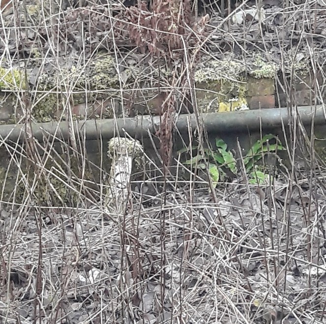
New posts marked 3
I have no photo, as the train is always in motion at this point, though I might try and get a shot off with my new phone (snazzy camera, apparently). Two of them, mossy and overgrown, but the same shape, if a little shorter. No paint that I can see, but they might have been originally. The letters are ‘I’ and ‘G’ again, but they run the opposite way to those at Guide Bridge (‘G’ and ‘I’ as opposed to ‘I’ and ‘G’).
I am now intrigued to the point of obsession! So then, the question is. What are they? There must be someone out there who knows. Surely!
I know they are technically not Glossop related, but I thought as so many of my gentle and wonderful readers commute, and that everyone loves a good mystery, you would forgive the misuse of the blog. Anyway, if nothing else, it will give you a chance to play i-spy on your next train journey, trying to spot the posts (the Hattersley ones are hard – blink and you will miss them).
There will be more posts this weekend too, real Glossop history ones. With pottery and other goodies!
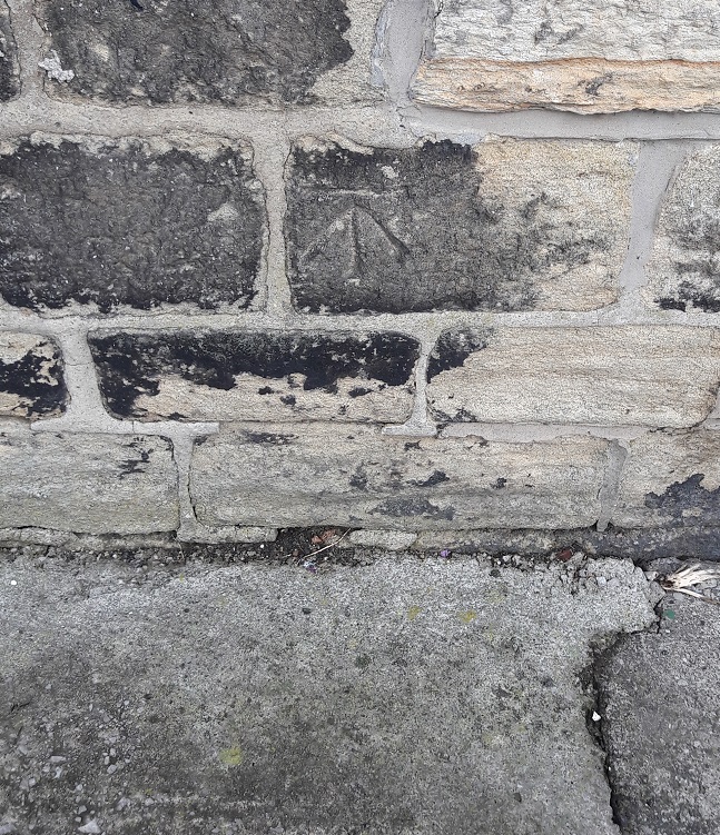
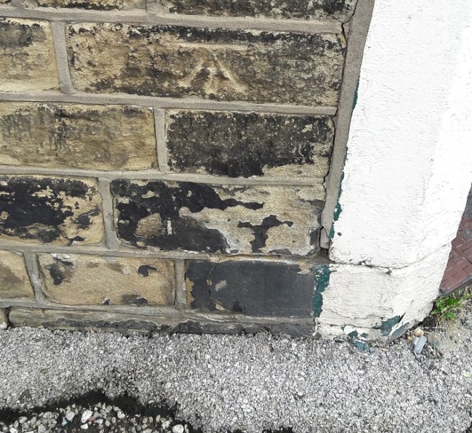
I realised recently that I still have quite a few Whitfield bench marks that I have not yet found, and that despite me having a bench mark obsession, I haven’t posted any for a long while. So here we are…
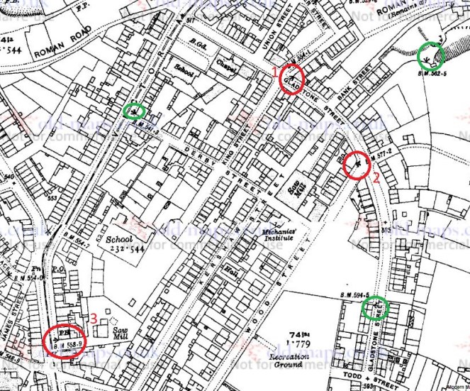
1921 1:2,500 OS map. The bench marks circled in red and numbered are photographed. Those circled in green are no longer there.
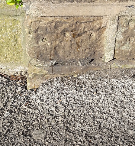
No 1 was extremely difficult to find at first – the building still stands, so it stands to reason that the mark would still be there. It is, but like the mark on the edge of Flatt Farm (No. 10, Here), the ground level had risen over the years – squint, and you can just about see the horizontal part of the mark. It took a while…
The mark is just about visible dead centre of the photo, just above the tarmac and just below the mortar. 554.1 ft above sea level.
No 2 was fairly easy to spot:
On the corner of a building/house – 577.2 ft above sea level.
No. 3 is on the corner of the Surrey Arms on Charlestown Road. Bizarrely, this is a pub in which I have never actually set foot. I fully intend to rectify this outrageous omission at some stage in the near future – if anyone fancies joining me for a swift half or three, let me know. The Surrey Arms is an interesting place, and has strong local connections. According to the earlier incarnation of me, it was built just before 1846 by a James Robinson, who also owned the Naptha works near the Beehive pub. This same James Robinson also built the Whitfield Brewery in 1849, and which was built on and used the waters from Whitfield Well. Hamnett then relates all the subsequent owners – Thomas Hampson in 1867, Samuel Clarkson in 1876, then later it became Walton’s Brewery with Adam Slater as the brewer who…
“made a special brew of ale for the late Lord Howard of Glossop to be consumed when the present Lord came of age. It was buried, and I have been told that when it was opened, it was stingo; only one pint for each person was allowed, and even that proved too much for some – it was true barley wine.”
Stingo (here and here) sounds like my kind of drink! The brewery eventually became a laundry, and was opened as such by Alderman B. Furniss in October 1895. Now that is a sad end.
No. 3 – The Surrey Arms. 558.9 ft above sea level.
Comparing the 1921 map with the 1968 1:2.500 map reveals that the No. 1 bench mark above has moved – probably because of the shift in ground level. Thus we have No 4:
It is now situated on the wall of a domestic house, but which was once The Sparrows pub, and more recently Flanagan’s. It stopped being a pub in about 2011, but I can find no more information about this pub, so would appreciate any thoughts.
No.4 – the ex Sparrows pub, or more recently Flannagan’s Irish themed bar… begorrah. Anyway, it is 531.89 ft above Dublin… I mean, sea level.
Right, that’s almost it. There are one or two more in this area that need checking out (when I get time…), so watch this space. And anytime anyone fancies a quick walk to find these things, give me a yell.
So, once again, I am forced to apologise for the lack of activity here of late – I expressly didn’t want the blog to be like the diary you start on New Year’s Day, full of good intentions, only for the next entry to be Auntie Mabel’s birthday sometime in July. The same can be said for those of you who I have not yet replied to their emails. So by way of an apology to you all, have a series of posts, starting with this one on the Guide Stoop.
Following on from the revelation here that one of the destinations on the stoop is probably Hayfield, I came across another example of a triangular guide stoop – this one is in the care of Saddleworth Museum and is kept in their outside/garden area.
The triangular guide stoop at Saddleworth Museum, similar in shape and style to our own.
It originally stood where the Standedge Road meets the A62 Huddersfield Road, and shows 6 destinations, two on each face, including Oldham, Manchester, and Huddersfield. Here’s how it would have originally looked:
From Huddersfield Highways Down The Ages by W.B. Crump
So this is similar to how the Glossop guide stoop would have looked… which got me thinking! If its original location was the top of Whitfield Cross, I wonder if the stoop would once have stood on top of the cross shaft. I find it unlikely that the guide stoop makers and installers would have made a new shaft if there was one standing in the right place already. Especially, as we must remember, by this time (early 18th Century) it had already lost its cross head, and due to puritan and Methodist views of the local people, would have lost all of its symbolism as a ‘Christian’ thing. In fact, so much so had it fallen from grace, that less than 100 years later it would be nicked and moved as a prank. So why not bung it on top of this convenient shaft?
Now, there is no evidence for this, and certainly there is no indication that anything was fixed to the remaining portion of the shaft as it is now, but we don’t know what was removed, or has worn away in its intervening 200 years standing as a stile. Just a thought.