Well, so far I have managed to fail utterly in my New Year’s resolution in posting at least once a week. So my apologies. A lot of my spare time has recently been taken up with writing and preparing for a talk I am going to give on the subject of Whitfield Cross. Interestingly, the Whitfield Cross post (here) is by far and away the most popular on this blog. I know this because behind the scenes here, there are a whole pile of statistics that can be accessed that tells me how many people visit each day, what they look at, and even from where they come – yesterday, for example, I even had a visitor from South Africa! Now, I have no idea why the Whitfield Cross post is so popular, but when I was asked to give a talk on any subject, I though I’d go with that!
The talk is titled: Whitfield Cross – Glossop’s Saxon Heritage
To be given to the excellent folk of the Glossop and Longdendale Archaeological Society (website here) on Tuesday 3rd April at the Bluebell Wood pub, Glossop Road, Gamesley. Talk starts at 7.30, so get there a little earlier, and it’ll cost £2 on the door (although for £5, you can join GLAS and reap the benefits for the year).
The talk will draw on the blog post, but will include new research into Glossop’s only Anglo Saxon feature, and include a discussion of other examples of Mercian Round Shafts.
Plus, this is your chance to find out who Robert Hamnett actually is… and buy him (well, me) a drink!
In all seriousness though, come along – if you are interested in the blog, or Whitfield Cross, you’ll be interested in this.
Right, despite having another cold (courtesy of the ever ill James), I shall try and bash out another blog entry
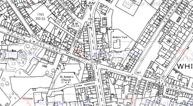
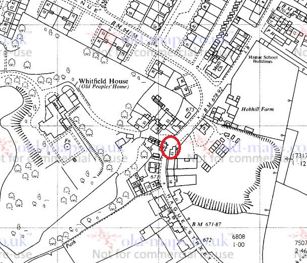
In his book ‘Crosses of the Peak District’, Sharpe (2002) lists Hollincross Lane, by St James’ church, Whitfield, as being the site of one of Glossop’s long lost crosses (p.110, paraphrasing Hamnett). When I had previously thought about Hollincross Lane, I had assumed that the name refers to the Whitfield Cross, and thus the road that runs down into Hollincross Lane via Freetown. But actually, a cross here would make sense as it would mark the junction of three trackways: north to Woodhead and beyond, east to Whitfield and thence to (Old) Glossop or Chunal via Gnat Hole, and west to Dinting and Simmondley. The way south, Charlestown Road, only came into existence with the construction of the turnpike road in the early 19th century – before that, the only way to Chunal was via Gnat Hole.
1969 1:2500 map showing routes north, east, and west. The hypothetical situation of the cross would probably have been at the church end of James Street
A cross marking this junction would have had its uses, then. Indeed, we can also play a speculation game (putting on my prehistorian’s hat for a moment) and suggest that the siting of St James’s Church (1840 or thereabouts – the foundation stone was laid on 27th September 1844, and it was consecrated almost 2 years later on 8 September 1846) was influenced by the existence (or memory) of a cross there indicating holy ground. Wild speculation, I know… but let’s pretend! Etymologically speaking ‘Hollincross’ may be understood as either ‘Holy Cross’, or ‘Holly Cross’ – a cross covered in or situated by some holly
Now obviously there is no cross there now, and Hamnett, writing in the late 19th century, could find no trace of a cross either – seemingly it’s location was lost to even the oldest residents of Whitfield. At some stage, then, our hypothetical cross has been removed. This could have happened for any number of reasons, ranging from pious iconoclasm (a stone cross is an object of adoration and thus ‘Popery’, or Roman Catholic veneration of things and people) to it simply being in the way of traffic. I know of one example, not local, of a 9th century Mercian Roundshaft that was rescued from a farmer who was in the process of rolling it down a hill and into a stream in order to plough his field. And this was in the 1960’s…
Crosses and bases were, then, broken up and re-used in walls, and as people don’t move stone further than they have to, especially in a stone rich area such as this, it sometimes pays to have a look around to see what you can see. With this in mind, and taking advantage of a lull in the rain, James and I went for a wander down to St James’ churchyard (via the park, obviously). He had a whale of time, helped no doubt by the drink of juice that the rector gave him! So, what did I find? Nothing definite, certainly, but just possibly, something.
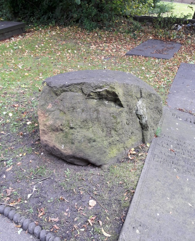
A stone amongst the stones. What is this lump?
Just opposite the main entrance to the church, by the path and amidst the gravestone sits a large lump of stone. It is roughly 2′ square and 1′ high, has been knocked about a fair bit, and is now fairy shapeless. However, one side has clearly been shaped and worked, and with the eye of faith one can see chisel marks.
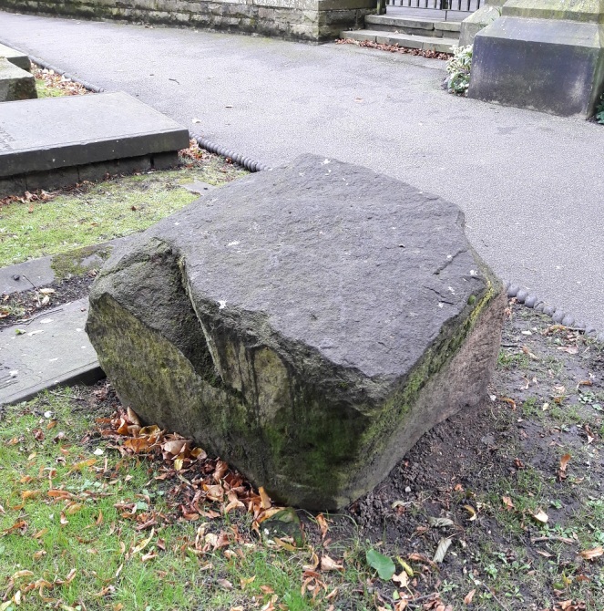
The side closest to the camera is flat and has been worked by tools. Is this the base of Hollin Cross?
Now, I am not sure what this is! It is not a glacial erratic as they are often rounded and smooth like a pebble, and I don’t think it is part of the church building, as it is the wrong type of stone. It might be the cross base, but there is no visible socket – the hole in which the cross shaft sits to make it secure. However, the socket may have been on the part that has been knocked off, or is perhaps underneath if the base had been up-ended. It is very uncertain, but we can be sure that the stone was not planned as such to be there – it makes no sense, and doesn’t even have an aesthetic value – rather it is a left-over from the land prior to the construction of the church.
I had a look around the walls for cross pieces, but could find nothing likely, and I think a winter trip around the churchyard is in order!
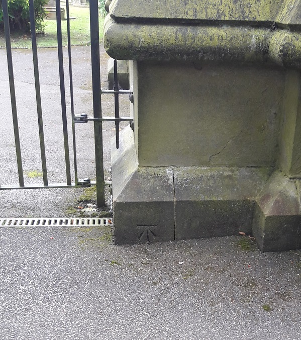
Of course, whilst I was there, I took the opportunity to photograph the bench mark on the church itself – how could I resist!
548.9 ft above sea level, to be precise. That’s a roughly 120 ft difference between here and the top end of Whitfield Cross.
Here’s a strange one, and one that may have a perfectly reasonable explanation, but it is a bit of a mystery.
First some context. I have always been intrigued by free-standing stones, and the multiple uses to which people put them. From glacial erratics to carved crosses, and from prehistoric standing stones marking a ritual space to boundary stones marking a modern urban district boundary, we rely on the natural material as a marker, as we have since we first found a need to mark place. There is something very human about a stone marker. A lot of my work in archaeology has been involved exploring space, and how we mark it, how we make it different from other space (specifically, in my case cemeteries and ritual places). I won’t get too bogged down in the detail here – I have a bigger post planned that explores some of these themes (you’ve been warned… and there will be questions afterwards), but for now, I present the first entry in a series entitled “The Stones of Glossop” that will explore the multitude of free-standing stones that populate the area.
And it is a bit of an odd one.
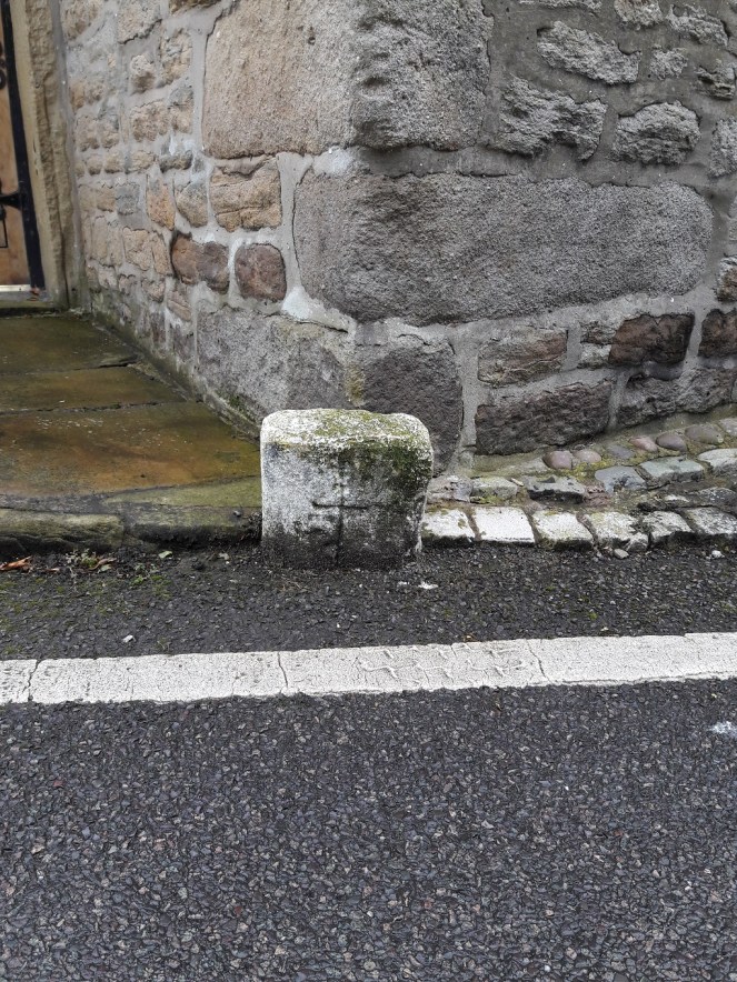
Walking on Hague Street, heading toward Derbyshire Level, and just past King Charles Court, the road bends to the left and passes very close to the 17th Century House there. Just on the corner of the house, and placed on the kerb, is a small stone.
Here!
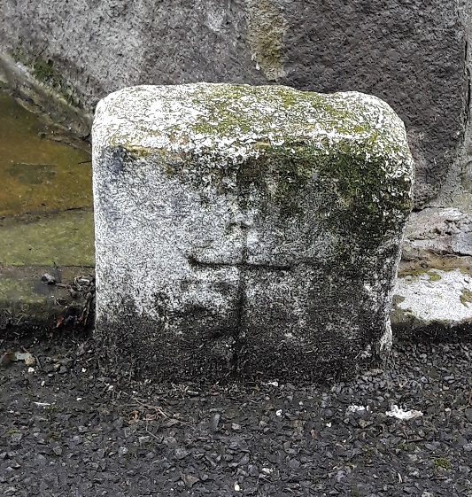
Less than a foot high, rectangular, and dirty, it was once painted white, making it very visible, one assumes, in darkness. What makes this stone particularly interesting is the neat cross carved on the front.
The stones of the 17th Century house are clearly visible behind, with what, I have just noticed, looks like a face carved into the uppermost stone in the photograph. Coincidence, obviously, but spooky nonetheless!
The cross is of the Christian variety, with an elongated vertical piece, and is very clearly intentional, with the grime of the road and many winters highlighting the effect. There may be other marks on the front surface, but it is difficult to tell if they are intentional or the result of wear and tear. It is worn, especially on the right hand side, but not as much as I would expect if it were particularly old, especially situated by a roadside, and the stone has largely maintained its rectangular shape. It has also been painted fairly recently; this may be the continuation of a tradition of painting roadside stones, or it might have been done for the first time two years ago.
Close up of the stone and the cross.
It may be modern – although that would be perhaps surprising – or it may be older – in which case, why does no one mention it in any of the texts? It could be a road marker, but there is a massive building behind it that marks the road in a much more clear way! And what is the purpose of the cross? I suppose in some way it should be considered a roadside cross, but if that is the case, I’m not sure how to interpret it. I quite literally know nothing about this oddity.
Whitfield Cross. An odd name for a road that doesn’t have a cross on it.
Leading from Gladstone Street up to Hague Street/Cliffe Road, the road takes you past Whitfield Wells, and into the heart of the Whitfield Conservation Area. I lived on King Street for a number of years, and regularly walked up and down the street, without really noticing the name beyond “hmmm, I bet there was cross here at some stage”.
However, whilst delving into the history of the area, I came across an article by the marvellous Robert Hamnett (my namesake) entitled “Botanical Ramble to Moorfield”, dated to about 1890. There is not much botany, but it is a goldmine of local history. You can read the article in PDF form here via the scanned scrapbooks of the New Mills History Society – they have a whole bunch of them to ready to read, all from the late 19th and early 20th century, and all history local to New Mills and surrounding areas, including Glossop. But I digress…
As I read the article my jaw dropped. I repeat the relevant chapter here in full as it is full of great language, some of which might need explaining.
“In the latter part of the last century the Cross Cliffe lads planned and partially carried out what was to them a most daring and audacious deed. One ” Mischief Night,” the eve of the first of May, it was resolved to steal the Whitfield cross. In the depth of night, when all was quiet, and the Whitfield lads were slumbering or dreaming of their “May birch”, the Cross Cliffe invaders came and detached a portion of the cross. With secrecy, care, and much labour, it was conveyed away nearly to its projected destination, but the exertions required for the nefarious deed had been under estimated, their previous work in removing all articles left carelessly in the yards or at the back doors of the good people of Cross Cliffe and neighbourhood, such as clothes lines, props, buckets, etc., etc., to their “May birch” had already taken much of their energy out of them, and, coupled with the steepness of the ascent to the “Top o’ th’ Cross,” distance and roughness of the road to Cross Cliffe, and the weight of the stone, they were reluctantly obliged to abandon their “loot” in the last field near to the pre-arranged destination. What the feelings were of the Whitfield lads on discovering the desecration and loss of a portion of their cross can be better imagined than described. The stolen portion remained in the field for some years. Mr Joseph Hague, of Park Hall, was solicited to restore the cross to its original form and position, but being imbued with a little Puritanism, he refused, and the other portions gradually disappeared until there is nothing left of the Whitfield Cross, except the stolen portion, which is now part and parcel of a stile in a field at Cross Cliffe, where the then tenant of the field placed it, over a century ago.”
“Blimey!”, thought I!
Date wise, the removal of the cross would have been 1790 or so. I find it interesting that the boys of Crosse Cliffe carried half a metric ton of stone for a prank… no wonder they left it a short distance from where it originally stood. An interesting bit of trivia here, though; in the northern counties of Yorkshire, Lancashire, Derbyshire, and Cheshire, Mischief Night was on May Eve rather than November 4th as it is now. How and why it switched, no one knows, but I can remember my father telling me about it (born in 1942 in Macclesfield), as well as my grandfather (born in 1909 in Blackley). A little research on the internet repays a lot of information about this, though curiously not the origin of the phrase “May birch”, meaning a prank, which I can find no reference to anywhere else.
So there the cross sits still, passed each day by dozens of dog walkers and hikers.
Upon reading this passage I quite literally ran out and had a look around, but, not knowing exactly where it was (and it is not marked on any OS Map that I have seen), I drew a blank. Weeks later, walking for pleasure rather than exploring, I walked along the right path, and the cross hoved into view.
The location of the cross on a footpath. To get your bearings, Cliffe Road is on the left, and just above the houses there are the allotments.
And it really is unmistakable.
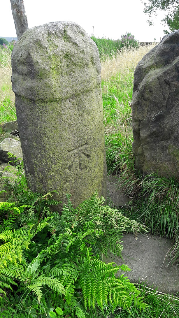
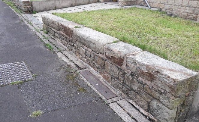
The Whitfield Cross, now permanently marked by a Bench Mark.
Technically, it is a 9th Century Mercian Round Shaft. That is, it is Anglo-Saxon in origin, carved and placed sometime between 800 and 900AD, and is of a type that is only found in this relatively small geographical area, the kingdon of Mercia. I say ‘this’ area, but technically we are living in the land of the Pecsaetan – the peak dewllers – an independent tribe until they merged with the Mercians prior to the invasion of 1066. Crosses normally have square or rectangular shafts, but the Round Shaft are characterised by an almost pot-bellied round shape, and the very characteristic band around the neck below the cross itself. Sometimes the shafts are decorated, but more often they are plain, as is our cross. Originally, it would have had a simple cross form on the top, just above the collar, and this as well as the neck, could sometimes decorated in panels. There are a few other examples of the round shaft in the area, but the closest are Robin Hood’s Picking Rods (which will be the subject of a future post).
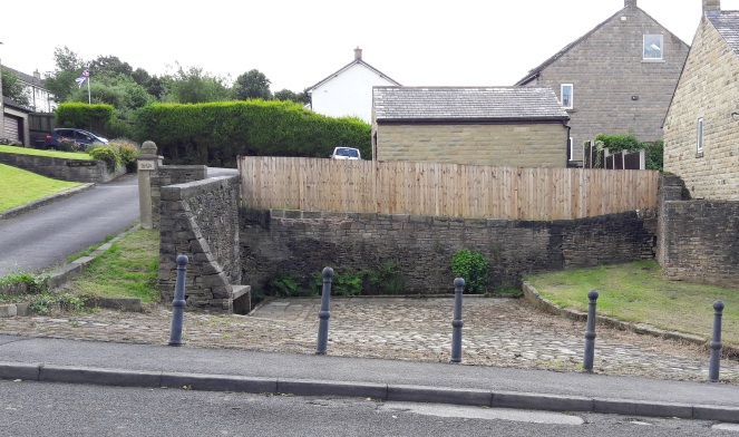
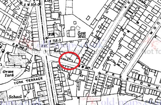
Hamnett suggests that the original location for our cross was at the Whitfield Wells, and the early maps show an area set back from the road that would work. However, it would make more sense for the cross to have stood at the top of Whitfield Cross (the road) as crosses of this sort usually mark road junctions. Here, there is the meeting of three (then) important roads.
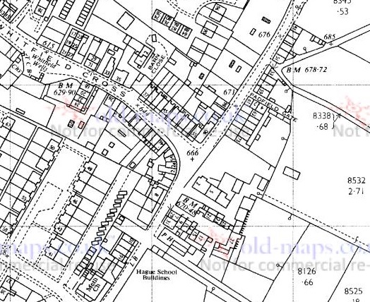
The location of the cross would have been where, coincidentally, the cross is at the centre of the map. That cross represents a ‘spot height’ above sea level, but the fact that figure is 666ft is deliciously ironic.
The old pack horse route comes from the south (Peak Forest, Buxton, and Chesterfield) through Gnat Hole, along Hague Street, through to the appropriately named Cross Cliffe, down to Old Glossop (for local traffic – the market and the parish church on Sundays), and on to Woodhead (and Yorkshire beyond, for commercial traffic). The stone would have marked the junction of the track that went along Whitfield Cross, Freetown, Hollincross Lane (Holy Cross? A cross standing by, or covered in, Holly?), Slatelands, and onto Simmondley and beyond. There was another spur coming out along what is now Gladstone Street, leading to that area of the town, and again onto Woodhead.
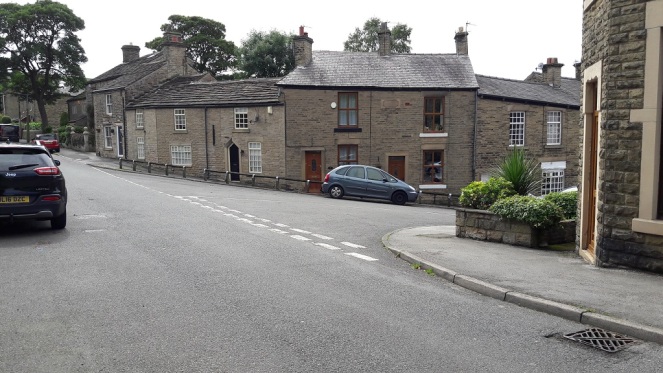
The location of the cross would have been dead centre. The roads all widen out at this point, presumably to have accommodated the cross. Left is to Peak Forest/Buxton, right down Whitfield Cross to Simmondly, behind the camera leads to Old Glossop/Woodhead
As we can see in the top photograph, the height of the land on either side of Whitfield Cross (the road) is surely testament to the age of the trackway, it being worn down to its present depth by millennia of use.
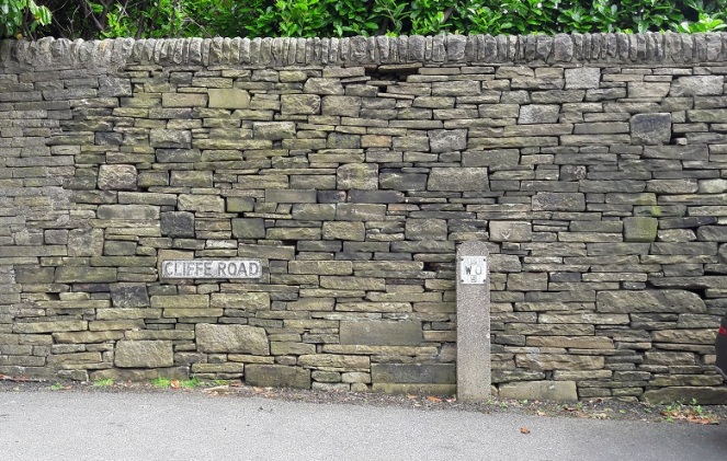
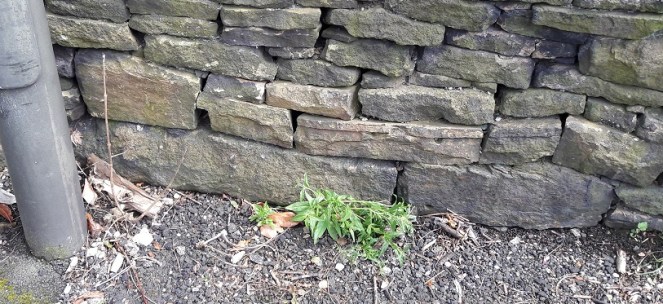
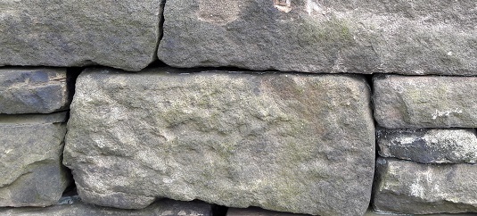
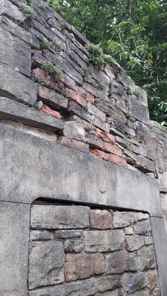
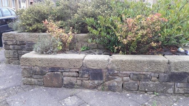
Neville Sharpe in his masterful study Stone Crosses of the Peak District notes that there are several large pieces of large built into the wall at the junction that could have formed the cross base. Closer inspection reveals numerous stones that have been re-used in the wall, several of which could be related to the cross, but without dismantling it in search of sockets, we can’t be certain.
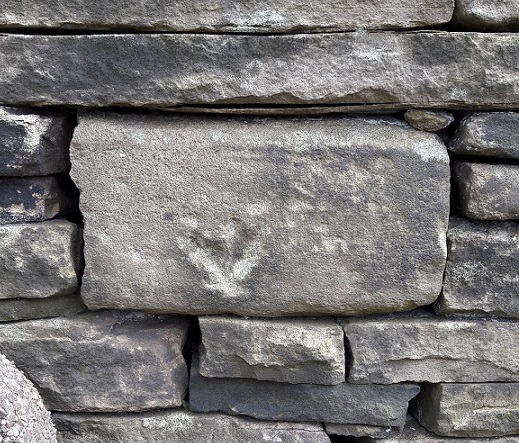
A section of walling – note the reused stone, any one of which could be part of the cross base.Likely candidates?Another candidate? Ignore the arrow, that was carved to indicate an electricity supply is buried there.Another candidate?Whilst looking at the wall, I spotted this dressed stone. It seems to have been a capstone to an arch – the curved line at the bottom gives it that impression, as does the diagonal sides. A doorway? A bridge? The rectangular panel has been deliberately pecked, perhaps to remove a date or name, or even a carving. I would suggest that it is early in date judging by its dressing – medieval perhaps? It’s amazing what you see in walls!
According to Sharpe, John Nelson, an assistant to John Wesley, preached at the cross in the mid 1700’s. This is very typical of the Wesleyan way – preaching outside and using a local landmark – and I’m surprised that Wesley himself didn’t preach here, given his activities in and love for the area. Alas, there is no mention of this is his diaries. There is a very interesting piece about the history of Methodism in the area, including a biography of Nelson, here.
I wonder how many of those dog walkers and hikers are aware of what it is they are passing by when they use that stile? Seriously though, I urge you to go and see it – it is truly a remarkable piece of history, and one that deserves a better fate than is currently befalling it.
I have a big idea about the cross! I would love to see it restored to its original site, or better yet, outside the Whitfield Wells, with a little placard explaining the history of both. The setting is perfect, and it would surely be a fantastic companion to the wells, particularly when dressed. Although in the infant stages, I am exploring possibilities… watch this space.
The cross would look perfect here, especially if the wells were decorated.
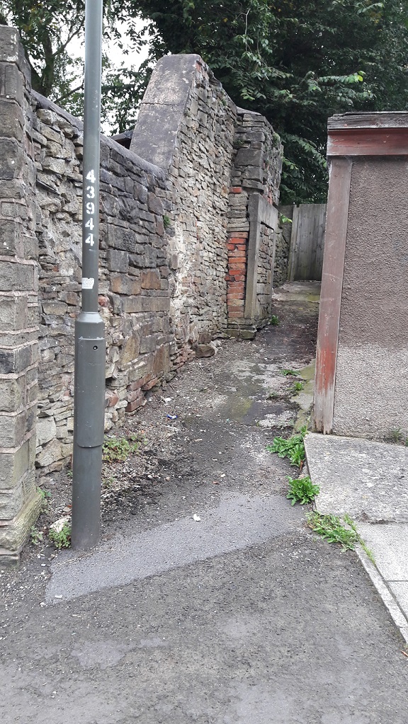
As you walk down Freetown toward St James’s church, just before you get to Charlestown Road there is, on the right-hand side, a small thin passageway that ends in a gate, probably leading to someone’s back garden or something. Now, I’m not sure if this private land as such, but I don’t think so. It is, rather, one of the anomalous bits of land left over after the extensive demolition and remodelling that this part of Whitfield underwent in the late 1960’s. A sort of architectural no-man’s land, the result of imposing a rigid housing plan onto an already existing street system, and one that had grown somewhat organically, and in a ramshackle and piecemeal way throughout the 19th Century. It doesn’t quite fit, so there are these angles and nooks left over which I like to explore. I never can resist a good nook!
Innocuous enough, and overlooked.
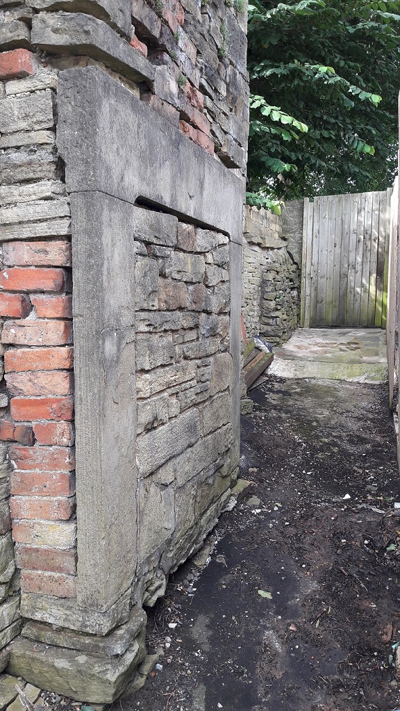
This one contains a bit of a surprise. A fireplace. A large inglenook fireplace made up of three stone – two uprights and a lintel – carved, dressed, and sitting proudly in the wall, exactly as it should be.
Except it’s not… it’s outside.
What you see is the front of the fireplace – as you face it, you would have had your back into the room. But there is no room.
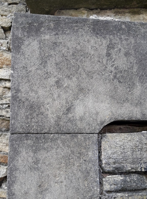
Given the size of the fireplace, and the cramped location, it is difficult to get a good photograph, so my apologies.The dressed surface and delicate lines are clearly visible. The walls around it would originally have been plastered and flat, once you get that, you can begin to reconstruct the house around the fireplace structure.
Now, putting my anthropologist head on for a moment (as we archaeologists do fairly often), we may note that humans almost universally, and throughout all periods of history, have placed great importance between the ‘outside’ and ‘inside’. This binary concept is prevalent throughout our lives, and is just about hard-wired into our brains. The inside of a house represents the safety of the domestic and the social, the known familar world, one with distinct limits (the walls), and one that is warm and safe and light. The exterior is the opposite of that – it is dark, wild, cold, dangerous, full of unknowns and without limits. Out there, we are helpless, alone, and out there, man is no longer the hunter, but is the hunted, pursued by predators. Consider too the garden; technically outside, it can be seen as symbolically taming the wild. It is outside, but is not – it is bounded by walls and fences, and the grass is cut, unwanted plants are weeded out, the trees are nurtured and the flowers are fed and watered – it is controlled by us, and is carefully and jealously guarded against incursion from the wild.
Arguably, the whole of humanity’s struggles and the evolution of society is based around this concept – making the distinction between outside and inside, developing the domestic, and keeping the ‘other’ at bay. Certainly the ‘Neolithic Revolution’ is as much about this as it is about farming, and the two go hand in hand.
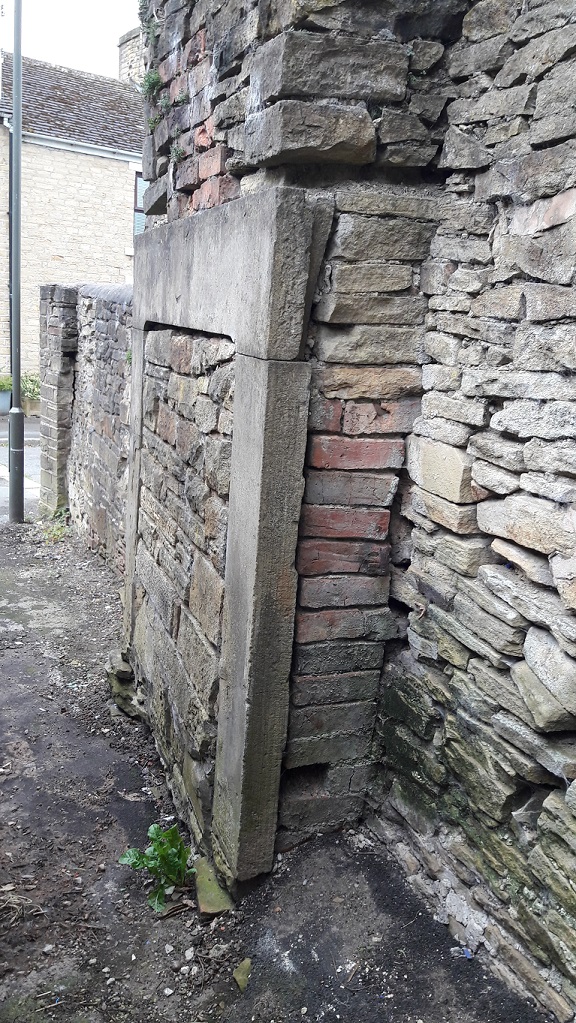
The bricked up central part seals its fate as merely part of a wall.
Now what, I hear you cry, has this got to do with a fireplace? Well, the fireplace or hearth is the embodiment of the domestic, the heart and soul of a house. Warmth, light, food, and safety all come from this one point, and it physically and metaphorically represents the concept described above; beyond the light of the fire is darkness, and we don’t know what lies in the darkness. To see it outside, the exact opposite of where it should be, is, anthropologically speaking, wrong – it is an inversion of the norm, it is unsettling and disturbing, and it is somehow dangerous.
Taking off my anthropological head, it is also a very nice piece of carved stone, and so it’s a shame to see it wasted like this. Indeed, I have a fireplace exactly like this one in my own house.
So, how did it end up here? Taking a look at various historical maps, there are a number of buildings marked here over time. The earliest, 1880, seems to have been a small outhouse, possibly a privy. The others are a bit more substantial, particularly that shown on the 1898 map, which may well be our source.
1880 1:500 map. A small outhouse or privy?1898 1:2500. A more substantial building.1921 1:2500. The building is now on an east-west axis.
The remodelling, probably largely uneccesary, of Whitfield has thrown up some interesting anomalies (not to mention the re-use of some of the original housing stone – see photos), but I think this is the oddest.
Re-use of the original building stone of the 1860’s houses of Whitfield and Freetown. These form the front garden wall of some of the 1960’s built ‘new’ houses.Doorway lintels, foundation stones, and window sills make up part of this planter on Freetown.
As always, comments and corrections are very welcome.