
Right… a sequel!
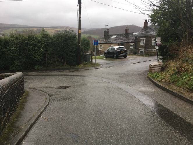
So, hopefully you all read the last post. And even more hopefully, it made sense to some of you. Ignoring the fact that the main point of writing it has been proven to be wrong, I mentioned in the post that I think there was once a crossroads at the bottom of Cliffe Road. Well, let’s concentrate on that! It’s just a t-junction now, where Cliffe Road joins Cross Cliffe (the road to the right), and continues down to Volcrepe and Bank Street (left)
But originally, I suspect, it would have gone straight on, right up to the bridge that crosses Hurst Clough – like this:
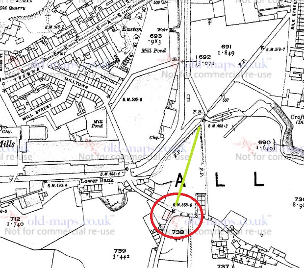
However, the whole area has been monkeyed around with pretty seriously, with the main culprit being the building of a Cross Cliffe Mill on Hurst Clough there, as you can see very clearly in this map:
So then, Cliffe Road is at the bottom, and Cross Cliffe runs to the right. My contention is that Cliffe Road once also continued on to the footbridge at the top of the map, and from there on to (Old) Glossop. Let me walk you through it.
Cliffe Road is the original medieval (and probably earlier) track that led from Hayfield down to Old Glossop (discussed HERE), and on which, at the junction of Whitfield Cross, stood the Anglo Saxon stone cross of Whitfield. Beyond this, it continues to what was originally a crossroads.
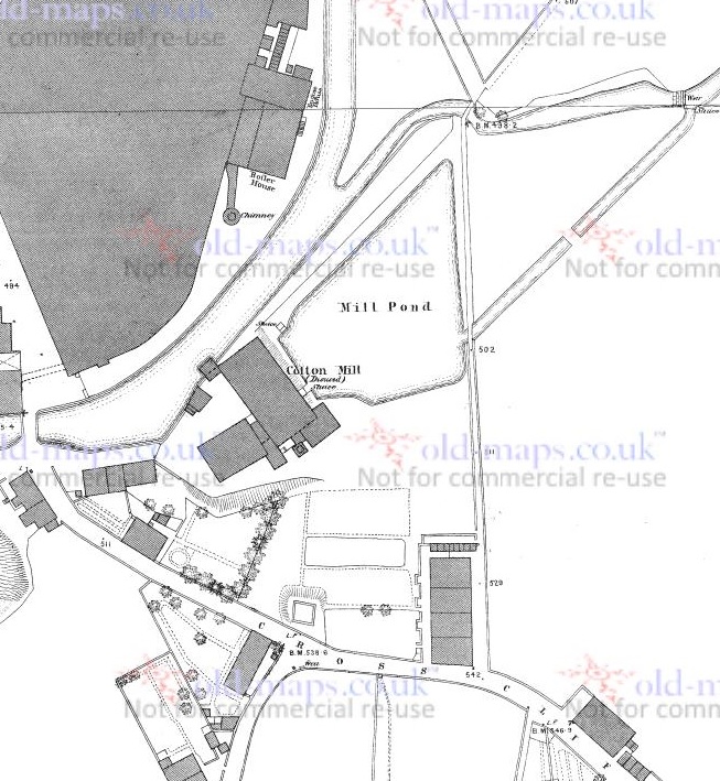
This crossroads was the junction of Bank Street (The Bank, coming ultimately from the Simmondley area), Cross Cliffe (the road leading to… well, I’m not certain, yet.), Cliffe Road (from Hayfield), and the track to Old Glossop heading north. But with the building of the mill in the early 1820’s, and specifically the mill pond, the old track was destroyed, pushing traffic further back toward Bank Street, and then along what became Volcrepe and Milltown, and giving us the kink in the road.
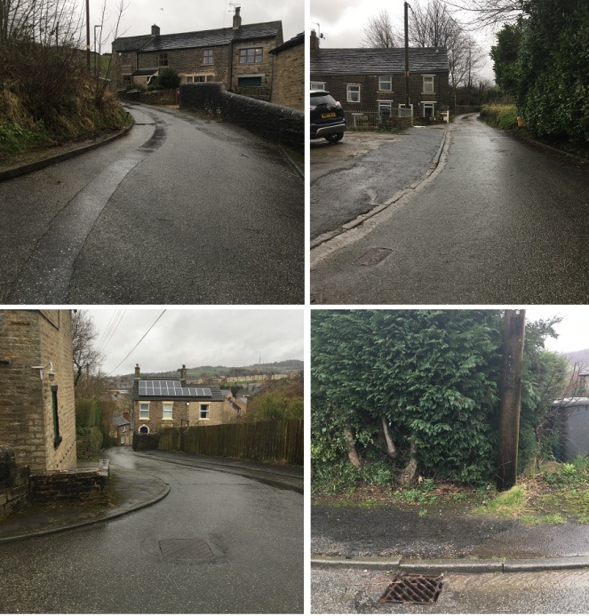
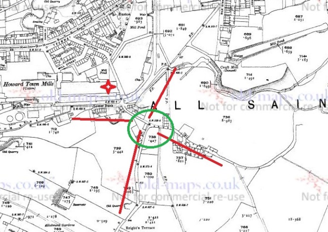
Although the northern arm of the crossroads is no longer there, there is a path way preserving the route running to the right of the houses and leading down to the bridge.
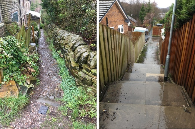
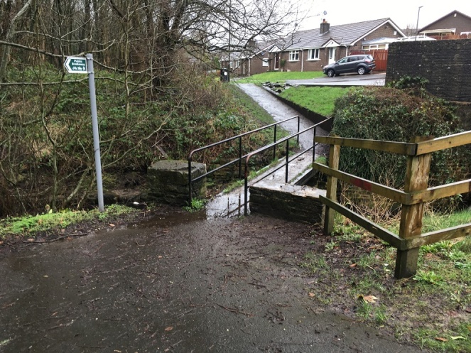
The original track lead down to a crossing over the brook there. It is now a modern concrete modern footbridge, but is clearly shown in older maps, and is thus presumably an older brook crossing – whether by bridge or as a ford.
After crossing the brook, the track continued along what is now a curiously wide and unusually placed unnamed footpath between Shirebrook Drive and Silk Street.
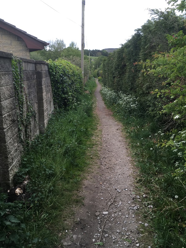
I would suggest that this footpath is the memory of the original medieval and early modern trackway preserved (perhaps fossilised is a better word), as these things often are, in the Victorian architecture. Glossop is full of these odd footpaths that lead from A to B for seemingly no reason, and often for no gain; they just exist. I have suggested that Whitfield Avenue preserves the memory of a track, which in itself preserved the memory of the Roman road, and I wonder how many others also preserve a memory of a track or road (watch this space for more explorations). From Silk Street, the track would have gone up what is now Manor Park Road to [Old] Glossop, and the church and market there.
So there we have it – a lost crossroads, and the rediscovery of the medieval way into Glossop from Whitfield.
Comments, even to tell me I’m wrong, are always welcome.
In the meantime, stay safe, look after yourselves and each other, and there is more coming soon… honestly!
Until then, I remain, your humble servant,
RH

I agree that the way through Whitfield to (Old) Glossop would originally have gone straight on, down what I presume was called Carr Bank, across Hurst Brook to Rose Green and then along the (approximate) line of what’s now Manor Park Road.
However, Burdett’s 1767 map appears to show that by then it had been diverted down the present road, crossing Glossop Brook and then following the (very approximate) line of Milltown, then over The Royle and into (Old) Glossop by the church. This would be consistent with what happened elsewhere on these ancient ways, from the late C17th on – the creation of diversions around steep slopes to make them manageable by wheeled vehicles. Approaching Whitfield from the south there’s a diversion at Gnat Hole which also takes a diagonal line across the face of a “river cliff”, created by the stream undercutting the sides of its flood plain, which wouldn’t necessarily have been there (or been so steep) when the way was first established.
The old line would probably have continued in use as a foot and horse way until it was obliterated by the building of Cross Cliffe Mill. According to the other Robert Hamnett, this was built by John Newton of Whitfield in 1782, but his account doesn’t match up with indentures discovered recently, and I think the most likely explanation is that the mill shown on the maps is a later development, probably dating from 1815, and that Newton’s mill, if it existed, was somewhere else.
But where else? I think the map gives a clue. I’ve always assumed that Cross Cliffe is a geographical description – a track running along a river cliff – but the eastern arm turns down towards Hurst Brook, then stops. There’s nothing there on the 1857 Poor Law Map, and no continuation on the other side of the brook. I think this is probably where Newton’s mill was, and that it may well have taken its power from Scotland (“Scotty”) Brook which joins Hurst Brook at that point.
If so, this is a very important site in terms of Glossop’s history, as this would have been its first cotton spinning mill, the genesis of the mill town. It’s a much more credible site than the assumed one, as in 1782 Arkwright’s patents were still in force, so anybody who didn’t want to pay up had to keep out of sight of his lawyers, and the later mill was in full view of what till the 1790s was still the main road. Newton is described elsewhere as a “labourer”, which seems doubtful, but he was unlikely to have had the means to take on the man who was then probably the richest in the world.
I say “is”, but unfortunately, it’s probably now “was”. Since the possibility hadn’t been recognised when this part of Shirebrook was being developed, nobody went looking, and any evidence will almost certainly have been destroyed. The maps have to be read with care, as Hurst Brook wandered about a lot, hence the steep river cliffs on both sides, and by 1857 it had been moved by the millowners and was later moved again, but I think the most likely site is somewhere around the junction of Shirebrook Drive and Hurst Crescent.
LikeLiked by 1 person