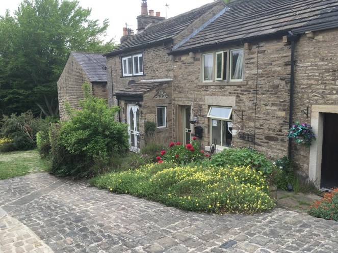
Good evening gentle readers. I say good evening, for this is when I am writing, but it could be anytime you are reading this. And indeed anyplace… which worries me slightly. Anyway, moving swiftly on.
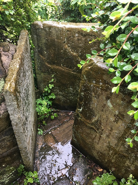
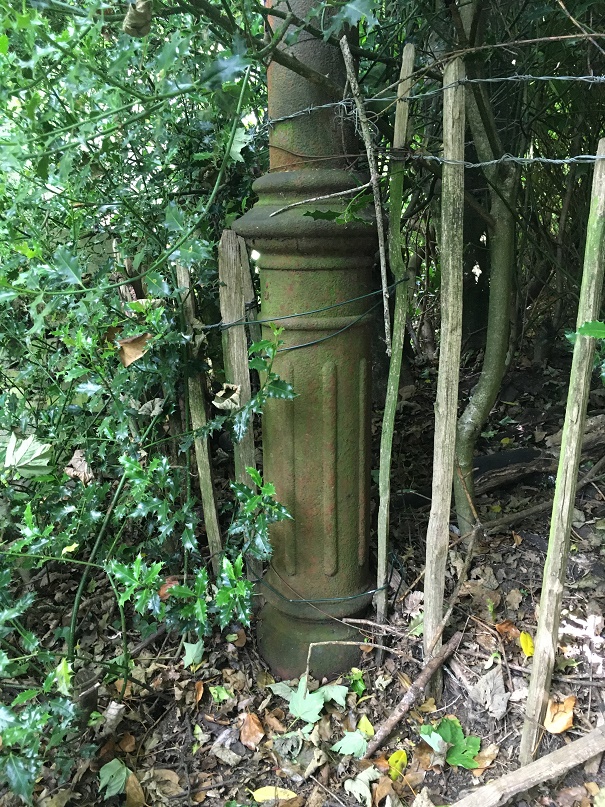
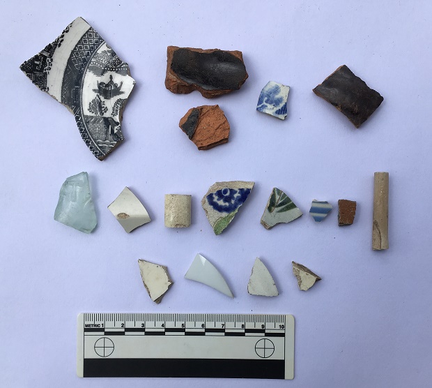
Recently, I posted a hotch-potch, pickle-type post, that looked at the cheese press I found that was being used to fill up a hole in a trackway. Well, some interesting developments have, well… er… developed.
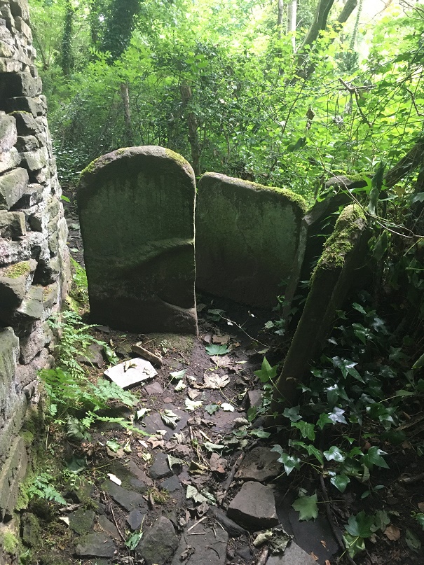
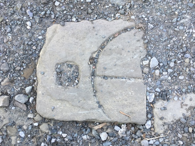
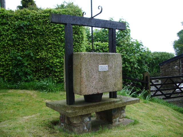
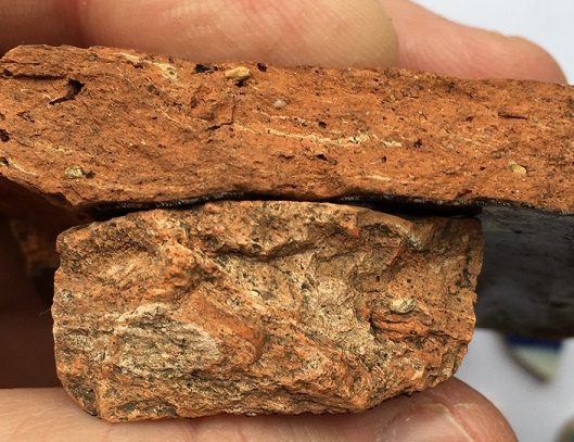
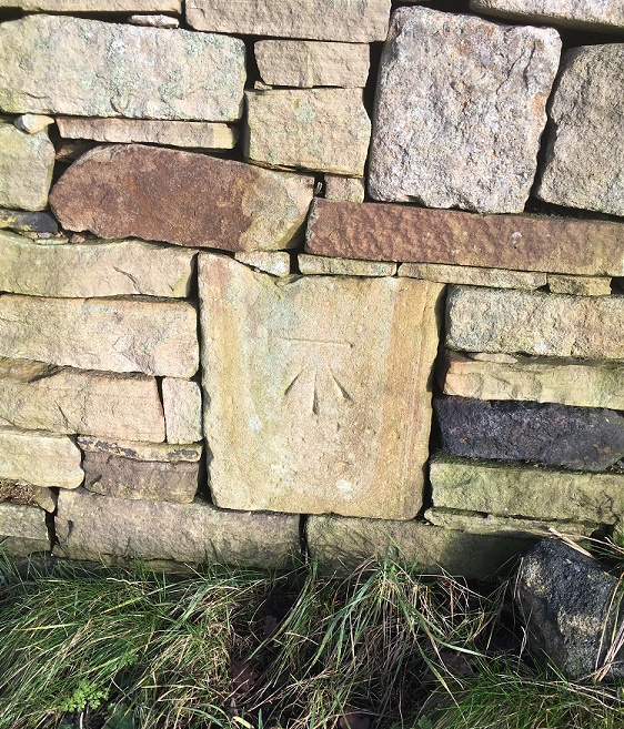
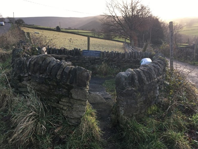
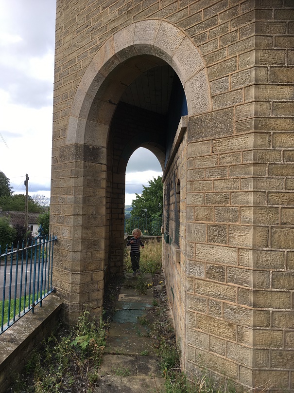
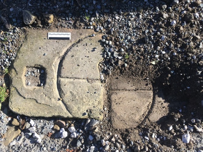
Firstly, it seems that the whole cheese press is present, which is excellent news. But alas it is broken into two pieces, which isn’t such excellent news. Still, the fact that it survives at all is pretty impressive. Secondly, and even more impressive, I think I might have identified to whom it belonged, which is amazing if true. Please note the use of the phrases “I think” and “if true“… I’ll leave it to you to decide.
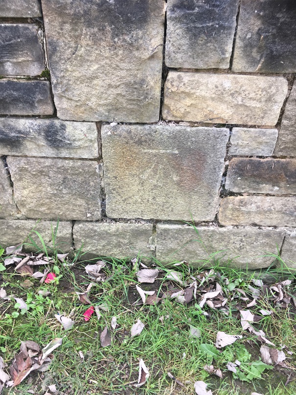
Firstly, then, the press.
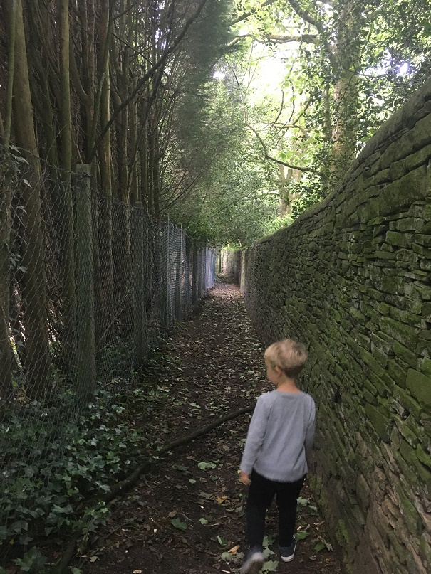
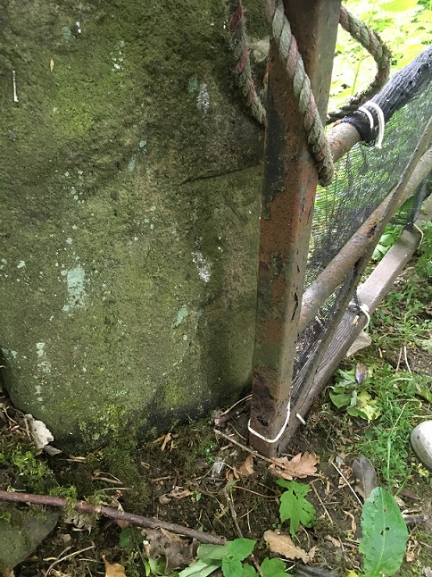
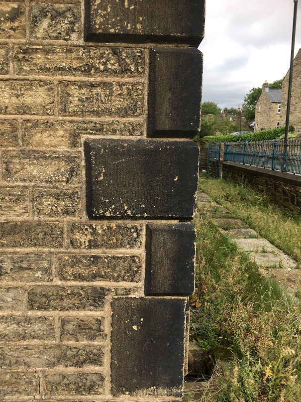
It’s complete, as in it’s all there, although as you can see it is sadly broken across the middle. It measures 94 x 43 cm, and about 10cm deep, so it’s not huge – and these things do come in huge sizes. I had a poke around mini excavation, just to reveal the edges, and to assess how much was there, but I didn’t want to dig too far – it is filling a large hole in a track after all.
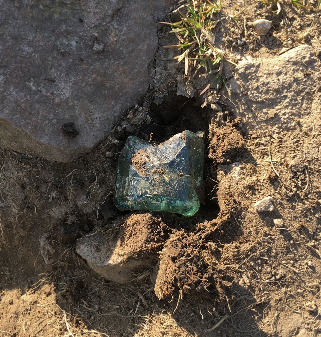
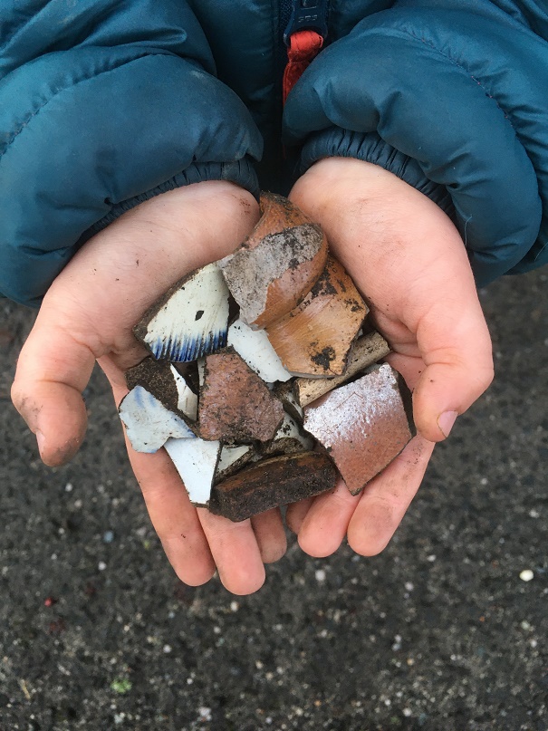
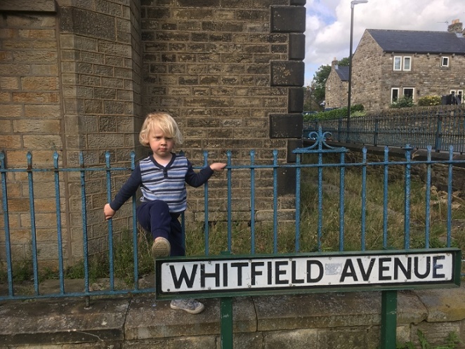
Master Hamnett helped reveal the press, of course… any excuse to get dirty.

It’s fantastic, and I honestly think that this needs to be removed from the road and put on display somewhere; it is a wonderful piece of evidence for life in 18th century rural Whitfield that deserves to be treated better than it currently is.
Right then, so who owned it? Well, I was reading through a collection of Glossop-based 17th and 18th Century wills the other evening.
Before we move on, perhaps we should examine that statement. I have just read it back, and the thought occurs to me… mine is perhaps not what you might call a ‘normal’ life. I mean, here I am, on a Friday night, reading 300 year old wills, and getting excited over some new bits of pottery I found yesterday. Sometimes it’s good to take stock of one’s life… and other times it’s good to simply leave one’s livestock alone.
Anyway, back to the wills. They have been digitised as part of the North West Derbyshire Sources project which is a truly remarkable source for local history and genealogy in this area, and filled with all kinds of information – if you don’t know the website, please do have look. The will that caught my eye was that of John Cowper (Cooper) of Whitfield, and dated 1750. The actual will is fairly bog standard, but is genuinely fascinating as it contains, in a nutshell, the contents of an average well-to-do household. Cooper was someone who we would now perceive as comfortably middle-class, but was then known as a yeoman farmer; someone who owns a small amount of land freehold (paying no rent), and who earns his living from it. I won’t reproduce the full preamble here as it is a wall of text – but it well worth a read (the full transcription is to be found here – it’s alphabetised, so look for John Cooper of 1749/50). However, the contents of the house is as follows:
| Item | Value (£ s d) |
| Imp/ Purse & Apparell | 7 0 0 |
| A large Bible & Clock | 3 0 0 |
| Two cows | 6 0 0 |
| A cupboard & table | 0 15 0 |
| Two coach chairs 15s 12 chairs 10s | 1 5 0 |
| One Fire Iron tongs, 3 bread Irons Fire Shovel & Brigg | 0 15 0 |
| One little Fire Iron, smoothing Iron Clever two Hand hooks & Spittle one frying pan | 0 3 0 |
| One Warming Pan a skellet a brass pan a brass pott & saucepan one Lead, Lead weight & Mustard Ball | 0 15 0 |
| 8 Pewter Dishes one Tankard 1 Cup 4 porringers, Spoons | 0 14 0 |
| Books & Linnen Meal Cheese & Bacon | 4 17 0 |
| One Bedsted & Bedding & a little Cupboard ith Parlour | 1 8 0 |
| One Bedsted & bedding in the long Chamber | 2 10 0 |
| One Press | 1 10 0 |
| A Long table & one little oval table ith parlor Chamber | 0 17 0 |
| One bed & bedding ith Chamber over House | 1 5 0 |
| One meal ark 8s one Chest 10s one little chest 6s one Desk 5s one Box 1s ith same Chamber | 1 10 0 |
| One Cheese Tubb 5s one kimlin 2s Cheese fatts & other wooden ware 5s & one cheese press 3s | 0 15 0 |
| One little Ark in the Porch 1s 2 Iron potts 2s a Glass case two fall tables 2s a kneading trough 1s | 0 6 0 |
| One Shovel Mattock & Bill & Dock fork & Ax | 0 3 0 |
| One Stock of Bees at Thomas Cowpers | 0 10 0 |
| Huslement | 0 5 0 |
| 46 3 0 | |
| In Bills | 88 2 0 |
| 134 5 0 |
The items listed, then, are those that are considered of value in the mid 18th century, and if you look, it’s largely the things that we would take for granted. Imagine someone doing this to your house – have a look around. Would they mention your pots and pans? Or your fire irons (assuming you have a fire – everyone in the 18th century certainly would have). Or your bed linen? Or your cheese and bacon? It’s bizarre, yet it also makes sense. There were not many frivolities then; would bacon count as a frivolity if you had raised the pig, killed it, salted it and stored it? No, it would be a resource that you had earned. Your iPad would be listed, but Cowper had a clock (along with a large Bible, valued at £3 [£350 in modern money]. Your car would be listed, but Cowper had two cows and a hive of bees valued at £6s10 (£758.35 in modern money). Your all-singing, all-dancing, ride-on, lawn mower might be listed, but Cowper had “One Shovel Mattock & Bill & Dock fork & Ax” valued at three shillings (£17.50).
Some of the items listed needed a little further exploration. For example, the ‘Mustard Ball‘ valued with the rest of the pots and pans from the kitchen threw me. But it turns out that they were literally balls of powdered mustard.

The seeds were powdered, and mixed with some form of binder – wine, vinegar, honey or raisins, for example – and when needed, slices were taken and soaked in a liquid to soften them (in vinegar, or verjuice, for example – the sour juice of crab apples), and added to food. They are still made, as they were 700 years ago, by a company in Tewkesbury (the Tewkesbury Mustard Company) who make the best, apparently (and I have no reason to doubt that). Thanks also to this fascinating blog about historical food for the information.
The above mentioned “Dock Fork” was also not something I had encountered before; a little research brought forth this:

As anyone who has ever weeded a garden will know that docks are difficult buggers to remove, and yet are brittle, breaking and leaving root fragments that will flourish into full bushes of weeds in weeks. A problem to which the answer is a dock fork, that allows you to lift the whole plant without breaking it. Obviously.
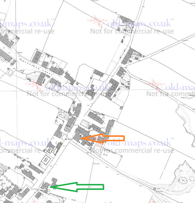
The important bit for our purposes here are those items listed that are used in cheese making, and specifically the cheese press. As you have seen, it’s not a small item, nor is it something that everyone would own – it’s a specialist implement used on much more than a domestic scale. It, and the other cheesemaking equipment mentioned in the inventory, indicate the relatively large-scale making of cheese to be sold, and perhaps supplying everyone in the local area. As perhaps only a single farm in each area would have one, I would suggest that the one mentioned in John Cowper’s will is the one I discovered a while back, and which is now filling a hole in the track. I realise that it is impossible to prove, after all the stone has no provenance, nor do we have an address for John Cowper other than Whitfield. But Whitfield as a settlement was concentrated along Cliffe Road and Hague Street – the old road from Hayfield to (Old) Glossop, and largely around The Beehive (it arguably still is) – then it is likely that Cooper lived in this area too, and thus his cheese press has not moved far. Anyway, I’m convinced. The big question is… are you?
However, although we might not be able to pinpoint his house, we do have a way of working out the type of house Cowper lived in. Essentially, the people who were assessing the worldly goods of the testator went from room to room, recording what was in each, and thus the inventory provides us with a sort of snapshot that allows layout to be reconstructed. So, on the ground floor we have the Kitchen/Living Room. This was where the main fire was, and all the cooking and eating equipment was, including “One Warming Pan, a skellet, a brass pan, a brass pott, & saucepan” and “8 Pewter Dishes, one Tankard, 1 Cup, 4 porringers, Spoons“.

This was a large long room – it contained “A cupboard & table“, as well as “Two coach chairs, 12 chairs” (which may be a mistake, as that seems a lot) – and had the fire at one end, and the door somewhere, possible in the middle of the long wall. There also seems to have been a pantry – probably just a built in cupboard – which contained “Books & Linnen, Meal, Cheese, & Bacon“. Next to this is what is termed the ‘Parlour‘ in which there is a “One Bedsted & Bedding & a little Cupboard“. Moving up the stairs to the first floor, we have the Master Bedroom, termed here the ‘Long Parlour‘, and which was presumably over the Kitchen/Living Room, and containing “bedsted & bedding” and a “press“. Next door is the ‘Parlour Chamber‘, literally the bed chamber over the Parlour, which contained “a long table & one little oval table“. The next floor up, the attic room, was over the whole upper floor and is named the “Chamber Over House“. It containing “One bed & bedding” and “One meal ark, one Chest, one little chest, one Desk, one Box“. The ‘meal ark’ mentioned here, and the ‘meal’ in the Kitchen is oatmeal, used for bread or making oakcakes, and traditionally kept in a wooden box.

So then, five rooms in total, centred around the hearth and kitchen, and with three bedrooms. This layout is a classic of its kind – very simple, very basic, but very functional. And I have to say, quite cosy. There may have been outbuildings, perhaps containing the cheese making equipment, and certainly a ‘Porch‘ is mentioned, containing “One little Ark, 2 Iron potts, a Glass case, two fall tables” and “a kneading trough” for making bread.

This type of house is described as a “Two Unit” type – essentially one large room divided into two rooms, one large and one small. The Handbook of Vernacular Architecture by R. W. Brunskill has a dozen different configurations of this type of building, and Cowper’s house could fit any one of them. Vernacular architecture refers to buildings on a domestic scale that use local building traditions, and local materials, rather than ‘fashionable’ architectural designs such as the grand halls and houses of the wealthy.

It’s just a pity that we can’t identify the actual house.
So there we are, cheese presses and wills… hope you enjoyed it. As always comments are very welcome, and I would be glad to hear from you. Please look after yourselves and each other, and until the next time, I remain
Your humble servant,
RH
![pipes[2]](https://glossopcuriosities.co.uk/wp-content/uploads/2020/07/pipes2.jpg?w=663)
![pipes[1]](https://glossopcuriosities.co.uk/wp-content/uploads/2020/07/pipes1.jpg?w=663)