Archaeology

Even More Shelf Brook Sherds

With an obvious predictability, I cannot resist having a poke around the brook whenever I’m in the neighbourhood – there is always something to find. Ok, so it’s not quite mudlarking on the Thames foreshore, but it is Glossop’s equivalent, and that makes it all the more important to us (if not quite as bountiful!). By the way, if anyone is interested in mudlarking, or the slightly haphazard and magpie approach to the past that this blog is following, then check out the book London in Fragments by Ted Sandling. I cannot recommend it enough – beautifully illustrated with fragments of pot, glass, pipe, stone, metal, etc. and each with a very interesting essay accompanying the item (be warned, the ‘Look Inside’ feature on Amazon misses out all of the photographs!). Just beautiful.

So then, the haul!
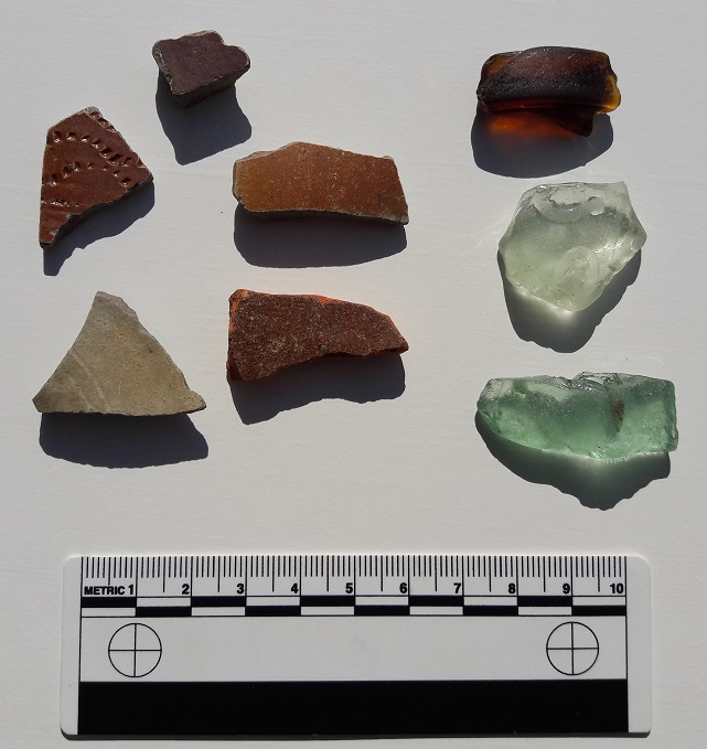
Pot 1
At first glance, not that inspiring… but bear with me!

As is becoming my habit, unless they were decorated, or a rim, a base, or a handle, I left the white glazed earthernware and china in the brook. As a rule of thumb, these are the four criteria archaeologists use to sort out the ‘feature sherds’, which are diagnostic (giving us information about date, type, function, etc.) from the ‘body sherds’, which normally make up the majority of a assemblage. It is a rule of thumb, though, and some body sherds can be equally important if they are of an unusual fabric, or are able tell us more information.

So what can we see?

Pottery first. Top sherd is a from a small-ish and closed salt-glazed stoneware vessel. We can tell it is from a closed vessel (i.e. like a bottle, not open like a bowl), by the fact that the interior surface is rougher and unfinished – why waste your time glazing it properly if no one is going to see it? Also, the salt glazing process involves literally throwing salt into the high temperature kiln where it vapourises forming the characteristic glaze; this vapour will not readily reach the interior of the vessel. This vessel was probably something like an ink pot or similar, but by the late 19th century, the date of this sherd, salt-glazed stoneware was mass produced on a literal industrial scale, so it is difficult to be certain.

Middle right. Another closed salt-glazed stoneware vessel, same date, but larger – possibly a milk or lemonade bottle bottle or similar. This sherd is thickening slightly at the left, and so is perhaps forming the shoulder of the bottle.

Middle left, is another salt-glazed stoneware vessel. This one appears to be open, and is decorated by using the rouletting method – a small wheel with teeth was run over the surface to produce the characteristic incised decoration. This one has a very common motif of undulating lines around the body of the pot. The sherd is mid to late 19th century, and probably from a storage jar or crock, and despite being relatively thin, is probably from a large vessel.

Bottom left is the base to a milk or lemonade bottle (it is flat, but lifting slightly toward the middle of the base, and you can see the concentric lines that characterise the base of these bottles). Stoneware again, but a more conventional glaze which gives it the characteristic cream colour. Interestingly, when I flipped it over, you can see a manufacturing flaw – the glaze has pooled against the interior wall, and instead of vitrifying uniformly, it has bubbled and produced a very messy surface.
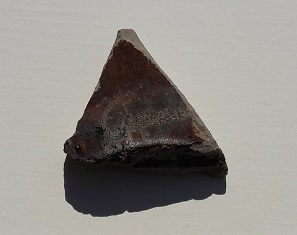
Pooled
Flawed glaze at the bottom.

However, it won’t be seen because it is a what? “A closed vessel, Mr Hamnett”, chorused everyone – good to see you are paying attention. It also illustrates why it was probably unwise to reuse these bottles – if it contained milk (raw and unpasteurised, of course), there is no way you could hope to get that clean enough, even with a steriliser.

Bottom right. An interesting sherd… honest. It is a slip-glazed earthernware vessel, and to judge from the colour of the fabric (the clay itself) and the colour of the glaze, as well as the way it flakes away, it is probably 18th Century. Of course, I could be wrong… but there is something about that sherd that gives it an early-ish date.

Glass! Top is from a corked beer bottle… probably. Certainly corked, not capped or screw threaded, and almost certainly beer. And likely Victorian, or early Edwardian.

Middle is probably a Victorian mineral water bottle. The glass is thick and has an embossed ‘&’ sign and some other marks visible, which would have been the name of the maker and their logo. Without doing a lot of serious research, it would be very difficult to say who made it, as a lot of companies were called ‘Something & Something‘. That stated, there were so many mineral water companies that the bottles tended not to travel far, so theoretically there can’t be that many in the area, so it might be worth a look.

Bottom is just a bottle fragment, again probably from a mineral water bottle. i include it here because a) it is a blueish colour, and so potentially earlier than the rest, and b) it has two air bubbles trapped in the glass. At first I thought that it might have been hand blown, but no, I think it is just a feature of the manufacture. What is fun, though, is the fact that within those bubbles lies a tiny amount of Victorian air, preserved for eternity. I wonder what the Victorian period smelled like? Actually, on second thoughts…

So, nothing truly award winning, but a little slice of Glossop history nonetheless.

Just as I was about to walk away, I turned over a stone, and found the other side was flat and dressed.

Stone 1
A lump of dressed sandstone!3

It is a sandstone, and not local to the area as far as I can tell, but then I am no geologist. The dressing can be more clearly seen in this photograph, with the low winter sun picking out the chisel marks.

Stone 2
The dressing clearly shown, with a possible mis-hit on the right.

Obviously it was once part of a building, but what part? Maybe a door or window lintel perhaps? I don’t think it is particularly old, and it is quite a coarse dressing, so perhaps it is from a worker’s cottage or similar. The bank in this area seems to have been shored up against erosion, and it probably building demolition rubble dumped here from nearby.

As always, comments are welcome.

I shall post more in a day or so… this time on the subject of Victoria Bridge. Probably!

Archaeology

More Shelf Brook Sherds

So, James and I went back to Manor Park last week and had a paddle round to see what we could see. He threw rocks, I had a poke around some sherds and and found a number of interesting bits and pieces. Behold, the haul:

More Shelf Brook Sherds
The haul of pottery!

Most of it is the usual type of white glazed stuff, the majority of which I left in situ… Mrs Hamnett can only cope with so many of these “valuable historical artefacts”/”bits of old pot” (delete as appropriate) stored in the house! The following are interesting (again, interesting is an objective term!) sherds:

Middle row, centre, is a clay pipe stem. These are quite literally the cigarette butt of the Victorian period, smoked and disposed of with gay abandon. I’m surprised there aren’t more of them in the brook, but then they are quite light and so are easily carried by the water. Date… from the stem alone, impossible to say – 16th to 20th Century! On balance though, almost certainly 19th Century, when tobacco had become an affordable luxury, and clay pipe smoking was normal for even the common man.

On either side of the pipe are pieces of glass. Rounded by being bashed against rocks, they resemble sea glass, and both come from bottles. The piece on the right is thin walled, and probably from a sauce bottle or similar.

Bottom row, from left to right is the rim of a thin and delicate shallow bowl of about 12cm in diameter. Thinking about it, it is probably a saucer, but from that fragment it is difficult to say, as is the date – 19th to 20th Century. Middle is a transfer printed handle from a tall upright vessel – possibly a tureen or similar. Date, as above! And on the right, the badly damaged base to a plate or bowl or similar large open vessel. The brown stripe across the middle is what remains of the ring base, which has come away. Date is almost certainly the same as above.

The best sherd I have saved for last, though. I thought it was an interesting rock when I pulled it out, and was quite excited when I recognised it for what it is.

Manganese
Manganese Glazed Ware – 17th-18th Century in date.

It would appear to be a sherd from a manganese glazed vessel. “Wow!” I hear you cry collectively…

Well, wow indeed! I suspect that this sherd is 18th Century in date, and could be quite easily be 17th Century, considerably earlier than the majority of the material I’ve found so far.

The blue-ish purple colour of the glaze is very characteristic, and the fabric of the pot is early – a low firing temperature has produced a relatively soft body quite unlike the hard fired later vessels, and it is a coarse earthenware, not a china. It is a thick walled vessel, again quite common in earlier pots, particularly utilitarian vessels such as storage and serving pots, and is markedly different from the mass produced Victorian vessels. I can’t tell the type of vessel from which it comes – it is an open vessel (i.e. not a bottle or similar closed vessel), and has an internal diameter of c.14cm. – so perhaps a jug, or deep bowl?

The move toward finer pottery in the late 18th/early 19th centuries as ‘tableware’ is a response to fashion – the finer the vessel, the more expensive it is – with fine bone china was reserved for the wealthy only. Of course, as a result, everyone wanted some in order to keep up with their ‘betters’, and so the demand for fine pottery trickled down the social ranks, and new ways were found to mass produce finer pottery, though obviously of poorer quality.

That this early pottery is here is not surprising – it dates from a period before Glossop as we know it existed – before the mass explosion of the mills in the early 19th Century, and the subsequent expansion of housing to cope with the need for mill workers. At this time, the main settlement area was Old Glossop, clustered around the church, and with a few mills on the water there. And of course, Shelf Brook flows through Old Glossop. I may take a walk up there sometime this weekend!

Archaeology · Oddities

The Letter ‘R’

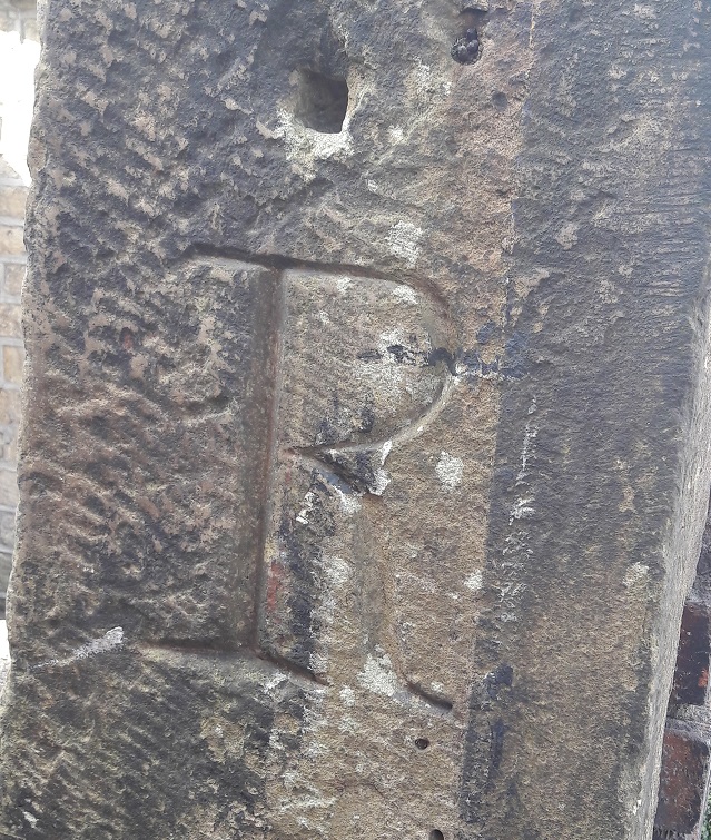
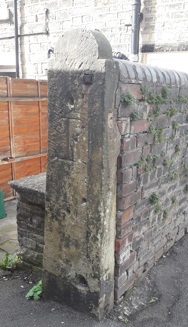
At the bottom of St Mary’s Road, on the left hand side, and just behind the back yard of The Retreat beauty salon, there is a gatepost next to the footpath. It is a fairly standard, if precisely carved, gatepost, and much like many of the others you would find in the area. However, this one has a large upper case letter ‘R’ carved expertly into its face.

Letter R 1
The letter ‘R’ beautifully carved.

I have no clue why it was carved, nor who did it, nor when. The buildings in this part of Glossop centre are among the oldest (1840’s or thereabouts), and the letter style certainly suggests Victorian origin, and probably early Victorian – the large serifs recalls Georgian lettering. It has clearly been used as a gatepost multiple times, with different gate sizes and shapes, and even paint colours – you can see the evidence in the form of holes and paint. Importantly, most of these were placed over the carving, so post-date it.

Letter R 2
Use and re-use – the evidence of the holes, fixings, and paint.

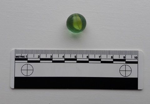
I checked the early maps for any idea, but nothing was shown that may explain its origin. I haven’t had time to check the census records, and these may shed some light on it, but as it stands… no idea! Whilst looking at the post, I found a child’s toy marble in the gutter – not a particularly old one, but it has seen some use, and is covered in scratches and chips. So obviously, I picked it up!

Marble
I can’t resist a find, even if it is not quite archaeology.

Any thoughts or suggestions regarding the letter on a postcard please (or you could just, you know, post a comment below).


Archaeology

Shelf Brook Sherds

During the sunny weather we had a few weeks ago, James (my son), myself, and some mummy friends decamped to Manor Park for the swings, slides and climbing frames. Now, James is 18 months old and desperate to explore the world around him, so when we decided to plonk our children into Shelf Brook for a spot of paddling and water-based hi-jinx, he took to it like a duck to… well, you get the idea. The brook at that point is shallow and slow moving, perfect for picking up stones and throwing them, something he loved doing.

But it is, I have noticed, also a great place to find bits of pottery and other interesting bits lying in the brook. This was our hoard for the day:

Shelf Brook Sherds
They don’t look like much, but I like them!

I found the piece on the left, immediately recognising it as part of a marmalade jar – it is a gray glazed stoneware, with characteristic vertical ridges on the exterior. I say marmalade, but actually they contained all sorts of preserved fruit, with a paper label pasted onto the exterior to say what is within. Date wise, they are long-lived… so anywhere between 1870 and 1920, or thereabouts. You can still buy them, sometimes with the labels intact, quite easily – on ebay for example. Here’s what they look like when whole:Marmalade

I actually have a whole one that I managed to piece together from a dozen sherds I found on a Victorian tip, and it now holds pens and pencils. Sherds of this type are quite a common find, and as they are so recognisable you start to see them everywhere, as future blog posts will show.

The sherd on the right was actually found by James – a proud father/son moment… his first piece of pottery! Of course, being 18 months old, he simply threw it back into the brook where it made an audible ‘plop!’. It’s a sherd of roughly painted, almost sponge ware, pottery, and quite a lovely one too, with a sort of floral leafy design in a beautiful blue colour. It is difficult to see what the original form of the sherd was – probably a bowl or plate. The date is difficult, too. I would guess Victorian, and potentially early Victorian.

Both of these sherds have been rolling around the Shelf Brook for 100+ years, and the wear pattern on each tells that story. Both are discoloured by the peat brown water coming down from the moors – the marmalade jar particularly so – and both show signs of worn edges. The longer a piece of pottery has spent being tossed about by the water and banging into stones, the more worn it gets, and eventually the edges will become so rounded that it resembles a pebble. The marmalade jar has comparatively sharp edges, but this is probably due to the fact that, as a stone-ware, it has been fired at a higher temperature and is very hard wearing. The decorated sherd is less fortunate, and has already become rounded at the edges. Interestingly, the glaze on this sherd is crazed – that is, it is covered in tiny cracks. Heat is the usual cause of this, and as it is not a cooking pot, we may assume that the vessel was at some stage placed in an oven either to heat up, or to keep food warm, and probably many times before the vessel was broken.

As we were pulling the sherds out of the brook and looking at them (there were plenty of them, but these were the two that caught my eye), my friend asked “how did they get here?”. Actually, a very good question.

There are potentially two ways. The first is that there is a Victorian tip upstream somewhere, and the material is washing out of the bank. Possible, but I don’t know of any tip upstream (not that that is a guarantee of anything). The second, more probably route, is that at some stage along the course of Shelf Brook, someone threw the pottery into the water. Humans are essentially lazy, and it is almost an archaeological law that people will only move rubbish as far as they have to in order to no longer be able to see or smell it. And no further. The brook offers a perfect place to dump waste and rubbish, and as pottery is virtually indestructible, it washed up here in the calm and shallow area before the sluice. For all the good they did us, the Victorians were some serious litter louts.

Anyway, as usual, keep your eyes open, and any comments, please let me know.

Archaeology

Bottle Top on Bank Street

I found an interesting thing the other day. I was walking down Bank Street, down to Milltown on the way to the park. For those of you who don’t know it, it is a cobbled path (setts, actually!) that winds its way through demolished mill-scapes, and which allows access to High Street East. I nearly wrote ‘easy access’, but with a push-chair it is a nightmare! That said, I really like it. It has the air of a long forgotten path, Tolkein-esque, leading to who knows what adventure.

Mirkwood
The path through Mirkwood, to the Lonely Mountain!

I want to do a longer post on Bank Street at some stage in the near future – it is interesting and full of history. It was originally believed to follow the path of a Roman road, although more recent research suggests, however, that this is in fact an early-modern (16th Century or so) track.

However, for now, I want to share my find.

Bottle Top 1
The screw-thread can be seen winding around the base.

It is a bottle stop made from vulcanised rubber. It had eroded out of the side of the path from behind a partly ruined wall, and was just lying on top of a trickle of soil on the left hand side going up. The screw-thread winds into the neck of a thick-walled glass bottle containing a carbonated liquid – often a soft drink such as water, but also beer. Originally it would have had a soft rubber ring around the cap that would form a seal to keep the drink fresh until it was unscrewed. The design was patented in the early 1880’s by Henry Barrett, and immediately became very popular, with various design improvements ensuring the basic concept was in use for nearly 100 years. Generally speaking, though, the date of such a screw top is roughly 1890-1920, after which time the crimped rim top became popular. There is a really interesting website that details quite a bit about these bottle stops here.

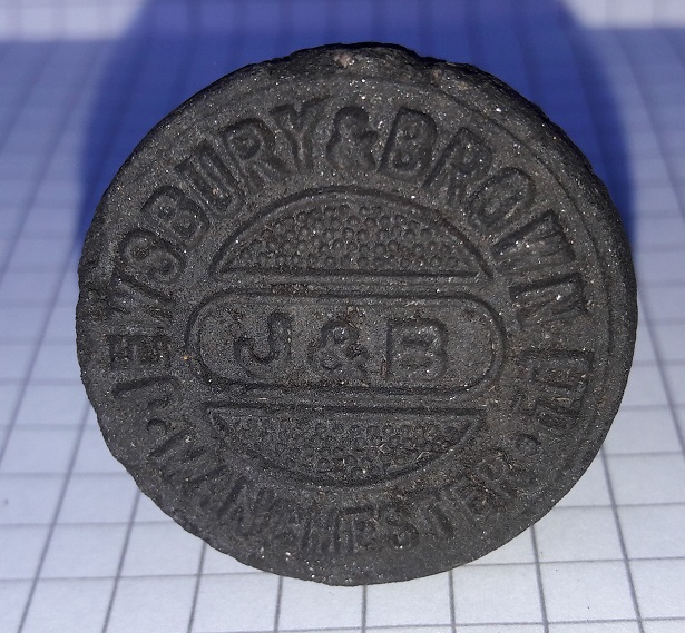
More interestingly, and as was quite common, the top of the screw cap carried the logo of the company manufacturing the drink inside the bottle – in this instance, the company is Jewsbury and Brown Ltd, Manchester.

Bottle Top 2
Jewsbury & Brown Ltd. Manchester. The preservation on the bottle top is wonderful.

Jewsbury and Brown were a large company founded in 1826 and based in Manchester, their premises being at 113 Market Street, and later Ardwick Green. They produced carbonated drinks that were sold in Lancashire and the north, and beyond, until they were bought out by Schweppes in 1964. A bit of internet research reveals that they specialised in non-alcoholic carbonated drinks, fizzy water, and toothpaste – but, disappointingly, never beer! Here is a bit of their history, but much more is available online with a little search.

I love this – not just a bit of archaeology that quite literally threw itself at me, but a real tangible insight into the lives of those of the past. There was nothing else associated with the screw-top, and one gets the impression that it was simply unscrewed from the bottle and thrown over the wall, the thrower determined to drink whatever was within the bottle in a single sitting. Let’s imagine them walking along that uneven path when they did it, clogs striking the setts, perhaps on a hot summer’s day, and at the end of a long shift in the mill, appreciating the fizzy drink playing on their tongue… 100+ years ago.

It’s a neat little thing, and one that will be added to the collection. It also makes me wonder what else is behind that wall, waiting to tumble out, so keep your eyes peeled!

Archaeology

Copper Nails

Some years ago, whilst walking to the station for my daily commute, I passed down King Street in Whitfield. As I approached the middle of the street, I had to skirt around some scaffolding that was placed onto the front of a house, and projecting into the path. As I passed, I looked down and saw, scattered quite literally all over the the path, dozens of pieces of thin green metal. On closer inspection, I could see they were copper nails, and promptly pocketed all that I could see.

Nails 1a
Fistfulls of copper nails!

The roof of one of the stone-built terraces on that street was being replaced and the copper nails were the fall out, having been removed during renovations. They had been used to pin the heavy stone roof tiles in place, each one carefully nailed into the timber through a hole drilled through the stone tiles, and now, no longer needed, they were simply tossed aside onto the street to be swept up. Now that is, I think you’ll agree, a shame; these little pieces of history deserve better! And besides, I can’t resist picking up interesting, and sometimes shiny, things!

Nails 1
The nail second from right has clearly hit a knot or some similar obstruction and folded. One wonders what expletive was uttered by the workman when he saw it bend… and then carried on hitting it in order to get the job completed as speedily as possible.

They are formed from copper, rather than iron, because copper doesn’t decay the same way iron does – it maintains its strength for far longer, resisting the elements and doesn’t turn to rust. Ship’s nails are made from copper for the same reason. Instead, it develops a thin green patina called verdigris, which makes them particularly beautiful to look at, especially when the verdigris is partly sanded off.

Nails 1b
A very bad photograph to illustrate the sun shining off the copper, contrasting with the matt green of the verdigris. These things are difficult to photograph, but very pretty!

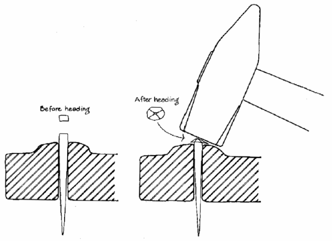
They are also hand made – each one cut via a press from a long flattened strip of copper, which accounts for the square body of the nail. It is then placed into a small mold or former, point down, and the exposed top is hammered by hand until it flattens out, forming the nail head, like this:

Nails 2
Illustration taken from ‘Nail Chronology’ by Lee H Nelson (American Association for State and Local History, 1968 )

This method accounts for the thin flattened strips on opposite sides of the nail, just below the head – the former is made of two adjustable halves to enable different size nails to be made, and when pressure is applied via the hammer, the copper is forced into the gap between the two halves of the former.

These nails date from the early to mid-19th century – I seem to remember reading somewhere that the houses in King Street were built in the 1860’s, and, one assumes, the nails are contemporary.

That said, my own house, which dates from the late 1840’s, originally had wooden oak pegs holding on the roof stones. When we replaced the loft insulation, we found dozens of them lying on the floor of the loft where they had been thrown down.

pegs

What I love about these is that you can see each the stroke of the knife that was used to form the pegs – in the photograph above the peg at the top was made using eight strokes, the middle using seven strokes, and the bottom peg using eight.

Whilst being fun and interesting artefacts in themselves, there is a sense of connection with the human in these objects; both have been formed by hand, and the mark of that hand is visible in both – the hammer and the knife. That for me is what makes archaeology so fascinating, connecting to past people through the objects they made and used, and the story they tell us.

Update. 

Whilst taking advantage of the sunshine to do a little gardening, I came across this little piece amidst the great piles of stone that originally littered our garden – a stone roof tile. It is very small, and is presumably a broken fragment, which explains why it is no longer on our roof. What is fantastic about this is the fact that you can see the hole that would have originally taken one of the pegs illustrated above. I love things like that!

Roof Tile
The peg hole is top right of this broken tile – you can clearly see the traces of the boring that created it – and it is a perfect size for the oak pegs shown above. The break in the middle is new, though – I think I may have trodden on it!
Oddities

Roman Inscription… Or Lack Thereof!

The previous post about the date stone reminded me of something I read a few years ago. It took me a while to track it down, but here it is.

Melandra Roman Fort is one of the places that you have to visit in the area if you have an interest in the past. It is situated at the edge of a dreary housing estate, and has a slightly desolate air about it, particularly the car park. But turn your back to the 1960’s built houses, and face out, standing at the centre of the AD 60’s fort, you really understand why they built it there – you can see all along Longdendale, across Glossopdale, and on the promontory it reaches out almost to the bank of the Etherow, which it overlooks for a long way either way. Strategically, it is a perfect place – commanding the area, yet safe and secure.

The area was known as ‘Castle Yard’ since time immemorial, and when it was first described in 1775 by Reverend John Watson (in Archaeologia Vol 3) the area was untouched by the plough, and the full fort could be made out by standing walls. Incidentally, it is likely that Watson made up the name Melandra – there is no record of anyone ever calling the field by that name before 1775, and crucially, Melandra is Greek in origin. I’m not certain, but I think we can go out on a limb and suggest that no rural Derbyshire farmer spoke classical Greek in the 18th Century. It’s actual Roman name seems to have been Ardotalia, a word vaguely associated with the name of the river, Etherow.

Over the years, the local farmers used the walls as quarries, building houses, walls, sheds and the like with the dressed stone found there. Amongst them, inscibed stones were found – probably one inscription placed above each of the four entrances into the fort, with more, and an altar, inside. One farmer had even built an inscribed stone over his doorway. However, not everyone understood the value in these inscriptions… I’ll let my pseudonym tell the story:

“Previous to the reservoir belonging to the Manchester Corporation being made at the Hague on the Cheshire side, the river Etherow was undermining the bank, and it was found necessary to build a wall to prevent its encroachments. For this purpose the workmen took away all the stone then lying at Melandra, and amongst them was another inscribed stone. One of the men had no knowledge of its antiquarian value and built it in the interior of the wall, though a bystander remonstrated with him for doing so, using these words in the local dialect: “thart puttin summut in neaw ut ul be wanted sum day”. A few days afterward, Mr. Bennet Woodcroft, a gentleman visiting in the neighbourhood, hearing of the matter, went to the place and offered £5 if the workman would recover the stone, but the clerk of the work would not permit the wall to be taken down, as the exact spot it was could not be accurately located”

Hamnett, R. 1899. “Melandra Castle” in Derbyshire Archaelogical and Natural History Society 21: 10-19

Amazing to think that there, on the banks of the Etherow, lies an unknown Roman inscription, bricked up by some ignoramus who couldn’t recognise its value beyond being just a piece of stone. Which makes me even more thankful that history didn’t repeat itself on the banks of Glossop Brook.

EDIT: Just out of interest, I just ran a quick value equivalency programme – £5 in 1850 is today worth about £500 – a significant sum of money.

Oddities

Brick and Stone

I was walking toward Manor Park the other day, down Crosse Cliffe and then along Milltown past the old Volcrepe buildings (well, the remaining one at least) and toward the Prince of Wales. This area is chock full of interesting historical bits and pieces, some of which I’ll share in later posts. But for now, I present an oddity and a mystery, both of which caught my eye, and which I’d like to share.

First, the oddity.

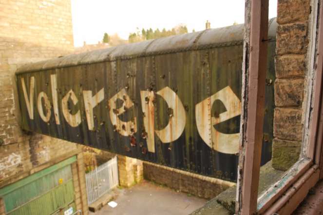
The derelict Volcrepe buildings, now partly demolished and missing its iron walkway, was a Glossop landmark. Huge and abandoned, they loomed large and formed a stone canyon down which one walked in order to get to the town centre from Cliffe Road. Spooky at night… and day, as it happens!

Volcrepe
The ‘famous’ iron walkway between the two buildings, below which the Milltown road ran/still runs. This image is shamelessly stolen, with thanks, from the amazing ’28 Days Later’ urban exploration website (more Volcrepe here). Copyright ‘Oliver’ from that website.

It is now massively reduced in size, with only the eastern building remaining, the massive western side having made way for housing and Lidl. Alas… progress!

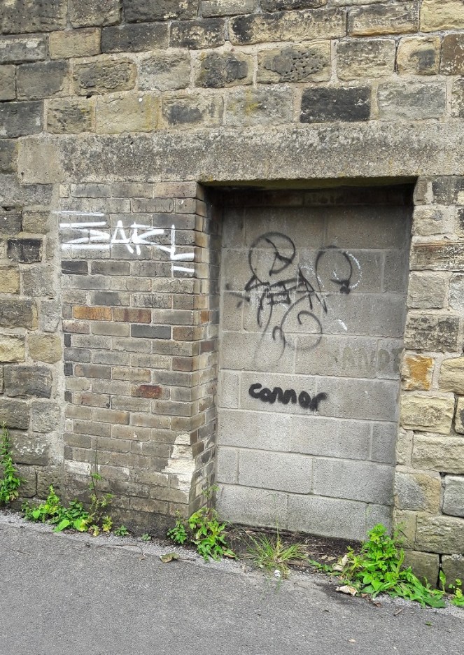
Walking along, pushing the pram, I noticed a bricked up doorway. Nothing wrong with that, the buildings are 150 years old, and doors and windows fall in and out of use. It was what it was bricked up with that puzzled me! London Stock Brick – the yellow brick that was favoured in London buildings during the 19th century and until the early 20th Century.

London Brick

It is found all over the greater London area, but particularly in the East End, and is very distinctive – bright yellow, but quite soft – the product of the brickyards of Kent, Sussex, and the inner London areas. It is very recognisable, and a walk along Brick Lane – no pun intended – will show you just how common it is in that area (more details here, or search for photographic examples).

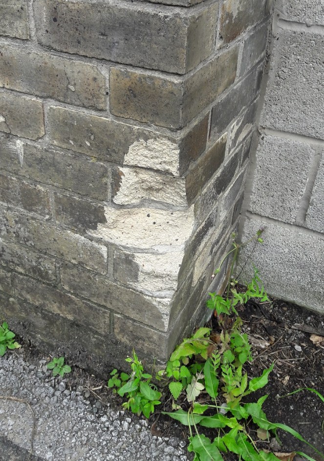
London Brick - Closeup
Unmistakeable – the yellow London Stock Brick, the place where someone has hit it with their car revealing the colour untarnished by coal pollution underneath.

How and why it ended up here, in Derbyshire, being used to block up a doorway, I have no clue. An oddity, as I say!

Now the mystery…

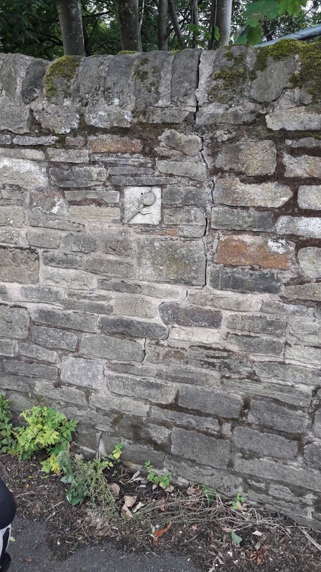
A little further along the road, and on the same side, toward the end of the wall of the Volcrepe factory, a square block caught my eye.

Tulip 1

Distinct from the rest of the wall, I approached, and was amazed.

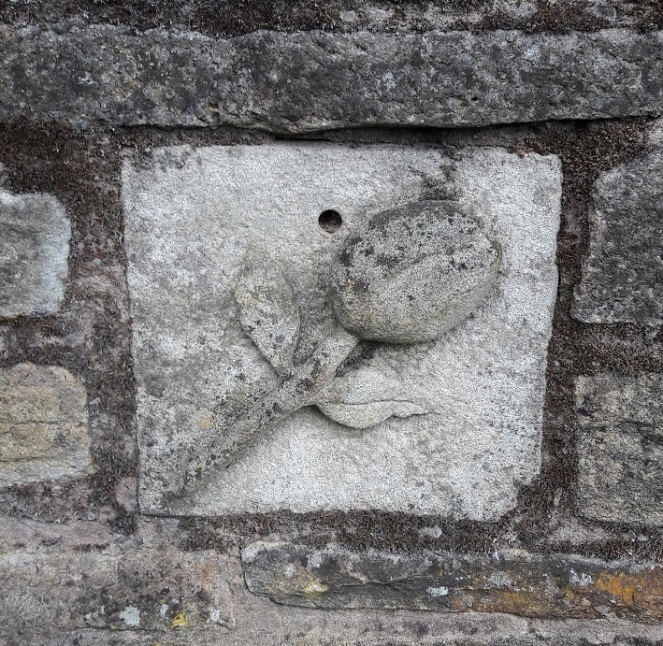
Behold… a tulip!

Tulip 2

Delicately carved in stone, a carefully cemented into the wall, the flower sits. It was clearly placed into the wall when the wall was built, and is not a later intrusion – you can see that it fits perfectly and deliberately, and none of the stones are cut to allow it to fit in. I don’t think the wall is the same age as the rest of the building, as it seems a little too ramshackle when compared to the wall of the factory, and there are bricks included in the matrix. But it still raises the question of why was the stone placed there, and by whom. And what is the significance of the tulip? Also, it’s such an odd place to put it – not above or near a door, or next to a window or other feature, it’s almost like it was found and cemented in place. And what is the purpose of the surely deliberate hole placed centrally above the flower?

A mystery!

If anyone has any thoughts or comments, please drop me a line or leave a comment below as I would love to know what and why!

Whitfield Well

Whitfield Well

Welcome to the first post of the blog, and I thought I’d start with a subject (very, for me) close to home: Whitfield Well.

Whitfield Well 1

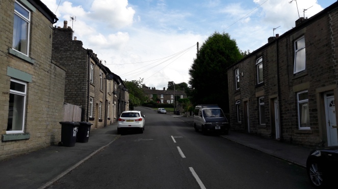
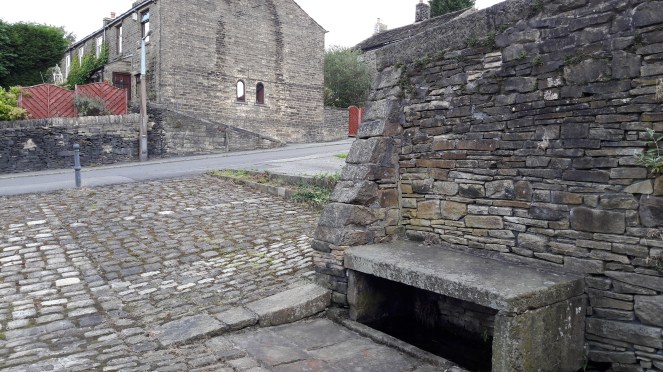
Situated on Whitfield Cross, halfway up on the right hand side, and set back from the road in a paved and ‘cobbled’ area. It is, I think, the overlooked star of the Whitfield Conservation Area. It is also a Grade II listed feature, and the description in the listing is far better and more concise than mine would be, so here it is:

Name: WHITFIELD WELL
List entry Number: 1384307
Location: WHITFIELD WELL, WHITFIELD CROSS
National Grid Reference: SK 03620 93405
County: Derbyshire
District: High Peak
Grade: II
Date first listed: 27-Jan-1978

Summary of Building:
Well. Mid C18, restored C20. Tooled slabs of gritstone. L-shaped series of rectangular troughs enclosing spring water along 2 sides, with moulded stone dams at intervals, and stone table above part of trough to east side. To rear of wells 2 sections of rubble walling with coping, that to north side partly rebuilt. East side has stone buttress. Third side bounded by stone wall of adjoining industrial yard.

So there you go. But there is a lot more to it that just that dry description.

It is a spring fed perpetual well, meaning that flows in even the most severe droughts. Indeed, its heavy flow once supplied the houses hereabouts with their drinking water, even after most other houses were plumbed into the mains. Because of its importance, it was, for a long time, the focus of a well dressing. Well dressings are justifiably famous and important aspects of the folk calendar of Derbyshire and parts of Staffordshire, and are probably a continuation, however distant, of the pagan veneration of the god or goddess of the water there. This same reverence of wells such this led to them being named, in the Christian period, after saints, though this too fell out of favour in the post-reformation period. We have no idea about the attribution of the well in either the pagan or Christian periods, but a well such as this would surely have had one.

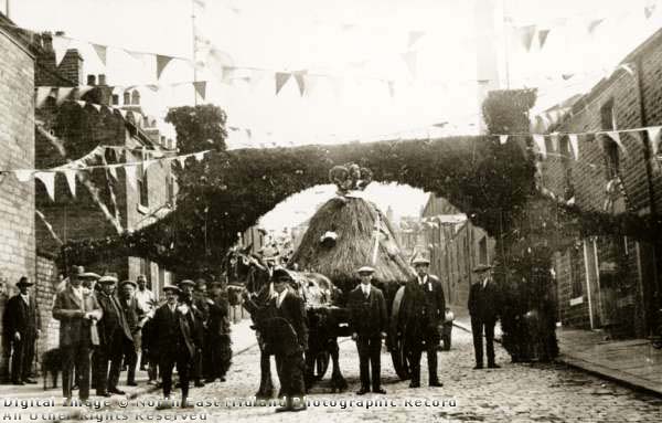
The well dressing at Whitfield was an important and rather grand affair, and seems to have coincided with the wakes week (early September), and the rush bearing ceremony at the Whitfield parish church, St James’. This involved a special blessing of the well by the vicar of St James’, and the creation of a rush cart to take the rushes to the church, where they would be used as flooring. The rush cart and celebratory archway and bunting can be seen in this (c.1920) photograph taken at the junction of Gladstone Street, and looking up Whitfield Cross.

Whitfield Well Dressing
The Well Dressing arch, with the rush cart underneath. Note the shadowy chimney visible in the sky behind the arch at the right.

The building at the extreme left of the photograph is the Roebuck Inn (now a private residence), where the Well Dressing Committee would meet to discuss that year’s celebrations. Apparently, this well was the only one in Derbyshire to be decorated with heather gathered from the surrounding moorland, though Hamnett (the actual historian, not my pseudonym) mentions it being “beautifully decorated with flowers and shrubs” Incidentally, Hamnett also believed that the Whitfield cross, the one that gave the name to the road, originally stood here at the well. More recent work has placed its original site at the top of the road, at the junction with Hague Street – which makes more sense. The cross will be the subject of a later blog post.

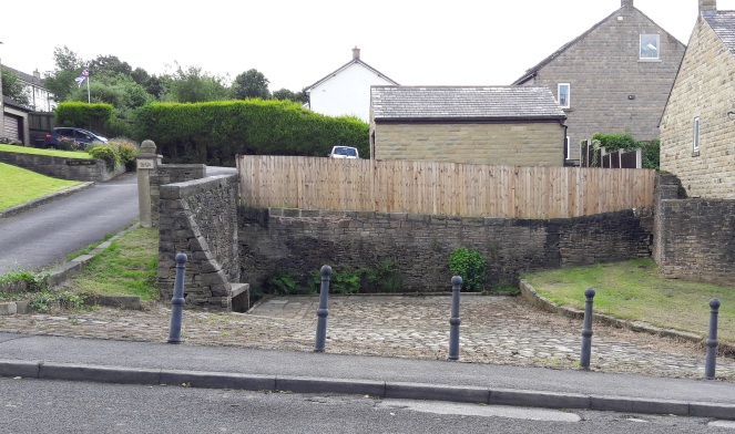
The View Today
The same view today, some has changed, but it is still recognizable.

When the well dressing died out, and why, is not clear; there is online a photograph of the 1976 well dressing fancy dress competition winners, so it continued until at least then (click here). One suspects, though, that by then it had lost some of the wonderful Victorian seriousness that the committee would have brought to it.

The water from the well also supplied a Brewery for a time. This was a two-storied building adjacent to the wells, and built in 1849 by James Robinson (who also built the Surrey Arms on Victoria Street, as well as many other houses and building hereabouts). The Whitfield Brewing Company seems never to have been successful, and it changed hands numerous times, eventually ending up as a steam laundry at the end of the 19th Century, before being demolished in the late 40s or early 50s and the area used as a builder’s yard. Finally, houses were built on the site. The tall square chimney of the brewery can just about be seen in background of the photo above – it is also marked on the 1975 1:2500 Ordnance Survey map, although I can’t believe it stood that long. There is a good, if short, history of the brewery here. Incidentally, the 1968 OS map shows a phone box at the western end of the well area.

Here are some photographs.

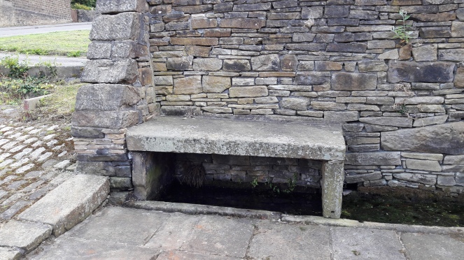
Well Bench
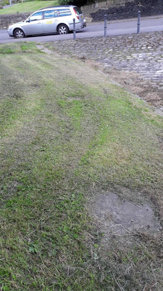
The well bench. Not sure what the original purpose of the bench was – perhaps a table for those using the well? The spring rises from below the bench and flows to the right along the troughs.
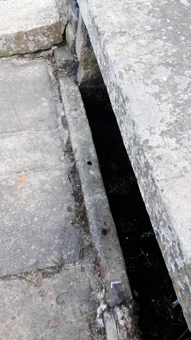
Bench - Railing
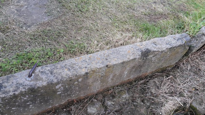
There are two holes in the kerb below the bench a uniform distance apart – possibly the remains of a railing? The iron and lead affair at the bottom of the photo is a staple that joins two kerb stones together; there are several of them around the length of the well.
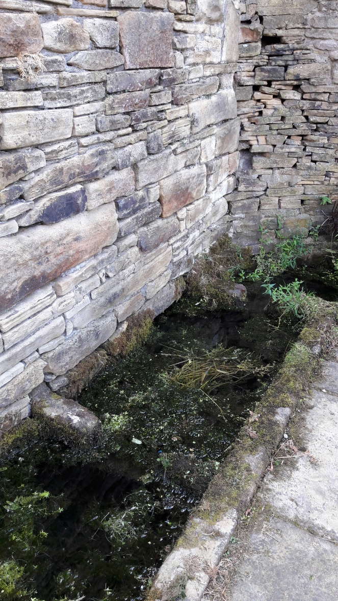
Well - water
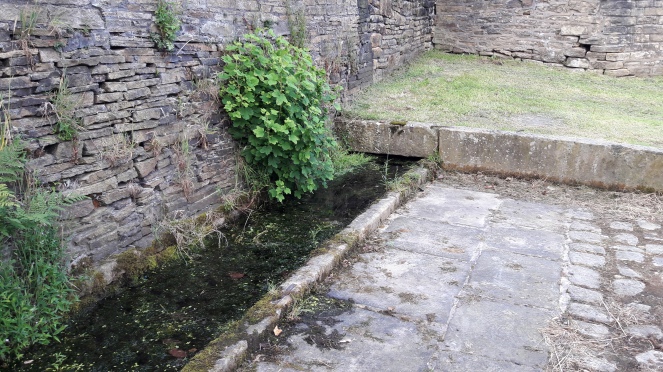
The water troughs; the stone ‘dams’ are visible amongst the pond weed.
The Trough
The water disappears under the stone at the end, there, reemerging in a drain to the right.
More railings
More evidence for railings – Victorian or earlier in date with the lead packing.
The capped well
The capped well that originally stood in the brewery yard.
The Drain
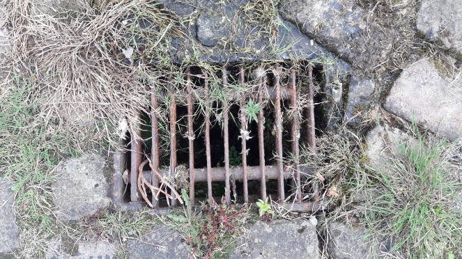
The drain, covered by a Victorian cast iron grid, where the Whitfield water ends up.
View from the well
The view from the well onto Whitfield Cross.

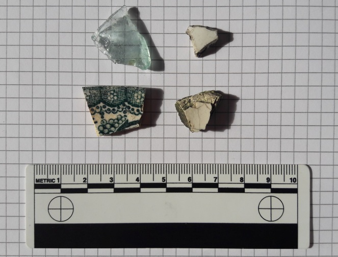
I went out last week and cleared the site up a bit. The well is a hangout for the local youth, and inevitably mess and litter accumulate (ranging from coke cans… to a scooter!). So I swept up and dredged the troughs for rubbish… my good deed for the week. Amongst the detritus were four interesting bits – three pottery sherds and a piece of glass.

I say interesting, but I realise that interesting is an entirely subjective word!

The two sherds on the right are white glazed fairly boring bits – bowls or plates probably, and late 19th or 20th century in date. One is a transfer-printed glazed rim of a plate roughly 12cm in diameter, and again late 19th or early 20th century in date. The glass fragment is from the neck of a bottle, possibly a mineral water bottle, or a beer bottle, perhaps. The bluey-green aquamarine tinge allows me to give it a date of… yep, you guessed it 19th or early 20th century. Many mass produced Victorian bottles are of this colour, the result of iron and other impurities in the sand used to make them, and it disappears in the early 20th century.

The Pottery
The pottery. Not quite Roman, but ‘interesting’ enough.

It would seem, then, that leaving litter at the well was a Victorian habit too. It is odd that they survived on the setts for so long, though. Perhaps they eroded out of the surrounding soil? And talking of Victorian habits, Neville Sharpe, in his book ‘Crosses of the Peak District’ notes that there was “an ancient practice in Whitfield township of local youths throwing strangers into the wells”. 

If anyone has any information relating to the well, and especially if corrections are needed, please email me or you can drop a comment in the box below.

I should mention here that I am currently making plans to reinstate the tradition of well dressing at Whitfield Wells. I would be very keen to hear from anyone who wants to join in, who remembers them from when they were originally going, or who has any old photographs or other detail relating to the well dressing.

I have big plans, but can’t do it on my own! Drop me a line with anything you want to say, or leave a comment below.

EDIT:

Deeds
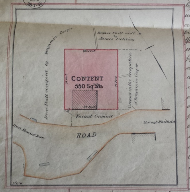
Deeds showing the wells in 1846