Archaeology · Pottery · Whitfield

Whitfield Green Wondering

What ho! Fancy meeting you all here…

Happy summer everyone! I hope the season finds you in good form… or at least not in actively terrible form. Having recently celebrated a somewhat significant birthday with a trip to Naples area – Pompeii and Herculaneum included – I returned exhausted, and filled to the gunwales with pizza, wonderful wine, and archaeology, which pretty much sums up my life, to be fair. I can heartily recommend such a trip, although it was a tad expensive, and I can now only just about afford to camp in my own garden!

Whilst I was there, I actually wrote a blog post about a Wander to the beach I made, and that I thought you might enjoy; this was meant to be it. But I haven’t finished it yet, obviously, and so we have to remain close to home today. I mean, it’s not quite as glamorous as Pompeii or the Bay of Naples, but Whitfield is just as interesting. Kind of.

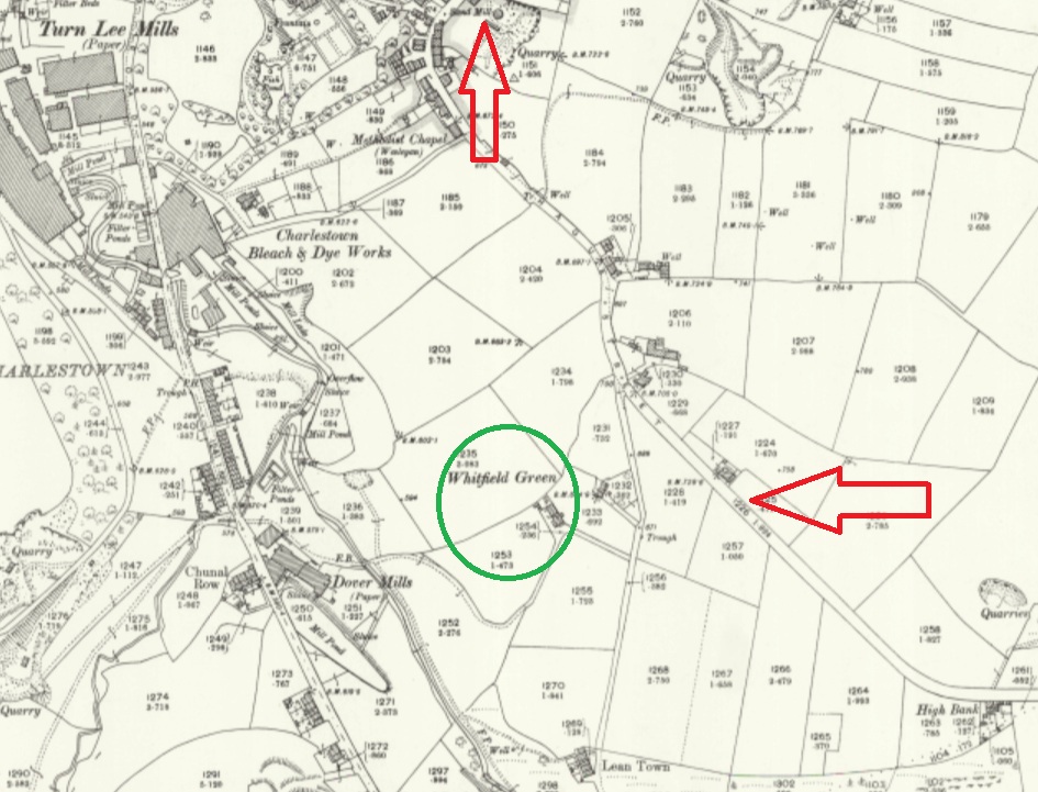
Anyway, I’ve often wondered about this place – Whitfield Green – a farm that is marked on older maps, but which is clearly no longer there.

For the sake of orientation, Whitfield Green is in green, The Beehive is just off the map, but indicated by the top arrow, and Derbyshire Level is indicated by the other arrow.

I mean, the building is clearly old, and is clearly marked Whitfield Green, but I can find absolutely no information out about the place. So I went exploring…

Firstly, the roads. The whole area around Derbyshire Level and Lean Town has been monkeyed with following the Whitfield Enclosure of 1813, so it is sometimes difficult to see exactly what went where before that point. Map work and physical walking helps, and it seems the road originally went along the lines of the red line in the map below – it continuing straight at Lane Ends Farm, instead of kinking left as it does now, and continues to Whitfield Green, thus:

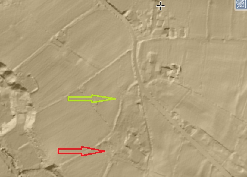
You can see a hollow where the field edge is now, and it is visible on LIDAR.

The site of Whitfield Green is indicated by the red arrow, and the hollow trackway – now a hedge and fence – is indicated by the green arrow.

From here (with numerous branches, and marked in red below), this track would go under Lean Town, and then onto Gnat Hole, and then to Chunal – unbelievably, it was once the main route from Glossop and Whitfield to the south – Buxton, Chapel en le Frith, etc.! However, when the Enclosures happened, one of the stipulations in the act of parliament was the building of wide solid roads – hence we have Derbyshire Level, which, whilst incorporating numerous existing routes, was a totally new road – no wonder when you look at state of the roads at that point. In fact, so bad were the roads that Glossop historian Ralph Bernard Robinson, writing in 1863, noted that

“Glossop, till a comparatively recent period, was a place difficult of approach, and, in some circumstances almost impassable, owing to the nature of the roads. They seem to have no roads but such as the Romans, ages before, had made for them.”

This paints a very different picture of this area of Whitfield, and makes it seem that Whitfield Green was more than simply a farm in the middle of nowhere. I wonder.

So it is at this point, with the radical shake up of the roads that followed the Enclosure Act, that many of the trackways with which I am obsessed become obsolete, and so it is with the red trackway, the access track to Whitfield Green – it simple ceases to be needed as the new road that goes down to Lean Town was made, and a new access track came off it. This is the footpath you now walk down in order to get to where Whitfield Green once stood (marked in green in the map above). Kidd Road was once known as Whitfield Green Road, and actually, I suspect that it once went across the field and that this ‘new’ access path is in fact the old route preserved, once the whole area had been monkeyed with (marked in blue, above).

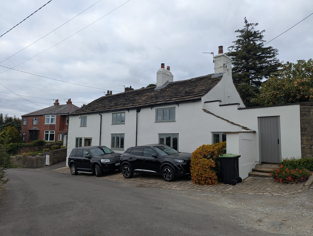
Indeed, Derbyshire Level, and the spur around Moorfield, combined with the Turnpike Road (Charlestown Road) meant that there were now new solid roads along which to travel, and thus the old muddy route below Lean Town and through Gnat Hole was no longer used, and the whole became footpaths. It also meant that new farms could be built, and it is at this point that I think Whitfield Green Farm was built, just to the north of Whitfield Green (circled in yellow above). It is still there, but is very difficult to see without being arrested for “acting suspiciously near an innocent person’s house”… again. It has a stone roof (so making pre-1850ish), but there is nothing that points to it being older that the first half of the 19th century, and I suspect that once the new Lean Town road was made in 1820, someone took the opportunity to build a new farm there.

We know Whitfield Green was there in the 1920’s, but no longer appears on maps from the 1960’s onwards, so presumably it was demolished between those dates. A pity, but there you go, such is the nature of progress. Thus, the timeline seems to be:

1720 (ish – maybe before, maybe after) – Whitfield Green built on existing track (in red), and also accessed via another track (Kidd Road, in blue)

1806 – Lean Town built on the same (red) trackway

1810-13 – Whitfield Enclosure Act, and thus…

1820 – New roads made, including Lean Town road, and access to Whitfield Green comes from that now (albeit via an existing track).

1825 (ish) – Whitfield Green Farm (the new one) built (in yellow)

1950 (ish) – Whitfield Green demolished

That seems to tally with what we know, but if you think differently, let me know – click the ‘contact’ button at the top, or leave a comment… I’m always happy to hear from you.

So what did I find when I went to look at where Whitfield Green once stood, I hear you ask. Well, I’m glad you asked, because I found:

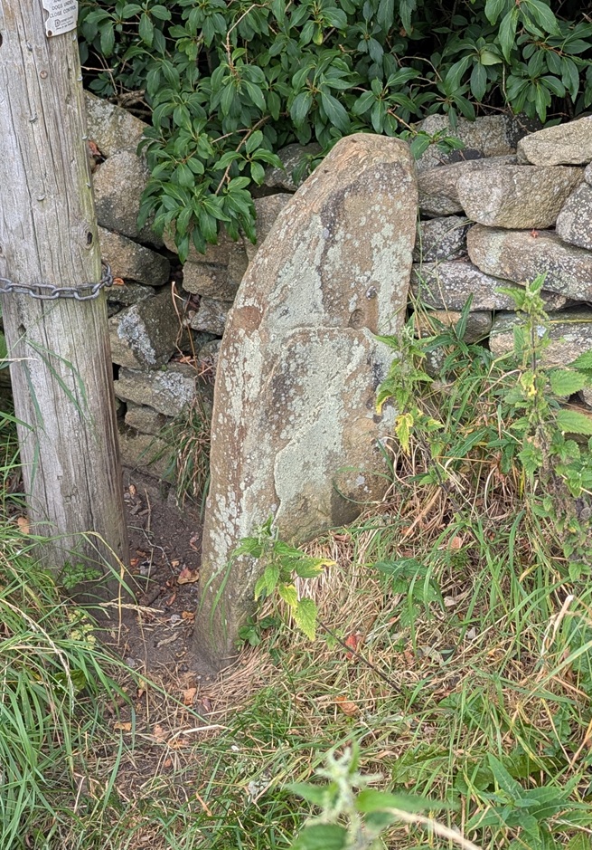
A stone stile. Lots of the paths around here have these, presumably to prevent anything other than foot traffic from using them. I wonder if they were put in when the newer – and toll paying – roads were created in order to stop packhorse trains using them. There are different types too, and I wonder if they were put in at different times.
Here’s where the Whitfield Green once stood, against this hedge line. Nowt there now.

However, look closer and…

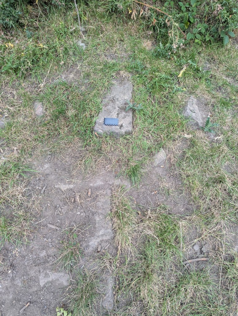
Shaped stones in-situ. These have not been moved into this position, this is where they were, and are the remains of the farmhouse… although what part is unclear.
And here is a stone-flagged floor. I wonder who – apart from the current farmer and their cows – stood on these last? They have to have been internal, so a part of the farmhouse proper, rather than the yard outside. Hmmm…
More stonework; in the world of archaeology, 3 stones in a row make a wall, so…
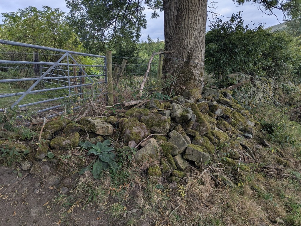
There’s also a huge pile of stone nearby, and whilst not a large farm’s worth of walling, I assume most of the rubble would have been re-used as drystone walling.
And a lot of it has been shaped, and rather than it being the product of a removed drystone wall… we are looking at the remains of a farmhouse.

It was the flagged floor that really brought it home that this was actually once a house; I love that moment when archaeology meets actual lived life; spooky, yet intimate, an odd feeling. It would be great to have a proper scrape around and uncover more of whatever remains.

And pray what, if anything, did you find there, you strange, pottery obsessed, person, you? Well, I’m glad you asked that, too:

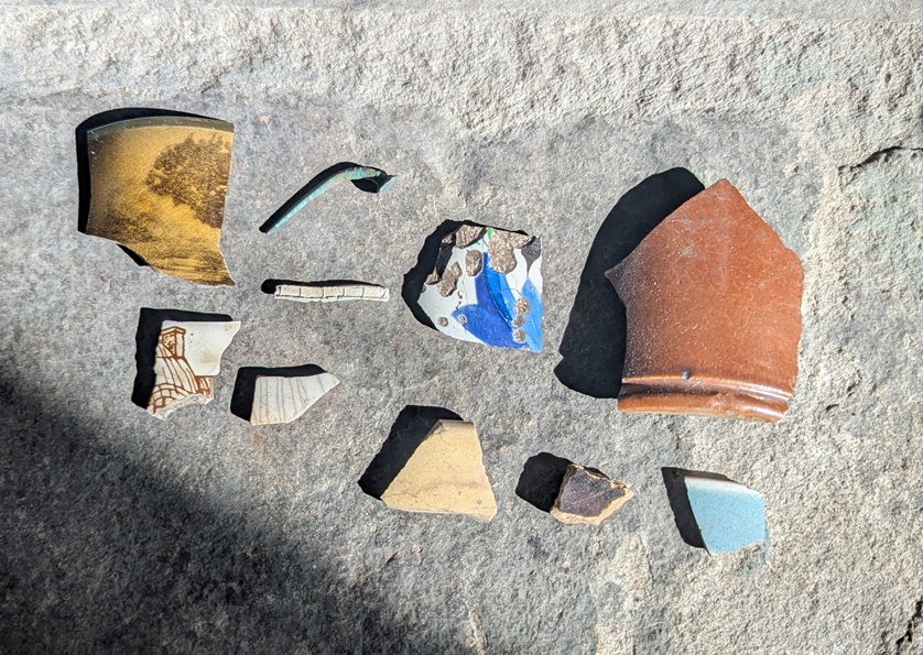
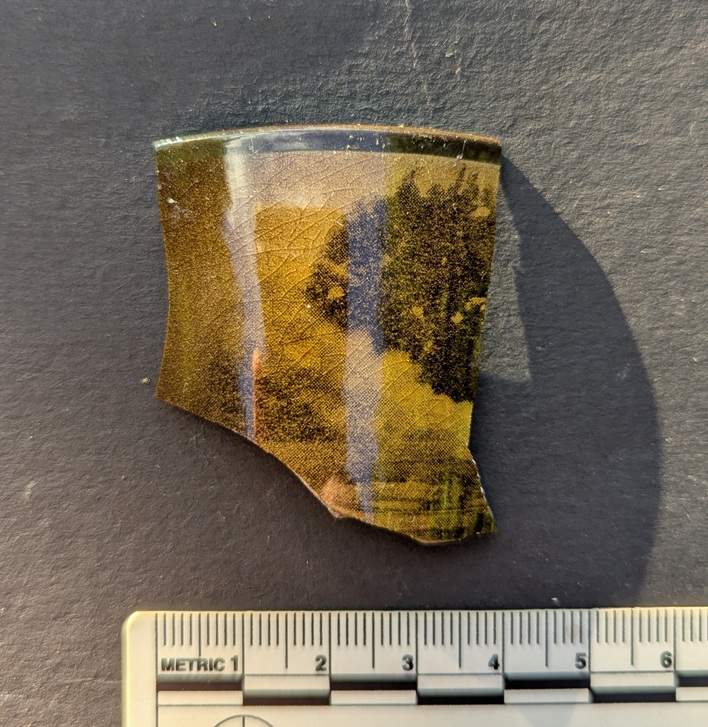
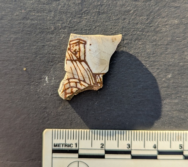
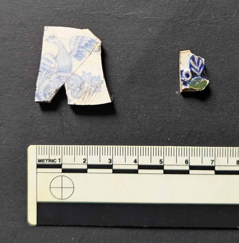
The expected ‘noise’ of Victorian pottery – Blue and White Transfer Printed, mainly (with some black printed), as well as one sherd of ‘Flow Blue’, and a possible sherd of Shell Edged.
Left is a wonderful bird; Victorian, and not at all rare, but the phoenix-like image is lovely. Right is an odd one – moulded, so the decoration in 3d, it is highlighted in both underglaze (blue) and over glaze (green). Again, not rare, but not commonly encountered… and nice.
Clay pipes… the cigarette butt of the Victorian period! I love them, but honestly… Stems and a bit of a bowl, nothing particularly interesting, although…
…the bowl has burn marks on the inside, evidence of the last drag!
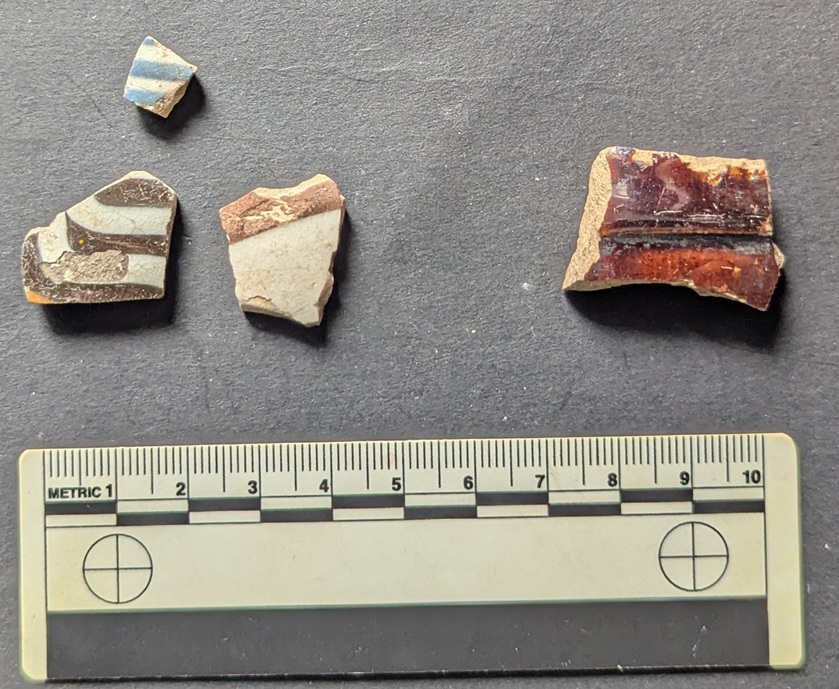
Left – 3 sherds of Industrial Slipware (1800-1900) – almost certainly bowls; right is a sherd of a Victorian ‘Brown Betty‘ teapot, still made if you feel the need (I do!).
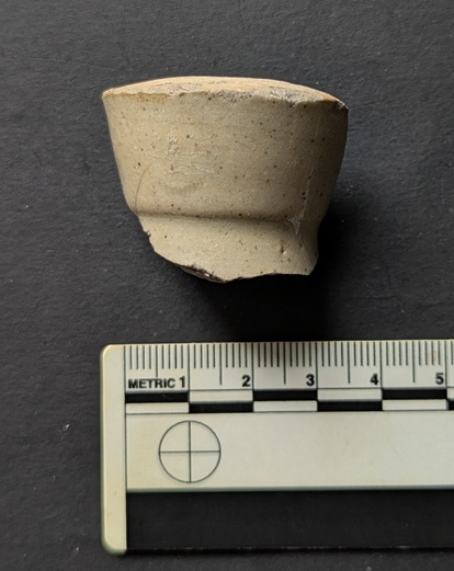
Top from a Victorian blacking bottle.

So far, so Victorian. However, against this background there were several sherds of older pottery lying around:

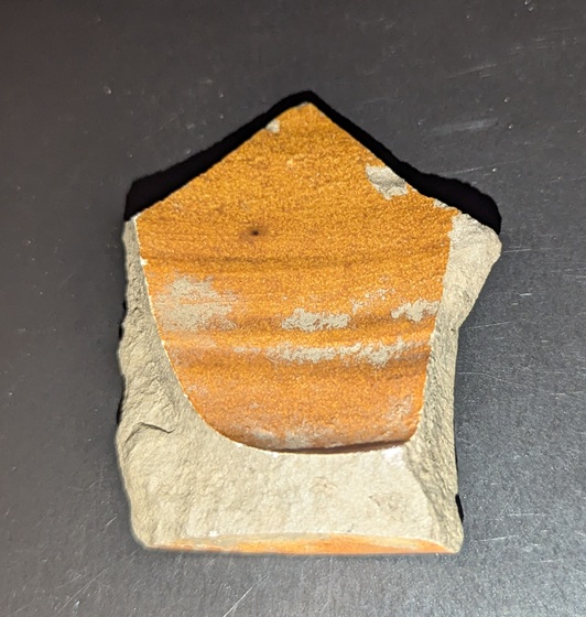
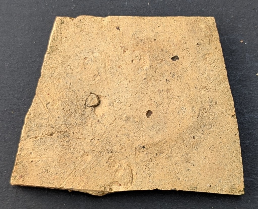
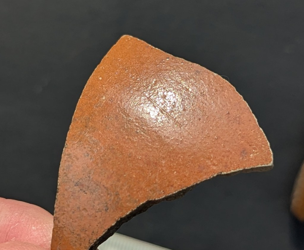
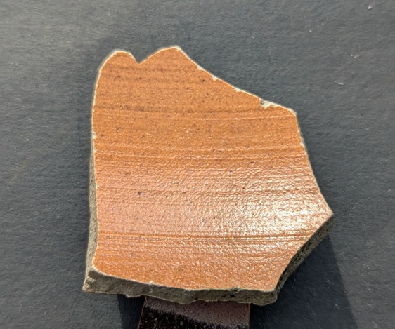
Early 18th century Staffordshire Slipware platter – roughly 1700-1740. The underside shows a slight red slip, and a line made in the clay during manufacture, possibly the result of moving the leather hard pot – pre-fired – over a rough surface.

Then there is this lovely thing, and I am aware that ‘lovely’ is an entirely subjective concept.

Lovely… honestly!

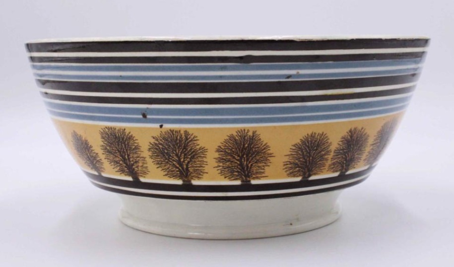
It’s the wide strap handle to a large cooking pot – this sort of thing:

Taken from here

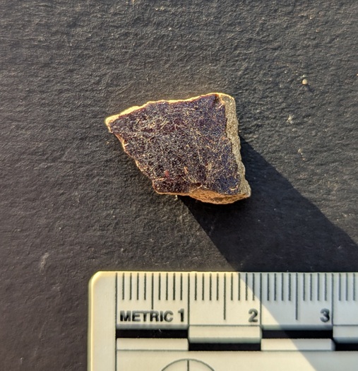
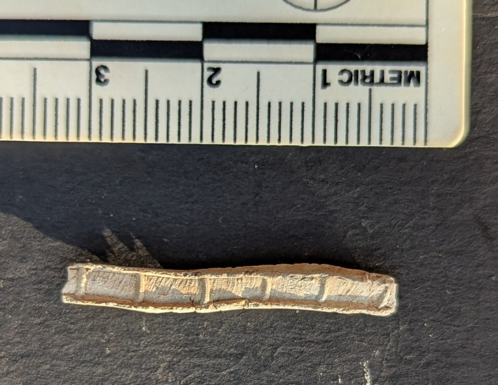
The fabric is unusual, though – very hard, with a purple colour, and a black and white mixture of inclusions – it’s a sort of Midland Purpleware, almost Cistercian Ware, and not at all like the normal Black Glazed stuff that you associate with Pancheons. Lovely stuff.

Also, there is the brown stoneware. Some Victorian Derbyshire Stoneware, but also early 18th century Nottingham Stoneware:

The two handle fragments at the top probably come from a tankard, again early-mid 18th century, and the bottom left bit I think comes from a bottle. The sherd in the centre come from a strange shaped lid… I think. It’s odd.

And finally, I found this:

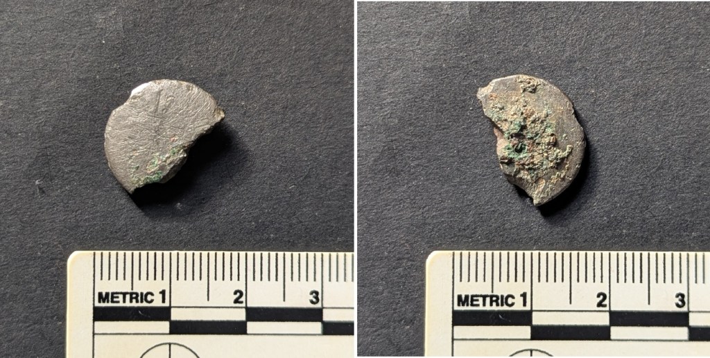
A ‘Tombac’ button; Tombac is an alloy that has a high copper content (80-95%) mixed with zinc.

Shiny (though sadly scratched), it still has the silver looking surface – which it was designed to do – and is a lovely thing to hold… that personal touch, again (you can see a better preserved example here). The back shows signs of it breaking down (the green bloom of copper), but also the reddish iron rust of where the loop that once held it in place was. This button is nothing special as such, it is plain, and of relatively poor quality, but it is dateable as Tombac plain buttons such as these were used from mid-18th century onwards (stopping perhaps late 19th). I love this thing… so intimate. Did it belong to someone who lived on the farm? Perhaps.

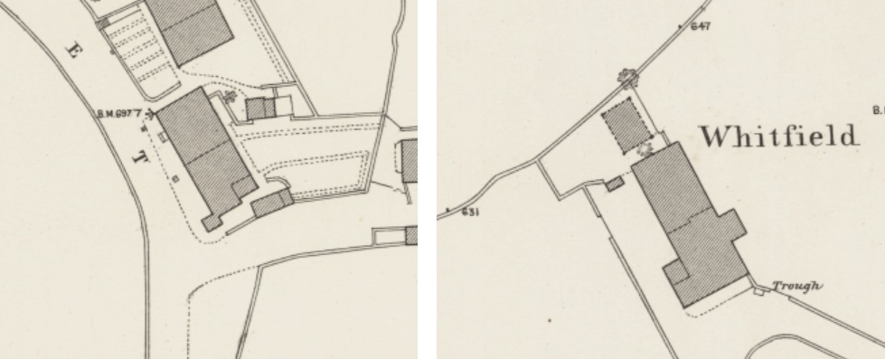
So there we have it… the farm. As to what it looked like – well I have found no photographs, but I would suggest it looks like this farmhouse on Hague Street; it’s about the right age, and has a similar layout/shape – although Whitfield Green is larger – and is also divided into two dwellings. Interestingly, they both face south-west. I hadn’t noticed before putting them on the page, but it makes sense as it maximises sunlight, and thus light in general.

Left is the Hague Road farmhouse, right is Whitfield Green, from the 1:500 town map, and stolen shamelessly from the NLS website.

There is no information in any of the usual books, and there are only a few references to it online. According to the ever wonderful and always useful GJH website, a Robert Wood, born in 1713, is described as being of Whitfield Green, as indeed is his son. So we know that by 1740 or so? the farm is there, and it suggests that the name of the farm is simply Whitfield Green, and that the later building took the name Whitfield Green Farm to distinguish it. There are later references, but this seems to be the earliest, and thus we have the name of someone who may have walked on those flags, and who may even have worn the button.

Well, that’s your lot for this month. I’ll try and get round to posting another one if I can – more pottery, obviously (ignoring the groans).

It was just lying on the surface of the track… a gift if you will.

Its from a cup or tankard, and dates to the last part of the 17th century or early 18th, so within the range of our building. Or perhaps we should revise the date back a bit? Certainly the late 17th century saw a lot of building work in the Glossop area, as a glance at the Datestone post will show you. Again, a little excavation (or a photograph!) would show us a bit more.

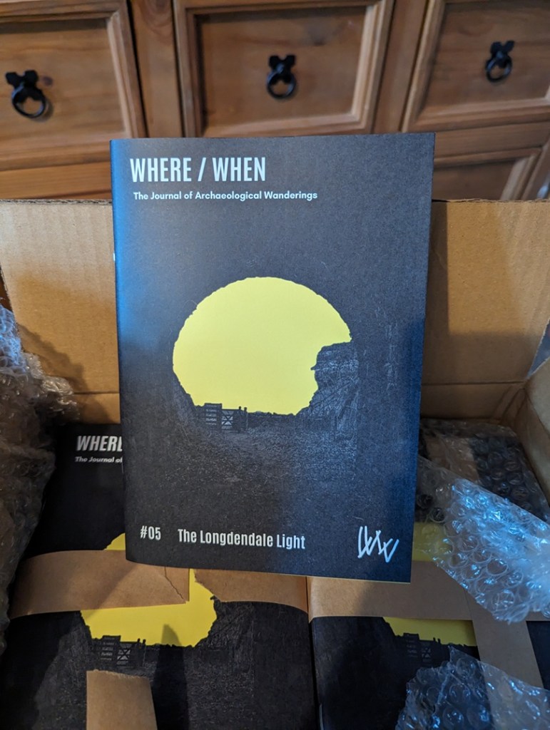
In other news, the new Where/When will be out soon – more info when it happens, but this one is a truly awesome Wander around Mellor – just over yonder! It has medieval field systems and farms, Victorian noise, Iron Age hill fort, medieval crosses, cracking views, a terrifying viaduct, bench marks, a trig point, wonderful gateposts, and it starts and finishes at a pub… what’s not to love? Here’s the cover to tempt you.

Righty ho, I’m off. I have housework to do before I’m allowed a glass of the stuff that cheers – Mrs CG’s rules, which I can’t help feel is unfair… into every life a drop of rain must fall, and all that.

More soon, I promise, but until then, look after yourselves and each other. I remain,

Your humble servant,

TCG

Archaeology · Bench Marks · Graffiti · Standing Stones

Gateposts

What ho, lovely people of the blog world. I hope you are all well as we hurtle headlong into summer, each of us fearing what terrible weather will mar an otherwise splendid season. Nevermind, this too shall pass and all that, and indeed we must grasp the nettle by the horns, or something, and make H whilst the S shines…

Today’s post is one of those brought about by happy coincidence, where a series of events conspire, almost waving at you, until you finally notice and say, loudly, “what ho… a blog post!” Or, in this case, a Gate Post. The first event was posting a few photographs on Twitter and Instagram (@roberthamnett on Twitter, and @timcampbellgreen on Instagram, for those of you who might fancy checking it out). Turns out I’m not the only one who likes a good gatepost or two. And then the next event was my seeing a tiny piece of metal in the soil whilst doing a recce for a Where/When (No.7, to be precise… Of Forts and Crosses: A Mellor Wander). All will become clear, honestly.

For years now I have been obsessed with gateposts. Mundane, utilitarian, and always overlooked, a good gatepost can be as interesting as a prehistoric standing stone to me, and truthfully, there is often very little difference: both made of stone, both standing upright, both important in the past, and also in the present. And if anything, gateposts have more interesting features! I mean, obviously prehistoric is fascinating, but they don’t really give us much to go on, whereas the later gateposts… well, read on.

They can be decorated – often just roughly dressed.

A simple rough dressing, to shape it in a uniform manner.

But sometimes some thought has gone into them, to create a pleasant design – which for a utilitarian functional object seemingly goes beyond what is needed.

A simple cross, surrounded by a border. I say simple… it takes some doing.

I mean, the only time you see the gateposts is when you are opening a gate to let sheep or cattle in and out, and it’s probably not something you’d see everyday. And even if you did, it’s only for a moment or two, it frankly doesn’t matter if it looks good, and I doubt farmers are wandering around making snarky comments about the plain decoration of another farmer’s gateposts. So why? What is the purpose behind them? I don’t mean they had some sort of secret meaning behind the decoration, rather they simply represent someone’s choices, but why those choices I wonder? Possibly it’s probably more to do with pride in the work taken by the stonemason who shaped it, perhaps a form of identifier: we know it’s person X who shaped it, as he always decorated it with a cross. But then there are those that go beyond simple decoration, and instead turn it into a work of art.

This is wonderful! The way it shifts from the upper band with a circular motif, to the lower aspect with the herringbone pattern is amazing. A lot of effort went into this.
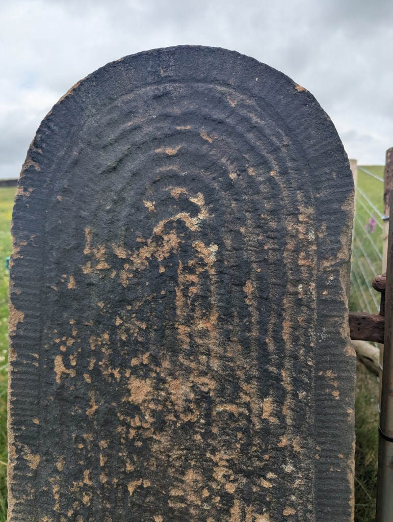
This too, is truly wonderful. The circular motif, with a border, is just amazing. This post seems to be in the reddish Cheshire sandstone, which makes sense given that it, and the last gatepost was found in the Mellor area, rather than Glossop.

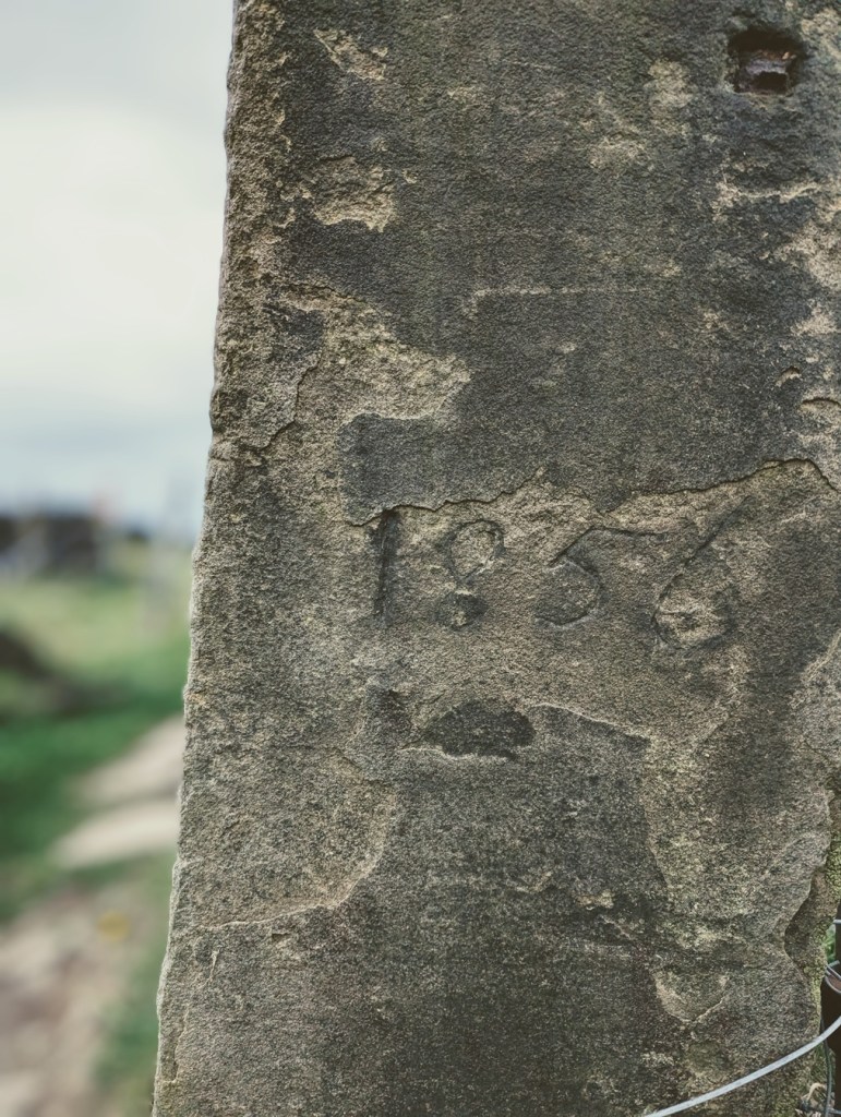
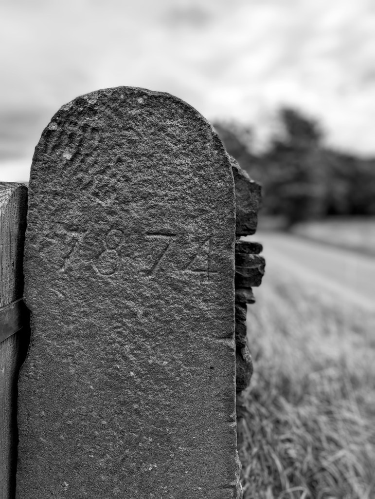
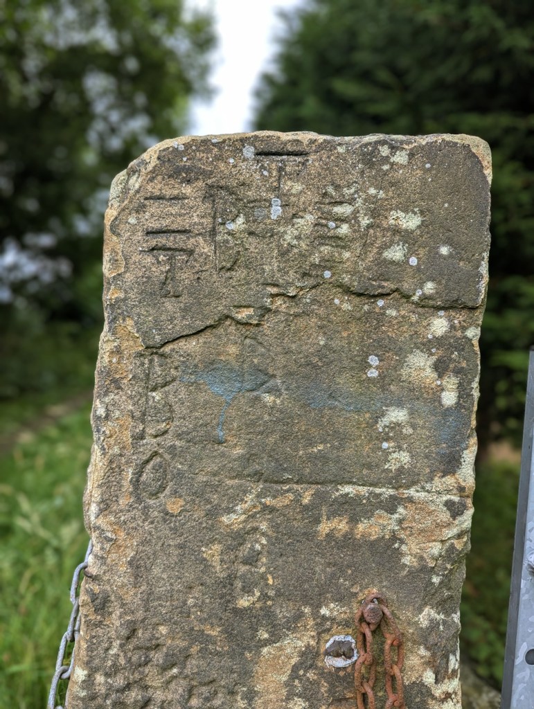
Other times, we find words and dates on gateposts. Often these are faded and barely legible, the weather and environment are not kind to these solid sentinels, and they have no shelter.

‘1856’, on the track from Fieldhead Farm to Whitfield Cross.
I went all arty with this shot… I’m quite proud of it! ‘1874’ in a very similar hand to that of the above gatepost – I wonder if it was the same person? This is on Kidd Road, just before its junction with Derbyshire Level.
Multiple ‘B’, ‘D’, and ‘O’ – from a post just by Fieldhead Farm.

The Ordnance Survey often use them to carry benchmarks – after all they’re not likely to be moved, and so are a safe and permanent marker for heights above sea level.

The line above the arrow is 682 ft above sea level, precisely.
This one is 716ft 2″ above sea level.
I love this photo… the grass almost mirrors the benchmark. Oddly, I don’t have a height for this mark – for some reason, no OS map I have come across shows its existence. Strange.

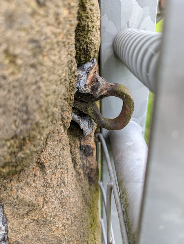
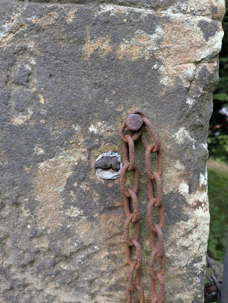
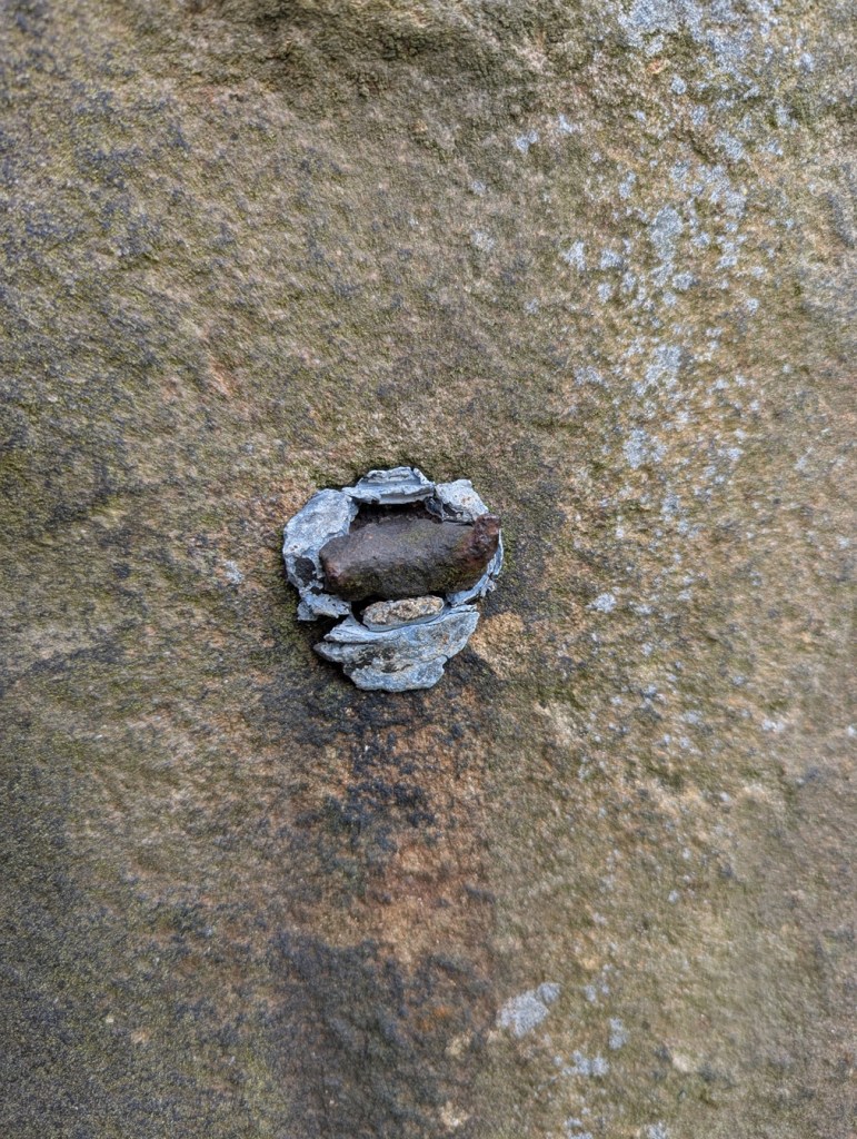
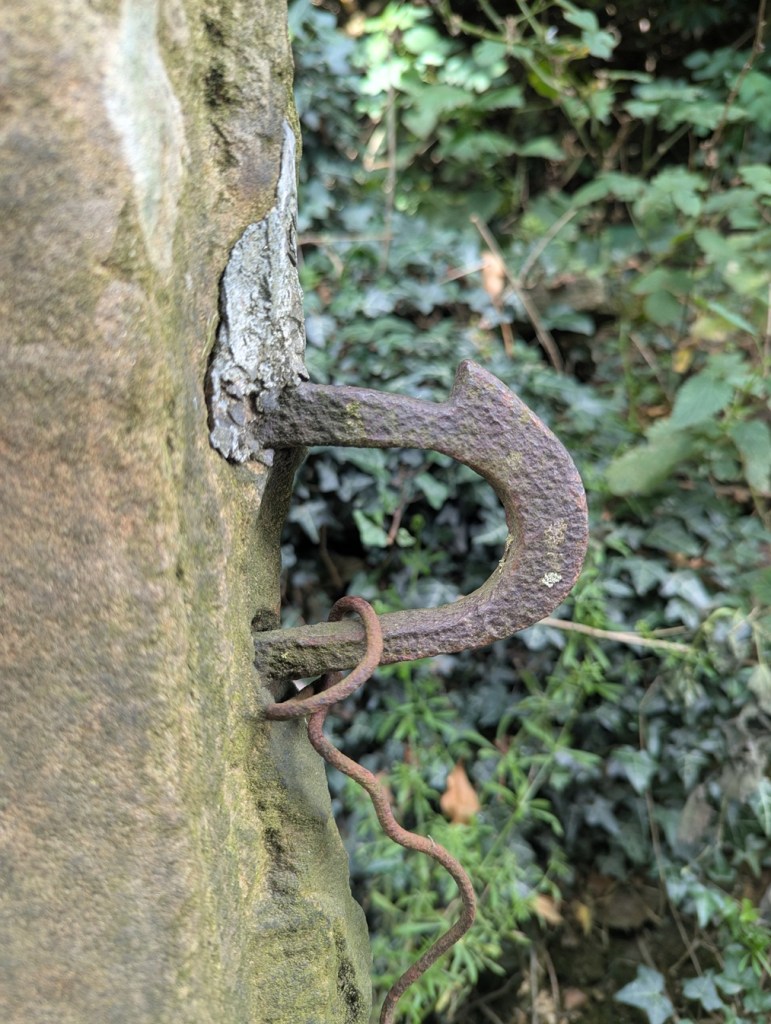
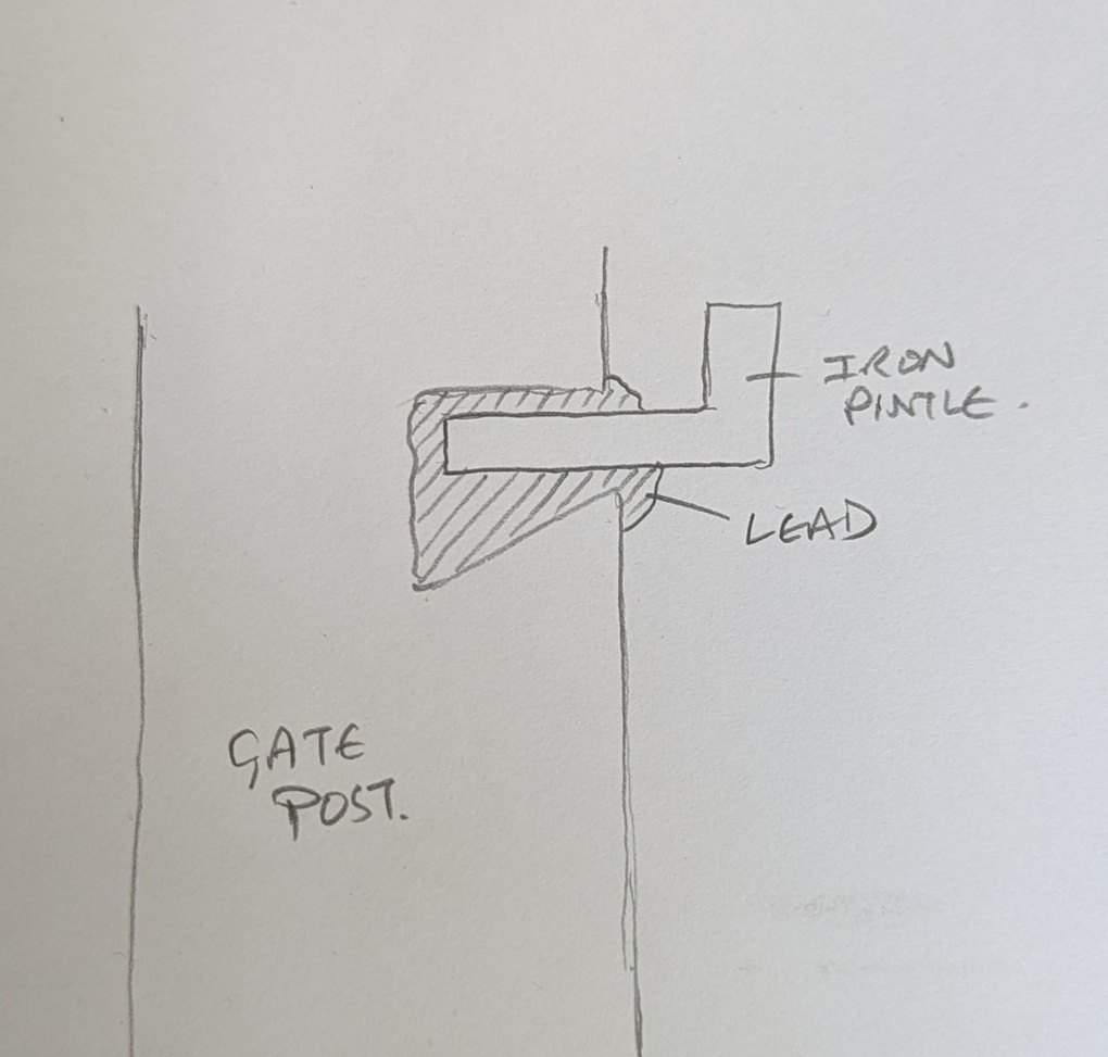
The fixtures and fittings of gateposts always fascinate me, too. Cast iron hoops and hooks, held in place by the tell tale grey/blue of lead. Sometimes you can only see the lead, the actual latch or pintle missing, it’s function no longer having purpose – it is just now a standing stone.

A now missing something or other, the metals eroding, staining the stone. It can get so bad that it actually kills the moss and lichen.
More something or other, now missing, but once important. The lead fixing is a tell-tale sign that the iron whatjamacallit is missing. I honestly love this, it really does show my theory of objects having a biography.
This is lovely… beautiful cast iron eyelet, twisted and shaped whilst red hot, and then held in place with lead. Although no longer needed to make the gatepost function – the modern steel gate does that (leaving it’s own scars on the stone) – it remains a part of its history.
Multiple phases of use, each leaving a mark.
Again, scars, but once meaning, purpose.
Hand made, and truly wonderful.

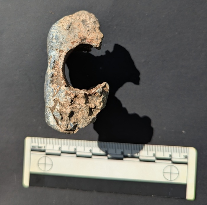
It was actually one of the lead fixings that I found that partly inspired this post. I saw what was obviously lead sticking out of the ground, and bending to remove it as I always do – it’s really not good for the environment – I realised it was bigger than I expected. I studied it for a moment trying to work out what it was, when suddenly: “aha” I thought “that’s a fixing“.

You can see rust on the inside, where the iron whatsit was held in place.

Looking at this lump, and using a small diagram, you can see what it is and how it worked. The long hollow through the middle once held the iron fixture – a pintle or latch, perhaps.

The iron whatsit was circular in section.

The shape of the lead piece is also a clue to how it actually held this in place. A hole is made into the side of the gatepost that needs the ironwork on it, with the lower part of the hole made deeper. The ironwork is placed in the hole, and the molten lead poured in using a funnel to hold it within the stone and around the iron whilst it cools.

If this makes sense.

When hardened, it forms a plug that is very difficult to move, keeping the iron work in place; clever, and elegantly simple. It’s also nice to see the ‘inside’ of the gatepost, or rather a cast of the inside, and one wonders why the lead has come away so intact from its original home – one can only imagine that the post itself was broken, freeing this fixing, which then found itself at my feet in the wilds of Derbyshire years later.

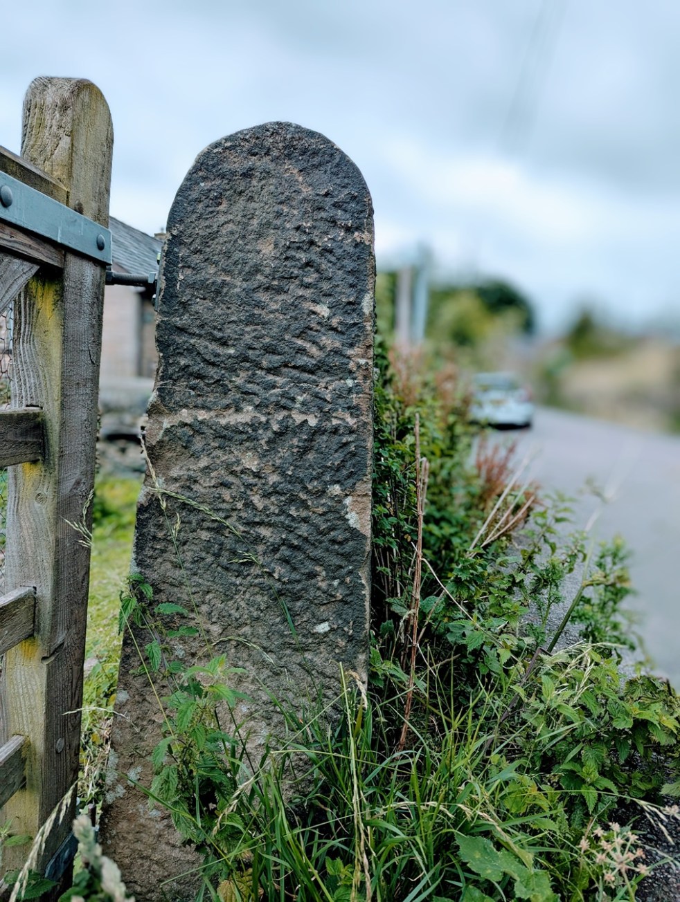
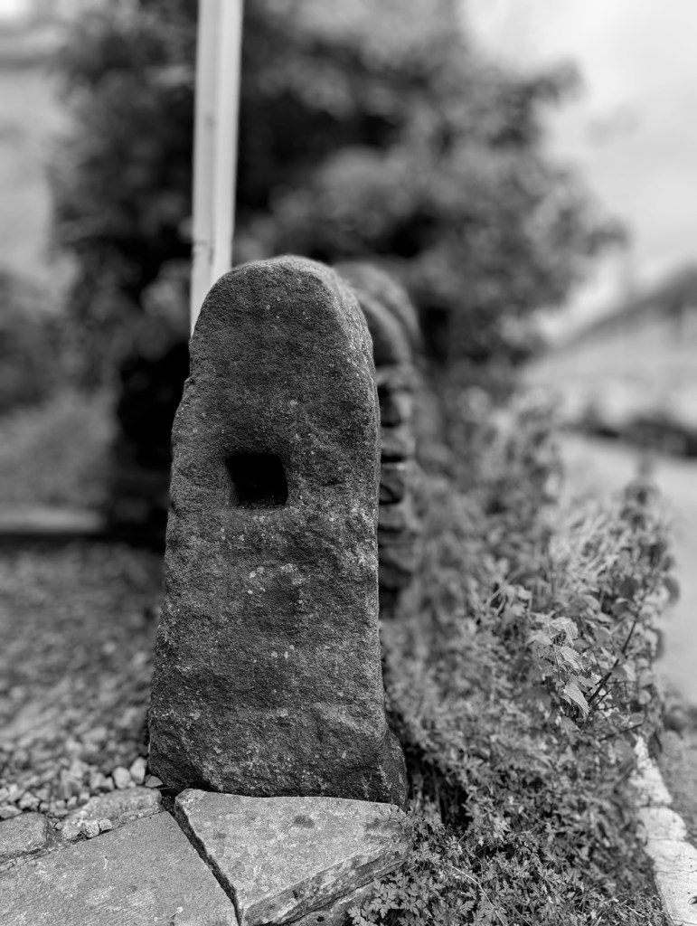
In terms of dates for these gateposts – well, it’s not clear. I think the more uniform stones, with a rounded head, are Georgian and Victorian – later 18th and 19th century. However, there are some that I think are significantly older – 17th, 16th, even 15th century, possibly. These are generally less formally worked, are shorter, and importantly are characterised by having a single straight hole through the stone a few feet above the ground.

Another arty shot, this one of the ancient gatepost on Hague Street.
Carrhouse Lane, Whitfield. And no, I didn’t stick my hand in the hole…

I was, until fairly recently, convinced that these were marker stones for trackways, the square hole perhaps taking a wooden pointer. However, I started to notice that this didn’t always fit the pattern, and despite multiple blog articles, twitter posts, and it even published in Where/When, I began to doubt this explanation. I then received an email that pretty much confirmed it for me (thank you PB, you amazing man!). In it, the author quoted a John Farey, whose 1815 book – General View of the Agriculture and Minerals of Derbyshire: With Observations on the Means of Their Improvement. Drawn Up for the Consideration of the Board of Agrigulture [sic] and Internal Improvement – gave the following quote:

Anciently, the Gates in the Peak Hundreds were formed and hung without any iron-work, even nails, as I have been told; and some yet remain in Birchover and other places, where no iron-work is used in the hanging: a large mortise-hole is made thro’ the hanging-post, perpendicular to the plane of the Gate, at about four feet and a half high, into which a stout piece of wood is firmly wedged, and projects about twelve inches before the Post; and in this piece of wood, two augur holes are made, to receive the two ends of a tough piece of green Ash or Sallow, which loosely embraces the top of the head of the Gate (formed to a round), in the bow so formed : the bottom of the head of the Gate is formed to a blunt point, which works in a hole made in a stone, set fast in the ground, close to the face of the Post. It is easy to see, by the mortise-holes in all old Gate-Stoops, that this mode of hanging Gates was once general.

Of course, it made sense, despite me banging on about them being marker stones. So, please accept my apologies for this; I am not always correct, and my knowledge is always growing. And thank you PB, who brought this to my attention – this is your discovery, not mine (you can read the book here – P.92 is the quote. There are about 20 of these gatepost types I know of, with many more awaiting discovery. And I actually think these are quite significant, as if we plot their location on a map, we might get a better grip on land use in the pre-industrial period. Marvellous.

I am obsessed with gateposts, and I want you to be, too. Everytime I pass one, I check it out, and often I am rewarded with some nugget of information, graffiti, decoration, or just a blast of the past. Let me know what you find via the contact page, and let’s keep an eye out for those holed ancient stones.

Right, I think that’s all for this month, and lucky you the next post will, I suspect, be a pottery post! Woohoo! I have found lots of cool stuff recently, and it all needs writing about. As always, I have about 30 projects ongoing, not all of which is coming to fruition anytime soon, but some will emerge relatively rapidly – watch this space. In the meantime, do please check out the Etsy store, or the Ko-Fi page – and feel free to buy me a beer coffee, or yourself a copy of Where/When, or even a t-shirt!

But until next time, please do look after yourselves and each other. I know I always say that, but you all matter, and we all need to take better care of each other… the world can be scary place at times, so lets band together and help each other.

And as always, I remain.

Your humble servant,

TCG

Archaeology · Longdendale · Pottery · Where / When

Torside Sherds & Walls

What ho, what ho, what ho!

Well, this last month or so has been splendid in terms of weather, what? And indeed much has been done outside – archaeology and Where/When stuff.

Anyway… pottery as promised!

So… Master CG has taken up Windsurfing, which is to be applauded. Like a fish to water you might say, and he’s quite good, apparently (the instructors seem to be very pleased). This means that for a few hours at a weekend, myself and Mrs CG get to relax at the wonderful Glossop Sailing Club (who I cannot recommend highly enough – they are simply amazing), and in the neighbourhood of the wonderful Torside Reservoir in the Longdendale Valley, surrounded by the glacial formed hills; it’s truly a wonderful landscape.

Torside Reservoir is the fourth, and largest, in the Longdendale Chain of reservoirs which flooded this part of the valley in 1864. It is named after Torside Farm, first mentioned in the baptism of Alycia Hadfield in All Saint’s, Glossop, on 16th July 1621. Now whilst this may be the first mention, for two reasons I had a feeling the farm would be older: firstly, Alycia clearly had parents who didn’t just pop into existence in 1621. And secondly, if a place is good for farming in the 17th century, it would have been good in the 13th, 14th, and 15th centuries.

Torside Farm on 1882 OS map, borrowed from the National Library of Scotland website

Interestingly, this first mention in the parish register was actually written as “Thorsett” which, like many others in those pages, is a remarkable fixed record of the local dialect and pronunciation of the 17th century; the clerk asks “where do you live” and the answer from the parent is “Thorsett”, which is then written precisely as said, in clipped northern tones. Even as late as the 19th century, spellings of names and places is not fixed, and confusingly there is often quite a range of spellings for a single farm. Alas, the farm seems to have been demolished by the 1960’s, probably by the water board, and where it stood is now the carpark and public toilets.

Now, knowing this, and whilst young CG was floundering in the somewhat chilly waters, I went for a wander with the hope of finding something interesting and ceramic with which to entertain you wonderful people. Along the edge of the water, and up to the road I walked; I didn’t know what I was looking for as such, more a vague sense that something would be there, this close to an early 17th century farmhouse. And lo! What wonders did appear…

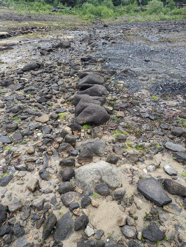
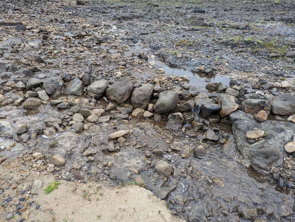
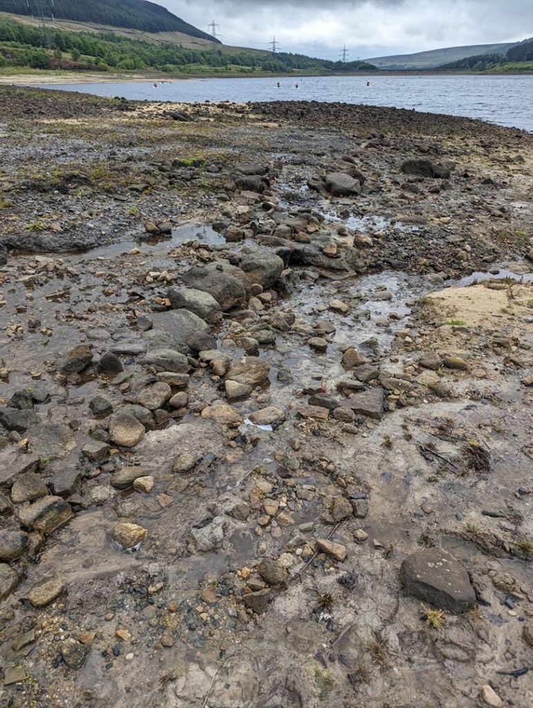
Firstly, I noticed two long walls amidst the general stony foreshore. Made from large boulders that would have, at one time, been plentiful in the fields; they were a convenient source of stone, as well as clearing the fields allowing them to be ploughed effectively.

A 30cm ruler in the foreground as a scale: I am professional… just on a budget!
Torside Reservoir, Longdendale: valley, pylons, windsurfing Master CG (and others) in full view… along with a mysterious wall running into the distance.

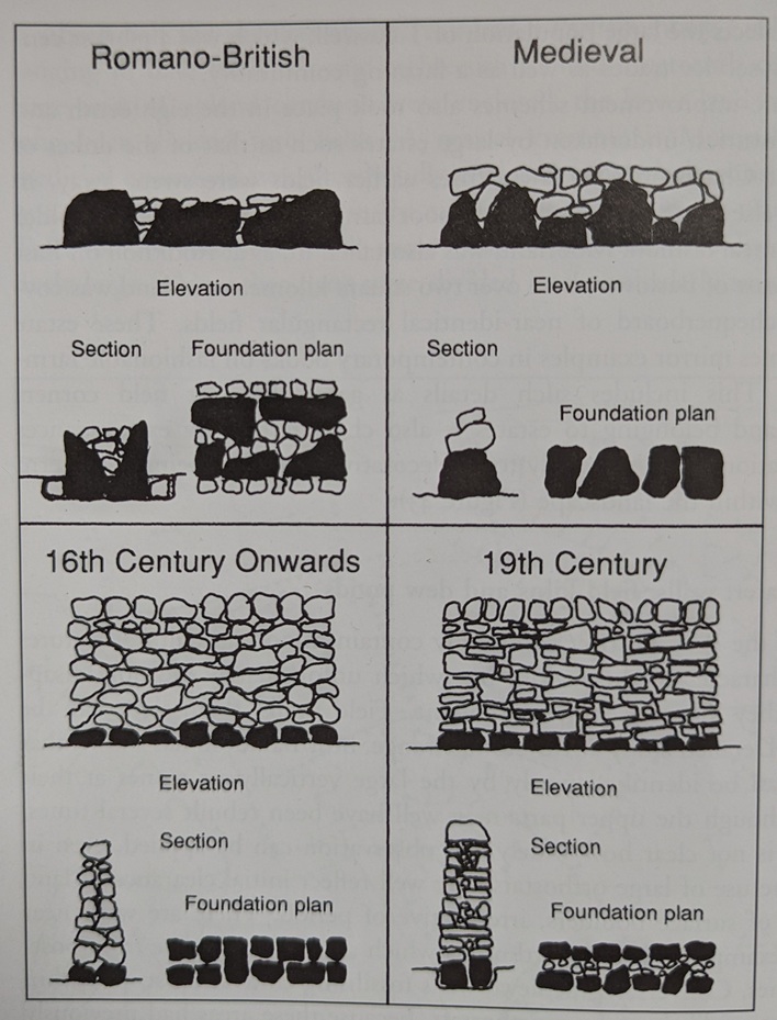
They would originally have stood higher, with this being the foundation course, and the size of the stones, combined with the lack of any map evidence, suggests an early, possibly medieval, date. There is a rough guide to dating walls in this area and hereabouts:

Taken from John Barnatt and Ken Smith’s highly recommended The Peak District: Landscapes Through Time. It’s based on data from Roystone Grange, and whilst it might be over simplistic, it does illustrate how walls changed over time.

It is a rough guide, and isn’t probably applicable everywhere, but it does serve to show differences in how walls were built. I honestly don’t know what these are, but I’m presuming field boundaries for a long lost field system. There are medieval field walls in Tintwistle, and they do look like this, but equally I have seen field clearance walls that date to the Bronze Age that look similar. The following is a rough map and rough measurements – maybe I should go back and really survey the walls properly… anyone fancy helping me?

But enough about the walls, “show us the good stuff… the pottery!” you shout (all except Mr Shouty-Outy, who shouted that he would apparently rather see my bottom…). Well here it is. The pottery that is, not my bottom.

All this was found on the surface, and it tells a very interesting story, but there are some genuinely important bits here. First up, we have a sherd of Manganese Glazed pottery.

Early 18th century in date – it stops being made around 1750 – this stuff is fairly commonly found on sites of this date, and probably come from a jug or mug. I explored this stuff here.

Other bits of Manganese Glazed include these 4 rim sherds from cups and mugs.

Clockwise from top left: an open bowl measuring 16cm, a cup of 10cm, another cup of 10cm, and another measuring 12cm. Lovely stuff.

Next up, some slipware.

On the left, a chunky sherd probably from a large jug or similar. On the right we have the rim from a large platter (it has a rim diameter of 30cm); the piecrust edge is hugely characteristic and immediately recognisable (again, I explore it in this article):

The glazed interior didn’t quite make it to the rim, and would have created a striking image: this would have been an impressive vessel when it was whole.

The middle sherd is Staffordshire Slipware, with a Dark on Light decoration. The reddish slip laid over the light background turns much darker when covered in the lead-based glaze. In this case it seems to be giving some form of geometric design – you can see the grooves where the slip was laid, but which has fallen away – the pottery is not particularly hardwearing, and the slip is often found to have delaminated from the body.

Wonderful stuff… you can just make out the linear design in the clay in this awful photo.

This is from the base of the vessel – probably a large platter used for presenting food on the table, and from which all the family would have taken their own share. Turning it over, you can see lots of interesting marks made during the manufacturing process.

When made, the pots are pressed into a mould until they are ‘leather’ hard – that is, hard enough to retain their shape, but not quite fully dry. What we can see on the base are the scars of manufacturing. There are numerous lines scraped into the clay, suggestive of tools used to remove the pot from the mould, or even string. There is also a small ball of clay lodged within the base – this would have been dry and sitting in the mould when the wet clay was placed in it, and when removed it became part of the base. The small holes around it suggest that there were others that didn’t become attached. I love this… it’s almost the secret side of pottery – whilst most people look at the decoration and say “oooh”, let’s instead flip it over and see what else it can tell us.

Next up, we have some Nottingham Stoneware:

I explored this wonderful stuff back in the first instalment of the Rough Guide to Pottery so I won’t discuss it here, but it dates to the 18th century, which is a good date for us. You can see the ‘orange peel’ surface made by using a salt glaze in this sherd:

And on this sherd interior, you can see the horizontal smoothing lines.

I think 2 of the sherds come from jugs or bowls, whilst the base sherd on the left has a diameter of 7cm, so it might have come from a squat round-bellied tankard.

Slightly later than all this is a beautiful sherd of Industrial Slipware:

It’s a lovely fragment of a sugar bowl type thing, with a wide mouth and straight sides. I like how the decoration gently mirrors the environment it was found in – very suggestive of water and sky.

For me, though, the absolute gem of a find was this fragment of a large Cistercian Ware jug.

Dating to the earlier 16th century (1550, perhaps), this is quite special in that it not only pushes back the date of Torside Farm, it is also not something that is commonly encountered. The surface is wonderful in a deep black glaze, and the fabric is textbook purple and hard, with the classic ‘salt and pepper’ inclusions.

The purple colour is on the bottom, the darker grey colour in the fabric is on the inside of the jug, and is caused by the pot being fired in a reduced oxygen environment – essentially, a lack of oxygen during the firing as air couldn’t get into the jug interior properly.

It would have originaly looked something like this:

Image is lovingly stolen from the University of Leicester Archaeological Service’s Facebook page – here

Genuinely, this sherd is, I think, something significant and had me all of a quiver when I found it. I had to have a bracer or two, and thankfully I was soon back to my normal stiff upper lipped-ness.

I also found some clay pipe stems here and there amongst the stones; all fairly standard and Victorian with the remarkable exception of this wonderful fragment.

The longer I look at it, the more it looks like it has two eyes, a nose… is singing to me!

It is chunky, being some 10mm thick, but crucially it is a large bore – the hole through the middle is 4mm – which is unusually large, and twice (or more) the width of a Victorian bore (sigh… yes thankyou Mr Shouty-Outy, calling me an ‘unusually large bore‘ says more about you than it does me). All of this means that the stem is early; early 17th century early… probably the same date as the earliest reference to the farm in 1621. It’s wonderful to imagine Alycia’s father sitting and smoking a nervous pipe in front of the fire, listening to the cries of his newborn daughter upstairs, and who knows… this could be the pipe. I love this, genuinely… it makes it real.

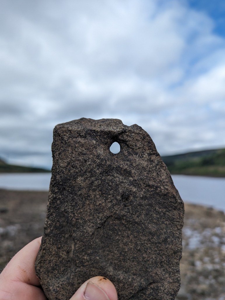
I also found a fragment of stone roof tile with the peg hole intact…

A nice shot, that! This must have come from the house or outbuilding, possibly as part of its demolition or perhaps during the course of its natural life.

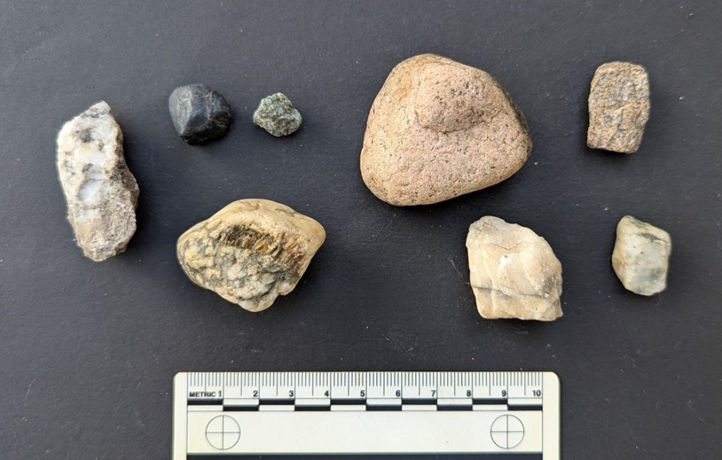
Slightly older… glacial erratics – bits of stone that are not part of the local geology, which in out case is Millstone Grit and coarse sandstone:

Another awful photo – I will get a proper camera soon, honestly.

I talked a little about glacial erratics here, but essentially they are bits of stone that have been picked up from all points north of here by glaciers moving south during the last ice age (granite, and large bits of quartzite, for example). The movement of these huge structures made of ice, mud, and stone, actually carved out the Longdendale Valley, and when they began to melt roughly 25,000 years ago, they dropped all this odd material. Glacial sand and clay can be found all over the Glossop area (my own house sits on glacial clay), but it is very prevalent in Longdendale. The types of stone, and indeed origin of these, I haven’t gone into; I am not a geologist, but perhaps I should write an article on them?

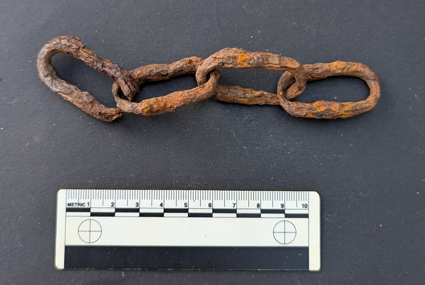
In addition to all that, I found a rather nice segment of hand forged, very worn, iron chain.

I have no idea of the age of it, but it’s certainly at least Victorian… and is very cool!

As I say, the first mention we have of the farmhouse at Torside is 1621, but I am fairly confident that the Cistercian Ware jug is earlier, and perhaps by as much as 150 years – which is very interesting and may point to an earlier incarnation of the farm in the area… which makes sense. The past is indeed all around us, and often at our feet… and it is always well worth having a look.

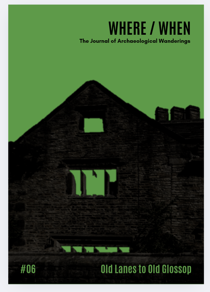
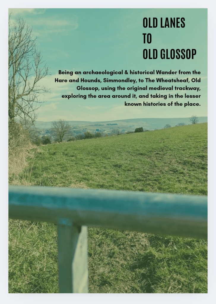
So then, in other news (and also having a look at), the new edition of Where/When has just come from the printers: No.6 – Old Lanes to Old Glossop.

This one is a Wander along the medieval main route between Simmondley and (Old) Glossop, now fossilised into footpaths and odd tracks between buildings. Filled with all manner of archaeological goodness and the usual nerdiness, with a pinch of psychedelia and a heavy hit of psychogeography. Put simply it’s a bloody good walk that goes between The Hare and Hounds and The Wheatsheaf, so what’s not to love?

Contact me here, buy it in the website store, buy it from my Etsy store, the Ko-Fi store, stop me in the street and say “what ho!”, or pop into Dark Peak Books on High Street West, Glossop and grab a copy. It is selling fast… worryingly fast, to be honest!

Right, I think that’s all for the archaeology this month… more soon, obviously. Perhaps more pottery; I’d like to finally wrap up the Rough Guide to Pottery – its unfinished status is frankly bothering my diverse and somewhat spicy mind, and I’d like to be able to wake up not screaming once in a while! Watch this space.

In the meantime, as always – and I do honestly mean it – look after yourselves and each other. This world is not always kind, so let’s – even you Mr Shouty-Outy – try and be kind instead. Until then, I remain, your humble servant.

TCG

Archaeology · History

A Follow Up Bullet-in

I know, I know, I promised pottery… and I can see you are upset by this, but something exciting has come up. Well, two things to be honest. Well, actually many things, but for now let’s focus on the two things that prompted me to write this post. And in particular, it seems appropriate to post it on the 80th anniversary of VE Day.

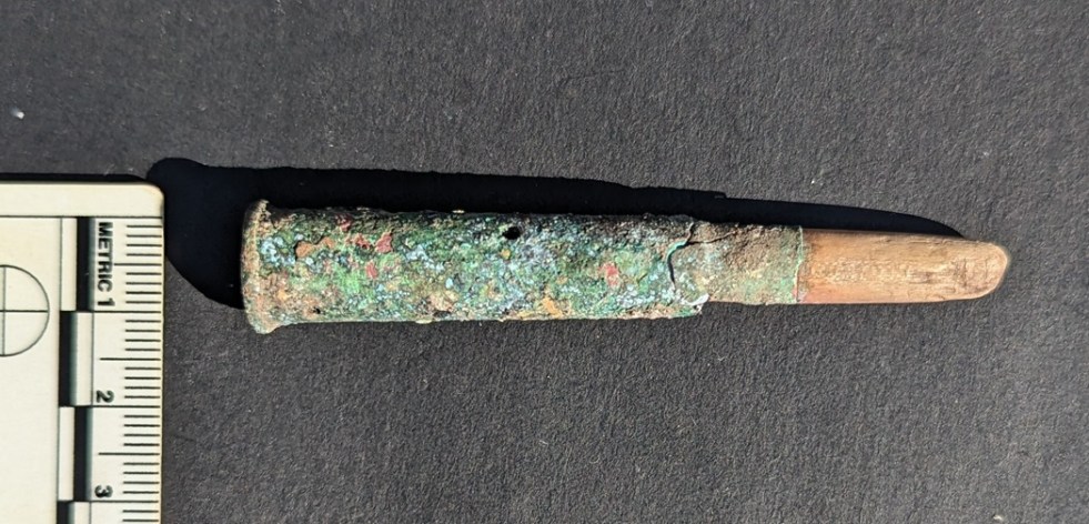
Ok, so, a friend showed me something interesting the other day (hello E.T.!) – a 1920’s dump site in the Glossop area. There are a few of these dumps around, including some early Victorian ones (and no, I honestly don’t know the location of any of these – this sort of thing is a closely guarded secret that even I’m not privy to… sadly!). This one was very small, and had mostly been built over by 1930’s/1940’s housing, sadly. I didn’t find much at all apart from a few bits of pottery (to be talked about in a later post), and some odds and ends including a bead, and some interesting looking buttons. However, Mrs CG found what we initially thought was a rifle cartridge. Well, it turns out it was a cartridge… of sorts, but is actually more of an interesting story than just that.

Now, you might remember a few years ago I blogged about the rifle range at Mossy Lea. It’s essentially the story of the local Rifle Volunteer Corps, and in particular their use of different weapons, and their corresponding bullets, at the range. One of these was the Lee-Metford .303 – the standard issue rifle leading up to WWI, and thing that fired one of these:

The two in the middle are from the .303 Lee-Metford, the ones we’re talking about.

Well, I could tell that the found was a .303 cartridge by its shape – it has a lip around the base, and from the other – bullet – end I could tell that it was an early version (the later bullets are more tapered, whereas this looked more rounded); “what ho Lee-Metford!” I muttered to myself. So it was interest that I started to clean the cartridge, thinking that if it’s live I’ll have to hand it into the police station; live ammunition can be dangerous, but it is also very illegal to own without a licence, and I’m not going to argue with that.

Awful photo. Just shocking. I’m in the process of buying a cheap second-hand camera with some form of macro setting.

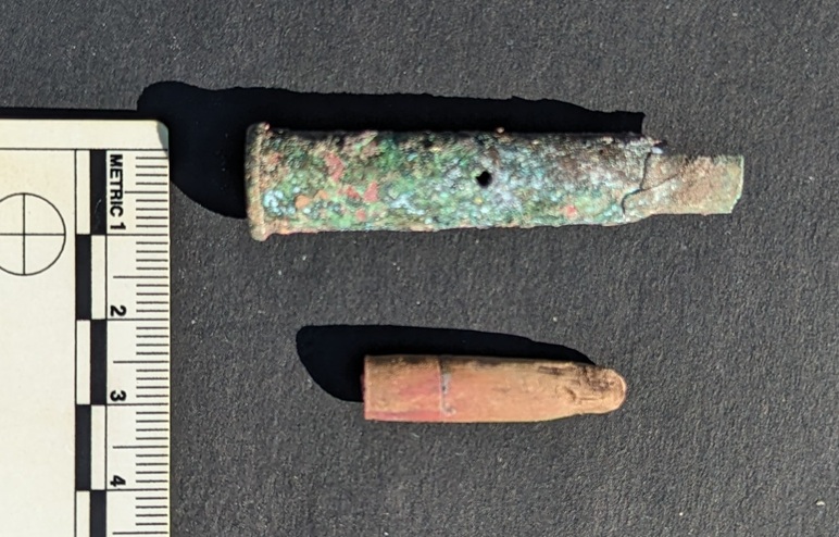
As I moved round the bullet end, I was expecting a copper jacket covering a lead/nickel centre, the kind illustrated above, only complete. Instead, what I found was a wooden copy of a bullet – exactly the same shape, but made instead of wood, possibly Lignum Vitae or similar non-rotting type.

Honestly, my new phone is truly terrible. I know… a bad workman, and all that, but honestly, I find it very difficult to take a good photograph with it, especially as it has no macro setting, which means I can’t take quality close-up photographs

Ok, I thought, and looking closely at the end of the cartridge, I saw it had no primer cap – the bit that is hit by the firing pin which then explodes and sets off the main explosive charge in the cartridge proper. And looking again, I saw the body of the cartridge had 4 holes drilled in it . I quickly realised that it wasn’t live, and it was in fact a ‘dummy’ cartridge – an inert round, with neither actual explosive (hence the holes) nor fireable bullet – which was designed to be loaded into a rifle safely, allowing training in loading and shooting, without the danger of it being accidentally fired. And this tells a more interesting, story, I think.

You can see where the wooden bullet was turned on a lathe – the nipple at the end is where it was attached to the lathe itself.

There was the hint of a marking on the headstamp – the bit at the bottom where the cap is, and which contains all the details needed to identify the what, where, and when of the cartridge – but the only way to reveal it would be to sandpaper the corrosion away, revealing the metal itself. After some debating, I decided that the metal is too far corroded to do this – there is very little actual metal left, and it is largely just Verdigris, and that to try and ‘clean’ it would essentially destroy the artefact. And then, after debating some more, I thought “tally ho, let’s give it a go”. An interesting, if tense, 10 minute dalliance with some oil and very high grade sandpaper, and voila! The headstamp is revealed:

Amazingly, some detail still remains.

G. 13. VII

Well… down a rabbit hole I went, head first, and with a glass of ‘potion‘ glasped firmly in hand (the bottle said ‘Drink Me‘… who am I to argue with that?), I began researching headstamp markings of early British .303 cartridges. Blimey! I thought pottery was a niche and very geeky subject! I love coming to a focused and highly specialised collecting hobby as an outsider, just dipping in; the level of knowledge – and sheer insanity – on display in some of the collecting forums (fora, technically… I know) is truly outstanding. And whilst I don’t understand the finer points, nor understand why anyone would want to, I fully and completely understand the compulsion, the drive, the need to explore the subject, and to hyperfocus in order to give order to a noisy and disordered mind world. I am also only too aware of what this says about me: I know it… you know it… so let’s move on!

So then, what does it all mean? Well, the ‘G‘ references Greenwood and Batley Ltd of Leeds, the engineering firm who physically made the cartridge. The ‘13‘ is the year it was made – 1913. And ‘VII‘ is the Mark Number – think Version VII of the bullet’s development. Specifically, Mark VII was introduced in 1910 as a development on the earlier types. It contained cordite as an explosive charge (rather than nitrocellulose) and was fitted for the new ‘spitzer’ long pointed bullets (on the right in the photograph of the bullets above), rather than the older style rounded-end bullets – the kind I found on the rifle range. I presume that this was overlooked for the training cartridge, as the wooden bullet is round shaped, not a the ‘spitzer’ type, despite it being a Mark VII on the headstamp. Here is a very detailed article on these developments, should you have an interest in such matters.

So then… why does this matter, beyond a passing interest? Well, the only reason for there to be a training cartridge in Glossop, is if there was training! And the only military training going on here, was with the 6th Battalion of the Cheshire Regiment, the part-time territorial army that I blogged about in the original rifle range article. This training cartridge could only have been used by the Glossop Territorials, and somehow ended up on a 1920’s dumpsite. Genuinely, I love this – something used by one of the men in this photo.

The territorials outside the drill hall in Glossop Town Hall.

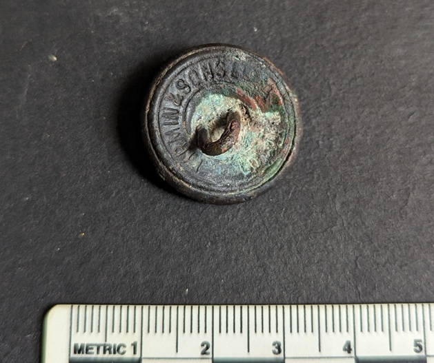
Now, those buttons… I haven’t cleaned them yet, but I could see that one was different, and that I did clean. It came from the same ‘area’ as the bullet (on the surface, 1 metre away), and thus I believe to be from the same dumping episode.

Button cleaned, and with a little oil applied to bring out the detail. I love it.

It’s a simple General Service Button of a post-Queen Victorian type (the crown is of the male type), and was worn by those in military service as part of their uniform. Given that the dumpsite is roughly pre-1920, the button must date from the reigns of either Edward VI (1901-1910) or George V (1910-1936), and was made by the famous Firmin & Sons factory, who still make huge numbers of uniform buttons.

It strikes me that, given the close proximity of the button of post-Victoria (1901), with the training bullet of post-1910, one may assume they are related, and thus the button comes from the uniform of a member of the 6th Battalion, Cheshire Regiment.

One can imagine that following the death – pre-WWI – of a member of the regiment (someone senior enough to have ownership of a dummy cartridge – surely not every soldier had one of their own?), these military bits and pieces were thrown away by the family. In all honestly, I’d like to think it was our old friend, the archaeologist and historian, Robert Hamnett, who, as Colour Sergeant, was very active in the regiment, and who died in 1914… but obviously that can never be proven, however much one hopes! I should go back to see if anything else remains, although I’m almost certain we got everything that was worth finding.

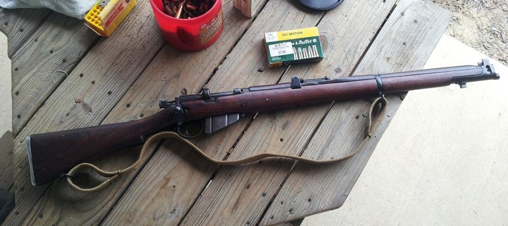
As an interesting aside, I actually own, and have shot, a Short Magazine Lee Enfield rifle – the kind that would have shot the bullet discussed. Built in 1917, it saw active service during WWI, and is a much cherished gift that currently lives in Brandon, Mississippi, USA.

My rifle, the No.1 Mk.III Short Magazine Lee Enfield. According to the stamps on the metal, it was made by the Birmingham Small Arms Company in 1917, it saw action on the Western Front, then moved to India where it was used for training, until it was sold as surplus, and moved to America, where it was bought at a gun show in Jackson, Mississippi, and given to me as a gift.

Alas, it would be difficult to import it from America over here as, quite rightly, there are all manner of complicated and expensive legal hoops through which I would have to jump. Maybe one day, but for now, here I am on a rifle range in Mississippi, firing it.

I need to work on my stance!

Right, that’s it for now. A short and sweet bit of historical archaeology to lighten your day.

I’ll be back soon for more shenanigans, probably involving pottery! What do you mean, “spare us“? Honestly, some people!

Until then, look after yourselves and each other. And I remain.

Your humble servant,

TCG
Archaeology · Pottery

Tired Pottery!

What Ho, dear and gentle readers!

I am tired. Honestly… I am beaten. Sincere apologies for the lack of activity here recently, but my life is now full, and I am having to do all manner of things in order to just exist! Full-time work at school (where I am Mr, or Dr, CG), volunteering at Cubs (where I am Bagheera, believe it or not), and being a parent (where I am dad – or Fat-Her, as Master CG insists on calling me), plus all manner of adult bollocks, like shopping and housework, get in the way of archaeology. As a consequence, balls that I would normally be easily juggling (and yes, I can juggle, before Mr Shouty-Outy asks) are occasionally dropped. And, as I say… I am tired.

In addition to all that, I occasionally run guided walking tours in the area – essentially a live action version of Where/When, which, depending on your opinion could be a good thing… or a complete nightmare (yes, thank you, Mr SO… we all know which camp you are in). And so it was last Sunday – a Wander happened! A group of wonderful people honoured me by allowing me to bleat on at them about medieval field systems, Anglo-Saxon crosses, Victorian housing, and whatnot for 3 hours as we Wandered from The Beehive in Whitfield to the Bulls Head in Old Glossop. I enjoyed it, and they also seemed to. Well, no one physically assaulted me at least, so I’m chalking that up as a win.

As we were Wandering the track from Pyegrove to Old Glossop, and just after having a mini discussion about finding bits of pottery along here, I found one, then another, that were different from the usual background noise of Victorian stoneware and blue and white. And here, for your delectation, I present them to you.

Sherd 1 – The Brown One

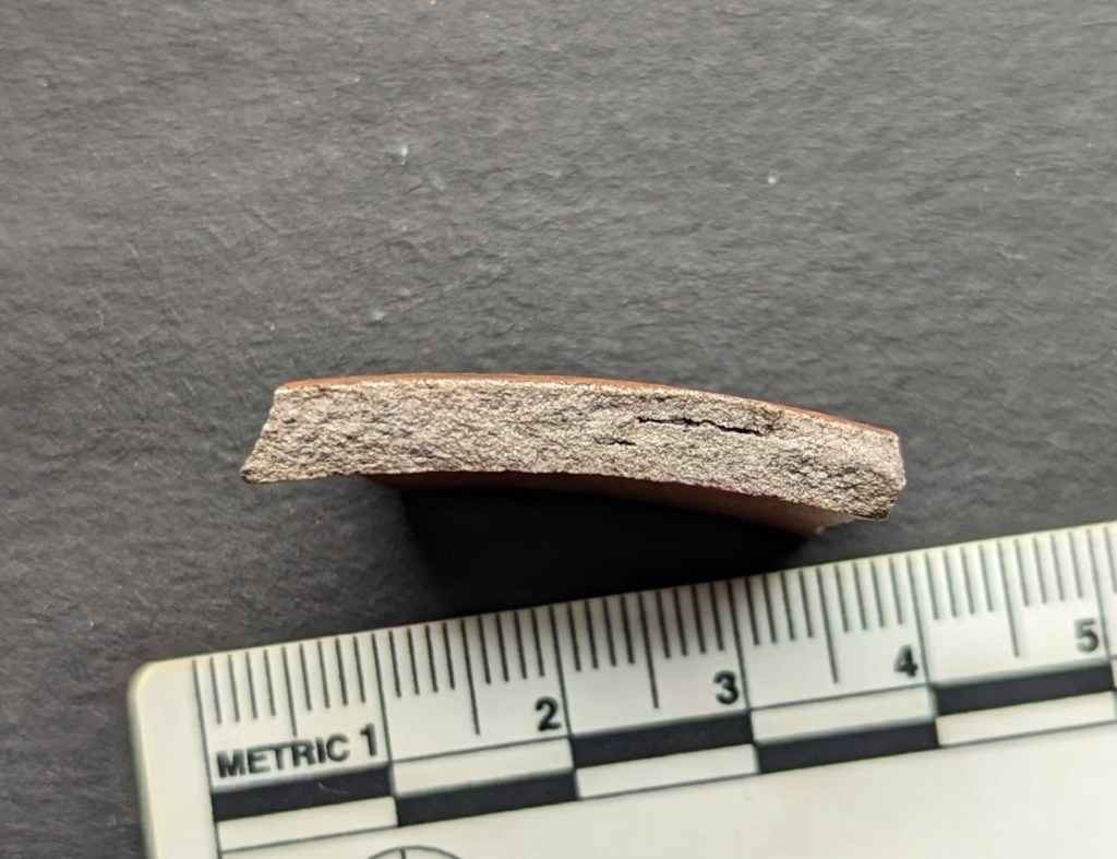
What we have here is a fragment of Nottingham Stoneware, and probably from the rounded belly of a jug or possibly a large ‘loving cup’ with large high handles – certainly something with a thin wall, anyway (it’s just 4mm thick). It has a diameter of c.16cm, and has very characteristic horizontal banding around its belly, engraved using a lathe whilst it was ‘leather hard’ during the drying process, and prior to firing in the kiln. The exterior was slipped in a white mixture, before the whole was covered in a salt glaze and then fired to this lovely warm brown. That stated, it doesn’t have that melted chocolate colour and feel that I associate with earlier examples, so is perhaps late in the Nottingham tradition? I’d say it dates to about 1730, possibly a smidge earlier… maybe 2 smidges.

The exterior surface is smooth – the result of the white slip applied, covering over the natural impurities (different coloured bits) in the clay that are visible in the fabric section (as darker bits against the almost uniform grey), and give it the ‘salt and pepper’ colouring. Also visible are the voids – often long and thin – caused by gases expanding within the clay whilst it is being fired.

These ‘bits’ are also visible on the interior surface, which, along with the fact that this is much rougher than the exterior, suggests that it is a fragment of a jug rather than a ‘Loving Cup’, as this side was clearly never meant to be seen.

The ware type as a whole was discussed in the very first Rough Guide to Pottery back in 1722 2022 (I know, I know… it’s been a while; I’ll finish it soon, honestly), and I genuinely love it. Even the more commonly found Derbyshire Stoneware – the mass-produced Victorian utilitarian stuff – always makes me feel happy when I find it. And yes, I realise this says a lot about me, but, dear reader, I am always honest with you.

Interlude: I wrote that sentence, then read it back. Interesting. As archaeologists – or even as simply interested ‘normal’ people – we don’t often talk about this, the emotional response to finding a broken bit of old pot, the simple, almost childlike, joy in finding. I mean, a lot of people would simply never see it in the ground, walking over it and on. And of those that do, I’d wager a large number would also simply ignore it. Not so us, though. Nope, not us… we few, we happy few, we band of buggered! (apologies to Shakespeare, and my thanks to Whedon). No, we stoop and scoop it up. A little moment of joy, a fragment of history held in our hands, and a connection with the past in the form of decorated clay. It doesn’t matter if it’s the most mundane bit of plate, it’s all wonderful stuff.

Anyway, moving on.

Sherd 2 – The Other Brown One

Alright, so colour choice was not huge in the 18th century! This is a lovely fragment of a Staffordshire Slip Coated pot-bellied mug or perhaps more likely small jug. It has the characteristic dark brown/black exterior, and lovely honey coloured interior.

Interior
Exterior

The colouring here was achieved by giving the exterior a slip of red (just about visible in the section), before the whole lot was glazed. The lead based glaze turns almost black where it covers the red slip, but fires yellow over the pale, un-slipped, interior surface.

A closer look – you can make out the red slip beneath the glaze in the chip, bottom right.

The speckled colouring of the interior surface is the result of the glaze darkening over the inclusions in the clay – probably in this case natural small stones, but also reddish pieces of grog (crushed pottery) added to the clay to improve strength. You can see these bits in the fabric in section:

Originally, it probably looking something like this:

The jug at the back. And yes, I know it’s not the same colour, but the shapes were fairly standard, only the decoration changed – this is in a Slip Trailed decorative style.

Date wise, it is similar to the Stoneware sherd above, but a little earlier – say 1700-1720? Although, potentially, it could be as early as 1650.

The track, as I said, leads from Pyegrove (first mentioned in 1631) to Old Glossop, and was an important route from Hurst (first mentioned in 1550) and Whitfield area at one point, and we may assume it is older than these first mentions. It has seen a lot of people travelling along it, and occasionally people drop things – the things we find.

Incidentally, this trackway is the subject of No.3 of Where/When – Of Hives and Heads – the archaeological and historical Wander from the Beehive to the Bulls Head. If you fancy walking the trackway, follow this link and buy a copy.

As I was writing this blog post, I was taking advantage of the unseasonably warm weather and was doing a spot of gardening. Digging through the soil, I was keeping an eye open for the Victorian pottery that occasionally pops up to say “what ho!”, and was rewarded by this wonderful sherd:

Nope, not Victorian, but somewhat older – I’d say early 18th century, or perhaps even late 17th at a push. It’s another fragment of Slip Ware, although again without any decoration, and again I think from a jug. The fabric is very similar to the other example, and it too was probably made Staffordshire.

You can see the inclusions clearly-ish.

It makes a nice change to find this instead of the normal Blue and White stuff, although where it came from, who knows. Whitfield is very old, as you know, gentle readers, so perhaps one of the houses that were here before the Victorian building boom utterly changed this once quiet rural place. Oh how I would love to have a Wander around 17th/18th century Whitfield.

And on that subject – Wanderings – the newest edition of Where/When is on sale as we speak:

An exploration of the Longdendale Trail from Hadfield (The Palatine) to the tunnel entrances – £5 from the above link, or pop into Dark Peak Books on High Street West. I’m also planning a series of other Wanders over the summer (watch this space) as well as some other interesting stuff – talks and the like.

More to follow later in the month (I hope), but for now, look after yourselves and each other, and I remain. Your humble servant,

TCG.

History · Placenames · Pubs · Towns of Glossop

Glossop – A Town of, well… Towns

What ho, delightful historical types (hysterical types?)! Welcome to a new article… don’t worry too much, it’s not pottery (I’m saving that for next time). Nope. This one looks at an interesting feature of Glossop’s personality. Buckle up!

So, some posts I can polish off in an evening (glass of stuff that cheers in hand, obviously). Others takes weeks to brew, and the process can be painfully slow. This one, though, is very different. I started writing it in August 2017… and it’s taken just under 8 years to publish it! No reason as such, it’s just I paused writing it, and moved onto something else, then I went back to it, and then did the same, and so on, and never quite finishing it. In fact, it’s so old, that it was written using an older version of WordPress (the platform I use for my website) which wasn’t really useable any more, and I had to paste the entire thing onto the newer version. Well, here we go.

It’s often said that Glossop is a town of different areas, and with different character. When I first moved here, I realised that a lot of these areas were named ‘town’ – Howard Town, for example. On a simple level, ‘town‘ here refers to a collection of houses in an area rather than the traditional meaning of a large urban conurbation. I wonder of this is a local dialect, or perhaps more likely, Howard Town was named as such, and then the others followed suit, possibly ironically (Roughtown), or perhaps as a way of keeping in fashion (Milltown? Anway, this and is a which got me thinking… how many of these towns are there? And where are they all?

Well, in answer to these questions, may I present…

MILLTOWN

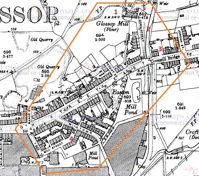
Despite its location, and seemingly obvious derivation, Milltown as an area has nothing to do with the Victorian mills, but instead it is so named because of its proximity to the medieval corn mill. Situated on what is now Corn Street, the mill was owned by the Lord of the Manor, and the people of the area paid to have their corn ground there – and nowhere else. It was, to all intents and purposes, a bit of a racket, but one that was universal throughout the land at the time. As you can see from the map below (and from photographs), there was a flour mill here in 1898, an 18th century building replacing an earlier one. It was demolished in the 1920’s, but you can still see the mill leat running alongside Corn Street. Also, the bridge over Shelf Brook as called Cornmill Bridge, which I did not know until just before I wrote these words… I love that!

Milltown marked in orange, to include the Corn Mill. In reality, Milltown is now just the area to the south of High Street East. On the map above, you can see the Corn Mill (1), Corn Street (2), and Cornmill Bridge (3). Milltown as a present day place is that to the south of High Street East, and comprising Milltown (the street) and Mill Street (4). The area has changed massively, but one constant is the Prince of Wales pub on the corner of those streets (I blogged about it here); pubs are often the only thing left after whole streets are demolished, as indeed is the case here.

LEAN TOWN

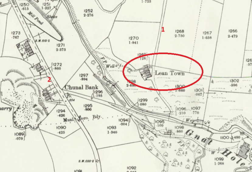
Lean Town is the name given to a group of four houses at the bottom of an apparently unnamed lane that runs from Hague Road to Gnat Hole. I can’t believe it is unnamed, but there you go… no map or document has so far given me a name! As you come from The Beehive toward Derbyshire Level, you pass a right hand downward track – follow this and eventually you hit Lean town. I wrote about Lean Town, here.

Lean Town. 1 is the track down from Derbyshire Level, 2 is Chunal.

The origin of the name ‘Lean Town’ is unclear; it might mean lean, as in not very rich, or poor for growing crops, or might be derived from ‘ling’, meaning the plant ‘heather‘ that grows around here. 

CHARLESTOWN

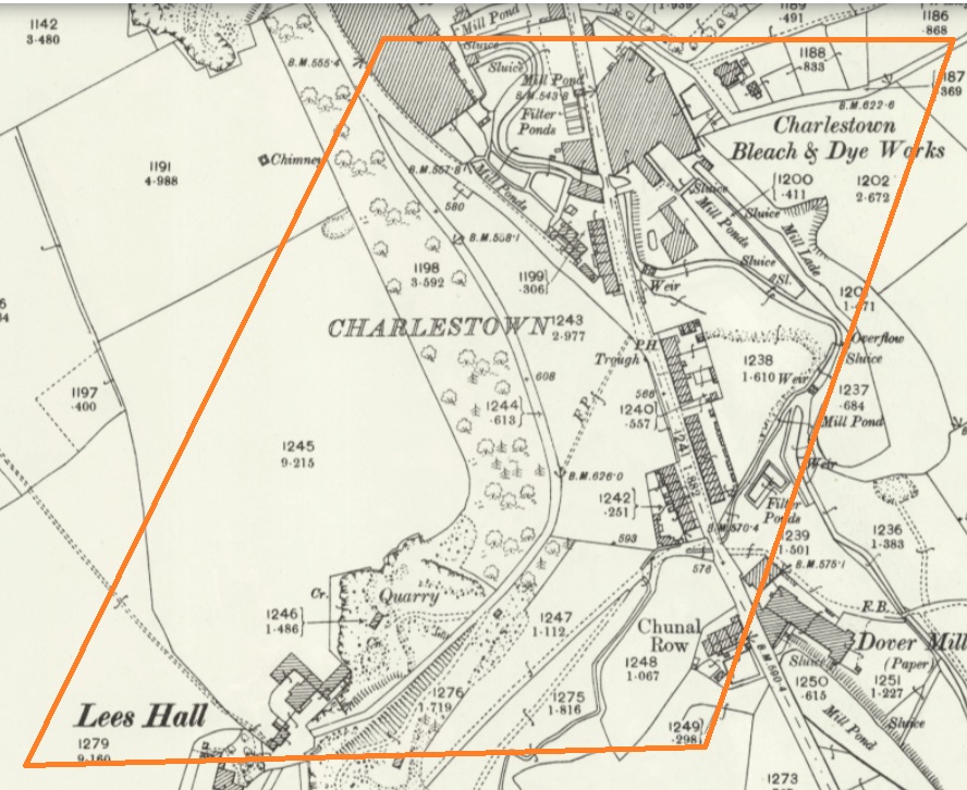
Once an area in its own right, it is now largely remembered in the name of Charlestown Road (and Charlestown Motors who I can heartily recommend, as it happens). It was named after Charles Hadfield who lived in Lees Hall in the late 18th century, and built the mill in Charlestown (now flats and houses).

Sort of this area, give or take. Charlestown Road runs from top down, and the PH (Public House) marked on the map is now Steak Land (replacing a firm favourite of mine, Casa d’Italia, although the word on the street is the Steak Land is amazing, so there’s that!)

ROUGHTOWN

Hope Street in Old Glossop was known as Roughtown, seemingly referring to the uncouth behaviour of its inhabitants, largely quarrymen from the nearby Glossop Low Quarries just up the road.

1 – Hope Street, 2 – The Greyhound pub, a factor in Roughtown’s reputation.

Apparently Roughtown was used as a semi-official name, with it appearing on census returns and trade directories of the time. Sticking with Old Glossop, we have…

TOP O’ TH’ TOWN

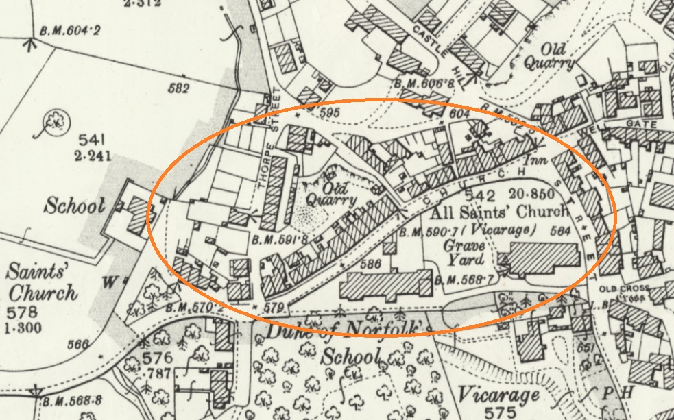
The area between Thorp Street and Church Street in Old Glossop. It is, I suppose, quite literally the top of the town. 

And the area at the end of Top o’ th’ Town is known as ‘Town End‘, which make sense. Over in Whitfield, however, we have…

FREETOWN

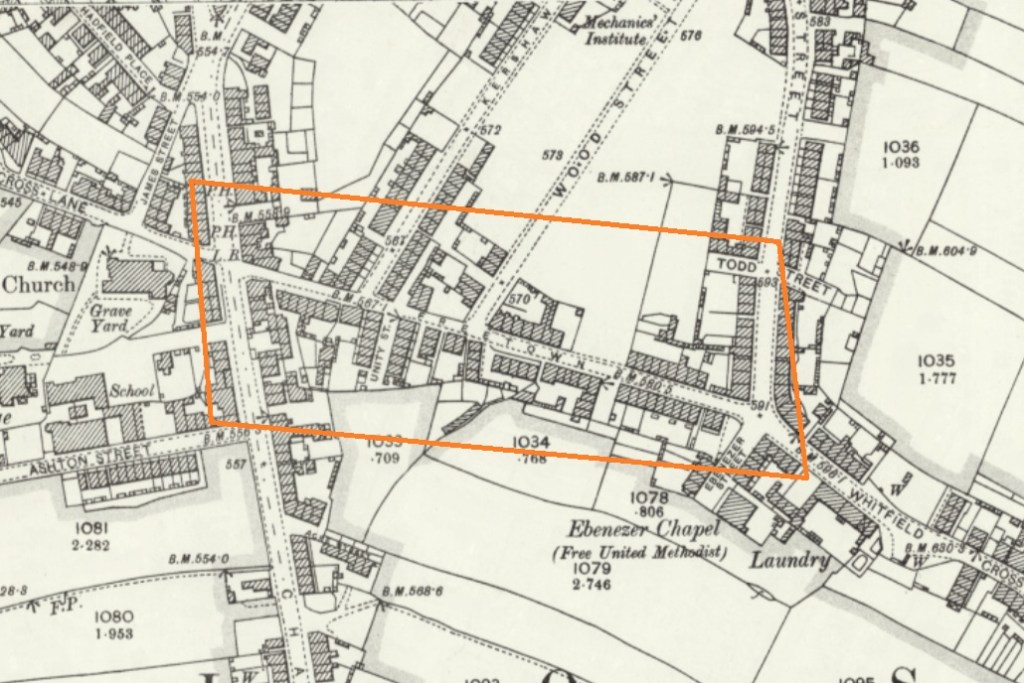
Stretches from the bottom of Whitfield Cross to the junction with Charlestown Road.

This sort of area, here. and particularly the road called Freetown.

Technically, and originally, Freetown was the name given to this area of Whitfield, with the name being derived from the fact that the land in this area, and subsequent houses built here, were freehold, as indeed it is still the case (my own house here included).

HOWARD TOWN

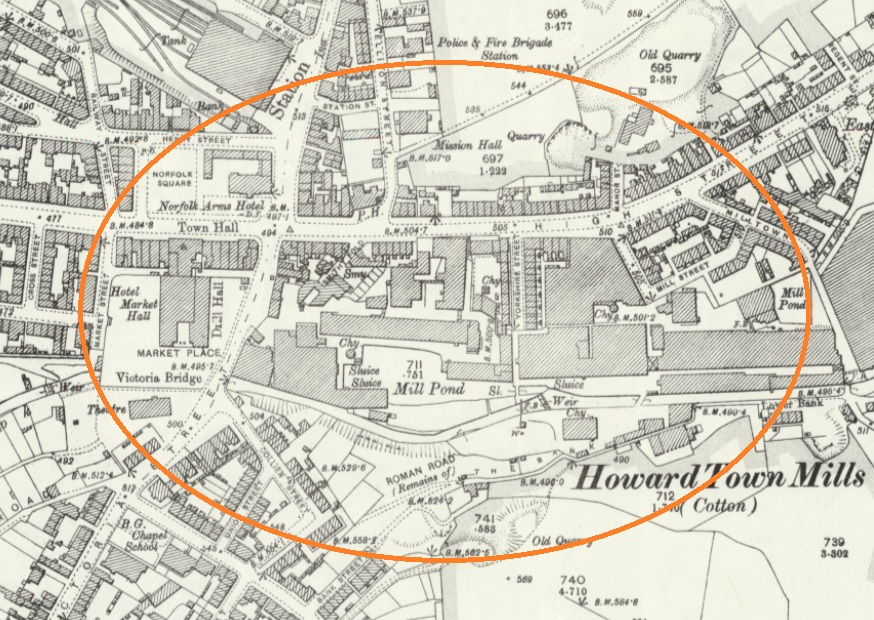
Essentially, what we understand as Glossop – the railway, Norfolk Square, the crossroads, and the whole area around the market and Wetherspoons.

Named after Bernard Edward Howard, 12th Duke of Norfolk (1765-1842) who invested heavily in Glossop – money and time. He built roads, the town hall, remodelled the whole area, and changed the focus of Glossop from what we now know as Old Glossop to what we now know as Glossop, but was originally Howard Town. This may have been the start of the ‘town’ naming process, as others followed suit, whether by flattery or through satire.

JERRYTOWN

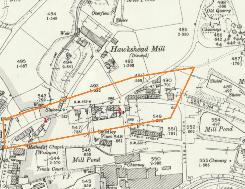
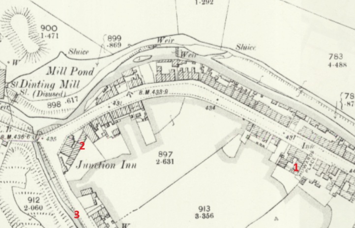
A bit of an obscure one this – it’s mentioned by Hamnett as stretching along High Street West, from roughly The Grapes inn to the former Junction Inn and around.

1 – The Grapes, 2 – The former Junction Inn (now Simple Lettings), 3 – Primrose Lane.

Apparently named after a Jerry Sykes (1779 – 1856) who built a number of houses in this area in the 1820’s.

And there we have it! The many towns of Glossop town. I can already feel several of you desperate to tell me that I’ve got something wrong, or that I’ve missed a ‘town’ out. Please feel free to do so. Honestly, please let me know if I’ve messed up – I’d rather the information was correct.

I do have pottery for next time, and I owe you a new Rough Guide To Pottery – Part 11 unless I’m mistaken, you lucky people, you.

In other news, I’m doing a guided walk at the end of the month… which should be amazing.

You can get tickets here – follow the link

Now that spring is coming I’m going to be walking the route of the Where/Whens so far published, and trying out some other new routes. Tickets for these will be available after the above walk has been done, and will be at the weekend, so everyone can take part – come and join us! Watch this space.

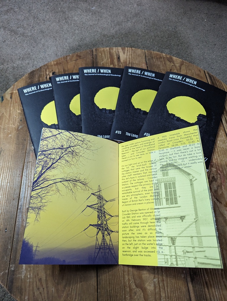
Talking of Where/When, No.5 has just been released.

An exploration of the history and archaeology of the Longdendale Trail, from the start at Hadfield to the tunnel entrances. Honestly, there is so much to see.

It’s available to buy from the usual places – Dark Peak Books, 96 High Street West, Glossop; the website’s store; or you can track me down and buy one.

I’m busy! Too busy, but it’s happening! I’ll post again soon, but until then, please look after yourselves, and each other, and I remain.

Your humble servant,

TCG
Mottram · Placenames · Simmondley

Vikings? In Simmondley? Hwaet? (Dark Age Glossop Part 1)

What ho, people, what ho! I hope you are all well and are suitably recovered after the Christmas season?

A word heavy – and pottery light – blog post today (those of you cheering at the back… don’t think I can’t hear you). It’s also a little speculative, too. Archaeology, and indeed history, rely on interpretation, and how we understand and use the evidence presented to us affects the story we tell. We don’t always have all the answers, and we do make mistakes, but speculation is essential, so let’s imagine… today’s story is of Anglo-Saxon Glossop, so buckle up!

Now, I love a good placename or two. Ask anyone who knows me and they’ll say “Oh yes, old TCG loves a good placename or two. He really loves them”. And then they’ll give a look. That look. I’ve never worked out what it means, that look, but shortly after the person who asked will give a nod of recognition, and say something along the lines of “… oh! I see!” And then both will turn to me, cock their heads and smile kindly, and give me an entirely different look, one of benevolence and calmness, that seems to say “awww, bless you“. Worryingly, I often get the same look from Mrs CG and Master CG. Anyway, moving swiftly on.

So then, Glossop in the Anglo-Saxon period; the Dark Ages, so-called due to the lack of historical knowledge. This is, truthfully, something of a misnomer, and our understanding of the turbulent period of 600 years between the Romans ‘leaving’ (410AD) and the Norman Invasion (1066) is becoming clearer all the time… mostly. For our own area, though, it is still by and large a black hole of historical detail. We know something was here during this time – we have Roman (certainly early Roman), and it’s highly unlikely that the military abandonment of Melandra (probably later 2nd century AD) meant that everyone left the area, especially given the location at the head of the Longdendale Valley. The Domesday survey of 1086AD lists 10 villages hereabouts, so there is definitely something here 600 years later that didn’t just spring into being overnight.

Phil Sidebottom has recently written an excellent book called ‘Pecsaetna‘ (and do feel free to order from our marvellous local bookstore – Dark Peak Books) which looks at the Anglo-Saxon tribal grouping that lived in this area – the Pecsaetna, or ‘Peak Sitters’ – of which we Glossopians should rightfully be proud to be a member of. It doesn’t cover Glossop as such – we are very much on the periphery of what was already a backwoods – but it is a great read for anyone who is interested in what was going on in the Peak District during this period. But the fact of the matter is that there is very little archaeology to be found relating to these 600 or so years; to be precise: 3 stone crosses (the 10th century Mercian Round Shafts – Whitfield Cross and Robin Hood’s Picking Rods), and placenames. That’s it. We don’t even have any pottery to look at, as it seems that in this area people were largely a-ceramic – that is, they simply didn’t use pottery. Imagine, a world without pottery… now that’s a sobering thought.

Some of the placenames in the area I have covered before (the main Domesday ones, for example), but some others I haven’t, and in particular, Mottram (in Longdendale), I find particularly interesting. It is probably derived from (ge)mot (a meeting or assembly) and either ‘treum‘ (tree or cross) or ‘trum‘ (a place or space). Either way, it is almost certain it describes a place where meetings took place, marked possibly by a tree or a cross. These meeting places – or ‘moots’ – have been described as the “cornerstone of Anglo-Saxon governance”, in that various Anglo-Saxon statutes dictated that these councils met publicly every four weeks at these moots to discuss local matters – think of them as local councils and magistrates. They are important places, often marked by a prominent feature – often a cross or a tree – and were in an elevated position – a hill, or lower slope, overlooking much of the land. The one at Mottram fits the bill perfectly, and it was possibly the extreme north eastern moot place of the pre-conquest Hamestan Hundred, right on the border of the land (the River Etherow). All very intriguing stuff, and has relevance for Part 2 of this Dark Age speculation – coming soon.

However, one small group of placenames got me thinking recently, and these are those that have a Scandinavian origin, and by Scandinavian I mean, essentially, Viking.

Soooo… Clan CG went on a week-long jaunt in Norway last summer. And wow, what a country! Beautiful, full of life and history, nature and culture… there is something about Scandinavia that really appeals to me. And at every stop (we hired a campervan) there was wild swimming. Marvellous stuff – the clean water of the fjords; fresh, invigorating, life affirming, health giving. I mean to say, not for me, obviously! I dipped a toe or two in… but brrr – far too cold! So I stayed on the bank and cheered on Master and Mrs CG, who seemed to enjoy it!

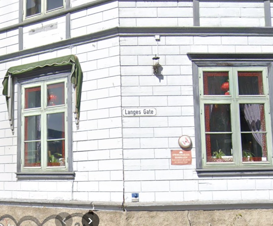
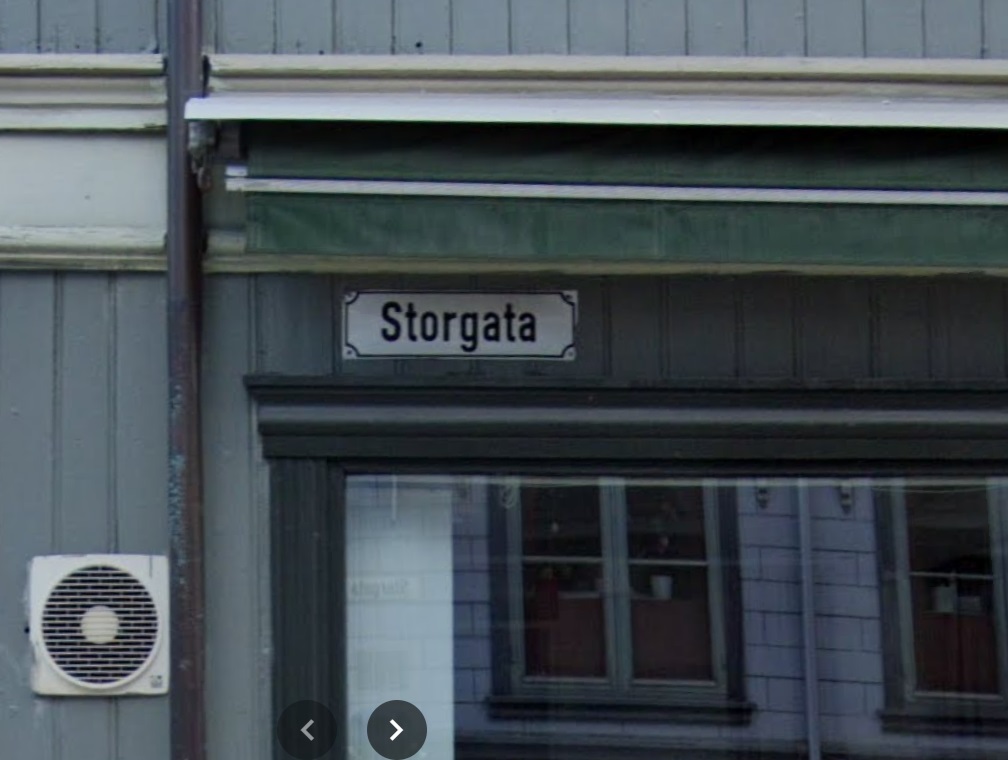
One of the places we visited was Trondheim, a lovely town right at the top of an enormous Fjord, next to an an enormous mountain; scale is a thing in Norway, and I’m sure these landmarks would be puddle and hillock respectively to the locals. We parked up a hill out of town and walked in, and as we approached a crossroads, my sherdy-sense tingled. No, not sherdy-sense, something else. And then I saw it… the road names. We were walking down “Langes Gate“, and we had just crossed “Storgata“, and before I knew what was afoot, my brain had forced out a mighty “what ho!” which might have alarmed the natives somewhat.

Langes Gate (Long Street), Trondheim, Norway.
Storgata (Big Street), Trondheim, Norway.

I recognised the word ‘gate‘ or ‘gata‘ from British placenames. Scandinavian in origin, meaning street or road, locally it can be found in Doctors Gate and Redgate, and this reminded me of a pet theory of mine, and I began to hastily scribble words down back in the campervan that evening, a glass of stuff that (expensively) cheers clasped firmly in hand.

Of those Domesday placenames I looked at, one really stuck in my mind, niggling with possibility. Truthfully, sometimes these things do, and I don’t know why; they shimmer and make a noise in my head, drawing attention to themselves more than others – I assume it’s my brain making connections, rather than an objective noise, but you never know… and once again, I feel I have overshared!)

Simmondley. First mentioned in the Forest Proceedings of 1285 as ‘Simundesleg‘, and then later as Simondeslee, the origin of the name is “the clearing (or ley/legh) in the forest belonging to a man named Sigemund (Old English) or Sigmundr (Scandinavian [Viking]): Simmondley. Ok then, so we have a possible ‘Viking’ name, but there is no evidence for Vikings hereabouts. Or is there? And this is where is started to get interesting.

The Vikings – and all manner of Scandinavian folk – first began raiding the coastlines of England en masse at the start of the 9th century. Eventually, the raiding stopped, and it became a steady flow of immigration, settlement, and farming – swords to ploughshares, and all that. It’s a big country, there was a lot of land, and so they stuck around, and in doing so they changed not only the language we use, but also the placenames of the area they settled – in particular, the area that became known as Danelaw – where they were allowed to keep following their own laws as long as they were loyal to English (Saxon) kings. The exact limits of Danelaw is a bit of an unknown, but it roughly stretched from Essex to Northumbria, and across to the Mersey – this is lifted from the Wikipedia page, and Danelaw is in red.

As you can see, whilst we are on the border, we Peak Sitters are still within Anglo Saxon (English) controlled lands, hence we don’t have many Scandinavian placename elements hereabouts, those name endings such as –thorpeholme, –by, and -ton that are common enough just over in West Yorkshire, but not at all here. It has been suggested that the limit of Danelaw, whilst flexible, may have been the River Etherow and Derwent Valley, making us very much at the limit of Saxon land (If you are really interested, the always excellent before1066 blog has a great read about the Danelaw in our part of the world – you can read it here). But this area is firmly Saxon in language, and thus in placename.

Or so it seemed… and here it gets speculative.

Whilst the area was never settled properly, Sidebottom notes that a small number of areas in the Peak District have Norse derived placenames in their landscape, perhaps indicating the presence of settlers (Monyash, for example). These, he suggests, are Hiberno-Norse settlers – in essence, Vikings who had settled in Ireland, but were expelled from there in the early 10th century and settled in the area around Chester and the Wirral. From here, they moved east and were allowed land to the east of Manchester, specifically in the marginal western slopes of the Pennines. Hmmm… east of Manchester, in the slopes of the Pennines…. does that description sound familiar? Yeah, it rang a bell with me.

These were not true Vikings, and were actually 2nd or 3rd generation immigrants, but they would have spoken their language, and whilst they might not have named any existing settlements as such, they used their dialect words to name the elements of the landscape, and these don’t often change.

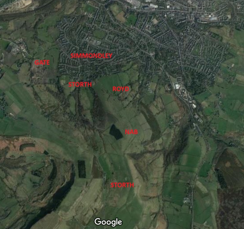
It was the origin of the placename Simmondley that initially rang the bell of possibility. It is first mentioned in the Forest Proceedings of 1285 as ‘Simundesleg‘, and then later as Simondeslee. The meaning of the name is “the clearing (or ley/legh) in the forest belonging to a man named Sigemund (an Old English name) or Sigmundr (a Norse name): Sigemund’s Legh = Simmondley. We assume it’s Saxon, because there are no Norsemen around here… but what if there were? And then the second bell was rung in Trondheim… Gate. In the Simmondley area, this is found as part of Hargate (as in Hargate Hill), but are there any other placenames of Norse origin in the Simmondley area, I wondered?… and promptly disappeared down a rabbit hole that I’m still not sure I have come out of!

So then, there are six Norse placename elements that occur in the Simmondley area:

  • Simmondley itself, we have already discussed, but its possible meaning is the ‘clearing in the woods belonging to Sigmundr‘. Sigmundr, and presumably his family, may well have arrived from Cheshire way, and cleared a smallholding in the woodland, where he would have set about naming things in his native tongue! Interestingly, Simmondley isn’t in the Domesday survey, possibly because it was simply a farm and too small to be recorded as its own settlement, so was just recorded under Charlesworth generally. We also need to realise that it may have only been in existence for 100 years in 1086, possibly even less.
  • Sitch – here used in Sitch Farm on Monks Road directly up from Simmondley. Sitch is derived from Old Norse ‘Sik‘ meaning a small stream, especially those flowing through flatland and marshy areas. It occurs elsewhere in Glossop: Wall Sitch by St James’ Church (discussed here), and Back Sitch, a footpath in Old Glossop.
  • Nab – here used in Whitley Nab. It is derived from the Old Norse ‘Nabbr‘ meaning a projecting peak or hill, which sums up the Nab perfectly. The Whitley (or Whiteley) part is presumably referring to a clearing; white here meaning without colour.
  • Royd – here used in Hobroyd. The word – meaning clearing – is not exclusively Norse, as it is found in Saxon places too: the root is the same for both German and Norse. But it is often used as evidence for Norse influence when found with other Norse placenames. Interestingly, the word ‘Hob’ here means a hobgoblin or other supernatural creature; Hobroyd is the ‘clearing belonging to the goblin‘. Bizarre.
  • Storth – here found in Storth Brook Farm and the adjacent Storth Brow Farm. The word Storth is Old Norse and means a young wood or plantation, possibly one planted.
  • Gate – here found in Hargate Hill Farm. Gate, from the Norse, Gata, meaning road.

This last one, the one that started this whole merry dance, is for me the cherry on the cake, and what just about convinces me. It gets its first mention as Hargatt in 1623 in the burial record of Widow Robinson. Now, 1623 is 650 years after the time we are talking about, but placenames stick around, and rarely change; this is why we call Glossop, Glossop: some 1000+ years ago, someone described the area as “oh, you know, Glott’s Hop“… and here we all are, on this website. Perhaps more importantly, church records only go back to 1620 in Glossop – very very late, but not uncommon, so 1623 is only the first mention we have, not when the place spring into being. ‘Gate’ makes sense, but the ‘Har’ element makes little sense, until we find in 1664 it is referred to as ‘Hardgate‘, and we see that this is probably the ‘correct’ name, and that all others are variants of this – the ‘d‘ being an obvious sound to drop.

This got me thinking: Hardgate… Hard Road? And then I realised that the Roman Road from Buxton passes through the area just west of the settlement. Was Hardgate referring to the ‘Hard Road’ of the only decent road in the area, a beautifully built and ‘hard’ surfaced Roman Road, as opposed to the muddy nightmare tracks that the rest of the area was filled with, and which even in the early 1800’s were still being moaned about? I wondered about the word Hard, and on a whim I entered the English word into Google Translate. Do you know what the Norwegian word for ‘hard‘, meaning solid or inflexible is?

Hard‘.

Hargate/Hardgate simply means the ‘Hard Road’ in Norwegian. I am convinced this refers to the Roman Road in their native tongue, and that convinces me that this whole ‘Viking’ enclave in Simmondley is a real thing. At least, I’m convinced… for now; I realise I’m not a placename specialist, and that this is something of a stretch. But c’mon…

Location of the placenames

So the next time you are in the Co-Op buying beans and some bread, remember: “We Gardena in geardagum, þeodcyninga, þrym gefrunon, hu ða æþelingas ellen fremedon…” and all that!

Ok, so, I can already hear the army of linguists and placename specialists lighting torches and starting to yell. Truthfully, I’m out of my depth here, but I believe what I’ve written. If you know better, please let me know… I’m always happy to be wrong, as it’s how we learn. But more importantly, if you know of any other Norse placenames in the Simmondley area, please let me know. Part 2 of this post – coming soon – is even more contentious! And in between – probably – is another instalment of the Rough Guide to Pottery… I know you have missed it so. Although the screaming I’m hearing (and swearing… don’t think I can’t hear that too) is a little off-putting. But in l know you are only joking, so as a reward, I’ll put in extra photographs.

Until then, though, look after yourselves and each other, and until next time, I remain.

Your humble servant,

TCG

Archaeology · Pottery

A New Year Quickie!

I say! What!

What ho, you wonderful folk, you. Well, you join me in full panic mode – I promised a December post (actually, pre-Christmas was the promise, but let’s overlook that), and here we are with mere hours of the month, and indeed year, left. Christmas was, as always, busy, especially having the new Job taking almost all of my time, and so I have been lacking in the blog – and pottery – department. And also… Hmmm? What’s that? What do you mean “we don’t care, just get on with it!“. Alright, hint taken… I do have a tendency to ramble on and, you know, procreating – if that’s the word I’m fumbling for – instead of actually doing the thing.

So then… pottery. Taken from my overflowing finds tray that needs to be sorted before Mrs CG sees it. Some choice pieces, perhaps? Okey-dokey!

First up, a simple tea cup fragment.

Very delicate Bone China, with walls less than 2mm thick (you can see light through it), and rim diameter of 9cm. Nothing fancy, and certainly not old (late Victorian), and not even particularly good quality – the transfer printing is a little ropey in places. The design is that of the Willow Pattern spurious legend, and you can just make out one half of one of the birds into which the lovers transformed in order to escape. At first I wasn’t sure why I had this in my finds tray, but then I remembered Master CG and I had found it together on Bank Lane in Tintwistle/Hadfield. It’s also a nice example of its kind.

Next we have this beautiful specimen. And yes, I realise that beauty is in the ‘E’ of the ‘B’, or something, and that equally yes, I am possibly certifiable.

Slightly larger and distinctly less delicate than the first example, we have a Pancheon rim. It’s a huge example – 50cm in diameter – and is chunky. Glazed on the interior, as is traditional, it has a red slipped exterior, and is really roughly finished, which I quite like – there’s a sense of practicality about it, a no-nonsense pot, if you will. There’s smoothing marks all over it, too, and great lumps of inclusions popping through the surface.

If you look at the fabric, you can see the characteristic marbling, with a buff coloured clay mixed with a reddish. It was found in the spoil from a hole dug in Whitfield Cross, and probably dates to the late 18th or very early 19th century, which would make sense as this was when the road was laid out and surfaced. I honestly love this.

Next up we have a tiny fragment of Staffordshire Slip Ware.

You can see the glaze on the interior and red slip on the exterior, with wonderful wiping marks left by the potter, and the characteristic fabric type.

It’s from the ledge rim of a plate, probably something like the sherd on the left in the image:

It has the characteristic Staffordshire buff fabric, with the usual inclusions, making it very identifiable. The fact that is comes from the area of the Guide Stoop, on the post-medieval path there, is perfect in terms of dating. I like it when it comes together like that!

Finally, we have this lovely thing – a ceramic toy marble, and a large one, too – 2.5cm in diameter. I wonder, does this qualify as a ‘dobber’?

It’s not glazed, and is slightly off being perfectly spherical, but is quite beautiful, and marbles are always welcome finds. This, too, came from the area around the guide stoop – it really is the area that keeps on giving!

Right then, that’s your lot for this post. I have a double whammy of somewhat speculative Anglo-Saxon based posts that need finishing off, and a whole pile more pottery ready to go (look, don’t moan… all this pottery is good for the mind, body, and soul). I’ve also got a new Where/When to explore and publish, and there are more Wanders planned for the new year. So lots more in 2025, but for now, enjoy the last hours of 2024, and, glass of the stuff that cheers in hand, here’s a health to you and yours.

But do look after yourselves, and each other. Christmas can be a difficult time for some people, so it’s always good to keep an eye on those around you, even if you don’t know them. Until next time, as ever, I remain.

Your humble servant,

TCG
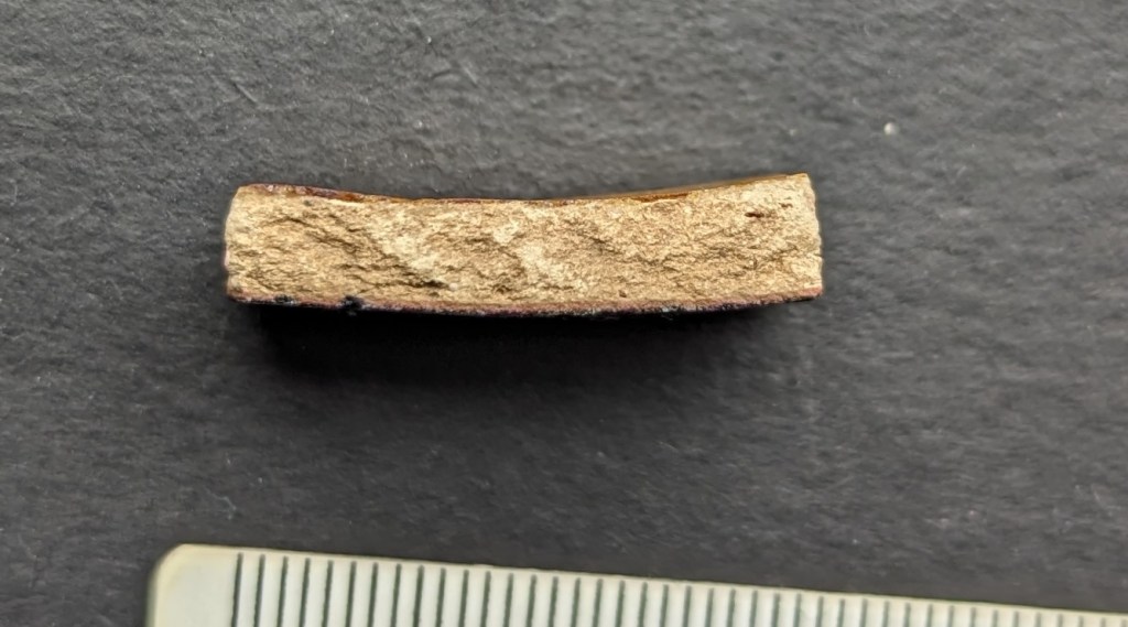
Etsy Shop · Where / When

Where/When No.4 (The Melandra Meander) and More

What ho, historical types, what ho!

So, the new Where/When ‘zine has just arrived, and just in time for Christmas! How has a year passed since I nervously unpacked Issue No.1, hoping that someone might buy it? I now have t-shirts available… but more about that in a moment. So then, Issue No.4: the lurid green cover was suggested by Master CG, so blame him for the migraines.

This one is subtitled The Melandra Meander, and, as you might have guessed, has a brief furtle around that most neglected of all Roman forts, Melandra. The Wander starts there, and then wends its probably weary way up the hill to The Hague, then up to St Michael and All Angel’s church, Mottram, and then down various trackways to Broadbottom, the viaduct, and on to Gamesleys old and new, and eventually back to the fort.

It does give a brief overview of the fort, but I think that really should be the subject of a Where/When special, as it is a hugely important site. It’s also slightly longer than previous Wanders, but it isn’t particularly difficult… although be warned it is incredibly muddy in places. You have been warned! It contains all the usual website shenanigans – history, a carefully planned wander, archaeology, psychedelically tinged photographs, bad jokes, pottery, a sense of ‘something or other’ and the obligatory snifter of the stuff that cheers… I mean, what’s not to love?

All four of the Where/Whens are now available to buy – I reordered some more of the long out of print No.1, as people have asked for it.

The price is £5 each – a mere snip to have my words droning on and on about old things ready at hand, any time day or night! They are available from the wonderful Dark Peak Books, High Street West, Glossop, or from this website (click here, you won’t regret it). Or simply drop me a line in the contact page, and I’ll get them to you ASAP. Or you could track me down, and make vague threats to me in order to get me to sign it – you won’t be the first (madness, I tell you!).

I’m also in the Glossop Chronicle, which is bizarre to say the least! Check it out here: https://online.flippingbook.com/view/781848889/10/

In other matters… I have set up an Etsy shop! This gives me a platform to sell my wares, which is amazing. At the moment it largely features A4 art prints taken from Where/When, on really good quality paper stock, perfect for framing and brightening up even the darkest of rooms (yes, Mr Shouty-Outy, I’m sure it would look good in your downstairs toilet… as always, I thank you for your input).

But also, crucially, we have some merchandise! If you fancy buying a 100% cotton t-shirt for Christmas, please feel free – I certainly won’t stop you! Now you too can recognise fellow Wanderers without having to resort to those tattoos that some of you have got. And now you too can look somewhat snazzy as you slither down a muddy bank whilst looking for pottery, or indeed simply spiffing as you tumble A over T down a ‘medieval trackway’ cursing me as you go (again, you won’t be the first).

Four slogans are available, and in a variety of colours:

‘What ho, Wanderer’

‘Wandering Where? Wandering When?’

Not Walking… Wandering’

Wander Definition

There’s also hoodies, and mugs! What’s not to love? And, of course, the ‘zine itself. And with much more in the pipeline.

Check the shop out here – DrTCG’s – you won’t regret it, and you’ll be helping me, too!

Righty, shameless self-promotion over with – I’ll have a proper December post ready in time for Christmas (probably involving pottery!). Until then, look after yourselves, and, as always, each other. And I remain, your humble servant,

TCG
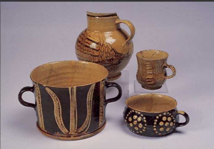
Pubs · Simmondley · Stones of Glossop

Datestones – Part 2

What ho, you wonderful and slightly strange bunch, you.

A quick one today… I have had almost no spare time to do much more. I have just finished the new edition of Where/When (No.4, The Melandra Meander) – which has taken all my time – and I’ve just started a new job! Busy busy busy! But the Cabinet of Curiosities is a priority, and you, kind and gentle readers, are very important. Plus, if I don’t publish something on the website, angry crowds start to gather outside my house, chanting and making threats – I mean to say, one has to think of the neighbours.

So here we are – a second part to the Datestone post I wrote 3 years ago (three years? Where has the time gone?). I’ll spare the introduction as the original covers that, and just dive in to say that all of the datestones are pre-Victorian (before 1837) – I’d like to do a survey of the datestones of the Victorian and later periods, but there are so many that it would be a big task. If anyone fancies giving me a hand, though, give me a shout.

So then, first up is a correction. Hurstnook Farm has a stone that I drew through a pair of binoculars, as I couldn’t get close enough to photograph it. Well, they’ve been doing some work there recently, and me being me, I wandered over and asked if I could take a snap, and Lo! The result is below.

F.S.M.W, and the date of 1772. Lovely detailing, too – this is an expensive looking stone.

And a wonderful datestone it is, too. Different from my interpretation of it, and I still have no idea of the names; W is probably the family name – possibly a Wagstaff? I’m sure looking through some deeds would produce a name, though. Any thoughts, anyone? There is another datestone on the extension next door that reads 2010, but is designed to copy the original one, to fit in with the building.

Next up is #13 Padfield Main Road, Hadfield.

J.H.A 1826. Simple and effective.

A simple datestone, but I honestly love this one. And the colouring is effective.

Next up, Hadfield Hall – a truly wonderful building. I could study this place for hours, and often find myself marvelling at the structure, and all the phases of construction. Now is not the time for a detailed look at the hall – a future post, perhaps. Still, it has a cracking datestone above the door.

I(J).H. T.A. 1646

Lovely stuff. Hadfield family? I’d love to know more – any thoughts?

Just opposite Hadfield Hall is 7 Old Hall Square:

AD 1769

A simple date, rather than a chance at immortality.

Next we have 2 from Shaw, the farmstead that is first mentioned in 1285. It forms one of a number of such places dotted around Mouselow, and is a fascinating place. I suspect there is a lot of history here, and would love to have a poke around some of the properties there. If anyone reading this in Shaw fancies letting a slightly odd bloke have a rummage, so to speak, shout out!

First is Shaw Farm Barn

G.B. (D) M.B. (B), 1694

Not a great photo, but the inscription is correct. It’s on a whacking great lintel, which is very suggestive of an earlier, perhaps Tudor, door lintel that’s been re-used. Makes you think… And then, next door, is Shaw Farm:

I (or more properly J).P. 1751, in a rather fetching shield motif.

The names here again escape me – J.P. (the ‘J’ is rendered as an ‘I’ as was the custom).

Next up, the Hare and Hounds, Simmondley.

G.B.P. 1784

I actually know the meaning of those initials – George and Peggy Booth. Also in Simmondley, we have Dingle Cottage which sits on the old trackway from the farms over Whitley Nab way.

M.L.R. 1706

A truly fascinating building, and again, one in which I wish I could have a poke around!

Next is Hall Fold Farm, Old Glossop.

J.S.J.G. 1806

The datestone was apparently found buried whilst the farmhouse was being renovated. The image is not mine, but was taken from the always interesting (and essential if you like Glossop’s history) Old Glossop History Trail website. I want to take one of my own, but oddly people view Herberts taking photographs of their houses with a bit of suspicion!

Another Old Glossop datestone is unusual – this is built into the side of Hillside Cottage, down by Laneside Farm:

R.A.C. 1635, with a decorative saltire.

A few things to say about this one. Firstly, it is the second oldest datestone in the Glossop area, pushing Hob Hill Cottage in Whitfield into third place. Secondly, the decorative saltire might also function as a protective motif, as the shape is a fairly commonly found apotropaic mark. But the important thing is that it is not in its original position, above a doorway, and in fact the house it is built into is late Georgian or early Victorian. I can only assume that it replaced an earlier building, and rather than throw the lintel away, the builders thought they might as well build it into the fabric of the house as decoration. As for the initials – I have no idea.

Next up, and finally: Flax Cottage, Wesley Street, Old Glossop.

S.W.E. 1783, and a little flower motif.

The flower motif in Flax Cottage is very similar to that at Hurstnook Farm – possibly the same stonemason carved it 11 years later?

Ok, so that’s it for datestones. There are others in the area – a few in Charlesworth, Herod Farm, Hobroyd Farm, etc. – but I don’t have photographs yet. If anyone does, or if anyone knows of any others that I don’t know about, then please give me a shout.

In other news. As I say, Where/When No.4 is about to be printed – I sent it yesterday, so it will be here next week, fingers crossed. I’m super excited about this one, and it might be the best yet. I’ll post more soon, and with other news too. But until then, look after yourselves, and each other, and I remain.

Your humble servant,

TCG