A proud Glossopian, archaeologist, idler, drinker, teacher, father, wanderer, delver, writer, and publisher of Where/When: the journal of Archaeological Wanderings.
Morning all. Apologies for the recent lack of activity; all usual reasons apply, but we’ll spare the grovelling and move swiftly on.
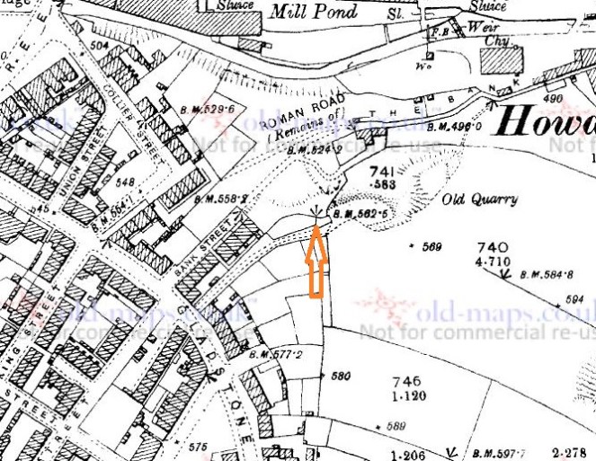
I was contacted recently by the wonderful Geoff Bell, who informed me that he knew the whereabouts of one of the bench marks that had been declared lost by me in this post. Specifically, this one.
The location of the no longer missing bench mark, 562.5 ft above sea level.
How wrong I was! I popped over to see him (and his wonderful garden), and he showed me the stone and mark. It wasn’t easy to get to, but at least I can now tick it off my list.
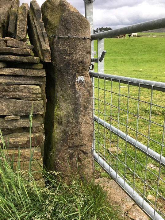
Here is the stone:
Stood at the end of, and incorporated into, the wall.
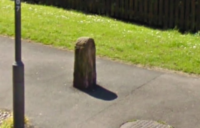
The stone is interesting. It is clearly in its original place, with the current wall being relatively recently added, but following the line of the original wall. This original wall used the stone as a reference point (it curves to meet it), and it was clearly here before the wall was built, leading to the question of… what was it? It seems not to have functioned as a gatepost, it has no evidence of metal ‘fixings’, nor is it shaped like other gateposts, and it would be an odd place to have it. It is possible that it was a free-standing standing stone, perhaps even prehistoric, but it is difficult to prove. It might also have marked a track, and although the probably Medieval or earlier Bank Street runs close by, it’s way below (some 39 ft and more, to be precise), and no one moves a stone that big very far up hill. No, it’s a bit of a mystery, but hey ho.
So, this is what 562.5ft above sea level looks like! Apologies for the close-up – there was no easier way of taking the shot – it really was quite inaccessible!
Exactly 562.5ft above sea level.
So there we have it. My sincere thanks to Geoff (lovely to meet you) for alerting me to this. If anyone else wants to get in touch and tell me about anything interesting, please do… especially if it involves bench marks!
Oh, and on the way out of his garden, I saw these striking Fly Agaric mushrooms:
Amanita Muscaria – the Fly Agaric.
Wonderful to look at, and used by shamen throughout the world to commune with the other worlds and work magic. Interesting, but I really wouldn’t recommend it.
Right. I ‘ll try and get another post done this evening, but for now, I remain.
A brief one today. Taking advantage of the lull in the rain coupled with a bit of a breeze, Master Hamnett and I went to fly a kite in the fields off Hague Street. On the way back, I found some bits of pottery which spurred me into doing the blog post that I have been thinking of doing for some time.
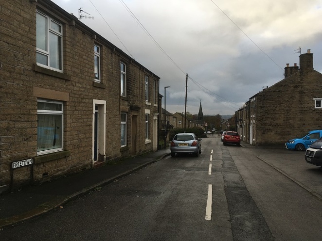
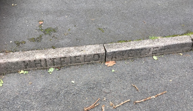
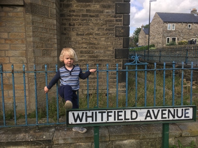
Just in case you get lost. Actually, it’s a nice touch, and I wonder where else the impressed concrete road names were placed.
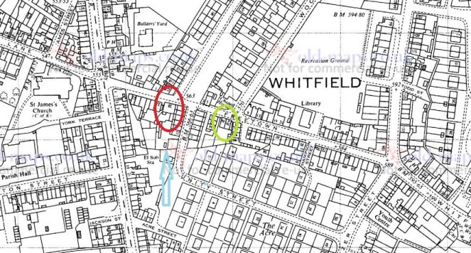
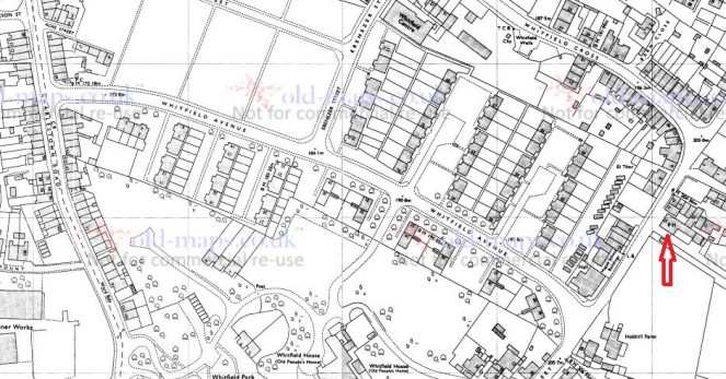
Whitfield Avenue runs downhill in a broadly NW – SE bearing from Hague Street to meet with Charlestown Road, and is parallel to Whitfield Cross.
Whitfield Avenue runs north-west – south-east. For orientation, The Beehive pub is indicated by the arrow. (1974 OS map)
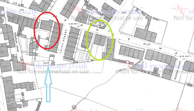
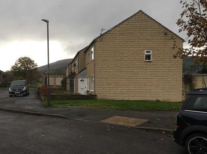
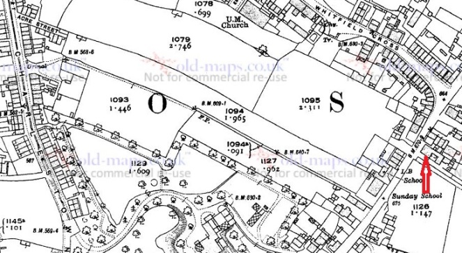
At first glance, it is not a particularly interesting road. The product of the 1960’s demolition and rebuild of the Whitfield area, the road didn’t exist prior to this, as you can see from the map below.
This is the 1921 OS map, and again, The Beehive is indicated.
What is there is a footpath, walled for most of its length, along the long thin fields that characterise the fields of Whitfield – possibly a survival of the medieval ‘croft and toft‘ field system, or more likely a result of the enclosure of the land there in the early 19th Century. This is interesting, as we shall see, but it also probably explains why the council chose there as the location of the road – using an already existing path.
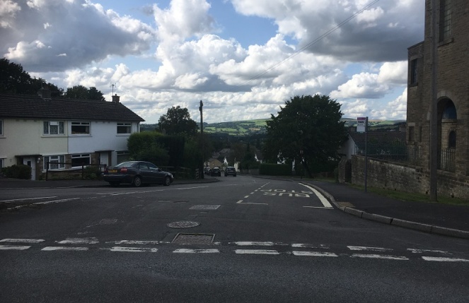
Whitfield Avenue from Hague Street looking down to St James’s Church and Charlestown Road. On the ridge line in the distance, on either side of the left hand tree, is All Saints Mottram (left) and the Deep Cutting at Roe Cross (right).
Historically, then, it is interesting, but not exactly earth-shattering. That is, until you peel back the modern, and take a closer look.
Hague Street was the original packhorse road from Chapel en le Frith to Glossop (now, Old Glossop) – there is some discussion about the road, here, and there is the Glossop Guide Stoop, too (and more here). It was an important route, and the village of Whitfield grew around it – this is the oldest part of the area. Dating for this road is tricky – we know it was there in the 10th Century, as the Whitfield Cross was placed at the junction of Hague Street and Whitfield Cross (the road), and presumably some form of settlement – perhaps just a farmhouse – was there at the time. Beyond this, however, we have no evidence. However…
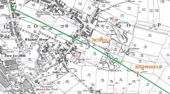
In the early 1970’s a series of excavations were carried out by two archaeologists – Peter Wroe and Peter Mellor – in order to establish the line of the Roman roads to and from Melandra Fort. Although this thorny and difficult subject has been much debated (and only recently – possibly – put to rest), they made great leaps. One of the roads, that coming from Navio Fort (Brough, near Castleton) passes through Brownhill, and comes through Hob Hill Meadows, and continues down the line of what is now Whitfield Avenue. From there it travels down the road that are now known as Hollincross Lane and Pikes Lane, and over into the fort.
Yes, you read that correctly, Hollincross Lane/Pikes Lane, especially its latter part toward Pikes Farm, is a Roman road.
The line of the Roman road is shown in green, leading down what will become Whitfield Avenue and onto Hollincross Lane and Pikes Lane, and then to Melandra Fort.
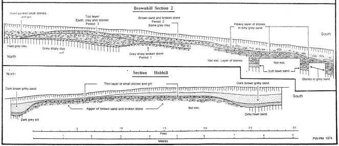
The excavations not only revealed the broad line of the road, but also how the road was built. The next picture shows what is called an archaeological section drawing – essentially a slice of the road was taken out, and the side of the slice was drawn showing the layers that made up the road. And all this is just 1ft below the ground, which is quite remarkable.
The upper section shows what is marked ‘Brownhill’ on the above map, the lower shows ‘Hobhill’. The road is very clear, and very large, too.
Interestingly, and as an aside, Hob Hill as a placename means ‘Devil’s Hill’ – I have said it before, I love it when folklore and history meet.
The ‘original’ footpath on the first map pretty much follows the line of the Roman Road. This is interesting, and suggests that the path used the surface of the Roman road, or a later incarnation of it; there is no point in making a new path if you can use an existing one, especially if that one has a good surface. What I like about this is that a road built 2000 years ago, directly dictated to the council the course of a road built in the 1960’s. History affects us in the present in many ways.
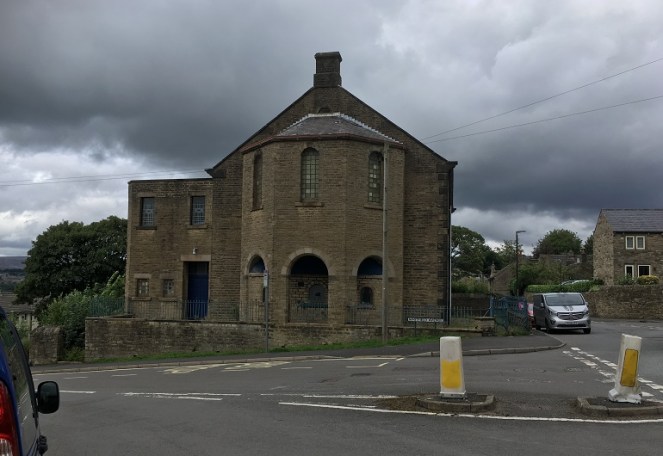
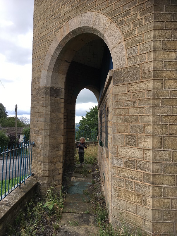
At the top of the road stands this wonderful, forlorn, and if I’m a little honest, slightly terrifying, building – the former Chapel/Sunday School.
I can’t be the only one who gets weird Amityville vibes from this building, can I? It is the ‘house on the hill’ after all.
I have always been intrigued by this building, and so taking advantage of the open gate, I had a look around.
Master Hamnett having a look around.
It’s really quite a lovely, if very Victorian, building, full of nice touches.
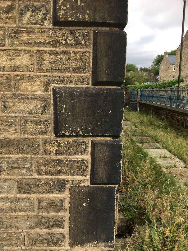
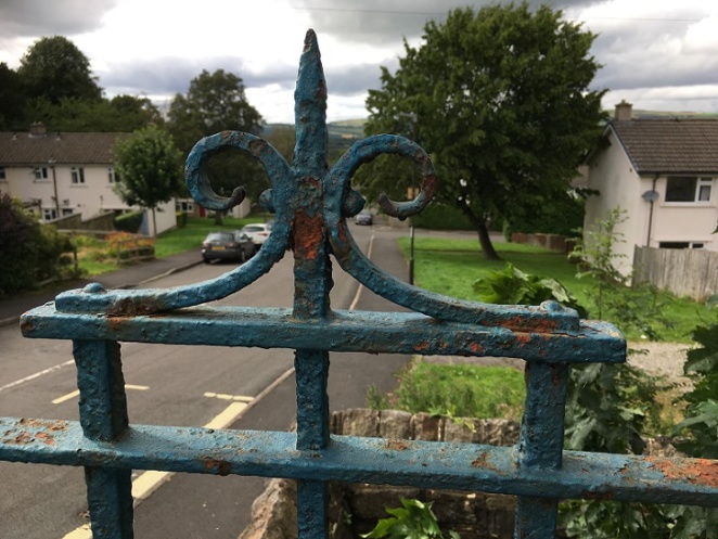
The quoins give it a rather grand air, with some nice masonry.Ornamental ironwork, sadly in disrepair, and in need of painting. An artful shot looking down Whitfield Avenue – very unlike me!
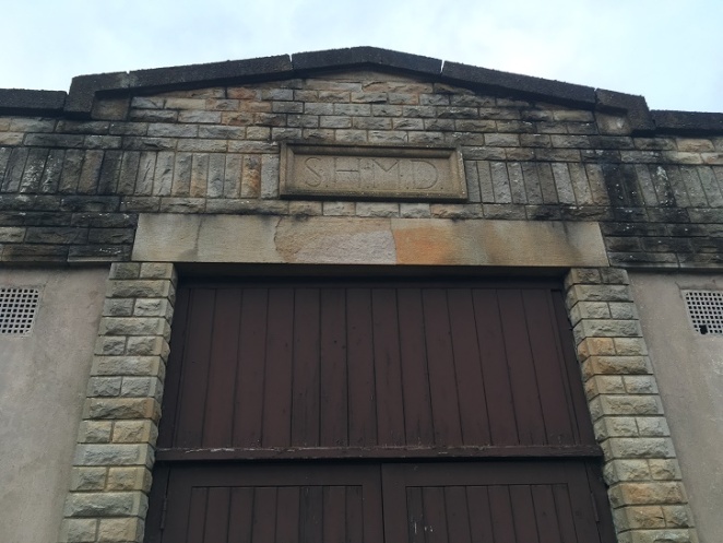
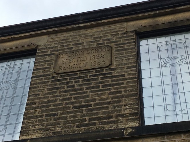
There is also a datestone, helpfully recording the dates of the original construction, the rebuild, and what its function was.
I do love the Victorian literal approach to recording things – it really helps us historical types.
Actually, it was also altered a third time in 1931 to incorporate the chapel further up Hague Street which by then had fallen into disuse. This Methodist chapel (itself rebuilt from the original 1813 version), had once contained the pulpit from which John Wesley had preached, and which in 2010 was returned to its rightful home in New Mills (see here for information and photograph).
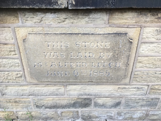
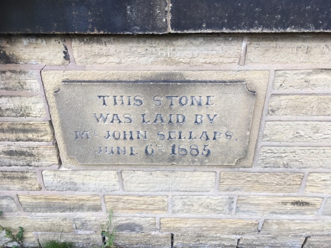
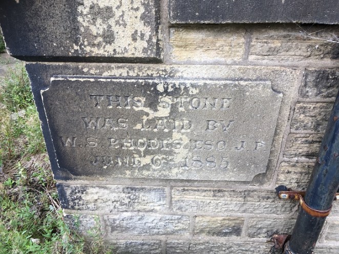
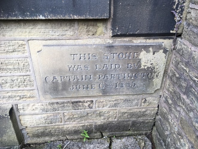
The 1885 rebuild had four cornerstones embedded into it, recording the local worthies who attended the ceremony, and which allow us a peek into Late Victorian Glossop life. Here they are:
“This stone was laid by Captain Partington. June 6th 1885”“This stone was laid by Mr Alfred Leech. June 6th 1885”“This stone was laid by Mr John Sellars. June 6th 1885”“This stone was laid by W.S. Rhodes esq. J.P. June 6th 1885”
So these are the stones, but who are these people?
Captain Edward Partington: Partington was a very important person in Glossop’s Victorian history – his biography is impressive, but in summary he was born in 1836, and moved to Glossop in 1873, buying up all sorts of mill concerns, and ending up Rt. Hon. Edward Baron DoverdaleRt. Hon. Edward Baron Doverdale, dying in 1925. He did a huge amount of philanthropic work around the town (funding the library, for example), and served as Captain in the 3rd Derbyshire (Volunteers) Rifle Corps. Oh, and was a mean rugby player, by all accounts.
Alfred Leech: There is very little information about Mr Leech that I can find. He crops up in a number of interesting places associated with Glossop society, and he is mentioned in the London Gazette as being elected as a land tax commissioner. His address is given as Cowbrook Cottage, Sheffield Road, Glossop. More research is clearly needed!
W. S. Rhodes: William Shepley Rhodes was a councillor, alderman and mayor for varying amounts of time. The Rhodes family were involved in various mill concerns in the aream and are well known. William was also known as a strong athlete and a good sportsman, being the president of the Glossop Cricket Club for a while.
So there you are – the more you know… or less, in some cases.
The chapel/Sunday school continued in use until Easter Sunday 1968 when it had its last service. It is now known as the Spencer Masonic Hall, and is where, from 1973 onward, the Freemasons Lodge of Hadfield 3584 have met on the first Thursday of each month. And at some stage it was up for sale – the sales brochure can be seen here (complete with interior view!). It’s a lovely building, but very neglected and tatty on the outside, and it’s a bit of shame that something more isn’t made of it.
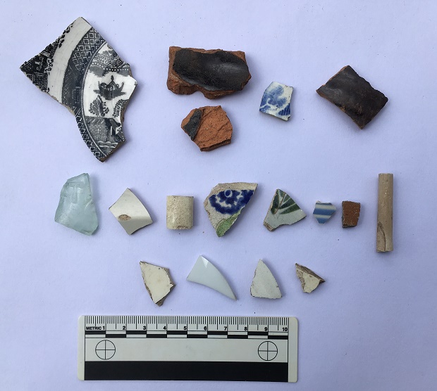
The pottery, then. Obviously it would be nice to find something Roman, but sadly no such luck. Instead, we have a selection of Victorian material, which might be the remains of household rubbish from the houses that once stood there (see above map), but equally might result from the process of nightsoiling. On balance, it is probably the former – there is no arable land in the area where I found the pottery, and the edges of the sherds are still sharp in some examples, and when pottery sherds are ploughed, the edges become rounded. There is nothing too exciting, but nice to see.
A modest selection of Victorian bits.
Top row, left to right: A shallow dish or saucer, transfer printed, and probably late Victorian, but difficult to date. Next to that are two sherds of a large Victorian cooking pot, very characteristic with thick walls, a black glazed interior, and a plain glazed reddish-orange exterior. They are made that way so that the heat can transfer through the unglazed side easily, but the glazed interior means that it is waterproof, and so holds the liquid well; quite clever really! Next is a willow pattern plate – very boring, but is patterned on both sides, so is from an open bowl type of vessel. Next, a glazed earthernware pot with grooved exterior – it’s probably a storage jar or something similar.
Middle row: Victorian glass fragment (the greenish/bluish tinge gives away its date), with a raised letter ‘T’ – clearly a company name or similar. Next, a plain sherd from a flaring rim from a soup bowl or similar; possibly early Victorian, as it has a slightly creamy opalescent glaze. Next, a handle from something – cup or bowl. Next, an early Victorian sponge ware sherd – the blue pattern actually printed, potato-like, on a sea sponge. This is the base to a bowl of some sort (base diameter is 12cm, so not huge), and judging from the wear on the ring foot, was a much used and loved bowl before it was broken. Next, a sherd from a large cup or similar (c.15cm diameter), with transfer printed decoration. After that is a blue and white striped fragment, probably from a cup or similar. Next is a stoneware fragment from a storage jar or similar, fairly bog standard (there is some discussion of the type and the method here). End, is a clay pipe stem (from toward the bowl), and has a some nice paring marks on the body, but is fairly boring stuff (although I do love them).
Bottom row: All featureless white body sherds.
As I said, overall a fairly standard, if uninspiring, collection of Victorian pottery, and almost exactly as one would expect to find (although I do like the spongeware!). The best find, however, was found by Master Hamnett amongst the rubble and rubbish outside the Masonic Hall.
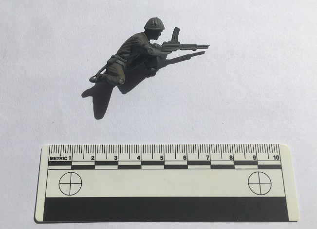
C.1980 vintage plastic soldier, courtesy of eagle-eyed Master Hamnett.
This was pretty much my childhood – plastic soldiers at a 1:32 scale. Whilst this one is not Airfix, it is still a good quality World War 2 figure – possibly Polish or Russian to judge from the helmet and gun. He’s lost his foot, and his stand, but to his credit he’s still fighting. Interestingly, he was also painted at some stage, too, and not professionally, so I think he was a much loved toy (if anyone recognises it, I’ll happily post it to them… I still mourn the loss of some of my soldiers!).
Of course, it wouldn’t be a decent post without a benchmark. On the original path there are three on the line of the track – from the top, a third of the way down (640.7 ft above sea level), one half way down (609.1), and one at the bottom (568.6).
The 1969 map (post Whitfield Avenue construction) has three benchmarks, but are of different heights (641.5, 601.5, & 564.9), and with this last on a now no longer existing ‘public convenience’ at the bottom of the road. Presumably they were re-surveyed and marked when the road was built, as the evidence of the carving seems to indicate. The only one that is still extant is the middle of the three, the others seem to have disappeared, alas.
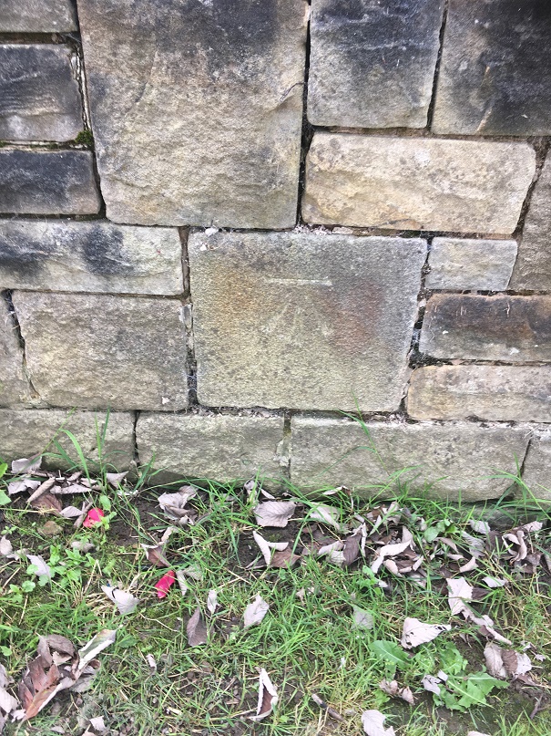
An old stone block, rebuilt into the 1960’s wall, and with a new benchmark carved into it. 195.5 metres above sea level (641.4 ft in old money)
So, a lot of history and archaeology of a single road were explored on a single afternoon
Master Hamnett looking like he owns the place.
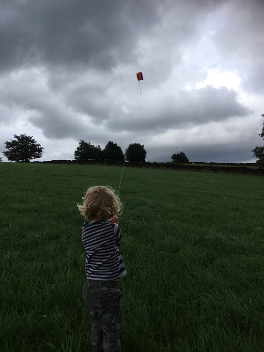
And, of course, we flew a kite, which was the best bit!
A successful day for Master Hamnett, too.
Well, that turned into a much larger post than I anticipated… who knew a 1960’s built street could be so interesting? Comments, as always, very welcome.
A while ago I posted a blog entry about some named wells in the Mottram area.
Read the post here to refresh your memory, it’ll help with what follows.
We were facing a slight conundrum. The issue was that there was the two wells in the one field – neither of which was really visible on the ground – coupled with the fact that one of them was called Boulder Well, a very specific place-name, despite there being no associated boulder. Oh, and there was a boulder in a different field, but with no associated well. Well, I think I have found out what it all means. Probably.
The map, first of all.
The two named wells are in the bottom circle, marked with a ‘2’. The boulder in the original blog post is in the upper circle, roughly where the tree is on field boundary.
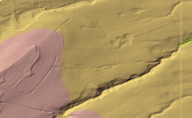
I was looking over some Lidar images of the area, and noticed something interesting. For those of you who don’t know, Lidar is a method of using light (laser) to map the ground surface, allowing for a greater contouring of the ground, and revealing every single bump and dip on the surface. Quite literally, everything – it simply strips away trees and vegetation. It’s application as an archaeological tool is enormous, and it allows us to not just identify, but to map, record, and categorise all sorts of things that are invisible on the ground.
Like old wells, for example.
So, using the government’s Lidar website (highly recommended, by the way), this is what I saw.
Despite being a mass of lumps and bumps, this is broadly the same area as the map above.
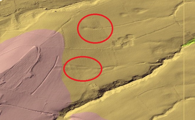
To help you identify the area better, here is the same image with the red circles on it.
The upper circle is where the boulder is, the lower is where the two wells are on the map.
What the image shows is that where the two wells are recorded on the map – Grave Well and Boulder Well – there is only the remains of a single feature. You can see the line of the waterway moving from left to right, passing through the lower circle, and eventually draining into the small valley there. Single feature, a single well. Not the two wells recorded on the map.
Now look again at the upper circle. The field boundary where the boulder is can just be made out, but to the right, precisely where there is a ‘trough’ marked on the map, is a spring head, and you can see the drain, running east and again emptying into a small valley. There IS a well there, it’s just that you can’t see it on the ground.
Looking again at the map, we can see only one well place or structure in the lower circle. This, I humbly submit, is Grave Well, not Boulder Well – its location right next to the graveyard is the clue. Boulder Well is situated in the upper circle, next to… yup, you guessed correctly, the boulder, and the trough marked the place where the spring issued forth. This makes sense.
I am convinced, then, I have rediscovered the location of Boulder Well.
All this is clear on the Lidar, but as I say, cannot be seen on the ground. It also means that the OS people made a small mistake in naming the wells – but then if a local says “yes, Boulder Well is just above Grave Well”, how literally are you to take them?
I need to go back and take some more photographs.
So there you have it. As Bertie Wooster was fond of saying “The lark’s on the wing, the snail’s on the thorn, God’s in His heaven. All’s right with the world!”.
Comments and discussions, even arguments against the newly rediscovered well will all be gratefully received. Also, I have a few more blog posts that are about to be published, so keep your eye open.
What ho! What ho! What ho! and all that (raising a glass to you, H & S).
I often spend a bit of time on the internet, and in particular on ebay, looking at all sorts of Glossop and area related things and obscurities. In between wishing I had more money (all donations will be gratefully received) and marvelling at just what people on ebay are trying to sell (and, by extension, what crap people are willing to buy) I occasionally come across an interesting object. Postcards are only interesting if the subject is interesting, but usually I just save a copy of the picture and move on. However, I found a group of four postcards of the “High Peak, Derbyshire, UK” mentioning Glossop, being sold by a chap in America which piqued my interest. Although there was nothing particularly special about the subjects – nice photographs though they are – I was intrigued by the writing on two of them.
First, the ‘boring’ postcards.
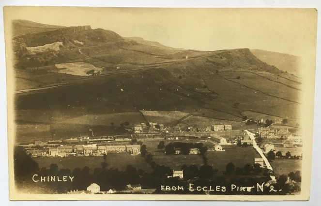
The first is titled “Chinley, from Eccles Pike No.2”, and shows exactly what it says.
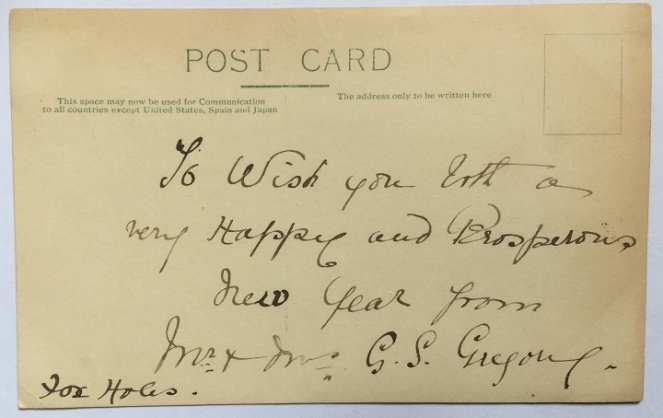
The postcard hasn’t been posted, so there is no stamp or postmark, and was probably inserted with a letter, and the whole posted. The message on the back reads: “To wish you both a very happy and prosperous new year from Mr and Mrs G.S. Gregory, Fox Holes”. Foxholes is in an area of Chinley called Whitehough, which fits the postcard view.
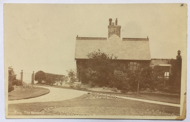
Next up is this view of the North Road entrance to Howard Park, or “Park. Top Entrance” as it is helpfully titled.
Park keeper’s cottage, Howard Park.
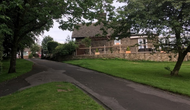
The building and gates are still there, as you can see in this modern view of the place.
Surprisingly, very little has changed in the 100 years.
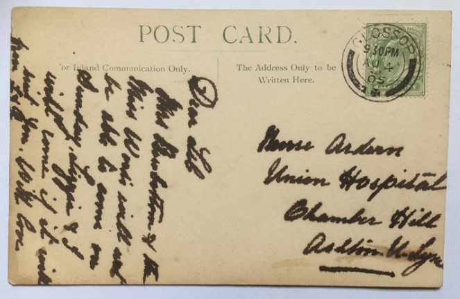
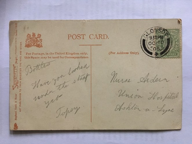
The back of the card, then.
Mrs Broadbottom (I think) and Miss Woods, helpfully written in thick pen and at a jaunty angle
It has been posted, and stamped “Glossop” (Glossop post office) and dated August 4th 1905, and was for the 9.30 post. The message reads “Dear Lib. Mrs Broadbottom (?) and Miss Woods will not be able to come on Sunday. Lizzie and I will come if it will suit you. With love from L & R.” One hopes that Lizzie and ‘I’ were a suitable replacement for what was clearly a comedy double act of Mrs Broadbottom and Miss Woods… but alas, we’ll never know. The address, however, is interesting:
Nurse Ardern, Union Hospital, Chamber Hill, Ashton Under Lyne
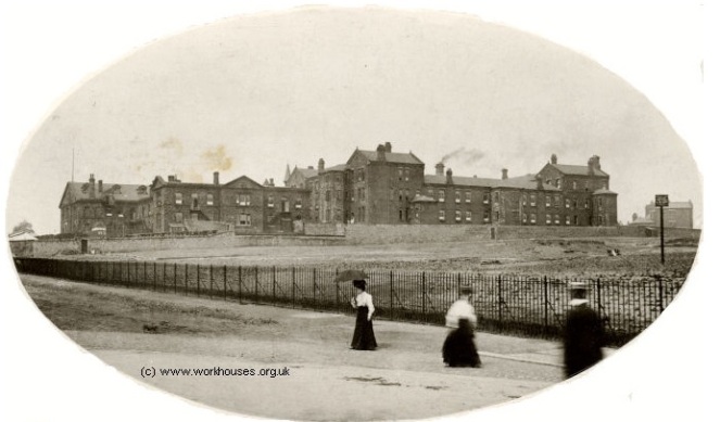
Frustratingly, I can’t find a Nurse Lib (Elizabeth?) Ardern in the 1901 or 1911 censuses, nor anywhere else I have looked (please feel free to have a look yourselves), but it is interesting. The Union Hospital is actually the Workhouse in Ashton, and the building is now part of Tameside General Hospital. Here is a view of the Hospital in 1905, the same date as the postcard – perhaps Nurse Ardern is one of the ladies in the photograph.
The Ashton Union Workhouse in 1905.
The above photograph was taken from a very informative website that gives the history of the Ashton Union Workhouse – go check it out here.
Now, the first of the interesting postcards, and one that contained a mystery! “Oooooooh” I hear you cry…
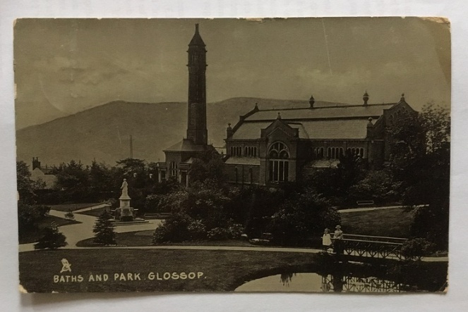
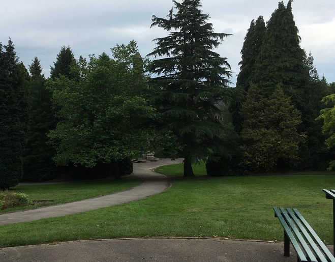
The view is of Howard Park again – this time the swimming baths and that end of the park. The view has not massively changed, as the lower photograph shows.
Howard Park and the swimming baths, chimney, and Wood’s monument, all built by the Wood family in the late 1880’s.Almost the same view, today. Too many trees to get the exact shot, but you can just make out the chimney, the white ornamental windows of the baths, and the base of the Wood’s statue.
Now, the mystery. The card is once again addressed to Nurse Ardern at the Union Hospital. It is marked and dated Glossop, October 10th 1905, and stamped for the 9.30pm post. The inscription is simple: “Bottles. Have you looked under the stamp yet. Topsy”. It sounds like a letter from a PG Wodehouse novel (are Bottles and Topsy members of the Drones Club?). Bottles must be a pet name for Nurse Ardern, and Topsy? Who knows? A suitor? A brother? There is a familiarity about it that suggests either. But what’s this about a stamp? I looked, and no, the stamp had not been tampered with; Bottles had evidently not looked under it.
To Bottles, from Topsy… via Jeeves and Wooster.
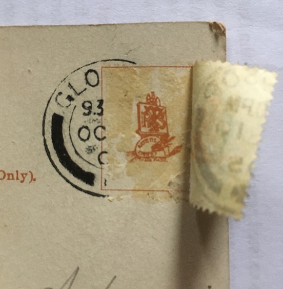
With slight fear and trepidation, I made a cup of tea, and using the steam from the kettle, I steamed off the stamp. What was under it? A heart? A love note? A secret spy code? A crude drawing of some male genitalia? (the heady days of early Edwardian Britain saw society throw off the shackles of Victorian prudishness, so who knows?). Carefully, I peeled back the stamp, and this is what I saw:
Ladies and gentlemen, the comedy styling of Topsy.
It is just the card maker’s mark (Raphael Tuck and Sons), and nothing remotely interesting. Bugger! Two possibilities suggest themselves here:
Topsy has a particularly weak sense of humour, and the ‘joke’ is that there is nothing under the stamp (oh, my sides. Nurse, the screens… etc. that last being especially appropriate). No, even a badly drawn willy would have been funnier.
The postcard is referring to another postcard or letter, and Topsy is reminding Bottles to look under its stamp.
Either way, I was as disappointed as you probably are right now.
This last postcard is not disappointing, though, and should make up for the above.
We’ll start with the back – and a particularly interesting one it is.
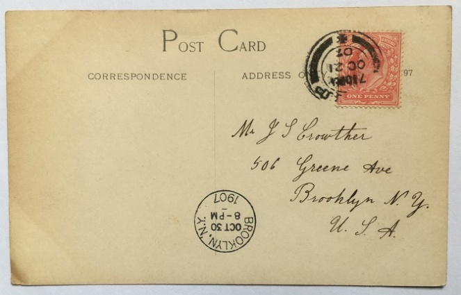
A letter to America all the way from Glossop.
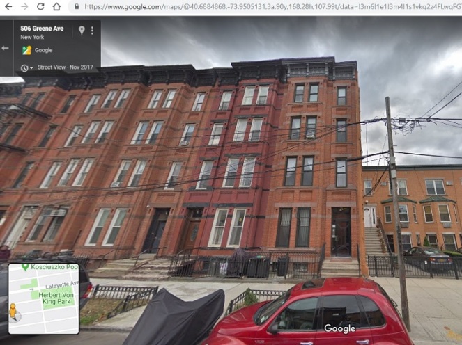
It is addressed to a Mr J S Crowther, 506 Greene Avenue, Brooklyn, New York, USA. It is postmarked Glossop, and dated Oct 21 1907, and stamped for the 7.30pm post. It is counterstamped ‘Brooklyn, NY’ with a date of October 30th 1907, and time stamped 8pm. This is presumably the time and date that the postcard landed in the USA – nine days to cross the Atlantic is quite impressive. There is nothing else written on the back, and the identity of Mr Crowther remains a mystery (as does his relationship with the postcard’s subject, as we shall see). His house in Brooklyn is still standing, though:
506 Greene Avenue, Brooklyn, New York, at the end of the row.
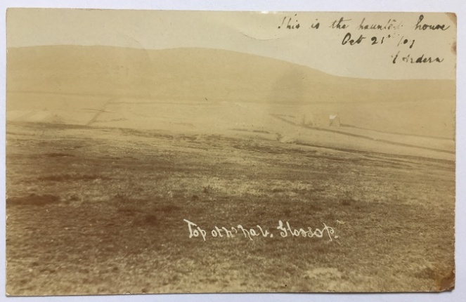
Right then, the subject of the postcard, and the reason I bought the quartet of postcards in the first place:
I love this sort of thing – when history and folklore collide.
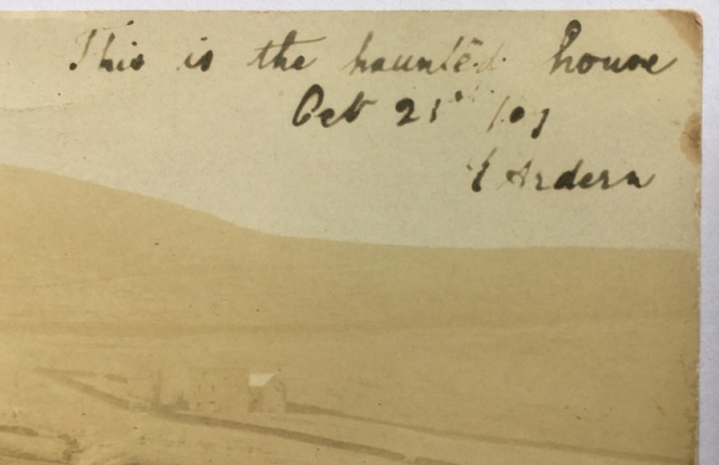
The subject is “Top oth’ Nab, Glossop”. Whitley Nab, of course, and you can indeed see the top in this quite atmospheric photograph. And in the mid ground, to the right, there is a building amidst a series of field walls. It is a good photograph anyway, but what drew me to it was the handwritten note at the top:
“This is the haunted house. Oct 21st ’07. T. Arden”
I do love a good spooky story.
I’m not a big believer in the supernatural, but I am a lover of folklore and of ghost stories, and I knew I had to have it!
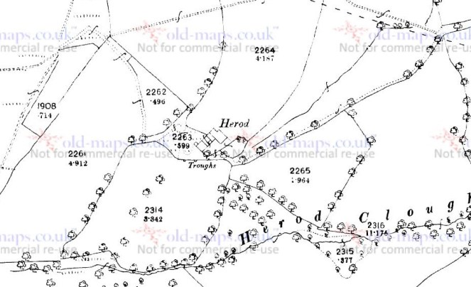
Well, where to start? I have looked at contemporary OS maps of the Nab, and am almost certain that the photograph is of Herod Farm; the location and the field boundaries all seem to make sense
If anyone wants to double check, please mail me if I’m incorrect
I find it interesting that Mr Crowther knew the area well enough that he didn’t need any further explanation of either the place, or the haunted house and its story. He must have been an emigre to the States from Glossop. The handwritten note is signed T. Arden – is this ‘Toppy’? And there is surely a relationship to the Nurse Arden, too – the coincidence of the name is too much. And how did they all end up in the America? Did Nurse Arden retire to the States? I would love to know the answers to these questions – any thoughts, anyone? But more importantly, what is the ghost story attached to Herod Farm? Does anyone know?
If you do, please let me know via email or twitter. Or, for that matter, any other ghost story or note of folklore you know about the Glossop area – I’ll happily take what I can! Just get in touch!
Anyway, I hope you enjoyed a wander round some old photographs. I’ll post an update if anything come from this post. Until then, I remain,
Welcome back for the third and final instalment… it was a very productive walk indeed! The first two are here and here.
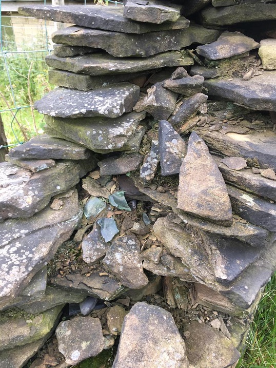
As we continued along the track, we came down, toward the place where it joins Cliffe Road, near where the Guide Stoop is. Here, the wall on the left has been removed, and replaced by a fence, but at the bottom of the track, there is a stump of the wall left, ruined. And spilling out of the wall’s innards, so to speak, I noticed some glass, some pottery and a black tubular object. Well, I could hardly leave them there, could I?
As you can see, the wall is not in great condition, and the bits spilled out.
So then, what do we have?
Firstly, fragments of a Codd Bottle.
The fragment on the right is from the neck going into the rim.
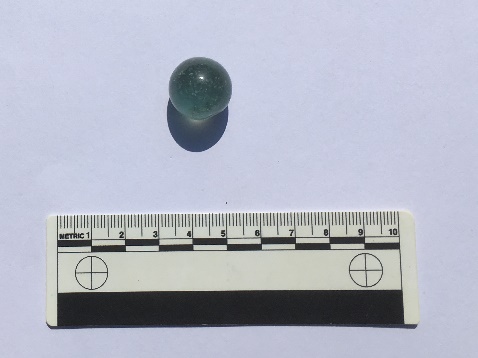
Invented by Hiram Codd (great name!), he patented the famous design in 1872, and began manufacturing them on a large scale in 1877, or thereabouts. This groundbreaking design was a way of keeping fizzy drinks carbonated using a glass ‘marble’ inside the bottle, with the gas keeping the marble pushed firmly against a rubber seal. When empty, they were often broken open by children to retrieve the marble; here is one I found in my garden a few months ago.
Hand made in two halves (you can just about make out the seam), it contains many small air bubbles. It’s quite a pretty, if utilitarian, thing. I really should blog about my garden finds sometime.
The bottle was broken before it went into the wall, and you can see that different fragments had different amounts of soot and air exposure, causing the variation in colour. I spent a happy 5 minutes gluing this together – superglue really is a marvel! Anyway, here is a complete Codd Bottle, showing its very distinctive ‘pinched’ shoulder/neck, very thick glass, and you can just make out the marble in the neck.
A lemonade Codd bottle from this great website here. Worth an explore.
It remained in use until perhaps the 1910’s, when other, more simple, designs – mainly the screw stopper – replaced it as a way of keeping drinks carbonated. Here is an excellent website that talks a bit about them – it is well worth an explore.
Next is a piece of green glass bottle dating from the 1870’s on, and which probably held mineral water or beer.
A moulded bottle – probably a beer bottle. You can see the shield border on the left.
This one was moulded, not blown, and has the remains of an embossed decorative shield that would have shown the manufacturer. Each company would have its own design, and usually they were locally made, so it might be a Glossop bottle. Here is a whole example of a bottle showing what I mean.
One green bottle…
There is a fascinating website here that discusses coloured glass from a historical archaeological approach, and despite being American in focus, it is very useful, and well worth an explore – it is one I return to time and again for facts and identification help.
Another bottle fragment, this time a concave base, and with an moulded number ’13’ on the bottom.
You can see the number ’13’ clearly at the bottom.
It has a base diameter of 8cm, is made of thick glass, and judging from the wear marks on the base rim, the bottle was used over a period of time, or possibly used and re-used. Late Victorian is a guess in terms of date (thick glass & greenish hue).
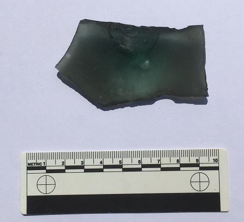
Then there is this…
Nope… not a clue!
It is glass, broken, and has a raised bump on one side, centred over a feature on the other side. This feature – visible in the above photograph – is circular, tube-like and hollow, and has an impressed mark in the centre, made when the glass was still soft. The only other features are a pair of parallel lines running diagonally to the right of this central feature, and scored onto the object when the glass was cold. The glass itself is thick, full of air bubbles, and has a greenish tint, all of which suggests that it is old (Victorian or earlier)
I have literally no idea what this is. None whatsoever. Answers on a postcard, please.
The black object is interesting; on closer inspection, it turns out that it is a pipe stem.
Hollow throughout, the left side is flattening to the mouthpiece.
Made from Ebonite (also known as Vulcanite), a type of hardened rubber, it is the bit that fits into the mouth, and through which the smoke is drawn. It is made as a separate part, fitting into the bowl via a metal ferrule – you can see the rounded end in the photograph. The other end, though broken, is of the ‘fish tail’ type stem, flat and wide, and would have originally had a lip at the end. Ebonite is still used for making pipe stems, but was first created by Charles Goodyear in 1839, with the process of making it patented in England by a Thomas Hancock in 1843. It was immediately put to all sorts of uses as a cheap durable alternative to Ebony wood, and from the 1850’s on, it was used in the making of pipe stems (another interesting website here).
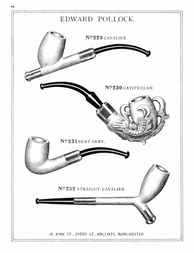
You can see the way it was used in this Late Victorian trade catalogue – the wall example even has the slight curve.
So far, so Late Victorian. So what, then, is this doing in the mix?
Midlands Purple Ware dating from roughly the early 18th Century.
This is Midlands Purple Ware, a type of coarse stoneware. It is hard (fired at a high temperature), purple (though can be more orange or red), and has a large number of black and white inclusions (they look like salt and pepper). It’s very characteristic, and once you know it, you can spot it a mile away. Midlands Purple was made in huge quantities between about 1600 and 1750 (although some sources state its production started earlier, I go with this date for the classic Midlands Purple), although I think this example is late (early to mid 18th century). What is interesting is that this pot was found mixed with the Victorian material – in the top photo, you can see the pipe stem lying underneath one of the Purple Ware sherds. I’ll return to this below.
These fragments (mended) come from the base of a pot, and using the internal wiping marks at the start of the upturn of the vessel wall, I would suggest a base diameter of 25cm, and it probably comes from a large storage vessel, such as this beer container. Most houses and farms would have brewed their own beer as it was cleaner than the water at the time.
The bunghole at the bottom is for draining the home brewed beer, leaving the grain on the base of the vessel.Close up showing the internal wiping marks (where the potter had run a rag around inside the vessels when it was still wet) and the start of the vessel wall. From these marks I was able to extrapolate a base diameter of 25cm.
So what does all this mean?
Well, we know that the wall is much earlier than the Victorian glass – it is here on the 1857 Poor Law map of Whitfield, for example – and almost certainly dates from the initial enclosure of the fields and moors in 1813.
1857 Poor Law map. The wall is running NW-SE between two large quarries.
The Late Victorian material probably represents a rebuilding episode. The wall itself is still in bad repair, and I think I can detect at least three phases of construction too.
The wall showing multiple rebuilds and repairs.
The Midlands Purple Ware is clearly much older than the wall, and is something of a conundrum – what is it doing here? It might represent residual rubbish incorporated into the wall. However, it is perhaps more likely the pot was still in use 100 years after it was made, but broke as the wall was being built in 1813, and ended up used as filler. Possibly. And it was then reincorporated into the wall as it was being repaired in the 1890’s. Again, possibly.
Now here is where it gets interesting.
Why would the repairer of a field wall place a Codd bottle, a beer bottle, and a pipe stem in the wall? Pottery and rubbish is often used as a foundation bedding for a wall at this period (I have a pile from my garden that I need to blog about), but these are high up in the wall. But it does seem that the obvious answer is rubbish disposal. In this scenario, the builder has a break, smokes his pipe, but then accidentally breaks it. He finishes his bottle of fizzy water, and another of beer, then accidentally breaks them both. He curses, then places some, but not all, of the fragments in the wall, along with some other bits and pieces, and carries on building. 100 years later I find it, and here we are.
This interpretation seems fair enough. But it seems a little too convenient – a discrete, neat, bundle, carefully walled up. And the fact that only fragments were placed, not the whole thing. It would also have taken effort to do this, too, when surely it would have been easier to simply have thrown them into the field.
“Hmmm…” I say.
However, there might be another reason.
I have recently been doing research into the tradition of hidden objects within the fabric of buildings (here is a great website that deals with the subject). Shoes, famously, have been found in the roof and around the fireplace of 1000’s of buildings up and down the country, as well as in colonial America and Australia (I have one from the Glossop area that needs to be blogged about). But it is not just shoes, these caches contain all sort of clothes, and indeed all sorts of objects – including bottles, pottery, and pipes – and all dating from c.1600 to 1900.
A deposit of various objects from a farmhouse in Suffolk. Taken from an article by Timothy Easton (the copyright is all his, and I have stolen the photograph for illustrative purposes only). And no, that’s not me in the photo.
The term used to describe these caches is a ‘Spiritual Midden’, with the idea being that each of the objects is placed in the cache at the end of its useful life, and is then sealed away and hidden from view in a midden. The study of this tradition is relatively new – bundles of rags and objects when discovered are usually thrown away – and it is little understood beyond a general consensus that they are broadly connected with concepts of ‘luck’ and ‘protection’ from evil or witchcraft. They are believed to be ‘apotropaic’ (that is, they ‘turn away’ evil – I blogged about the subject here and will return to it again, as I find it fascinating). Briefly, spiritual middens seemed to have functioned by making the deposit of clothing and objects the target of bad luck or witchcraft, rather than the people within the house. In a real sense the cache stands for, or personifies, the individuals within, and acts as a lightning rod for any negative energy, safely diffusing it.
The ‘meaning’ of the individual items within the midden is unclear. The shoes, gloves, trousers, and other garments are the most obvious – they are very personal items, and are usually deposited worn out, meaning they have, in a sense, moulded to the individual, and have been imbued with their essence. The bottles are less clear; perhaps connected with ‘witch bottles‘. Bones may relate in some sense to food, and pipes have been suggested as connected with fire, or more specifically fire prevention. This is all speculation, of course, but something is going on with deposits of objects from the early 17th century on, and which lasts until the end of the Victorian period. Perhaps, then, we are seeing a decayed form of this deposition ritual in the objects hidden during the wall rebuild in the 1890’s. Of course, by this time the ‘meaning’ of the caches, whatever it was, would likely have been lost, and the ritual of hiding certain objects was carried out as a ‘tradition’ or ‘thing we do’, or simply ‘for luck’, with none of the belief that drove and informed earlier caches.
This interpretation is made all the more plausible by the fact that the location of the ‘cache’, if such it is, is at the very end of the wall. Thus, it represents either the very first part of the wall begun, or it forms the last section made; either way, the deposition of objects there seems appropriate. There is also the tantalising possibility that the Midland Purple Ware pot base also represents the remains of a similar, earlier, cache. A small cache of objects deposited for luck, to help the wall stay upright, and the land and its owner prosper.
But then again, of course, it could just be rubbish!
If you are interested in Spiritual Middens and hidden objects, there is an excellent paper here which discusses the contents and their meaning. It’s written for the general reader, so it’s not too theory heavy, and it contains links to other papers on the subject. Also, you can email me for more information, as it is a special interest of mine, and one that is only now receiving attention.
As always, comments are welcomed… even encouraged. More soon, I promise, but until then, I remain,
Here is the second installment of a terrific triptych of trivial twaddle.
As previously mentioned, the path curves round to Fieldhead, and along the track, and here and there were bits of pottery and glass. Nothing earth-shattering or particularly old, but some interesting bits nonetheless. The question of ‘how did it get there?’ is a good one. In this case, it seems to have been a combination of nightsoiling, general littering in the past, and the presence of a rubbish dump. The quarry shown in the 1898 map below eventually goes out of use, and by the 1920’s has a new role as a miniature rifle range. Eventually, this too goes out of use, and the quarry is used as a refuse tip and filled in. Behold, the evolution of a quarry:
A Quarry in 1898.A Miniature Rifle Range in 1921.A Rubbish Dump in 1969.
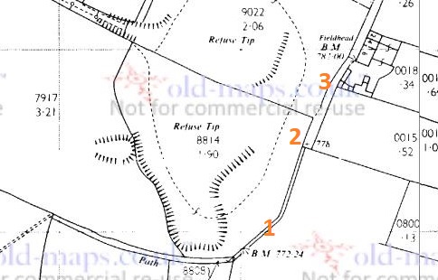
It’s been a well used area, and it’s no surprise that there is bits of pottery all around – in particular the stretch from point 1 to point 2 on the above map. Incidentally, point 2 is the location of the gatepost bench mark in the last post. I’m also well aware of other bench marks in the immediate vicinity, only some of which I have looked for (it’s on my (very long) to-do list!). However, I did find two – those marked points 1 and 3 on the map:
BM No. 1 – 772.24 ft above sea level (or 769.7, according to the older OS maps). I think this is a more modern replacement for a missing older BM – the carving looks almost new.BM No.2 – 782.00ft above sea level (or 781.3, according to older maps). This one is on the side of Fieldhead Farm.
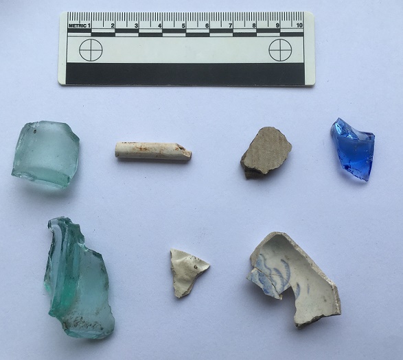
So then, the pottery/glass.
Left to right, top:
The base of a small cylindrical bottle, measuring 3cm across. Probably a sauce or relish bottle (Henderson’s perhaps), and Late Victorian/early 20th century in date.
Clay pipe stem – again, probably Late Victorian. It has some nice paring marks on it.
Our old friend, a fragment of a stoneware marmalade pot. It has a 9cm wide body, and the usual distinctive fluting on the side.
The neck and finish of a blue glass bottle. The finish looks like a ‘crown‘ type, and so is not particularly old, but the blue glass is interesting. I always thought that blue glass is associated with ‘poison’ or medicine bottles, but it seems I am mistaken.
Left to right, bottom:
the rectangular corner and base of a sauce bottle, possibly a Garton’s HP Sauce bottle, although there were dozens of similar bottles. Probably Late Victorian or Edwardian in date.
A tiny sherd of a glazed vessel with a raised decoration. Probably floral, although the sherd is to small to clearly see the motif. Almost certainly Victorian in date.
Sherds (glued together) of a fine Victorian teacup. It has a deep ring foot that measures 4cm in diameter, and is thin walled, which usually indicates expensive potter. The decoration is floral based, transfer printed, but seems to be quite fine
I really should draw these sometime, so that you can see what they are… I’ll save that for another blog post though.
That is just about it for this post… though Part 3 will be coming very soon, and that should be a very interesting post. Honestly.
So, I have returned. I’m not going to bore you with the usual apologies for a lack of posts… let’s just ignore it and awkwardly move on.
Interesting things have occurred since I last blogged. I no longer work at a certain local museum, which means I now have more time to spend doing this sort of thing. For the first time in too many years, I put a trowel in the ground and went back to my roots of excavation rather than the academic theorising of more recent years. Even if it was only a 1m x 1m test pit, it was a good feeling, particularly as it was at Melandra, where my namesake excavated in the early part of last century. I didn’t find anything interesting (a piece of flint amongst some modern backfill), but the project as a whole seems to have made a significant discovery… more about that another time.
I have also recently returned from Florida, spending some time with my amazing daughter (hello Evie). Nothing archaeological to report from there, but we did find some nice bits of Native American flint in a flea market – I’ll blog about it, as it’s fun to look at.
So then, today’s post is a bit of a placeholder. I have almost finished a long and interesting post about a wall (stop groaning… I can hear you, you know!), but I need a few more photographs. Until then, I’ll post a short companion piece.
Mrs Hamnett, Master Hamnett, and myself, went on a short ramble the other day, to blow away the cobwebs so to speak (not a reflection on Mrs Hamnett’s housekeeping…). Being short in the leg department, and peculiarly large in the whingeing department, young Master Hamnett sets the length of our walks these days. And so, with much faffing and snot on the face, we set off “up and over” – that is, past The Beehive, along Hague Street, left into the field, and then follow the path round until we arrive at Fieldhead, and then down to The Beehive (or if we are feeling full of energy and less full of whinge, we push on to Whitfield Cross (the cross) and then back. The last few times we have done this, I have picked up some bits and pieces of pottery and glass along the path – nothing earth shattering, but interesting nonetheless. I’ll post them tomorrow, as well as a third installment – the original post – later this week. Today’s post is made up of two of my obsessions: carved graffiti and benchmarks.
This is the route we took.
We didn’t get as far as the cross, but instead cut back towards the Guide Stoop. The red lines show the route taken (1898 1:2500 OS map via old-maps.co.uk)
Bits and pieces of pottery were along the path, as I say, but I stopped to take these photographs in the areas marked with a green circle.
The first, in the lower circle… a benchmark! I’ve not posted many recently, and I really must address that as, well, they’re great. There are several on this route, as you can see from the map above, and a few hidden in field walls in the middle of nowhere. I’d like to do an odyssey at some stage, and track them all down – if anyone fancies joining me, give me a shout! Anyway, here is the benchmark in all its glory:
Fairly standard choice of immovable object – a gatepost – but some nice detailed carving on the mark.
This is a bit of an odd one. It’s clearly a bench mark, it’s clearly on an immovable object, and the gate is clearly marked on the maps, but… there is no bench mark marked on the map at that point – check it out in the map above. The nearest is a spot height of 777 ft above sea level. Spot heights are recorded OS heights above sea level, but are not marked on the landscape by carving them – they serve more as a guide, than a definite point. I trawled through a pile of maps, and eventually found a spot height at that point on the 1954 OS map of 779 ft above sea level. It is probably a late entry in the Ordnance Survey, and it seems whilst they marked it on the stone, they forgot to mark that on the map. If there was a category for ‘rare’ types of bench marks, this would surely be one (and no, I’m not looking for bench mark collectors websites; I have too many ‘collections’ as it is, if I get sucked into bench mark collecting, Mrs Hamnett will almost certainly divorce me*). The gatepost itself is interesting; it appears to be a roughly shaped upright stone, rather than a carefully dressed, more traditional, post. Whilst one is hesitant to say ‘standing stone‘ for several reasons, it is quite common for them to be used as gateposts, and a brief glance at all the other gateposts in the area reveals them to be like the photograph below – shaped properly for the job.
Here is the upper green circle… carved graffiti!
Another gatepost. Fieldhead is in the background.
An inexperienced hand, but very clearly writing letters. At the top, we have a ‘T’ and a ‘B’ or ‘R’, and on the left, running down, are a ‘T’, a ‘B’, and an ‘O’, and there are other marks carved around the top, but nothing recognisable. The Ts are carved quite nicely with serifs, but overall it’s a bit messy… 3/10?
Right, that’s all for today. As I say, I have two more related posts almost ready to go (tomorrow for at least one of them, if I get chance), and lots more to go after that.
As always, comments are very welcome, and please feel free to email me with any information or questions.
More soon, I promise.
But until then I remain, your humble servant.
RH
*Alright, so I lied. I did check. And there are so many. So like a moth to a flame… apparently, we are called ‘bench mark baggers’. Here are two websites to whet your appetite: One is the central bench mark database, which is worth an explore, and the other is a blog run by someone worryingly like me, well worth checking out. I might be single again very soon.
Placenames in the past were given because of what was there, not aspirational or deliberately flowery. They were practical. Descriptive. Truthful. There was no Laurel View if there was no view of laurels. Gnat Hole was not named ironically. And Shittern Clough was… well, you get the picture.
For me, Gallowsclough has always stood out in the map of the area – the clough, or narrow valley, where the gallows were. There is something of the macabre about the name, and I was also aware of a folktale from the area which really made an impression on me (more of that in a bit). So I decided to do some exploring, to see if I could add to the placename, and see if I could work out where the gallows were… as Mrs Hamnett put it “lucky me, you take me to the loveliest places”.
I’ve blogged about this area before (White Stone of Roe Cross), but the area is effectively the Deep Cutting between Mottram and Stalybridge. Gallowsclough is highlighted (the clough itself, or small deep valley, running towards the Dog and Partridge).
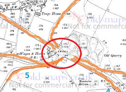
Gallowsclough and area. This from the 1898 1:2500 OS map (via the awesome oldmaps.co.uk). The main road to Stalybridge from Mottram runs diagonally through the map, with the deep cutting starting at the Wagon and horses.
So then, the gallows.
The last person to be hanged in public was in 1868, after which time, and until capital punishment was abolished in 1965, executions took place within the prison, away from the public eye. But before 1868 it was a public spectacle, to the point that the hangings at Tyburn were turned into a public holiday. Often associated with the public hangings of the 17th and 18th centuries was the punishment of gibbeting, in which the hanged criminal was enclosed in a tight fitting cage or chains, and effectively left to rot. The body was covered in tar in order to protect it against the elements, and hung there as a warning to others until it finally fell to pieces.
Each area, feudal estate, or manor had a gallows/gibbet, and certainly until the later Tudor period or even the early modern period, capital punishment was the responsibility of the lord or equivalent. It seems that the victims were buried underneath, or nearby, the gallows, but certainly not on consecrated ground. To be executed was to be condemned to eternal restlessness, to never know peace, and to wander the Earth an unhappy spirit.
In order to achieve maximum visual impact, the gallows were normally set up at prominent places – central open spaces, or more normally, crossroads. And so it was here, in Roe Cross. The body swinging, both at execution, and in a gibbet, could be seen easily by both locals, and by travellers moving along the various roads – a physical reminder to obey the laws, or suffer the consequence. Interestingly, this tradition of both execution and burial at a crossroads has given rise to the concept that a crossroads is an odd, supernatural, place. If you want to sell your soul to the devil, where do you do it? Where do you bury witches? Or suicides? Or criminals? At the crossroads, that’s where.
So where were the gallows at Gallowsclough? It is very doubtful that they would have placed them further up the clough – difficult to get to, in arable land, and there are no crossroads. No, I think they erected the gallows at the point Gallowsclough – the clough, or deep valley, upon which the gallows are placed – crosses the road. At almost exactly the point seven – count them – seven tracks join. This is no crossroads… this is a crossroads and a half. Here is a map showing the tracks (numbered).
The seven tracks shown on the map existed before both the turnpike road and the ‘Deep Cutting’ were made. Walking them, you can see why the turnpike was created. It is still perfectly possible to travel to and from places on these tracks, but perhaps don’t if you don’t have a 4×4.
This is the area close up – you can see the tracks meeting.
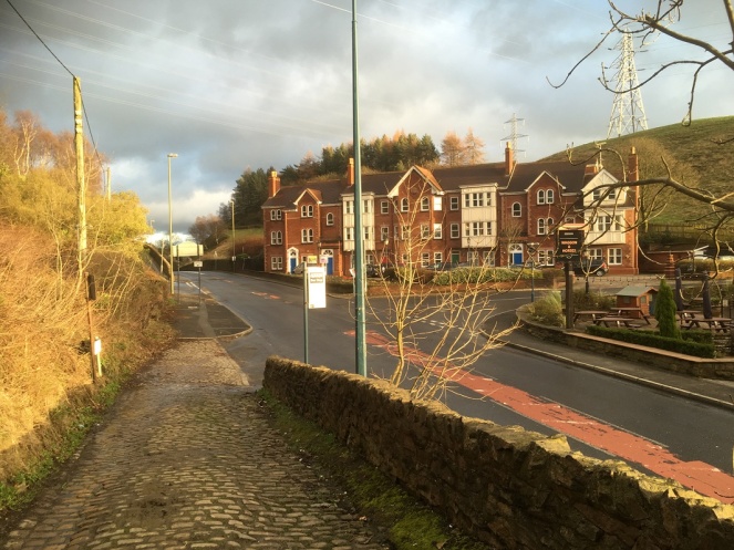
Right by the Wagon and Horses… enjoy your pint!This is the site. You can see the roads meeting, and here at the bottom of Gallowsclough Road, you can see the setts of the original track, laid to give horses some traction at the start of the hill.
The roads are as follows (the numbers are faint in blue in the map above):
Gallowsclough Road – From Saddleworth, via Millbrook (avoiding Stalybridge). This is the Roman Road between Castleshaw Roman fort and Melandra (thanks Paul B.)
From… well, the middle of nowhere – local traffic from farms
From Hollingworth.
From Mottram via the old road.
From Hattersley, via Harrop Edge.
From Newton.
From Stalybridge, via the old road.
A perfect situation for an execution and gibbet. It was said that it was to these gallows that Ralph de Ashton (1421 – 1486) sent the unfortunate tenant farmers who couldn’t pay the fines for allowing Corn Marigold to grow amongst their crops. The death of the hated Ralph is the origin of the Riding the Black Lad custom and the Black Knight Pageant in Ashton Under Lyne, a tradition sadly no longer undertaken. Naturally, the area is said to be haunted, with the locals avoiding the place, even in daytime. Although, as is so often the case, there are no references, only suggestions.
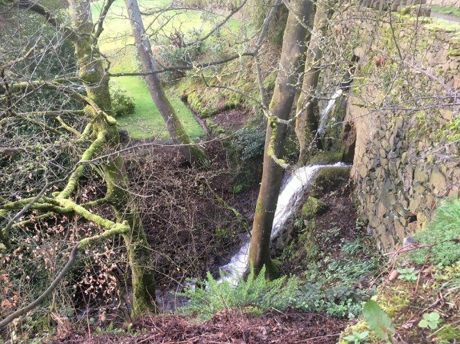
This is the clough
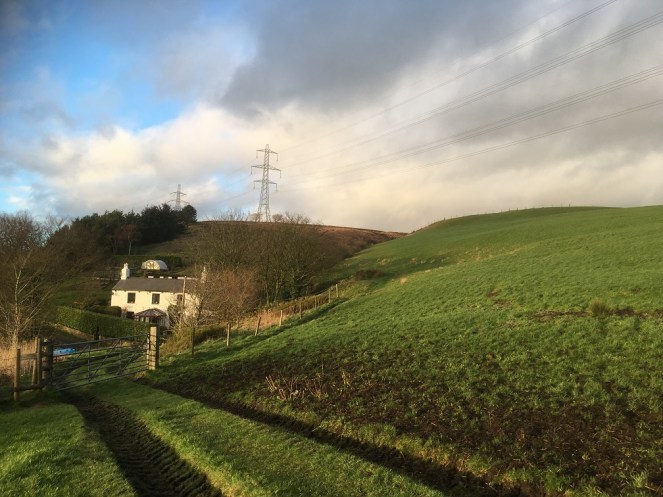
The brook flows under Gallowsclough Farm.Gallowsclough in the background, behind Gallows Clough Farm. The electricity pylons completely ruin the area, unfortunately.
Of course, whilst I was stomping around, I happened upon a bunch of mole hills…
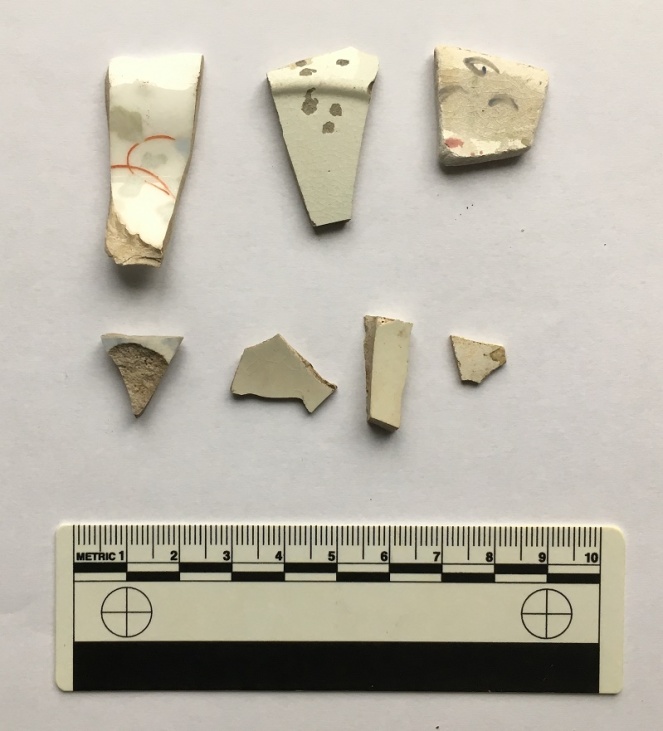
Evidence of nightsoiling (as I’m sure you all know, having read previous posts about this). The top row right: a medium bone china plate (c.18cm in diameter), hand painted flowers and abstract floral designs in pastel colours. This is quite nice, and is probably early Victorian in date. Middle is a plain white glazed plate, thin, and again about 18cm in base diameter (you can see the ring of the base in the photo), which makes it perhaps 24cm or more in ‘real’ diameter. Left is more difficult – it has an undulating rim, with a curled decorative motif – which means that I can’t tell you how big it is. Over 25cm in diameter, I suspect. It is a shallow dish, or deep plate, and is deocrated with abstract floral designs. Date wise? Late Victorian? Looks more modern than that, though… Edwardian? The bottom four are fairly boring body sherds, though the sherd on the left is a blurred willow pattern, so potentially quite early?
Contents of a Molehill, pt. II
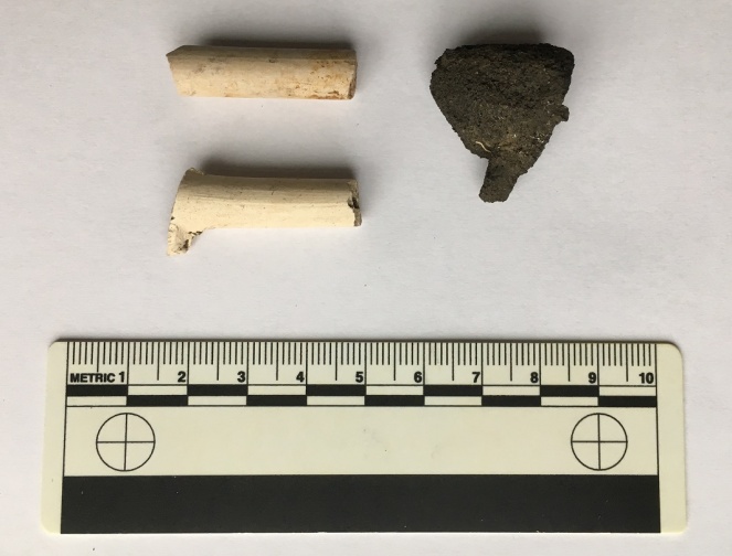
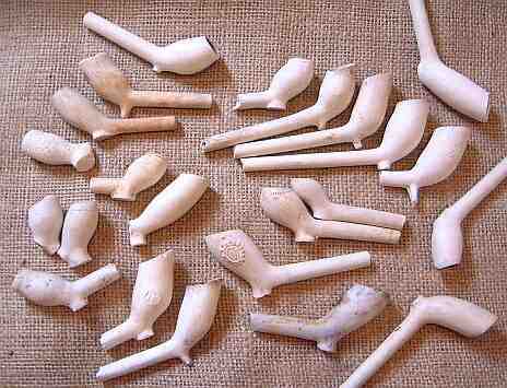
The ubiquitous lump of coal/coke to the right, and the ubiquitous clay pipe to the left. The lower of the pipes is nice as it still has the spur that juts out and forms the base of the bowl, which you can see just emerging. It’s probably early to mid-Victorian in date. -Check out this wonderful website for more information.
The spurred type of pipe is middle right.
And finally, to end on, this lovely thing.
Ding dong, the Mesolithic calling.
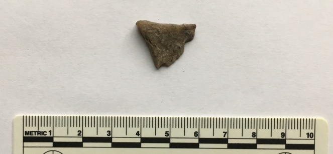
A flake of quartzite that has been struck in prehistory, during the course of making a tool. Flint doesn’t occur naturally in this area, so all sorts of stones were used in the making of stone tools in prehistory. Quartz, though a poor cousin of flint, still keeps enough of an edge to be useful, and this piece carries all of the hallmarks of a bit chipped off a larger tool or weapon – the striking platform (top), and the bulb of percussion (facing, half way down). I suspect that this is Mesolithic in date, so c.6000 – 4000 bc, or thereabouts. I’ll post some more flint/chert/quartzite when I get a chance, as it’s fascinating stuff, and the area is not exactly lacking in it.
*
Interestingly, there is a brewery marked on the map (top left, numbered 8). This is the Matley Spring Brewery, which brewed beer here, using the local spring for water, and presumably selling it in the Dog and Partridge, at the end of the wonderfuly named Blundering Lane. I was going to write a little about it, but came across this site with some information and photographs. Actually, the whole blog is a good read, filled with fascinating titbits relating to the area, so go forth and explore.
*
And finally, as promised, I’ll end with the folk story of Gallowsclough. This is taken from Thomas Middleton’s Legends of Longdendale (the book is a mine of local legends and folktales, as well as some good photographs, and is well worth seeking out – or reading in the pdf format at the link below)
It’s very Victorian in its telling, but the story is as black and evil as any I have read; there is something about it that disturbs and lingers in the mind – the imagery, and particularly the witch walking away at the end. No, I like a good dark folktale, but this is just on the border of being a little too dark for my tastes. Enjoy at night, and you have been warned…
So there you go. There’s plenty more in the pipeline, so watch this space. As always, comments are very welcome, and all will be published.
No, this is not going to be a long essay on the much overlooked site, so don’t worry. In fact, you might say quite the opposite when I present a wonderful piece of archaeology… you’ll see.
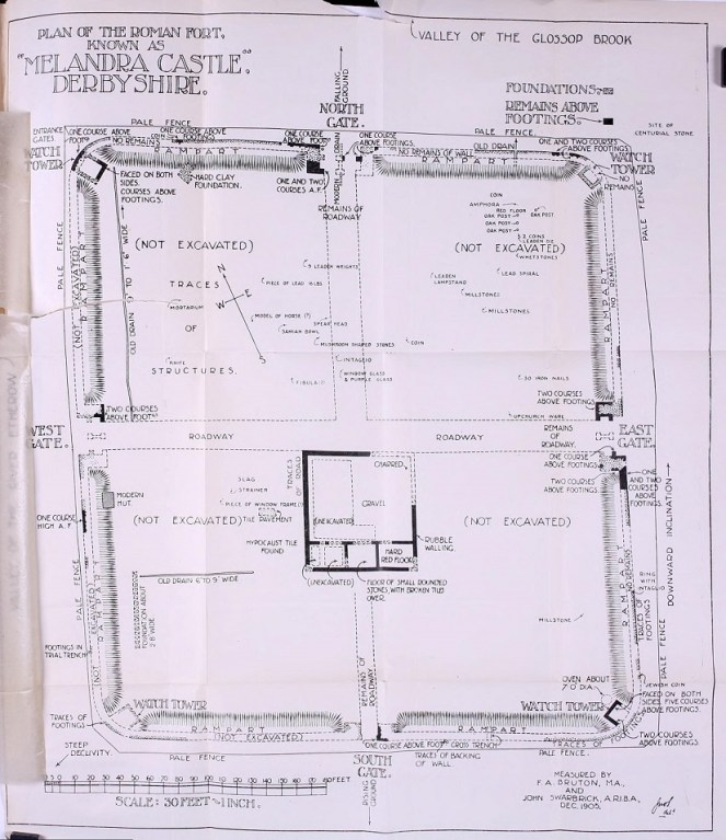
Plan taken from RS Conway’s ‘Melandra’ shows the layout of the fort, as well as the find spots of interesting bits and pieces. Most of these are now in Buxton Museum, which is well worth a look.
I was there a few months ago with the family Hamnett, and following Mike Brown and Roger Hargreave’s talk at the Glossop and Longdendale Archaeology Society. Both have been heavily involved in trying to get some sort of archaeological project resurrected for the site, as there is still so much not known, and both are great ambassadors for the fort. Sadly, there is nothing major in the pipeline, but their talk prodded me to go and look again at the overgrown site, windswept and slightly out of place against the backdrop of a 1960’s council estate. Face the other way, though, and it is the wilds of Longdendale that confront you. What a difference between this landscape and that in which the soldiers who built it grew up: The First Cohort of Frisiavones, originally from Belgium/Netherlands area, and assisted by men from the 3rd Cohort of Bracara Augustani, who were originally from Portugal.
Longdendale Valley, brooding. From Melandra.
It an amazing site, but one that is very neglected, and what could be a huge source of pride for the people of not just Longdendale, but of Derbyshire too, is all too easily passed by, overgrown and forlorn. So go and visit it, people. Read Mike Brown’s excellent booklet on it (couldn’t find a link, but it crops up all over). R.S. Conway’s 1906 academic book is out of print, but you can still get it relatively cheaply.
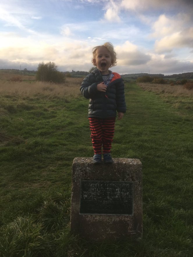
The young Master Hamnett at the north gate. Behind him, to the left, is St Michael’s, Mottram, and to the right, the ‘Deep Cutting’ at Roe Cross (and the White Stone).
Before we go on, though, a digression about the name Melandra.
According to the Ravenna Cosmography (a 7th Century list of Roman towns and forts), its actual name, was Ardotalia, not Melandra (see no.108 in the above link).
It is likely that Melandra is a name made up by the Reverend John Watson, the Rector of St Mary’s in Stockport, who first described the site following a visit in 1772. Seemingly, he wanted to give it a ‘classical’ air. Indeed, there is no record of the name Melandra existing prior to Watson’s and at that time of his ‘discovery’, as Watson himself notes, the area of the fort was known as the ‘Castle-Yard‘, and the eleven fields adjoining it are named ‘Castle Carrs‘ in various land deeds (1). Where, then, did Melandra originate? According to Anderson “The word Melandra has a curiously Greek appearance” (2), and is alleged to be a “Roman name derived from the Greek Melaxdryon, which signifies ‘the heart of oak‘ or ‘the heart in the oak“, perhaps a reference to the trees of Longdendale” (3). However, it is very unlikely that the Roman name remained unchanged for 1600 years. And, it is equally unlikely that the local population of late 18th century Glossopdale and Longdendale spoke classical Greek. No, they would simply have called it Castle Hill or similar, which is exactly what they did! However, an Oxford educated academic and clergyman would almost certainly have spoken several classical languages, and be at least proficient enough to invent a name. So thank you Reverend Watson, because of you, the name Melandra Castle has become common usage, and so we continue to call it thus.
Right, the find!
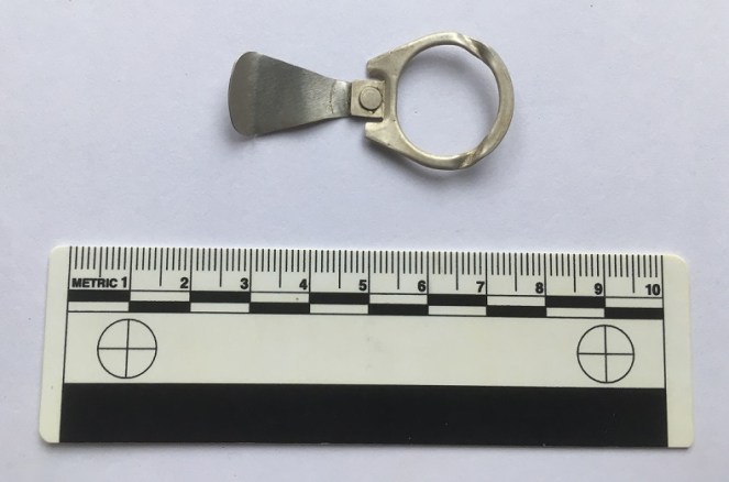
The fort is a scheduled ancient monument, so it is illegal to take anything out of the ground here. Even stuff off the molehills, which is where I found this:
Ring pull from a 1980’s drinks can. No idea what type, but I’m sure someone, somewhere, will know!
Don’t worry, I’m not about to feel the long arm of the law, it is quite literally rubbish, and of a 1970’s-80’s vintage. Anyone who watched the TV show Detectorists will immediately chuckle (very highly recommended, by the way, even if I don’t always see eye to eye with metal detectorists and their hobby).
According to this website, ring pulls like this stopped being used in the UK in around 1989/1990. So there you go. I was so taken aback by nostalgia, that I immediately thought “I need to blog this!” Also, I surely can’t be the only one who used to detach the seal bit, insert the larger end into the slot on the ring, and using the natural sprung tension, ‘ping’ it off in a frisbee fashion. You could get some distance on these things. Am I the only one?
Anyway, a bit of fun. I have a few more serious posts to finish off, so expect those relatively soon (after the weekend?)
And as always, I remain,
Your humble servant,
RH
Watson, J. 1775. “An Account of an Undescribed Roman Station in Derbyshire” Archaeologia 3: 236-238
Anderson, W.B. 1906 “The Roman Place-Names of Derbyshire” in Conway, S (ed.) 1906 “Melandra”.
With an article on the Victorian rifle range half-written, and another on the sunken village of Derwent in the brewing stage, I thought I’d sprinkle some Christmas cheer!
I occasionally have reason to look at old newspaper articles via the British Newspaper Archive. There is always something interesting to be found, especially Glossop related, but this actually made me laugh out loud.
So, may I present to you, a Christmas special of the Glossop Cabinet of Curiosities, culled from the pages of the Manchester Times, and dated 28th April 1832.
GROSS INDECENCY
To the Editor of the Manchester Times
Sir, Permit me to bring before the attention of your readers a very gross breach of public decency, and, I fear, a rapidly increasing evil. I mean foot races in a state of nearly total nakedness. On Saturday the 14th instant, I had occasion to walk up Stayley Wood, in company with my wife, and when a short distance beyond the eighth milestone on the Mottram Road, we were met by four brutes, whose shapes, I am ashamed to acknowledge, were human, with no other article of clothing than an apology for a pair of drawers each; shouting and commanding us to leave the footpath, that they might pursue their race uninterruptedly.
Last Saturday, too, business led me to a gentleman’s house, in Glossop Dale; in passing through H______ T______ (presumably Howard Town – RH.) I observed a hat hanging from the bedroom window of a beer shop, which I understand was the prize to be contested for in this manner: a short distance further I met two candidates for this kind of fame, in the same state of nudity, surrounded by applauding crowds, amongst whom were many effigies of women (English matrons and maidens, as a Briton, I boldly deny they could possibly be).
Mr. Editor, I do assure this is a fact, I am writing a true statement. I know the names of many of the parties, but no part of your paper must be defiled with so base, so hateful a pollution as the mention of them would be. I naturally inquired of my friend “have you any constables here?” “Oh yes, many.” “Where do they reside?” “The constables for H______ T______ reside at the next door to the…” – judge my surprise – … very house where I had seen the prize exhibited.
It is not my intention, Sir, to reprove these diligent officers, but if I were to ask, with the sexton, “which be the malefactors?” Dogberry and Verges (comically inept policemen in Shakespeare’s ‘Much Ado About Nothing’ – RH.) would answer “Marry, that be I and my partner”. It is by no means my intention to interfere with popular amusements; the poor men have not too many; but against such outrages and violations of public decency I will protest to the last: a shirt would not impede the runner, and none but men lost to every sense of morality, decency, and religion, would ever sanction such proceedings. I will hope, for the honour of humanity, such proceedings will be prevented for the future. Should I be disappointed, I will beg permission to insert a castigation which shall make the authors and participants writhe in mental agony.
I remain, Sir, your humble servant, PUDENS (a Roman nickname meaning ‘modest’ – RH)
The actual letter, just to prove I’m not making it up!
So there you have it… there is very little I can add to that.
Expect more blogging soon, but in the meantime, should you be walking on Boxing Day, watch out for semi-naked joggers. Oh, and if anyone fancies meeting up for a drink, you’ll find me outside Wetherspoons, topless, fighting people for a hat.
Have a very Merry Christmas, and a Happy New Year.