Archaeology · Pottery · Whitfield

A Possible Pair of Post-Medieval Paths, a Potential Pub, and Plenty of Pottery.

As I have said many times before, I do love alliteration. What ho! and all that. I trust you are all keeping well in these odd times? Well, now this is a monumental post – it is precisely three years to the day that I made the first post on this blog (you can read it here if you want). When I first started it I had no idea what it was going to be, other than I had some interesting bits and pieces that I wanted to share, and which I thought other people living in Glossop moght be interested in. The blog is still pretty much that in aim – bits and pieces – and I was right… there are lots of you out there who seem to enjoy the ramblings of a man who gets excited by bits of old rubbish. So thank you, you wonderful people, for reading, and here’s to many more blog posts. Now, on with the show. RH

During the lockdown, Master Hamnett and I have been taking a daily constitutional up and around what has become known as the “secret passageways”. Overgrown and wild in places, even for a man of modest size such as myself it is a mysterious place, but to a 4 year old it is indeed another world. Naturally, I have been keeping an eye open for bits and pieces of history, and I think I have a story to tell. Possibly. Well, I certainly have some pottery to show, so there’s that!

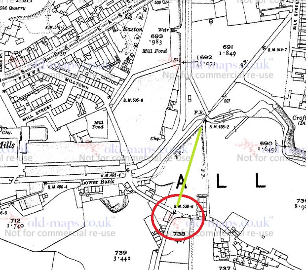
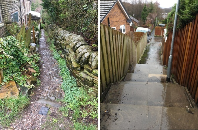
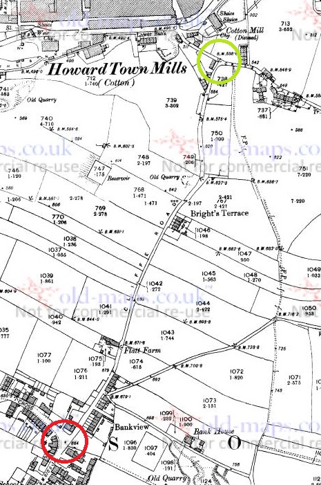
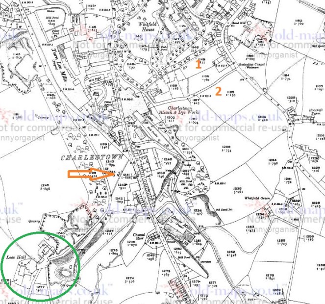
The route we walk is essentially along Hague Street, down one track to Charlestown Road, along, and then up another back to Hague Street. We often continue on and round if it’s not raining, but always walk these paths, which I have helpfully marked Tracks 1 and 2 on the map below:

M6
Tracks 1 & 2 at the top. Ignore the arrow and a circle for now… all will become clear!

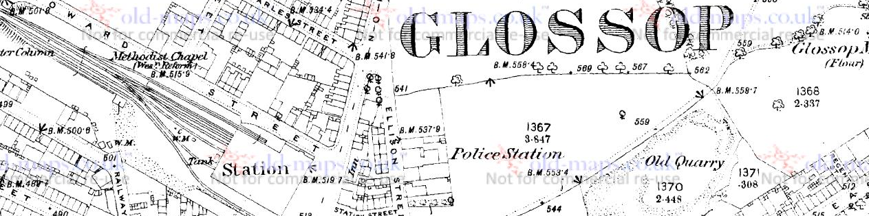
The tracks and immediate area are more clearly shown on the 1968 1:2500 map

m10
It’s a nice and short circular walk, if anyone fancies it.

The tracks are interesting in themselves in that they are once again an example of what I call the fossilisation of trackways – they are older tracks that no longer perform a function as such, but are preserved as footpaths. Certainly in this case as it makes no sense to have two tracks mere metres apart going between the same places. Instead, I think they are preserving the memory of a single older track, which I suggest below is Track 2, potentially the more interesting of the two. But I’m getting ahead of myself.

Track 1 runs down the side of this house, which was originally a pub called the Seven Stars (hence the sign on the door frame, although the sign above the door is a mystery… if you are reading this and own the house, could you tell us?).

M7
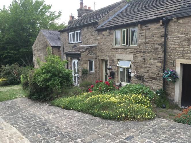
The one-time Seven Stars pub – I always feel a bit weird photographing people’s houses, but this is visible from the road, so it’s not as though I’m sneaking around gardens.

I know nothing about this establishment, but it was probably a beer house. As a reaction to the widespread and dangerous consumption of cheap gin – the so-called ‘Gin Craze’ of the late 18th century – the government encouraged more beer drinking (beer being considered relatively healthy) by allowing householders to open up their houses to brew and sell ale. These private houses became known as beer houses, and the individual paid a small fee to the local magistrates in return for an annual license allowing them to sell beer, but not the wines or spirits that the normal pub or inn could. If anyone has any information about the Seven Stars, please do get in contact.

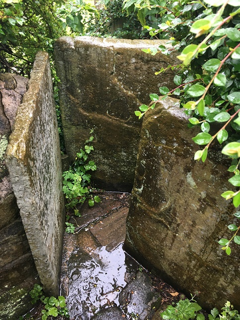
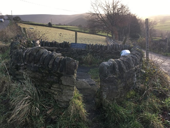
Just here is a series of upright stones presumably placed to stop horse riding or cycling. The gap between them is very thin; I might have put on a little weight during lockdown, but even I had to squeeze through.

M22
Breath in!

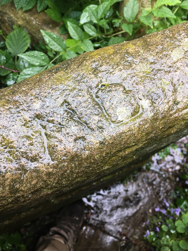
Carved onto one of these uprights are the intials ‘M.D.’ – I must have walked through these 100 times and never noticed the letters before, but the light and the rain were just right this time.

M23
And as you all know by now, I can’t resist carved graffiti.

Further down the footpath I noticed a reused quern or grind stone – possibly Victorian, but I suspect earlier – being used as a coping stone for the wall. And why not? It’s the perfect shape, and may well have been hanging around for centuries after being used to grind wheat into flour.

M9
The worn central hole is visible, and it’s possible the other half is around here somewhere.

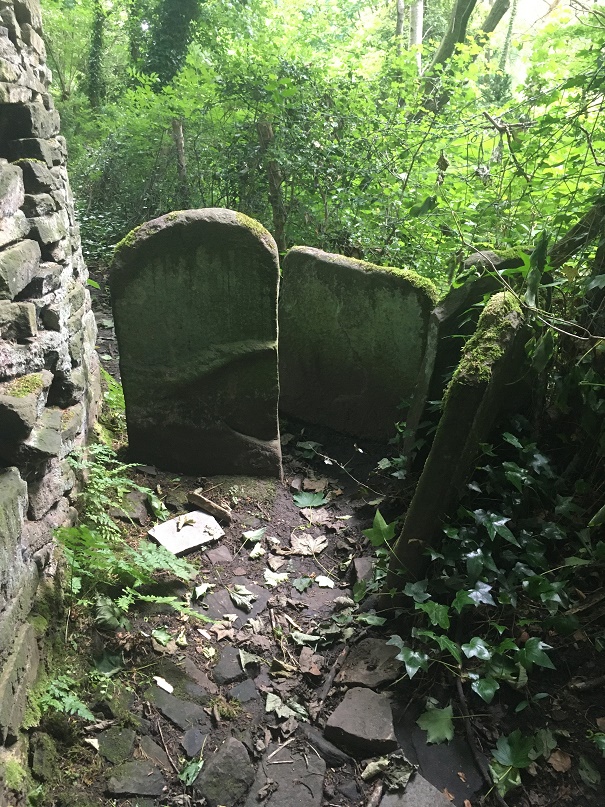
About halfway down, you come face to face with more of those upright stones, although in this case I can only assume they were put there to stop a headless horseman! Honestly, they are quite unnerving.

M19
Not at all creepy and gravestone looking. Nope. Absolutely not.

The path continues:

M18
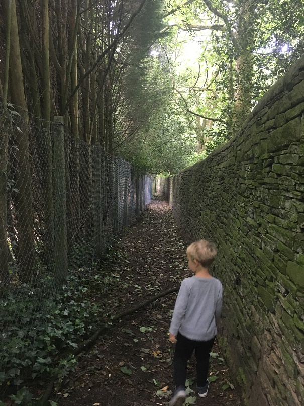
Master Hamnett on the final stretch down to Charlestown Road. At the end of the path, in spring, there is a truly spectacular spread of wild garlic.

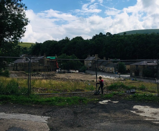
Until we arrive at Charlestown House, and the Charlestown Works that were – now demolished and awaiting houses.

M30
The site awaiting re-generation. The hairpin bend where Charlestown Road meets Turnlee Road is visible. Whitley Nab in the background right, Casa d’Italia left (very nice pizza, highly recommended). Dead ahead is Lees Hall, which is important… stick around!

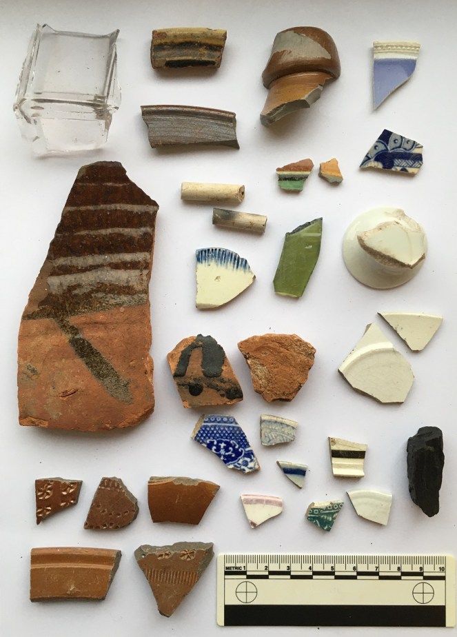
So, here’s the pottery:

M3
A small assemblage of fairly typical Victorian bits, with a potentially earlier piece.

Top row, from the left: a base of a saucer or small plate; a huge chunky handle belonging to a large jug; a base of a glass jar or jug, or possibly from a tankard – it’s nice and decorative, but not expensive. Next is a fragment of a pedestal footed drinking cup, which is again fancy, but not especially expensive, it being just glazed earthernware. Then there is a rim to a large plate of some sort, being about 30cm in diameter.

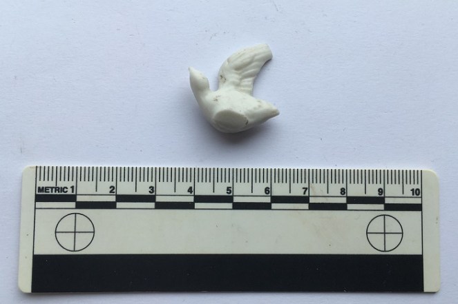
The lower row from the left: a fragment of a stoneware bottle, a chunk of a pancheon, and a fragment of a manganese glazed jug or similar thick walled vessel. Then we have two pieces of blue and white earthernware, and a base of a tea cup. There is nothing massively interesting, and it all seems to be Victorian in date, as we might expect… except for the manganese glazed jug! This is, I think, earlier – perhaps early 18th century. It’s quite characteristic, and although there was a revival of manganese glazed pottery in the Victorian period, this glaze is of relatively poor quality, and the fabric (the actual clay of the pot) is quite rough, both of which suggest an earlier date. Then there is this lovely bit of pot; it’s a china dove, shaped to fit onto what would have been a tasteless Victorian jug or bowl – you can see the flat bit where it was joined to the vessel it flew away from.

M4
Found lurking below some dandelions.

Then there was this:

m20
A bottle top

A screw bottle top, probably from a beer bottle or similar, and dating to the early 20th century. I love these things, and have blogged about them previously – here, for example. Unusually, this one doesn’t have the drink makers name or logo on the top, just the name of the bottler – R. Green of Leigh.

M21
Always nice to see.

Moving on to Track 2, there is a noticeable difference between the two. This one is more of an actual track; it is certainly wide enough to drive a horse and cart down it, and it seems to have had a surface at some stage. It is also deeply worn in places, which can be suggestive of an older trackway.

M26
Possibly worn by traffic, the track is quite deep in places.
M27
It’s not much to look at, but this is the surface of the track.

I’d love to put a trench across this track to see how it was made up.

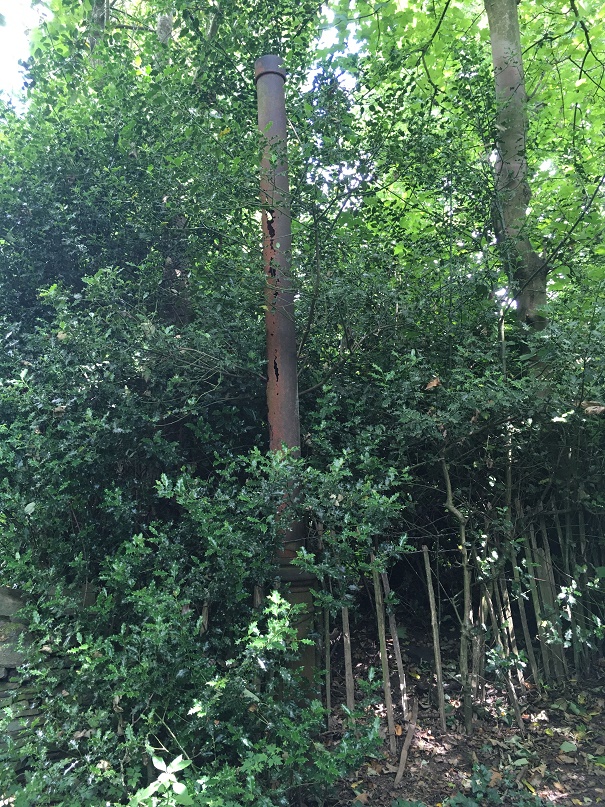
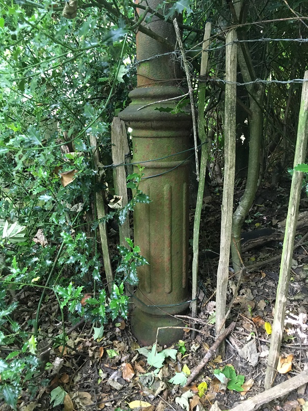
Further on, it has what seems to be a late 19th or probably early 20th century cast-iron streetlight, which is interesting and spookily out of place now, but suggests strongly that it was used as a ‘proper’ track until fairly recently.

m24
It has seen better days, but there it is, slowly being overtaken by nature.
m25
I can’t work out if it is gas or electric… further research is needed.

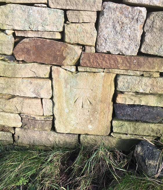
Right next to the streetlight is a gateway into a seemingly random field, and a benchmark on the gatepost – it’s been a while! This one – 616.77 above sea level – is a late addition as it is only marked on the 1968 1:2500 map. There was another benchmark marked on the opposite side of the track – 622.6ft above sea level – but it’s long gone (you can see it in the map above).

m13
The bench mark. This is what 616.77ft above sea level looks like.

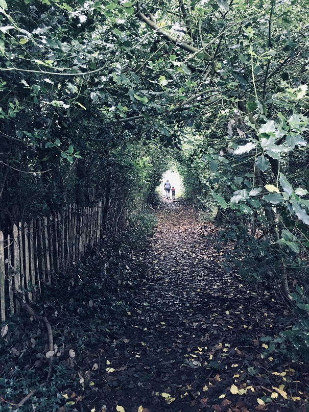
The track continues until daylight is reached.

m32
I love this shot… artful (courtesy of the iphone filters, not talent on my part). Mrs and Master Hamnett providing the scale.

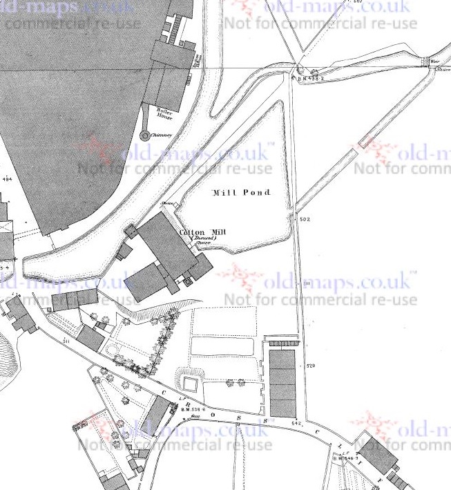
The top of the track, where it joins Hague Street again, is the site of the original Whitfield Methodist chapel – it is visible on the 1880 1:500 OS map:

M28
The chapel is clearly marked.

Built in 1813, it had seating for 200 worshippers, and at one time was the home of the pulpit from which John Wesley had preached in New Mills (as discussed in this post). There are more details about the chapel on the Glossop Heritage webpage.

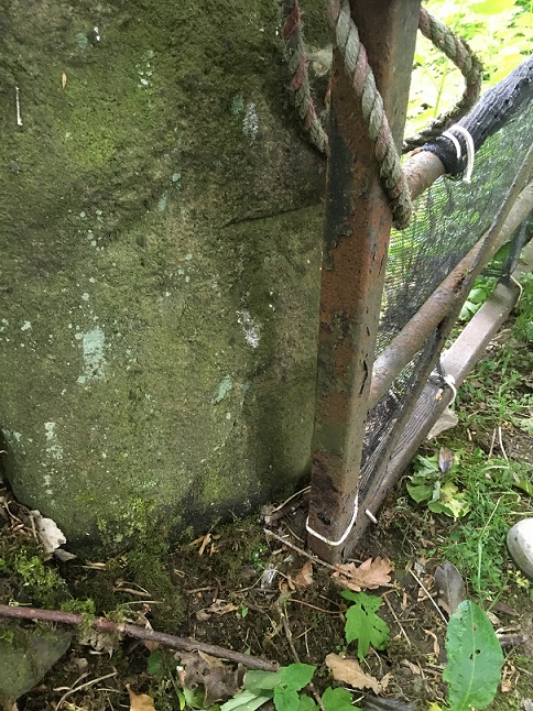
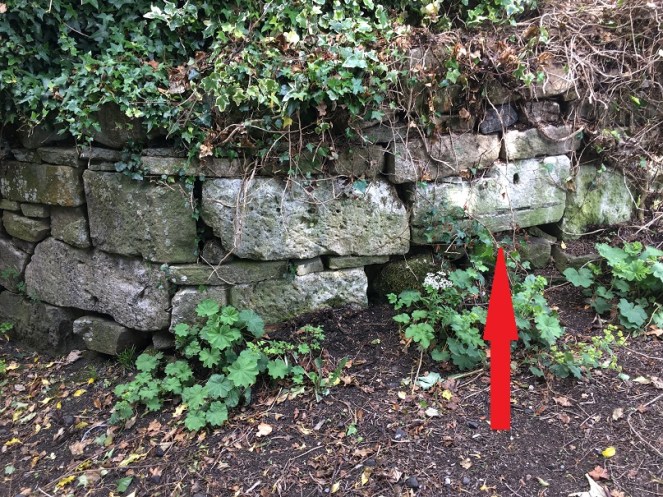
It was demolished in 1885, and the site is now occupied by a private house, but there are some interesting re-used stones on the trackway which almost certainly came from the chapel. The one indicated by the arrow in particular seems to have been a window frame – originally it would have laid upright, and you can see where the wooden frame was bedded in, and possibly a cross bar set into the stone.

M29
I love Microsoft Paint!

A closer look reveals what might be a mason’s mark. Possibly… but then I really rather badly need glasses.

m31
Squinting, after two glasses of wine, and with the eye of faith…

So then, the pottery:

m14
Fairly standard stuff, but still nice.

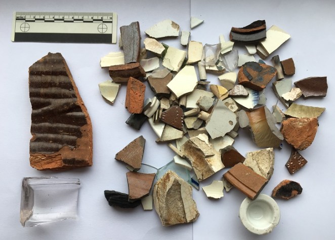
Top row, left to right: a fragment of a large stoneware vessel with a cream glaze. I have photographed it showing the interior – it is roughly finished, and you can see wiping marks, and it probably came from a large cider flagon.

Next is an annular ware bowl or similar type, with the characteristic horizontal linear bands around the rim and below. Abrim from probably the same vessel is above it. Despite it looking 1950’s, this stuff ranges in date from the mid-18th century to the late Victorian; this is, I think, early 19th century. Next is a sherd of a cream ware jug, this being a part of the spout – you can tell by the twisted curve of the rim – again, early 19th century. Next is a stoneware flaring rim to a large jar, Victorian in date. Next we have a sherd of black glazed pottery which, I think, might be 18th century in date – the glaze seems to be lead based, which it isn’t in the Victorian period, and the fabric is very red, which is also common in Black Ware of the 18th century. I’ll post some more about this in the future – I’m actually trying to put together a crib sheet for pottery identification for this part of the country which some of you might be interested in (I know, I know, stop groaning… you don’t have to read this blog, you know. And I did say ‘some of you‘!). Beyond that is a fairly uninspiring selection of Victorian sherds at which even I pale!

Track 2 is odd – there’s summat rum about it. It has the air of a deserted roadway that was once of some importance, certainly important enough to have a substantial gateway and a streetlight on it. Looking at it, and thinking about the fossilisation I talked about above, I wonder if this was the line of an earlier track, perhaps even the medieval road that led from Whitfield to Lees Hall (which is circled in green in the first above – see, I told you it would all become apparent!). The hall, though 18th century in date now, stands on the site of a medieval manor house, possibly even the original manor house of Whitfield mentioned in the Domesday Book. It was certainly important in the medieval and early modern periods as the seat of the Manor of Glossop, where tax and tithe from Glossop and Whitfield was taken – first to the Earls of Shrewsbury, and then, from 1606 onwards, the Howards. The road from (Old) Glossop came through Cross Cliffe (discussed here), along what is now Cliffe Road through Whitfield, and from there down this track to Lees Hall. One less obvious part of it may be the footpath indicated by the orange arrow in the map above; I don’t think that it is the exact route the track would have taken, but it again ‘preserves’ the way in the landscape. I would suggest, then, that Track 2 is either this hugely important road fossilised into the landscape, or it broadly follows the line of that road which no longer exists. A point that may also support this is that on the 1968 OS map, also above, the track is marked by a series of ‘Boundary Mereing Symbols” (they look like lolipops – circles on sticks) which  apparently indicates that it is the boundary of a parish or parish council (here, for an explanation). Boundaries, or meres, often use ancient and established objects or features to lay out the area that is bounded – an old track is a very common and perfect example of this type of feature.

This part of Glossop – I suppose technically Whitfield – is very interesting.

Right, that’s your lot for today. As always, please feel free to comment – even if it’s simply to tell me I’m talking out of my hat. I have more that I am picking away at, but until then stay safe and look after each other. Oh, and happy anniversary.

And as always I remain, your humble servant,

RH

Folk Tales · Oddities · Waterways of Glossop

Nat Nutter: Glossop’s Very Own Witch

Greetings all.

An interesting title, and a tantalising tale, today. I was originally going to post today’s topic at the end of the Lean Town posts (here and here), but after they became too large I thought I’d do it as a separate post.

Reading through Hamnett the other day, I came across this:

“The Gnat Hole Wood is very pleasant in the Summer time when there are no gnats about. The small stream of water that runs through the wood at one place forms a small pool; this was known as Old Nat Nutter’s Porridge Kettle. She had the reputation of being a witch and fortune teller and used this pool for unholy practices and incantations. She was a bogey to children.”

Interesting… I do love a good folk story, and one with tantalising clues, too.

So off I buggered (in those happy-go-lucky pre-covid times, when one could just bugger off into the woods) to look for the Porridge Kettle, and any signs of Nat Nutter.

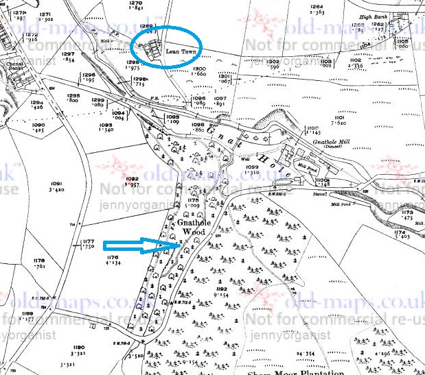
The stream referred to is, presumably, the one pointed to by the large blue arrow in the map below, as it is the only one to run through Gnat Hole Wood (or Gnat Hole Plantation, as the earlier maps name it).

Nat Map
The map of the area. For reference, Lean Town is circled in blue.

As far as I can tell, it is unnamed. I’m sure it had a name at some stage in its history, as watercourses are one of those landscape features that no matter how small – and this one is less than a mile long – are given a name, even if only a local one. However, we must remember that the surveyors who actually drew the maps, whilst superhuman, were not invincible – they might have had an off day, or it might have been raining and they didn’t fancy getting wet, or there was no one around to ask the name of that particular stream, or… you get the idea. Moreover, the fact that Hamnett himself didn’t know the name, particularly given his uncanny ability to “know things”, seems to indicate that the name was lost by 1910 (when the article was written), and probably a good deal earlier. The brook itself begins on, and is formed largely from the water run off from, Shaw Moor (perhaps we should call it Shaw Moor Brook) and it joins Bray Clough Brook between Gnat Hole Mill and Lean Town.

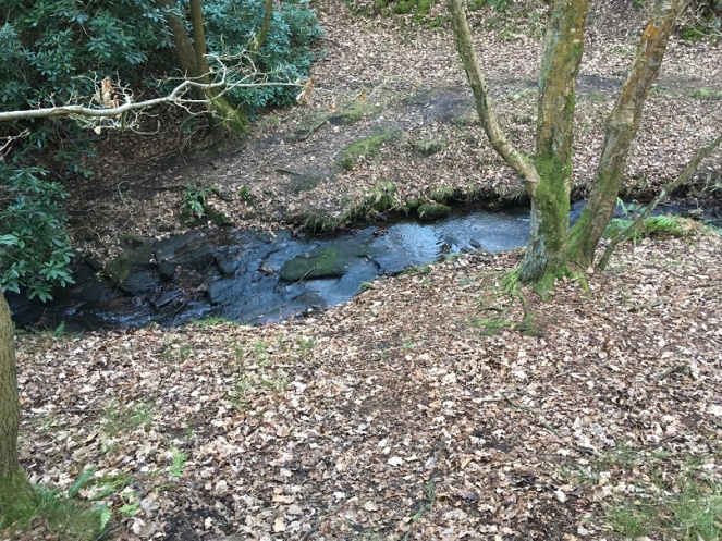
I travelled through the woods here, looking for a “pool”, or something that might match the description:

Nat 3
This is the upper part, with Bray Clough Brook below.
Nat 2
Here it drops into a series of waterfalls, in a steep secluded glade. Atmospheric to be sure, and perhaps a perfect place for witchcraft.
Nat 1
Lower down, and more open, but still steep sided

Alas, I found nothing that would definitely be called a pool as such, nor anything that could be connected to Nat Nutter. The area must have changed a huge amount since 1910, and even more so since the ‘witch’ was supposedly living there (early 19th century, perhaps earlier?), so it’s not surprising. Disappointing, but there you go.

So who was this Nat Nutter? Well, the description of her as “a witch and fortune teller” suggests that she was what is known as a ‘wise woman’ or ‘cunning woman‘ – a sort of combination of healer, folk magician, and someone who divines for fortune or lost objects. A particularly important function they performed was the production of spells and magically protective charms, as well as being a first port of call for medical matters, especially those involving pregnancy and abortion. They were common from the medieval period until the early part of the 20th century.

Whoever she was in reality, she was still remembered by 1910. Her name, though. Well, her name is suspicious, and is perhaps a construction – Nat Nutter, living in Gnat Hole Wood? Hmmmm. Also, the Nutter part recalls Alice Nutter, the Pendle Witch executed in 1612. It all seems a little too good to be true! But perhaps this was deliberate, the name adding to the mysterious otherness of the scary woman who lived in the woods by a stream that she used as a witch’s cauldron.

Nat 4
The old ways are not too dead – this tree is overlooking the brook.

Marvellous stuff.

Please feel free to comment, even if just to tell me that you are related to Nat Nutter, and that I have libelled her.

Stay safe, and look after yourselves and each other. More to follow soon(ish).

Until then I remain, your humble servant,

RH

Cross Cliffe · Whitfield

Crossroad Blues: A Cross Cliffe Followup

Right… a sequel!

So, hopefully you all read the last post. And even more hopefully, it made sense to some of you. Ignoring the fact that the main point of writing it has been proven to be wrong, I mentioned in the post that I think there was once a crossroads at the bottom of Cliffe Road. Well, let’s concentrate on that! It’s just a t-junction now, where Cliffe Road joins Cross Cliffe (the road to the right), and continues down to Volcrepe and Bank Street (left)

Cross Cliffe 5
The site of the possible crossroads, and of Cross Cliffe Cross.

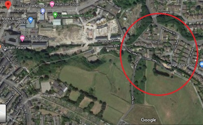
But originally, I suspect, it would have gone straight on, right up to the bridge that crosses Hurst Clough – like this:

Cross Cliffe - Map
The photo above shows the area circled in red, the proposed road is shown in green. The footbridge is noted on the map as FB.

However, the whole area has been monkeyed around with pretty seriously, with the main culprit being the building of a Cross Cliffe Mill on Hurst Clough there, as you can see very clearly in this map:

Cross Cliffe 8
The 1880 1:500 map shows both the mill and the projected route of the track. Interestingly, there is a gas lamp post marked at the junction.

So then, Cliffe Road is at the bottom, and Cross Cliffe runs to the right. My contention is that Cliffe Road once also continued on to the footbridge at the top of the map, and from there on to (Old) Glossop. Let me walk you through it.

Cliffe Road is the original medieval (and probably earlier) track that led from Hayfield down to Old Glossop (discussed HERE), and on which, at the junction of Whitfield Cross, stood the Anglo Saxon stone cross of Whitfield. Beyond this, it continues to what was originally a crossroads.

Cross Cliffe 3
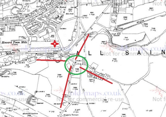
The crossroads circled in green, with the arms shown roughly in red.

This crossroads was the junction of Bank Street (The Bank, coming ultimately from the Simmondley area), Cross Cliffe (the road leading to… well, I’m not certain, yet.), Cliffe Road (from Hayfield), and the track to Old Glossop heading north. But with the building of the mill in the early 1820’s, and specifically the mill pond, the old track was destroyed, pushing traffic further back toward Bank Street, and then along what became Volcrepe and Milltown, and giving us the kink in the road.

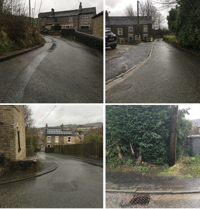
Cross Cliffe - Crossroad
Clockwise from bottom left: road down to Bank Street and now Milltown; Cliffe Road; Cross Cliffe; er… a hedge! The now blocked northern arm of the road.

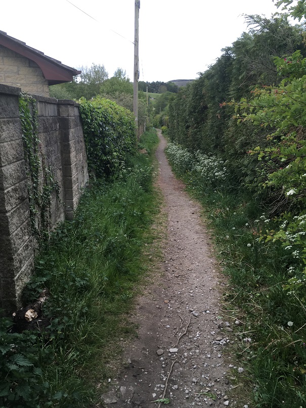
Although the northern arm of the crossroads is no longer there, there is a path way preserving the route running to the right of the houses and leading down to the bridge.

Cross Cliffe - Path
The path beside the houses, preserving the memory of the trackway down to the bridge.

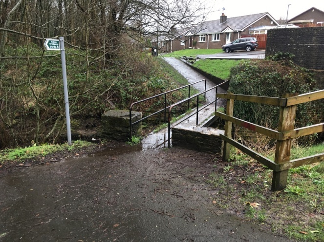
The original track lead down to a crossing over the brook there. It is now a modern concrete modern footbridge, but is clearly shown in older maps, and is thus presumably an older brook crossing – whether by bridge or as a ford.

Cross Cliffe 9
The bridge over Hurst Clough, standing in Whitfield and looking into Glossop… bandit country!

After crossing the brook, the track continued along what is now a curiously wide and unusually placed unnamed footpath between Shirebrook Drive and Silk Street.

Cross Cliffe - Path2
The track looking from Silk Street toward the footbridge.

I would suggest that this footpath is the memory of the original medieval and early modern trackway preserved (perhaps fossilised is a better word), as these things often are, in the Victorian architecture. Glossop is full of these odd footpaths that lead from A to B for seemingly no reason, and often for no gain; they just exist. I have suggested that Whitfield Avenue preserves the memory of a track, which in itself preserved the memory of the Roman road, and I wonder how many others also preserve a memory of a track or road (watch this space for more explorations). From Silk Street, the track would have gone up what is now Manor Park Road to [Old] Glossop, and the church and market there.

So there we have it – a lost crossroads, and the rediscovery of the medieval way into Glossop from Whitfield.

Comments, even to tell me I’m wrong, are always welcome.

In the meantime, stay safe, look after yourselves and each other, and there is more coming soon… honestly!

Until then, I remain, your humble servant,

RH

Cross Cliffe · Crosses of Glossop · Placenames · Whitfield

When Is A Cross Not A Cross?

Ok, so I think I’m onto something!

EDIT: No… no I’m not!

Alas, a mis-attribution in the Place-Names of Derbyshire has meant I have barked up the wrong tree! That’s not to say that there definitely isn’t a cross at Cross Cliffe,  as suggested below, just that we can’t rely on the early place name evidence. Read the insightful comments by Neil Buckley below, which give what must surely be the correct reading of the text. My thanks to him for supplying the information, and working out the details. I’ll return to this in a later post as I think it is important, and in the meantime, feel free to re-read the blog post.   

You know those moments when something that you have been staring at for years suddenly, and jarringly, comes into focus, and there is a slight tingle at the back of the neck. And then you dig a little deeper, and the tingle becomes a hunch, and then a possibility, and then a… you get the idea. Well, I’m there, and I’d like to share a discovery with you. This is still theoretical, even if the theory is based on good evidence, and I’m fairly certain that I can never prove it. But I’m getting ahead of myself.

Diving in and out of The Place-Names of Derbyshire to various previous blog posts (HERE and HERE) was a joy, and had me marvelling at both the sheer number of placenames recorded in the book, and the incredible depth of scholarship that accompanied their explanation. For those that have never read the book (and you should), it is a list of all the names of towns, villages, fields, roads, and streams in the area. However, on page 104, under the Glossop general heading, I came across a curious entry that got me thinking. 

Cross Cliffe 4
Here is the page in question

Specifically the entry for the road/area Cross Cliff, in Whitfield. For those of you who don’t now the area (and why not?), Cross Cliffe is this area, here:

Cross Cliffe 7
Cross Cliffe is broadly that area circled in red.

Although now it gives its name to a road, it was once an area (circled in red above) which  started at the bottom of Cliffe Road and lead down to Hurst Clough. The entry in the book reads:

Cross Cliff (6″), crucem de Cresclyf 1285 For.

It gives the earliest example of the name (crucem de Cresclyf), the date of this (1285), and the reference for this example (For = Forest Proceedings). So far, so perfectly ordinary.

So then, Cross Cliffe… and then a thought. “Hang on a minute… Crucem de Cresclyf?

Now, I’ll admit it, my medieval Latin is about as good as my understanding of the language of the San people of Botswana – the one that uses clicks and other sounds. Or indeed, Klingon. I checked, and was – broadly – right (hurrah… personal victory, I’ll take that). I also checked with a real linguist (thank you AG), and was – broadly – backed up.

Crucem de Cresclyf: the cross of Cross Cliffe.

The cross? Which cross? Oooooh…

Bloody hell, thought I, and I went and bored Mrs Hamnett with this potential discovery. More research later, and I think I have just about convinced myself.

This, the first reference to Cross Cliffe, is taken from a 1285 document which gives a description of the boundary of land owned by a certain Thomas le Ragged. Thomas was a forester in the Peak Forest, and was given the lands by William Peverel, son of William the Conquerer and resident of the castle in Castleton. These lands included the hamlet of Whitfield. The descendants of Thomas le Ragged sold the Whitfield portion in 1330 to a John Foljambe, and from there it was portioned off and sold in lumps (Whitfield really does have an interesting history).

The description of the boundary of this land reads:
Required by the Foresters and others concerning the metes and bounds of the land of Thomas le Ragged of Fernley who claimed liberties, who say, that the metes and bounds of the said lands of the said Thomas begin at the Bridge of Welegh by the Royal Way to the (cross) to Crescliff, and from the said cross by certain caves (fovia) up to Routing-clought, and from Routing to Brownhegge, and up to the Waynstones, and from Waynstones descending to the Hocklow, and from Hocklow descending to the water of G’wit and by the water of G’wit ascending to the wood of Horworth.

Boundaries are based on and related to landscape features, and always incorporate immovable and visible objects, ones that can’t be disputed. Now, out of this, only a few points are identifiable. Whaley Bridge, Cross Cliffe, Hucklow, the River Goyt (G’wit), and possibly the Wain Stones on Bleaklow (although, I suspect that it may reference another ‘Wain Stones’, now lost to us). The other places I have not been able to identify (any help would be appreciated), and I’m not sure what to make of the caves – are these literal or figurative, and does a cave (fovia in the text) in the 14th century mean the same as it does now.

I digress, as the important bit here relates to Crosse Cliffe, or rather “crucem de Cresclyf” as it is in the orginal – the cross of Cross Cliffe. Not the bridge at Cross Cliffe, or the brook at Cross Cliffe, but the cross at Cross Cliffe. This is at a time when they didn’t use metaphors or flowery terms for place names – if it says the cross at Cross Cliffe, it meant the cross at Cross Cliffe. A physical, actual, stone cross. One that has been there long enough for everyone to know where it is, and use it as a point of reference. Which is very interesting. A previously unknown cross.

Its location also would support this. It would be situated on a crossroads – a favoured spot for crosses of this sort (Whitfield Cross for example). The present layout of the roads does not show this easily, but they have been changed, probably in the 18th century – I’ve got a post almost ready to go that explains all that, but here is a map to help:

Cross Cliffe 3
The cross roads, with Cliffe Road coming from the bottom, Cross Cliffe (the road) on the right, Bank Street on the left, and the original line of the road heading down to the bridge/ford over Hurst Brook, and on to Old Glossop. The green circle marks the – hypothetical – location of the cross. For orientation, the red star marks the location of what was Volcrepe.

The upcoming blog post will make a lot more sense of this area, but for now, roll with it!

Cross Cliffe 5
This is broadly the area in which the hypothetical cross would have stood. It was once a crossroads, with the road having continued on and down to Hurst Clough 50m away. Probably.

Importantly, the cross would have stood at the border between the manors of Whitfield and Glossop – effectively Hurst Clough – and boundaries like this are exactly the sort of places that crosses are erected. Then there is the name Cross Cliffe. I had always, at the back of my mind, assumed that it meant the place where you crossed the cliff – perhaps a tall edge over Hurst Clough that no longer exists – or simply references the footbridge here. Well no. Delving further into the etymology of the name, it is derived from ‘Cliff‘ meaning a steep river bank, and ‘Cross‘ meaning, well, a cross. The name is literally ‘the steep river bank with a cross on it’, and crucem de Cresclyfe is then ‘the cross of the steep river bank with a cross on it‘. This a perfect description of that monster of a hill –  it drops from 650ft at Bright’s Terrace to 500ft at the bridge over Hurst Clough – a 150ft drop over roughly 1000ft.

Placename evidence, coupled with a physical description, and a reading of the landscape and roads, seems fairly convincing. Well, to me anyway.

Now, there might a possibility that I am reading too much into this (‘surely not!’ groans everyone… I can hear you, you know! Don’t think I can’t). The ‘Cross of Cross Cliffe’ might refer to Whitfield Cross which would have been situated at the start of a small rise before the long steep slope down to Hurst Clough. If this is the case, then there is no need to look for another cross. However, I’m just not sure that this is the case. For one, the wording is too specific; “the cross of Cross Cliffe”, not just Cross Cliffe as an area –  Whitfield Cross would surely have been too far away to be the cross described there, it is firmly in Whitfield, not Cross Cliffe.

Cross Cliffe 6
The red circle marks the original location of Whitfield cross, the green circle marks the location of the hypothetical Cross Cliffe cross – a distance of over 1/3 of a mile.

Moreover, if Thomas’s land went to just the Whitfield Cross, then everything beyond that – including what is now Cross Cliff – would be outside of the described land. No, it makes sense his land went to the very edge of Whitfield, and the natural border of Hurst Clough, and it used a cross at the crossroads there as a marker.

What type of cross would it be, then? I would suggest that it was probably the same type as that which originally stood further up the same road at Whitfield – a 10th century Anglo-Saxon stone cross.

If this is correct, then where is the actual cross? 1000 years is a long time for a stone cross to survive. It may have been swept away in the iconoclasm of the Protestant Reformation of the Tudor period, or the iconoclasm that followed the Civil War, when crosses were routinely smashed – I read the other day of a Saxon cross that was broken up and used to fill a pothole in a road. However, the fact that Whitfield Cross survived these periods would suggest to me that Cross Cliffe would have likely survived, too. Perhaps we are looking at something more mundane; maybe it was accidentally broken, or worse, simply forgotten about as an important object, gradually falling into obscurity, to be lost in the hedgerows. Perhaps – and this really is a flight of fantasy – the stealing of the Whitfield Cross by the Cross Cliffe lads as a Mischief Night prank was not just a prank, and instead they were stealing a cross to replace theirs that was lost. It has never made sense that they would steal something so ridiculously large and heavy, so is this the answer? Well, probably not, but one can speculate wildly!

If anyone fancies joining me looking in hedgebacks and ditches for the original cross – after the current corona madness has subsided, obviously – then please drop me a line.

More soon – as I say, I have a whole post about the crossroads almost ready to go.

Until then, stay safe and stay inside, and take care of yourselves and each other.

And I remain, your humble servant,

RH

Archaeology · Graffiti · Pottery · Whitfield

Odd Bits and Pieces… and Cheese.

Well, this escalated quickly.

Apologies for the lack of posts recently, but things are a bit odd at the moment. Six weeks ago we were concerned about Covid19, but were still joking about it, and how it will amount to a fuss over nothing. Now, here I am in front of my computer in ‘lockdown’ for the foreseeable future, and a very real and sobering death count is still rising. It really is a strange time, and the country is a strange place; the start of it all reminds me of what my grandfather said of the ‘Phony War‘ – you knew something big was happening, but it wasn’t actually happening there and then. Well it is now.

Sadly, it also means that we have had to cancel all the tours and talks that I was involved in that were about to occur: in particular, the ‘By Seven Firs and Goldenstone‘ exploration of the legend and landscape of Alderley Edge, and the Objects Tell Stories evening of folklore and archaeology. Oh, and if you want to find out who I really am, you can watch me talking archaeology and ritual in the promo for that event here – I’m the one on the right.

More to the point, this has put something of a crimp in the Cabinet of Curiosities. Rest assured, though, I do have a backlog of posts that I have been trying to write that doesn’t involve me moving anywhere. And of course, there is now time to write… well there would be if Master Hamnett wasn’t being home schooled for the duration.

In the meantime let’s keep buggering on, as Churchill was fond of saying.

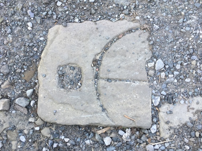
So I went for my state-mandated exercise the other day and found a few bits and pieces – random is the theme of today’s post. But first, a quiz. What’s this?

What
Ooooh, a mystery object!

I’ll give the answer at the end of the post… no peeking!

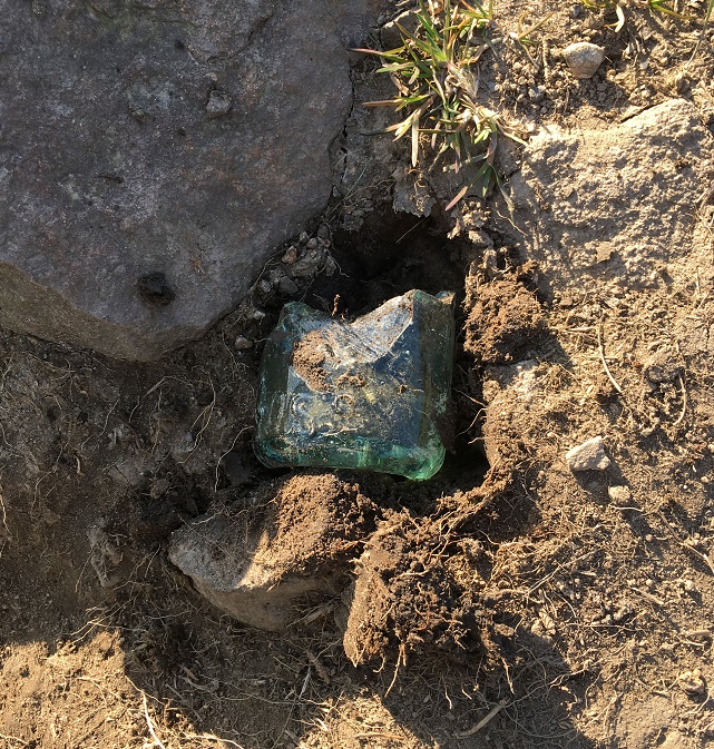
In the meantime, I spotted this sticking out of the ground:

What 2

Ooooh, thought I. The greenish colour of the glass gave it away as being older than mere litter, along with the thickness of the walls. Master Hamnett helped me hoik it out of the ground, and cleaned up it looks like this:

What 4
The lovely pale green colour is the result of impurities in the silicone, and dates it to the Victorian period or thereabouts.

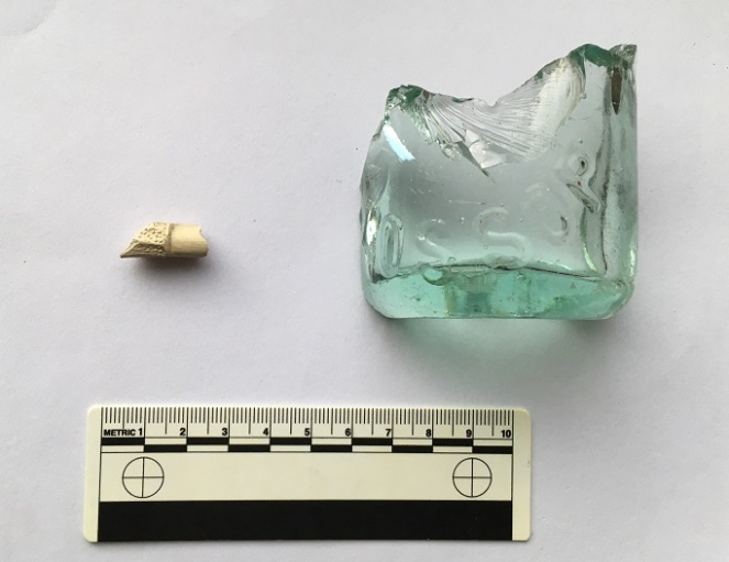
You can just about make out the word ‘Glossop’ impressed in the glass. This was likely to have contained either carbonated water or beer, but a brief search of bottles reveals nothing similar. More research is definitely needed.

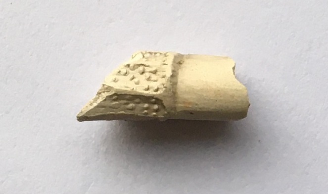
The small white object next to it is a fragment of a clay pipe, but interestingly, it has a some molded decoration on it. Here it is in close-up.

What 3

This is a fragment of stem, just at the point where it joins to the bowl. It is unclear what the completed decoration would look like – foliage perhaps? Dating clay pipe stems is always tricky, but the decorated types are usually late, so late Victorian is about right.

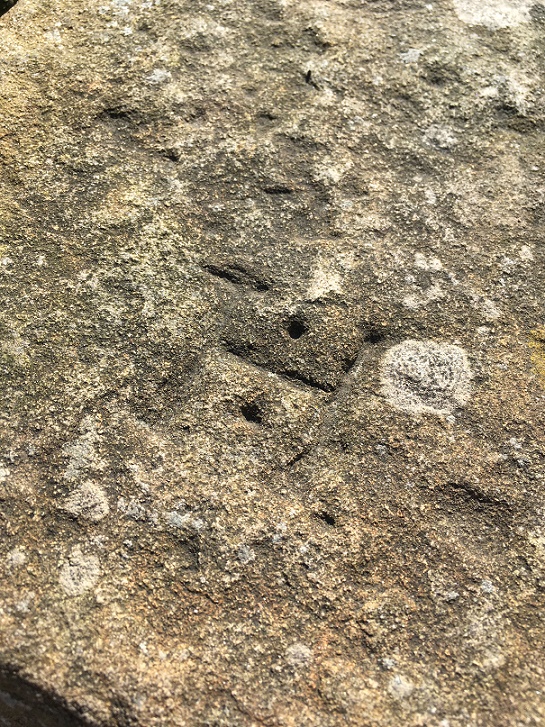
We later came across this stone with the letter ‘H’ carved on it, and being a connoisseur of such graffiti, I had to collect it.

What5
A Hague Street ‘H’

It’s nicely executed with a flourish of decoration in the form of drilled holes between the arms of the ‘H’ – I’d give it a 7/10.

Right. That mystery object… did you get it? I believe you, honestly!

Ok, well, it’s a cheese press. Yes, you read that correctly! A cheese press. A thing for squeezing the whey out of cheese curds. Well, technically, it’s half of a cheese press – it’s missing the right half.

The square hole on the left is to house an upright pole which, along with another on the right, now missing, held the pressing weight in place. The circle and lines carved into the surface allowed the whey to run off, leaving behind the solids which are then matured to make cheese. Cheese was home made, or at least farm made in small batches, until relatively recently, so the press must  have belonged to a farm nearby, as you aren’t going to shift that stone any great distance, when others, closer, would do to fill a hole.

What
The mystery object again.

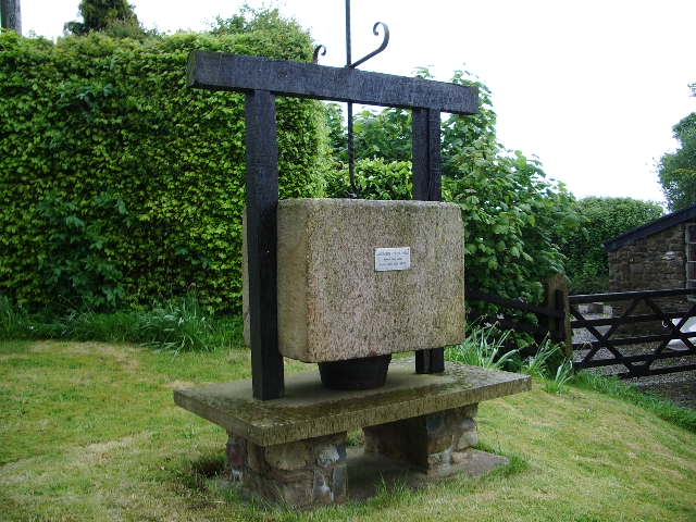
Here’s a complete one in Bashall Eves in Lancashire:

What Lancashire_Cheese_Press_-_geograph.org.uk_-_431556
Cheese press in Lancashire, and used to make, well, Lancashire Cheese. Image shamelessly stolen from Wikipedia.

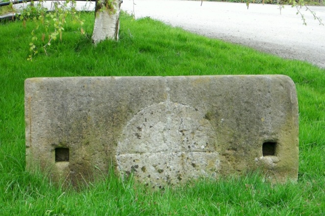
  And here is another one carved in the same manner as ours:

cheese-press
The cheese press in Draycott in the Moors churchyard. Photograph is courtesy of their local blog, and I hope they don’t mind me stealing it – please visit the blog here, it’s very good.

This one caused a bit of confusion, apparently – read all about it at this wonderful blog.

In terms of date… who knows? Certainly not hugely old – possibly Victorian, but equally possibly earlier. The only other one I have seen (which is how I know what it is) is propped up where I work at The Blackden Trust, and was in fact carved on the reverse of an old gravestone dated to the early 18th century, which at least gives us a date to work with. I’m going to write a little more about this soon, as it involves two of my greatest loves – archaeology and cheese… if we could just work in wine somehow, then it would be perfect.

Incidentally, the press is currently being used to fill a pot hole in a trackway, which I think is a shame. Sigh… I’ll add it to the list of historical objects things that need to be hoiked out and displayed properly (along with Whitfield Cross and the Whitfield Guide Stoop) – I think it would look great displayed at the wells. Seriously, I think we need to do something about reclaiming our heritage, as it is being slowly eroded. The guide stoop is currently under 3ft of soil, and looks like it will be left like that, So then, who’s with me?

Right. I’m off do some more gardening.

Please stay inside and stay safe, and take care of yourselves and each other.

More soon, I promise, but until then I remain,

Your humble servant,

RH

Domesday Book · Placenames · Towns of Glossop

What’s In A Name?

The thought occurred to me after publishing the previous blog post – what do the names of each of the manors of Longdendale mean? And I thought you, gentle reader, might also be interested.

I find placenames endlessly fascinating, and there is something magical about the origin of a name, whether traced back in the prehistoric period (‘Celtic’ placenames) or of a more recent coinage (Victoria Street, for example, named after Victoria Wood, of course…). Moreover, once you name a place it becomes familiar, and less scary, allowing you to find your place within, and manoeuvre your way through, the landscape. It is also a fundamental aspect of human behaviour: by naming the land, you are taming the land.

We have a huge number of influences in placenames in this area: Celtic, Saxon, Norse (Viking), Norman French, vernacular and slang English, and Welsh, to name a few. All of which mix together to create the landscape, and the places within, we know so well.

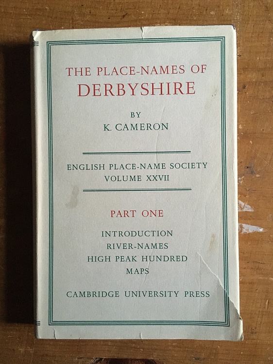
So then, using the 3 volume set of The Place-Names of Derbyshire by Kenneth Cameron, and some other sources, I set about finding out.

Names2
It may not appeal to everyone, but honestly this is absolutely fascinating book, if flawed due to the large number of placenames, field names, brook names, etc. that have been omitted.  
  • Longdendale

First mentioned in Domesday Book of 1086 as Langedenedele, then Langdundale (1158), and Langdaladala (1161). This is a classic example of a tautology, caused by the naming of a place by someone who didn’t understand the original name. The origin is Lang Denu, ‘the long valley’, to which at some stage someone added the unnecessary ‘Dael‘, meaning ‘valley’ – thus Longdendale means ‘the long valley valley’.

  • Glossop

First mentioned in Domesday as ‘Glosop’. The Book of Fees of 1219 records it as ‘Glotsop’, and in 1285 it is given as Glosshope. Cameron gives the etymology as Glott’s Hop – Glott’s Valley – The valley (Hop – think Hope, as in Hope Valley) belonging to a man named Glott. Relatively straightforward then. Probably. Other theories are available. Mike Harding, the folk singer, thinks Glott should be read as ‘Gloat’, in which case it is the ‘Valley of the Gloater or Starer’, a reference to the numerous carved stone heads that were, and still are, relatively commonly found in the area (a subject of much debate, and a future blog post). This seems a little too convenient and smacks of mystical wishful thinking, but is still worth considering. It is also a possibility that ‘Glos’ is a derivation of the Welsh ‘Glwys’, meaning silver or grey, in which case it would mean ‘Valley of the Stream called Glwys”, which presumably would be Glossop Brook. Ultimately, I am going to go for Cameron’s ‘Glott’s Valley’ as I think it makes more sense.

  • Charlesworth

First recorded in 1086 in the Domesday Book as Cheuenwrde, then as Chavelesworth (1285), Chasseworth (1285), and Challesworth (1552). The meaning is either ‘Ceafl’s enclosure‘, the enclosure (worth) belonging to a person called Ceafl, or ‘Ceafl enclosure‘, which would mean ‘the enclosure near the ravine (ceafl)’. This might conceivably refer to the valley of the Etherow, particularly as it nears Broadbottom, but it is unclear. On balance, I prefer the simple ‘the enclosure (worth) belonging to a person called Ceafl’.

  • Chisworth

First recorded in 1086 in the Domesday Book as Chiswerde, then as Chisteworthe (1285), Chesseworth (1285), and Chesworth (1634). The meaning is simple – ‘Cissa’s enclosure’, the enclosure (worth) belonging to a person called Cissa.

  • Hayfield

First recorded in 1086 in the Domesday Book as Hedfelt (the same as that at Hadfield below), then Heyfeld (1285), Heathfeld (1577), and Magna Heyfeld (1584 – as opposed to Little Hayfield). Cameron discusses the possibility that there is some confusion regarding this name. In the Domesday Book the meaning is ‘Haed Feld’ – ‘heathy open land’, but the later, Middle English, forms seem to suggest ‘the field where hay is obtained’. Actually, I would suggest that two aren’t incompatible as land use may have changed over the course of 300 years – it is no longer heathy, and instead is more, well, hay-y.

  • Chunal

First recorded in 1086 in the Domesday Book as Ceohal, then as Chelhala in 1185, and Cholhal in 1309. The origin is Ceola Halh, which means either the ‘the neck of land belonging to a person called Ceola’ or ‘the neck of land by the ravine’. I personally favour the latter, with the ravine here being Long Clough Brook.

  • Whitfield

First recorded in 1086 in the Domesday Book at Witfelt, then as Wytfeld (1282), Whitefeld (1283) and Whytfelde (1294) in various Inquiries Post Mortem. It is also recorded as Qwytfeld in a land deed of 1424 pertaining to one John del Boure (Bower) of Qwytfeld. The meaning is ‘Hwit Feld‘ – open (figuratively ‘white’) land or field, presumably to differentiate it from the surrounding moorland.

  • Hadfield

Relatively straightforward, this one. First recorded in 1086 as Hetfelt, and later as Haddefeld (in 1185), Hadesfeld (in 1263), and Hettefeld (in 1331), it is derived from ‘Haed Feld’, meaning ‘heathy open land’ – literally, a heath field.

  • Padfield

Also relatively straightforward. It is first recorded in the Domesday book of 1086 as Padefeld, and in 1185 as Paddefeld. It means either the ‘open land (feld) belonging to a person called Padda‘, or an ‘open land where the toads live’, from the Old English ‘Padda‘ meaning toad. I like toads and frogs so I’m going with that, but you decide as you see fit.

  • Dinting

This one is more difficult. First recorded in the Domesday Book of 1086 as Dentinc, and then Dintyng in 1226, and Dontyng in 1285. It is also almost certainly the Dontingclought (Dinting Clough or Dinting Vale, as we now know it) mentioned in the Forest Proceedings of 1285. However, the meaning of this name is difficult to uncover. Cameron suggests that the first part of the word “Dint” is Celtic in origin, but can offer no meaning for the word. The second part ‘ing‘ is commonly encountered, but is complicated as it has many possibilities in its meaning. Here, it either means the ‘place of the Dint‘ (whatever Dint means), or it denotes an association of a person to the place or feature, so here it would be ‘Person X’s Dint‘ (again, whatever Dint means). The other (original… real) Robert Hamnett suggests that the name is made up of two elements – the Celtic word ‘Din‘ meaning ‘camp’, and the Norse ‘Ding‘, meaning ‘council’, thus it means the ‘council camp’, or a place where people meet to discuss law and other matters. Perhaps then we have our meaning – ‘the camp belonging to person x‘, or the ‘place of the camp‘. This latter may well be more likely, given that Dinting as we know it is at the foot of Mouselow Iron Age hillfort.

  • Kinder

This one is similarly difficult to pin down. First recorded as Chendre in the Domesday Book, then Kunder in 1299, Kynder and Kyndyr variously in the 13th and 14th centuries, and Chynder in 1555. Cameron suggests the name is “pre-English”, that is pre-Saxon and thus probably Celtic. He offer no explanation for its origin, as the “material is not adequate for any certain etymology”, alas. Still, the fact that the name is essentially Iron Age in origin is quite important.

  • Thornsett

First recorded in 1086 in the Domesday Book as Tornesete, then as Thorneshete (1285), Tharset (1577) and Thorsett (1695). The meaning is very straightforward – Thorn Tree Pasture.

  • Ludworth

First recorded in 1086 in the Domesday Book as Lodeuorth, then as Ludeworda (1185), Loddeworth (1285), and Luddeworthe (1330). The meaning is very simple – Luda’s Enclosure, the enclosure (worth) belonging to a person called Luda.

That concludes the 12 manors of Longdendale. However, I thought I’d also include Simmondley – even though it’s not one of the original 12, it is one of the towns that make up Glossop as we now know it. Plus, I know people who live there and don’t want them to feel left out.

  • Simmondley

First mentioned in the Forest Proceedings of 1285 as ‘Simundesleg‘, and then later as Simondeslee, the origin of the name is “the clearing (or ley/legh) in the forest belonging to a man named Sigemund or Sigmundr (an Old English or Scandinavian [Viking] name) – Sigemund’s Legh = Simmondley.

And there you have it.

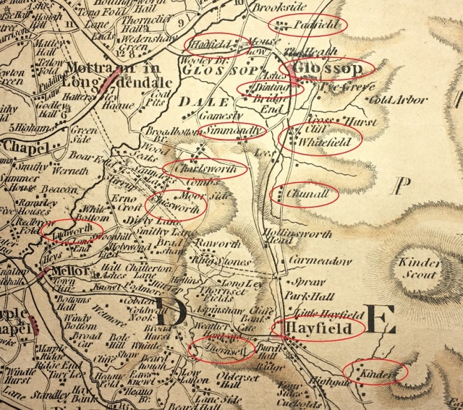
Names1
Here are the 13 (+1) placenames discussed above, illustrated here on a 1794 map.

Well that was fun! I’d like to do some more exploring of names the area; we have a rich tapestry of placenames in England, brought to us from hundreds of different sources, and recorded in countless documents, maps, letters, deeds, books, and memories, and this area seems to be richer than others. So if you enjoyed this, then watch this space. As always comments, questions, offers to buy me a drink, are all welcome.

And as always, I remain,

Your humble servant,

RH

Domesday Book · Towns of Glossop

Glossop In The Domesday Book

What ho, and all that.

Today’s post is one I have been meaning to do for a while – Glossop in the Domesday Book. I have been picking away at this one for a few months now, and finally I spent a bit of down time finishing it off. I must say I enjoyed writing it, and I really had to do some homework… which was fun. Hope you enjoy.

The ‘great survey’ of England (and parts of Wales) that would eventually become known as the Domesday Book was commissioned by William the Conquerer and completed in 1086. According to the Anglo Saxon Chronicle of c.1100, it was a survey of “How many hundreds of hides were in the shire, what land the king himself had, and what stock upon the land; or, what dues he ought to have by the year from the shire.“. In essence, what had William actually won in his new kingdom, and more importantly for him, how much he could make in taxes. I’m not a fan of old Billy, as you have probably guessed, and although Norman England brought with it some good, it also brought widescale changes throughout society – lay and secular – some of which were not particularly great. Academic argument rages, and will continue to do so, but I cannot forgive William the Bastard, as he was known (he was the illegitimate son of Robert I, Duke of Normandy, by his mistress Herleva), and even by the standards of his day he lived up to the other meaning of his name. But he did give us this unparalleled piece of historical evidence

Great and Little Domesday Books today bound in five parts: two (above) for Great Domesday and three (below) for Little Domesday; Catalogue reference: E 31/2/1-2 and  E 31/1/1-3
The Domesday ‘Book’, now in 5 volumes at the National Archives in Kew.

Actually, the survey was undertaken and published in 2 parts – the ‘Little Domesday’, which covered Norfolk, Suffolk, and Essex, and the ‘Great Domesday’, which covered the rest of England and parts of Wales. Incidentally, the title Domesday Book, though not contemporary, is derived from the fact that the details recorded in it were as serious and as unmoving as the decisions made by God on the Day of Judgement – Doomsday. Also, as an interesting aside, my grandfather told me that he once had reason to be working at the Public Record Office in London, and that whilst there he found himself in the storeroom where the Domesday Book was then being kept. With a pound note pressed into his hand, the guard on duty opened up the high security box, and allowed my grandfather to place his own hand on the actual Domesday Book. But I digress…

So then, Glossop and area in the Domesday Book. The reference within the book is in Derbyshire, Chapter 1 (Land Belonging to the King), paragraph 30, and comes under the heading ‘Longdendale’.

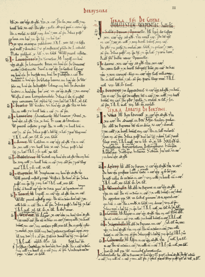
Here is the page:

Dom
The page from the book that contains Longdendale (top left)

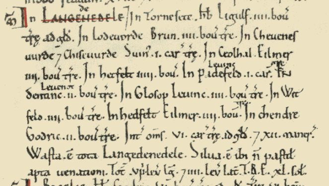
And here is Longdendale as it was recorded in the book:

12973-1
Here we are in the nearly 1000 year old book. Quite remarkable.

The above image is courtesy of this phenomenal website which has digitised the whole Domesday Book, with all sorts of notes and details. Go and explore this fascinating document, and priceless item of English history.

I’ll give you the complete transcription, translate, and then discuss what it means.

In LANGEDENEDELE. In Tornesete. Hb. Ligulf. iiii bov. Tre ad Gld. In Lodeuorde, Brun. iiii bov. tre. In Cheuenesuurde Chiseuurde. Suin. i car. tre. In Ceolhal. Eilmer iiii bov. tre. In Hetfelt iiii bov. In Padefeld. Leofing i car. In Dentine. Leofnoth. ii bov. tre. In Glosop Leuine. iii. bov. tre. In Witfeld. iiii. bov. tre. In Hedfelt Eilmer. iiii. bov. tre. In Chendre. Godric. ii. bov. tre. Int. oms. vi. car. tre ad gld. Xii maner. Wasta. e tota Langedenedele. Silua. e ibi n pastit apta uenationi. Tot viii. leg lg. iiii. lev lat. T.R.E xl. sol. 

  • In Thornsett (Tornesete), Ligulf had 4 bovates of land that were taxable.
  • In Ludworth (Lodeuorde), Brown (Brun) has 4 bovates of land that is taxable.
  • In Charlesworth (Cheuenesuurde) and Chisworth (Chiseuurde), Swein (Suin) has 1 carucate of land that is taxable.
  • In Chunal (Ceolhal), Aelmer (Eilmer) has 4 bovates of land that is taxable.
  • In Hadfield (Hetfelt), Aelmer (Eilmer) has 4 bovates of land that is taxable.
  • In Padfield (Padefeld), Leofing has 1 carucate of land that is taxable.
  • In Dinting (Dentine), Leofnoth has 2 bovates of land taxable.
  • In Glossop (Glosop), Leofing has 4 bovates of land that is taxable.
  • In Whitfield (Witfelt), Leofing has 4 bovates of land that is taxable.
  • In Hayfield (Hedfelt), Aelmer (Eilmer) has 4 bovates of land that is taxable.
  • In Kinder (Chendre), Godric has 2 bovates of land that is taxable.

Phew! Right… so what on earth does that mean? Well, Longdendale (Langedenedele as the book has it) is first broken down into areas, then who owns these areas is recorded, followed by the amount of land that is taxable – the Domesday book is essentially a tax record of how much William stood to gain from the invasion, after all. However, here, recorded for the first time ever, are the names of the places we know well. And I am struck immediately by how similar they are… stick a decent Glossop accent onto them, and they haven’t changed at all – Whitfield and Hadfield in particular! And I love the Saxon names, too. Aelmer and Leofing are the big landowners around here with 1 1/2 and 2 carucates of land respectively, and so are probably quite wealthy and with good lands. Poor Godric is stuck out in the wilds around Kinder, where it is difficult to see where his 2 bovates of taxable land could be located. Which brings us on to the next question… what the hell is a bovate? Or, for that matter, a carucate?

They are both ancient measurements of land area. A bovate (also known as an oxgang) is technically the amount of land a single ox could plough in a single season – somewhere around 15 acres depending on land and animal. However, a plough is normally driven by a team of 8 oxen, and the amount this team could plough in a single growing season is known as a carucate. Thus, a bovate is one 8th of a carucate. Now, I struggle to picture area, so the idea of a large area defined by how much work an animal does is, quite frankly, baffling.

Following the register of places and taxes, there is a general description of the area.

  • Between them 6 carucates of land is taxable, and 12 manors

Each of the 12 manors (the areas named above) would have had a manor house to go with it, and one wonders where they are. I have a few ideas, but there is no way of knowing without excavation. One can imagine Leofing, beer cup in hand, sitting on a chair in the centre of his house – effectively a large open hall in which multiple people ate, drank, slept and lived around a central fire pit, the smoke from which would have dissipated amongst the thatch or turf roof, as there were no chimneys in the 11th Century.

12 Manors
The 12 manors of Longdendale circled in red. Thanks to Google

Looking at the above map, I am struck by two things. Firstly, how almost all of the manors are situated on major roads (Whitfield is on the old road to Glossop, before it was diverted to what is now Glossop town centre), and how they are all still recognisable and distinct places. The one glaring exception is Kinder, which ceases to be a ‘place’ as such after the Medieval period; one presumes that it is in the area of the houses and farms on Kinder Road, but further research is needed.

Then there is the single word ‘Wasta’. Waste.

  • “All Longdendale is waste”.

Following the invasion of 1066, the North of the country – Cheshire, Derbyshire, Lancashire, Staffordshire, and Yorkshire – rebelled against the French king. William the Bastard chose to teach them a lesson over the winter of 1069-1070, and operated a ‘scorched earth’ policy of complete destruction of all villages, property, crops and people – the ‘Harrying of the North‘ as it is now known. There is some debate about the extent of the destruction, but there is no getting away from the fact that he utterly destroyed huge swathes of the North in revenge, and North Yorkshire in particular, with refugees from there mentioned as far away as Worcestershire. The effect was such that 16 years after the Harrying, Yorkshire had only 25% of the people and oxen that it had in 1066. The almost contemporary historian Ordericus Vitalis (basing it on contemporary descriptions) describes it thus:

Nowhere else had William shown such cruelty… In his anger he commanded that all crops and herds, chattels and food of every kind should be brought together and burned to ashes with consuming fire, so that the whole region might be stripped of all means of sustenance. In consequence so serious a scarcity was felt in England, and so terrible a famine fell upon the humble and defenceless populace, that more than 100,000 Christian folk of both sexes, young and old, perished of hunger”

The word ‘Waste’ here in Longdendale is the result of this destruction – the valley, never particularly prosperous, or indeed populous, was laid waste… the Bastard burned the place to the ground. This is an astonishing fact, and that one word – waste – resonates. Indeed, as you read through the Domesday Book entries for the surrounding areas, the phrase crops up time after time “it is waste”.

Moving swiftly on.

Longdendale is then described as “woodland, unpastured, and fit for hunting” – which is better than some of the Trip Advisor reviews for places in Glossop – and the fact that it is “8 leagues long, and 4 leagues wide” (roughly 24 miles by 12 miles).

The entry in the Domesday Book finishes with letters “T.R.E. xl. sol.”. T.R.E. stands for ‘tempore Regis Edwardi’ – that is, in the time of the reign of Edward the Confessor, and refers to the worth of the land in the time immediately prior to the invasion. In 1066, Londendale’s worth (in terms of taxes) was 40 Shillings (represented in the book by the Roman numeral ‘XL’ for 40, and the abbreviation ‘sol’ for ‘solidus’ or shilling. 40 Shillings is not a lot, comparatively, and must surely represent the poor quality of arable land in these parts, as well as a lack of mineral resources.

Now, what is interesting, is what is left out. For example, there is no mention of people – freemen, villagers, smallholders, etc. – and we are left with the impression that there is no one here. Yet just over the hill, in Hope, we read that “30 villagers and 4 smallholders have 6 ploughs. A priest and a church to which belongs one carucate of land” and that “before 1066 these 3 manors paid £30, 5 1/2 sesters  of honey, and 5 wagon loads of 50 lead sheets. They now pay £10 6s.” Clearly in Hope the invasion had had an effect – they now pay £20 less in tax, so one assumes there is less there now that is taxable – but there are people there, in 3 manors. So it seems odd, then, that Longdendale, despite having 12 manors, has no mention of people. It may be poor record taking by the surveyors, or it may be more sinister – Longdendale is the main route west out of Yorkshire, after all. The other oddity is that there is no mention of the church. It is possible that Glossop Parish Church is of Anglos Saxon origin, there is no evidence for this, and the lack of a mention in the Domesday Book is also quite telling. Which begs the question… where was the nearest church? Hope? That’s quite a journey to be made every Sunday, but I can’t think of anywhere else nearby.

So there we have it, Glossop’s debut in the historical record. One wonders where exactly Glossop was at the time – certainly not Howard Town, but perhaps Old Glossop. There is the suspicion that it may have been further out, toward Shittern Clough and Lightside along Doctor’s Gate, but again, we can’t be certain without excavation.

Anyway, I hope you enjoyed this little romp around Early Medieval Longdendale, As always, any comments, questions – or even abuse from pro-Norman activists – are all very welcome.

Until next time, I remain.

Your humble servant,

RH
Archaeology · Pottery · Towns of Glossop

Lean Town Part 2 – The Finds

Welcome back to Part 2.

I love Lean Town – it’s a good walk from my house (even Master Hamnett can do it with the minimum of fuss… mostly), and yet feels oddly distant. The houses are beautiful, and I sometimes feel a tiny pang of jealousy as I pass, so it’s nice to finally do this blog post that has honestly been years in the making. Part 2 is the finds.

LT2
Lean Town from the bottom.

As you can see from the above photograph, the houses are perched on the edge of a steep slope. Now, in the Victorian period, there was no rubbish collection – all household waste that couldn’t be fed to livestock, burned in the fire, reused, repaired, sold for scrap, or spread on the food crops, had to be disposed of by the individual. Now, I’ve probably mentioned this before, but humans are essentially lazy creatures. Almost as a rule, they will take only two considerations into account when disposing of rubbish: 1) can I see it? 2) can I smell it?

With this in mind, you can usually tell where a waste dump – or midden – will be by studying the area and asking a simple question: where would I put the it to get it out of my sight and smell, but with the minimum amount of hassle? Houses, situated on a steep slope, hmmm… there’s only one place they would chuck it. Any thoughts?

That’s right, well done, you guessed correctly and win a sherd of pottery (please email me with an address if you want it… I have many!). Over the back wall went the rubbish, and on the footpath below that wall went I. And by Jove, what a trove! This was all lying on the surface on the footpath that would have originally led from the houses to the well. Between myself and Master Hamnett we cleared out all we could see, but wait for the next rainfall, and more will pop up.

LT - p
A proud parent! Master Hamnett was so excited to be picking the pottery up, stuffing it into his pocket, and walking along holding some in his hand. Like father like son…

So, what did we get? The short answer is masses of early Victorian to Edwardian bits and pieces – woo hoo! I divided the slope area into two sections: one directly below the back wall of the houses, and one a little further west along the slope.

LTP1
The assemblage from below the houses. Very impressive, and with some interesting bits in it.
LTP2
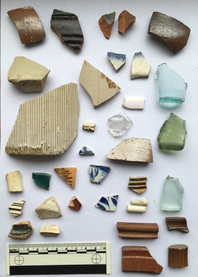
The assemblage from further west, also impressive.

Truthfully, they are both rubbish dump areas from the same set of houses, but old archaeological habits die hard, and it is easier to keep them separate than it is to re-separate them if I needed to after joining the groups. In pottery analysis we call this “splitting” as opposed to “lumping” – once lumped, pottery is almost impossible to split.

I’m only going to discuss the ‘interesting’ sherds here – there is a lot of it (see pictures above), and life is too short. As a pottery specialist, I have a system that I follow when studying pottery, the short version of which is that I look at only ‘feature’ sherds (bases, rims, handles, and decorated sherds), and discount the rest (there is also a very much longer version, believe me… I can talk for hours about it).

So then, here we are with the interesting bits. First up, below the houses:

LTP3
The interesting bits from directly below the houses.

Top row: glass side to a square sauce bottle – possibly HP sauce, but certainly very common in the Late Victorian period; one can’t help but think their food was quite bland. Upper rim is from an open bowl, possibly a cooking pot. It measures 20cm in diameter, and is glazed in what appears to be a slip-ware glaze, which puts it late 18th early 19th century. Lower rim is from a stoneware open bowl with a flat lip, measuring 24cm in diameter – probably a mixing or serving bowl, and mid-19th Century in date. Next to that, the top to a stoneware ink or beer bottle, mid to late 19th Century – I love this, aesthetically, it just so pleasing. Next to that a very fine impressed mug or tankard, 10cm in diameter, with purple glazed body. This is very delicate and fine, and the impressed pattern is lovely, it’s possibly Wedgwood, but if not it would nonetheless have been expensive – which makes me think.

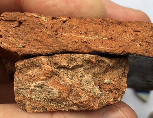
On the left we have a large sherd from a pancheon (a large milk or mixing bowl), with the interior, rim, and upper exterior surface glazed. Here we can see the upper exterior, with the classic dripped surface, which, rather than it being the result of a mistake, is a deliberate decoration. This example is very interesting, as it has been given a manganese ‘mottled ware’ glaze, rather than the usual black, which makes me think this is an early example – mid to late 18th Century, I would say. You can see a more common black example next to it, complete with external drips. Sherds from pancheons are quite common, due in part to most people having one, but also to the fact that they are large (larger examples can be 60-70cm across), which means they produce many sherds when broken. The clay they are made from is always reddish-orange, with pale yellow or grey folds badly mixed into it – don’t ask me why, but it is always so.

LTP6
Greyish yellow folds within the clay. Is it odd that I find that quite appetising? Actually, perhaps a more important question is should I have shared that information with you, gentle readers?

Above the black pancheon sherd is a sherd of our old friend the feather edged ware bowl. It is another rather nice pearlware vessel, measuring perhaps 20cm in diameter, and was probably a shallow bowl with a flat edge. I have recently done some research on this type, and suggest a date of 1800-1830 for when this was made, which fits perfectly. A quick archaeological aside: when made, and when thrown away are two very different things – I have some of my grandmother’s crockery which I still use, and which must be at least 70 years old. Heirlooms like this do crop up in archaeology, and can cause problems, but generally, I would suggest that 10 years is probably a good innings for an average plate or bowl, especially when you remember there were few carpets and a lot of stone flagged floors.

The green glass fragment has the letter ‘F’ impressed on it, and is late Victorian or later. Next to that is a base to a delicate pearlware eggcup, measuring 4cm. Again, this is quite nice, as is the pearlware base and rim next to it (rim diameter of 18cm so a small plate or soup bowl). There are some spongeware sherds, and some blue and white transfer printed bits, including a green example which quite frankly shows how crappy some of these mass produced pots are – if you look closely, this one has a broken transfer roughly fitted together before being glazed. Above this, there is a moulded base to another very fine 18th Century tankard or mug. Below that, there is a creamware moulded bowl rim, probably quite early (1790-1800?), and again probably quite expensive. Finally, we have a group of stoneware vessels – bowls, storage jars, and the like. These are fairly standard, with impressed decoration (flowers, rouletting, and undulating lines), and date to, well, the Victorian period – made continuously, they were very utilitarian and common.

Next…

LTP4
The interesting bits from further west.

Top left, is a large, rounded stoneware bottle or closed shape of some sort – beer, perhaps? Certainly Victorian in date. Next to it is a black ware sherd, with an inscibed decorative band on the exterior, and dating to the late-18th and early 19th centuries. The shiny glaze is the result of lead being added. Far right on the top row is a salt-glazed stoneware sherd, again from bottle, and you can just make out where it forms into the neck. This is interesting, as it looks like it is a continental stoneware – imported gin, perhaps? Below that is a base fragment from a small sauce or syrup bottle – the glass is early, judging by the colour, so perhaps mid-Victorian, but do continue into the 1920’s. These are normally hand blown into a mould, and have a rough rim where it is cracked off the mouth piece – check out a good example here. Actually, the whole website What The Victorians Threw Away is an amazing resource – essentially run by another lunatic like me, if you like this blog, you will love that whole project… it’s basically what I would like to do if I had the time and money (donations always gratefully recieved!).

To the left of that is a pair of feather edge fragments, both on a pearl ware background, and both of the same age as the above example. Below these is a clear glass cup with a handle; it’s moulded not cut glass, but is nonetheless quite nice and fancy.  Below and left of this is a sponge ware sherd, possibly from a plate, and probably dating to the 1850’s. Above that (ignoring the tiny sherd) is a large fragment of a stoneware jam jar, and to the left of that is a large stoneware storage jar. The base diameter of this is 20cm, which makes it a monster – possibly a cider flagon, or similar. What is interesting is that it has a lot of wear on the bottom, meaning that it has been taken off and on a shelf or floor many times, and suggesting that it was refilled.

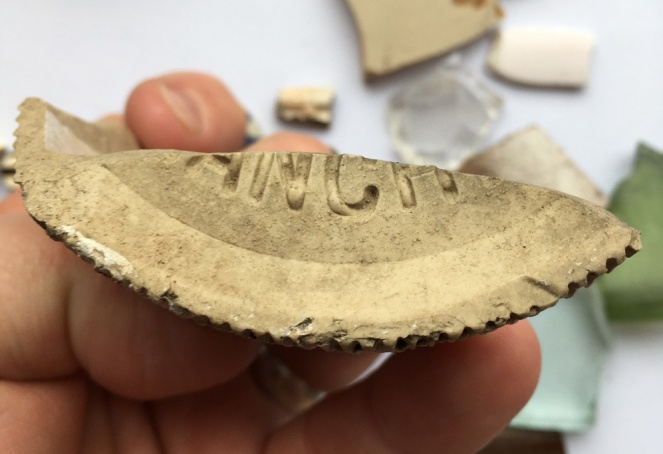
Below that is a large, roughly made, sherd from a large (2lb) stoneware jam jar, with the characteristic vertical fluting – once recognised, always seen! This has part of the base intact, with the words “ANCH” impressed into it.

LTP9
I love it when I come across words. You can see clearly the stoneware fabric, and the glaze peeking through from the sides of the jar

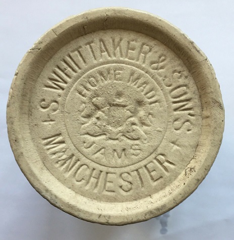
Unless it was ‘ANCHOVIES’, this could only be “MANCHESTER”, and thus it has to be a Whittaker & Son’s jar, the base of which would have originally looked like this:

LTP7
You can buy this one on ebay.

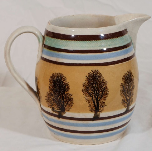
Love it! Moving on, below this, there are some random sherds, including four interesting ones. Top right, with the black tree on a brown background, is actually from a Mocha Ware pot, and would have originally looked something like this:

LTP10
Mocha Ware. I can’t make up my mind whether it is truly hideous or whether I like it?

The tree like effect is created by applying, amongst other things, tobacco juice to the slip, where it spreads to create the effect you can see. In terms of date, it begins to be made in the late 18th century, but this is probably early Victorian. There are other Mocha Ware sherds throughout the pile I found in Lean Town (for example, the sherd immediately below this one, or the two sherds below the bottle top in the first photograph), so it seems to have been quite popular here.

In the middle of the group is a base to a pearl ware bowl – quite fine, again, and small, with a base diameter of 6cm. Bottom left is an open bowl of mid-late 18th century date, in a slip-ware glaze. Right of that is another very fine tankard with a moulded base, and dating again to the late 18th century. To the right of the group, there is a delicate blue painted porcelain fragment, again thin and very fine, and quite expensive. To the right, we have some clay pipes – nothing interesting there, I just like them! Below them there is some more of the brown glazed stoneware – bowls and jars, and including a handle from a hefty jug, which in my mind was filled with frothy home-made ale (but then, to be fair, most thing in my mind are).

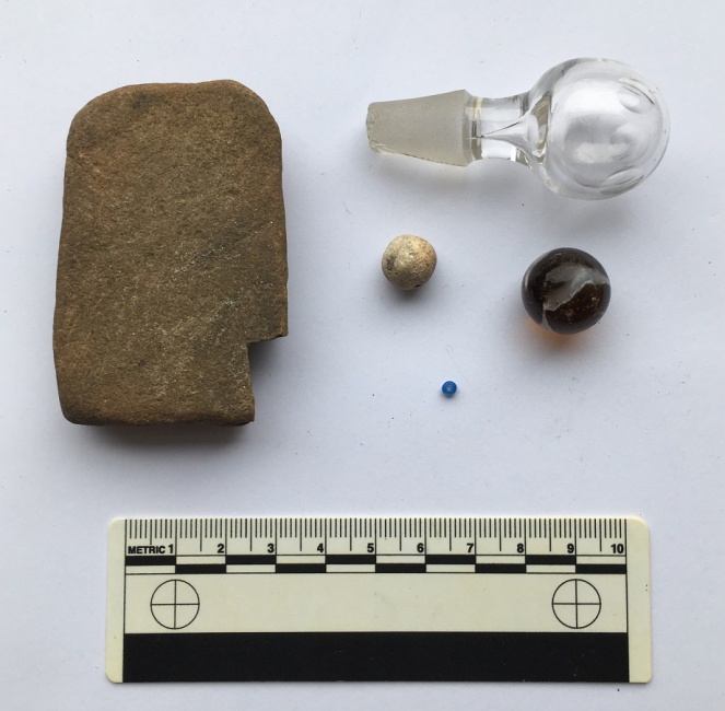
That’s the end of the pottery, but now for the other material. In archaeology we make a distinction between what we call ‘bulk finds’, that is, material (usually pottery) that occurs in large quantities, and ‘small finds’, which are individual items, unique to the site or objects that can tell us more about the site than the bulk finds. Often there is overlap – a piece of pottery with an inscription, for example – and usually the small finds are what most people would call ‘the goodies’! And so it is here:

LTP5
The small finds.

The stone on the left is, I think, a whetstone, used for sharpening knives. It is flat on both sides, worn on the surface and edges, and is the perfect shape, size, and stone type. It was probably discarded after being dropped and broken. Top is a glass stopper from a rather nice serving jar or wine carafe. It’s very delicate and beautiful – hand blown and hollow, with delicate cuts to give it a texture and grip around the top. Below this are a pair of marbles – right is brown glass with a white ribbon running through it – it’s worn, well loved, and certainly late Victorian. Left is a small, roughly made, ceramic marble, partly glazed and misshapen. Possibly early Victorian in date. Bottom is a tiny (2mm) glass bead, possibly from a decorated bag or similar. It’s lovely, and one assumes it was lost in the house, swept up, and thrown away with the rubbish. Don’t ask me how I spotted it… it just stood out against the soil.

So there we have it, Lean Town via the rubbish it once threw away, but what can we say? Firstly, the date. A lot of the material dates to the late 18th and early-mid 19th century, that is to the first decades of people living in the houses here. This is interesting, and suggests perhaps that in the late Victorian period, they buried most of their rubbish elsewhere. The second thing that stands out is the quality of the material – it better than you would expect from a simple worker’s household – some of it is very fine and tasteful, and it seems to have been expensive. Certainly the fine tankards, and the possible Wedgwood cup were, but also things like the glass stopper, the porcelain, and the pearl ware – not what I would expect from a humble mill worker’s house. I would suggest that after building it, Elizabeth Hampson lived here, or if not her, then someone like her – someone fairly well-to-do with taste. A little more research might reveal much more.

*

And finally, of course, what’s a blog post without a brace or two of benchmarks? There were several marked on the map:

Lean BM1
The upper part of the lane and…
Lean BM2
The lower part of the lane, including Lean Town itself and the footbridge.

Number 1 was easy to spot, although I suspect that the wall has been rebuilt, so it might not be in exactly the correct spot. Nonetheless, excellent work by whoever rebuilt the wall to include the benchmark – very conscientious! Here it is in all its glory.

LTBM1
This is what 705ft above see level looks like. Probably. I love the veining on the rock its carved on – each line representing a splashing wave laying down sand on a beach millions of years ago. Wow, that got deep!

Number 2 was also an easy spot, on the wall leading down.

LTBM2
This one is a bit worn, and seems to have been made sometime in the 1950’s or 60’s, as it doesn’t show on the earlier OS maps, so we have to go metric for this spot height – 201.34m above sea level (which Google informs me is 660.5ft in old money)

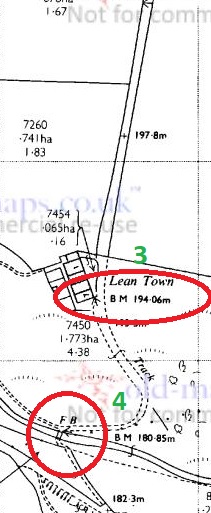
Number 3 should have been on the south east corner of the row of houses – I looked and couldn’t see anything (I didn’t look closely – nobody wants to be ‘that man who peered over our gate’, that’s how rumours start). According to this bench mark spotter’s website, the mark is definitely still there, but alas, I have no photo to show you.

Number 4, however, was there, on the stone base to the bridge across Bray Clough Brook.

LTBM4
The bridge has never struck me as being particularly old, and the bench mark doesn’t show on maps until the 1960’s, so I presume this is contemporary with Number 2 above. Anyway, here we are at 180.85m above sea level.

Bray Clough Brook joins Long Clough Brook a little farther upstream, and in turn it joins Glossop Brook at the bottom of Primrose Lane – I blogged about the confluence here.

Right then, I think that’s about it (I can hear you, you know, breathing a sigh of relief). I will try and be a bit more frequent in my posting… and try to tackle smaller subjects! When I started to write this, I really had no idea how large a post it would become! But there you go. Please, any comments and ideas are always welcome. More soon, I promise.

But until then, I remain.

Your humble servant,

RH
Towns of Glossop · Whitfield

Lean Town Part 1

Glossop is a town made up of towns, you may have noticed.

I have a blog post about 30% written that describes each of them, but briefly they are: Milltown, Jerry Town, Charlestown, Rough Town, Howard Town, Freetown, Top o’ th’ Town, and Lean Town, the subject of today’s blogpost.

Lean Town is Glossop’s lesser known ‘town’, but is the most easily defined – it is simply a row of terraced houses in Whitfield, at the end of an unnamed track that comes south off Hague Street.

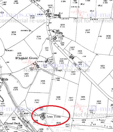
Lean Town 2
Hague Street runs NW-SE, and an unnamed road runs due south from Hague Street, to Lean Town (circled in red).
LT1
Lean Town from the south east. the path down to Bray Clough is behind the camera.

The name origins are obscure, and even the usually reliable Robert Hamnett states “why it is called Lean Town, I have never been able to find out” (and he normally knows what he is talking about, does that chap). A number of possibilities present themselves. The ‘Town‘ element is easy and obvious “a township, or community“, in this case used loosely to describe the small group of houses. ‘Lean‘, however, is a bit more difficult. I have always thought it refers either to the land hereabouts – lean in the sense of not very good for growing crops – or the people living in the houses i.e. they were poor. Another possibility is that it refers to the houses ‘leaning’, that is perched on the edge of a steep hill, which they are.

LT2
You can get a feel for just how perched or ‘leaning’ they are from this shot, taken from what is essentially the floodplain for Bray Clough, behind me.

Annoyingly, it doesn’t feature in the 3 volume set of The Place-Names of Derbyshire at all, but then that is not surprising, as the book is woeful in its shortcomings, leaving out dozens of local place and brook names that I know of – there must be thousands more. However, looking in the much more comprehensive The Place-Names of Cheshire for similar sounding possibilities gives the following:

Lyng (Old Norse), ling, heather.

Given its location on the edge of the common land that was, and still is, covered in gorse and heather, I am now starting to lean* towards that as an explanation. Over time, Lyng, the name descriptive of the area, becomes Lean, and is then attached to Town – Lyng Town/Lean Town. Perhaps. Maybe.                                                                                                  *Pun fully intended.

LT3
Is this the origin of Lean? Heather and gorse just by Lean Town.

Anyway, let’s move on!

According to Hamnett, the houses here were built in 1806 by Elizabeth Hampson, a member of a well known local family, who were responsible for building large numbers of the houses in the Whitfield area. Originally there were four terraced houses of a typical late Georgian/early Victorian design, stone built, with stone mullioned windows, and a stone roof. I’m not sure how many houses are there now, or whether any have been knocked through – there are still four chimneys, though.

The date of construction fits nicely with what we know of the area, which was radically changed at the end of the 18th and early 19th centuries, when the area was enclosed. The process of enclosure saw what was previously ‘common’ land, available to all, was closed off and sold to private individuals. These landowners built walls around the fields, creating the landscape that we know so well; prior to this, the whole area was just open moorland and fields. Indeed, the gate to the moor here was situated at Lane End Farm – as the name suggests, here the lane, or Hague Street as we now know it, ended, and beyond it was just common moorland. With the sale came certain stipulations laid down in law, particularly the creation of roads, and many of the roads in this area were created at this time: Kidd Road (originally called Whitfield Green Road), Derbyshire Level (originally called Hurst Road), Hague Street, and even Gladstone Street. All were declared public carriageway, and were ordered to be 30ft wide (go get a tape measure and have a look!). The unnamed track, at the end of which sits Lean Town, was created in c.1813, it was declared a bridleway, and ordered to be 10ft wide. Presumably it replaced an earlier path down to the houses, unless the dates are slightly off. What is interesting is that the path marks the limit of the ‘ancient enclosure’ (that is, the medieval or early modern enclosures) – if you stand at the top looking down to Lean Town, all that is to the right of you is ancient, and to the left of you all was common land until the early 19th Century.

LT4
The walled space at Lane Ends Farm dedicated to Norman and Irene Greenhalgh of Lane Ends Farm. To the left is Kidd Road, to the right the unnamed path down to Lean Town.
LT5
Behold, the unnamed path down to Lean Town. A bridal path built in 1813 or thereabouts, and by law to a width of 10ft. It probably replaced an earlier path to the houses from Lane Ends.

Like I say, a huge upheaval – people lost their right to graze livestock, and even the right to cut peat for fuel for their stoves . The peat fields were moved much farther away, but I believe that residents of Whitfield still have the right to cut peat – don’t quote me, of course, and I’m not sure a multi-fuel burner could handle peat to be honest. There is an interesting account of the process of enclosure in Whitfield here.

If you look at the map above, you can clearly see marked ‘well’ at the end of a path from Lean Town. Now, having a thing for wells, I obviously set forth to see if anything remained. No, was the short answer. Here is the location, and the area is wet, but there was nothing that might be termed ‘well’. Ho hum.

LT6
The location of the Lean Town well. I’m not sure what was here originally – perhaps just a trough, or spring head, but there is nothing there now, alas.

Right ho, that’s the end of Part 1. Part 2 contains all kinds of goodies in the form of finds, (lots of) pottery, and bench marks… what’s not to love? Oh, and a witch! You can hardly contain your excitement, I know, and I feel the same. It’ll be up soon, honestly – it’s almost done.

Until then, I remain,

Your humble servant.

RH

Folk Tales · Postcards

Haunted House Update

Happy New Year, dear and gentle readers. The first post of a new decade is just a quick one to fill in the gap whilst I finish a much longer post on the subject of Lean Town… all will be revealed soon.

So, a few months back I blogged about some postcards I bought on Ebay, and one in particular really caught my attention. The blog post is here, if you want to refresh your memories, and this is the postcard that piqued my interest, and made me buy them from a chap in America:

Post11
Top oth’ Nab, Glossop, October 21st 1907.

I love a good ghost story – one of my absolute pleasures is reading MR James stories by the fire – so the writing on the card that read “this is the haunted house” sealed the deal of me buying the cards. In the original post I though that the hunted house might be Herod Farm.

Roll on New Year’s Day 2020, and slightly bleary eyed and thick-headedly (courtesy of the Goosefields – thanks again!), Clans Hamnett and Bowes ascended Whitley Nab from The Hare and Hounds. It blew the cobwebs away (and if I’m honest, knackered me out – new year’s resolution is to get fitter), but we made it – and this is the site that greeted me.

Haunted
Top oth’ Nab, Glossop, January 1st 2020.

It looked familiar. And then it hit me… the ridgeline of Coombes Edge, and the skyline… this was the haunted house photograph. The haunted house was, in fact, Herod Edge Farm, just off Monk’s Road – visible, just, in the trees, middle ground. Here’s a map.

Haunted 2
Herod Edge Farm is circled in red, my photograph was taken from the area of the green arrow, the original photograph was taken from the blue arrow, or thereabouts.

Compare the two photographs, and although it’s taken from a slightly different angle, there are so many features in common that I can say with certainty that this is the place. Herod Edge Farm is haunted… apparently. I wonder if they know? And more importantly, does anyone know the story of the haunting? I wonder if it is tied up with alleged ghostly Roman soldiers in the area? Someone must know – as I say, I love a good ghost story.

I should add that, since that post, a whole pile of information has been uncovered, largely by the ever helpful Charles Wynford Lodge (who is on twitter as @2hrTV, check him out). I will do a full re-write including all his information, as well as corrections and addenda on other previous posts, too. See, I do listen… honest!

In the meantime, I’m off to drink some of the stuff that nourishes and try and finish some other exciting work (oddly, involving a parrot and the High Medieval period… no, it’s not a set up for a joke). Oh, and the Lean Town post will be up and running very soon (it’s a two-parter!).

Until then, I remain.

Your humble servant,

RH