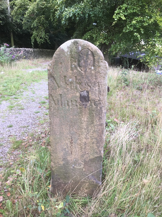
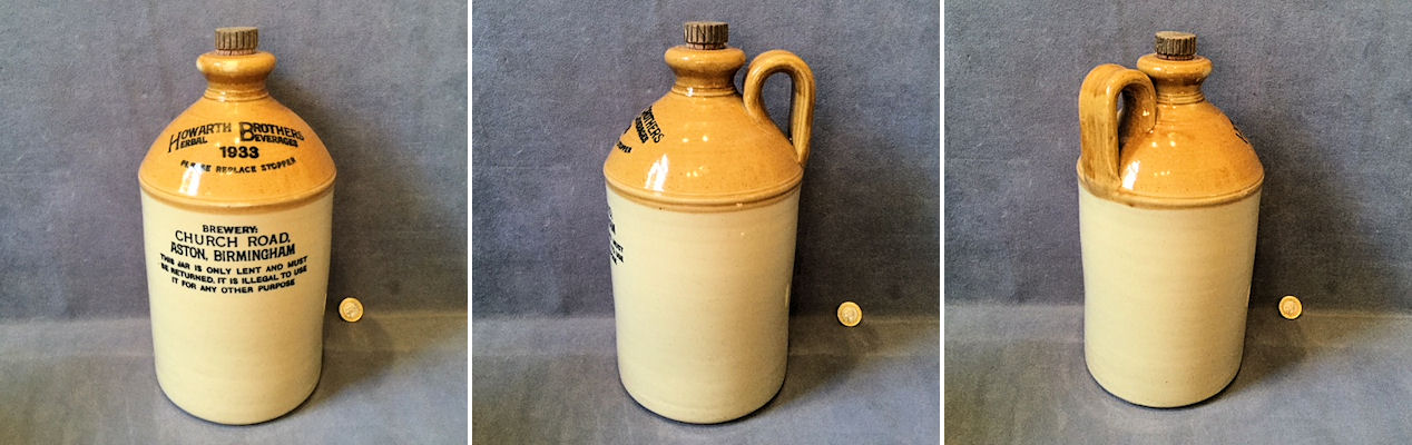
Glossop is a town made up of towns, you may have noticed.
I have a blog post about 30% written that describes each of them, but briefly they are: Milltown, Jerry Town, Charlestown, Rough Town, Howard Town, Freetown, Top o’ th’ Town, and Lean Town, the subject of today’s blogpost.
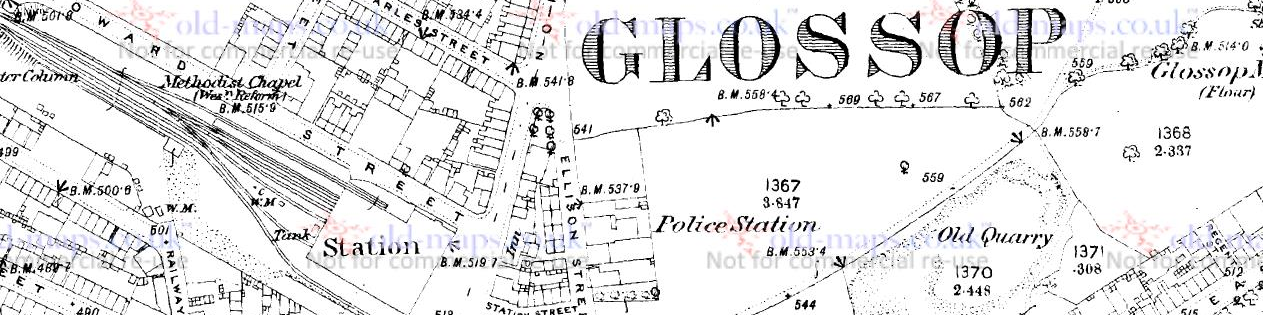
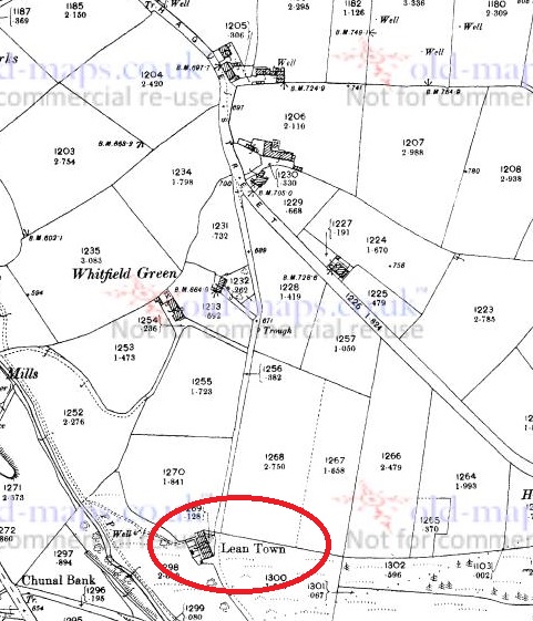
Lean Town is Glossop’s lesser known ‘town’, but is the most easily defined – it is simply a row of terraced houses in Whitfield, at the end of an unnamed track that comes south off Hague Street.
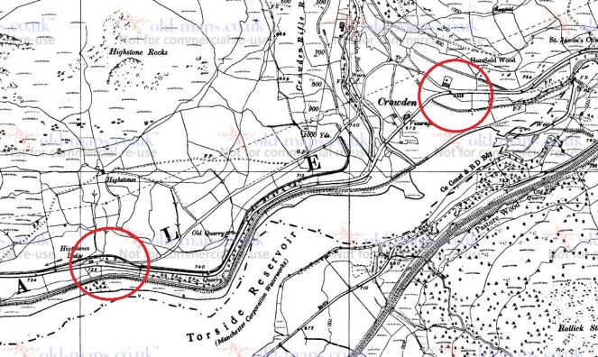
Hague Street runs NW-SE, and an unnamed road runs due south from Hague Street, to Lean Town (circled in red).Lean Town from the south east. the path down to Bray Clough is behind the camera.
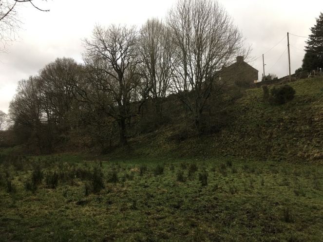
The name origins are obscure, and even the usually reliable Robert Hamnett states “why it is called Lean Town, I have never been able to find out” (and he normally knows what he is talking about, does that chap). A number of possibilities present themselves. The ‘Town‘ element is easy and obvious “a township, or community“, in this case used loosely to describe the small group of houses. ‘Lean‘, however, is a bit more difficult. I have always thought it refers either to the land hereabouts – lean in the sense of not very good for growing crops – or the people living in the houses i.e. they were poor. Another possibility is that it refers to the houses ‘leaning’, that is perched on the edge of a steep hill, which they are.
You can get a feel for just how perched or ‘leaning’ they are from this shot, taken from what is essentially the floodplain for Bray Clough, behind me.
Annoyingly, it doesn’t feature in the 3 volume set of The Place-Names of Derbyshire at all, but then that is not surprising, as the book is woeful in its shortcomings, leaving out dozens of local place and brook names that I know of – there must be thousands more. However, looking in the much more comprehensive The Place-Names of Cheshire for similar sounding possibilities gives the following:
Lyng (Old Norse), ling, heather.
Given its location on the edge of the common land that was, and still is, covered in gorse and heather, I am now starting to lean* towards that as an explanation. Over time, Lyng, the name descriptive of the area, becomes Lean, and is then attached to Town – Lyng Town/Lean Town. Perhaps. Maybe. *Pun fully intended.
Is this the origin of Lean? Heather and gorse just by Lean Town.
Anyway, let’s move on!
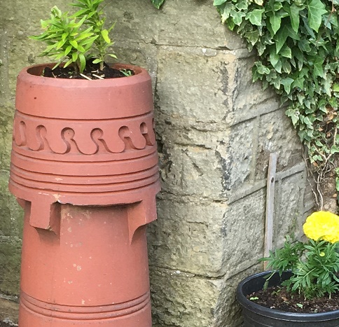
According to Hamnett, the houses here were built in 1806 by Elizabeth Hampson, a member of a well known local family, who were responsible for building large numbers of the houses in the Whitfield area. Originally there were four terraced houses of a typical late Georgian/early Victorian design, stone built, with stone mullioned windows, and a stone roof. I’m not sure how many houses are there now, or whether any have been knocked through – there are still four chimneys, though.
The date of construction fits nicely with what we know of the area, which was radically changed at the end of the 18th and early 19th centuries, when the area was enclosed. The process of enclosure saw what was previously ‘common’ land, available to all, was closed off and sold to private individuals. These landowners built walls around the fields, creating the landscape that we know so well; prior to this, the whole area was just open moorland and fields. Indeed, the gate to the moor here was situated at Lane End Farm – as the name suggests, here the lane, or Hague Street as we now know it, ended, and beyond it was just common moorland. With the sale came certain stipulations laid down in law, particularly the creation of roads, and many of the roads in this area were created at this time: Kidd Road (originally called Whitfield Green Road), Derbyshire Level (originally called Hurst Road), Hague Street, and even Gladstone Street. All were declared public carriageway, and were ordered to be 30ft wide (go get a tape measure and have a look!). The unnamed track, at the end of which sits Lean Town, was created in c.1813, it was declared a bridleway, and ordered to be 10ft wide. Presumably it replaced an earlier path down to the houses, unless the dates are slightly off. What is interesting is that the path marks the limit of the ‘ancient enclosure’ (that is, the medieval or early modern enclosures) – if you stand at the top looking down to Lean Town, all that is to the right of you is ancient, and to the left of you all was common land until the early 19th Century.
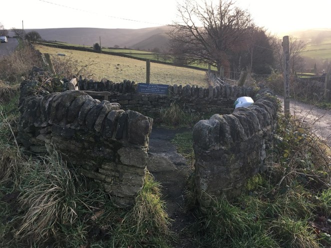
The walled space at Lane Ends Farm dedicated to Norman and Irene Greenhalgh of Lane Ends Farm. To the left is Kidd Road, to the right the unnamed path down to Lean Town.Behold, the unnamed path down to Lean Town. A bridal path built in 1813 or thereabouts, and by law to a width of 10ft. It probably replaced an earlier path to the houses from Lane Ends.
Like I say, a huge upheaval – people lost their right to graze livestock, and even the right to cut peat for fuel for their stoves . The peat fields were moved much farther away, but I believe that residents of Whitfield still have the right to cut peat – don’t quote me, of course, and I’m not sure a multi-fuel burner could handle peat to be honest. There is an interesting account of the process of enclosure in Whitfield here.
If you look at the map above, you can clearly see marked ‘well’ at the end of a path from Lean Town. Now, having a thing for wells, I obviously set forth to see if anything remained. No, was the short answer. Here is the location, and the area is wet, but there was nothing that might be termed ‘well’. Ho hum.
The location of the Lean Town well. I’m not sure what was here originally – perhaps just a trough, or spring head, but there is nothing there now, alas.
Right ho, that’s the end of Part 1. Part 2 contains all kinds of goodies in the form of finds, (lots of) pottery, and bench marks… what’s not to love? Oh, and a witch! You can hardly contain your excitement, I know, and I feel the same. It’ll be up soon, honestly – it’s almost done.
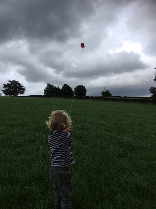
A brief one today. Taking advantage of the lull in the rain coupled with a bit of a breeze, Master Hamnett and I went to fly a kite in the fields off Hague Street. On the way back, I found some bits of pottery which spurred me into doing the blog post that I have been thinking of doing for some time.
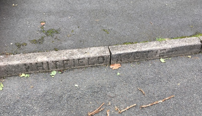
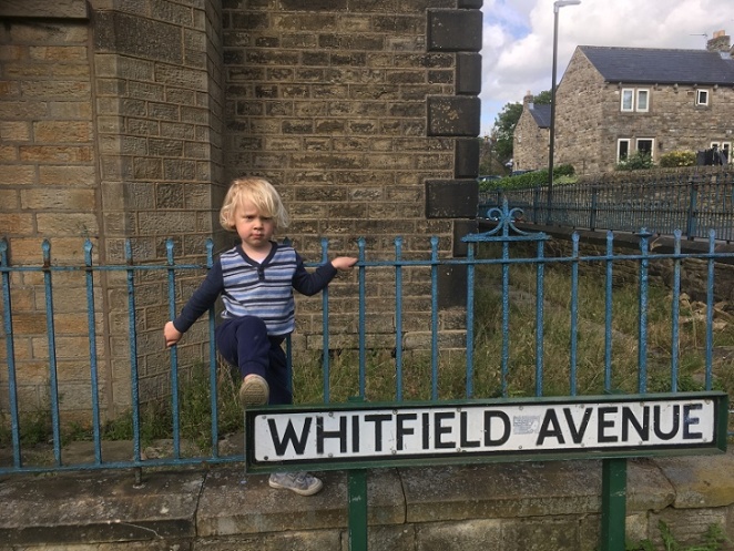
Just in case you get lost. Actually, it’s a nice touch, and I wonder where else the impressed concrete road names were placed.
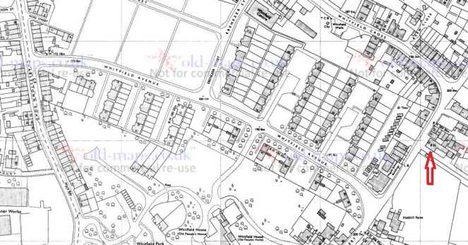
Whitfield Avenue runs downhill in a broadly NW – SE bearing from Hague Street to meet with Charlestown Road, and is parallel to Whitfield Cross.
Whitfield Avenue runs north-west – south-east. For orientation, The Beehive pub is indicated by the arrow. (1974 OS map)
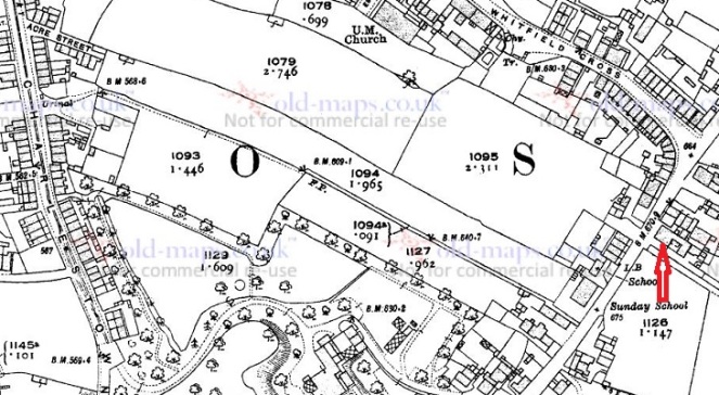
At first glance, it is not a particularly interesting road. The product of the 1960’s demolition and rebuild of the Whitfield area, the road didn’t exist prior to this, as you can see from the map below.
This is the 1921 OS map, and again, The Beehive is indicated.
What is there is a footpath, walled for most of its length, along the long thin fields that characterise the fields of Whitfield – possibly a survival of the medieval ‘croft and toft‘ field system, or more likely a result of the enclosure of the land there in the early 19th Century. This is interesting, as we shall see, but it also probably explains why the council chose there as the location of the road – using an already existing path.
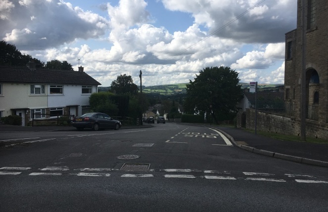
Whitfield Avenue from Hague Street looking down to St James’s Church and Charlestown Road. On the ridge line in the distance, on either side of the left hand tree, is All Saints Mottram (left) and the Deep Cutting at Roe Cross (right).
Historically, then, it is interesting, but not exactly earth-shattering. That is, until you peel back the modern, and take a closer look.
Hague Street was the original packhorse road from Chapel en le Frith to Glossop (now, Old Glossop) – there is some discussion about the road, here, and there is the Glossop Guide Stoop, too (and more here). It was an important route, and the village of Whitfield grew around it – this is the oldest part of the area. Dating for this road is tricky – we know it was there in the 10th Century, as the Whitfield Cross was placed at the junction of Hague Street and Whitfield Cross (the road), and presumably some form of settlement – perhaps just a farmhouse – was there at the time. Beyond this, however, we have no evidence. However…
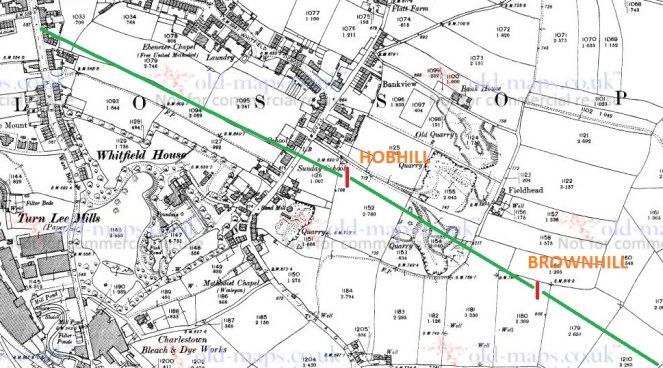
In the early 1970’s a series of excavations were carried out by two archaeologists – Peter Wroe and Peter Mellor – in order to establish the line of the Roman roads to and from Melandra Fort. Although this thorny and difficult subject has been much debated (and only recently – possibly – put to rest), they made great leaps. One of the roads, that coming from Navio Fort (Brough, near Castleton) passes through Brownhill, and comes through Hob Hill Meadows, and continues down the line of what is now Whitfield Avenue. From there it travels down the road that are now known as Hollincross Lane and Pikes Lane, and over into the fort.
Yes, you read that correctly, Hollincross Lane/Pikes Lane, especially its latter part toward Pikes Farm, is a Roman road.
The line of the Roman road is shown in green, leading down what will become Whitfield Avenue and onto Hollincross Lane and Pikes Lane, and then to Melandra Fort.
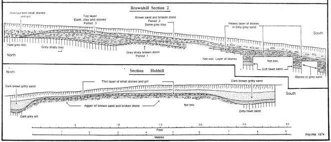
The excavations not only revealed the broad line of the road, but also how the road was built. The next picture shows what is called an archaeological section drawing – essentially a slice of the road was taken out, and the side of the slice was drawn showing the layers that made up the road. And all this is just 1ft below the ground, which is quite remarkable.
The upper section shows what is marked ‘Brownhill’ on the above map, the lower shows ‘Hobhill’. The road is very clear, and very large, too.
Interestingly, and as an aside, Hob Hill as a placename means ‘Devil’s Hill’ – I have said it before, I love it when folklore and history meet.
The ‘original’ footpath on the first map pretty much follows the line of the Roman Road. This is interesting, and suggests that the path used the surface of the Roman road, or a later incarnation of it; there is no point in making a new path if you can use an existing one, especially if that one has a good surface. What I like about this is that a road built 2000 years ago, directly dictated to the council the course of a road built in the 1960’s. History affects us in the present in many ways.
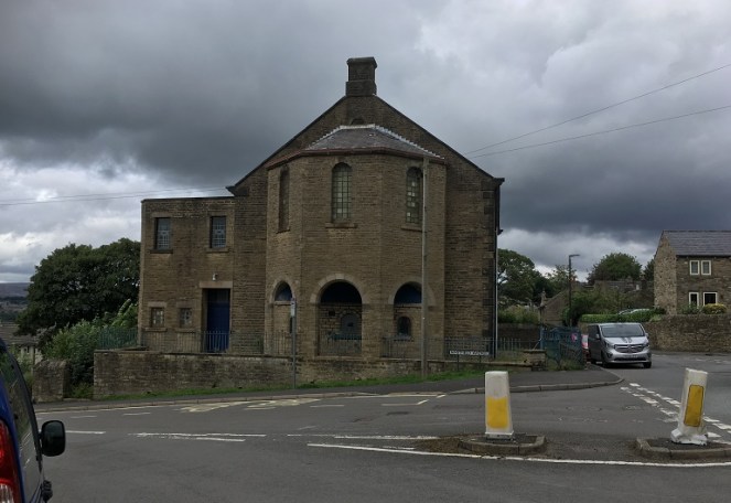
At the top of the road stands this wonderful, forlorn, and if I’m a little honest, slightly terrifying, building – the former Chapel/Sunday School.
I can’t be the only one who gets weird Amityville vibes from this building, can I? It is the ‘house on the hill’ after all.
I have always been intrigued by this building, and so taking advantage of the open gate, I had a look around.
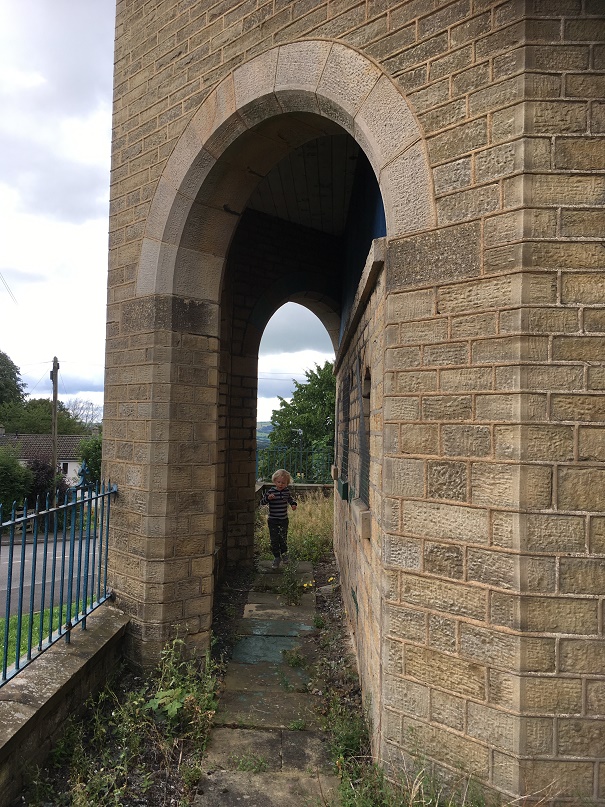
Master Hamnett having a look around.
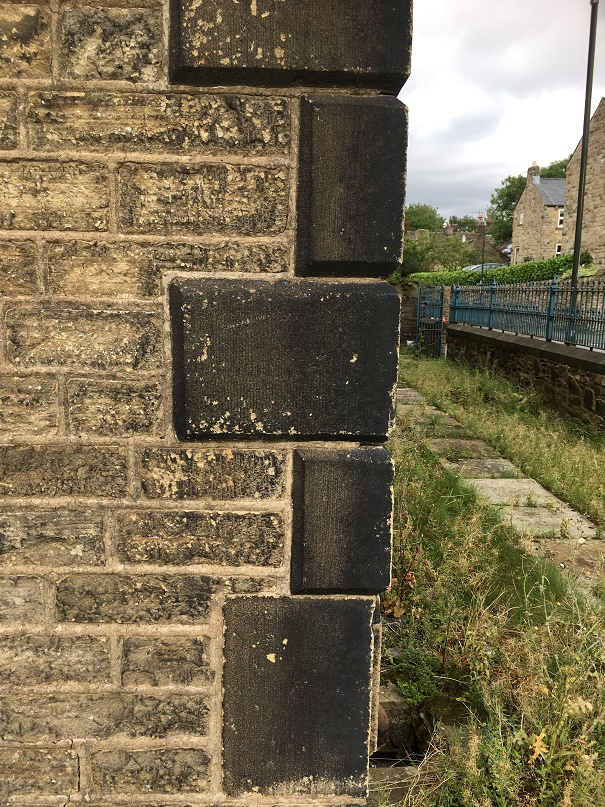
It’s really quite a lovely, if very Victorian, building, full of nice touches.
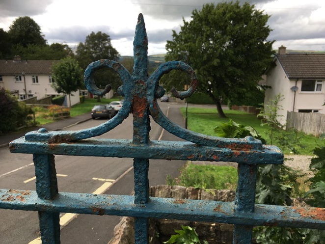
The quoins give it a rather grand air, with some nice masonry.Ornamental ironwork, sadly in disrepair, and in need of painting. An artful shot looking down Whitfield Avenue – very unlike me!
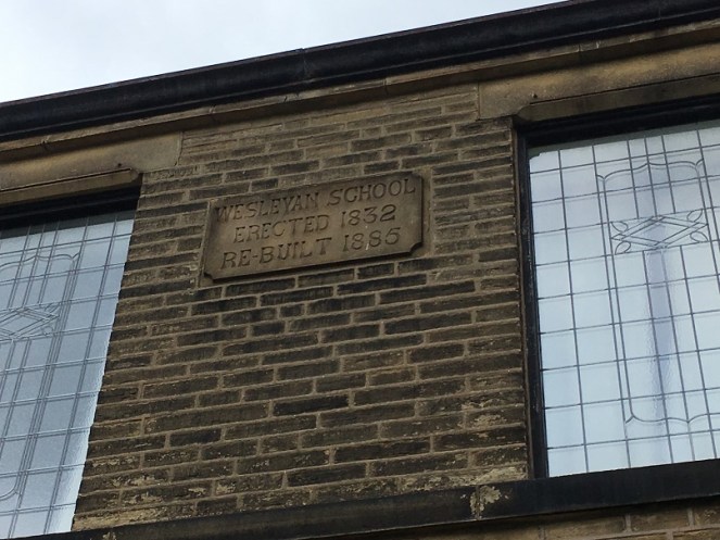
There is also a datestone, helpfully recording the dates of the original construction, the rebuild, and what its function was.
I do love the Victorian literal approach to recording things – it really helps us historical types.
Actually, it was also altered a third time in 1931 to incorporate the chapel further up Hague Street which by then had fallen into disuse. This Methodist chapel (itself rebuilt from the original 1813 version), had once contained the pulpit from which John Wesley had preached, and which in 2010 was returned to its rightful home in New Mills (see here for information and photograph).
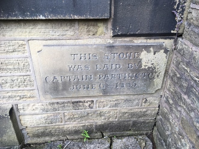
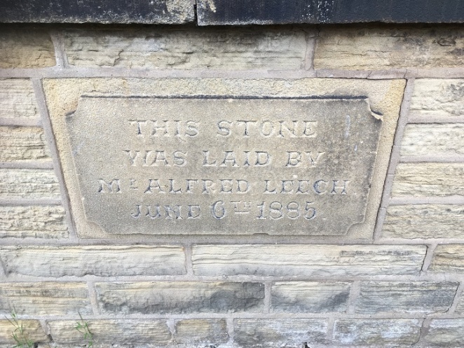
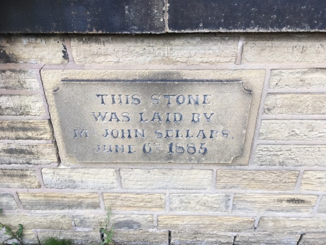
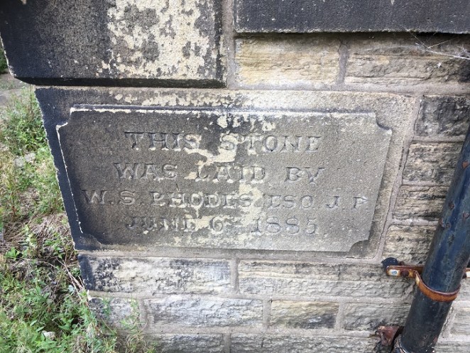
The 1885 rebuild had four cornerstones embedded into it, recording the local worthies who attended the ceremony, and which allow us a peek into Late Victorian Glossop life. Here they are:
“This stone was laid by Captain Partington. June 6th 1885”“This stone was laid by Mr Alfred Leech. June 6th 1885”“This stone was laid by Mr John Sellars. June 6th 1885”“This stone was laid by W.S. Rhodes esq. J.P. June 6th 1885”
So these are the stones, but who are these people?
Captain Edward Partington: Partington was a very important person in Glossop’s Victorian history – his biography is impressive, but in summary he was born in 1836, and moved to Glossop in 1873, buying up all sorts of mill concerns, and ending up Rt. Hon. Edward Baron DoverdaleRt. Hon. Edward Baron Doverdale, dying in 1925. He did a huge amount of philanthropic work around the town (funding the library, for example), and served as Captain in the 3rd Derbyshire (Volunteers) Rifle Corps. Oh, and was a mean rugby player, by all accounts.
Alfred Leech: There is very little information about Mr Leech that I can find. He crops up in a number of interesting places associated with Glossop society, and he is mentioned in the London Gazette as being elected as a land tax commissioner. His address is given as Cowbrook Cottage, Sheffield Road, Glossop. More research is clearly needed!
W. S. Rhodes: William Shepley Rhodes was a councillor, alderman and mayor for varying amounts of time. The Rhodes family were involved in various mill concerns in the aream and are well known. William was also known as a strong athlete and a good sportsman, being the president of the Glossop Cricket Club for a while.
So there you are – the more you know… or less, in some cases.
The chapel/Sunday school continued in use until Easter Sunday 1968 when it had its last service. It is now known as the Spencer Masonic Hall, and is where, from 1973 onward, the Freemasons Lodge of Hadfield 3584 have met on the first Thursday of each month. And at some stage it was up for sale – the sales brochure can be seen here (complete with interior view!). It’s a lovely building, but very neglected and tatty on the outside, and it’s a bit of shame that something more isn’t made of it.
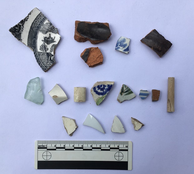
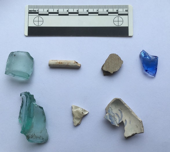
The pottery, then. Obviously it would be nice to find something Roman, but sadly no such luck. Instead, we have a selection of Victorian material, which might be the remains of household rubbish from the houses that once stood there (see above map), but equally might result from the process of nightsoiling. On balance, it is probably the former – there is no arable land in the area where I found the pottery, and the edges of the sherds are still sharp in some examples, and when pottery sherds are ploughed, the edges become rounded. There is nothing too exciting, but nice to see.
A modest selection of Victorian bits.
Top row, left to right: A shallow dish or saucer, transfer printed, and probably late Victorian, but difficult to date. Next to that are two sherds of a large Victorian cooking pot, very characteristic with thick walls, a black glazed interior, and a plain glazed reddish-orange exterior. They are made that way so that the heat can transfer through the unglazed side easily, but the glazed interior means that it is waterproof, and so holds the liquid well; quite clever really! Next is a willow pattern plate – very boring, but is patterned on both sides, so is from an open bowl type of vessel. Next, a glazed earthernware pot with grooved exterior – it’s probably a storage jar or something similar.
Middle row: Victorian glass fragment (the greenish/bluish tinge gives away its date), with a raised letter ‘T’ – clearly a company name or similar. Next, a plain sherd from a flaring rim from a soup bowl or similar; possibly early Victorian, as it has a slightly creamy opalescent glaze. Next, a handle from something – cup or bowl. Next, an early Victorian sponge ware sherd – the blue pattern actually printed, potato-like, on a sea sponge. This is the base to a bowl of some sort (base diameter is 12cm, so not huge), and judging from the wear on the ring foot, was a much used and loved bowl before it was broken. Next, a sherd from a large cup or similar (c.15cm diameter), with transfer printed decoration. After that is a blue and white striped fragment, probably from a cup or similar. Next is a stoneware fragment from a storage jar or similar, fairly bog standard (there is some discussion of the type and the method here). End, is a clay pipe stem (from toward the bowl), and has a some nice paring marks on the body, but is fairly boring stuff (although I do love them).
Bottom row: All featureless white body sherds.
As I said, overall a fairly standard, if uninspiring, collection of Victorian pottery, and almost exactly as one would expect to find (although I do like the spongeware!). The best find, however, was found by Master Hamnett amongst the rubble and rubbish outside the Masonic Hall.
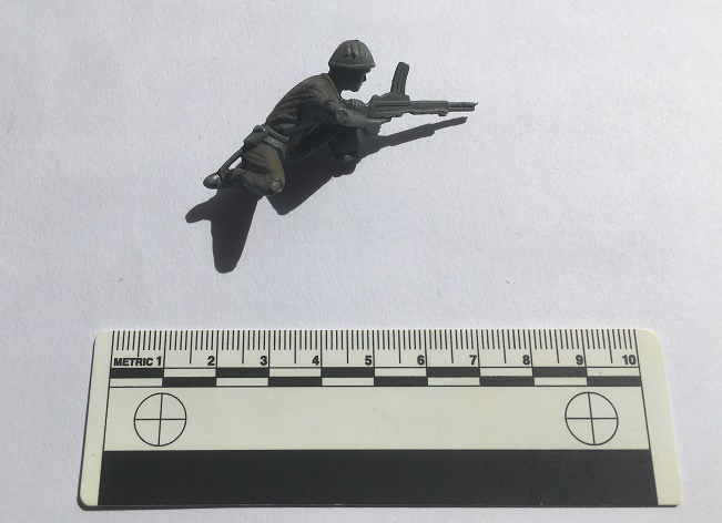
C.1980 vintage plastic soldier, courtesy of eagle-eyed Master Hamnett.
This was pretty much my childhood – plastic soldiers at a 1:32 scale. Whilst this one is not Airfix, it is still a good quality World War 2 figure – possibly Polish or Russian to judge from the helmet and gun. He’s lost his foot, and his stand, but to his credit he’s still fighting. Interestingly, he was also painted at some stage, too, and not professionally, so I think he was a much loved toy (if anyone recognises it, I’ll happily post it to them… I still mourn the loss of some of my soldiers!).
Of course, it wouldn’t be a decent post without a benchmark. On the original path there are three on the line of the track – from the top, a third of the way down (640.7 ft above sea level), one half way down (609.1), and one at the bottom (568.6).
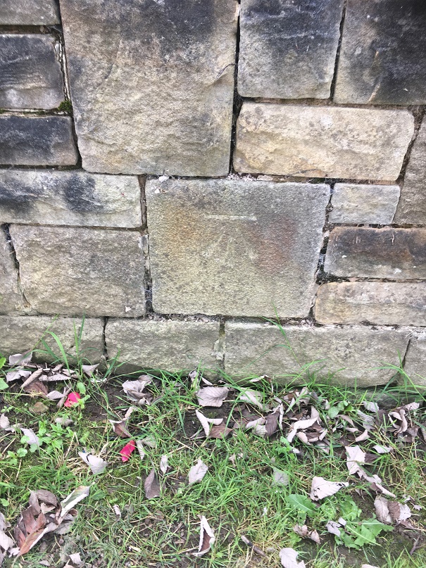
The 1969 map (post Whitfield Avenue construction) has three benchmarks, but are of different heights (641.5, 601.5, & 564.9), and with this last on a now no longer existing ‘public convenience’ at the bottom of the road. Presumably they were re-surveyed and marked when the road was built, as the evidence of the carving seems to indicate. The only one that is still extant is the middle of the three, the others seem to have disappeared, alas.
An old stone block, rebuilt into the 1960’s wall, and with a new benchmark carved into it. 195.5 metres above sea level (641.4 ft in old money)
So, a lot of history and archaeology of a single road were explored on a single afternoon
Master Hamnett looking like he owns the place.
And, of course, we flew a kite, which was the best bit!
A successful day for Master Hamnett, too.
Well, that turned into a much larger post than I anticipated… who knew a 1960’s built street could be so interesting? Comments, as always, very welcome.
A while ago I posted a blog entry about some named wells in the Mottram area.
Read the post here to refresh your memory, it’ll help with what follows.
We were facing a slight conundrum. The issue was that there was the two wells in the one field – neither of which was really visible on the ground – coupled with the fact that one of them was called Boulder Well, a very specific place-name, despite there being no associated boulder. Oh, and there was a boulder in a different field, but with no associated well. Well, I think I have found out what it all means. Probably.
The map, first of all.
The two named wells are in the bottom circle, marked with a ‘2’. The boulder in the original blog post is in the upper circle, roughly where the tree is on field boundary.
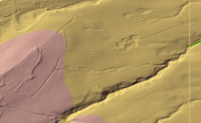
I was looking over some Lidar images of the area, and noticed something interesting. For those of you who don’t know, Lidar is a method of using light (laser) to map the ground surface, allowing for a greater contouring of the ground, and revealing every single bump and dip on the surface. Quite literally, everything – it simply strips away trees and vegetation. It’s application as an archaeological tool is enormous, and it allows us to not just identify, but to map, record, and categorise all sorts of things that are invisible on the ground.
Like old wells, for example.
So, using the government’s Lidar website (highly recommended, by the way), this is what I saw.
Despite being a mass of lumps and bumps, this is broadly the same area as the map above.
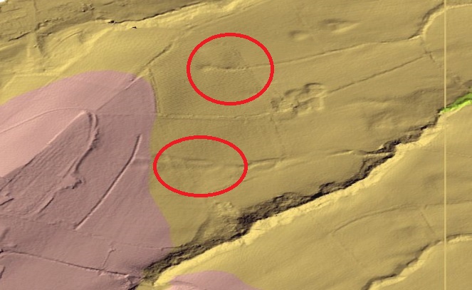
To help you identify the area better, here is the same image with the red circles on it.
The upper circle is where the boulder is, the lower is where the two wells are on the map.
What the image shows is that where the two wells are recorded on the map – Grave Well and Boulder Well – there is only the remains of a single feature. You can see the line of the waterway moving from left to right, passing through the lower circle, and eventually draining into the small valley there. Single feature, a single well. Not the two wells recorded on the map.
Now look again at the upper circle. The field boundary where the boulder is can just be made out, but to the right, precisely where there is a ‘trough’ marked on the map, is a spring head, and you can see the drain, running east and again emptying into a small valley. There IS a well there, it’s just that you can’t see it on the ground.
Looking again at the map, we can see only one well place or structure in the lower circle. This, I humbly submit, is Grave Well, not Boulder Well – its location right next to the graveyard is the clue. Boulder Well is situated in the upper circle, next to… yup, you guessed correctly, the boulder, and the trough marked the place where the spring issued forth. This makes sense.
I am convinced, then, I have rediscovered the location of Boulder Well.
All this is clear on the Lidar, but as I say, cannot be seen on the ground. It also means that the OS people made a small mistake in naming the wells – but then if a local says “yes, Boulder Well is just above Grave Well”, how literally are you to take them?
I need to go back and take some more photographs.
So there you have it. As Bertie Wooster was fond of saying “The lark’s on the wing, the snail’s on the thorn, God’s in His heaven. All’s right with the world!”.
Comments and discussions, even arguments against the newly rediscovered well will all be gratefully received. Also, I have a few more blog posts that are about to be published, so keep your eye open.
Welcome back for the third and final instalment… it was a very productive walk indeed! The first two are here and here.
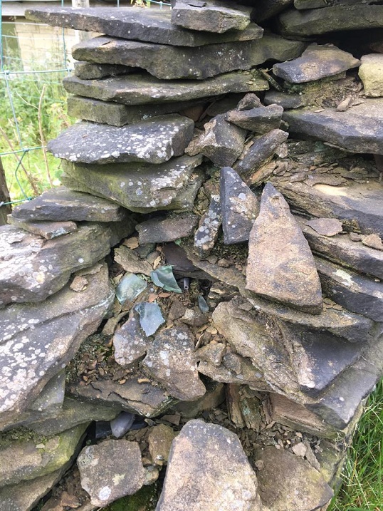
As we continued along the track, we came down, toward the place where it joins Cliffe Road, near where the Guide Stoop is. Here, the wall on the left has been removed, and replaced by a fence, but at the bottom of the track, there is a stump of the wall left, ruined. And spilling out of the wall’s innards, so to speak, I noticed some glass, some pottery and a black tubular object. Well, I could hardly leave them there, could I?
As you can see, the wall is not in great condition, and the bits spilled out.
So then, what do we have?
Firstly, fragments of a Codd Bottle.
The fragment on the right is from the neck going into the rim.
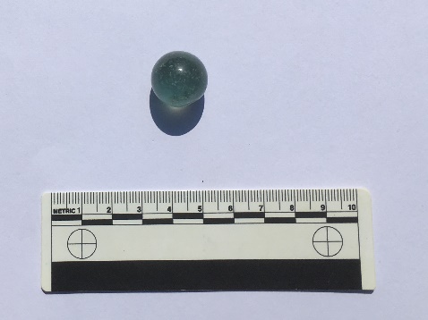
Invented by Hiram Codd (great name!), he patented the famous design in 1872, and began manufacturing them on a large scale in 1877, or thereabouts. This groundbreaking design was a way of keeping fizzy drinks carbonated using a glass ‘marble’ inside the bottle, with the gas keeping the marble pushed firmly against a rubber seal. When empty, they were often broken open by children to retrieve the marble; here is one I found in my garden a few months ago.
Hand made in two halves (you can just about make out the seam), it contains many small air bubbles. It’s quite a pretty, if utilitarian, thing. I really should blog about my garden finds sometime.
The bottle was broken before it went into the wall, and you can see that different fragments had different amounts of soot and air exposure, causing the variation in colour. I spent a happy 5 minutes gluing this together – superglue really is a marvel! Anyway, here is a complete Codd Bottle, showing its very distinctive ‘pinched’ shoulder/neck, very thick glass, and you can just make out the marble in the neck.
A lemonade Codd bottle from this great website here. Worth an explore.
It remained in use until perhaps the 1910’s, when other, more simple, designs – mainly the screw stopper – replaced it as a way of keeping drinks carbonated. Here is an excellent website that talks a bit about them – it is well worth an explore.
Next is a piece of green glass bottle dating from the 1870’s on, and which probably held mineral water or beer.
A moulded bottle – probably a beer bottle. You can see the shield border on the left.
This one was moulded, not blown, and has the remains of an embossed decorative shield that would have shown the manufacturer. Each company would have its own design, and usually they were locally made, so it might be a Glossop bottle. Here is a whole example of a bottle showing what I mean.
One green bottle…
There is a fascinating website here that discusses coloured glass from a historical archaeological approach, and despite being American in focus, it is very useful, and well worth an explore – it is one I return to time and again for facts and identification help.
Another bottle fragment, this time a concave base, and with an moulded number ’13’ on the bottom.
You can see the number ’13’ clearly at the bottom.
It has a base diameter of 8cm, is made of thick glass, and judging from the wear marks on the base rim, the bottle was used over a period of time, or possibly used and re-used. Late Victorian is a guess in terms of date (thick glass & greenish hue).
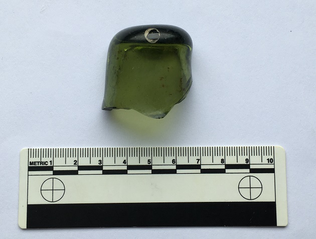
Then there is this…
Nope… not a clue!
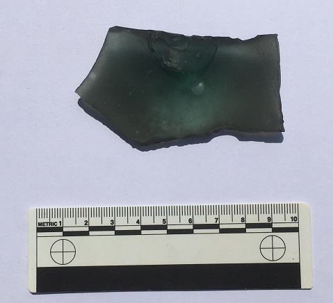
It is glass, broken, and has a raised bump on one side, centred over a feature on the other side. This feature – visible in the above photograph – is circular, tube-like and hollow, and has an impressed mark in the centre, made when the glass was still soft. The only other features are a pair of parallel lines running diagonally to the right of this central feature, and scored onto the object when the glass was cold. The glass itself is thick, full of air bubbles, and has a greenish tint, all of which suggests that it is old (Victorian or earlier)
I have literally no idea what this is. None whatsoever. Answers on a postcard, please.
The black object is interesting; on closer inspection, it turns out that it is a pipe stem.
Hollow throughout, the left side is flattening to the mouthpiece.
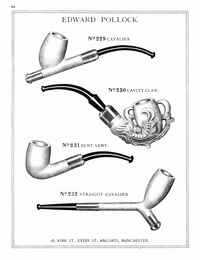
Made from Ebonite (also known as Vulcanite), a type of hardened rubber, it is the bit that fits into the mouth, and through which the smoke is drawn. It is made as a separate part, fitting into the bowl via a metal ferrule – you can see the rounded end in the photograph. The other end, though broken, is of the ‘fish tail’ type stem, flat and wide, and would have originally had a lip at the end. Ebonite is still used for making pipe stems, but was first created by Charles Goodyear in 1839, with the process of making it patented in England by a Thomas Hancock in 1843. It was immediately put to all sorts of uses as a cheap durable alternative to Ebony wood, and from the 1850’s on, it was used in the making of pipe stems (another interesting website here).
You can see the way it was used in this Late Victorian trade catalogue – the wall example even has the slight curve.
So far, so Late Victorian. So what, then, is this doing in the mix?
Midlands Purple Ware dating from roughly the early 18th Century.
This is Midlands Purple Ware, a type of coarse stoneware. It is hard (fired at a high temperature), purple (though can be more orange or red), and has a large number of black and white inclusions (they look like salt and pepper). It’s very characteristic, and once you know it, you can spot it a mile away. Midlands Purple was made in huge quantities between about 1600 and 1750 (although some sources state its production started earlier, I go with this date for the classic Midlands Purple), although I think this example is late (early to mid 18th century). What is interesting is that this pot was found mixed with the Victorian material – in the top photo, you can see the pipe stem lying underneath one of the Purple Ware sherds. I’ll return to this below.
These fragments (mended) come from the base of a pot, and using the internal wiping marks at the start of the upturn of the vessel wall, I would suggest a base diameter of 25cm, and it probably comes from a large storage vessel, such as this beer container. Most houses and farms would have brewed their own beer as it was cleaner than the water at the time.
The bunghole at the bottom is for draining the home brewed beer, leaving the grain on the base of the vessel.Close up showing the internal wiping marks (where the potter had run a rag around inside the vessels when it was still wet) and the start of the vessel wall. From these marks I was able to extrapolate a base diameter of 25cm.
So what does all this mean?
Well, we know that the wall is much earlier than the Victorian glass – it is here on the 1857 Poor Law map of Whitfield, for example – and almost certainly dates from the initial enclosure of the fields and moors in 1813.
1857 Poor Law map. The wall is running NW-SE between two large quarries.
The Late Victorian material probably represents a rebuilding episode. The wall itself is still in bad repair, and I think I can detect at least three phases of construction too.
The wall showing multiple rebuilds and repairs.
The Midlands Purple Ware is clearly much older than the wall, and is something of a conundrum – what is it doing here? It might represent residual rubbish incorporated into the wall. However, it is perhaps more likely the pot was still in use 100 years after it was made, but broke as the wall was being built in 1813, and ended up used as filler. Possibly. And it was then reincorporated into the wall as it was being repaired in the 1890’s. Again, possibly.
Now here is where it gets interesting.
Why would the repairer of a field wall place a Codd bottle, a beer bottle, and a pipe stem in the wall? Pottery and rubbish is often used as a foundation bedding for a wall at this period (I have a pile from my garden that I need to blog about), but these are high up in the wall. But it does seem that the obvious answer is rubbish disposal. In this scenario, the builder has a break, smokes his pipe, but then accidentally breaks it. He finishes his bottle of fizzy water, and another of beer, then accidentally breaks them both. He curses, then places some, but not all, of the fragments in the wall, along with some other bits and pieces, and carries on building. 100 years later I find it, and here we are.
This interpretation seems fair enough. But it seems a little too convenient – a discrete, neat, bundle, carefully walled up. And the fact that only fragments were placed, not the whole thing. It would also have taken effort to do this, too, when surely it would have been easier to simply have thrown them into the field.
“Hmmm…” I say.
However, there might be another reason.
I have recently been doing research into the tradition of hidden objects within the fabric of buildings (here is a great website that deals with the subject). Shoes, famously, have been found in the roof and around the fireplace of 1000’s of buildings up and down the country, as well as in colonial America and Australia (I have one from the Glossop area that needs to be blogged about). But it is not just shoes, these caches contain all sort of clothes, and indeed all sorts of objects – including bottles, pottery, and pipes – and all dating from c.1600 to 1900.
A deposit of various objects from a farmhouse in Suffolk. Taken from an article by Timothy Easton (the copyright is all his, and I have stolen the photograph for illustrative purposes only). And no, that’s not me in the photo.
The term used to describe these caches is a ‘Spiritual Midden’, with the idea being that each of the objects is placed in the cache at the end of its useful life, and is then sealed away and hidden from view in a midden. The study of this tradition is relatively new – bundles of rags and objects when discovered are usually thrown away – and it is little understood beyond a general consensus that they are broadly connected with concepts of ‘luck’ and ‘protection’ from evil or witchcraft. They are believed to be ‘apotropaic’ (that is, they ‘turn away’ evil – I blogged about the subject here and will return to it again, as I find it fascinating). Briefly, spiritual middens seemed to have functioned by making the deposit of clothing and objects the target of bad luck or witchcraft, rather than the people within the house. In a real sense the cache stands for, or personifies, the individuals within, and acts as a lightning rod for any negative energy, safely diffusing it.
The ‘meaning’ of the individual items within the midden is unclear. The shoes, gloves, trousers, and other garments are the most obvious – they are very personal items, and are usually deposited worn out, meaning they have, in a sense, moulded to the individual, and have been imbued with their essence. The bottles are less clear; perhaps connected with ‘witch bottles‘. Bones may relate in some sense to food, and pipes have been suggested as connected with fire, or more specifically fire prevention. This is all speculation, of course, but something is going on with deposits of objects from the early 17th century on, and which lasts until the end of the Victorian period. Perhaps, then, we are seeing a decayed form of this deposition ritual in the objects hidden during the wall rebuild in the 1890’s. Of course, by this time the ‘meaning’ of the caches, whatever it was, would likely have been lost, and the ritual of hiding certain objects was carried out as a ‘tradition’ or ‘thing we do’, or simply ‘for luck’, with none of the belief that drove and informed earlier caches.
This interpretation is made all the more plausible by the fact that the location of the ‘cache’, if such it is, is at the very end of the wall. Thus, it represents either the very first part of the wall begun, or it forms the last section made; either way, the deposition of objects there seems appropriate. There is also the tantalising possibility that the Midland Purple Ware pot base also represents the remains of a similar, earlier, cache. A small cache of objects deposited for luck, to help the wall stay upright, and the land and its owner prosper.
But then again, of course, it could just be rubbish!
If you are interested in Spiritual Middens and hidden objects, there is an excellent paper here which discusses the contents and their meaning. It’s written for the general reader, so it’s not too theory heavy, and it contains links to other papers on the subject. Also, you can email me for more information, as it is a special interest of mine, and one that is only now receiving attention.
As always, comments are welcomed… even encouraged. More soon, I promise, but until then, I remain,
Here is the second installment of a terrific triptych of trivial twaddle.
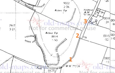
As previously mentioned, the path curves round to Fieldhead, and along the track, and here and there were bits of pottery and glass. Nothing earth-shattering or particularly old, but some interesting bits nonetheless. The question of ‘how did it get there?’ is a good one. In this case, it seems to have been a combination of nightsoiling, general littering in the past, and the presence of a rubbish dump. The quarry shown in the 1898 map below eventually goes out of use, and by the 1920’s has a new role as a miniature rifle range. Eventually, this too goes out of use, and the quarry is used as a refuse tip and filled in. Behold, the evolution of a quarry:
A Quarry in 1898.A Miniature Rifle Range in 1921.A Rubbish Dump in 1969.
It’s been a well used area, and it’s no surprise that there is bits of pottery all around – in particular the stretch from point 1 to point 2 on the above map. Incidentally, point 2 is the location of the gatepost bench mark in the last post. I’m also well aware of other bench marks in the immediate vicinity, only some of which I have looked for (it’s on my (very long) to-do list!). However, I did find two – those marked points 1 and 3 on the map:
BM No. 1 – 772.24 ft above sea level (or 769.7, according to the older OS maps). I think this is a more modern replacement for a missing older BM – the carving looks almost new.BM No.2 – 782.00ft above sea level (or 781.3, according to older maps). This one is on the side of Fieldhead Farm.
So then, the pottery/glass.
Left to right, top:
The base of a small cylindrical bottle, measuring 3cm across. Probably a sauce or relish bottle (Henderson’s perhaps), and Late Victorian/early 20th century in date.
Clay pipe stem – again, probably Late Victorian. It has some nice paring marks on it.
Our old friend, a fragment of a stoneware marmalade pot. It has a 9cm wide body, and the usual distinctive fluting on the side.
The neck and finish of a blue glass bottle. The finish looks like a ‘crown‘ type, and so is not particularly old, but the blue glass is interesting. I always thought that blue glass is associated with ‘poison’ or medicine bottles, but it seems I am mistaken.
Left to right, bottom:
the rectangular corner and base of a sauce bottle, possibly a Garton’s HP Sauce bottle, although there were dozens of similar bottles. Probably Late Victorian or Edwardian in date.
A tiny sherd of a glazed vessel with a raised decoration. Probably floral, although the sherd is to small to clearly see the motif. Almost certainly Victorian in date.
Sherds (glued together) of a fine Victorian teacup. It has a deep ring foot that measures 4cm in diameter, and is thin walled, which usually indicates expensive potter. The decoration is floral based, transfer printed, but seems to be quite fine
I really should draw these sometime, so that you can see what they are… I’ll save that for another blog post though.
That is just about it for this post… though Part 3 will be coming very soon, and that should be a very interesting post. Honestly.
No, this is not going to be a long essay on the much overlooked site, so don’t worry. In fact, you might say quite the opposite when I present a wonderful piece of archaeology… you’ll see.
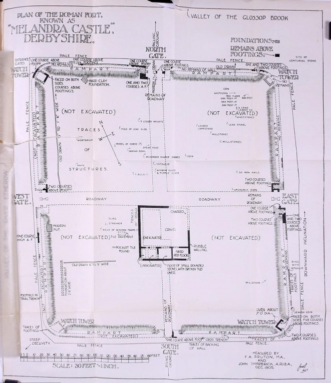
Plan taken from RS Conway’s ‘Melandra’ shows the layout of the fort, as well as the find spots of interesting bits and pieces. Most of these are now in Buxton Museum, which is well worth a look.
I was there a few months ago with the family Hamnett, and following Mike Brown and Roger Hargreave’s talk at the Glossop and Longdendale Archaeology Society. Both have been heavily involved in trying to get some sort of archaeological project resurrected for the site, as there is still so much not known, and both are great ambassadors for the fort. Sadly, there is nothing major in the pipeline, but their talk prodded me to go and look again at the overgrown site, windswept and slightly out of place against the backdrop of a 1960’s council estate. Face the other way, though, and it is the wilds of Longdendale that confront you. What a difference between this landscape and that in which the soldiers who built it grew up: The First Cohort of Frisiavones, originally from Belgium/Netherlands area, and assisted by men from the 3rd Cohort of Bracara Augustani, who were originally from Portugal.
Longdendale Valley, brooding. From Melandra.
It an amazing site, but one that is very neglected, and what could be a huge source of pride for the people of not just Longdendale, but of Derbyshire too, is all too easily passed by, overgrown and forlorn. So go and visit it, people. Read Mike Brown’s excellent booklet on it (couldn’t find a link, but it crops up all over). R.S. Conway’s 1906 academic book is out of print, but you can still get it relatively cheaply.
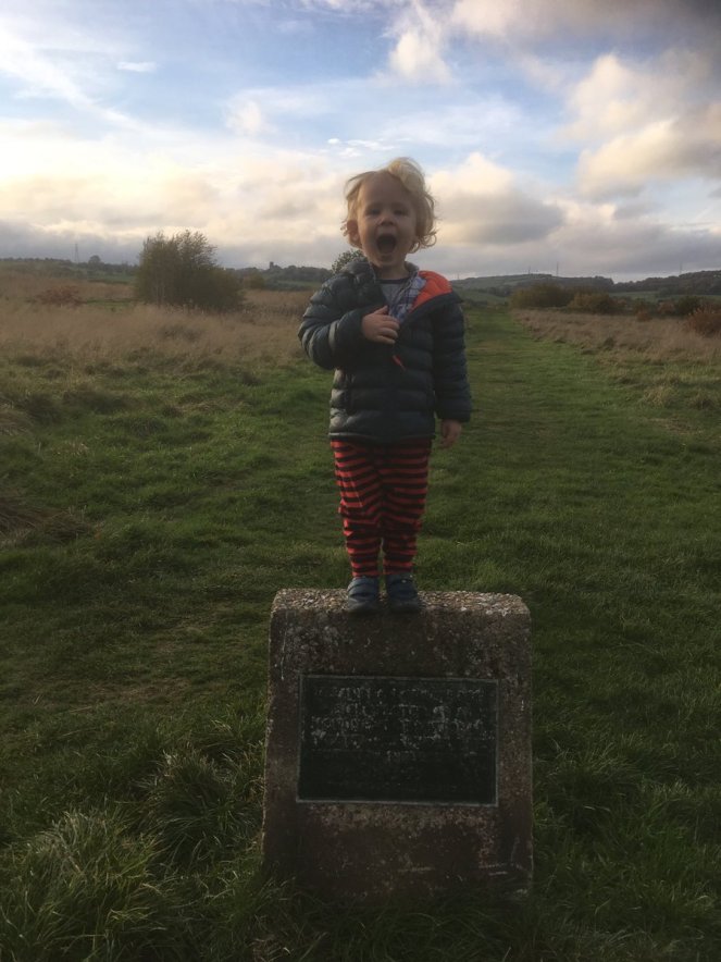
The young Master Hamnett at the north gate. Behind him, to the left, is St Michael’s, Mottram, and to the right, the ‘Deep Cutting’ at Roe Cross (and the White Stone).
Before we go on, though, a digression about the name Melandra.
According to the Ravenna Cosmography (a 7th Century list of Roman towns and forts), its actual name, was Ardotalia, not Melandra (see no.108 in the above link).
It is likely that Melandra is a name made up by the Reverend John Watson, the Rector of St Mary’s in Stockport, who first described the site following a visit in 1772. Seemingly, he wanted to give it a ‘classical’ air. Indeed, there is no record of the name Melandra existing prior to Watson’s and at that time of his ‘discovery’, as Watson himself notes, the area of the fort was known as the ‘Castle-Yard‘, and the eleven fields adjoining it are named ‘Castle Carrs‘ in various land deeds (1). Where, then, did Melandra originate? According to Anderson “The word Melandra has a curiously Greek appearance” (2), and is alleged to be a “Roman name derived from the Greek Melaxdryon, which signifies ‘the heart of oak‘ or ‘the heart in the oak“, perhaps a reference to the trees of Longdendale” (3). However, it is very unlikely that the Roman name remained unchanged for 1600 years. And, it is equally unlikely that the local population of late 18th century Glossopdale and Longdendale spoke classical Greek. No, they would simply have called it Castle Hill or similar, which is exactly what they did! However, an Oxford educated academic and clergyman would almost certainly have spoken several classical languages, and be at least proficient enough to invent a name. So thank you Reverend Watson, because of you, the name Melandra Castle has become common usage, and so we continue to call it thus.
Right, the find!
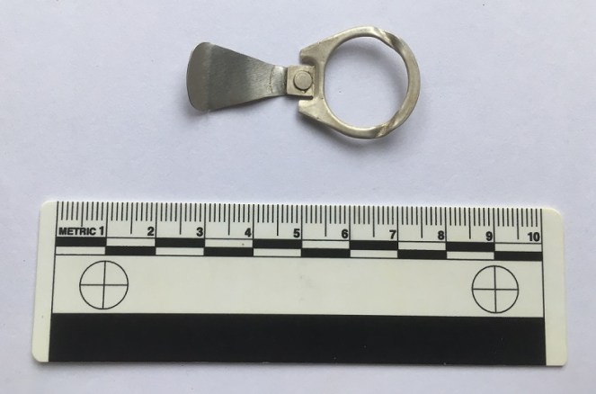
The fort is a scheduled ancient monument, so it is illegal to take anything out of the ground here. Even stuff off the molehills, which is where I found this:
Ring pull from a 1980’s drinks can. No idea what type, but I’m sure someone, somewhere, will know!
Don’t worry, I’m not about to feel the long arm of the law, it is quite literally rubbish, and of a 1970’s-80’s vintage. Anyone who watched the TV show Detectorists will immediately chuckle (very highly recommended, by the way, even if I don’t always see eye to eye with metal detectorists and their hobby).
According to this website, ring pulls like this stopped being used in the UK in around 1989/1990. So there you go. I was so taken aback by nostalgia, that I immediately thought “I need to blog this!” Also, I surely can’t be the only one who used to detach the seal bit, insert the larger end into the slot on the ring, and using the natural sprung tension, ‘ping’ it off in a frisbee fashion. You could get some distance on these things. Am I the only one?
Anyway, a bit of fun. I have a few more serious posts to finish off, so expect those relatively soon (after the weekend?)
And as always, I remain,
Your humble servant,
RH
Watson, J. 1775. “An Account of an Undescribed Roman Station in Derbyshire” Archaeologia 3: 236-238
Anderson, W.B. 1906 “The Roman Place-Names of Derbyshire” in Conway, S (ed.) 1906 “Melandra”.
So, apologies for the late running of this blog post. I have half a dozen half-written posts at any one time, and this one seems to have had a difficult birth! It was finally scrawled on the back of the minutes of the AGM for the Glossop & Longdendale Archaeological Society in a cafe whilst waiting for Mrs Hamnett to come out of surgery in Wythenshaw Hospital! (All is good on that front, and she is making a recovery). Apologies also for the length of this one, and for the archaeological theory. I do love a good bit of interpretation, and in my previous archaeological life this was the stuff that nourished!
I was having a conversation with my brother-in-law the other day (Hi Chris), and he asked whether I had seen the standing stone on Long Lane, between Charlesworth and Broadbottom Bridge. As it happens, I had, and it was on my ‘to do’ blog list.
And here it is, being done… well, we’ll get to it in a minute
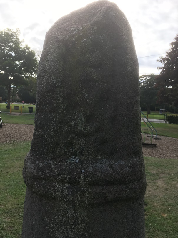
Standing stones and stone circles are some of the things that first grabbed me when I began to look at archaeology seriously. The fact that they were a tangible and impressive representation of the past made them stand out, and yet they were enigmatic – their function and meaning still not fully understood. Single standing stones in particular have been overlooked as monuments; their very nature – a single stone, standing upright – has meant interpretation is difficult. Moreover, they are largely undatable unless associated with other monuments such a stone circle, and people throughout history have stood stones upright, and for a variety of reasons (cattle scratching post, waymarker, gatepost, etc.). Generally, though, they are considered to belong to the later Neolithic and Early Bronze Age (roughly 3000BC – 2000BC). As to their function, they are often viewed as marking a territory, or as a meeting place, usually with ‘ritual’ overtones. In more recent times, they are often associated with folklore and the supernatural, and even leylines.
A stone beside the River Etherow, in Broadbottom. This one is, I think, a glacial erratic.
Recent archaeological work has begun to unpick the possible meanings and functions of many of the monuments of prehistoric Britain, and especially those of the Neolithic. This has been done more subtly and intuitively than previously, and looks at monuments in their surroundings, and how the people would have experienced, used, and passed through them, rather than viewing them as just objects. Words like landscape and phenomenology are used, and it often draws on other disciplines such as philosophy to help with understanding the past. Extrapolating from this work at the larger monuments, and in particular the pits, causewayed enclosures, and chambered tombs of the Early Neolithic, we can use some of these ideas to explore a possible meaning of the standing stones of the Late Neolithic and Early Bronze Age.
As I’ve said before, a standing stone is just that, a stone, standing. But conceptually, it is much more than that, it is a fixed point in the landscape, around which human experience can revolve, and emerges from a concern with marking a particular space as being different from it surroundings, transforming it, and placing it within the landscape but apart.
It is clear that the actual creation of monuments such as these was just as important as the finished product, and the erection of a standing stone is not a simple task. It requires group work and cooperation; with the stone weighing perhaps a ton or more, families, extended families, kinship groups, or even clans would be working together to make the stone. It would be a period of community, sharing work and food, and the creation of joint place. The stone would have to be shifted and shaped, and here we have decision to be made. From where is the stone to be quarried? The source may be significant to the people creating the monument, and perhaps that quarry or stone type already figures in their stories and beliefs, already a sacred site. Although practical considerations are possible, it may not always be the case – the Stonehenge Bluestones were moved by land, sea, river, and land from the Preseli Hills in Wales – a journey of over 150 miles, because they were deemed important. Our practical concerns are different from theirs.
Then we must consider location, why was the stone sited where it was. The larger monuments, such as the enclosures of the Early Neolithic, often have evidence of earlier occupation, and it seems that the monuments are referencing these flint scatters and back-filled pits, a way of acknowledging those who went before – the ancestors. It may be the case with the standing stones. But equally, they may reference something else – a feature of the landscape, or perhaps some other, more numinous reason which we would never be able to fathom. Did a shaman have a vision suggesting the site? Or did lightning strike? Or someone die there? Or… you get the idea. And did the stones stand on a bare hillside as they do now, or did they lurk in a bright woodland clearing?
Another stone by the River Etherow. This one is shaped, and was perhaps a gatepost.
Once in place, the people responsible for erecting it might visit periodically – every year on midsummer’s eve, for example, or every full moon, or when the cattle are herded from lowland pasture to the upper areas, or even every day. But certainly through these periodic visits it would be seen as, calendar-like, marking time, or even creating a ‘mythic’ time, outside of ‘real’ time. They might have visited in large groups, taking the form of kin-related clan-wide celebrations, for example, or perhaps in small family groups, or even as individuals. Each visit would recall previous visits, previous times of coming together in celebration, or in mourning, for example. But there would be feasting and celebrating, certainly, with people gathered in their groups round hearths and fires.
Perhaps the area around the stone was kept spotlessly, meticulously, clean, and each visit revealed traces of the old hearths clearly, and the conversations, people, exchanges, jokes even, that happened around those hearths would be recalled and spoken about. And it’s not hard for us to imagine a group of people, framed by firelight, moving in a circular fashion around the stone, dancing. But perhaps, and I suspect more likely, the area around the stone was littered with the detritus of these older meetings – pottery, animal bone, flint, pits dug into the earth, stone, and other bits and pieces, all deliberately displayed as a reminder of the past visits. There may well have been human remains, too, in the form of cremation or as an internment, or even random bones, carefully kept and handled – curated for generations – before finally being deposited around the stone. Each item or object speaking to the people of the past, of past lives and events, and of the ancestors. With each visit, again and again, there was the creation of new memories, new meetings, and yet still the recollection of older ones – the ancestors would have loomed large and heavily in these times.
The stone here acts as a mnemonic device, an object that helps us remember. That is its purpose, its meaning… to help us recall previous visits to the stone. Using the stone as a focus in this way, time can be manipulated: the individual can visit past people and events, travelling and recalling; but equally the ancestors and past gatherings can be brought into the present through shared memory. Importantly, the ancestors can be projected forward into the future, asking for their intercession for a good harvest, for example, or for help and advice.
And of course, when the people gathered together for feasting and celebrating, there would have been exchanges in the form of gifts and barter – and from hearth to hearth, and valley to valley, there was an exchange of resources, news, gossip, alliances, ideas, beliefs, objects, allegiances, skills, animals, marriage partners, and so on.
In fact, all the drama of human existence revolving round this fixed point in the universe, a node, a single stone standing in not just a physical landscape, but in this case a cultural landscape, and on a personal level, a psychological landscape.
Phew!
So then, the stones…
Hargate Hill Stone
Let’s start with the stone that sits on the corner of Hargate Hill Lane and High Lane, the road between Simmondley and Charlesworth. It’s here:
The stone is circled. The air shaft to the right is the mine shaft down which Albert Burrows, the Simmondley Pit Murderer, pushed his four victims – the subject of a future blog post.
Here is the stone.
The standing stone above Hargate Hill. Mouselow Iron Age Hillfort is in the background.
The stone is very obviously deliberately placed, and sits on the junction of two tracks, both clearly ancient, and like many standing stones, it stands mid-slope, i.e. not at the top or bottom of the hill. It could be argued that the stone is placed as a marker for the tracks, but I suspect that the track from Hargate Hill used an already existing stone as a sight marker. Interestingly, Neville Sharp suggests that its chisel-like head points towards Shire Hill, some 3km north west of the stone. And yes, seemingly it does.
Shire Hill looms darkly through the murk.
This may be important. It is not uncommon for standing stones to reference features like this, and Shire Hill is fairly prominent in the landscape, even on gloomy days, it can be made out easily, as the above photograph shows. Interestingly, in the mid 1950’s, the cremated remains of a female dating to the Late Bronze Age was uncovered on the south slope of Shire Hill during the building of a bungalow there. The remains had been placed in an upturned burial vessel, which was laid on a bed of charcoal. Sadly, there is very little information available about this important find. Out of our period, but points to prehistoric activity on the site.
There is, marked on the 1887 OS map (see above) another stone just to the east of this one. I have looked but cannot find any remains of a stone, even a small one, and not even reused as part of a wall – whatever was there in 1887 is no longer there now, sadly. But it is worth mentioning that standing stones sometimes occur in pairs.
Hague Stone.
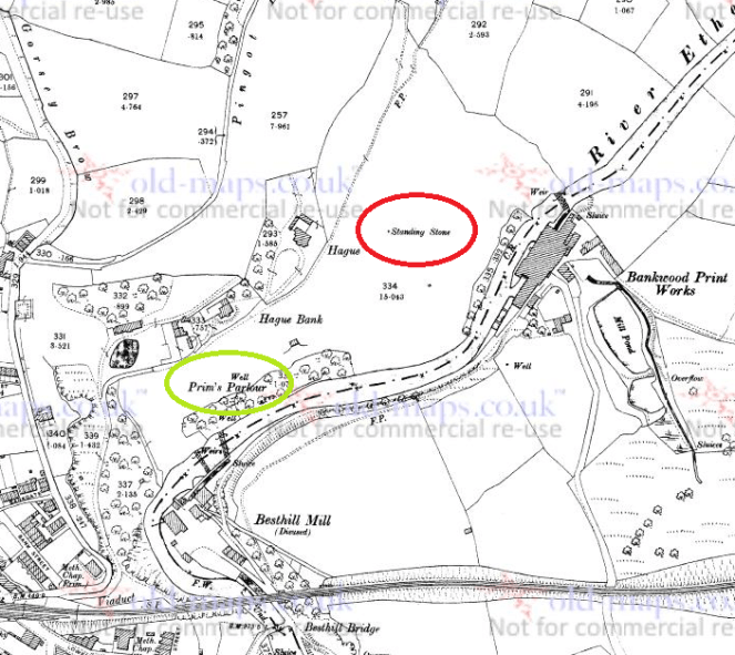
I found this one years ago – I did a ramble in search of this stone and Pymm’s Parlour Roman rock shelter on the banks of the River Etherow (the subject of a future blog). Finding it was not easy, as it now tucked away in a wooded area, and for some reason I didn’t take any decent photographs… not sure why.
Hague Stone marked in red, Pymm’s Parlour (here Prim’s), a Roman rock shelter, in green. 1898 1:2500 OS map
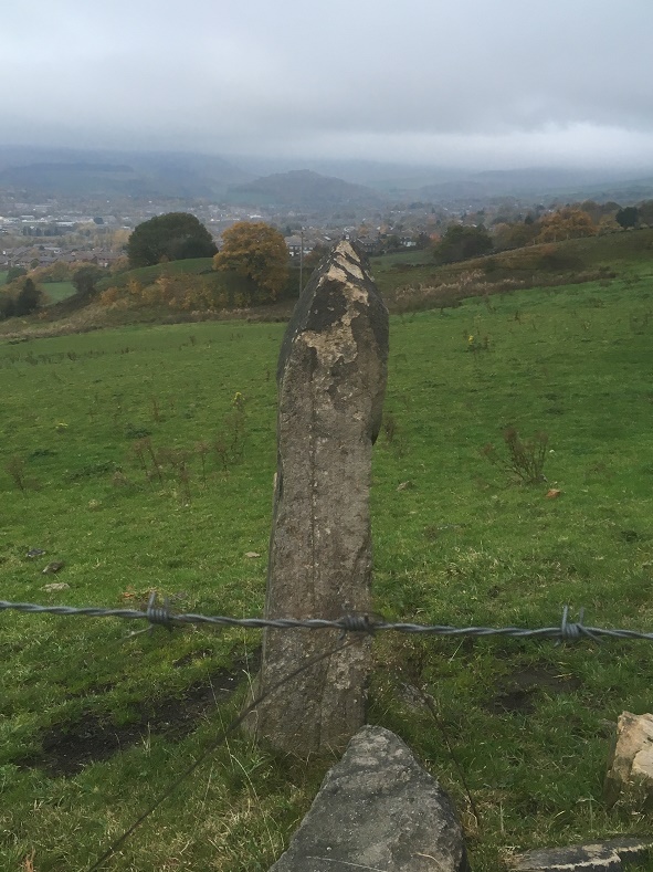
Here’s the stone.
The Hague Stone, dead centre, disguised as a tree. Apologies for the photograph.
It’s a fairly hefty stone, as you can see, and tucked away, though the 1898 OS map shows it as standing in open fields. I will get a better photograph this winter, I promise! Not a great deal to say about this stone, though I think it is important, as we’ll see.
Long Lane Stone
Very visible from Long Lane, this stone has long intrigued me.
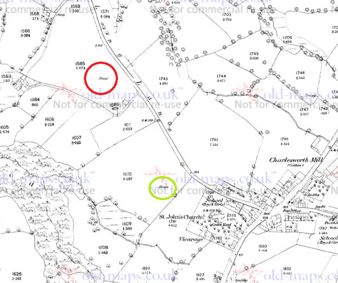
The Long Lane Stone marked in red. Another stone is circled in green. 1887 1:2500 OS Map
I have been unable to get a decent photograph of the stone, as it stands in a field that grows turf for Lymefield Garden Centre, and one doesn’t like to trample on the new grass (and I don’t recommend you do either). Every other time I’ve tried, it’s been too dark, too bright, etc. So here is the Google maps version. I’ll keep trying, and replace when I can.
The Long Lane stone. Long Lane is behind the camera, and Charlesworth to the left.
It’s a fairly bog-standard standing stone, shaped and set into the ground in the middle of a field. The 1898 OS map shows it standing at the head of what it describes as an ‘Old Quarry’, something that the earlier maps don’t show. I can’t believe it’s a quarry… what would they be quarrying here? A marl pit perhaps, but not a quarry. Perhaps it is a feature associated with the stone? What I do find interesting is that the stone hasn’t been moved – either in the past, or more recently, in order to make harvesting the turf more easy. Folkloric associations with bad luck? Whatever the reason, it’s great that it remains
As with the Hargate Hill stone, on the 1887 OS map, there is another stone marked, south of the main one, further up the hill toward the church (in green on the map). I have not been able to investigate this as it now stands on very private property, behind a locked and alarmed gate. I have not been able to see anything on later maps or aerial photographs, and it may just be a small unrelated stone – the early OS surveyors marked anything that couldn’t be moved on their maps. I would still like to investigate though, so if anyone knows anyone or anything, please let me know.
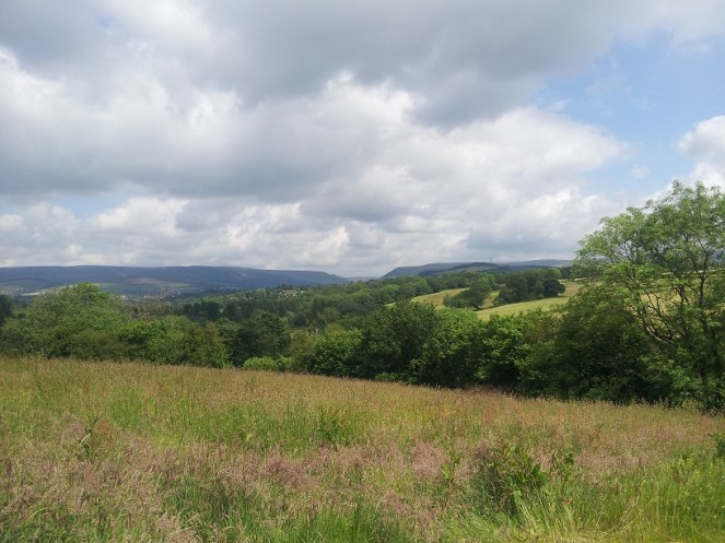
Now, these last two stones, for me, are particularly interesting. Let’s play a game of ‘what if’ Assuming that the stones existed at the same time, they would have been intervisible – you could see one from the other. They stand on opposite sides of the river, and on opposing hillsides, but are at about the same elevation, and both middle hill, not at the top. In a sense they are facing each other, and we may understand them perhaps as rivals, representing two different nodal points, perhaps for two different clans. But what if, instead, they are viewed as complementary? What if we take them together, as a pair, making a statement? The location of the Hague stone is at the head of the valley, just past the Besthill Bridge and the cliffs of Cat’s Tor there. The cliffs are steep and difficult, and logically the slope where the stone is located is the first patch of land that would allow it to be dug in. I feel almost certain that the stone references this point, and that it is placed at the head of the Longdendale Valley.
The view from just about where the Hague stone is. The Long Lane stone is far to the right, the Longdendale Valley is opening out ahead, and the Iron Age Hill Fort at Mouselow is middle right.
If we accept that the Long Lane stone references the Hague stone, then we seem to have a pair of distant, yet connected, stones standing at the head of the Longdendale Valley – gateposts of a sort allowing you access into the valley, and which form a part of a larger landscape, shaped and controlled by the people in prehistory. This puts a very different spin on the place, and suggests all sorts of areas for further research.
Of course, it is all ‘what ifs’ – a story if you will, and one that is completely unprovable. But it is possible, and I genuinely believe that the Hague stone at least is there for that purpose; you often find stone circles situated at the confluence or head of valleys, so why not a single (or pair of) stone(s)? Something to think about, if nothing else.
If you are interested in the ideas about British prehistory that I have been talking about, there are a number of very good books on this subject. I would recommend starting with:
Britain BC by Francis Pryor An excellent and easily read overview of prehistoric Britain. Really very good.
Stonehenge by Mike Parker Pearson A compelling & easily read account of the Stonehenge Riverside Project, and in particular it covers Parker Pearson’s theory that stone = death, and wood = life.
Ancestral Geographies of the Neolithic by Mark Edmonds Academic, but a good and accessible read. Full of wonders. Highly recommended.
These next are academic archaeological books that are a bit more complicated, and require some background knowledge.
Understanding the Neolithic by Julian Thomas Essential reading, but very dense. Not recommended for the casual reader.
The Significance of Monuments by Richard Bradley. Another good one, dense in places
Ritual and Domestic Life in Prehistoric Europe by Richard Bradley. Again, really good, and quite accessible. It covers the whole of Europe.
As always, any comments, questions or corrections are welcome, just drop me a line – either email in ‘contact’ above, or in the comments section below. Next time I’ll blog about some interesting pottery… I think.
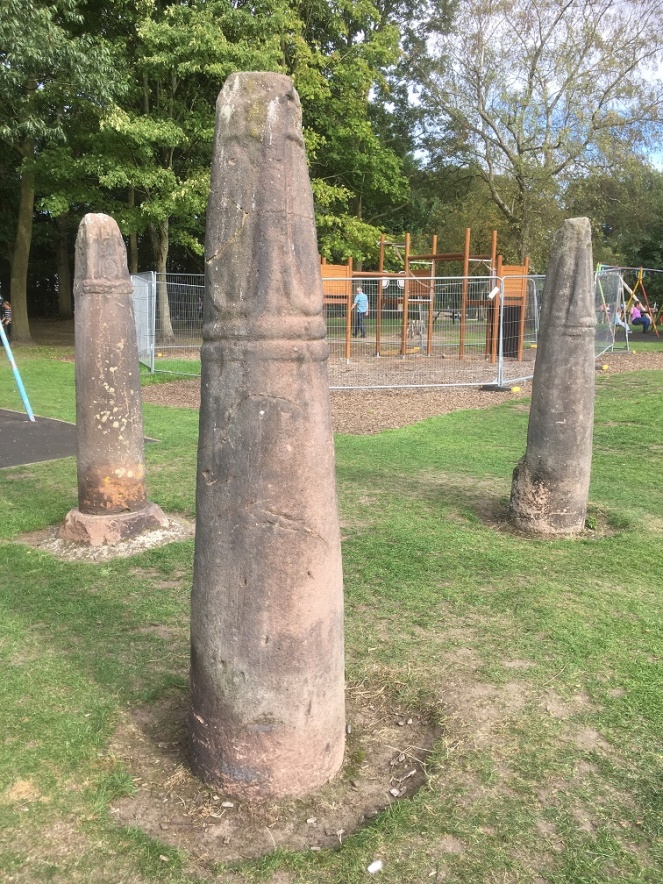
Mrs Hamnett, Master Hamnett, and myself found ourselves passing through Macclesfield a few weeks ago. So I took the opportunity to visit the three splendid Mercian Round Shaft crosses that were erected in West Park there. I had tentatively suggested that one of them was a dead ringer for Whitfield Cross, and in a slightly better state of preservation. Definitely worth a closer look, and, of course, Master Hamnett was pleased as it means he got to go to the park.
The three cross shafts are located in the middle of the play area, and impossible to miss.
The Macclesfield Crosses, situated in the excellent West Park in town centre.
They were originally sited together at Ridge Hall Farm in Sutton (about a mile south of Macclesfield – here). Two of them were being used as gateposts, with iron and lead fixings carved into the stone, and the third was in a pile of rubbish. Their importance recognised, they were promptly moved to West Park, arriving there on 7th January 1858. Interestingly, Ridge Hall Farm was originally a moated farmhouse of medieval date – the remains of the moat can be seen in the aerial photograph above, circling the farm at the south and west.
Now, although the crosses were ‘found’ together, I don’t think that the farm was their original site, and it is likely that they had been moved there from points unknown. The probability of their movement is given evidence by the fact that the farmer had two cross shafts on his land, exactly the right width and in exactly the right location to form a useful gate. And by the fact that one of the crosses was “in a pile of rubbish” – such wording suggests it had been moved and discarded, perhaps awaiting employment as a fence or gate post. Also, whilst they occur in pairs (and the gatepost pair may well be an example of this), we know of no other examples of three crosses occurring together. However, caution should perhaps be urged here; with so few examples of this cross type surviving, we don’t have a huge body of evidence from which to draw comparisons or to make bold statements, and as the old archaeological dictum runs, absence of evidence in not evidence of absence. But in this instance, and on balance, I think it is likely they had been moved. Given that Ridge Hall Farm is not near any parish boundary, nor is close to a church, we might tentatively suggest that they originally marked the junction of tracks, as Whitfield Cross once did.
But I digress.
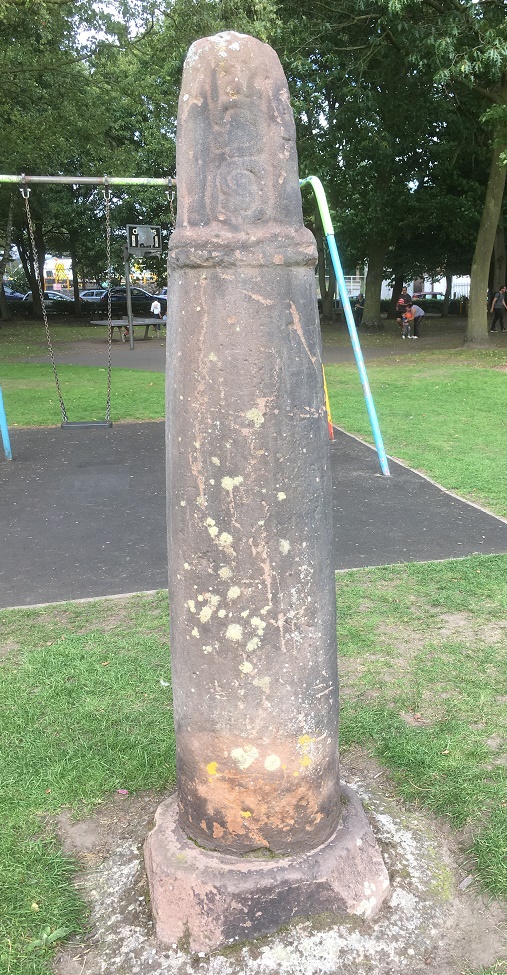
The one that resembles Whitfield Cross is on the left of the three in the above picture. In the Cheshire and Lancashire volume of Corpus of Anglo-Saxon Sculpture (website here) it is listed as Sutton (Ridge Hall Farm) 1, and dates it to 10th or 11th Century. Here is a close up.
The south-west side of the cross.
Although it is made of a similar stone, it is unclear if the cross base is original to the cross. I have to say, it looks like it might be, and if it is the case then we might suggest that this cross was in its original position on the farm. The other two crosses don’t have their bases, and it seems doubtful that the farmer would go to all the trouble of digging up the cross base, when he could just sink a hole and place the shaft that way. Also, if the other two had their bases, then the 19th Century antiquarians who were responsible for their movement would have taken them too.
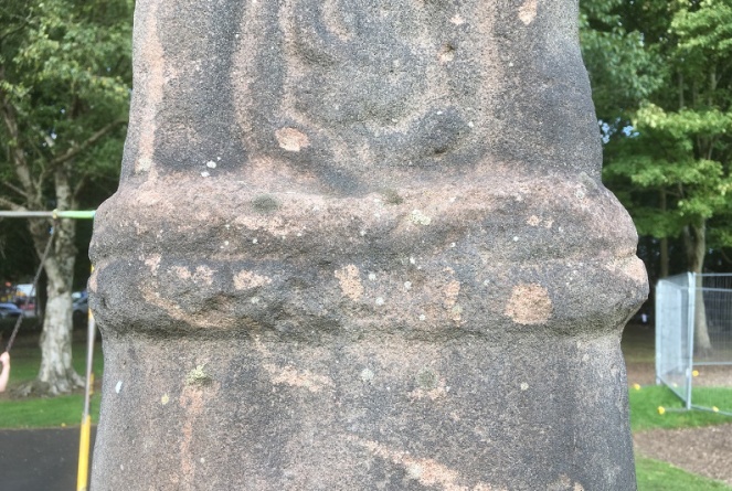
The collar is of a very similar style to Whitfield – sloppily executed with a rough groove drawn around the neck, rather than two distinct bands.
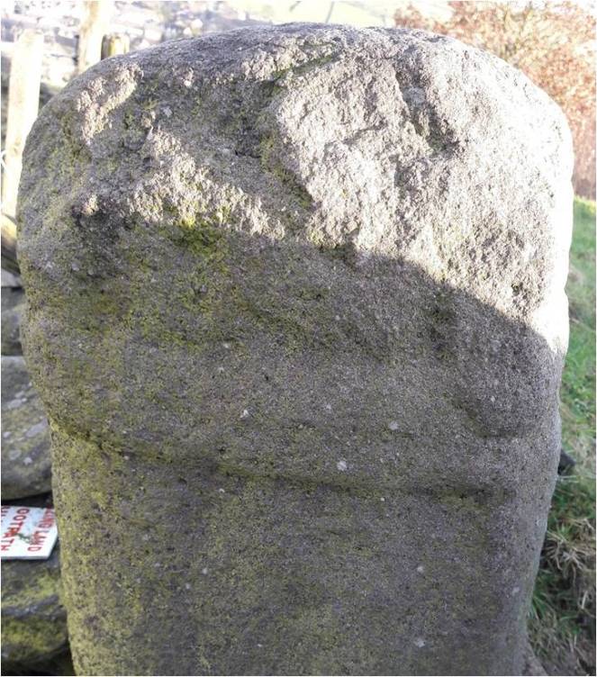
The Macclesfield cross – note the collar.Whitfield Cross – detail of the neck band. Similar in style to the Macclesfield Cross above.
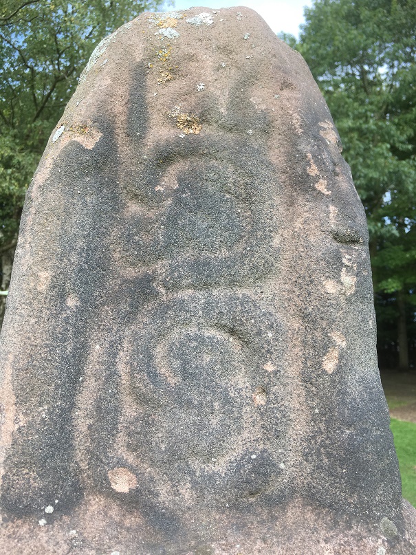
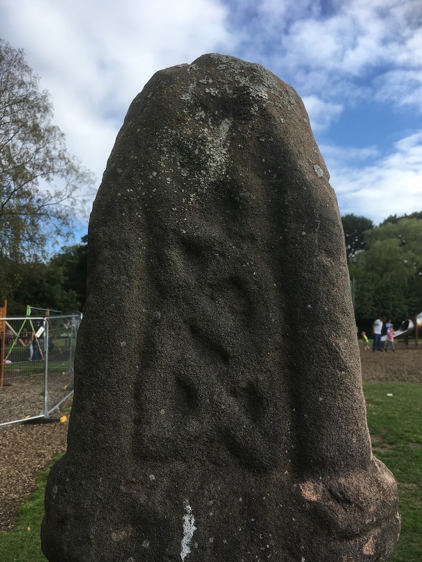
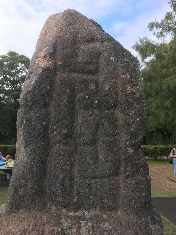
I also suggest that the decoration which is missing from Whitfield would be of a similar nature to the Macclesfield example. Here is a closeup of the decoration. You can see what remains of decoration on the Whitfield example above and below.
The decoration is, with the eye of faith, just about visible. Compare with those below.South west side, described in the Corpus as a “simple scroll, its three offshoots terminating in a triple round scooped leaves”. That looks about right.North east side, described in the Corpus as “crossing two-strand interlace terminating in a Stafford knot with pointed terminals”.South-east side – described in the Corpus as simply a “meander pattern”.North-west side, described in the Corpus as “two-strand encircled twist, with two loose and inward-turning ends at the bottom of the composition”
So there you are. This is what I think a little better preserved Whitfield Cross would have looked like had the puritans and drunken louts of the 18th Century not got hold of it. Having said that, I recently read about people digging up roadside crosses because they believed treasure was buried beneath them, which is another reason these crosses are so rare. Bloody barbarians!
Anyway, I know this is a long way from Glossop, but I think it is important that the comparison with Whitfield Cross is made and explored… who knows, the same craftsman or woman may have carved the crosses. And it’s interesting nonetheless.
Next time, I’ll be a lot more local… very local indeed.
As always, any comments and questions are welcome. There really is quite a thriving community of people out there, and it’s great to hear from you all.
It suddenly occurred to me that I hadn’t published any pottery or other bits and pieces for a while. Of course, whilst I may not have written anything, it doesn’t mean that I have stopped picking things up… nope, I have literal bags of the stuff, much to Mrs Hamnett’s annoyance.
So here goes with some interesting bits and pieces from all over Glossop.
These first sherds of pottery are from the back garden of the Prince of Wales pub, Milltown, Glossop. I have already blogged about the clay pipes from here in this post, but this is the pottery that goes with them.
Treasure from the Prince of Wales pub. I’m happy to return them, if they want them.
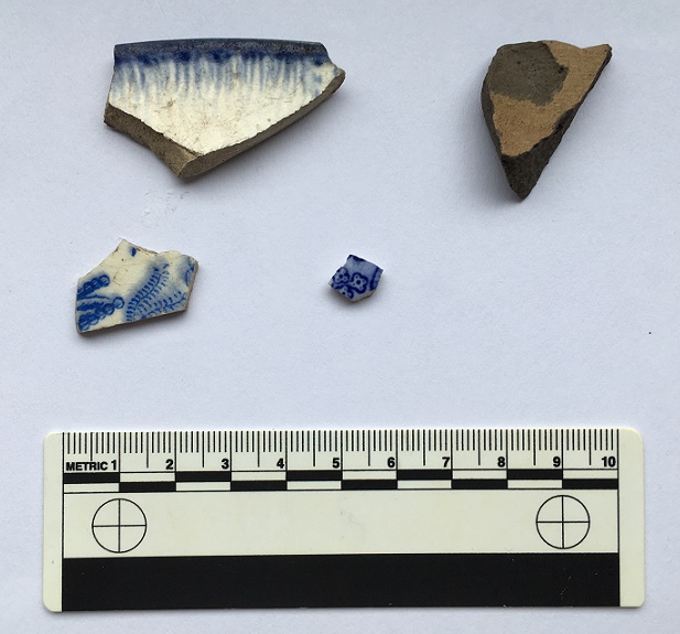
The same age, unsurprisingly, Mid to late Victorian, possibly early 20th Century. The stoneware (top right) is fairly bog standard, and probably comes from a ginger beer bottle or similar (which makes sense, given where we are). The blue on white pottery is difficult to date from small fragments, but it starts in the 1790’s, and carries on until… well, now! This wouldn’t be early stuff, and it’s been kicking around for a while in the soil, so Mid – Late Victorian it is. The top left is from a featheredge decorated dinner plate, measuring 24cm in circumference. Here is a good example of the type with some discussion. This style of pottery also starts 1790ish, but the type we see here is the same date as the others. It is commonly found with a ‘shell edge’, but this one has the impressions on the surface, but not the undulations. All very common, and very in keeping with the place being a pub in the busy Milltown area. I want to know what was being served on the plate – good hearty pub food of meat and veg, one assumes.
This next sherd is from Whitfield Recreation Ground. I found it a few years ago, after some heavy rain, just underneath the bench by the swings.
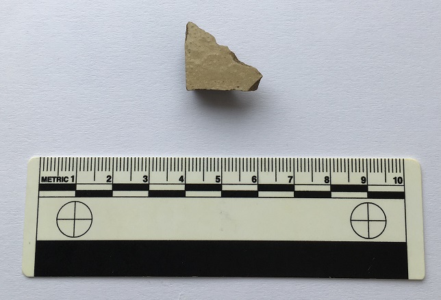
Unexpected find from Whitfield Rec.
Cream coloured stone ware, hard fired, and virtually indestructible, as I have mentioned elsewhere. This sherd is glazed inside and out, and comes from the bit that the joins the base to the side. This type of pottery was only normally used for ginger beer or milk in the late 19th and very early 20th Centuries, so we may assume that as the date. It’s a possible rare survival from a time before the recreation Ground was there (it opened in January 1903). I intend to do a future blog post about the ground, as it has a fascinating history.
This next lot is from Old Lane in Simmondley. This was the original road between Charlesworth and Glossop, and joined in the meeting of several roads at St James’s church, Whitfield (I have blogged about that meeting place before). I did a bit of a walk along the path as far as it goes (here, on my Twitter feed – and the next few photographs on from it), and it eventually fizzles out into fields. But along the way I picked up a few sherds.
Simmondly, Old Lane – the original road.
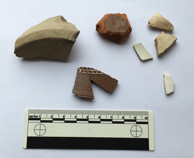
Top right is three sherds of cream ware, without decoration, and eminently undatable – probably Victorian, but ultimately these are destined for the midden in my garden. Top middle is a piece of thick slip glazed earthenware. This, I think, is 18th Century, so relatively early, and certainly earlier than the other sherds. It is glazed on the interior surface only, with the outer surface being washed with a red slip, so I think it is probably a cooking pot of some sort. Top left is a large stoneware storage jar of some form, or possibly a flagon like this. It is salt glazed on the inside, measures 14cm in diameter, has a chamfered edge around the base, and is almost certainly mid to late Victorian. Bottom right is a fine china open vessel – a saucer possibly – it is undecorated, and not enough remains to get a diameter. Bottom left is a broken fragment of a stoneware storage jar. It is salt glazed, and has an impressed decoration of a border of round blobs, which is a very common motif for this type of pottery.
Now, the good stuff!
There is a place, if you know where to look, in Manor Park, that produces all sorts of goodies. I think it is a late Victorian – Edwardian rubbish dump, or at least was one before being redeposited. Over the last few years, I have pulled some very interesting bits and pieces out of the soil, and I suspect there is plenty more, too.
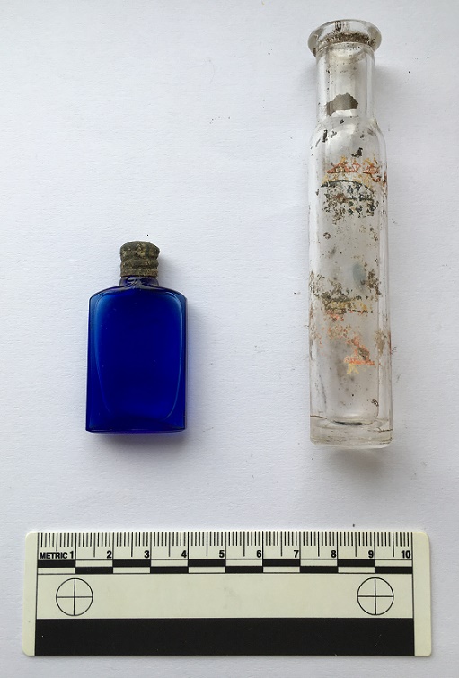
First up, these two.
Unbroken glass bottles – something of a rarity.
The one on the right probably contained a hair oil or something (I don’t known why I know that, or even if it’s true, but I seem to recall reading it somewhere). Not that impressive, other than the fact that it still has the original label on it… except I can’t read the bloody thing! Frustrating.
The blue one on the left is lovely, though. Not a mark on it, and when I cleaned it off, I realised two things – firstly, there was a thick liquid inside it, and secondly, the seal was still good. I cleaned it really well, and gently opened up the bottle, and despite Mrs Hamnett daring me to taste it, I instead smelled it – faintly floral and clean. I think it’s rose scented oil for ladies to wear. A wonderful find.
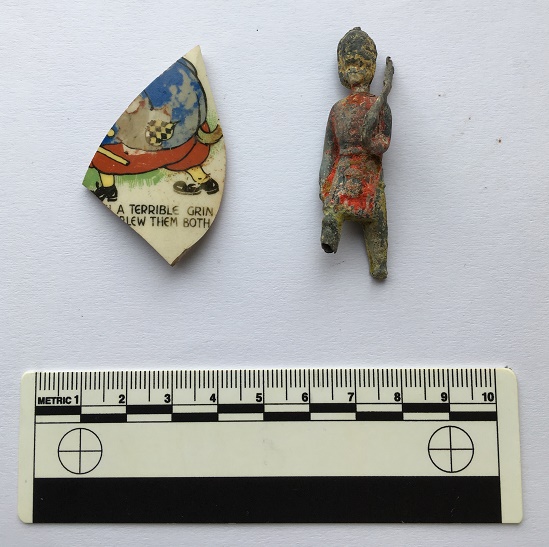
The next two are really quite nice, too.
A taste of childhood – I love the personal side to archaeology.
On the left, a fragment of a child’s cup, presumably with a nursery rhyme round it. I have looked up the phrases “a terrible grin” and “blew them both”, but nothing pops up the internet. If anyone has an idea, please let me know, as I’d love to find out. The fat figure also seems to have a tail – a dog or wolf? I was thinking the Three Pigs as a possibility, with the wolf blowing down the houses, but I don’t remember him blowing two houses down…
On the right, one of my favourite finds. A hollow-cast toy soldier, a child’s prized possession, perhaps. A member of the Grenadier Guards, he has his rifle shouldered, and is marching, albeit with no feet, but at least he has the dignity of having paint. I love toy soldiers, and my own childhood was filled with Airfix plastic ones (I still have them… they await Master Hamnett’s sticky claws!). They were cheaply produced in their thousands, and are not uncommon in rubbish dumps, but I absolutely adore this figure. I have looked online, and although there are thousands like him, I can’t quite place him.
Amazing stuff, and if you buy me a drink, I’ll tell you where to look!
And to end with, a little foreign fun. During my France trip this summer, I found this crumbling out of a soil bank in a vineyard, on the road to the walled city of Carcassonne.
A surprise find, although not unexpected given where we were!
It’s the dimple from the bottom of a wine bottle – technically called a ‘punt’. This one is blown glass, which ages it – you can make out the tiny air bubbles when you hold it up to the light. I’m no expert, but I would say it is certainly 19th Century – and apparently the deeper the punt, the earlier the bottle – so perhaps earlier? Anyway, given where we were, I couldn’t very well leave it there, could I?
Hope you have enjoyed the pottery, and as always comments and questions are most welcome.
After my last post on milestones, I received a message from the always interesting Roger Hargreaves (see comments below the above article). Now, Roger is something of an expert in these matters, and has done some considerable research into the road system of the area through the ages – Roman to 19th Century in fact – and he helpfully offered some information, and some photographs, too.
So then, the milestones…
Following an act of parliament in 1770, the milestones were erected every mile (hence the name) along the 1730’s turnpike from Manchester to Saltersbrook by the surveyor James Brown jr. Later sections of turnpike were built from Saltersbrook to t’other side o’ Pennines – there’s a great website, with lots of pictures, dealing with that section, here. This road from Roe Cross follows broadly the route of what is now A628 / Woodhead Pass, itself a turnpike from the early 19th Century, and which overlays the original road.
However, in places, this 1730 turnpike is still visible where the 19th Century road deviates, perhaps taking an easier route, and so sections can be walked, and it is along these that milestones, where they survive, can be seen.
Here is a section of the original 1730’s turnpike. It leaves the Woodhead pass at the first circle, and rejoins past Crowden, at the second circle.The 1730’s turnpike as seen on Google Streetview. The road originally went up to the left – you can see the path, and can walk along it for a large portion.
Now, because milestones are placed exactly one mile from each other, it is possible to work out where they should be. Of course, in some places where we would expect to find them, however, the newer road has obliterated all traces of the older road, and presumably the milestones would have been broken up and used as hardcore, although not necessarily, and it might be worth a further investigation – they are perfect for gateposts, after all.
So, starting from Roe Cross, then
10 Miles from Manchester – this would have stood at the Toll House at Roe Cross
11 Miles (somewhere on Mottram Moor) and 12 Miles (far side of Hollingworth) are missing – the area has been built up, although they may well still be in a hedgeback somewhere.
13 Miles to Manchester – this would have originally stood somewhere in Tintwistle – annoyingly, the mileage doesn’t work with it being situated at the toll gate there, which stood at the far end of the village, west of Townhead Farm.
14 miles is missing, but would presumably have stood east of Townhead Farm – again, worth a look in hedgebacks and walls.
15 Miles to Manchester. Just by Rhodeswood Reservoir. Photograph by Roger Hargreaves. And a damn fine one it is too!
16 Miles would be just below Highstones, where the track still exists, and so would be a strong contender for a survival in the walls and hedgebacks.
17 Miles and 18 Miles are in places where the 19th Century road overlies the 18th Century, and thus are likely to be lost. Although, again, maybe worth a look.
19 Miles to Manchester – mutilated and forlorn in a wall at Higher Wooodhead. Photograph by Roger Hargreaves. I love this photograph.
20 and 21 Miles to Manchester are beyond this, and although there is a survival of the road in these areas, there are no walls in which the stones may be hiding. It is likely that they are simply buried in the peat in that area, waiting to be discovered. A walking trip with a steel pole, anyone?
This takes us to Saltersbrook, and the other side of the turnpike system there. Here is a map of the road from Saltersford into Yorkshire.
The Yorkshire side of the turnpike road, from Saltersford to Wortley. There are plenty of milestones and other interesting goodies along this route, but they are truly beyond the scope of this blog. Check them out in this really amazing website.
So after the journey, let’s end on a song – a particular favourite of mine, from a particularly good album, and whose title is very apt.
I also want to thank Roger Hargreaves for allowing me to use his photographs, and for the additional information.
As always, comments or questions are always welcome.