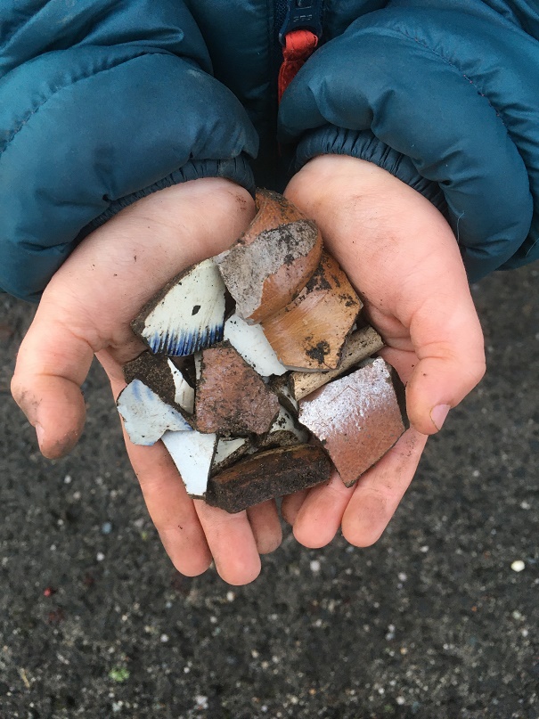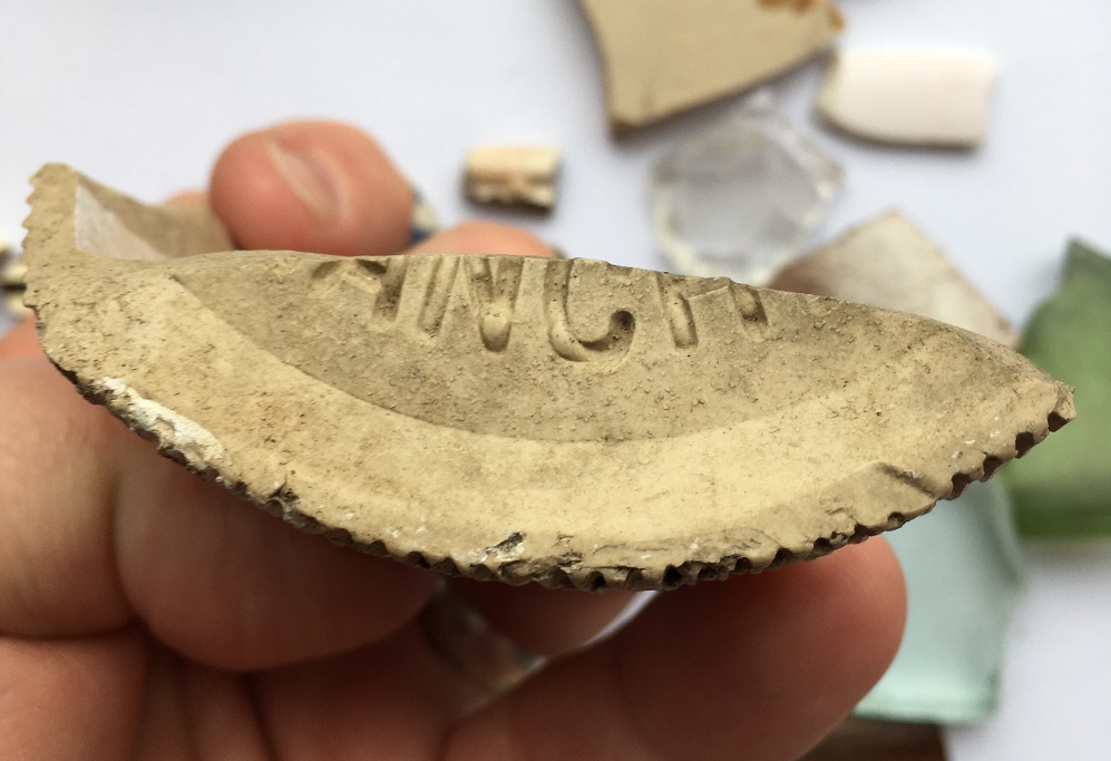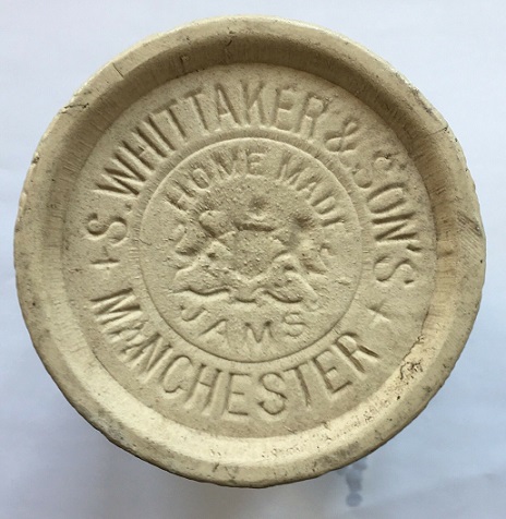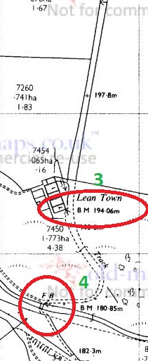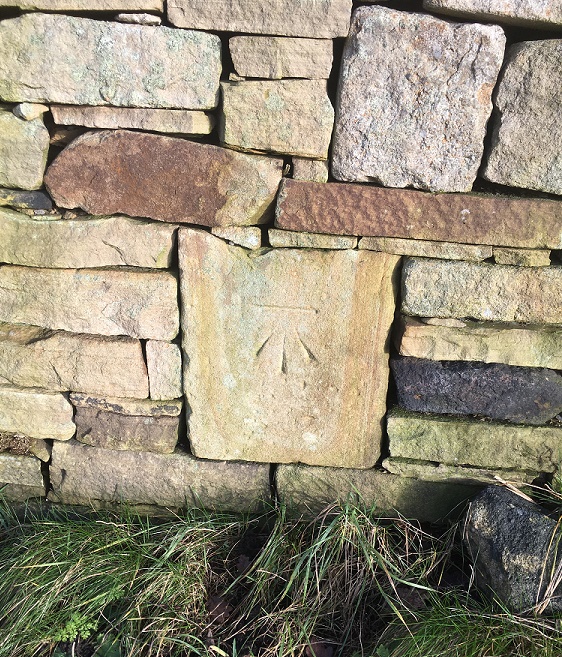
What ho! Hope you are enjoying the summer so far. A quick post today, but more very soon.
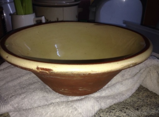
So, I know I promised you pottery this time, and I can tell you are wildly disappointed, but this is an interesting bit of history. Honestly. It really is. Don’t just look at the first picture and yawn… Philistines.
There are a number of places around Glossop that never fail to produce some bits and pieces – Lean Town, Harehills, etc. One such place is at the top of Whitfield Avenue. Never lots, but always a sherd or two, and this time a piece of lead. Window lead to be precise.
Lead is one of those substances that is instantly recognisable once you know what it looks like, and can be spotted from quite a distance. It doesn’t rust, or even really react beyond producing a white powder on the surface. It is soft, which means it can get damaged – in particular bent – easily, but it also means that it doesn’t break in the way that pottery or glass does, so it often survives. It is also worth remembering that it is highly toxic, so be careful when you handle it.
Don’t worry, I washed my hands afterwards.
So there it was, lying on the surface of the soil, a dull grey flash exposed after all the rain we have recently suffered. I would have picked it up anyway – I try and do that with lead, as it’s not great in the environment – but I knew at a glance what it was, and was excited as they can be interesting. I was not disappointed.
Window lead, or came as it is more properly known, has been with us for as long as there have been glass windows, and is essentially an elegant solution to a big problem – the fact that it is very difficult and expensive to produce glass in any large size. It is far easier to join together smaller pieces, and this was still the case until the 19th century, and why even early 20th century windows are made up smaller pieces separated by wooden mullions. But the multi-part aspect also allowed works of art to be created in the form of stained glass windows that adorned medieval churches and cathedrals, and is a fashion that continues down to today.
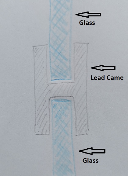
The came works by allowing separate pieces of glass to slot into its grooves, joining them together, with the whole being held in place by the window frame. In profile (that is, cut in half), came is broadly ‘H’ shaped:
A pretty awful drawing, but you get the idea… I hope.
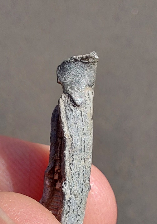
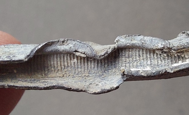
So then, what can we say about this little piece of twisted metal? Well, a surprising amount, to be honest. Firstly, rather than being poured and shaped in a mould, the came has been milled – the lead was drawn through a former by a cog. This means that it is not medieval, but instead puts it into the archaeological ‘misc.’ tray that is ‘Post-Medieval‘ (roughly, after 1500). We can, however, narrow it down a bit; the cog used in the manufacturing process leaves characteristic tooth marks on the interior. As the process was refined and improved over time, these marks grew further apart, and broadly speaking, the closer the teeth, the earlier the date. On our piece of came, they are very close together, and thus an earlier date is suggested.
Teeth marks, where the cog has pulled the came through the former.
This is backed up by the slightly rounded profile, which is also associated with earlier examples. We might suggest a date of perhaps 1700 – 1800, possibly earlier, but unlikely to be later.
Left: the slightly rounded ‘H’ profile, also slightly squashed. Right: the clean cut edge, probably by a knife.
It seems to have been cut cleanly at either end, which means it is the original length, which is significant. It measures just under 6cm, or 2 1/4 inches, so not very long, but a perfect size for the diamond style windows that were common in the 17th and 18th centuries, when whole windows were made up of smaller pieces and joined by the came. Look closely, you can see the tin solder that would have joined it to another lead came piece.
The melted end, but also marks where it was pulled through the former.
Looking even more closely, you can see the putty that would have weather-proofed it still inside the groove.
White putty visible.
Here is a 17th century window:
Typical Tudor & Jacobean diamond pattern window.
And here is our piece of lead in a mocked up window, showing how it would have been used.
Another rather poor drawing, but one hopes you get the idea.
How this piece of lead came came to be lurking in the soil on that rainy day is not certain, but it is in the right place – some of the oldest houses in Whitfield are right there, including Hob Hill Cottage with its datestone of 1638. The came must have originated in one of these houses, and at some stage either window was repaired, or replaced entirely. Indeed, if we look closely, we can see two marks where the lead flange has been lifted away from the glass to remove it.
The lead flange has been peeled back from the glass.
At that point, the lead has been lost or thrown away. I’d love to be able to say for certain which house it came from, and the obvious choice would be Hob Hill Cottage as it is just opposite the find spot, but in reality who knows? I am amazed at how much information it is possible to glean from what is, at first glance, just a small piece of twisted metal. And see, I told you it would be interesting.
More soon. As always, look after yourselves and each other, and until next time, I remain.
What ho, kind and gentle folk of the blog reading world!
Sooooo, today is back to some sense of normality in that I am looking at pottery. “Woo-hoo!” I hear you cry. Well alright, some of you cried “woo-hoo!“. Well alright, not that many of you if I’m honest. Certainly not enough of you. Well tough… it’s my blog, and I like pottery, so we’re doing pottery. Now pay attention, I may ask questions.
Actually, this stuff is interesting in two ways. Firstly, as bits of archaeology. And secondly, I didn’t find them! No, that dubious honour rests with my friend and fellow delver and obsessive, Charles Winford Lodge (actually not his real name, but then you are reading a blog written by a man who has been dead for well over 100 years, so it’s probably best not to start asking too many questions at this point). He goes by @2hrTV on Twitter, and usually has something interesting to say on the subject of the history of Glossop and area. Usually… I mean, I can’t promise.
Anyway, the conversation – pretty normal for us – went along the lines of: Him – “Years ago I found some pottery at Valehouse Reservoir. I’ve just re-found it in the house… want to see it?“ Me – “Absolutely, my good man… lead on.”
Out it comes (in a plastic doughnut box from Tesco – price £1.10 – bear in mind this is the man who once gave me some pottery in a camembert box, so doughnuts are a step up). Most of them are fairly standard Victorian sherds, but one or two made me sit up. Now, the sherds had not been washed (tut! tut!), and so I volunteered to take them, clean them, and blog about them. Which is how I ended up washing up someone else’s broken old rubbish. Please, no one tell Mrs Hamnett… it might not end well. For any of us. However, I think the risk was worth it.
Valehouse is an interesting place; now just the name of a reservoir in the Longdendale Valley, below the Woodhead Road, it was once a village that in its prime, and prior to its flooding, had roughly 600 residents in 100 cottages with a number of shops, a school, and other amenities. Samuel Oldknow built the first mill here in 1775 – the first to harness the power of the Etherow – and it is after this point, and largely in the early 19th century, when the mills were substantially expanded, that the majority of houses were built to house the mill workers. The valley was flooded in 1869 to provide Manchester with water, and the mills and houses were all submerged. I also have a personal connection with the village in that my great great great grandfather, Benjamin Livesey, was born there in 1824.
Valehouse prior to the 1869 flooding. Note the large mill buildings, and the many houses.
Valehouse as it was in 1899, and indeed still. Note the large quantity of water and lack of houses.
So then, the pottery. It was recovered during a drought a few years ago, and from the area around the viewing platform on the north side of the reservoir. Having studied the sherds, it’s clear they can be split into two broad chronological groups – early 18th century and late 19th century – which probably represent two different origins. I’ll discuss the latest first, before looking at the oldest, and arguably more interesting.
Not, at first glance, particularly inspiring.
1 – A Victorian earthenware jar or jug, vertical ridged decoration, with a body diameter of 9cm, and glazed in a lovely cobalt blue colour. Nothing special, but quite fancy.
2 – Simple sherd of blue and white earthenware, with the bog standard transfer print.
3 – Thick base to a Late Victorian Codd Bottle. It has ‘TON-U-LYNE’ embossed on one side, and a little research gives us ‘R.A. Barrett & Co.’ of Ashton-Under-Lyne. They manufactured soft drinks and mineral water, and were particularly noted for their ginger beer. Their factory still stands in Dean Street, Ashton.
A complete Barrett & Co. Codd bottle, and the factory as it stands today. The bottle fragment above would have been made in this factory.
4 – Fragment of bottle, probably Victorian mineral water or beer.
5 – Another fragment of green glass – probably Victorian, as it is quite thin walled, but it does contain large numbers of bubbles, suggesting perhaps an earlier date.
6 – A large, thick walled, earthenware sherd, perhaps part of a lid to a very large “Brown Betty” teapot – it is certainly the right colour for this, and curves the right way. The surface colour is a mottled brown, and is a type that deliberately recalls the earlier, 18th century, manganese ware. Interestingly, you can see how this effect is achieved by looking at the break. Two colours of clay – one dark reddish brown and one a creamy buff – are loosely mixed, and the clay is shaped into the mould. It is first fired, then a clear or slightly yellow glaze applied, followed by a second higher temperature firing. Where the cream buff forms the surface, it is a yellow or golden brown, and where the reddish clay forms the surface, it produces a dark rich brown, together forming the mottled effect. I quite like it, but much prefer the original 17th century stuff.
The appetising looking Victorian mottled ware sherd. You can see how the different coloured clay affects the surface colour
Right, let’s move onto the arguably more interesting stuff.
This material dates from roughly the early 18th century – let’s say 1700 – 1750… ish.
1 – Large and chunky strap handle probably of Nottingham Stoneware, and probably from a large jug or flagon. It measures 4.5cm wide, and is typical of its type. Stoneware is fired to a very high temperature, melting – or vitrifying – the clay, making it into a very hard and almost metallic pottery. It has a dark grey fabric, with a brown glazed surface which is very shiny – the result of adding iron to the glaze. Interestingly, this is not as fine or well made as the earliest material here, and shows some similarities with the later Derbyshire Stoneware, so it might be the somewhere in late 18th century.
2 – Base to a stoneware jug or jar, with a diameter of 10cm. This too has characteristics of both earlier Nottingham Stoneware and the later Derbyshire type – the glaze for example, is less lustrous than early sherds, but it has the classic grooved decoration running around the base. The underside shows wear suggestive of use and re-use over time. On balance, I’m going to say it is early, safe in the knowledge that no one is going to double check (as he scurries away and hides it).
3 – Lovely Nottingham Stoneware bowl, with a rim diameter of 13cm, and a slightly flaring out-turned rim. It’s thin walled, with a grey uniform fabric that was slipped in white before glazing. The surface glaze is a lovely melted chocolate colour, very lustrous and almost metallic looking, and is very characteristic, as is the horizontal grooved decoration on the exterior, and glaze drip marks on the interior. I liked this so much that a drew it using the archaeological method – essentially looking at the whole vessel in profile, and removing a quarter to allow both the interior and exterior to be shown.
The profile of the sherd is shown on the left, coloured in black – this shows the shape of the pot. The interior of the pot is shown next, with the wavy lines where the glaze dripped. Then the exterior of the vessel is shown next to that. I might do a post about this type of drawing, as I’d like to do more. It’s been a while since I did this last, though.
4 – This is a bit of an odd one. Stoneware, but potentially quite early. Certainly it fits with the 18th century stuff, but the surface is off – it looks like orange peel, dimpled all over with a salt glaze, and reminds me of the earlier 18th and even 17th century German stonewares that were imported in huge quantities. Whatever it is, it’s a huge rounded or pot bellied vessel with a diameter of roughly 26cm, despite being very thin walled. It is also a closed vessel, being glazed on the exterior only, so perhaps some form of small barrel or large bottle?
5 – Nottingham Stoneware – flask or bottle type. The body, shoulder, and beginning of the neck only, it has a body diameter of 18cm, so quite large despite being very thin walled. It has a double band of horizontal incised decoration which is showing the under slip where the glaze is thinnest. Like No.3, the glaze is lustrous and a melted chocolate in colour.
6. Finally, we have the star of the show – a rim fragment of a Staffordshire Slipware platter or large plate. This stuff is very diagnostic, and gives a clear date of between 1650 and 1750, with this sherd from 1700ish.
Interesting stuff!
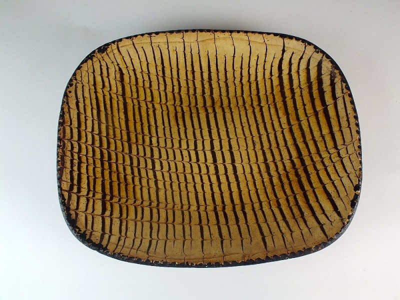
Slipware like this is quite good quality, and a step up from the wood or plain wares that the average man or woman would eat from – or rather take from, as this would be a communal dish that everyone would eat from. Often broadly rectangular (as this is, I think), they are shallow, and would be completely covered in this linear banded decoration of yellow and dark brown. It’s quite striking, and would be a blast of colour in a world that was otherwise quite drab, particularly in winter. I still can’t work out whether I love or hate this stuff! Here is a complete example:
A complete example of migraine inducing 18th century pottery.
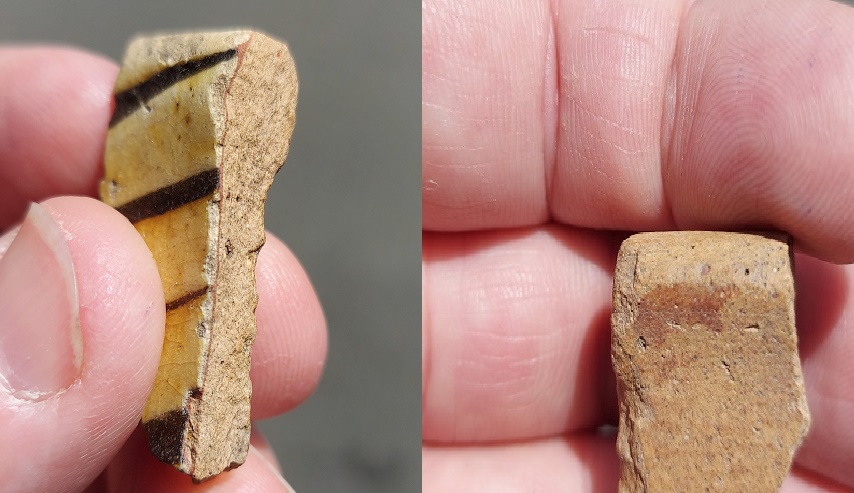
The process of decorating the pot went as follows: the pot is first moulded, then fired at a low temperature. The interior, and only the interior, is covered in a red slip, then overlaid with a white slip, and a tool is then dragged through this white slip, revealing the red underneath. The whole interior is then covered in a clear glaze and fired, transforming the colours to dark brown on the red, and honey yellow on the white. The whole process can be seen if we look at the break on the sherd:
Right – some of the red slip splashed on the exterior of the sherd, it remains red because it hasn’t reacted with the glaze. Left – all there elements can be seen in the break: the red and white slips, the tool that scraped away the white slip, and the glaze that overlays the lot.
So what does all this mean, then?
Because the valley was flooded to create Valehouse Reservoir, it gives us a cut off point (a terminus ante quem in archaeological terms – essentially the latest time an event could have happened) – any buildings and such there must have been built before this point. However, that is not strictly true with portable objects, especially those found near the edge of the water – the reservoir was almost immediately a picnic and pleasure spot, and plates get broken, bottles get launched into the water, etc. So we can suggest tentatively that although some of the material will likely be from the village before it was drowned, most of the Victorian material, and in particular the Codd Bottle, was deposited after the reservoir was filled.
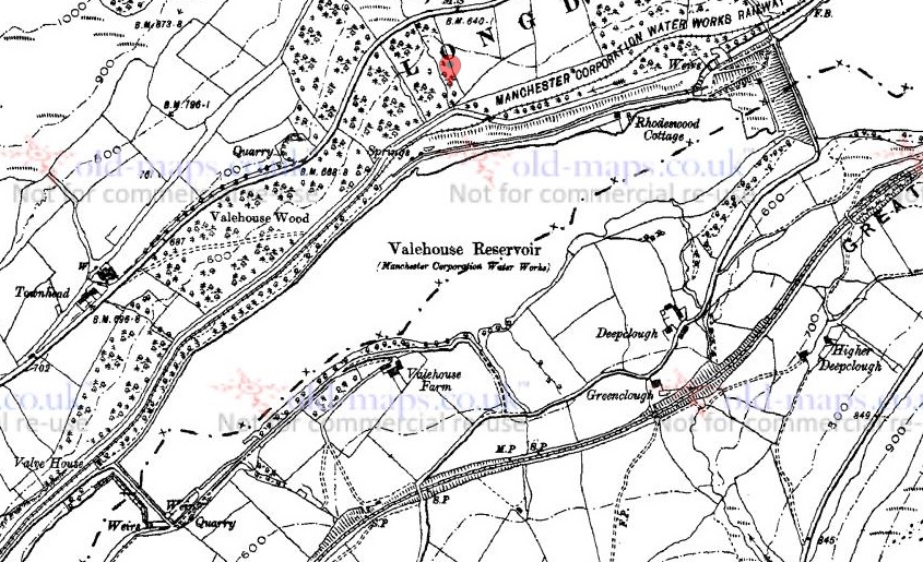
The same cannot be said for the earlier material, and therefore there was clearly some form of settlement here prior to the Victorian period, as no one in their right mind is going to carry around 150 year old pottery to throw in a reservoir. Alright, I might… but most people don’t. So this material has to be from an 18th century dump of some form… but from where. Studying a map of Vale House prior to flooding shows clearly the mill complex and all the houses.
I love playing around with Microsoft Paint!
Circled in red is the rough location of where the pottery was found. But here, in the green triangle, is an odd looking group of buildings. Set apart and in its own land, it looks like the standard farming hamlet for this area, made up of the farm building, outbuildings, and farm worker’s cottages. And in Bagshaw’s Directory for Cheshire dated 1850, we read of Joseph Roe, Farmer, Vale House Farm. Even the name ‘Vale House’ suggests a house of some importance. I wonder if, as so often happens, the local big house or manor house became less important over time and ended up as simply Vale House Farm. If so, then this might explain the 17th – 18th century pottery, and given that it’s made up of several different domestic vessels, suggests strongly that this is the midden, or rubbish dump, associated with the farmhouse. All we have to do now is wait for another drought and we can see what else is buried there.
Valehouse Reservoir today. Somewhere in the middle of that photograph, below the water, lies the remains of a 17th century farmhouse.
Hope you enjoyed this weeks romp around with pottery… let me know what you think, anything at all, even to tell me I’m wrong about the stoneware base (I’m not… it’s my site, and therefore I’m always right!). Also, if you have any pottery that you want me to look at… just don’t tell Mrs Hamnett.
Next month, we have a very interesting tale to tell… more of that later. For now, take care of yourselves and others, and until then, I remain.
So, despite having half a dozen half-written posts, piles of interesting objects and sherds to talk about, and a few adventures to recount, I want to try something a little different today. “Oh no!” I hear you cry. But fret ye not, gentle reader, for it is still archaeology, it is still Glossop based, and it is still interesting. But it is a little… quirky. You’ll see what I mean.
I have a friend who is a writer, and quite a good one at that. He has often mentioned that stories usually start with what he terms a “What If?” moment, where something – often an object – presents itself, and the question is posed “what if…?” From there the story grows, based on and around that one question. The answer that comes doesn’t have to be ‘real’, it is fiction after all, but it has to be possible. What if a house was haunted? And what if the house fell down? And what if a brick from the house was haunted too? And what if a dashing archaeologist took the brick home to write about it on his extremely popular and incredibly interesting blog? What if…?
Archaeology, I think, uses a similar technique. An object is excavated, and the interpretation – the story – begins. However, where we differ from writers is that we base our ‘what ifs…?’ on evidence and supposition grounded in data. The interpretation, in this sense, has to be ‘real‘, although it is only ‘real’ for as long as the data supports it. Sometimes though, It’s fun to play “what if…?” – and here we join today’s post.
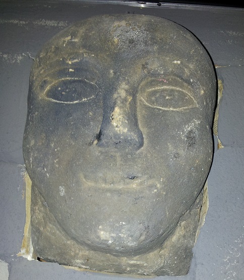
A stone head displaying all the characteristic features, including almond eyes. This one was allegedly found on Mouselow, and now lives on a wall in Buxton Museum
Stone heads. A lot has been written about them. They are cursed and evil. Or they are warm and friendly. They are ‘Celtic’ (i.e. Iron Age or Romano-British) in date. Or they are medieval or early modern in date. Or a combination of both. They represent an unbroken pre-Christian tradition, and an aspect of the whispered ‘Old Ways‘. Or they are simply folk art, and just decorative. Or they are magically protective (that wonderful word, apotropaic, again). Or both. Or neither. A brief trawl of the internet gives a lot of different sites and opinions, ranging from the scholarly and the more open minded, to what can only be termed outright nonsense.
Whatever they are, carved stone heads are a feature of this part of the Pennines – from Longdendale, over the hills to West Yorkshire, and up to the Calder Valley. I actually have a serious project that is looking at them; cataloguing known examples from Glossop and Longdendale, and trying to place them geographically, as well as giving some sort of date to them. There are at least 23 examples from the Glossop area, with more doubtless waiting to be uncovered. But it’s an ongoing project, and not really ready to publish – here, or anywhere else for that matter – and I just keep chipping away at it. It was during the course of trying to map where they were found, that I noticed something very interesting.
Stone head in Old Glossop. Image stolen shamelessly from the Old Glossop website (follow this link – the website is very good)
Before we go any further, I should state that my personal belief is that most of the stone heads are medieval or post-medieval in date (indeed, there is a record of them being carved in the 19th Century). That’s not to say that Iron Age ‘Celtic’ examples don’t exist (one was found at Binchester Roman Fort, in County Durham in 2013), it’s just that it is very difficult to date them as they usually don’t come from any secure archaeological context, and basing a date on ‘style’ or method of carving, as has happened in the past, is notoriously dodgy. That stated, there is the possibility that I might be wrong. And this led to my ‘what if…?‘ moment.
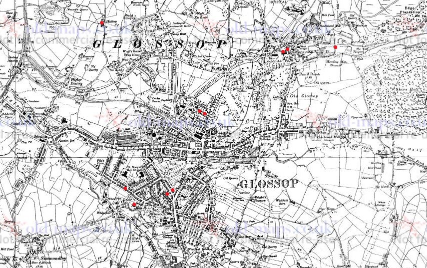
Back to the find location, sadly the majority of the heads are simply “found in Glossop area“, and thus have no exact place. But from various sources, I was able to identify where some of the heads were found. The distribution map is below:
1:10,000 map of Glossop. The Find spots – where the heads were found – are marked in red.
They seem to be dotted all around the area: Mouselow, Manor Park Road, several in Old Glossop, etc. However, looking at the above map, I noticed there was a distinct grouping in Whitfield – four of them centred around Slatelands Road and Hollin Cross Lane. Hmmmmm… let’s have a closer look, then.
Here is the Whitfield group on the 1:2500 map.
Duke Street, Pikes Lane, St Mary’s Road, and Slatelands Road. Geographically, they are in the same tangle of roads in that area. But the heads more than likely pre-date the Victorian roads, so we need to strip them back. What was there then? Well fields, mainly, though the medieval track from Simmondley to Glossop ran through here (that blog post is coming, I promise!). And before that, the Roman road also ran through here, along Pikes Lane, before kinking over Long Clough Brook and onto the fort and settlement at Melandra.
And then, the “what if…?” hit me.
For the sake of a good story, what if these heads actually were Iron Age or Roman in date? What could this cluster mean?
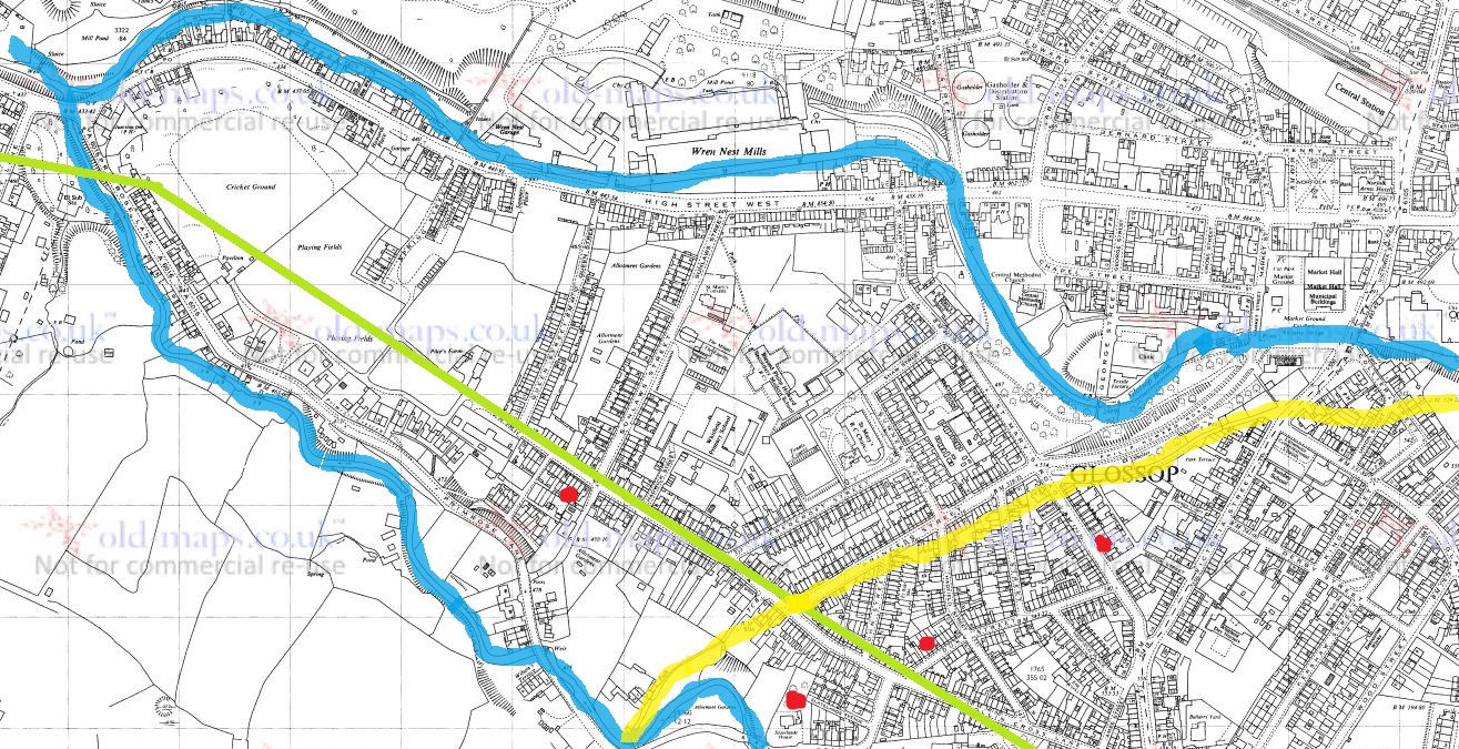
Looking again at the area stripped of the Victorian houses, it’s very clearly a promontory, a high plateau that runs between two brooks – Glossop Brook to the north, and Long Clough Brook to the south. In the Iron Age, they liked their elevated places – Mouselow, which dominates the area, is a classic Iron Age hillfort, and others exist nearby, at Mellor and Mam Tor. One only has to look at St Mary’s Road from Harehills Park to see how steep those slopes are (try doing it pushing Master Hamnett in a pram with a load of shopping from Aldi). And on the other side, who hasn’t cursed Slatelands Road halfway up, gasping for breath. This is a very real landscape feature, completely masked by later development, but one which would have been very visible back then. This would have been particularly true where the peninsular narrows at the west, leading down to the junction of the two brooks. This too, is significant.
Throughout prehistory water was a sacred thing, and was considered ritually important. A spit of land, elevated, defined by water and ending in the confluence of two bodies of water, would have been hugely significant. Actually, a perfect place for an Iron Age temple or shrine, perhaps one devoted to the ‘Celtic head cult’ as suggested by scholars such as Dr Ann Ross (in her Pagan Celtic Britain)? Indeed, the North Derbyshire Archaeological Survey notes that the number of heads in the Glossop area “might suggest a cult centre” based in the town in the Romano-British period (Hart 1984:105). It has been suggested that the heads are sometimes associated with liminality and boundaries, and were protective. What if they were they placed facing down the peninsular, to mark out the sacred space, and to defend it?
The Roman road moves through this promontory, sticking to the high ground away from the valley floors and marshy terrain, as the Romans preferred (see map below). But what if the location of the possible shrine or temple influenced the choice of road location, ploughing through the sacred enclosure, perhaps to make a point about Roman dominance?
The location of the heads in relation to the landscape. The blue is the waters of Glossop Brook (north) and Long Clough Brook (south), forming the spit of land. The yellow line is the medieval trackway, and the green line is the course of the Roman road.
What if…?
Now, I’m not suggesting for a moment that that the above is absolutely true; this is a wild flight of fantasy, and pure fiction – a story. Indeed, doubts are being raised about the reality of the ‘Celtic head cult’ theory in general. But it is a possibility, at least: an archaeological what if…? However, if that isn’t the answer, there still remains the issue of why four stone heads were found in a cluster in this area. What is going on?
If we return to my original thought, that the heads are medieval or post-medieval in date, might they be related to the Simmondley – (Old) Glossop trackway in someway? If we look at the map above, we can see this track (marked in yellow) runs broadly along the line of Princess Street. And just to the east of the three of the heads run along the same alignment. Is this significant? What if people somehow, and for some reason, deposited these heads to the east of the track? But why? Well, I came across a possible reference to just such a practice in this area – Clarke states that “Oral tradition in the High Peak of Derbyshire suggests heads were buried as charms beneath newly-built roads, presumably to keep permanent watch over them” (1999:286). He cites no sources for this “oral tradition”, but this type of apotropaic function – preventing witchcraft and promoting good fortune – is associated with carved heads all over the United Kingdom (Billingsley 2016). Perhaps, then, we are seeing the ritual deposition of carved heads as part of the road building tradition.
What if…?
A pair of Whitfield Heads. These are at the end of Kershaw Street… and that is all I know about them. It’s on my ‘to do’ list, don’t worry.
No, it is a mystery, and ultimately we are left with questions for which there are no obvious answers. Three of the heads are in Manchester Museum, and the fourth presumably in the hands of the owner/finder. I will have to go and see them, as that might help in dating. As I say the project is ongoing, and any comments or help in the area would be greatly appreciated. Do you know of any stone heads? Do you have photographs of any? Or stories – they seem to attract folklore and superstition like nothing else! Please contact me in the usual way – email me, or through twitter ( @roberthamnett ). Or just come and find me in the street, as people are increasingly doing… so much for pseudonyms and anonymity!
I do hope you enjoyed the little flight of fantasy, but we’ll be back to business as usual next time – the sherds are mounting up! Until then, look after yourselves and each other.
And I remain, your humble servant
RH
References:
John Billingsley – Instances and Contexts of the Head Motif in Britain
David Clarke – The Head Cult: Tradition and Folklore Surrounding the Symbol of the Severed Human Head in the British Isles. (Unpublished PhD Thesis, accessed here)
Anne Ross – Pagan Celtic Britain: Studies in Iconography and Tradition
What ho! Greetings one and all. Come on in and take a seat. Can I get anyone a drink?
Today, I finally finish a blog post that was started 2 years ago. Not for any particular reason, it’s just that some posts are more urgent, and others seem to, well, ferment… if that’s the word I’m searching for. If it isn’t, it’ll have to do.
So, I was reading a little bit about the history of St James’ church, the parish church of Whitfield. And a splendid one it is too. Living in Whitfield, I have a strong attachment to the church, not least of which I can see its spire from my bedroom window, but also Mrs Hamnett and I were married there. And by a spooky coincidence my namesake and pseudonym – the original Robert Hamnett – was a member of the congregation and is in fact buried in the graveyard there, something I didn’t know at the time of my nuptials.
The church was built in 1845 (and consecrated in 1846), on land that was bought from the estate of Thomas Dearnley, of Tintwistle, a schoolmaster who had died in 1842, at a price of £110. This land – Lower Meadow as it was originally called – was described in the deeds as being bounded by “Holly Cross Lane and Wall Sitch“. Holly Cross Lane – now known as Hollin Cross Lane – makes sense, but Wall Sitch? Well, it is an unusual name, and, given my love of placenames and their meanings, I went digging. According to the paper “Semantic Structure of Lexical Fields” by David Kronenfeld and Gabriella Rundblad (2003:29) (no, I don’t understand what it means either… something to do with words, apparently) Sitch is “commonly used for (very) small streams, especially those flowing through flatland, and can be used for both natural and artificial watercourses”. It is derived from the Old Norse ‘Sik’, via Old English ‘Sic’, both meaning a marsh and/or a watercourse. It is not uncommon in the North West, and in particular those areas that fell under Dane Law (that is the area controlled by the Vikings, and subject to their laws). Glossopdale and surrounds is right on the border between Anglo-Saxon Mercia and Viking controlled Danelaw, so it is not surprising that we have a few Norse place names. Indeed, a little further up the valley, off Monk’s Road, is a ‘Sitch Farm’, which sits just above a small brook.
So then, I went looking for the Wall Sitch – the small watercourse by the wall – and do you know what? I think I found it, despite it being very hidden.
Here’s a map of the area, so we can see what’s what.
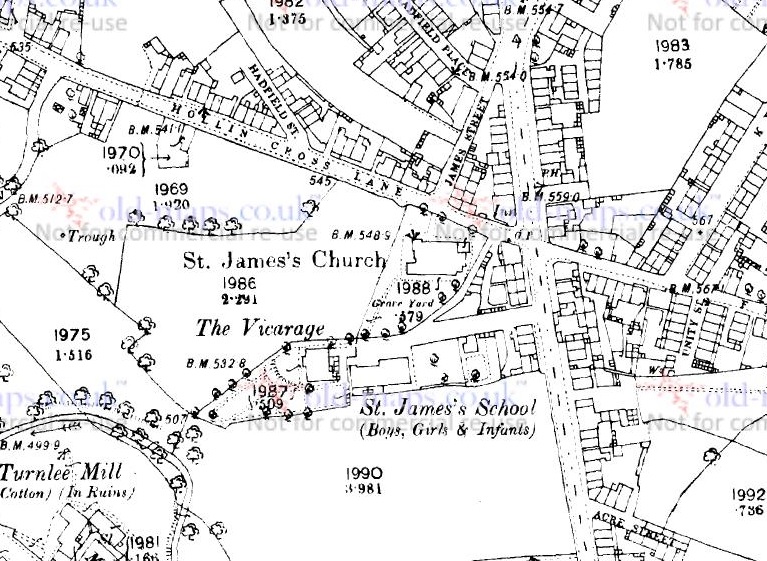
The 1880 1:2500 OS map. The church is central, with Hollin Cross Lane above it.
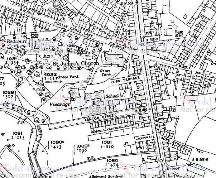
I first thought it might be roughly parallel to Hollin Cross Lane, so I looked at the south side of the churchyard. Nope… nothing on the ground, or on the maps. “But wait… hang on a moment!” thought I. The vicarage and St James’ school (the original one, not the newer one further up Pikes Lane) must have been built on church land too, and at the same time as the church, so I looked at the boundary below them. Well, it is immediately obvious there is no stream visible as such, but there is something very odd about the shape of the boundary – you can see it in the map above above the words ‘St James’s School’. Generally, when someone draws a boundary, it is straight, unless of course something stops it from being straight… and this one is a meandering shape. This type of ‘landscape archaeology’ can really help in identifying older or lost features, and I think it does here – the boundary has been determined by the course of the stream. So I went looking down Ashton Street (a road not yet built in 1880) to see what, if anything, I could see. Here it is on the 1921 map:
Ashton Street below the school. The meandering boundary has been straightened here.
And here it is in real life:
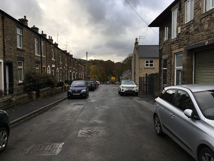
Ashton Street, looking west. You an see the slope of the road as it goes down to Long Clough Brook.
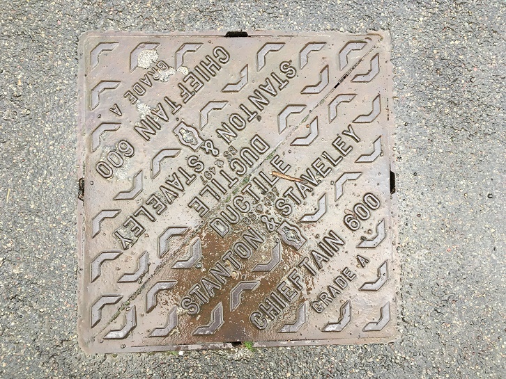
Well, disappointingly, there was not a lot to see. The school has been demolished – Master Hamnett now attends the successor school, built in the early 1920’s – and houses now occupy the site, although there are traces here and there. However, halfway down I heard a noise. Water! Below a drain cover in the road water was rushing, and then again farther down the hill toward the Long Clough Brook, below another drain cover.
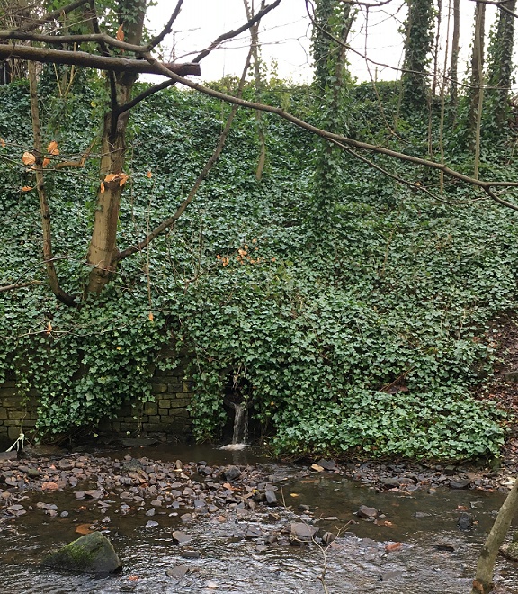
This has to be it. I wondered if there was an outfall into the brook, surely the final destination for the sitch? And lo!
Wall Sitch outfall into Long Clough Brook.
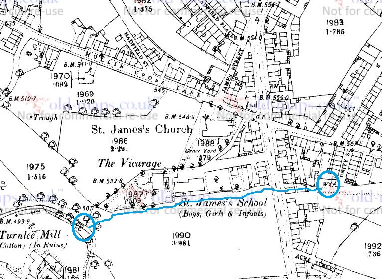
Excellent! I love detective work, and it’s exciting when a hunch pays off. This is exactly the sort of thing that I started the blog for. So there is the outfall, but it got me thinking… where is the start of Wall Sitch? Well, tracing the meandering line of the sitch back, and under Charlestown Road, it seems to stem from a well (marked with a ‘W‘ on the map below) at the end of Unity Street. Now, by coincidence this well was the subject of a previous blog post – check it out here – and although it is no longer there, clearly the water from what would have been a spring head, similar to Whitfield Well and many others in the area, is still running.
The probable route of Wall Sitch – from the well on the right, under Charlestown Road and along what is now Ashton Street, to the outfall into Long Clough Brook circled on the left
Makes you wonder what else is lurking, hidden in the ground, or in maps.
That’s all for now, but more soon – I have some posts that are 3/4 finished, so I should be able to get these published fairly rapidly. So, until next time, and as we head into another lockdown, take care of yourselves and each other.
Mrs Hamnett complains that going for a walk with me is difficult – apparently I’m like a dog, running about looking for things. We’ll be walking along, talking, and I’ll disappear into a hedgeback or ditch, pulling out a bit of pot or stone, and leaving her talking to herself. Master Hamnett has now adopted the custom, and he regularly finds bits of pottery that he hands to me, looking very pleased with himself. This leaves small piles of pottery around the place, which get cleaned and put into bags with the intention of sharing them with you, gentle reader. And as you know, intention and actually doing are two widely different things – I’m going to have “well, I was going to, but what happened was…” carved on my headstone.
Well, not today. Today I do! I am seizing the day, grasping the nettle, taking the bull by the horns, striking whilst the iron is hot, and a host of other tired cliches. Today is a pot and other bits day… but first a cup of tea.
Right, that’s better! Off we go.
A few months ago I posted this, a toy soldier fund by Master Hamnett at the Spencer Masonic Hall/Sunday School at the top of Whitfield Avenue. Well, we went back recently, and blow me… we found some more.
Bizarre, and slightly creepy. I love these things.
Bizarre. I can only think that someone was using this as a place to play with their soldiers, and then lost them. As I said before, these were my childhood (I still have them). From right to left: a 1:32 scale Airfix British Commando (mid 1970’s to, well, now in date). Then we have a copy of a 1:32 scale Airfix British 8th Army Desert Rat; it says ‘Made in Hong Kong’ on the bottom, which dates it to pre-1997, when Hong Kong became Chinese. Then there is the lower half of Marvel’s Iron Man, which has the date 2005 on the base. I suppose these are technically ‘rubbish’, being deposited only in the last few years, but I reasoned that if I picked up a Victorian child’s marble, then why not these too. If you recognise them, and want them back, give me a message. Above the toys is a squashed thimble, again probably of relatively recent vintage.
Some other bits and pieces found in the grounds:
Other bits and pieces from the grounds of the Masonic Hall
From the top down, then. Randomly, fragments of a clay pigeon – which begs more questions than it answers. This is definitely rubbish, and will be going straight in the bin, but I thought I’d post it in the interests of completion. Below that, a copper roofing nail – Victorian or early 20th Century, and clearly from the roof of the building, dropped during a re-roofing, perhaps – I love these things, and have blogged about them previously. Below that, an ‘L-Headed’ machine cut wrought iron nail – probably used for flooring, and perhaps Victorian.
Continuing the revisit of that post, here is some more pottery from the area:
A small haul, and nothing too spectacular.
Some odds and ends. Top row, from left, then: the bottom of a jar of some sort – earthernware, and with the letters ‘A’ and ‘D’ impressed on the bottom. It’s possible this is ‘MARMALADE’, as it’s the right type of jar, but I don’t think it’s an ‘L’ before the letters. ‘M[AD]E IN ENGLAND’, perhaps? Next a saucer, then a black glazed open vessel, and then the chunky handle of a jug or similar, but certainly not a tea cup, the handles of which were delicate in the Victorian period, which is when all of this pottery dates from. Bottom row from left: a creamware jug, and from the curve of the sherd, this the rim of the spout; early Victorian, at a guess. Next, the base of an open bowl, then the interior shoulder of soup bowl, the base of a plate (complete with knife mark scratched into the glaze), and then the shoulder and neck of a small saltglazed stoneware bottle. Originally, it looked like this one, probably an ink bottle, and which has roughly the same dimensions:
A stoneware bottle which, incidentally, I found in a Victorian tip in Broadbottom.
Next up, we have some interesting new bits from below Lean Town, picked up whilst I was waiting for Master Hamnett to finish at the excellent Inside Out Forest School in Gnat Hole Woods, not too far from Nat Nutter, as it happens.
Some very nice bits here. Oi! You there! Not you, you! Stop sighing… I can hear you muttering under your breath you know, it is not a “pile of old crap”. Honestly, the nerve of some people.
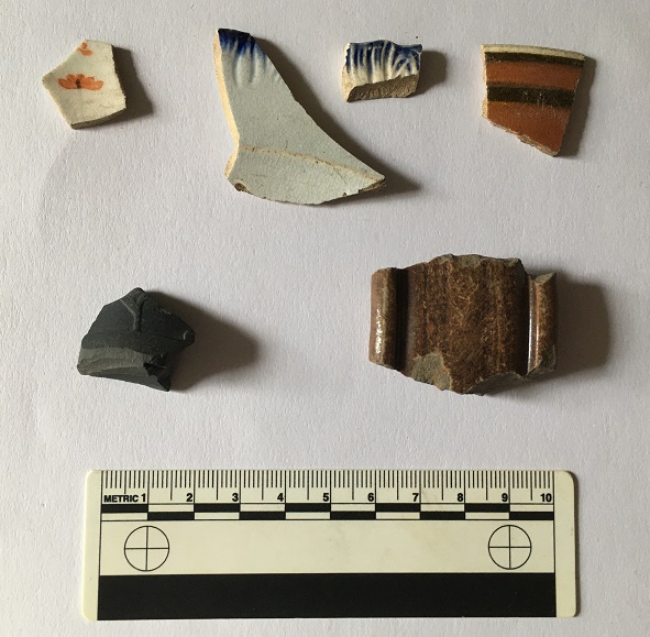
Top row: sherd of earthernware with painted orange flowers, which I thought looked nice. Then we have two different shell-edge ware vessels decorated a blue scalloped edge. The one on the right is the earlier, being made between 1780 and 1810, whilst the sherd on the left was made between 1800 and 1830. Then a sherd of annular or banded ware – the decoration looks very 1950’s to modern, but this stuff – usually in blue (there is an example below) – actually starts being made in the 1790’s. This one is Victorian. Second row on the left, a base sherd from a basalt stone ware bowl, roughly 1780-1830-ish, It’s a lovely example, very thin walled and with the bottom of an acanthus leaf or something coming up from the bottom. They were heavily influenced by Classical pottery, and it looks Roman orAncient Greek from a distance, but was in fact made by Josiah Wedgewood’s factory in Staffordshire. Then we have the handle to a monstrous stone ware jug or storage jar, and although it looks almost medieval, it probably came from a Victorian water jug or something. Following on from the mega post about Lean Town I’ll add this lot to the bag of bits, and I’m sure more will wash out over winter.
Moving on, we have a rim sherd of a pancheon and another sherd picked up from a path that leads from Bankswood Park in Hadfield to Mouselow.
Big chunky rim – I love these things.
The smaller sherd is a from a cup or bowl with blue horizontal stripes on a white background – more annular or banded ware from the Victorian period. The larger sherd is part of the rim from a large pancheon – essentially a large mixing bowl that most kitchens in the 18th and 19th centuries would have had (I talked about them here). What looks like a yellow glaze is actually a clear glaze over a white slip – you can just about see it on the edges. Below is what it would have looked like, although this example is later and much smaller, the rim sherd suggesting a vessel 70+ cm in diameter.
A Victorian pancheon yesterday.
The path crosses another track which originally ran from Cemetery Road to Shaw, along what would become Shaw Lane, before it was bisected by the building of the railway.
The lane actually skirts the edge of the Iron Age hillfort, and parts of it are preserved in footpaths and tracks, but I don’t want to get into this here, as it is a topic of another post. However, here are some photos of Shaw Lane as it crosses Mouse Low – the above pot fragment was found at this junction with the footpath, marked in red on the map.
Overgrown and unused, this was Shaw Lane looking South West. In case you can’t see it, it’s the sunken road bit to the left of the tree in the centre of the photo. Apologies for the darkness.
Shaw Lane looking North East. I need to explore this track – it looks so appealing!
Next we have a small collection of bits from the bottom of Cross Cliffe, along the road edge and by the track there. Nothing earth shattering, but a good selection.
A good selection of bits, and a clay pipe!
Top row, from the left: a fairly substantial transfer printed soup bowl roughly 20cm in diameter; the base to a ceramic marmalade or preserve jar of about 10cm in diameter; a stoneware sherd from a storage jar of about 16cm in diameter. The thing that looks like a mint is either a button or the end to a hat pin, and is made from alabaster. Next row: sherd from a large jug or similar, with large hand-painted flowers on the exterior; rim of a stone ware ginger ale or lemonade bottle, with the very characteristic brown salt glazed surface; a fragment of willow pattern transfer-printed plate, and a stem of a clay pipe with, alas, no maker’s name, but some nice paring marks.
Ok, so this is turning into a far larger post than I had anticipated, and I’m going to draw a line under it for now – nobody, not even you, you wonderful and attentive people, wants to read a wall of text. Expect Part II either next time, or sometime in the future
So, to end with, for now at least, two superb examples of Glossop bricks, a gift from our equally superb neighbours (hello Helen and Sarah).
I love these things – simple and mundane, and literally stamped with their place of origin.
I don’t know a great deal about these bricks, but a future blog post might delve deeper. The company was based at Mouselow, with the clay extracted from nearby. It seems to have been founded in the 1920’s by a John Greenwood, and continued until the 1980’s. Somewhere in the garden I also have Glossop brick with both Greenwood’s name and Glossop printed on it – perhaps this was an earlier brick? There is some information on this website, but I can definitely feel a blog post coming on.
Bricks are so mundane, and yet so fascinating, and useful archaeological dating material too. And once they begin stamping the maker’s name into the frog (the dipped bit in the middle) – sometime around the mid-Victorian period – they become individual, too. I stumbled across this website the other day – a gigantic collection of photographs of bricks with the names showing, and all alphabetised; this is what the internet excels at, the dissemination of knowledge that would otherwise be inaccessible, and it is truly magnificent. I look upon these bricks with envy, but silent and certain in the knowledge of one single fact: were I to start a ‘brick collection’ Mrs Hamnett would forcibly and violently eject me from the marital home. I would be a single and homeless (and brickless) man again before you could say “now wait, dash it all”. No, she puts up with quite enough as it is, so this injustice and pain is a weight I must bear with quiet resignation. However, if someone does have a spare shed, you can contact me in the usual way…
Right, that’s your lot! And it is a lot… too much, in fact! The question of “what am I going to with it all” never really occurs to me, and beyond the obvious “put it on the blog” I have no idea. I’m going to have a clearout soon, and get rid of the more boring bits and pieces – the plain white china, etc. and bury them somewhere for future archaeologists to ponder over. In fact, I was going to do it last week, but what happened was…
More soon, but until then, take care of yourselves and each other.
Good evening gentle readers. I say good evening, for this is when I am writing, but it could be anytime you are reading this. And indeed anyplace… which worries me slightly. Anyway, moving swiftly on.
Recently, I posted a hotch-potch, pickle-type post, that looked at the cheese press I found that was being used to fill up a hole in a trackway. Well, some interesting developments have, well… er… developed.
Firstly, it seems that the whole cheese press is present, which is excellent news. But alas it is broken into two pieces, which isn’t such excellent news. Still, the fact that it survives at all is pretty impressive. Secondly, and even more impressive, I think I might have identified to whom it belonged, which is amazing if true. Please note the use of the phrases “I think” and “if true“… I’ll leave it to you to decide.
Firstly, then, the press.
It’s complete, as in it’s all there, although as you can see it is sadly broken across the middle. It measures 94 x 43 cm, and about 10cm deep, so it’s not huge – and these things do come in huge sizes. I had a poke around mini excavation, just to reveal the edges, and to assess how much was there, but I didn’t want to dig too far – it is filling a large hole in a track after all.
Nice to see the whole thing – you can just make out the corresponding beam hole on the right.
Master Hamnett helped reveal the press, of course… any excuse to get dirty.
Master Hamnett ‘helping’ with the excavation and the photographs
It’s fantastic, and I honestly think that this needs to be removed from the road and put on display somewhere; it is a wonderful piece of evidence for life in 18th century rural Whitfield that deserves to be treated better than it currently is.
Right then, so who owned it? Well, I was reading through a collection of Glossop-based 17th and 18th Century wills the other evening.
Before we move on, perhaps we should examine that statement. I have just read it back, and the thought occurs to me… mine is perhaps not what you might call a ‘normal’ life. I mean, here I am, on a Friday night, reading 300 year old wills, and getting excited over some new bits of pottery I found yesterday. Sometimes it’s good to take stock of one’s life… and other times it’s good to simply leave one’s livestock alone.
Anyway, back to the wills. They have been digitised as part of the North West Derbyshire Sources project which is a truly remarkable source for local history and genealogy in this area, and filled with all kinds of information – if you don’t know the website, please do have look. The will that caught my eye was that of John Cowper (Cooper) of Whitfield, and dated 1750. The actual will is fairly bog standard, but is genuinely fascinating as it contains, in a nutshell, the contents of an average well-to-do household. Cooper was someone who we would now perceive as comfortably middle-class, but was then known as a yeoman farmer; someone who owns a small amount of land freehold (paying no rent), and who earns his living from it. I won’t reproduce the full preamble here as it is a wall of text – but it well worth a read (the full transcription is to be found here – it’s alphabetised, so look for John Cooper of 1749/50). However, the contents of the house is as follows:
Item
Value (£ s d)
Imp/ Purse & Apparell
7 0 0
A large Bible & Clock
3 0 0
Two cows
6 0 0
A cupboard & table
0 15 0
Two coach chairs 15s 12 chairs 10s
1 5 0
One Fire Iron tongs, 3 bread Irons Fire Shovel & Brigg
0 15 0
One little Fire Iron, smoothing Iron Clever two Hand hooks & Spittle one frying pan
0 3 0
One Warming Pan a skellet a brass pan a brass pott & saucepan one Lead, Lead weight & Mustard Ball
0 15 0
8 Pewter Dishes one Tankard 1 Cup 4 porringers, Spoons
0 14 0
Books & Linnen Meal Cheese & Bacon
4 17 0
One Bedsted & Bedding & a little Cupboard ith Parlour
1 8 0
One Bedsted & bedding in the long Chamber
2 10 0
One Press
1 10 0
A Long table & one little oval table ith parlor Chamber
0 17 0
One bed & bedding ith Chamber over House
1 5 0
One meal ark 8s one Chest 10s one little chest 6s one Desk 5s one Box 1s ith same Chamber
1 10 0
One Cheese Tubb 5s one kimlin 2s Cheese fatts & other wooden ware 5s & one cheese press 3s
0 15 0
One little Ark in the Porch 1s 2 Iron potts 2s a Glass case two fall tables 2s a kneading trough 1s
0 6 0
One Shovel Mattock & Bill & Dock fork & Ax
0 3 0
One Stock of Bees at Thomas Cowpers
0 10 0
Huslement
0 5 0
46 3 0
In Bills
88 2 0
134 5 0
The items listed, then, are those that are considered of value in the mid 18th century, and if you look, it’s largely the things that we would take for granted. Imagine someone doing this to your house – have a look around. Would they mention your pots and pans? Or your fire irons (assuming you have a fire – everyone in the 18th century certainly would have). Or your bed linen? Or your cheese and bacon? It’s bizarre, yet it also makes sense. There were not many frivolities then; would bacon count as a frivolity if you had raised the pig, killed it, salted it and stored it? No, it would be a resource that you had earned. Your iPad would be listed, but Cowper had a clock (along with a large Bible, valued at £3 [£350 in modern money]. Your car would be listed, but Cowper had two cows and a hive of bees valued at £6s10 (£758.35 in modern money). Your all-singing, all-dancing, ride-on, lawn mower might be listed, but Cowper had “One Shovel Mattock & Bill & Dock fork & Ax” valued at three shillings (£17.50).
Some of the items listed needed a little further exploration. For example, the ‘Mustard Ball‘ valued with the rest of the pots and pans from the kitchen threw me. But it turns out that they were literally balls of powdered mustard.
Traditional mustard balls. Image stolen from the Tewkesbury Mustard Company website – there is a link to the site below… fascinating stuff.
The seeds were powdered, and mixed with some form of binder – wine, vinegar, honey or raisins, for example – and when needed, slices were taken and soaked in a liquid to soften them (in vinegar, or verjuice, for example – the sour juice of crab apples), and added to food. They are still made, as they were 700 years ago, by a company in Tewkesbury (the Tewkesbury Mustard Company) who make the best, apparently (and I have no reason to doubt that). Thanks also to this fascinating blog about historical food for the information.
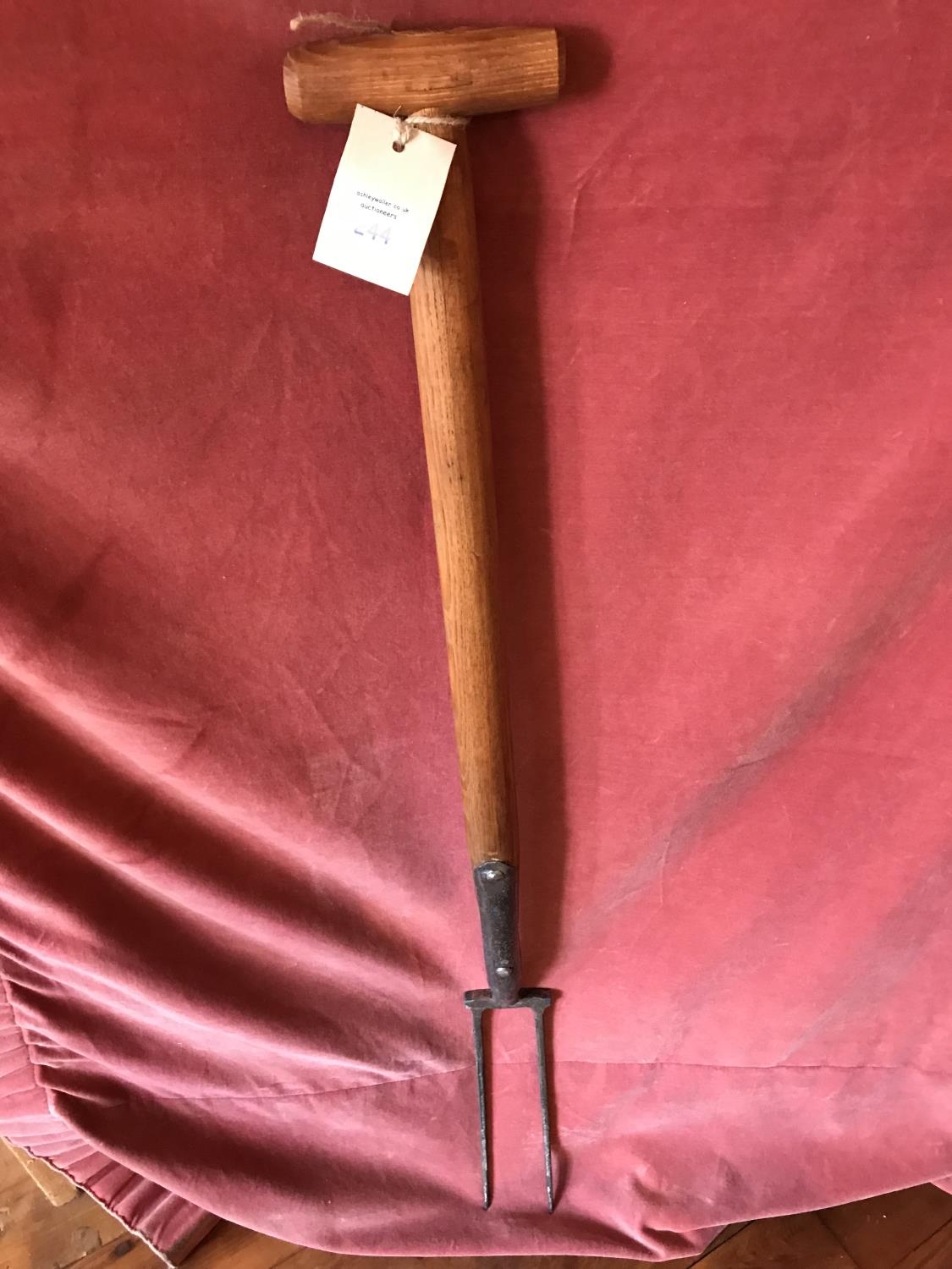
The above mentioned “Dock Fork” was also not something I had encountered before; a little research brought forth this:
Dock fork, from the easyliveauction.com website – this one sold for £25… a bit more than the £17.50 it was valued at, with other implement, in 1750.
As anyone who has ever weeded a garden will know that docks are difficult buggers to remove, and yet are brittle, breaking and leaving root fragments that will flourish into full bushes of weeds in weeks. A problem to which the answer is a dock fork, that allows you to lift the whole plant without breaking it. Obviously.
The important bit for our purposes here are those items listed that are used in cheese making, and specifically the cheese press. As you have seen, it’s not a small item, nor is it something that everyone would own – it’s a specialist implement used on much more than a domestic scale. It, and the other cheesemaking equipment mentioned in the inventory, indicate the relatively large-scale making of cheese to be sold, and perhaps supplying everyone in the local area. As perhaps only a single farm in each area would have one, I would suggest that the one mentioned in John Cowper’s will is the one I discovered a while back, and which is now filling a hole in the track. I realise that it is impossible to prove, after all the stone has no provenance, nor do we have an address for John Cowper other than Whitfield. But Whitfield as a settlement was concentrated along Cliffe Road and Hague Street – the old road from Hayfield to (Old) Glossop, and largely around The Beehive (it arguably still is) – then it is likely that Cooper lived in this area too, and thus his cheese press has not moved far. Anyway, I’m convinced. The big question is… are you?
Whitfield – the medieval and post-medieval heart of the settlement along the main road from Hayfield to (Old) Glossop. For orientation, The Beehive is marked by the large orange arrow. The oldest building in Whitfield, Hob Hill Farm – which has a datestone of 1638 and associated 18th century buildings – is marked by the green arrow.
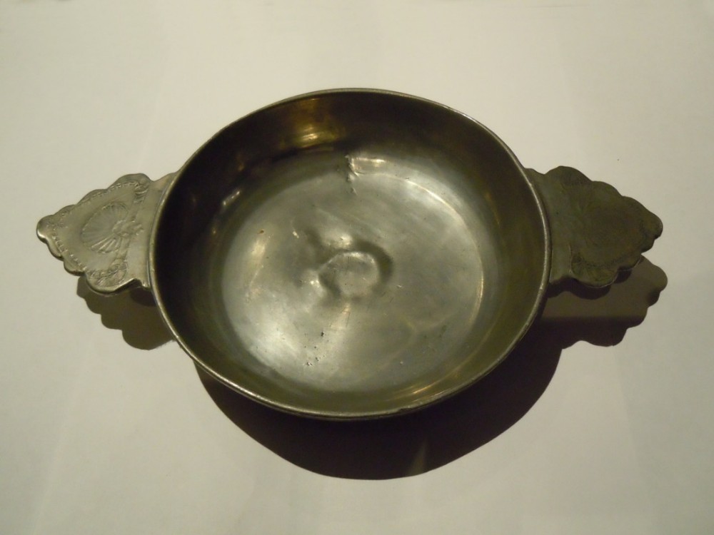
However, although we might not be able to pinpoint his house, we do have a way of working out the type of house Cowper lived in. Essentially, the people who were assessing the worldly goods of the testator went from room to room, recording what was in each, and thus the inventory provides us with a sort of snapshot that allows layout to be reconstructed. So, on the ground floor we have the Kitchen/Living Room. This was where the main fire was, and all the cooking and eating equipment was, including “One Warming Pan, a skellet, a brass pan, a brass pott, & saucepan” and “8 Pewter Dishes, one Tankard, 1 Cup, 4 porringers, Spoons“.
A 17th century pewter porringer – a bowl with a handle used for stews. They were incredibly popular in pottery as well as pewter until the 19th century, when meals became less ‘wet’ and plates became more popular.
This was a large long room – it contained “A cupboard & table“, as well as “Two coach chairs, 12 chairs” (which may be a mistake, as that seems a lot) – and had the fire at one end, and the door somewhere, possible in the middle of the long wall. There also seems to have been a pantry – probably just a built in cupboard – which contained “Books & Linnen, Meal, Cheese, & Bacon“. Next to this is what is termed the ‘Parlour‘ in which there is a “One Bedsted & Bedding & a little Cupboard“. Moving up the stairs to the first floor, we have the Master Bedroom, termed here the ‘Long Parlour‘, and which was presumably over the Kitchen/Living Room, and containing “bedsted & bedding” and a “press“. Next door is the ‘Parlour Chamber‘, literally the bed chamber over the Parlour, which contained “a long table & one little oval table“. The next floor up, the attic room, was over the whole upper floor and is named the “Chamber Over House“. It containing “One bed & bedding” and “One meal ark, one Chest, one little chest, one Desk, one Box“. The ‘meal ark’ mentioned here, and the ‘meal’ in the Kitchen is oatmeal, used for bread or making oakcakes, and traditionally kept in a wooden box.
A 17th Century meal ark.
So then, five rooms in total, centred around the hearth and kitchen, and with three bedrooms. This layout is a classic of its kind – very simple, very basic, but very functional. And I have to say, quite cosy. There may have been outbuildings, perhaps containing the cheese making equipment, and certainly a ‘Porch‘ is mentioned, containing “One little Ark, 2 Iron potts, a Glass case, two fall tables” and “a kneading trough” for making bread.
A kneading trough, in which dough was kneaded and left to prove.
This type of house is described as a “Two Unit” type – essentially one large room divided into two rooms, one large and one small. The Handbook of Vernacular Architecture by R. W. Brunskill has a dozen different configurations of this type of building, and Cowper’s house could fit any one of them. Vernacular architecture refers to buildings on a domestic scale that use local building traditions, and local materials, rather than ‘fashionable’ architectural designs such as the grand halls and houses of the wealthy.
The basic Two-Unit house plan. Cowper’s house was probably along the lines of ‘h’, although any could fit to be honest.
It’s just a pity that we can’t identify the actual house.
So there we are, cheese presses and wills… hope you enjoyed it. As always comments are very welcome, and I would be glad to hear from you. Please look after yourselves and each other, and until the next time, I remain
Alas, a mis-attribution in the Place-Names of Derbyshire has meant I have barked up the wrong tree! That’s not to say that there definitely isn’t a cross at Cross Cliffe, as suggested below, just that we can’t rely on the early place name evidence. Read the insightful comments by Neil Buckley below, which give what must surely be the correct reading of the text. My thanks to him for supplying the information, and working out the details. I’ll return to this in a later post as I think it is important, and in the meantime, feel free to re-read the blog post.
You know those moments when something that you have been staring at for years suddenly, and jarringly, comes into focus, and there is a slight tingle at the back of the neck. And then you dig a little deeper, and the tingle becomes a hunch, and then a possibility, and then a… you get the idea. Well, I’m there, and I’d like to share a discovery with you. This is still theoretical, even if the theory is based on good evidence, and I’m fairly certain that I can never prove it. But I’m getting ahead of myself.
Diving in and out of The Place-Names of Derbyshire to various previous blog posts (HERE and HERE) was a joy, and had me marvelling at both the sheer number of placenames recorded in the book, and the incredible depth of scholarship that accompanied their explanation. For those that have never read the book (and you should), it is a list of all the names of towns, villages, fields, roads, and streams in the area. However, on page 104, under the Glossop general heading, I came across a curious entry that got me thinking.
Here is the page in question
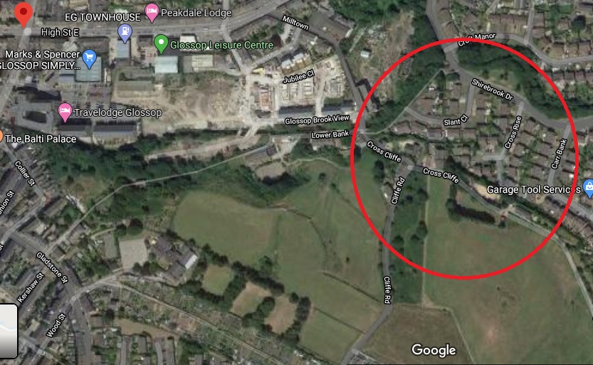
Specifically the entry for the road/area Cross Cliff, in Whitfield. For those of you who don’t now the area (and why not?), Cross Cliffe is this area, here:
Cross Cliffe is broadly that area circled in red.
Although now it gives its name to a road, it was once an area (circled in red above) which started at the bottom of Cliffe Road and lead down to Hurst Clough. The entry in the book reads:
Cross Cliff (6″), crucem de Cresclyf 1285 For.
It gives the earliest example of the name (crucem de Cresclyf), the date of this (1285), and the reference for this example (For = Forest Proceedings). So far, so perfectly ordinary.
So then, Cross Cliffe… and then a thought. “Hang on a minute… Crucem de Cresclyf?“
Now, I’ll admit it, my medieval Latin is about as good as my understanding of the language of the San people of Botswana – the one that uses clicks and other sounds. Or indeed, Klingon. I checked, and was – broadly – right (hurrah… personal victory, I’ll take that). I also checked with a real linguist (thank you AG), and was – broadly – backed up.
Crucem de Cresclyf: the cross of Cross Cliffe.
The cross? Which cross? Oooooh…
Bloody hell, thought I, and I went and bored Mrs Hamnett with this potential discovery. More research later, and I think I have just about convinced myself.
This, the first reference to Cross Cliffe, is taken from a 1285 document which gives a description of the boundary of land owned by a certain Thomas le Ragged. Thomas was a forester in the Peak Forest, and was given the lands by William Peverel, son of William the Conquerer and resident of the castle in Castleton. These lands included the hamlet of Whitfield. The descendants of Thomas le Ragged sold the Whitfield portion in 1330 to a John Foljambe, and from there it was portioned off and sold in lumps (Whitfield really does have an interesting history).
The description of the boundary of this land reads: Required by the Foresters and others concerning the metes and bounds of the land of Thomas le Ragged of Fernley who claimed liberties, who say, that the metes and bounds of the said lands of the said Thomas begin at the Bridge of Welegh by the Royal Way to the (cross) to Crescliff, and from the said cross by certain caves (fovia) up to Routing-clought, and from Routing to Brownhegge, and up to the Waynstones, and from Waynstones descending to the Hocklow, and from Hocklow descending to the water of G’wit and by the water of G’wit ascending to the wood of Horworth.
Boundaries are based on and related to landscape features, and always incorporate immovable and visible objects, ones that can’t be disputed. Now, out of this, only a few points are identifiable. Whaley Bridge, Cross Cliffe, Hucklow, the River Goyt (G’wit), and possibly the Wain Stones on Bleaklow (although, I suspect that it may reference another ‘Wain Stones’, now lost to us). The other places I have not been able to identify (any help would be appreciated), and I’m not sure what to make of the caves – are these literal or figurative, and does a cave (fovia in the text) in the 14th century mean the same as it does now.
I digress, as the important bit here relates to Crosse Cliffe, or rather “crucem de Cresclyf” as it is in the orginal – the cross of Cross Cliffe. Not the bridge at Cross Cliffe, or the brook at Cross Cliffe, but the cross at Cross Cliffe. This is at a time when they didn’t use metaphors or flowery terms for place names – if it says the cross at Cross Cliffe, it meant the cross at Cross Cliffe. A physical, actual, stone cross. One that has been there long enough for everyone to know where it is, and use it as a point of reference. Which is very interesting. A previously unknown cross.
Its location also would support this. It would be situated on a crossroads – a favoured spot for crosses of this sort (Whitfield Cross for example). The present layout of the roads does not show this easily, but they have been changed, probably in the 18th century – I’ve got a post almost ready to go that explains all that, but here is a map to help:
The cross roads, with Cliffe Road coming from the bottom, Cross Cliffe (the road) on the right, Bank Street on the left, and the original line of the road heading down to the bridge/ford over Hurst Brook, and on to Old Glossop. The green circle marks the – hypothetical – location of the cross. For orientation, the red star marks the location of what was Volcrepe.
The upcoming blog post will make a lot more sense of this area, but for now, roll with it!
This is broadly the area in which the hypothetical cross would have stood. It was once a crossroads, with the road having continued on and down to Hurst Clough 50m away. Probably.
Importantly, the cross would have stood at the border between the manors of Whitfield and Glossop – effectively Hurst Clough – and boundaries like this are exactly the sort of places that crosses are erected. Then there is the name Cross Cliffe. I had always, at the back of my mind, assumed that it meant the place where you crossed the cliff – perhaps a tall edge over Hurst Clough that no longer exists – or simply references the footbridge here. Well no. Delving further into the etymology of the name, it is derived from ‘Cliff‘ meaning a steep river bank, and ‘Cross‘ meaning, well, a cross. The name is literally ‘the steep river bank with a cross on it’, and crucem de Cresclyfe is then ‘the cross of the steep river bank with a cross on it‘. This a perfect description of that monster of a hill – it drops from 650ft at Bright’s Terrace to 500ft at the bridge over Hurst Clough – a 150ft drop over roughly 1000ft.
Placename evidence, coupled with a physical description, and a reading of the landscape and roads, seems fairly convincing. Well, to me anyway.
Now, there might a possibility that I am reading too much into this (‘surely not!’ groans everyone… I can hear you, you know! Don’t think I can’t). The ‘Cross of Cross Cliffe’ might refer to Whitfield Cross which would have been situated at the start of a small rise before the long steep slope down to Hurst Clough. If this is the case, then there is no need to look for another cross. However, I’m just not sure that this is the case. For one, the wording is too specific; “the cross of Cross Cliffe”, not just Cross Cliffe as an area – Whitfield Cross would surely have been too far away to be the cross described there, it is firmly in Whitfield, not Cross Cliffe.
The red circle marks the original location of Whitfield cross, the green circle marks the location of the hypothetical Cross Cliffe cross – a distance of over 1/3 of a mile.
Moreover, if Thomas’s land went to just the Whitfield Cross, then everything beyond that – including what is now Cross Cliff – would be outside of the described land. No, it makes sense his land went to the very edge of Whitfield, and the natural border of Hurst Clough, and it used a cross at the crossroads there as a marker.
What type of cross would it be, then? I would suggest that it was probably the same type as that which originally stood further up the same road at Whitfield – a 10th century Anglo-Saxon stone cross.
If this is correct, then where is the actual cross? 1000 years is a long time for a stone cross to survive. It may have been swept away in the iconoclasm of the Protestant Reformation of the Tudor period, or the iconoclasm that followed the Civil War, when crosses were routinely smashed – I read the other day of a Saxon cross that was broken up and used to fill a pothole in a road. However, the fact that Whitfield Cross survived these periods would suggest to me that Cross Cliffe would have likely survived, too. Perhaps we are looking at something more mundane; maybe it was accidentally broken, or worse, simply forgotten about as an important object, gradually falling into obscurity, to be lost in the hedgerows. Perhaps – and this really is a flight of fantasy – the stealing of the Whitfield Cross by the Cross Cliffe lads as a Mischief Night prank was not just a prank, and instead they were stealing a cross to replace theirs that was lost. It has never made sense that they would steal something so ridiculously large and heavy, so is this the answer? Well, probably not, but one can speculate wildly!
If anyone fancies joining me looking in hedgebacks and ditches for the original cross – after the current corona madness has subsided, obviously – then please drop me a line.
More soon – as I say, I have a whole post about the crossroads almost ready to go.
Until then, stay safe and stay inside, and take care of yourselves and each other.
Apologies for the lack of posts recently, but things are a bit odd at the moment. Six weeks ago we were concerned about Covid19, but were still joking about it, and how it will amount to a fuss over nothing. Now, here I am in front of my computer in ‘lockdown’ for the foreseeable future, and a very real and sobering death count is still rising. It really is a strange time, and the country is a strange place; the start of it all reminds me of what my grandfather said of the ‘Phony War‘ – you knew something big was happening, but it wasn’t actually happening there and then. Well it is now.
Sadly, it also means that we have had to cancel all the tours and talks that I was involved in that were about to occur: in particular, the ‘By Seven Firs and Goldenstone‘ exploration of the legend and landscape of Alderley Edge, and the Objects Tell Stories evening of folklore and archaeology. Oh, and if you want to find out who I really am, you can watch me talking archaeology and ritual in the promo for that event here – I’m the one on the right.
More to the point, this has put something of a crimp in the Cabinet of Curiosities. Rest assured, though, I do have a backlog of posts that I have been trying to write that doesn’t involve me moving anywhere. And of course, there is now time to write… well there would be if Master Hamnett wasn’t being home schooled for the duration.
In the meantime let’s keep buggering on, as Churchill was fond of saying.
So I went for my state-mandated exercise the other day and found a few bits and pieces – random is the theme of today’s post. But first, a quiz. What’s this?
Ooooh, a mystery object!
I’ll give the answer at the end of the post… no peeking!
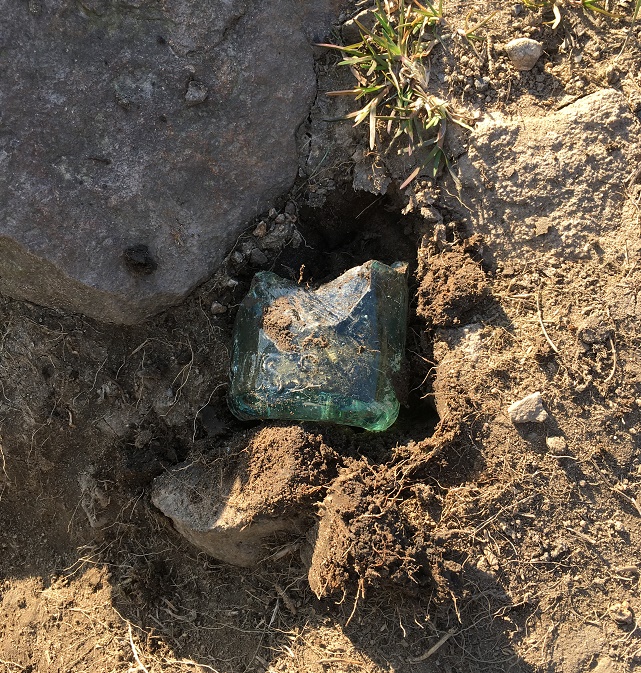
In the meantime, I spotted this sticking out of the ground:
Ooooh, thought I. The greenish colour of the glass gave it away as being older than mere litter, along with the thickness of the walls. Master Hamnett helped me hoik it out of the ground, and cleaned up it looks like this:
The lovely pale green colour is the result of impurities in the silicone, and dates it to the Victorian period or thereabouts.
You can just about make out the word ‘Glossop’ impressed in the glass. This was likely to have contained either carbonated water or beer, but a brief search of bottles reveals nothing similar. More research is definitely needed.
The small white object next to it is a fragment of a clay pipe, but interestingly, it has a some molded decoration on it. Here it is in close-up.
This is a fragment of stem, just at the point where it joins to the bowl. It is unclear what the completed decoration would look like – foliage perhaps? Dating clay pipe stems is always tricky, but the decorated types are usually late, so late Victorian is about right.
We later came across this stone with the letter ‘H’ carved on it, and being a connoisseur of such graffiti, I had to collect it.
A Hague Street ‘H’
It’s nicely executed with a flourish of decoration in the form of drilled holes between the arms of the ‘H’ – I’d give it a 7/10.
Right. That mystery object… did you get it? I believe you, honestly!
Ok, well, it’s a cheese press. Yes, you read that correctly! A cheese press. A thing for squeezing the whey out of cheese curds. Well, technically, it’s half of a cheese press – it’s missing the right half.
The square hole on the left is to house an upright pole which, along with another on the right, now missing, held the pressing weight in place. The circle and lines carved into the surface allowed the whey to run off, leaving behind the solids which are then matured to make cheese. Cheese was home made, or at least farm made in small batches, until relatively recently, so the press must have belonged to a farm nearby, as you aren’t going to shift that stone any great distance, when others, closer, would do to fill a hole.
The mystery object again.
Here’s a complete one in Bashall Eves in Lancashire:
Cheese press in Lancashire, and used to make, well, Lancashire Cheese. Image shamelessly stolen from Wikipedia.
And here is another one carved in the same manner as ours:
The cheese press in Draycott in the Moors churchyard. Photograph is courtesy of their local blog, and I hope they don’t mind me stealing it – please visit the blog here, it’s very good.
This one caused a bit of confusion, apparently – read all about it at this wonderful blog.
In terms of date… who knows? Certainly not hugely old – possibly Victorian, but equally possibly earlier. The only other one I have seen (which is how I know what it is) is propped up where I work at The Blackden Trust, and was in fact carved on the reverse of an old gravestone dated to the early 18th century, which at least gives us a date to work with. I’m going to write a little more about this soon, as it involves two of my greatest loves – archaeology and cheese… if we could just work in wine somehow, then it would be perfect.
Incidentally, the press is currently being used to fill a pot hole in a trackway, which I think is a shame. Sigh… I’ll add it to the list of historical objects things that need to be hoiked out and displayed properly (along with Whitfield Cross and the Whitfield Guide Stoop) – I think it would look great displayed at the wells. Seriously, I think we need to do something about reclaiming our heritage, as it is being slowly eroded. The guide stoop is currently under 3ft of soil, and looks like it will be left like that, So then, who’s with me?
Right. I’m off do some more gardening.
Please stay inside and stay safe, and take care of yourselves and each other.
I love Lean Town – it’s a good walk from my house (even Master Hamnett can do it with the minimum of fuss… mostly), and yet feels oddly distant. The houses are beautiful, and I sometimes feel a tiny pang of jealousy as I pass, so it’s nice to finally do this blog post that has honestly been years in the making. Part 2 is the finds.
Lean Town from the bottom.
As you can see from the above photograph, the houses are perched on the edge of a steep slope. Now, in the Victorian period, there was no rubbish collection – all household waste that couldn’t be fed to livestock, burned in the fire, reused, repaired, sold for scrap, or spread on the food crops, had to be disposed of by the individual. Now, I’ve probably mentioned this before, but humans are essentially lazy creatures. Almost as a rule, they will take only two considerations into account when disposing of rubbish: 1) can I see it? 2) can I smell it?
With this in mind, you can usually tell where a waste dump – or midden – will be by studying the area and asking a simple question: where would I put the it to get it out of my sight and smell, but with the minimum amount of hassle? Houses, situated on a steep slope, hmmm… there’s only one place they would chuck it. Any thoughts?
That’s right, well done, you guessed correctly and win a sherd of pottery (please email me with an address if you want it… I have many!). Over the back wall went the rubbish, and on the footpath below that wall went I. And by Jove, what a trove! This was all lying on the surface on the footpath that would have originally led from the houses to the well. Between myself and Master Hamnett we cleared out all we could see, but wait for the next rainfall, and more will pop up.
A proud parent! Master Hamnett was so excited to be picking the pottery up, stuffing it into his pocket, and walking along holding some in his hand. Like father like son…
So, what did we get? The short answer is masses of early Victorian to Edwardian bits and pieces – woo hoo! I divided the slope area into two sections: one directly below the back wall of the houses, and one a little further west along the slope.
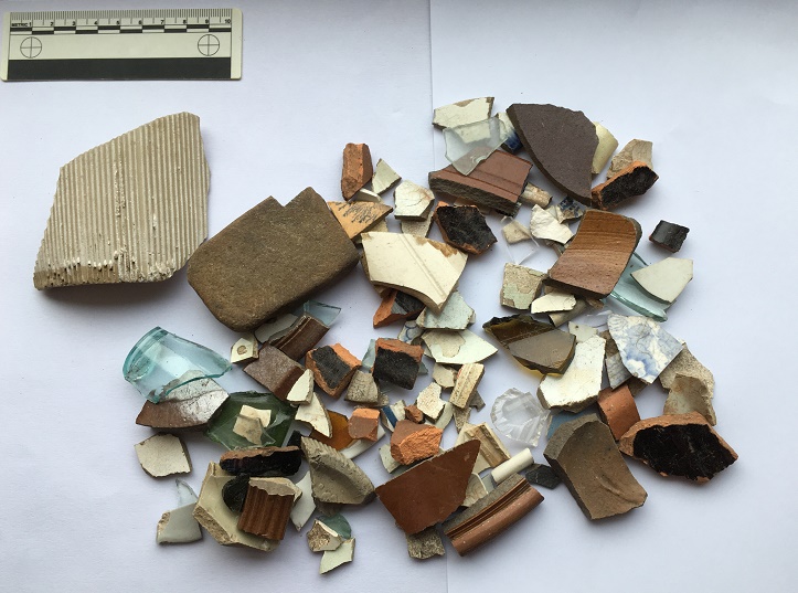
The assemblage from below the houses. Very impressive, and with some interesting bits in it.
The assemblage from further west, also impressive.
Truthfully, they are both rubbish dump areas from the same set of houses, but old archaeological habits die hard, and it is easier to keep them separate than it is to re-separate them if I needed to after joining the groups. In pottery analysis we call this “splitting” as opposed to “lumping” – once lumped, pottery is almost impossible to split.
I’m only going to discuss the ‘interesting’ sherds here – there is a lot of it (see pictures above), and life is too short. As a pottery specialist, I have a system that I follow when studying pottery, the short version of which is that I look at only ‘feature’ sherds (bases, rims, handles, and decorated sherds), and discount the rest (there is also a very much longer version, believe me… I can talk for hours about it).
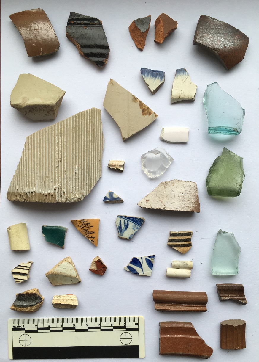
So then, here we are with the interesting bits. First up, below the houses:
The interesting bits from directly below the houses.
Top row: glass side to a square sauce bottle – possibly HP sauce, but certainly very common in the Late Victorian period; one can’t help but think their food was quite bland. Upper rim is from an open bowl, possibly a cooking pot. It measures 20cm in diameter, and is glazed in what appears to be a slip-ware glaze, which puts it late 18th early 19th century. Lower rim is from a stoneware open bowl with a flat lip, measuring 24cm in diameter – probably a mixing or serving bowl, and mid-19th Century in date. Next to that, the top to a stoneware ink or beer bottle, mid to late 19th Century – I love this, aesthetically, it just so pleasing. Next to that a very fine impressed mug or tankard, 10cm in diameter, with purple glazed body. This is very delicate and fine, and the impressed pattern is lovely, it’s possibly Wedgwood, but if not it would nonetheless have been expensive – which makes me think.
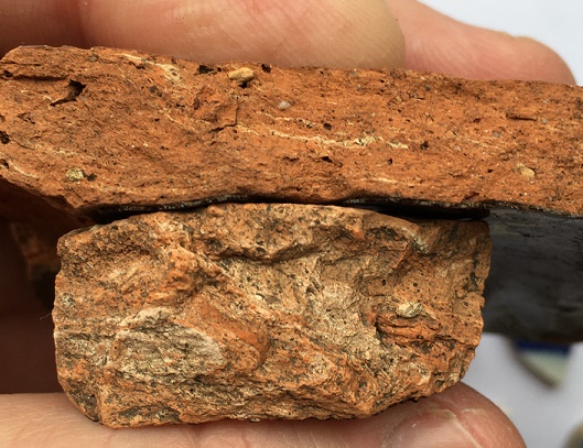
On the left we have a large sherd from a pancheon (a large milk or mixing bowl), with the interior, rim, and upper exterior surface glazed. Here we can see the upper exterior, with the classic dripped surface, which, rather than it being the result of a mistake, is a deliberate decoration. This example is very interesting, as it has been given a manganese ‘mottled ware’ glaze, rather than the usual black, which makes me think this is an early example – mid to late 18th Century, I would say. You can see a more common black example next to it, complete with external drips. Sherds from pancheons are quite common, due in part to most people having one, but also to the fact that they are large (larger examples can be 60-70cm across), which means they produce many sherds when broken. The clay they are made from is always reddish-orange, with pale yellow or grey folds badly mixed into it – don’t ask me why, but it is always so.
Greyish yellow folds within the clay. Is it odd that I find that quite appetising? Actually, perhaps a more important question is should I have shared that information with you, gentle readers?
Above the black pancheon sherd is a sherd of our old friend the feather edged ware bowl. It is another rather nice pearlware vessel, measuring perhaps 20cm in diameter, and was probably a shallow bowl with a flat edge. I have recently done some research on this type, and suggest a date of 1800-1830 for when this was made, which fits perfectly. A quick archaeological aside: when made, and when thrown away are two very different things – I have some of my grandmother’s crockery which I still use, and which must be at least 70 years old. Heirlooms like this do crop up in archaeology, and can cause problems, but generally, I would suggest that 10 years is probably a good innings for an average plate or bowl, especially when you remember there were few carpets and a lot of stone flagged floors.
The green glass fragment has the letter ‘F’ impressed on it, and is late Victorian or later. Next to that is a base to a delicate pearlware eggcup, measuring 4cm. Again, this is quite nice, as is the pearlware base and rim next to it (rim diameter of 18cm so a small plate or soup bowl). There are some spongeware sherds, and some blue and white transfer printed bits, including a green example which quite frankly shows how crappy some of these mass produced pots are – if you look closely, this one has a broken transfer roughly fitted together before being glazed. Above this, there is a moulded base to another very fine 18th Century tankard or mug. Below that, there is a creamware moulded bowl rim, probably quite early (1790-1800?), and again probably quite expensive. Finally, we have a group of stoneware vessels – bowls, storage jars, and the like. These are fairly standard, with impressed decoration (flowers, rouletting, and undulating lines), and date to, well, the Victorian period – made continuously, they were very utilitarian and common.
Next…
The interesting bits from further west.
Top left, is a large, rounded stoneware bottle or closed shape of some sort – beer, perhaps? Certainly Victorian in date. Next to it is a black ware sherd, with an inscibed decorative band on the exterior, and dating to the late-18th and early 19th centuries. The shiny glaze is the result of lead being added. Far right on the top row is a salt-glazed stoneware sherd, again from bottle, and you can just make out where it forms into the neck. This is interesting, as it looks like it is a continental stoneware – imported gin, perhaps? Below that is a base fragment from a small sauce or syrup bottle – the glass is early, judging by the colour, so perhaps mid-Victorian, but do continue into the 1920’s. These are normally hand blown into a mould, and have a rough rim where it is cracked off the mouth piece – check out a good example here. Actually, the whole website What The Victorians Threw Away is an amazing resource – essentially run by another lunatic like me, if you like this blog, you will love that whole project… it’s basically what I would like to do if I had the time and money (donations always gratefully recieved!).
To the left of that is a pair of feather edge fragments, both on a pearl ware background, and both of the same age as the above example. Below these is a clear glass cup with a handle; it’s moulded not cut glass, but is nonetheless quite nice and fancy. Below and left of this is a sponge ware sherd, possibly from a plate, and probably dating to the 1850’s. Above that (ignoring the tiny sherd) is a large fragment of a stoneware jam jar, and to the left of that is a large stoneware storage jar. The base diameter of this is 20cm, which makes it a monster – possibly a cider flagon, or similar. What is interesting is that it has a lot of wear on the bottom, meaning that it has been taken off and on a shelf or floor many times, and suggesting that it was refilled.
Below that is a large, roughly made, sherd from a large (2lb) stoneware jam jar, with the characteristic vertical fluting – once recognised, always seen! This has part of the base intact, with the words “ANCH” impressed into it.
I love it when I come across words. You can see clearly the stoneware fabric, and the glaze peeking through from the sides of the jar
Unless it was ‘ANCHOVIES’, this could only be “MANCHESTER”, and thus it has to be a Whittaker & Son’s jar, the base of which would have originally looked like this:
Love it! Moving on, below this, there are some random sherds, including four interesting ones. Top right, with the black tree on a brown background, is actually from a Mocha Ware pot, and would have originally looked something like this:
Mocha Ware. I can’t make up my mind whether it is truly hideous or whether I like it?
The tree like effect is created by applying, amongst other things, tobacco juice to the slip, where it spreads to create the effect you can see. In terms of date, it begins to be made in the late 18th century, but this is probably early Victorian. There are other Mocha Ware sherds throughout the pile I found in Lean Town (for example, the sherd immediately below this one, or the two sherds below the bottle top in the first photograph), so it seems to have been quite popular here.
In the middle of the group is a base to a pearl ware bowl – quite fine, again, and small, with a base diameter of 6cm. Bottom left is an open bowl of mid-late 18th century date, in a slip-ware glaze. Right of that is another very fine tankard with a moulded base, and dating again to the late 18th century. To the right of the group, there is a delicate blue painted porcelain fragment, again thin and very fine, and quite expensive. To the right, we have some clay pipes – nothing interesting there, I just like them! Below them there is some more of the brown glazed stoneware – bowls and jars, and including a handle from a hefty jug, which in my mind was filled with frothy home-made ale (but then, to be fair, most thing in my mind are).
That’s the end of the pottery, but now for the other material. In archaeology we make a distinction between what we call ‘bulk finds’, that is, material (usually pottery) that occurs in large quantities, and ‘small finds’, which are individual items, unique to the site or objects that can tell us more about the site than the bulk finds. Often there is overlap – a piece of pottery with an inscription, for example – and usually the small finds are what most people would call ‘the goodies’! And so it is here:
The small finds.
The stone on the left is, I think, a whetstone, used for sharpening knives. It is flat on both sides, worn on the surface and edges, and is the perfect shape, size, and stone type. It was probably discarded after being dropped and broken. Top is a glass stopper from a rather nice serving jar or wine carafe. It’s very delicate and beautiful – hand blown and hollow, with delicate cuts to give it a texture and grip around the top. Below this are a pair of marbles – right is brown glass with a white ribbon running through it – it’s worn, well loved, and certainly late Victorian. Left is a small, roughly made, ceramic marble, partly glazed and misshapen. Possibly early Victorian in date. Bottom is a tiny (2mm) glass bead, possibly from a decorated bag or similar. It’s lovely, and one assumes it was lost in the house, swept up, and thrown away with the rubbish. Don’t ask me how I spotted it… it just stood out against the soil.
So there we have it, Lean Town via the rubbish it once threw away, but what can we say? Firstly, the date. A lot of the material dates to the late 18th and early-mid 19th century, that is to the first decades of people living in the houses here. This is interesting, and suggests perhaps that in the late Victorian period, they buried most of their rubbish elsewhere. The second thing that stands out is the quality of the material – it better than you would expect from a simple worker’s household – some of it is very fine and tasteful, and it seems to have been expensive. Certainly the fine tankards, and the possible Wedgwood cup were, but also things like the glass stopper, the porcelain, and the pearl ware – not what I would expect from a humble mill worker’s house. I would suggest that after building it, Elizabeth Hampson lived here, or if not her, then someone like her – someone fairly well-to-do with taste. A little more research might reveal much more.
*
And finally, of course, what’s a blog post without a brace or two of benchmarks? There were several marked on the map:
The upper part of the lane and…
The lower part of the lane, including Lean Town itself and the footbridge.
Number 1 was easy to spot, although I suspect that the wall has been rebuilt, so it might not be in exactly the correct spot. Nonetheless, excellent work by whoever rebuilt the wall to include the benchmark – very conscientious! Here it is in all its glory.
This is what 705ft above see level looks like. Probably. I love the veining on the rock its carved on – each line representing a splashing wave laying down sand on a beach millions of years ago. Wow, that got deep!
Number 2 was also an easy spot, on the wall leading down.
This one is a bit worn, and seems to have been made sometime in the 1950’s or 60’s, as it doesn’t show on the earlier OS maps, so we have to go metric for this spot height – 201.34m above sea level (which Google informs me is 660.5ft in old money)
Number 3 should have been on the south east corner of the row of houses – I looked and couldn’t see anything (I didn’t look closely – nobody wants to be ‘that man who peered over our gate’, that’s how rumours start). According to this bench mark spotter’s website, the mark is definitely still there, but alas, I have no photo to show you.
Number 4, however, was there, on the stone base to the bridge across Bray Clough Brook.
The bridge has never struck me as being particularly old, and the bench mark doesn’t show on maps until the 1960’s, so I presume this is contemporary with Number 2 above. Anyway, here we are at 180.85m above sea level.
Bray Clough Brook joins Long Clough Brook a little farther upstream, and in turn it joins Glossop Brook at the bottom of Primrose Lane – I blogged about the confluence here.
Right then, I think that’s about it (I can hear you, you know, breathing a sigh of relief). I will try and be a bit more frequent in my posting… and try to tackle smaller subjects! When I started to write this, I really had no idea how large a post it would become! But there you go. Please, any comments and ideas are always welcome. More soon, I promise.
Glossop is a town made up of towns, you may have noticed.
I have a blog post about 30% written that describes each of them, but briefly they are: Milltown, Jerry Town, Charlestown, Rough Town, Howard Town, Freetown, Top o’ th’ Town, and Lean Town, the subject of today’s blogpost.
Lean Town is Glossop’s lesser known ‘town’, but is the most easily defined – it is simply a row of terraced houses in Whitfield, at the end of an unnamed track that comes south off Hague Street.
Hague Street runs NW-SE, and an unnamed road runs due south from Hague Street, to Lean Town (circled in red).
Lean Town from the south east. the path down to Bray Clough is behind the camera.
The name origins are obscure, and even the usually reliable Robert Hamnett states “why it is called Lean Town, I have never been able to find out” (and he normally knows what he is talking about, does that chap). A number of possibilities present themselves. The ‘Town‘ element is easy and obvious “a township, or community“, in this case used loosely to describe the small group of houses. ‘Lean‘, however, is a bit more difficult. I have always thought it refers either to the land hereabouts – lean in the sense of not very good for growing crops – or the people living in the houses i.e. they were poor. Another possibility is that it refers to the houses ‘leaning’, that is perched on the edge of a steep hill, which they are.
You can get a feel for just how perched or ‘leaning’ they are from this shot, taken from what is essentially the floodplain for Bray Clough, behind me.
Annoyingly, it doesn’t feature in the 3 volume set of The Place-Names of Derbyshire at all, but then that is not surprising, as the book is woeful in its shortcomings, leaving out dozens of local place and brook names that I know of – there must be thousands more. However, looking in the much more comprehensive The Place-Names of Cheshire for similar sounding possibilities gives the following:
Lyng (Old Norse), ling, heather.
Given its location on the edge of the common land that was, and still is, covered in gorse and heather, I am now starting to lean* towards that as an explanation. Over time, Lyng, the name descriptive of the area, becomes Lean, and is then attached to Town – Lyng Town/Lean Town. Perhaps. Maybe. *Pun fully intended.
Is this the origin of Lean? Heather and gorse just by Lean Town.
Anyway, let’s move on!
According to Hamnett, the houses here were built in 1806 by Elizabeth Hampson, a member of a well known local family, who were responsible for building large numbers of the houses in the Whitfield area. Originally there were four terraced houses of a typical late Georgian/early Victorian design, stone built, with stone mullioned windows, and a stone roof. I’m not sure how many houses are there now, or whether any have been knocked through – there are still four chimneys, though.
The date of construction fits nicely with what we know of the area, which was radically changed at the end of the 18th and early 19th centuries, when the area was enclosed. The process of enclosure saw what was previously ‘common’ land, available to all, was closed off and sold to private individuals. These landowners built walls around the fields, creating the landscape that we know so well; prior to this, the whole area was just open moorland and fields. Indeed, the gate to the moor here was situated at Lane End Farm – as the name suggests, here the lane, or Hague Street as we now know it, ended, and beyond it was just common moorland. With the sale came certain stipulations laid down in law, particularly the creation of roads, and many of the roads in this area were created at this time: Kidd Road (originally called Whitfield Green Road), Derbyshire Level (originally called Hurst Road), Hague Street, and even Gladstone Street. All were declared public carriageway, and were ordered to be 30ft wide (go get a tape measure and have a look!). The unnamed track, at the end of which sits Lean Town, was created in c.1813, it was declared a bridleway, and ordered to be 10ft wide. Presumably it replaced an earlier path down to the houses, unless the dates are slightly off. What is interesting is that the path marks the limit of the ‘ancient enclosure’ (that is, the medieval or early modern enclosures) – if you stand at the top looking down to Lean Town, all that is to the right of you is ancient, and to the left of you all was common land until the early 19th Century.
The walled space at Lane Ends Farm dedicated to Norman and Irene Greenhalgh of Lane Ends Farm. To the left is Kidd Road, to the right the unnamed path down to Lean Town.
Behold, the unnamed path down to Lean Town. A bridal path built in 1813 or thereabouts, and by law to a width of 10ft. It probably replaced an earlier path to the houses from Lane Ends.
Like I say, a huge upheaval – people lost their right to graze livestock, and even the right to cut peat for fuel for their stoves . The peat fields were moved much farther away, but I believe that residents of Whitfield still have the right to cut peat – don’t quote me, of course, and I’m not sure a multi-fuel burner could handle peat to be honest. There is an interesting account of the process of enclosure in Whitfield here.
If you look at the map above, you can clearly see marked ‘well’ at the end of a path from Lean Town. Now, having a thing for wells, I obviously set forth to see if anything remained. No, was the short answer. Here is the location, and the area is wet, but there was nothing that might be termed ‘well’. Ho hum.
The location of the Lean Town well. I’m not sure what was here originally – perhaps just a trough, or spring head, but there is nothing there now, alas.
Right ho, that’s the end of Part 1. Part 2 contains all kinds of goodies in the form of finds, (lots of) pottery, and bench marks… what’s not to love? Oh, and a witch! You can hardly contain your excitement, I know, and I feel the same. It’ll be up soon, honestly – it’s almost done.